Knotbury Common

Downs, Moorland in Staffordshire Staffordshire Moorlands

England

Knotbury Common

Lone tree in a sheep pasture at Spring Head
Lone tree in a sheep pasture at Spring Head Credit: Neil Theasby

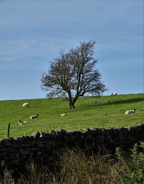
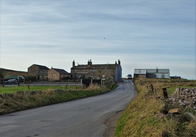
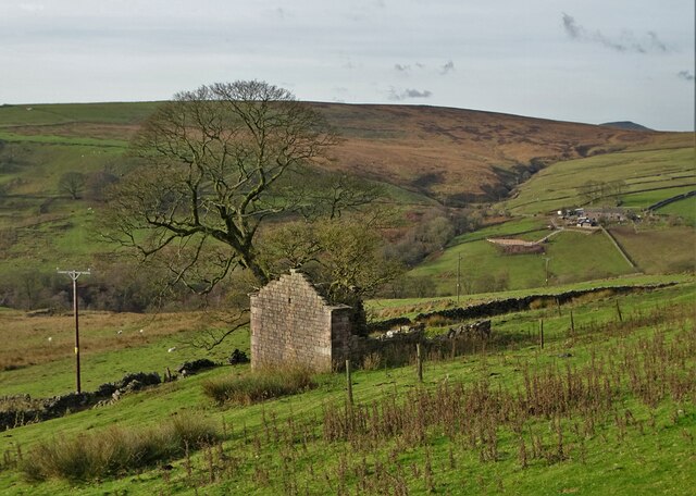
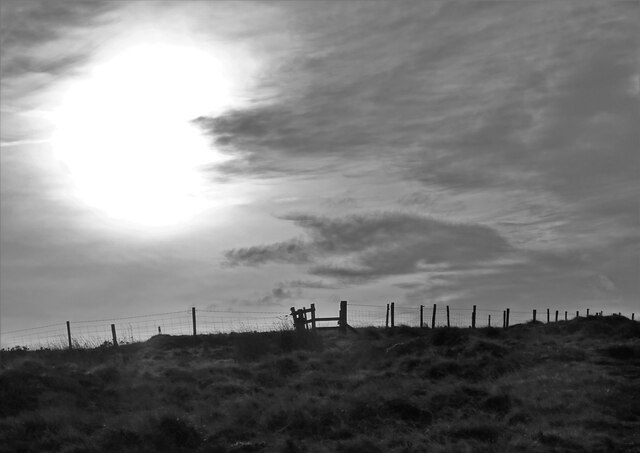
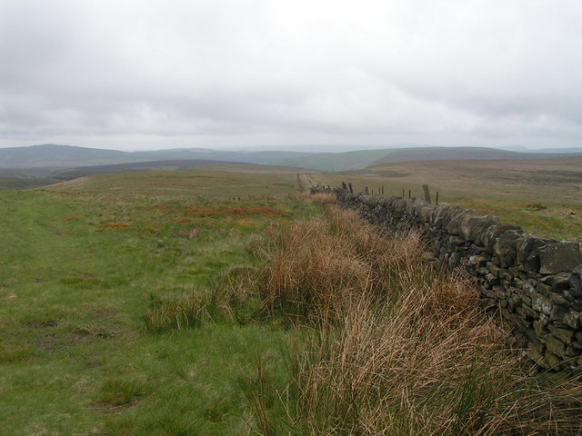
Knotbury Common is a picturesque area located in Staffordshire, England. Situated amidst the rolling hills and scenic landscapes, it encompasses vast stretches of downs and moorland. Covering an area of approximately 500 acres, it is a popular destination for nature enthusiasts, hikers, and birdwatchers.

The common is characterized by its diverse flora and fauna, with a variety of plant species such as heather, gorse, and wildflowers dotting the landscape. These colorful blooms provide a vibrant display, especially during the summer months. The common is also home to a range of wildlife, including birds like larks, kestrels, and pheasants, as well as smaller mammals like rabbits and foxes.

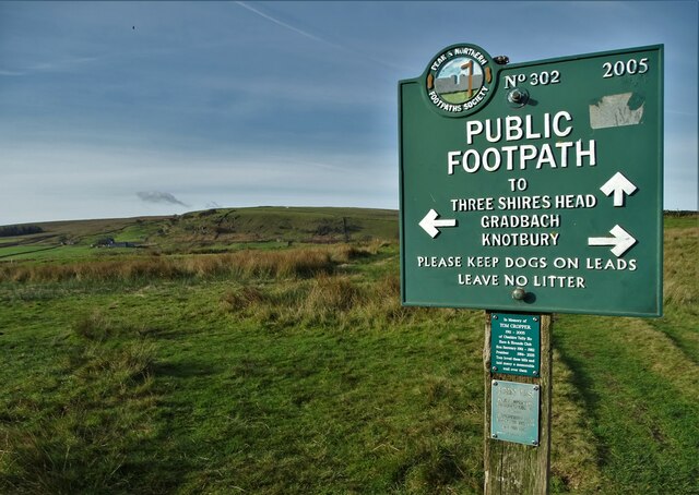
The terrain of Knotbury Common is quite varied, with open grasslands, heathland, and patches of dense woodland. This diversity makes it an ideal place for walking and exploring, with numerous trails and footpaths crisscrossing the area. Visitors can enjoy breathtaking views of the surrounding countryside from higher vantage points, and the tranquil atmosphere lends itself well to relaxation and contemplation.

The common is managed by the local authorities, who strive to preserve its natural beauty and protect its habitats and species. Access to the common is open to the public, and there are designated parking areas and picnic spots available for visitors. Despite its popularity, Knotbury Common retains a peaceful and unspoiled ambiance, making it a hidden gem for nature lovers seeking solace in the heart of Staffordshire.

If you have any feedback on the listing, please let us know in the comments section below.

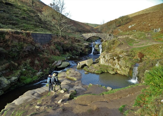
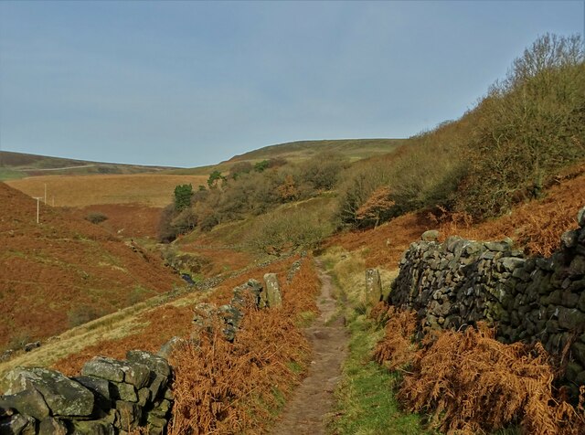
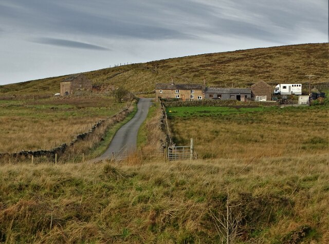
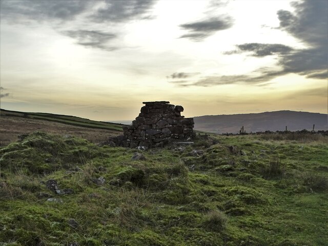
Knotbury Common Images

Images are sourced within 2km of 53.213549/-1.9749677 or Grid Reference SK0168. Thanks to Geograph Open Source API. All images are credited.

Lone tree in a sheep pasture at Spring Head
View from the Longnor Road To "The Knights Table" inn - by the A53 Buxton/Leek road.
View from the Longnor Road
To "The Knights Table" inn - by the A53 Buxton/Leek road.
St Paul's Church, Flash In the parish of Quarnford, the construction of St Paul's Church began in 1743.
St Paul's Church, Flash
In the parish of Quarnford, the construction of St Paul's Church began in 1743.
Elderberry Cottage near Flash
Boulder in a field in the parish of Quarnford
Crippled tree near Spring Head With a light aircraft flying overhead
Crippled tree near Spring Head
With a light aircraft flying overhead
Junction of paths north of Spring Head
Cocket Knowl High in the Staffordshire moors.
Cocket Knowl
High in the Staffordshire moors.
Barn ruin below Turn Edge
Three Shires Head Bridge - crossing The River Dane This is where the ancient ceremonial counties of Cheshire, Staffordshire and Derbyshire meet. Three Shires Head is also known as Three Shires Heads - both versions are acceptable. The pool to the right is I think known as Panniers Pool - often braved by hardy swimmers.
Three Shires Head Bridge - crossing The River Dane
This is where the ancient ceremonial counties of Cheshire, Staffordshire and Derbyshire meet. Three Shires Head is also known as Three Shires Heads - both versions are acceptable. The pool to the right is I think known as Panniers Pool - often braved by hardy swimmers.
On the moorland track to Three Shires Head Along the valley of The River Dane
On the moorland track to Three Shires Head
Along the valley of The River Dane
A view of Blackclough Farm
View to Readyleech Green Farm
November View Weather-beaten signpost above the village of Flash, looking out over the Staffordshire moors towards Cheshire.
November View
Weather-beaten signpost above the village of Flash, looking out over the Staffordshire moors towards Cheshire.
Lonely ruin on Oliver Hill Long ago someone might have lived here but more likely it was a sheep barn.
Lonely ruin on Oliver Hill
Long ago someone might have lived here but more likely it was a sheep barn.
On the path to Oliver Hill
Sign on "The New Inn" in Flash Shame about the missing apostrophe and the unnecessary capital "V". Perhaps it was the altitude's fault.
Sign on "The New Inn" in Flash
Shame about the missing apostrophe and the unnecessary capital "V". Perhaps it was the altitude's fault.
Blackclough & Dane Valley Way
Show me another place!

Knotbury Common is located at Grid Ref: SK0168 (Lat: 53.213549, Lng: -1.9749677)

Administrative County: Staffordshire

District: Staffordshire Moorlands

Police Authority: Staffordshire

What 3 Words

///validated.landlady.fortunate. Near Buxton, Derbyshire

Nearby Locations

Knotbury Common Knotbury

Related Wikis

Three Shire Heads

Three Shire Heads (also known as Three Shires Head) is the point on Axe Edge Moor where Cheshire, Derbyshire and Staffordshire meet, at UK grid reference...

Oliver Hill (Peak District)

Oliver Hill is a hill, 513 metres (1,683 ft) high, in the Peak District in the county of Staffordshire in England. It is a treeless summit surrounded by...

Quarnford

Quarnford is a village and civil parish in the Staffordshire Moorlands district of Staffordshire, England. According to the 2001 census it had a population...

Cheeks Hill

Cheeks Hill is a hill on Axe Edge Moor in the Peak District, England. It lies just south of the Cat and Fiddle Road near Buxton, and forms part of the...

Nearby Amenities

Located within 500m of 53.213549,-1.9749677
Barrier: cattle_grid
Foot: yes
Lat/Long: 53.216947/-1.9782684
Ele: 432
Lat/Long: 53.2168206/-1.9746391
Ele: 439
Lat/Long: 53.2171644/-1.9746666
Ele: 444
Lat/Long: 53.2178786/-1.9759092
Barrier: stile
Material: wood
Source: survey;gps
Stile: stepover
Lat/Long: 53.2114491/-1.9779087
Barrier: stile
Material: stone
Source: survey;gps
Stile: stepover
Lat/Long: 53.2114861/-1.9777963
Barrier: stile
Material: wood
Source: survey;gps
Stile: stepover
Lat/Long: 53.2130032/-1.9796398
Barrier: stile
Material: stone
Source: survey;gps
Stile: stepover
Lat/Long: 53.2132097/-1.9796536
Barrier: stile
Material: stone
Source: survey;gps
Stile: squeezer
Lat/Long: 53.21429/-1.9800059
Barrier: stile
Material: wood
Stile: ladder
Lat/Long: 53.213076/-1.9730001
Barrier: stile
Material: stone
Source: survey;gps
Stile: stepover
Lat/Long: 53.2171198/-1.9721233
Barrier: stile
Material: wood
Source: survey;gps
Step Count: 2
Stile: stepover
Lat/Long: 53.2169158/-1.9779956
Barrier: entrance
Source: survey
Lat/Long: 53.2171888/-1.9773183
Barrier: stile
Material: wood
Source: survey
Step Count: 2
Stile: stepover
Lat/Long: 53.2173675/-1.9766021
Barrier: stile
Source: survey
Stile: stepover
Lat/Long: 53.2174577/-1.9764254
The data included in this document is from www.openstreetmap.org. The data is made available under ODbL.

Have you been to Knotbury Common?

Leave your review of Knotbury Common below (or comments, questions and feedback).