Cold Moor

Hill, Mountain in Yorkshire Hambleton

England

Cold Moor

Farm track and bridleway off Bank Lane This track, which is also bridleway number 10.56/2, runs along the bottom of the Cleveland Hills scarp linking a number of farms and other residences.
Farm track and bridleway off Bank Lane Credit: Gordon Hatton

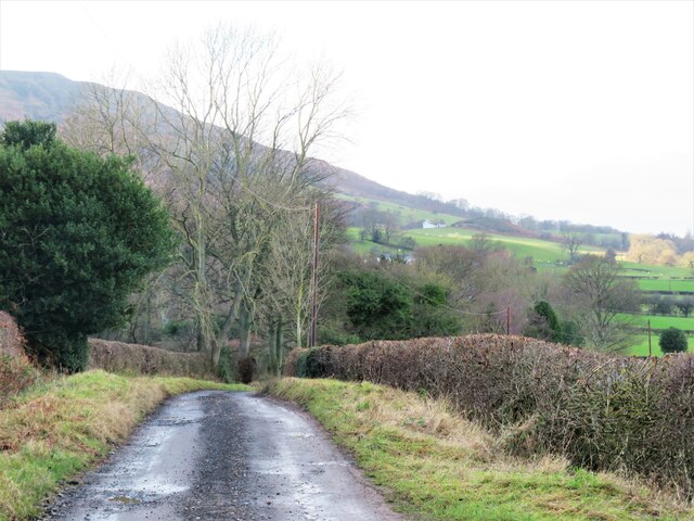
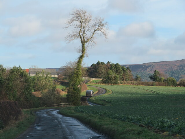
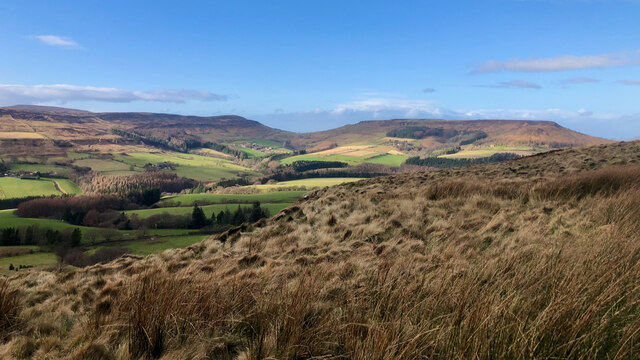
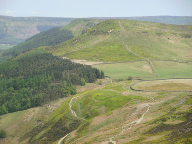
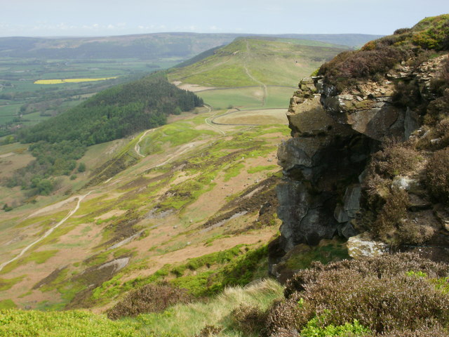
Cold Moor is a prominent hill located in the North York Moors National Park in Yorkshire, England. Standing at an elevation of 402 meters (1,319 feet), it forms part of the expansive moorland landscape that characterizes the region. The hill is situated approximately 9 kilometers (5.6 miles) northeast of the village of Osmotherley.

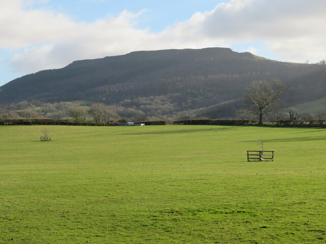
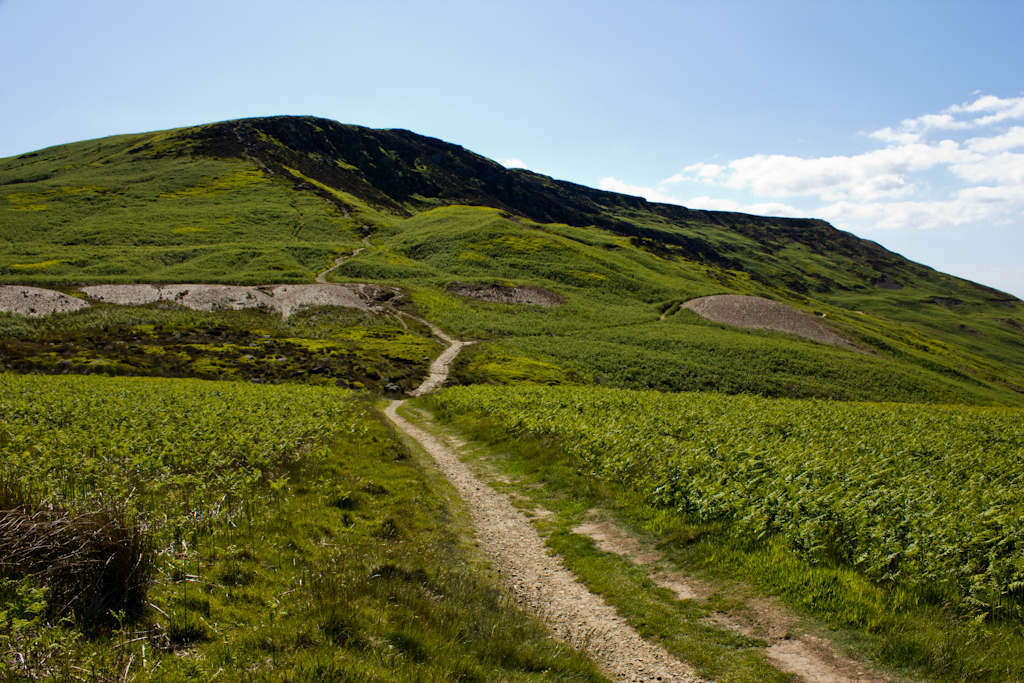
Cold Moor offers visitors breathtaking panoramic views of the surrounding countryside. To the north, one can see the picturesque Cleveland Hills, while to the south lies the vast expanse of the North York Moors. The hill's exposed position and lack of vegetation contribute to its name, as it can often be chilly, especially during the winter months.

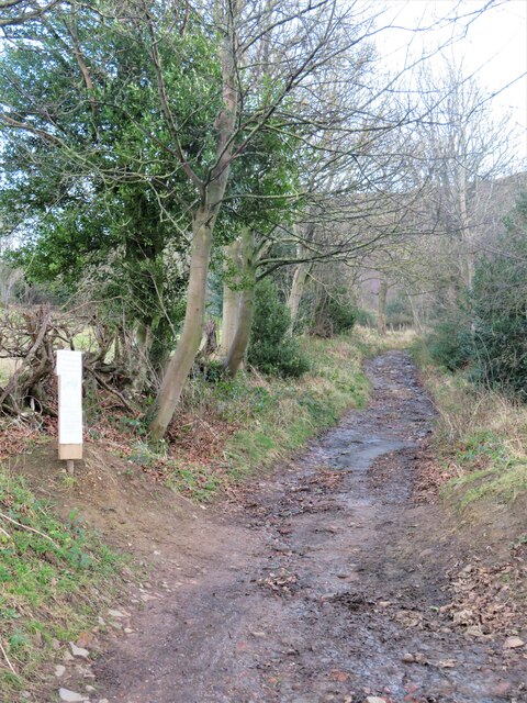
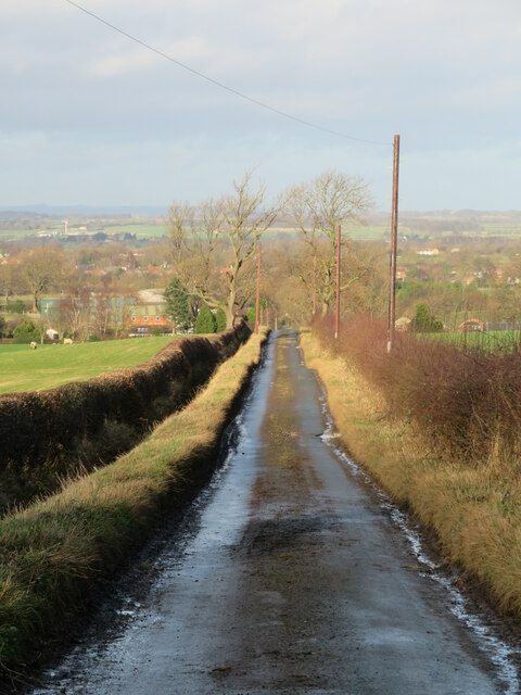
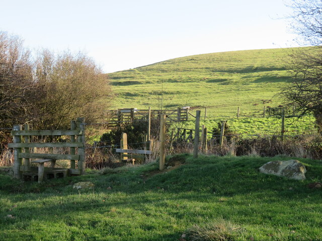
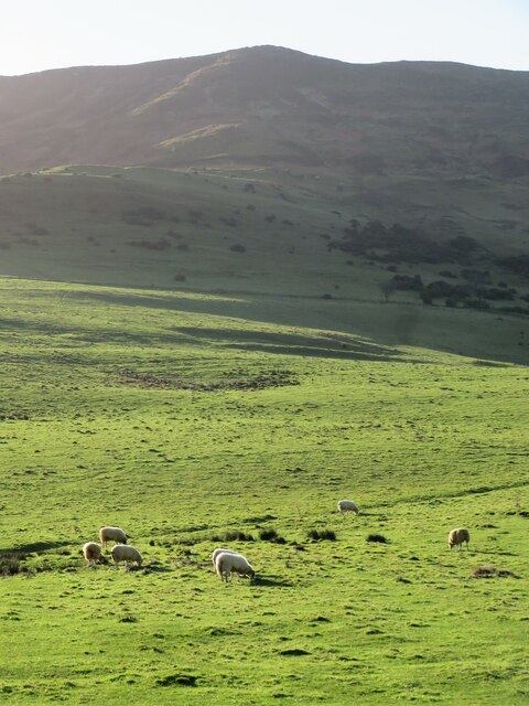
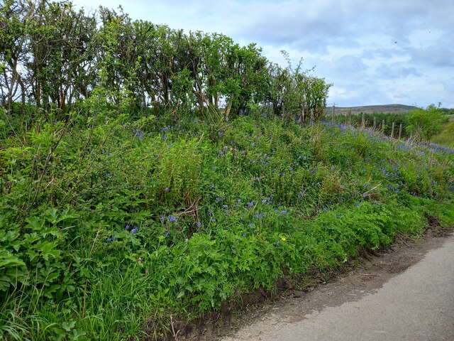
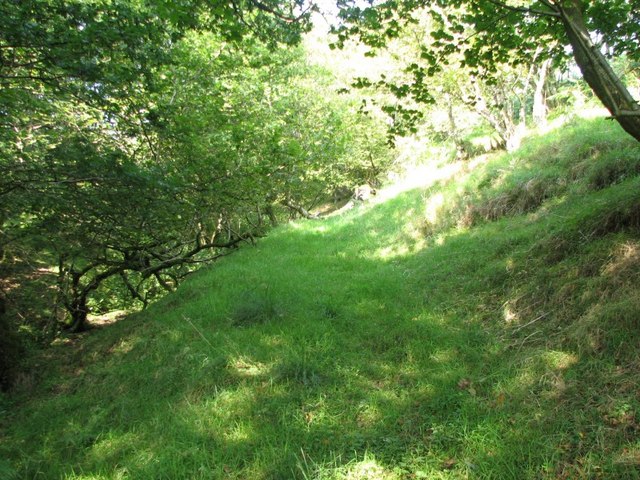
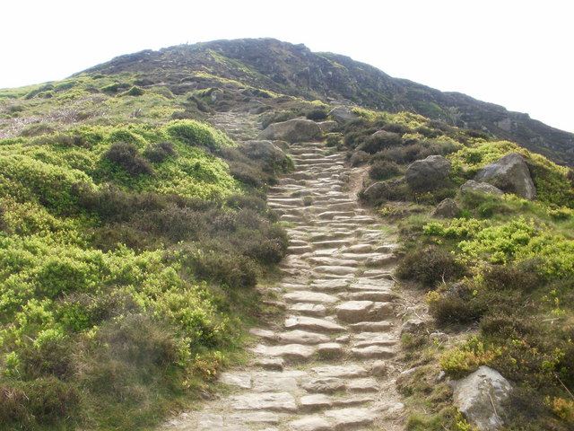
The hill is a popular destination for outdoor enthusiasts, offering a range of activities such as hiking, walking, and mountain biking. Several footpaths and trails traverse the moor, allowing visitors to explore its rugged terrain and enjoy its natural beauty. Cold Moor is also home to a diverse array of wildlife, including birds of prey, sheep, and various species of flora and fauna.

In addition to its natural attractions, Cold Moor holds historical significance. It is believed to have been utilized by ancient civilizations, evident from the presence of prehistoric burial mounds and stone circles in the area. These remnants serve as a reminder of the hill's rich cultural heritage.

Overall, Cold Moor is a captivating destination that offers visitors an opportunity to immerse themselves in the stunning natural landscape while appreciating the historical and cultural value of the Yorkshire region.

If you have any feedback on the listing, please let us know in the comments section below.

Cold Moor Images

Images are sourced within 2km of 54.423565/-1.1528171 or Grid Reference NZ5503. Thanks to Geograph Open Source API. All images are credited.

Farm track and bridleway off Bank Lane This track, which is also bridleway number 10.56/2, runs along the bottom of the Cleveland Hills scarp linking a number of farms and other residences.
Farm track and bridleway off Bank Lane
This track, which is also bridleway number 10.56/2, runs along the bottom of the Cleveland Hills scarp linking a number of farms and other residences.
The start of the climb The tarmacked section of Bank Lane ends here and the route continues as a bridleway, climbing 150m up a steep hill to the gap between Cold Moor and Hasty Bank. The notice to the left, which is dates July 2021, warns of a path closure higher up the hillside due to a landslip, but one can go so far and then use forest tracks to avoid the obstacle. This is bridleway number 10.56/1.
The start of the climb
The tarmacked section of Bank Lane ends here and the route continues as a bridleway, climbing 150m up a steep hill to the gap between Cold Moor and Hasty Bank. The notice to the left, which is dates July 2021, warns of a path closure higher up the hillside due to a landslip, but one can go so far and then use forest tracks to avoid the obstacle. This is bridleway number 10.56/1.
Bank Lane Looking north down this dead end lane towards Broughton. The foreground shadow is not due to cloud, but the high hills behind the camera position which block out the mid winter sun.
Bank Lane
Looking north down this dead end lane towards Broughton. The foreground shadow is not due to cloud, but the high hills behind the camera position which block out the mid winter sun.
Narrow Lane towards Water Beck Farm A poorly surfaced road heading east from B1257 towards Water Beck Farm, which is part visible in the middle distance.
Narrow Lane towards Water Beck Farm
A poorly surfaced road heading east from B1257 towards Water Beck Farm, which is part visible in the middle distance.
Garfit Gap and upper Bilsdale In spite of the blue sky and sunshine over upper Bilsdale, Urra Moor was decidedly gloomy and showery this afternoon.

Ahead is Garfit Gap, the col between the Wainstones and Cold Moor.

The farm below the gap to the left is Whingroves where Jack Garbutt, the Bilsdale Bombardier, grew up as a child. He was killed on the Western Front in 1918.

To the right of the gap, nestled in a combe on Hasty Bank is Garfitts, a farm which has some history.

There is no mention of Bilsdale in the Domesday Book but there are indications of pre-Norman settlement. Perhaps William the Conqueror did indeed get lost on the moors above Bilsdale and told his legati not to bother with the dale when ordering the survey of his realm.

But the thinking is that medieval Bilsdale consisted of a number of scattered hamlets, and one of these was Garthwait, the ‘clearing with an enclosure’, situated where Garfitts farm is today.

Interesting too, and probably completed unconnected, is that ‘garfits’ is an 18th-century Yorkshire ‘provincialism’ for garbage.

For links and references see my blog <span class="nowrap"><a title="http://www.fhithich.uk/?p=27439" rel="nofollow ugc noopener" href="http://www.fhithich.uk/?p=27439">Link</a><img style="margin-left:2px;" alt="External link" title="External link - shift click to open in new window" src="https://s1.geograph.org.uk/img/external.png" width="10" height="10"/></span>
Garfit Gap and upper Bilsdale
In spite of the blue sky and sunshine over upper Bilsdale, Urra Moor was decidedly gloomy and showery this afternoon. Ahead is Garfit Gap, the col between the Wainstones and Cold Moor. The farm below the gap to the left is Whingroves where Jack Garbutt, the Bilsdale Bombardier, grew up as a child. He was killed on the Western Front in 1918. To the right of the gap, nestled in a combe on Hasty Bank is Garfitts, a farm which has some history. There is no mention of Bilsdale in the Domesday Book but there are indications of pre-Norman settlement. Perhaps William the Conqueror did indeed get lost on the moors above Bilsdale and told his legati not to bother with the dale when ordering the survey of his realm. But the thinking is that medieval Bilsdale consisted of a number of scattered hamlets, and one of these was Garthwait, the ‘clearing with an enclosure’, situated where Garfitts farm is today. Interesting too, and probably completed unconnected, is that ‘garfits’ is an 18th-century Yorkshire ‘provincialism’ for garbage. For links and references see my blog LinkExternal link
More slithering ahead A January walk along footpath number 10.83/5 was not without its difficulties. Mud, swamps and dodgy stiles were all part of the fun. The stile in the foreground here is probably the best on the whole route, but it leads into a slither down to a tricky minor beck crossing and a mini bog on the far side before reaching a hand gate. Further on, the last 'stile' into the grounds of Toft Hill lacks any footboards and requires a climb over a fence. Is this a NYM footpath I wonder, or one under the management of the local authority?
More slithering ahead
A January walk along footpath number 10.83/5 was not without its difficulties. Mud, swamps and dodgy stiles were all part of the fun. The stile in the foreground here is probably the best on the whole route, but it leads into a slither down to a tricky minor beck crossing and a mini bog on the far side before reaching a hand gate. Further on, the last 'stile' into the grounds of Toft Hill lacks any footboards and requires a climb over a fence. Is this a NYM footpath I wonder, or one under the management of the local authority?
Sheep below the scarp Sheep grazing on the lower slopes of the scarp that rises dramatically to Cringle Moor.
Sheep below the scarp
Sheep grazing on the lower slopes of the scarp that rises dramatically to Cringle Moor.
Toft Hill holiday home park Things appear to have gone rather more upmarket since Mick Garratt's pictures taken in 2007. This is no longer a caravan and camping park, but one with mobile homes.
Toft Hill holiday home park
Things appear to have gone rather more upmarket since Mick Garratt's pictures taken in 2007. This is no longer a caravan and camping park, but one with mobile homes.
Reservoir building at Toft Hill Part of the small reservoir works at Toft Hill below the edge of the Cleveland Hills.
Reservoir building at Toft Hill
Part of the small reservoir works at Toft Hill below the edge of the Cleveland Hills.
Lane to Kirkby in Cleveland The lane appears to be nameless, nothing appearing on old maps. The familiar 'pimple' of Roseberry Topping on the right.
Lane to Kirkby in Cleveland
The lane appears to be nameless, nothing appearing on old maps. The familiar 'pimple' of Roseberry Topping on the right.
Green fields and shadowy moors Fields south of Kirkby in Cleveland with the impressive scarp of Hasty Bank in the distance.
Green fields and shadowy moors
Fields south of Kirkby in Cleveland with the impressive scarp of Hasty Bank in the distance.
Hedgerow with bluebells near Urra village
Public footpath to Broadfield Farm Little used path, leading uphill from the B1257.  It was quite overgrown to the west of this point.
Public footpath to Broadfield Farm
Little used path, leading uphill from the B1257. It was quite overgrown to the west of this point.
Starting off on a traverse of Cringle Moor On the Cleveland Way, setting off up Cringle Moor from Carlton Bank to the west.  This is part of Alfred Wainwright’s Coast to Coast route.
Starting off on a traverse of Cringle Moor
On the Cleveland Way, setting off up Cringle Moor from Carlton Bank to the west. This is part of Alfred Wainwright’s Coast to Coast route.
Roseberry Topping from Cringle Moor viewpoint
Looking east to north east across Cringle Moor Looking towards the second and third tops from the first top on a west-east traverse.
Looking east to north east across Cringle Moor
Looking towards the second and third tops from the first top on a west-east traverse.
Rocky outcrops just off the Cleveland Way
Looking back up the path towards the first top on Cringle Moor
Show me another place!

Cold Moor is located at Grid Ref: NZ5503 (Lat: 54.423565, Lng: -1.1528171)

Division: North Riding

Administrative County: North Yorkshire

District: Hambleton

Police Authority: North Yorkshire

Also known as: Broughton Bank

What 3 Words

///basically.enrolling.haircuts. Near Ingleby Greenhow, North Yorkshire

Related Wikis

Cringle Moor

Cringle Moor (also known as Cranimoor), at 432 m (1,417 ft), is the third-highest hill in the North York Moors, England, and the highest point west of...

Kirkby, North Yorkshire

Kirkby (historically known as Kirkby-in-Cleveland) is a village and civil parish in Hambleton district of North Yorkshire, England, near Great Busby and...

Great Broughton, North Yorkshire

Great Broughton is a village in the Great and Little Broughton civil parish of the Hambleton district of North Yorkshire in northern England. == History... ==

Cleveland Hills

The Cleveland Hills are a range of hills on the north-west edge of the North York Moors in North Yorkshire, England, overlooking Cleveland and Teesside...

Great Busby

Great Busby is a village and civil parish in the Hambleton District of North Yorkshire, England. The population of the parish was estimated at 70 in 2013...

Busby Hall

Busby Hall is a Grade II* listed Country House in Little Busby, North Yorkshire, England, close to the village of Carlton-in-Cleveland. The house and parkland...

Chop Gate

Chop Gate ( CHOP YAT) is a small village in the Hambleton district of North Yorkshire, England. The village lies within the North York Moors National Park...

Ingleby Greenhow

Ingleby Greenhow is a village and civil parish in the Hambleton district of North Yorkshire, England. It is on the border of the North York Moors and 3...

Nearby Amenities

Located within 500m of 54.423565,-1.1528171
Barrier: stile
Foot: yes
Lat/Long: 54.4227513/-1.1592217
Barrier: kissing_gate
Foot: yes
Lat/Long: 54.4228451/-1.1576362
Ele: 305.8228760
Lat/Long: 54.4223531/-1.158944
Ele: 402
Natural: peak
Lat/Long: 54.4236173/-1.152888
Ele: 381
Lat/Long: 54.419586/-1.151776
Access: yes
Note: The gate has been removed
Lat/Long: 54.423647/-1.1450861
Information: guidepost
Tourism: information
Lat/Long: 54.4234675/-1.1466609
Information: route_marker
Tourism: information
Lat/Long: 54.4232245/-1.1474577
Information: route_marker
Tourism: information
Lat/Long: 54.4233477/-1.147269
Information: route_marker
Tourism: information
Lat/Long: 54.4236692/-1.1450897
Information: guidepost
Tourism: information
Lat/Long: 54.4227417/-1.159267
Information: route_marker
Tourism: information
Lat/Long: 54.4228229/-1.1576305
Information: route_marker
Tourism: information
Lat/Long: 54.4227138/-1.1596483
Information: guidepost
Tourism: information
Lat/Long: 54.4230836/-1.1602929
The data included in this document is from www.openstreetmap.org. The data is made available under ODbL.

Have you been to Cold Moor?

Leave your review of Cold Moor below (or comments, questions and feedback).