Honister Crag

Hill, Mountain in Cumberland Allerdale

England

Honister Crag

Crags on Hindscarth Edge Leaving Dale Head.
Crags on Hindscarth Edge Credit: steven ruffles

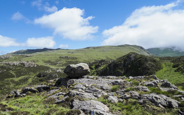
Honister Crag is a prominent hill located in the county of Cumberland, in the northwestern region of England. Standing at an elevation of 356 meters (1,168 feet), it is considered a popular destination for hill walkers and outdoor enthusiasts.

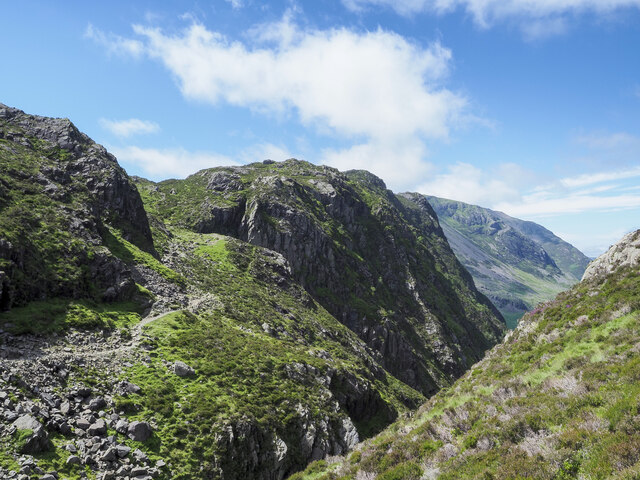
Situated in the heart of the Lake District National Park, Honister Crag offers breathtaking views of the surrounding landscape, including the nearby Buttermere and Crummock Water lakes. The crag is part of a larger range of fells known as the Western Fells, which also includes renowned peaks such as Fleetwith Pike and Haystacks.

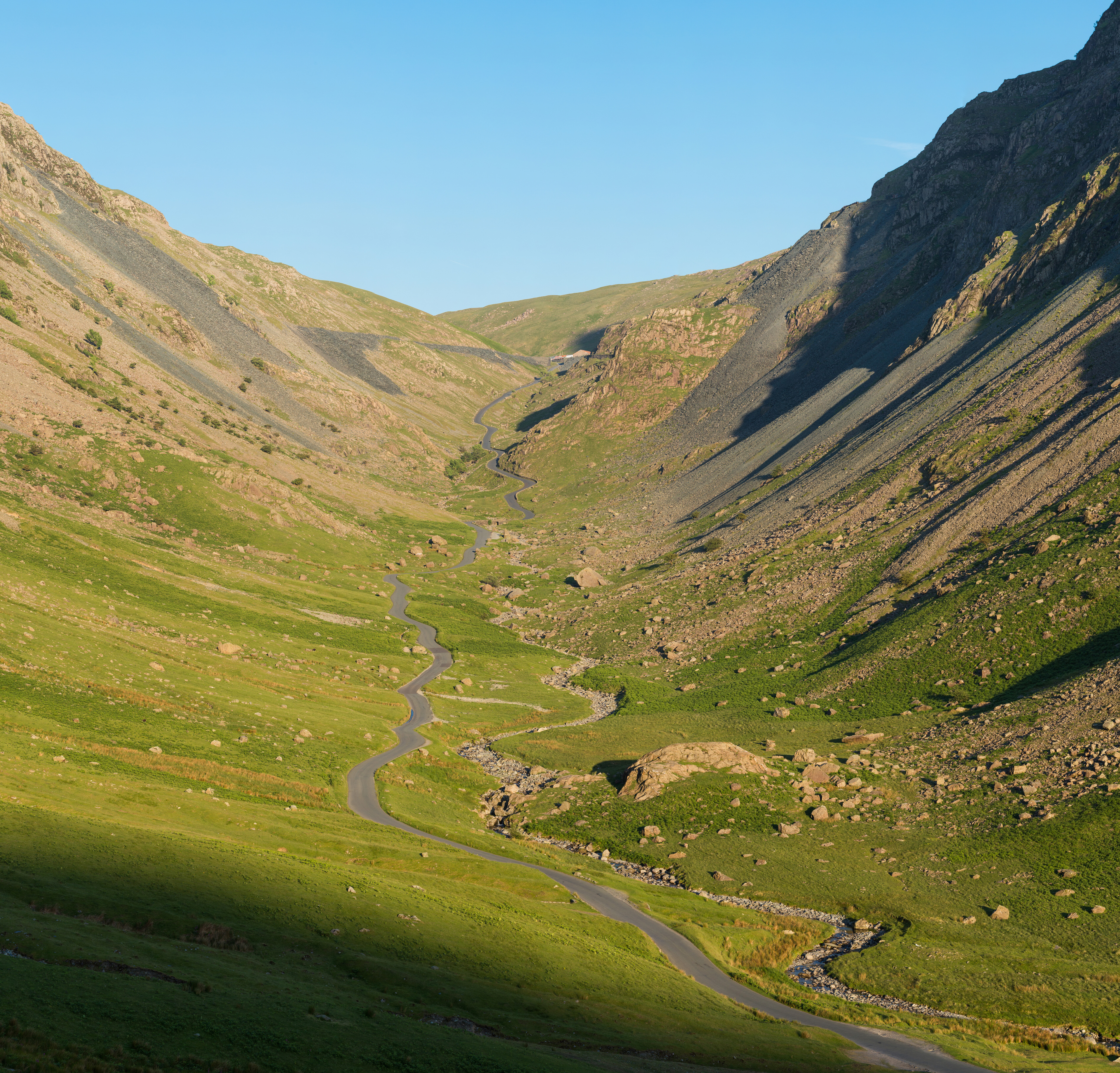
The terrain of Honister Crag is characterized by rugged and rocky slopes, making it a challenging yet rewarding climb. The ascent can be approached from various directions, with the most popular route starting from the Honister Pass, a mountain pass that connects the valleys of Buttermere and Borrowdale.

Honister Crag is also notable for its historic significance. The hill is home to Honister Slate Mine, one of the few remaining operational slate mines in England. The mine has been in operation for over 300 years and offers guided underground tours, allowing visitors to learn about the history and process of slate mining.

Overall, Honister Crag is a picturesque and captivating destination that showcases the natural beauty and geological heritage of the Lake District. Whether it's for hiking, sightseeing, or exploring the slate mine, this hill provides an immersive and memorable experience for all who visit.

If you have any feedback on the listing, please let us know in the comments section below.

Honister Crag Images

Images are sourced within 2km of 54.516585/-3.218044 or Grid Reference NY2114. Thanks to Geograph Open Source API. All images are credited.

Crags on Hindscarth Edge Leaving Dale Head.
Crags on Hindscarth Edge
Leaving Dale Head.
A Frosty Dub's Hut in the Sunset This ex-quarry building is now maintained as a basic hiking shelter by volunteers of the Mountain Bothies Association with permission of the landowners.
A Frosty Dub's Hut in the Sunset
This ex-quarry building is now maintained as a basic hiking shelter by volunteers of the Mountain Bothies Association with permission of the landowners.
Warnscale Head Bothy Maintained by volunteers of the Mountain Bothies Association with permission of the landowner. This small hiking shelter is made from local stone and so blends in well with its surroundings.
Warnscale Head Bothy
Maintained by volunteers of the Mountain Bothies Association with permission of the landowner. This small hiking shelter is made from local stone and so blends in well with its surroundings.
Innominate Tarn  with knolls beyond Innominate Tarn's western end in-filling with vegetation. The central knoll rises to 545 metres; Kirk Fell is beyond it, in the distance.
Innominate Tarn with knolls beyond
Innominate Tarn's western end in-filling with vegetation. The central knoll rises to 545 metres; Kirk Fell is beyond it, in the distance.
Path connecting Innominate Tarn with Blackbeck Tarn. The path passes along the north side of Innominate Tarn, continuing above the steep rocky downfall to the north to reach the outflow at the northern end of Blackbeck Tarn.
Fleetwith Pike is the main mountain in the image, the other obvious top is Green Crag.
Path connecting Innominate Tarn with Blackbeck Tarn.
The path passes along the north side of Innominate Tarn, continuing above the steep rocky downfall to the north to reach the outflow at the northern end of Blackbeck Tarn. Fleetwith Pike is the main mountain in the image, the other obvious top is Green Crag.
Perched boulder on rock slabs The boulder is in rough, complex hill country south of Blackbeck Tarn.
Grey Knotts and Brandreth are two mountain tops on the horizon beyond.
Perched boulder on rock slabs
The boulder is in rough, complex hill country south of Blackbeck Tarn. Grey Knotts and Brandreth are two mountain tops on the horizon beyond.
Rough country between Blackbeck Tarn and Innominate Tarn The ground in view is some of the little-frequented wild country between the two tarns and extending towards Haystacks and Great Round How. The rocky knoll at the right side of the image rises to 545 m. and is unnamed on OS Maps.
Pillar is the distant mountain, it's on the far side of Ennerdale.
Rough country between Blackbeck Tarn and Innominate Tarn
The ground in view is some of the little-frequented wild country between the two tarns and extending towards Haystacks and Great Round How. The rocky knoll at the right side of the image rises to 545 m. and is unnamed on OS Maps. Pillar is the distant mountain, it's on the far side of Ennerdale.
Path descending to cross cleft between mountains The path on a shelf below crags is descending to cross the stream which issues from Blackbeck Tarn in the cleft before rising again to the camera location. Haystacks is the mountain across the void.
Path descending to cross cleft between mountains
The path on a shelf below crags is descending to cross the stream which issues from Blackbeck Tarn in the cleft before rising again to the camera location. Haystacks is the mountain across the void.
Striddle Crag of Fleetwith Pike The crag is beyond the two walkers along the path which is close to Little Round How.
Striddle Crag of Fleetwith Pike
The crag is beyond the two walkers along the path which is close to Little Round How.
Base of Drum House The Drum House was the location of winding equipment - presumably a large-diameter, vertically mounted drum around which a cable was wound by its rotation. Trucks were hauled along the causeway which is seen reaching the base and also presumably, lowered to Honister Pass. The route to and from the location is now in use as a path.
Base of Drum House
The Drum House was the location of winding equipment - presumably a large-diameter, vertically mounted drum around which a cable was wound by its rotation. Trucks were hauled along the causeway which is seen reaching the base and also presumably, lowered to Honister Pass. The route to and from the location is now in use as a path.
Knolls on slope above Honister Pass The knolls are on the north side of a disused tramway which operated at the Honister Quarry and is now in use as a footpath. Honister Pass lies beyond the knolls with Dale Head on its far side.
Knolls on slope above Honister Pass
The knolls are on the north side of a disused tramway which operated at the Honister Quarry and is now in use as a footpath. Honister Pass lies beyond the knolls with Dale Head on its far side.
Innominate Tarn, Haystacks, Lake District Wainwright's ashes were scattered by his wife, Betty, near the shores of Innominate Tarn.
Innominate Tarn, Haystacks, Lake District
Wainwright's ashes were scattered by his wife, Betty, near the shores of Innominate Tarn.
Warnscale Head Bothy, Lake District Lovely bothy with a remarkable view.
Warnscale Head Bothy, Lake District
Lovely bothy with a remarkable view.
Heading for Haystacks from Gatesgarth
Trying to keep dry feet, heading for Haystacks from Gatesgarth Even midweek in October, one has to be up fairly early to get a parking space at Gatesgarth if you are in a large van, so the ascent starts out in deep shade whilst the low morning sun illuminates the slopes of our destination. This turned out to be a splendid sunlit day between a pair of dreich ones, followed by gales two days later. It definitely pays to be in the right place when the weather comes good.
Trying to keep dry feet, heading for Haystacks from Gatesgarth
Even midweek in October, one has to be up fairly early to get a parking space at Gatesgarth if you are in a large van, so the ascent starts out in deep shade whilst the low morning sun illuminates the slopes of our destination. This turned out to be a splendid sunlit day between a pair of dreich ones, followed by gales two days later. It definitely pays to be in the right place when the weather comes good.
Heading for Haystacks from Little Round How
Approaching Haystacks from the East
Blackbeck Tarn
Blackbeck Tarn
Show me another place!

Honister Crag is located at Grid Ref: NY2114 (Lat: 54.516585, Lng: -3.218044)

Administrative County: Cumbria

District: Allerdale

Police Authority: Cumbria

Also known as: Black Star

What 3 Words

///horns.awkward.trending. Near Keswick, Cumbria

Related Wikis

Honister Crag

Honister Crag is a fell in the English Lake District. It has a height of 634 metres. It is adjacent to Fleetwith Pike, a higher summit, but it can claim...

Honister Pass

Honister Pass is a mountain pass in the Lake District in Cumbria, England. It is located on the B5289 road, linking Seatoller, in the valley of Borrowdale...

Fleetwith Pike

Fleetwith Pike is a fell in the English Lake District in the county of Cumbria which reaches a height of 648 metres (2,126 feet). The fell is a well-known...

Dale Head

Dale Head is a fell in the north-western sector of the Lake District, in northern England. It is 753 metres or 2,470 foot above sea level and stands immediately...

Nearby Amenities

Located within 500m of 54.516585,-3.218044
Black Star
Ele: 634
Natural: peak
Lat/Long: 54.5164678/-3.2181756
Burnt Scarth
Place: locality
Lat/Long: 54.5180933/-3.2224129
Direction: 170
Man Made: adit
Lat/Long: 54.515471/-3.2163202
No Public Access, Live Mine, Danger Of Death
Information: guidepost
Tourism: information
Lat/Long: 54.5158651/-3.2168334
Ash Gill
Place: locality
Lat/Long: 54.5165445/-3.214803
Bull Gill
Place: locality
Lat/Long: 54.5160349/-3.2118184
Nag Beck Sill
Place: locality
Lat/Long: 54.5152205/-3.2145918
Nag Beck Incline
Place: locality
Lat/Long: 54.5152043/-3.2129048
The data included in this document is from www.openstreetmap.org. The data is made available under ODbL.

Have you been to Honister Crag?

Leave your review of Honister Crag below (or comments, questions and feedback).