Black Law

Hill, Mountain in Peeblesshire

Scotland

Black Law

Peebles Rig from Dunslair Heights Whitehope Law (623m) is in view across the valley of the Leithen Water.
Peebles Rig from Dunslair Heights Credit: Jim Barton

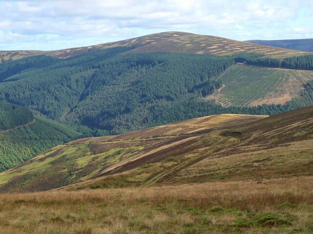
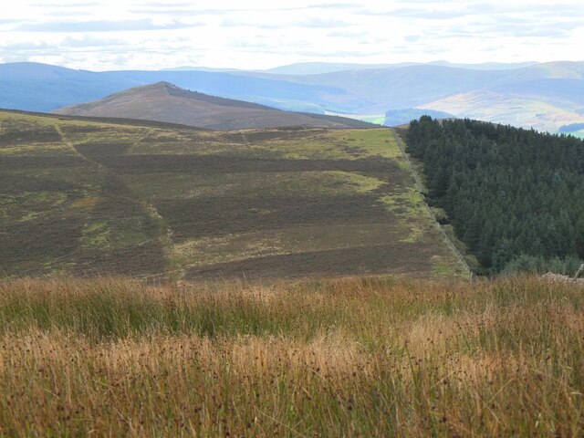
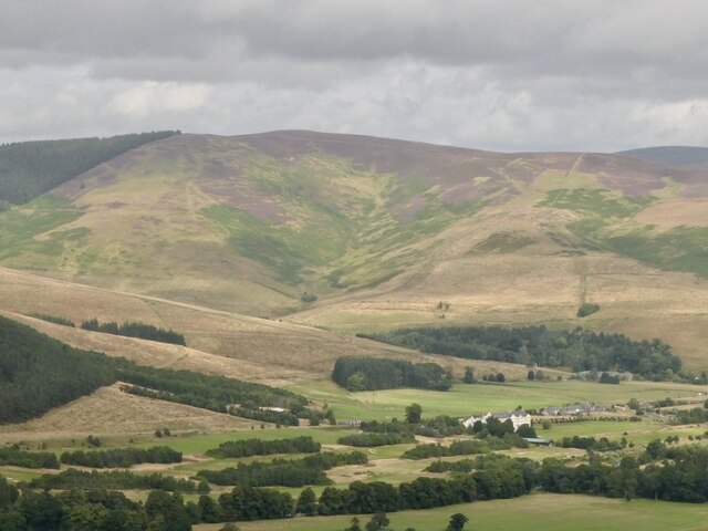
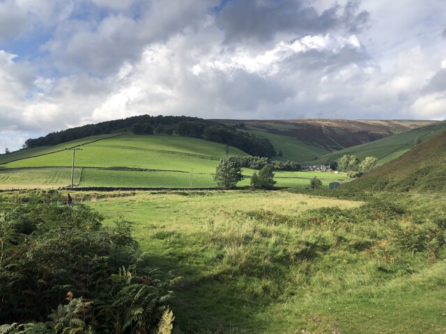
Black Law is a prominent hill located in Peeblesshire, a historic county in the southern part of Scotland. With an elevation of approximately 638 meters (2,093 feet), it is considered one of the higher peaks in the region. The hill is situated within the scenic Moorfoot Hills, which form part of the larger Southern Uplands.

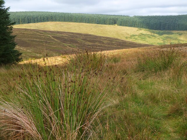
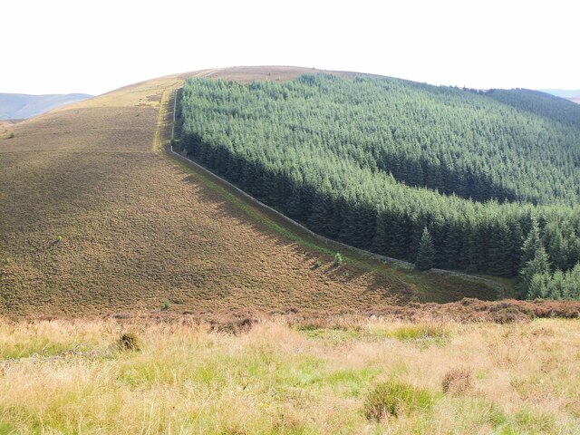
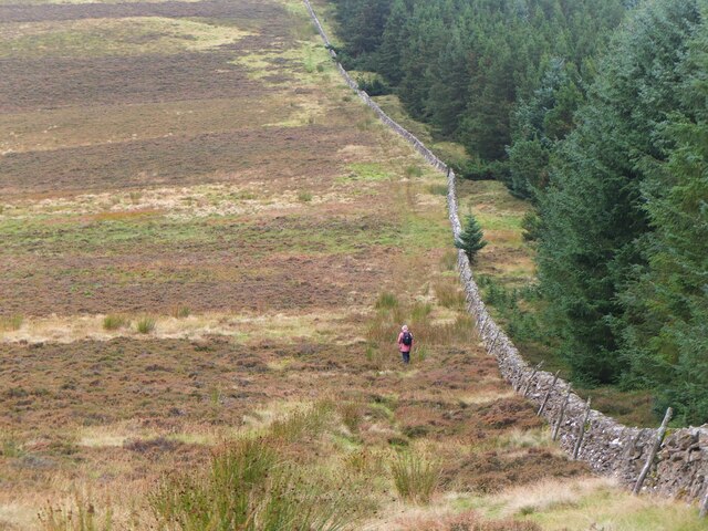
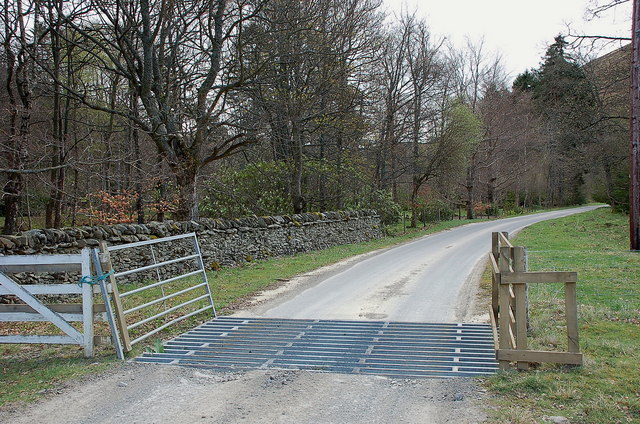
Black Law boasts a distinctive conical shape and is predominantly covered in heather, giving it a dark appearance that inspired its name. The hill is accessible to hikers and outdoor enthusiasts, offering a variety of routes to reach its summit. While the climb can be challenging, the reward is well worth it, as it provides stunning panoramic views of the surrounding countryside.

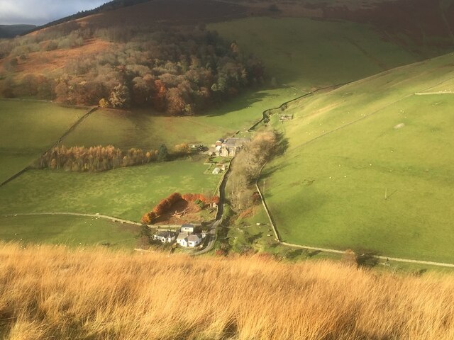
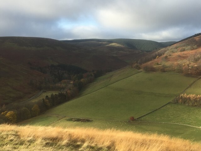
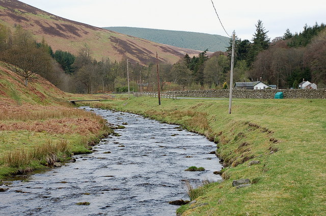
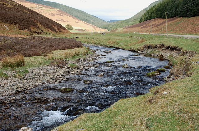
This area is rich in biodiversity, and Black Law is no exception. The hill is home to a diverse range of flora and fauna, including heather, bilberry, and various species of birds and insects. Additionally, the hillside is dotted with several small lochs, adding to the picturesque landscape.

Black Law is a popular destination for outdoor activities such as hillwalking, hiking, and birdwatching. Its location within the Moorfoot Hills also provides opportunities for other recreational pursuits, including mountain biking, horse riding, and orienteering.

Overall, Black Law offers visitors a chance to immerse themselves in the natural beauty of Peeblesshire, with its stunning views, diverse wildlife, and a wide range of outdoor activities.

If you have any feedback on the listing, please let us know in the comments section below.
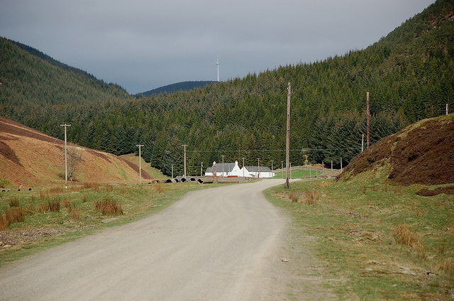
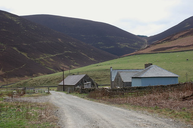
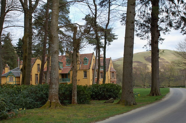
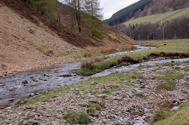
Black Law Images

Images are sourced within 2km of 55.665994/-3.0952107 or Grid Reference NT3141. Thanks to Geograph Open Source API. All images are credited.

Peebles Rig from Dunslair Heights Whitehope Law (623m) is in view across the valley of the Leithen Water.
Peebles Rig from Dunslair Heights
Whitehope Law (623m) is in view across the valley of the Leithen Water.
Summit of Leithen Door Hill Clumps of rushes on the grassy summit with the forest edge on Dunslair Heights in view across Peebles Rig.
Summit of Leithen Door Hill
Clumps of rushes on the grassy summit with the forest edge on Dunslair Heights in view across Peebles Rig.
Black Law across Leithen Door Leithen Door is a steep 60m drop and re-ascent on the ridge walk from Dunslair Heights to Lee Pen.
Black Law across Leithen Door
Leithen Door is a steep 60m drop and re-ascent on the ridge walk from Dunslair Heights to Lee Pen.
Lee Pen in sight The conical summit of Lee Pen (502m) marks the end of the ridge running SE between the Leithen Water and the Tweed. This view from Clog Knowe is across the intervening top of Black Knowe.
Lee Pen in sight
The conical summit of Lee Pen (502m) marks the end of the ridge running SE between the Leithen Water and the Tweed. This view from Clog Knowe is across the intervening top of Black Knowe.
Col below Clog Knowe The ridge between Clog Knowe and Black Knowe on the walk from Dunslair Heights to Lee Pen and Innerleithen. The plantation is part of Glentress Forest.
Col below Clog Knowe
The ridge between Clog Knowe and Black Knowe on the walk from Dunslair Heights to Lee Pen and Innerleithen. The plantation is part of Glentress Forest.
Stile on Black Knowe Junction of a wire fence and the ridge wall at the summit.
Stile on Black Knowe
Junction of a wire fence and the ridge wall at the summit.
Black Knowe Hill above the Cardrona Hotel.
Black Knowe
Hill above the Cardrona Hotel.
Whitehope View from Dod Hill.
Whitehope
View from Dod Hill.
Looking up the Leithen Water Towards the conifers of Glentress Forest. The background block were newly planted when I walked down that slope in 1987. The name Glentress suggests that the forest was going to be a lot larger, including Dod Hill where I was standing. Glen Tress itself is below and right of the picture and remained unplanted.
Looking up the Leithen Water
Towards the conifers of Glentress Forest. The background block were newly planted when I walked down that slope in 1987. The name Glentress suggests that the forest was going to be a lot larger, including Dod Hill where I was standing. Glen Tress itself is below and right of the picture and remained unplanted.
Burnside and Whitehope Burn Moorfoot Hills.
Burnside and Whitehope Burn
Moorfoot Hills.
Leithen Water The Leithen Water rises on the southern slopes of Bowbeat Rig and runs in a substantial valley along the E side of the ridge of hills between Innerleithen and Peebles. This view is just SE of the imposing house of Leithen Lodge.
Leithen Water
The Leithen Water rises on the southern slopes of Bowbeat Rig and runs in a substantial valley along the E side of the ridge of hills between Innerleithen and Peebles. This view is just SE of the imposing house of Leithen Lodge.
Edge of the woodland at Leithen Lodge The cattle grid marks the edge of the enclosed woodland beyond which the track continues up the Leithen Water valley.
Edge of the woodland at Leithen Lodge
The cattle grid marks the edge of the enclosed woodland beyond which the track continues up the Leithen Water valley.
Leithen Water below Lamb Law The valley is partly open hillside for sheep grazing and partly forested.
Leithen Water below Lamb Law
The valley is partly open hillside for sheep grazing and partly forested.
Road by the Leithen Water The road serves the farms and forestry around the Leithen Water and Wiliamslee Burn. The white cottage is Hunter's Knowe and one of the Bowbeat wind turbines is on the skyline.
Road by the Leithen Water
The road serves the farms and forestry around the Leithen Water and Wiliamslee Burn. The white cottage is Hunter's Knowe and one of the Bowbeat wind turbines is on the skyline.
Williamslee farm The steep pass of Leithen Door is on the skyline, beyond the pastures at the foot of Peebles Rig.
Williamslee farm
The steep pass of Leithen Door is on the skyline, beyond the pastures at the foot of Peebles Rig.
Leithen Lodge An ornate lodge, centre of the estate by the Leithen Water. Part of the house can be booked for self-catering accommodation.
Leithen Lodge
An ornate lodge, centre of the estate by the Leithen Water. Part of the house can be booked for self-catering accommodation.
Leithen Water bird habitat Home to a variety of bird life - two oystercatchers are in view on the grass bank near centre, the steep erosion slope had a number of sand martins popping in and out of the holes, and around the burn were dippers, pied wagtails and a heron.
Leithen Water bird habitat
Home to a variety of bird life - two oystercatchers are in view on the grass bank near centre, the steep erosion slope had a number of sand martins popping in and out of the holes, and around the burn were dippers, pied wagtails and a heron.
Glentress Water meets the Leithen Water Glentress Water rises on the W side of Windlestraw Law and is joined by burns from either side of the B709 up to the watershed by the Piper's Grave.
Glentress Water meets the Leithen Water
Glentress Water rises on the W side of Windlestraw Law and is joined by burns from either side of the B709 up to the watershed by the Piper's Grave.
Show me another place!

Black Law is located at Grid Ref: NT3141 (Lat: 55.665994, Lng: -3.0952107)

Unitary Authority: The Scottish Borders

Police Authority: The Lothians and Scottish Borders

Also known as: Clog Knowe

What 3 Words

///tasks.voting.quietest. Near Innerleithen, Scottish Borders

Nearby Locations

Clog Knowe Black Law

Related Wikis

Nether Horsburgh Castle

Nether Horsburgh Castle is a ruined tower house near Cardrona, in the Scottish Borders, in the former county of Peebleshire. It is situated at the back...

Cardrona, Scottish Borders

Cardrona is a village on the A72 and B7062, between Peebles and Innerleithen, in the Scottish Borders area of Scotland. Places nearby include Glentress...

Glentress Forest

Glentress Forest is located near Peebles in the Scottish Borders, about 30 miles south of Edinburgh. Part of the Tweed Valley Forest Park along with Traquair...

Cardrona railway station

Cardrona railway station served the village of Cardrona, Scottish Borders, Scotland from 1864 to 1962 on the Peebles Railway. == History == The station...

Nearby Amenities

Located within 500m of 55.665994,-3.0952107
Clog Knowe
Ele: 541
Natural: peak
Wikidata: Q115299152
Lat/Long: 55.6661651/-3.0949942
Black Law
Ele: 538
Man Made: survey_point
Natural: peak
Wikidata: Q115288587
Lat/Long: 55.6674442/-3.1013854
The data included in this document is from www.openstreetmap.org. The data is made available under ODbL.

Have you been to Black Law?

Leave your review of Black Law below (or comments, questions and feedback).