Mill Hill

Hill, Mountain in Norfolk South Norfolk

England

Mill Hill

Stanchion for old railway bridge
Stanchion for old railway bridge Credit: Matthew Chadwick

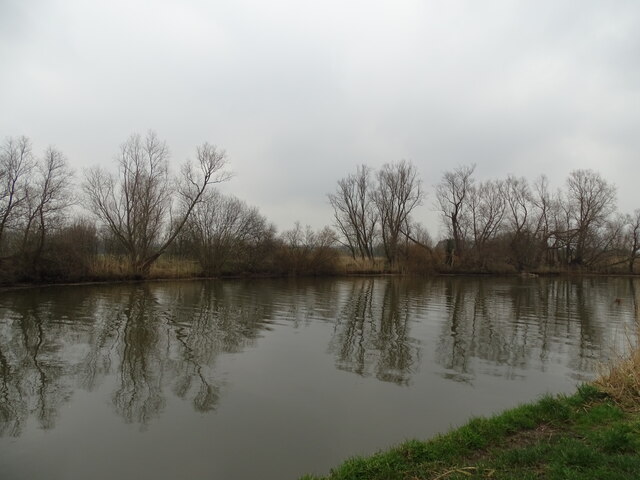
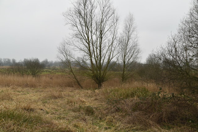
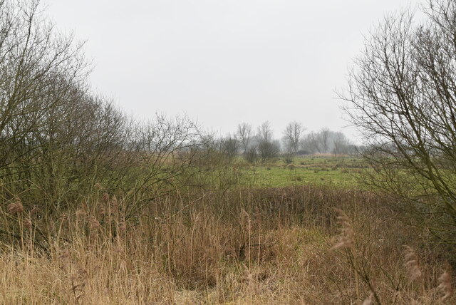
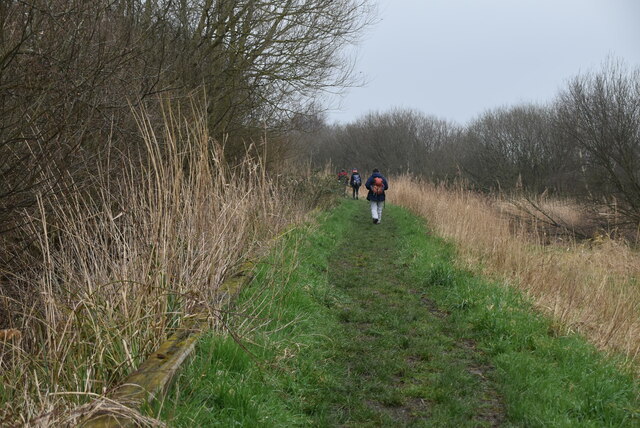
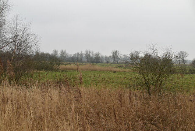
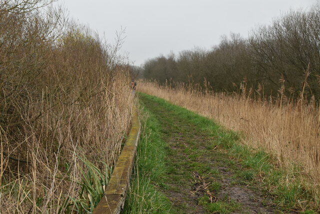
Mill Hill is a small hill located in the county of Norfolk, England. Situated near the town of Fakenham, it is part of the wider rural landscape of the region. While Mill Hill is not particularly tall, it offers a picturesque view of the surrounding countryside and is a popular destination for nature enthusiasts and hikers.

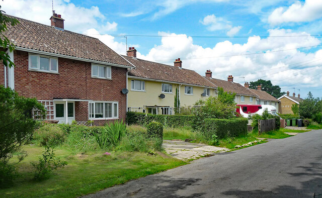
The hill is covered in lush greenery, with a variety of trees and plants dotting its slopes. It is also home to a diverse range of wildlife, including birds, small mammals, and insects. The area surrounding Mill Hill is predominantly agricultural, with fields and farmland stretching out in all directions.

At the summit of Mill Hill, there is a small stone marker that signifies its status as a notable landmark. From this vantage point, visitors can enjoy panoramic views of the Norfolk countryside, with its rolling hills, meandering rivers, and scattered villages.

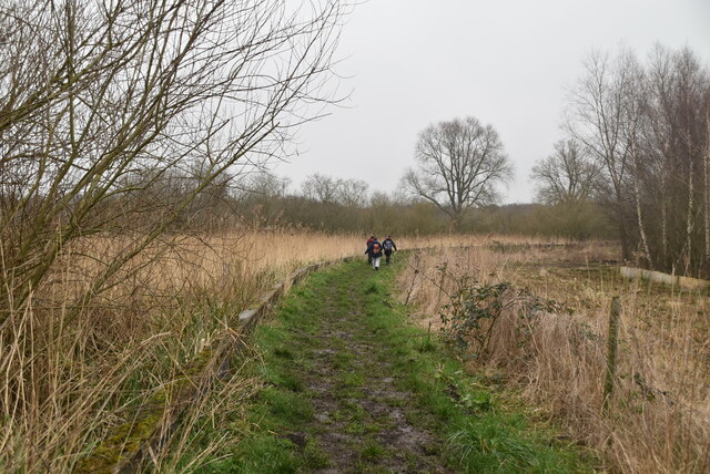
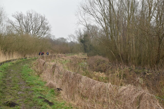
Despite its relatively modest size, Mill Hill holds a special place in the hearts of locals, who often visit for leisurely walks or to simply take in the tranquil atmosphere. The hill's peaceful surroundings make it an ideal spot for a picnic or for those seeking a break from the hustle and bustle of daily life.

Overall, Mill Hill is a charming and serene destination, offering a glimpse into the natural beauty of the Norfolk countryside. Whether it's for a leisurely stroll or to admire the stunning vistas, this small hill provides a refreshing escape for visitors and locals alike.

If you have any feedback on the listing, please let us know in the comments section below.
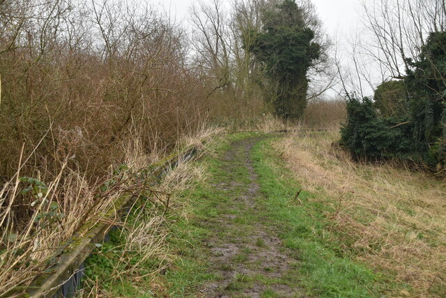
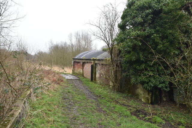
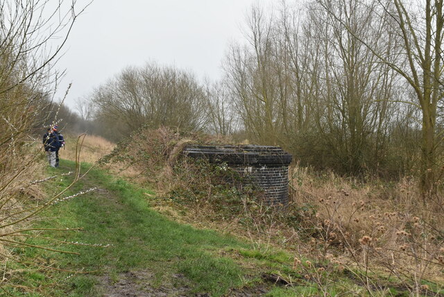
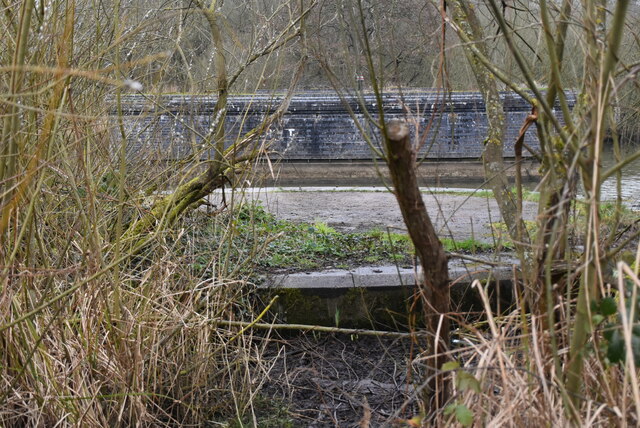
Mill Hill Images

Images are sourced within 2km of 52.483443/1.611291 or Grid Reference TM4593. Thanks to Geograph Open Source API. All images are credited.

Stanchion for old railway bridge
River Waveney
River Waveney
Angles Way
Angles Way
River Waveney
River Waveney
Former railway bridge support On River Waveney. Railway formerly connecting Beccles with Haddiscoe and St Olaves to the north directly, across the marshes.
Former railway bridge support
On River Waveney. Railway formerly connecting Beccles with Haddiscoe and St Olaves to the north directly, across the marshes.
Whiteways, Wheatacre One of several distinctive and thoughtful council housing projects by Herbert Tayler & David Green for Loddon District Council. Built in two phases, 1948 and 1957. Mostly two-storey houses.
Whiteways, Wheatacre
One of several distinctive and thoughtful council housing projects by Herbert Tayler & David Green for Loddon District Council. Built in two phases, 1948 and 1957. Mostly two-storey houses.
Muddy Angles Way A 77 mile long path. From Great Yarmouth the route goes by Breydon Water, along and near the River Waveney, passing around Oulton Broad, Beccles and Bungay, and Harleston and Diss, to its source, and then by the Little Ouse from its source very close by through heathland and marsh to Knettishall Heath in the Suffolk Brecks. Less than a mile onwards west across the heath the coincident start of the Peddars Way and finish of the Icknield Way Path are reached.
Logo <a href="https://www.geograph.org.uk/photo/7632664">TM3890 : Angles Way Logo</a>
Muddy Angles Way
A 77 mile long path. From Great Yarmouth the route goes by Breydon Water, along and near the River Waveney, passing around Oulton Broad, Beccles and Bungay, and Harleston and Diss, to its source, and then by the Little Ouse from its source very close by through heathland and marsh to Knettishall Heath in the Suffolk Brecks. Less than a mile onwards west across the heath the coincident start of the Peddars Way and finish of the Icknield Way Path are reached. Logo TM3890 : Angles Way Logo
Ditch by Angles Way A 77 mile long path. From Great Yarmouth the route goes by Breydon Water, along and near the River Waveney, passing around Oulton Broad, Beccles and Bungay, and Harleston and Diss, to its source, and then by the Little Ouse from its source very close by through heathland and marsh to Knettishall Heath in the Suffolk Brecks. Less than a mile onwards west across the heath the coincident start of the Peddars Way and finish of the Icknield Way Path are reached.
Logo <a href="https://www.geograph.org.uk/photo/7632664">TM3890 : Angles Way Logo</a>
Ditch by Angles Way
A 77 mile long path. From Great Yarmouth the route goes by Breydon Water, along and near the River Waveney, passing around Oulton Broad, Beccles and Bungay, and Harleston and Diss, to its source, and then by the Little Ouse from its source very close by through heathland and marsh to Knettishall Heath in the Suffolk Brecks. Less than a mile onwards west across the heath the coincident start of the Peddars Way and finish of the Icknield Way Path are reached. Logo TM3890 : Angles Way Logo
Angles Way A 77 mile long path. From Great Yarmouth the route goes by Breydon Water, along and near the River Waveney, passing around Oulton Broad, Beccles and Bungay, and Harleston and Diss, to its source, and then by the Little Ouse from its source very close by through heathland and marsh to Knettishall Heath in the Suffolk Brecks. Less than a mile onwards west across the heath the coincident start of the Peddars Way and finish of the Icknield Way Path are reached.
Logo <a href="https://www.geograph.org.uk/photo/7632664">TM3890 : Angles Way Logo</a>
Angles Way
A 77 mile long path. From Great Yarmouth the route goes by Breydon Water, along and near the River Waveney, passing around Oulton Broad, Beccles and Bungay, and Harleston and Diss, to its source, and then by the Little Ouse from its source very close by through heathland and marsh to Knettishall Heath in the Suffolk Brecks. Less than a mile onwards west across the heath the coincident start of the Peddars Way and finish of the Icknield Way Path are reached. Logo TM3890 : Angles Way Logo
Pumping station by Angles Way A 77 mile long path. From Great Yarmouth the route goes by Breydon Water, along and near the River Waveney, passing around Oulton Broad, Beccles and Bungay, and Harleston and Diss, to its source, and then by the Little Ouse from its source very close by through heathland and marsh to Knettishall Heath in the Suffolk Brecks. Less than a mile onwards west across the heath the coincident start of the Peddars Way and finish of the Icknield Way Path are reached.
Logo <a href="https://www.geograph.org.uk/photo/7632664">TM3890 : Angles Way Logo</a>
Pumping station by Angles Way
A 77 mile long path. From Great Yarmouth the route goes by Breydon Water, along and near the River Waveney, passing around Oulton Broad, Beccles and Bungay, and Harleston and Diss, to its source, and then by the Little Ouse from its source very close by through heathland and marsh to Knettishall Heath in the Suffolk Brecks. Less than a mile onwards west across the heath the coincident start of the Peddars Way and finish of the Icknield Way Path are reached. Logo TM3890 : Angles Way Logo
Base of old railway bridge Part of the old Yarmouth - Beccles line. <span class="nowrap"><a title="https://en.wikipedia.org/wiki/Yarmouth%E2%80%93Beccles_line" rel="nofollow ugc noopener" href="https://en.wikipedia.org/wiki/Yarmouth%E2%80%93Beccles_line">Link</a><img style="margin-left:2px;" alt="External link" title="External link - shift click to open in new window" src="https://s1.geograph.org.uk/img/external.png" width="10" height="10"/></span>
Base of old railway bridge
Part of the old Yarmouth - Beccles line. LinkExternal link
Beccles Marshes
Beccles Marshes
Beccles Marshes
Beccles Marshes
Angles Way A 77 mile long path. From Great Yarmouth the route goes by Breydon Water, along and near the River Waveney, passing around Oulton Broad, Beccles and Bungay, and Harleston and Diss, to its source, and then by the Little Ouse from its source very close by through heathland and marsh to Knettishall Heath in the Suffolk Brecks. Less than a mile onwards west across the heath the coincident start of the Peddars Way and finish of the Icknield Way Path are reached.
Logo <a href="https://www.geograph.org.uk/photo/7632664">TM3890 : Angles Way Logo</a>
Angles Way
A 77 mile long path. From Great Yarmouth the route goes by Breydon Water, along and near the River Waveney, passing around Oulton Broad, Beccles and Bungay, and Harleston and Diss, to its source, and then by the Little Ouse from its source very close by through heathland and marsh to Knettishall Heath in the Suffolk Brecks. Less than a mile onwards west across the heath the coincident start of the Peddars Way and finish of the Icknield Way Path are reached. Logo TM3890 : Angles Way Logo
Beccles Marshes
Beccles Marshes
Angles Way A 77 mile long path. From Great Yarmouth the route goes by Breydon Water, along and near the River Waveney, passing around Oulton Broad, Beccles and Bungay, and Harleston and Diss, to its source, and then by the Little Ouse from its source very close by through heathland and marsh to Knettishall Heath in the Suffolk Brecks. Less than a mile onwards west across the heath the coincident start of the Peddars Way and finish of the Icknield Way Path are reached.
Logo <a href="https://www.geograph.org.uk/photo/7632664">TM3890 : Angles Way Logo</a>
Angles Way
A 77 mile long path. From Great Yarmouth the route goes by Breydon Water, along and near the River Waveney, passing around Oulton Broad, Beccles and Bungay, and Harleston and Diss, to its source, and then by the Little Ouse from its source very close by through heathland and marsh to Knettishall Heath in the Suffolk Brecks. Less than a mile onwards west across the heath the coincident start of the Peddars Way and finish of the Icknield Way Path are reached. Logo TM3890 : Angles Way Logo
River Waveney The River Waveney forms the boundary between Suffolk and Norfolk. It rises at Redgrave Fen and flows in an easterly direction though the towns of Diss, Bungay (the head of navigation) and Beccles. There is a weir at Billingford, shortly after the River Dove, flowing northwards from Eye, joins the Waveney on the southern bank. The Waveney passes round Bungay and on to Beccles. Having skirted past Oulton Broad it passes through Somerleyton and Hadiscoe before merging with the Yare in Breydon Water.
River Waveney
The River Waveney forms the boundary between Suffolk and Norfolk. It rises at Redgrave Fen and flows in an easterly direction though the towns of Diss, Bungay (the head of navigation) and Beccles. There is a weir at Billingford, shortly after the River Dove, flowing northwards from Eye, joins the Waveney on the southern bank. The Waveney passes round Bungay and on to Beccles. Having skirted past Oulton Broad it passes through Somerleyton and Hadiscoe before merging with the Yare in Breydon Water.
Show me another place!

Mill Hill is located at Grid Ref: TM4593 (Lat: 52.483443, Lng: 1.611291)

Administrative County: Norfolk

District: South Norfolk

Police Authority: Norfolk

What 3 Words

///moth.coached.opened. Near Beccles, Suffolk

Nearby Locations

Mill Hill Aldeby

Related Wikis

Aldeby

Aldeby is a village and civil parish in the English county of Norfolk. It is bounded to the south by the River Waveney, on the other side of which is Suffolk...

Wheatacre

Wheatacre is a civil parish in the English county of Norfolk. It covers an area of 4.38 km2 (1.69 sq mi) and had a population of 112 in 43 households at...

Aldeby railway station

Aldeby railway station was a station in Aldeby, in the English county of Norfolk. It was on the line between Great Yarmouth and Beccles; the station was...

Burgh St Peter

Burgh St Peter is a village and civil parish in the South Norfolk district of Norfolk, England. The village is about 3+1⁄2 miles (6 km) northeast of Beccles...

Nearby Amenities

Located within 500m of 52.483443,1.611291
Barrier: stile
Lat/Long: 52.4829931/1.6163124
Bus Stop
Green, adj
Bus: yes
Naptan AtcoCode: 2900A071
Naptan Bearing: E
Naptan CommonName: green
Naptan Indicator: adj
Naptan Landmark: bus shelter
Naptan Locality: Aldeby
Naptan NaptanCode: nfoadawd
Naptan ShortCommonName: green
Naptan Street: Beccles Road
Naptan Verified: no
Public Transport: platform
Shelter: yes
Source: naptan_import
Lat/Long: 52.4840284/1.6059507
Aldeby
Place: village
Source Name: OS_OpenData_StreetView
Wikidata: Q1785132
Wikipedia: en:Aldeby
Lat/Long: 52.4843038/1.6068817
Give Way
Direction: forward
Lat/Long: 52.4841934/1.6059787
Barrier: entrance
Foot: yes
Lat/Long: 52.4840581/1.6052771
Barrier: entrance
Foot: yes
Lat/Long: 52.4843619/1.6056281
Barrier: entrance
Foot: yes
Lat/Long: 52.4858534/1.6060139
Bench
Backrest: yes
Colour: brown
Material: wood
Seats: 2
Lat/Long: 52.4845617/1.6050299
Aldeby
Inscription: Designed and created by Geoffrey Charles Buck to Celebrate the Silver Jubilee Of HM Queen Elizabeth II 1977 / Restored for the Queens Diamond Jubilee 2012 by IBBC Oulton Broad
Man Made: village_sign
Material: wood
Lat/Long: 52.4854512/1.6096472
Waste Basket
Lat/Long: 52.4840365/1.6058156
Post Box
Brand: Royal Mail
Brand Wikidata: Q638098
Brand Wikipedia: en:Royal Mail
Operator: Royal Mail
Operator Wikidata: Q638098
Post Box Mounting: pier
Post Box Type: lamp
Royal Cypher: EIIR
Royal Cypher Wikidata: Q33102113
Lat/Long: 52.4840484/1.6059778
Grit Bin
Colour: green
Lat/Long: 52.4840745/1.6060236
Give Way
Direction: forward
Lat/Long: 52.4839973/1.6061201
Give Way
Direction: backward
Lat/Long: 52.4840061/1.605684
Give Way
Direction: backward
Lat/Long: 52.4862136/1.6064702
Defibrillator
Access: yes
Booth: K6
Covered: booth
Defibrillator Location: inside old red phone box, Aldeby
Disused Amenity: telephone
Emergency: defibrillator
Man Made: telephone_box
Lat/Long: 52.4840787/1.6059838
The data included in this document is from www.openstreetmap.org. The data is made available under ODbL.

Have you been to Mill Hill?

Leave your review of Mill Hill below (or comments, questions and feedback).