Toll's Hill

Hill, Mountain in Norfolk North Norfolk

England

Toll's Hill

A149 Cromer direction
A149 Cromer direction Credit: David Pashley

Toll's Hill is a prominent geological formation located in the county of Norfolk, England. Despite its name, it is not a hill in the traditional sense, but rather a small, low-lying mound that could be described as more of a gentle rise in the landscape. It is situated near the village of Toll Bar, roughly five miles northeast of the town of Swaffham.

Standing at an elevation of approximately 60 meters above sea level, Toll's Hill offers panoramic views of the surrounding Norfolk countryside. The hill is primarily composed of glacial till, a mixture of clay, sand, and gravel left behind by retreating glaciers during the last Ice Age. This gives the mound its distinctively rounded shape and contributes to its geological interest.

Toll's Hill is known for its diverse flora and fauna. The area surrounding the hill is home to a variety of plant species, including heather, gorse, and bracken, which give the landscape a vibrant, colorful appearance during the summer months. The hill also provides a habitat for various bird species, such as skylarks and meadow pipits, making it a popular spot for birdwatchers.

Access to Toll's Hill is relatively easy, with public footpaths and bridleways leading to the site. Visitors can enjoy leisurely walks or hikes to the top, where they can take in the picturesque views of the Norfolk countryside. The hill's location in the heart of rural Norfolk adds to its charm, providing a peaceful and serene setting for nature enthusiasts and those seeking a break from the hustle and bustle of everyday life.

If you have any feedback on the listing, please let us know in the comments section below.

Toll's Hill Images

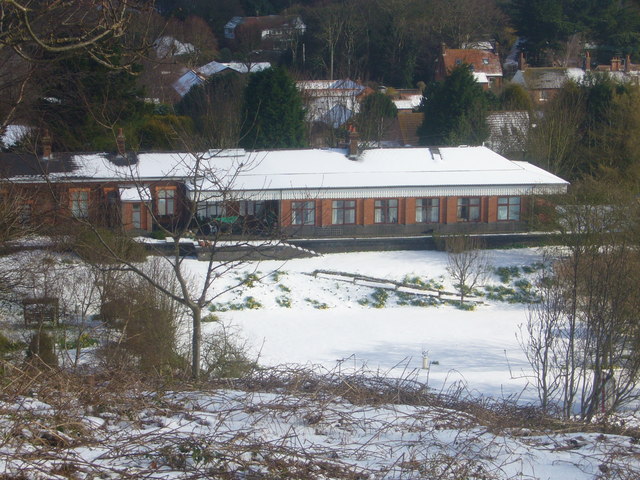
Images are sourced within 2km of 52.91299/1.3349088 or Grid Reference TG2440. Thanks to Geograph Open Source API. All images are credited.

A149 Cromer direction
Cromer : North Norfolk coastline
Overstrand : gateway to "The Pleasaunce" Grade II* listed structure built from a design by architect Edwin Lutyens. Description at this <span class="nowrap"><a title="https://historicengland.org.uk/listing/the-list/list-entry/1049819?sec" rel="nofollow ugc noopener" href="https://historicengland.org.uk/listing/the-list/list-entry/1049819?sec">Link</a><img style="margin-left:2px;" alt="External link" title="External link - shift click to open in new window" src="https://s1.geograph.org.uk/img/external.png" width="10" height="10"/></span>.
Overstrand : gateway to "The Pleasaunce"
Grade II* listed structure built from a design by architect Edwin Lutyens. Description at this LinkExternal link.
Overstrand : "The Pleasaunce" Grade II* listed building designed by Edwin Lutyens in the late 1890s. Full description at this <span class="nowrap"><a title="https://historicengland.org.uk/listing/the-list/list-entry/1049817?section=official-list-entry" rel="nofollow ugc noopener" href="https://historicengland.org.uk/listing/the-list/list-entry/1049817?section=official-list-entry">Link</a><img style="margin-left:2px;" alt="External link" title="External link - shift click to open in new window" src="https://s1.geograph.org.uk/img/external.png" width="10" height="10"/></span>.
Overstrand : "The Pleasaunce"
Grade II* listed building designed by Edwin Lutyens in the late 1890s. Full description at this LinkExternal link.
Overstrand : entrance block, "The Pleasaunce" Grade II* listed building designed by Edwin Lutyens in the late 1890s. Full description at this <span class="nowrap"><a title="https://historicengland.org.uk/listing/the-list/list-entry/1049817?section=official-list-entry" rel="nofollow ugc noopener" href="https://historicengland.org.uk/listing/the-list/list-entry/1049817?section=official-list-entry">Link</a><img style="margin-left:2px;" alt="External link" title="External link - shift click to open in new window" src="https://s1.geograph.org.uk/img/external.png" width="10" height="10"/></span>.
Overstrand : entrance block, "The Pleasaunce"
Grade II* listed building designed by Edwin Lutyens in the late 1890s. Full description at this LinkExternal link.
Overstrand : entrance, "The Pleasaunce" Grade II* listed building designed by Edwin Lutyens in the late 1890s. Full description at this <span class="nowrap"><a title="https://historicengland.org.uk/listing/the-list/list-entry/1049817?section=official-list-entry" rel="nofollow ugc noopener" href="https://historicengland.org.uk/listing/the-list/list-entry/1049817?section=official-list-entry">Link</a><img style="margin-left:2px;" alt="External link" title="External link - shift click to open in new window" src="https://s1.geograph.org.uk/img/external.png" width="10" height="10"/></span>.
Overstrand : entrance, "The Pleasaunce"
Grade II* listed building designed by Edwin Lutyens in the late 1890s. Full description at this LinkExternal link.
Beach Reflection, Overstrand, Norfolk I liked the reflection of the sky in this tidal puddle.
Beach Reflection, Overstrand, Norfolk
I liked the reflection of the sky in this tidal puddle.
Overstrand, Norfolk Seen from promenade.
Overstrand, Norfolk
Seen from promenade.
Overstrand, Norfolk Seen from the promenade.
Overstrand, Norfolk
Seen from the promenade.
Paston Way north of Overstrand Part of the English Coastal Path
Paston Way north of Overstrand
Part of the English Coastal Path
Cliffs above Foulness
Royal Cromer Golf Course at Overstrand
Path beside Royal Cromer Golf Course
Cromer Lighthouse
Cromer Lighthouse
Cliffs by Foulness
Cliffs by Foulness
Groyne Groyne on the beach at Overstrand, part submerged at high tide.
Groyne
Groyne on the beach at Overstrand, part submerged at high tide.
Royal Cromer Golf Club Cliff path alongside the Royal Cromer Golf Club's course.  In the far right background is Cromer Pier.
Royal Cromer Golf Club
Cliff path alongside the Royal Cromer Golf Club's course. In the far right background is Cromer Pier.
Royal Cromer Golf Club Cliff path alongside the Royal Cromer Golf Club's course.
Royal Cromer Golf Club
Cliff path alongside the Royal Cromer Golf Club's course.
Show me another place!

Toll's Hill is located at Grid Ref: TG2440 (Lat: 52.91299, Lng: 1.3349088)

Administrative County: Norfolk

District: North Norfolk

Police Authority: Norfolk

What 3 Words

///eyelid.wiggling.replace. Near Overstrand, Norfolk

Related Wikis

Overstrand railway station

Overstrand railway station was a station in North Norfolk on the Norfolk and Suffolk Joint Railway, serving the settlement of Overstrand. It opened on...
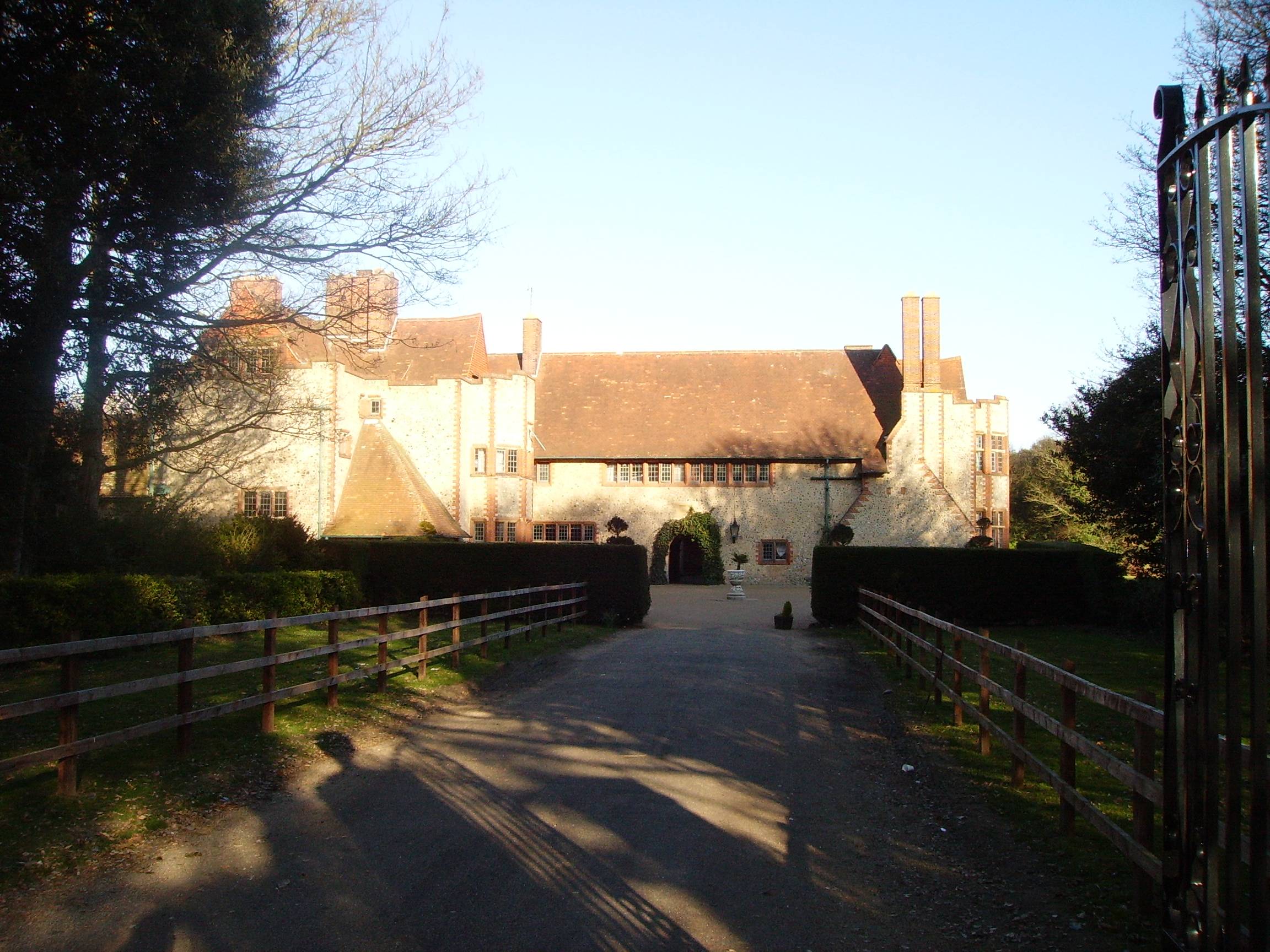
Overstrand Hall

Overstrand Hall is a country house in Overstrand, Norfolk, England, designed by Edwin Lutyens for Charles William Mills, 2nd Baron Hillingdon, a partner...

Northrepps

Northrepps is a village and a civil parish in the English county of Norfolk. It is 3.4 miles (5.5 km) southeast of Cromer, 22.2 miles (35.7 km) north of...

Overstrand Cliffs

Overstrand Cliffs is a 57.8-hectare (143-acre) biological and geological Site of Special Scientific Interest in Cromer in Norfolk. It is a Special Area...

Nearby Amenities

Located within 500m of 52.91299,1.3349088
Overstrand
Historic Railway: station
Railway: site
Source: wikipedia
Wikidata: Q7113989
Wikipedia: en:Overstrand railway station
Lat/Long: 52.9149332/1.3353152
Bus Stop
High Street, adj
Alt Name: Overstrand- opp Garden Centre
Naptan AltCommonName: Overstrand- opp Garden Centre
Naptan AtcoCode: 2900O0511
Naptan Bearing: SE
Naptan CommonName: High Street
Naptan Indicator: adj
Naptan Locality: Overstrand
Naptan NaptanCode: nfodmwpg
Naptan Street: Mundesley Road
Naptan Verified: no
Source: naptan_import
Lat/Long: 52.9159258/1.3398298
Bus Stop
High Street, opp
Alt Name: Overstrand- Garden Centre
Naptan AltCommonName: Overstrand- Garden Centre
Naptan AtcoCode: 2900O0512
Naptan Bearing: NW
Naptan BusStopType: CUS
Naptan CommonName: High Street
Naptan Indicator: opp
Naptan Locality: Overstrand
Naptan NaptanCode: nfodmwpj
Naptan Street: Mundesley Road
Naptan Verified: no
Source: naptan_import
Lat/Long: 52.9158548/1.3397945
Bus Stop
Primary School, adj
Naptan AtcoCode: 2900O054
Naptan Bearing: NW
Naptan CommonName: Primary School
Naptan Indicator: adj
Naptan Locality: Overstrand
Naptan NaptanCode: nfodmwpm
Naptan Street: Cromer Road
Naptan Verified: no
Source: naptan_import
Lat/Long: 52.9166862/1.3361388
Bus Stop
Primary School, opp
Naptan AtcoCode: 2900O056
Naptan Bearing: SE
Naptan CommonName: Primary School
Naptan Indicator: opp
Naptan Locality: Overstrand
Naptan NaptanCode: nfodmwpw
Naptan Street: Cromer Road
Naptan Verified: no
Source: naptan_import
Lat/Long: 52.9167575/1.3361592
Sally Beans Wood 1760
Historic: monument
Note: small iron plaque on stone in woods
Lat/Long: 52.9108644/1.3290506
Crossing
Crossing: island
Lat/Long: 52.9160553/1.3391787
Crossing
Crossing: unmarked
Lat/Long: 52.9171522/1.332236
Restaurant
Repton's Restaurant
Lat/Long: 52.9130106/1.3277304
Give Way
Lat/Long: 52.9139731/1.3278591
Waste Basket
Colour: red
Waste: dog_excrement
Lat/Long: 52.9161984/1.3392417
Bench
Backrest: yes
Colour: brown
Material: wood
Seats: 4
Lat/Long: 52.9161347/1.3392189
Bench
Backrest: yes
Colour: brown
Inscription: yes
Material: wood
Seats: 3
Lat/Long: 52.9161082/1.3391921
Overstrand
Inscription: WI / yes
Man Made: village_sign
Material: wood;metal
Lat/Long: 52.9161345/1.3391961
Give Way
Lat/Long: 52.9161592/1.3388662
Turning Loop
Lat/Long: 52.9150942/1.335806
Ivy Farm Airstrip
Aeroway: airstrip
Lat/Long: 52.9106149/1.3399939
Give Way
Lat/Long: 52.9171715/1.332241
Material: wood
Power: pole
Lat/Long: 52.9157078/1.3303816
Location Transition: yes
Power: pole
Lat/Long: 52.9149223/1.3371295
Power: pole
Lat/Long: 52.9139697/1.3367338
Power: pole
Lat/Long: 52.9087904/1.3326448
Power: pole
Lat/Long: 52.9092717/1.3332805
Power: pole
Lat/Long: 52.9097505/1.333892
Power: pole
Lat/Long: 52.9102139/1.3345116
Power: pole
Lat/Long: 52.913186/1.3365112
Power: pole
Lat/Long: 52.9127469/1.3363181
Power: pole
Lat/Long: 52.9122083/1.3361196
Power: pole
Lat/Long: 52.9116705/1.3359292
Power: pole
Lat/Long: 52.9111593/1.3357253
Power: pole
Lat/Long: 52.9109652/1.3368706
Power: pole
Lat/Long: 52.9107849/1.3380374
Power: pole
Lat/Long: 52.9105843/1.3392726
Power: pole
Lat/Long: 52.9105309/1.3410093
The data included in this document is from www.openstreetmap.org. The data is made available under ODbL.

Have you been to Toll's Hill?

Leave your review of Toll's Hill below (or comments, questions and feedback).