Bunker's Hill

Hill, Mountain in Norfolk North Norfolk

England

Bunker's Hill

Top of Franklin Hill With sea views limited by growing gorse and trees.
Top of Franklin Hill Credit: Hugh Venables

Bunker's Hill, located in Norfolk, is a prominent hill that offers picturesque views and serves as a popular recreational spot for both locals and tourists. Situated in the southeastern part of England, this hill is part of the larger Bunker's Hill Nature Reserve, which spans over 100 acres of protected land.

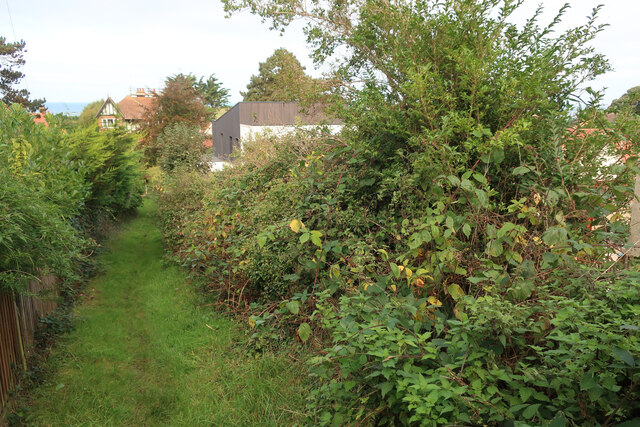
Rising approximately 30 meters above sea level, Bunker's Hill is not a towering mountain, but its elevation provides a notable vantage point for observing the surrounding landscape. The hill is covered in lush greenery, including a variety of trees and shrubs, creating a serene and tranquil atmosphere.

Visitors can enjoy a leisurely hike up the hill, following well-marked trails that wind through the dense vegetation. As they ascend, they are rewarded with breathtaking panoramic views of the Norfolk countryside, the nearby coastline, and the North Sea. On clear days, it is even possible to spot distant landmarks such as the iconic Cromer Pier.

The hill's name, Bunker's Hill, has historical significance. It is believed to have been named after a local family, the Bunkers, who were prominent landowners in the area during the medieval period. This historical connection adds to the charm and intrigue of the site.

Overall, Bunker's Hill in Norfolk is a natural gem, offering visitors the opportunity to connect with nature, enjoy stunning vistas, and immerse themselves in the rich history of the region. Whether for a peaceful walk or to capture breathtaking photographs, this hill is a must-visit destination for nature enthusiasts and history buffs alike.

If you have any feedback on the listing, please let us know in the comments section below.

Bunker's Hill Images

Images are sourced within 2km of 52.939973/1.2041539 or Grid Reference TG1542. Thanks to Geograph Open Source API. All images are credited.

Top of Franklin Hill With sea views limited by growing gorse and trees.
Top of Franklin Hill
With sea views limited by growing gorse and trees.
Path up Franklin Hill A small bump within Sheringham.
Path up Franklin Hill
A small bump within Sheringham.
Building site on the side of Franklin Hill
Steps up Franklin Hill
End of Hooks Hill Road No link through to Uplands Park.
End of Hooks Hill Road
No link through to Uplands Park.
Path down Franklin Hill
Church Street, Sheringham
Sheringham Court Flats for those over 55.
Sheringham Court
Flats for those over 55.
Station Approach car park, Sheringham
Wyndham Street, Sheringham
Tesco, Sheringham
Tesco, Sheringham
Dew pond, Beeston Common Quite wet in spring, normally dries out in summer, making it attractive to some plants and damselflies. See <span class="nowrap"><a title="http://www.beestoncommon.org.uk/dewpond.html" rel="nofollow ugc noopener" href="http://www.beestoncommon.org.uk/dewpond.html">Link</a><img style="margin-left:2px;" alt="External link" title="External link - shift click to open in new window" src="https://s1.geograph.org.uk/img/external.png" width="10" height="10"/></span>
Dew pond, Beeston Common
Quite wet in spring, normally dries out in summer, making it attractive to some plants and damselflies. See LinkExternal link
Links Road, Sheringham The edge of Sheringham, next to the golf course.
Links Road, Sheringham
The edge of Sheringham, next to the golf course.
Former care home, North Street
Turnstones on Sheringham seafront The Turnstones in Sheringham are very tame and will come to food. A ringed bird amongst them is likely to be the Canadian-ringed bird from last winter.
Turnstones on Sheringham seafront
The Turnstones in Sheringham are very tame and will come to food. A ringed bird amongst them is likely to be the Canadian-ringed bird from last winter.
Cliffs near Sheringham Some of the more resistant bit of glacial deposits.
Cliffs near Sheringham
Some of the more resistant bit of glacial deposits.
Cliffs near Sheringham With a recent cliff fall revealing interesting layers of sediment within the glacial deposits. See <a href="https://www.geograph.org.uk/photo/5365075">TG1443 : Landslide at Sheringham</a>
Cliffs near Sheringham
With a recent cliff fall revealing interesting layers of sediment within the glacial deposits. See TG1443 : Landslide at Sheringham
Walkway past Tesco, Sheringham
Show me another place!

Bunker's Hill is located at Grid Ref: TG1542 (Lat: 52.939973, Lng: 1.2041539)

Administrative County: Norfolk

District: North Norfolk

Police Authority: Norfolk

What 3 Words

///regrowth.roofed.airless. Near Sheringham, Norfolk

Related Wikis

Masonic Hall, Sheringham

The Masonic Hall, Sheringham was built in 1914 to house the Electric Picture Palace. == Location == The hall is located on the landward side of the coast...

Sheringham railway station (North Norfolk Railway)

Sheringham is the name of a preserved railway station in Sheringham, Norfolk. It was once part of the Midland and Great Northern Joint Railway network...

Sheringham Town Hall

Sheringham Town Hall, formerly known as Sheringham Council Offices, is a former municipal building in Church Street, Sheringham, Norfolk, England. The...

Sheringham F.C.

Sheringham Football Club is a football club based in Sheringham, England and was established in 1897. They are currently members of the Eastern Counties...

Nearby Amenities

Located within 500m of 52.939973,1.2041539
Sheringham
Naptan AtcoCode: 9100SHRGHAM
Network: National Rail
Network Website: https://www.nationalrail.co.uk/stations/shm/
Network Wikidata: Q26334
Operator: Greater Anglia
Owner: Network Rail
Public Transport: station
Railway: station
Ref Crs: SHM
Source Ref: ATOC
Train: yes
Wikipedia: en:Sheringham railway station
Lat/Long: 52.9413671/1.2107897
Sheringham (NNR)
Naptan AtcoCode: 940GZZNNSHM
Operator: North Norfolk Railway
Public Transport: station
Railway: station
Tourism: preserved_railway
Usage: tourism
Lat/Long: 52.9417019/1.2080451
Crossing Barrier: no
Railway: level_crossing
Lat/Long: 52.9414839/1.2098717
Post Box
Collection Times: Mo-Fr 09:00; Sa 07:00
Post Box Type: pillar
Ref: NR26 2607
Royal Cypher: EVIIR
Royal Cypher Wikidata: Q33102324
Lat/Long: 52.9399863/1.2088471
Bus Stop
Station Approach
Bench: yes
Bus: yes
Naptan AtcoCode: 2900S701
Naptan Bearing: W
Naptan CommonName: Railway Approach
Naptan Indicator: W-bound
Naptan Locality: Sheringham
Naptan NaptanCode: nfodwgja
Naptan Street: Railway Approach
Public Transport: platform
Shelter: yes
Source: naptan_import
Timetable: yes
Lat/Long: 52.9416667/1.2091273
Bus Stop
Station Approach
Bus: yes
Naptan AtcoCode: 2900S7018
Naptan Bearing: E
Naptan CommonName: Railway Approach
Naptan Indicator: E-bound
Naptan Landmark: North Norfolk Railway
Naptan Locality: Sheringham
Naptan NaptanCode: nfodwgjw
Naptan ShortCommonName: Sherringham
Naptan Street: Railway Approach
Public Transport: platform
Source: naptan_import
Lat/Long: 52.9419334/1.2078512
Cremers Drift, opp
Naptan AtcoCode: 2900S7021
Naptan Bearing: SE
Naptan BusStopType: CUS
Naptan CommonName: Cremers Drift
Naptan Indicator: opp
Naptan Locality: Sheringham
Naptan NaptanCode: nfodwgmg
Naptan Street: Cromer Road
Naptan Verified: no
Source: naptan_import
Lat/Long: 52.9406552/1.2113154
Golf club, opp
Naptan AtcoCode: 2900S7048
Naptan Bearing: NW
Naptan BusStopType: CUS
Naptan CommonName: Golf club
Naptan Indicator: opp
Naptan Locality: Sheringham
Naptan NaptanCode: nfodwjag
Naptan Street: Weybourne Road
Naptan Verified: no
Source: naptan_import
Lat/Long: 52.9422091/1.2002747
Bus Stop
Golf club, adj
Bus: yes
Kerb: raised
Naptan AtcoCode: 2900S7049
Naptan Bearing: SE
Naptan CommonName: Golf club
Naptan Indicator: adj
Naptan Locality: Sheringham
Naptan NaptanCode: nfodwjaj
Naptan Street: Weybourne Road
Naptan Verified: no
Public Transport: platform
Source: naptan_import
Tactile Paving: yes
Lat/Long: 52.9421853/1.2008238
Bus Stop
Greenlands Way
Bench: no
Bus: yes
Naptan AtcoCode: 2900S7050
Naptan Bearing: NE
Naptan BusStopType: CUS
Naptan CommonName: Greenlands Way
Naptan Indicator: adj
Naptan Locality: Sheringham
Naptan NaptanCode: nfogpdaj
Naptan Street: Holt Road
Public Transport: platform
Shelter: no
Source: naptan_import;survey
Lat/Long: 52.9389435/1.1996465
Bus Stop
Uplands Park
Bus: yes
Check Date Shelter: 2023-05-29
Naptan AtcoCode: 2900S7051
Naptan Bearing: SW
Naptan BusStopType: CUS
Naptan CommonName: Greenlands Way
Naptan Indicator: opp
Naptan Locality: Sheringham
Naptan NaptanCode: nfogpdam
Naptan Street: Holt Road
Public Transport: platform
Shelter: no
Source: naptan_import;survey
Lat/Long: 52.938702/1.1995705
Bus Stop
Abbey Road
Bus: yes
Naptan AtcoCode: 2900S7052
Naptan Bearing: SW
Naptan CommonName: Abbey Road
Naptan Indicator: adj
Naptan Latitude: 52.9410546
Naptan Locality: Sheringham
Naptan Longitude: 1.2037325
Naptan NaptanCode: nfogpdja
Naptan Street: Holt Road
Public Transport: platform
Shelter: no
Source: naptan_import;survey
Lat/Long: 52.9410749/1.2035858
Bus Stop
Abbey Road
Bus: yes
Naptan AtcoCode: 2900S7053
Naptan Bearing: NE
Naptan CommonName: Abbey Road
Naptan Indicator: opp
Naptan Latitude: 52.9413611
Naptan Locality: Sheringham
Naptan Longitude: 1.204038
Naptan NaptanCode: nfogpdap
Naptan Street: Holt Road
Public Transport: platform
Shelter: no
Source: naptan_import;survey
Lat/Long: 52.9412996/1.2038916
Pub
The Tyneside Club
Addr City: Sheringham
Addr Housenumber: 95
Addr Postcode: NR26 8RG
Addr Street: Station Road
Fhrs Id: 689688
Source Addr: FHRS Open Data
Website: https://tynesideclub.org.uk/
Lat/Long: 52.9410191/1.2099506
Pub
The Jolly Tar
Addr City: Sheringham
Addr Housenumber: 55
Addr Postcode: NR26 8RG
Addr Street: Station Road
Fhrs Id: 281361
Source Addr: FHRS Open Data
Lat/Long: 52.9415995/1.2101328
Recycling
Lat/Long: 52.9415882/1.2080928
Addr City: Norwich
Addr Country: GB
Addr Postcode: NR26 8RA
Addr Street: Station Approach
Opening Hours: Mar 25-Apr 7: 10:00-16:00; Apr 8-May 19: 10:00-14:00; May 20-Sep 8: Mo-Sa 10:00-17:00; Su 10:00-16:00; Sep 9-Nov 3: 10:00-14:00; Nov 4-Mar 24: off
Opening Hours Url: http://www.northnorfolk.org/council/8416.asp
Phone: +44 1263 824329
Tourism: information
Website: http://www.northnorfolk.org/council/8416.asp
Wheelchair: yes
Lat/Long: 52.9416706/1.2088536
Post Box
Brand: Royal Mail
Brand Wikidata: Q638098
Collection Times: Mo-Fr 17:00; Sa 10:00
Note: Unusual hexagonal pillar with decorated roof
Operator: Royal Mail
Operator Wikidata: Q638098
Post Box Design: penfold
Post Box Type: pillar
Ref: NR26 2627
Royal Cypher: VR
Royal Cypher Wikidata: Q33102356
Lat/Long: 52.9415568/1.2095602
Toilets
Fee: no
Female: yes
Male: yes
Opening Hours: Oct-Mar Mo-Su 07:00-17:00; Mar-Oct Mo-Su 07:00-20:00
Lat/Long: 52.9416845/1.208764
Franklin Hill
Tourism: viewpoint
Lat/Long: 52.9382991/1.2038747
Turning Circle
Lat/Long: 52.941342/1.2020643
Crossing Barrier: no
Crossing Light: yes
Railway: level_crossing
Lat/Long: 52.9425887/1.2004457
Booth: K6
Covered: booth
Man Made: telephone_box
Note: no phone inside
Lat/Long: 52.9418122/1.208308
Crossing
Crossing: traffic_signals
Crossing Ref: pelican
Tactile Paving: yes
Lat/Long: 52.9407396/1.2098439
Blyth & Wright
Addr City: Sheringham
Addr Housenumber: 34-40
Addr Postcode: NR26 8RQ
Addr Street: Station Road
Shop: ironmongers
Website: https://www.blythandwright.co.uk/
Lat/Long: 52.9424573/1.210293
Cafe
The Quarter Deck
Addr City: Sheringham
Addr Housenumber: 8
Addr Postcode: NR26 8RA
Addr Street: Station Approach
Fhrs Id: 1556713
Source Addr: FHRS Open Data
Lat/Long: 52.9417369/1.2094851
Fast Food
Zahra's
Addr City: Sheringham
Addr Housenumber: 8A
Addr Postcode: NR26 8RA
Addr Street: Station Approach
Cuisine: indian
Fhrs Id: 281765
Phone: +44 1263 825990
Source Addr: FHRS Open Data
Lat/Long: 52.9417526/1.2093788
Turning Circle
Lat/Long: 52.9356056/1.2045968
Bicycle Parking
Bicycle Parking: stands
Capacity: 4
Colour: grey
Covered: no
Material: aluminium
Lat/Long: 52.9415053/1.2102009
Post Box
Brand: Royal Mail
Brand Wikidata: Q638098
Collection Times: Mo-Fr 09:00; Sa 07:00
Operator: Royal Mail
Operator Wikidata: Q638098
Post Box Design: type_b
Post Box Type: pillar
Ref: NR26 2613D
Royal Cypher: VR
Royal Cypher Wikidata: Q33102356
Lat/Long: 52.9414492/1.2043709
Post Box
Collection Times: Mo-Fr 09:00; Sa 07:00
Operator: Royal Mail
Operator Wikidata: Q638098
Post Box Design: type_b
Post Box Type: pillar
Ref: NR26 2614D
Royal Cypher: EIIR
Royal Cypher Wikidata: Q33102113
Lat/Long: 52.9378774/1.1985525
Barrier: cycle_barrier
Lat/Long: 52.9368582/1.2012225
Barrier: cycle_barrier
Lat/Long: 52.9360194/1.2051102
Barrier: cycle_barrier
Lat/Long: 52.9361601/1.2046702
Bicycle Parking
Bicycle Parking: stands
Capacity: 6
Check Date: 2023-08-11
Covered: no
Lat/Long: 52.9413877/1.2097102
Post Box
2 Railway Stn
Collection Times: Mo-Fr 07:15,10:15,16:00,18:30; Sa 07:15,10:15,11:30; Su,PH off
Inscription: This is a private posting box for the use of visitors. Any Mail posted here will be re-posted by staff of the North Norfolk Railway
Note: Private box on platform, plaque says mail will be re-posted by railway staff
Operator: North Norfolk Railway
Post Box Type: wall
Royal Cypher: VR
Royal Cypher Wikidata: Q33102356
Lat/Long: 52.9417516/1.2082705
Crossing Bell: no
Crossing Light: no
Railway: level_crossing
Lat/Long: 52.941628/1.2086193
Railway: switch
Lat/Long: 52.9415944/1.2089372
Cafe
Station Buffet
Addr City: Sheringham
Addr Housename: North Norfolk Railway
Addr Postcode: NR26 8RA
Addr Street: Station Approach
Fhrs Id: 281916
Source Addr: FHRS Open Data
Lat/Long: 52.9418025/1.2079058
Crossing Bell: no
Crossing Light: no
Railway: level_crossing
Lat/Long: 52.941652/1.2086276
Crossing Barrier: no
Crossing Bell: no
Crossing Light: no
Railway: level_crossing
Lat/Long: 52.9415241/1.2094928
Entrance: main
Lat/Long: 52.9418121/1.2082407
Post Box
Brand: Royal Mail
Brand Wikidata: Q638098
Collection Times: Mo-Fr 09:00; Sa 07:00
Operator: Royal Mail
Operator Wikidata: Q638098
Post Box Type: pillar
Ref: NR26 2612D
Royal Cypher: GR
Royal Cypher Wikidata: Q33102273
Lat/Long: 52.9427372/1.2050164
Bunker's Hill
Place: locality
Lat/Long: 52.9403323/1.20331
Franklin Hill
Natural: peak
Lat/Long: 52.9384031/1.2038322
Post Box
Brand: Royal Mail
Brand Wikidata: Q638098
Collection Times: Mo-Fr 09:00; Sa 07:00
Operator: Royal Mail
Operator Wikidata: Q638098
Post Box Type: pillar
Ref: NR26 2615D
Royal Cypher: GR
Royal Cypher Wikidata: Q33102273
Lat/Long: 52.9395648/1.2031675
Entrance: yes
Lat/Long: 52.9430675/1.2084165
Entrance: main
Lat/Long: 52.943162/1.2085507
Entrance: yes
Lat/Long: 52.9430004/1.2088756
Entrance: main
Lat/Long: 52.9428969/1.208571
Give Way
Lat/Long: 52.9393716/1.2055531
Addr Postcode: NR26 8JL
Building: yes
Lat/Long: 52.9414152/1.2003751
Railway: switch
Lat/Long: 52.9418704/1.2060108
Railway: switch
Lat/Long: 52.9418103/1.2061644
Railway: switch
Lat/Long: 52.9425124/1.2012832
Railway: switch
Lat/Long: 52.9420759/1.204834
Railway: switch
Lat/Long: 52.9423817/1.2021927
Railway: switch
Lat/Long: 52.9424304/1.2014139
Railway: switch
Lat/Long: 52.9419479/1.2055099
Railway: switch
Lat/Long: 52.9419403/1.2058299
Railway: switch
Lat/Long: 52.942015/1.2055403
Railway: switch
Lat/Long: 52.9420317/1.2051713
Golf: pin
Lat/Long: 52.942875/1.1998412
Entrance: main
Lat/Long: 52.941993/1.2027896
Atm
Lat/Long: 52.9421242/1.2028434
Bench
Lat/Long: 52.9413049/1.2106813
Bench
Lat/Long: 52.9412942/1.2107503
Description: Best view of steam railway
Tourism: viewpoint
Lat/Long: 52.9415727/1.2061161
Crossing
Crossing: uncontrolled
Crossing Island: no
Crossing Ref: zebra
Lat/Long: 52.9416857/1.1973429
Give Way
Lat/Long: 52.9427573/1.208539
Cafe
Norfolk's Pie Man
Addr City: Sheringham
Addr Housenumber: 54-56
Addr Postcode: NR26 8RG
Addr Street: Station Road
Contact Facebook: https://www.facebook.com/people/Norfolks-pieman/100063453370000/
Fhrs Id: 1100145
Source Addr: FHRS Open Data
Lat/Long: 52.9419269/1.2099941
Big C
Addr City: Sheringham
Addr Postcode: NR26 8RG
Addr Street: Station Road
Brand Wikidata: Q99528814
Shop: charity
Source Addr Postcode: code-point_open
Website: https://www.big-c.co.uk/shop/sheringham/
Lat/Long: 52.9419895/1.210035
J&D Papworth Farms
Addr City: Sheringham
Addr Housenumber: 46
Addr Postcode: NR26 8RG
Addr Street: Station Road
Fhrs Id: 281359
Shop: farm
Website: http://www.papworthbutchers.co.uk/sheringham-butchers-shop/
Lat/Long: 52.9420602/1.2100699
Cafe
Sheringham Kitchen
Addr City: Sheringham
Addr Housenumber: 44A
Addr Postcode: NR26 8RG
Addr Street: Station Road
Fhrs Id: 1131019
Source Addr: FHRS Open Data
Lat/Long: 52.942162/1.2101121
Just Cards & Gifts
Addr City: Sheringham
Addr Street: Station Road
Contact Facebook: https://www.facebook.com/people/Just-cards-gifts/100039949006269/
Shop: gift
Lat/Long: 52.9422073/1.2101403
Sullivan
Addr City: Sheringham
Addr Street: Station Road
Shop: hairdresser
Lat/Long: 52.9422542/1.2101591
East Anglia's Children's Hospices
Addr City: Sheringham
Addr Street: Station Road
Brand Wikidata: Q104585876
Shop: charity
Lat/Long: 52.942259/1.2104896
Mr Fifty
Addr City: Sheringham
Addr Street: Station Road
Contact Facebook: https://www.facebook.com/MrFiftySheringham/
Shop: variety_store
Lat/Long: 52.9422008/1.2104521
Cafe
Street Boss
Addr City: Sheringham
Addr Housenumber: 37
Addr Postcode: NR26 8RG
Addr Street: Station Road
Fhrs Id: 1407071
Source Addr: FHRS Open Data
Lat/Long: 52.9420808/1.2103676
The Chocolate Box
Addr City: Sheringham
Addr Housenumber: 43
Addr Postcode: NR26 8RG
Addr Street: Station Road
Contact Facebook: https://www.facebook.com/TheChocolateBoxSheringham
Fhrs Id: 689858
Shop: confectionery
Source Addr: FHRS Open Data
Lat/Long: 52.9420145/1.2103341
Coast and Country
Addr City: Sheringham
Addr Housenumber: 45
Addr Postcode: NR26 8RG
Addr Street: Station Road
Contact Facebook: https://www.facebook.com/coastandcountryea
Office: estate_agent
Source Addr Postcode: code-point_open
Lat/Long: 52.9419673/1.2102905
Dawn Fresh
Addr City: Sheringham
Addr Housenumber: 47
Addr Postcode: NR26 8RG
Addr Street: Station Road
Contact Facebook: https://www.facebook.com/dawnfreshgreengrocers/
Fhrs Id: 689750
Shop: greengrocer
Source Addr: FHRS Open Data
Lat/Long: 52.9419071/1.2102617
Creative Crafts
Addr City: Sheringham
Addr Postcode: NR26 8RG
Addr Street: Station Road
Shop: craft
Source Addr Postcode: code-point_open
Lat/Long: 52.9418186/1.210214
Fashion Wheel
Addr City: Sheringham
Addr Postcode: NR26 8RG
Addr Street: Station Road
Shop: clothes
Source Addr Postcode: code-point_open
Lat/Long: 52.9417826/1.2101597
Holland & Barrett
Addr City: Sheringham
Addr Housenumber: 51
Addr Postcode: NR26 8RG
Addr Street: Station Road
Brand: Holland & Barrett
Brand Wikidata: Q5880870
Brand Wikipedia: en:Holland & Barrett
Fhrs Id: 696405
Shop: health_food
Source Addr: FHRS Open Data
Website: https://www.hollandandbarrett.com/stores/sheringham-4079/
Lat/Long: 52.9417163/1.2101302
Sheringham Nail Bar
Addr City: Sheringham
Addr Housenumber: 53
Addr Postcode: NR26 8RG
Addr Street: Station Road
Shop: beauty
Source Addr Postcode: code-point_open
Lat/Long: 52.9416606/1.210096
Watsons
Addr City: Sheringham
Addr Housenumber: 58
Addr Postcode: NR26 8RG
Addr Street: Station Road
Office: estate_agent
Source Addr Postcode: code-point_open
Website: https://www.watsons-property.co.uk/residential-sales/sheringham/
Lat/Long: 52.9417947/1.2099203
Roger Lee
Addr City: Sheringham
Addr Housenumber: 60
Addr Postcode: NR26 8RG
Addr Street: Station Road
Shop: optician
Website: https://www.rogerleeopticians.co.uk/
Lat/Long: 52.941724/1.2099063
Cafe
The Junction
Addr City: Sheringham
Addr Housenumber: 62
Addr Postcode: NR26 8RG
Addr Street: Station Road
Contact Facebook: https://www.facebook.com/Whistlestop-298146926971348/
Fhrs Id: 1391386
Source Addr: FHRS Open Data
Lat/Long: 52.9416735/1.2098593
Parcel Locker
Brand: InPost
Brand Wikidata: Q3182097
Operator: InPost
Parcel Mail In: yes
Parcel Pickup: yes
Lat/Long: 52.9412415/1.2107445
Woodfields Den
Addr Postcode: NR26 8RS
Addr Street: Station Road
Shop: charity
Website: https://sheringhamwoodfields.co.uk/woodfields-den/
Lat/Long: 52.9411708/1.2105708
Sheringham Mobility
Addr City: Sheringham
Addr Housenumber: 67
Addr Postcode: NR26 8RG
Addr Street: Station Road
Shop: mobility_aids
Website: https://www.sheringhammobility.co.uk/
Lat/Long: 52.9411926/1.2104179
Cafe
The Plaza Cafe
Addr City: Sheringham
Addr Housenumber: 75
Addr Postcode: NR26 8RG
Addr Street: Station Road
Facebook: https://www.facebook.com/The-Plaza-Caf%C3%A9-1098533493496689/
Fhrs Id: 281364
Source Addr Postcode: FHRS Open Data
Website: https://plazacafeonline.co.uk/
Lat/Long: 52.9412274/1.2102006
Bicycle Parking
Bicycle Parking: stands
Capacity: 6
Covered: no
Operator: Tesco Stores Ltd
Lat/Long: 52.9413712/1.210324
North Norfolk Insurance
Addr City: Sheringham
Addr Housenumber: 57
Addr Postcode: NR26 8RG
Addr Street: Station Road
Addr Unit: 4
Office: insurance
Website: https://northnorfolkinsurance.co.uk/
Lat/Long: 52.941364/1.2101939
Hairport
Addr City: Sheringham
Addr Street: Station Road
Shop: hairdresser
Lat/Long: 52.9413591/1.2101349
Defibrillator
Access: yes
Check Date: 2023-03-10
Defibrillator Location: On exterior wall of the Tyneside Club, to the left of the right-hand entrance on Station Road.
Emergency: defibrillator
Indoor: no
Ref GB The Circuit: 61548CF6-31D1-48DB-BE8C-AD8101043365
Lat/Long: 52.9410086/1.209838
Anglia Taxis
Addr City: Sheringham
Addr Housenumber: 77
Addr Postcode: NR26 8RG
Addr Street: Station Road
Office: taxi
Website: https://www.anglia-taxis.co.uk/
Lat/Long: 52.9412532/1.2100538
Priscilla Bacon Hospice
Addr City: Sheringham
Addr Housenumber: 79
Addr Street: Station Road
Brand Wikidata: Q122731520
Shop: charity
Website: https://www.priscillabaconhospice.org.uk/shops/
Lat/Long: 52.9412193/1.2100129
Fast Lane
Addr City: Sheringham
Addr Housenumber: 93
Addr Postcode: NR26 8RG
Addr Street: Station Road
Shop: car_parts
Website: https://www.fastlaneautoshop.co.uk/
Lat/Long: 52.9411651/1.2099928
Owl Tree Crafts
Addr City: Sheringham
Addr Housenumber: 24
Addr Postcode: NR26 8QS
Addr Street: Church Street
Shop: craft
Website: https://owltreecrafts.co.uk/
Lat/Long: 52.9431387/1.2092029
The Salvation Army
Addr City: Sheringham
Addr Postcode: NR26 8QS
Addr Street: Church Street
Brand: The Salvation Army
Brand Wikidata: Q188307
Brand Wikipedia: en:The Salvation Army
Shop: charity
Source Addr Postcode: code-point_open
Website: https://www.salvationarmy.org.uk/sheringham-charity-shop
Lat/Long: 52.9431856/1.209337
Sunline Curtains & Blinds Ltd
Addr City: Sheringham
Addr Housenumber: 31
Addr Postcode: NR26 8QS
Addr Street: Church Street
Shop: curtain
Website: https://www.sunlinecurtainsandblinds.co.uk/
Lat/Long: 52.9430377/1.2094885
Recycling
Recycling Plastic Bags: yes
Recycling Type: container
Lat/Long: 52.9411779/1.2112427
Give Way
Lat/Long: 52.94381/1.2072705
Give Way
Lat/Long: 52.9434007/1.2078965
Give Way
Lat/Long: 52.9431439/1.2079996
Give Way
Lat/Long: 52.9428105/1.2084365
Restaurant
Labone Indian Cuisine
Addr City: Sheringham
Addr Housenumber: 40
Addr Postcode: NR26 8RR
Addr Street: Cromer Road
Fhrs Id: 281325
Source Addr: FHRS Open Data
Website: https://www.laboneindiancuisine.co.uk/sheringham
Lat/Long: 52.9407085/1.2089601
Cafe
The Gangway
Addr City: Sheringham
Addr Housenumber: 2-6
Addr Postcode: NR26 8RA
Addr Street: Station Approach
Fhrs Id: 1397556
Source Addr: FHRS Open Data
Lat/Long: 52.9417018/1.209695
Give Way
Lat/Long: 52.9395353/1.1982694
Crossing
Crossing: unmarked
Crossing Markings: no
Tactile Paving: yes
Lat/Long: 52.9357903/1.2055832
Give Way
Lat/Long: 52.9368866/1.2057979
Give Way
Lat/Long: 52.9371073/1.2061709
Crossing
Crossing: unmarked
Crossing Markings: no
Lat/Long: 52.9370916/1.2062172
Give Way
Lat/Long: 52.9357466/1.2053255
Give Way
Lat/Long: 52.9356949/1.2055789
Give Way
Lat/Long: 52.9357636/1.205582
Crossing
Crossing: unmarked
Crossing Markings: no
Tactile Paving: yes
Lat/Long: 52.935737/1.2054504
Crossing
Crossing: traffic_signals
Crossing Island: no
Crossing Ref: pelican
Tactile Paving: yes
Lat/Long: 52.9365694/1.2056002
Bench
Backrest: no
Lat/Long: 52.9411224/1.2079203
Bench
Backrest: no
Lat/Long: 52.9411756/1.2076663
Bench
Backrest: yes
Lat/Long: 52.9415607/1.2052572
Give Way
Lat/Long: 52.9418367/1.1974454
Give Way
Lat/Long: 52.9406519/1.2105641
Waste Basket
Colour: transparent
Waste: trash
Lat/Long: 52.9413906/1.211068
Bench
Backrest: yes
Colour: rose
Material: wood
Seats: 4
Lat/Long: 52.9414159/1.210841
Bench
Backrest: yes
Colour: rose
Material: wood
Seats: 4
Lat/Long: 52.9414298/1.2107156
Bicycle Parking
Bicycle Parking: stands
Capacity: 4
Colour: grey
Material: aluminium
Lat/Long: 52.9414908/1.2103626
Vending Machine
Tickets
Covered: yes
Operator: Greater Anglia
Vending: public_transport_tickets
Lat/Long: 52.941489/1.210327
Waste Basket
Colour: transparent
Waste: trash
Lat/Long: 52.9414615/1.2102865
Bench
Backrest: yes
Covered: yes
Material: wood
Seats: 4
Surface: concrete
Lat/Long: 52.9415028/1.2102653
information
Board Type: notice
Description: Train times, terms, engineering work
Information: board
Tourism: information
Lat/Long: 52.9415211/1.210144
Crossing Bell: yes
Crossing Light: yes
Railway: crossing
Lat/Long: 52.9425849/1.2004877
Restaurant
Lotus House
Addr City: Sheringham
Addr Housenumber: 10
Addr Postcode: NR26 8RA
Addr Street: Station Approach
Cuisine: chinese
Fhrs Id: 281819
Source Addr: FHRS Open Data
Lat/Long: 52.9417969/1.2093302
Communication Mobile Phone: yes
Layer: 1
Man Made: mast
Material: metal
Note: Unusual phase array antenna
Operator: O2-UK;Vodafone UK
Tower Construction: guyed_tube
Tower Type: communication
Lat/Long: 52.940281/1.2114573
Bench
Armrest: both
Backrest: yes
Colour: brown
Inscription: no
Material: wood
Seats: 4
Lat/Long: 52.9407744/1.209976
Colour: white
Communication Mobile Phone: yes
Man Made: mast
Material: metal
Operator: EE
Tower Construction: freestanding
Tower Type: communication
Lat/Long: 52.9406309/1.2099995
Barrier: bollard
Lat/Long: 52.9363506/1.2055752
Place Of Worship
Life Church
Lat/Long: 52.9406707/1.2091397
The data included in this document is from www.openstreetmap.org. The data is made available under ODbL.

Have you been to Bunker's Hill?

Leave your review of Bunker's Hill below (or comments, questions and feedback).