Eve's Hill

Hill, Mountain in Norfolk Broadland

England

Eve's Hill

Booton, St Michael Church Roof angels at the east end of the nave.
Booton, St Michael Church Credit: Tim Royall

Eve's Hill, located in Norfolk, England, is a picturesque hill that offers a stunning natural landscape and breathtaking views of the surrounding area. Despite its name, Eve's Hill is not a mountain but rather a modest-sized hill that gently rises from the surrounding countryside.

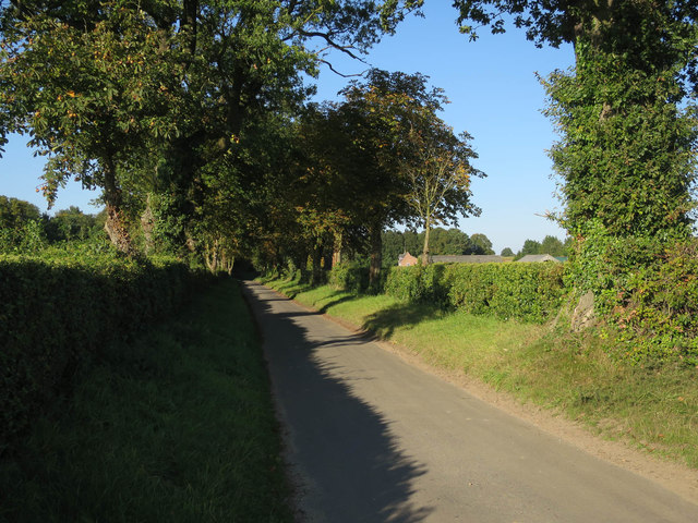
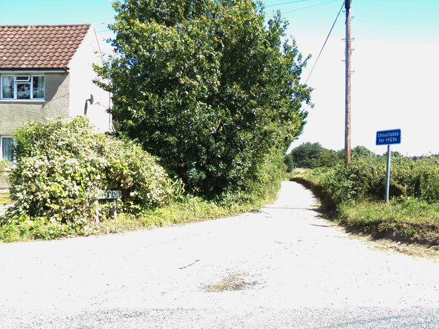
Situated in the rural village of Norfolk, Eve's Hill is known for its lush greenery and tranquil atmosphere. The hill is covered in a variety of vegetation, including grass, shrubs, and trees, which create a vibrant and inviting ambiance. It serves as a popular spot for nature enthusiasts, hikers, and locals seeking a peaceful retreat from the hustle and bustle of everyday life.

At the summit of Eve's Hill, visitors are rewarded with panoramic views of the surrounding countryside and neighboring villages. On clear days, it is possible to see for miles, with rolling hills, fields, and meadows stretching as far as the eye can see. The breathtaking vistas make it an ideal location for photographers and artists looking to capture the beauty of the Norfolk landscape.

Eve's Hill also holds historical significance, as it is rumored to have been a site of ancient settlements and burial grounds. Archaeological finds in the area suggest that the hill has been inhabited for centuries, adding to its allure and charm.

Overall, Eve's Hill in Norfolk offers a tranquil escape and a chance to immerse oneself in nature's beauty. Whether it's a leisurely stroll, a hike, or simply enjoying the stunning views, this hill provides a peaceful and serene experience for all who visit.

If you have any feedback on the listing, please let us know in the comments section below.

Eve's Hill Images

Images are sourced within 2km of 52.75221/1.1353443 or Grid Reference TG1121. Thanks to Geograph Open Source API. All images are credited.

Booton, St Michael Church Roof angels at the east end of the nave.
Booton, St Michael Church
Roof angels at the east end of the nave.
Church of St Mary & Church of St Michael There are the remains of another church (All Saints) in the churchyard. St Mary's nearest the camera is the one in use for services and St Michael is for community use.
Church of St Mary & Church of St Michael
There are the remains of another church (All Saints) in the churchyard. St Mary's nearest the camera is the one in use for services and St Michael is for community use.
Brandiston: Road to Cawston
Brandiston: Ploughed field
Church Road
Church Road
Reepham Road, Little Witchingham At the junction with Ketts Lane
Road No.C260
Reepham Road, Little Witchingham
At the junction with Ketts Lane Road No.C260
Ketts Lane sign On Ketts Lane at the junction with Reepham Road
Road No.C279
Ketts Lane sign
On Ketts Lane at the junction with Reepham Road Road No.C279
Signpost on Reepham Road At the junction with Ketts Lane
Road No.C260
Signpost on Reepham Road
At the junction with Ketts Lane Road No.C260
Ketts Lane, Little Witchingham At the junction with Reepham Road 
Road No.C279
Ketts Lane, Little Witchingham
At the junction with Reepham Road Road No.C279
The Cardinals Hat In Back Street. The Cardinals Hat is an early 17th century house with an extension of exposed 16th century timber framing and a jetty. It is believed to have been a merchant's house, as a number of weavers are recorded to have worked here in the 15th century. The building may originally have had a thatched roof, and there are indications that there used to be an undercroft, which may have been used for storing cloth. Back Street once used to be the main thoroughfare. Most of the buildings, many of them shops, were destroyed by the fire in 1543.

Reepham is an attractive Georgian market town which has had its status since 1277; by the 18th century the Reepham brewery was established and the market was supported by a maximum of thirteen public houses. Three churches share the same churchyard:  Reepham's church of St. Mary is joined by its choir vestry to St. Michael’s (facing the Market Place, once serving the parish of Whitwell), and a third church, burned down in 1543) that belonged to Hackford. Only a fragment of the tower wall remains. Many of the buildings around the Market Place retain the wattle and daub, flint and brick and clay lump of even earlier buildings, many of which were rebuilt in Georgian and Victorian times. Reepham is a significant stop on the Marriott's Way cycle and footpath.
The Cardinals Hat
In Back Street. The Cardinals Hat is an early 17th century house with an extension of exposed 16th century timber framing and a jetty. It is believed to have been a merchant's house, as a number of weavers are recorded to have worked here in the 15th century. The building may originally have had a thatched roof, and there are indications that there used to be an undercroft, which may have been used for storing cloth. Back Street once used to be the main thoroughfare. Most of the buildings, many of them shops, were destroyed by the fire in 1543. Reepham is an attractive Georgian market town which has had its status since 1277; by the 18th century the Reepham brewery was established and the market was supported by a maximum of thirteen public houses. Three churches share the same churchyard: Reepham's church of St. Mary is joined by its choir vestry to St. Michael’s (facing the Market Place, once serving the parish of Whitwell), and a third church, burned down in 1543) that belonged to Hackford. Only a fragment of the tower wall remains. Many of the buildings around the Market Place retain the wattle and daub, flint and brick and clay lump of even earlier buildings, many of which were rebuilt in Georgian and Victorian times. Reepham is a significant stop on the Marriott's Way cycle and footpath.
Tall hedge beside rural lane This lane leads to the hamlet of Whitwell Street which adjoins Reepham in the southeast.  Whitwell has its own Hall and its church, dedicated to St Michael > <a title="https://www.geograph.org.uk/photo/766121" href="https://www.geograph.org.uk/photo/766121">Link</a> shares a site with two others - St Mary's of Reepham and the ruined  All Saints, Hackford.
Tall hedge beside rural lane
This lane leads to the hamlet of Whitwell Street which adjoins Reepham in the southeast. Whitwell has its own Hall and its church, dedicated to St Michael > Link shares a site with two others - St Mary's of Reepham and the ruined All Saints, Hackford.
Approaching Whitwell Street Whitwell Street adjoins Reepham in the southeast.  Whitwell has its own Hall and its church, dedicated to St Michael > <a title="https://www.geograph.org.uk/photo/766121" href="https://www.geograph.org.uk/photo/766121">Link</a> shares a site with two others - St Mary's of Reepham and the ruined  All Saints, Hackford.
Approaching Whitwell Street
Whitwell Street adjoins Reepham in the southeast. Whitwell has its own Hall and its church, dedicated to St Michael > Link shares a site with two others - St Mary's of Reepham and the ruined All Saints, Hackford.
Glimpsed through the hedge The buildings seen in the background (in adjacent grid square) are located on Whitwell Street. Whitwell Street adjoins Reepham in the southeast.  Whitwell has its own Hall and its church, dedicated to St Michael > <a title="https://www.geograph.org.uk/photo/766121" href="https://www.geograph.org.uk/photo/766121">Link</a> shares a site with two others - St Mary's of Reepham and the ruined  All Saints, Hackford.
Glimpsed through the hedge
The buildings seen in the background (in adjacent grid square) are located on Whitwell Street. Whitwell Street adjoins Reepham in the southeast. Whitwell has its own Hall and its church, dedicated to St Michael > Link shares a site with two others - St Mary's of Reepham and the ruined All Saints, Hackford.
A narrow path This path links an unnamed country lane with houses at the southern end of Whitwell Street. Whitwell Street adjoins Reepham in the southeast.  Whitwell has its own Hall and its church, dedicated to St Michael > <a title="https://www.geograph.org.uk/photo/766121" href="https://www.geograph.org.uk/photo/766121">Link</a> shares a site with two others - St Mary's of Reepham and the ruined  All Saints, Hackford.
A narrow path
This path links an unnamed country lane with houses at the southern end of Whitwell Street. Whitwell Street adjoins Reepham in the southeast. Whitwell has its own Hall and its church, dedicated to St Michael > Link shares a site with two others - St Mary's of Reepham and the ruined All Saints, Hackford.
St. Faith's church, Little Witchingham This church is now redundant and in the care of the Churches Conservation Trust.
St. Faith's church, Little Witchingham
This church is now redundant and in the care of the Churches Conservation Trust.
Lane in Little Witchingham
Barn conversion at The Grove For a view of this barn before conversion see <a href="https://www.geograph.org.uk/photo/454692">TG1221 : Thatched Barn at The Grove, Brandiston</a>
Barn conversion at The Grove
For a view of this barn before conversion see TG1221 : Thatched Barn at The Grove, Brandiston
The churchyard at Booton A Roman road once crossed here.
The churchyard at Booton
A Roman road once crossed here.
Show me another place!

Eve's Hill is located at Grid Ref: TG1121 (Lat: 52.75221, Lng: 1.1353443)

Administrative County: Norfolk

District: Broadland

Police Authority: Norfolk

What 3 Words

///positions.future.hesitate. Near Reepham, Norfolk

Nearby Locations

Eve's Hill The Rookery

Related Wikis

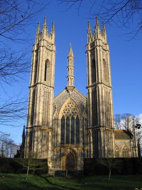
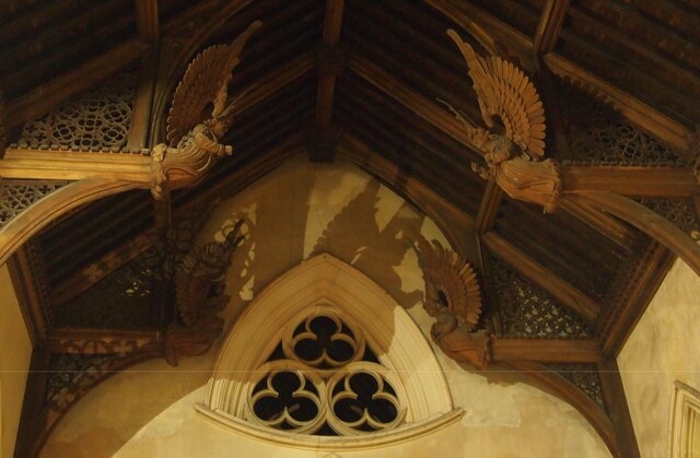
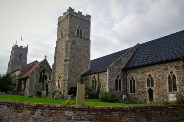
St Michael the Archangel's Church, Booton

St Michael the Archangel's Church is a redundant Anglican church near the village of Booton, Norfolk, England. It is listed in the National Heritage List...
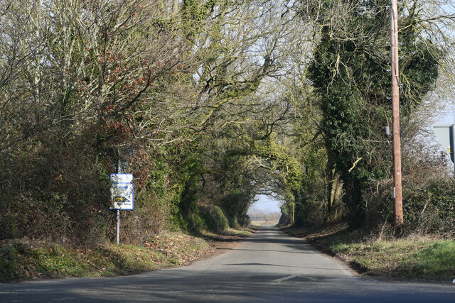
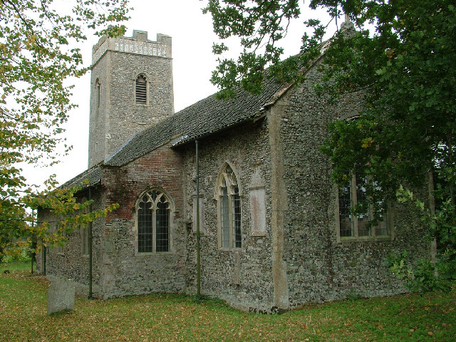
Booton, Norfolk

Booton is a village and civil parish in the Broadland district of Norfolk, England, just east of Reepham and seven miles west of Aylsham. According to...

Booton Common

Booton Common'' is an 8.2-hectare (20-acre) biological Site of Special Scientific Interest north-west of Norwich in Norfolk. It is managed by the Norfolk...

Little Witchingham

Little Witchingham is a village and civil parish in the English county of Norfolk. It covers an area of 3.01 km2 (1.16 sq mi) and had a population of 36...

Nearby Amenities

Located within 500m of 52.75221,1.1353443
Power: pole
Lat/Long: 52.7535943/1.1336593
Power: pole
Lat/Long: 52.7543272/1.1373165
Power: pole
Lat/Long: 52.7538459/1.1349012
Power: pole
Lat/Long: 52.7540846/1.136143
Power: pole
Lat/Long: 52.7550172/1.1401516
Power: pole
Lat/Long: 52.7545732/1.1386777
The data included in this document is from www.openstreetmap.org. The data is made available under ODbL.

Have you been to Eve's Hill?

Leave your review of Eve's Hill below (or comments, questions and feedback).