Barnfield

Settlement in Kent Ashford

England

Barnfield

The font in the church of St. Nicholas, Pluckley. Looking across to the south aisle.
The font in the church of St. Nicholas, Pluckley. Credit: pam fray

Barnfield is a small village located in the county of Kent, in southeastern England. Situated approximately 50 miles southeast of London, it falls within the administrative district of Tonbridge and Malling. The village is known for its picturesque countryside, charming houses, and rich historical heritage.

Barnfield is surrounded by lush green fields and rolling hills, providing residents and visitors with a peaceful and idyllic setting. The village is primarily residential, with a close-knit community that values its rural atmosphere. The houses in Barnfield range from traditional cottages to more modern properties, offering a diverse mix of architectural styles.

Despite its small size, Barnfield has a strong sense of community spirit, with various local events and activities held throughout the year. The village boasts a well-maintained village hall, which serves as a hub for social gatherings, meetings, and celebrations.

In terms of amenities, Barnfield benefits from its close proximity to nearby towns and villages, where residents can find a range of shops, schools, and healthcare facilities. The village is well-connected to the rest of Kent and beyond by road, with easy access to major transport links.

For those seeking outdoor activities and leisure pursuits, Barnfield is surrounded by beautiful countryside, offering ample opportunities for walking, cycling, and exploring nature. The village is also a short distance from historical landmarks and tourist attractions, such as the stunning Leeds Castle and the charming town of Tonbridge.

In conclusion, Barnfield is a picturesque and welcoming village in Kent, offering a peaceful and rural lifestyle with easy access to nearby towns and amenities.

If you have any feedback on the listing, please let us know in the comments section below.
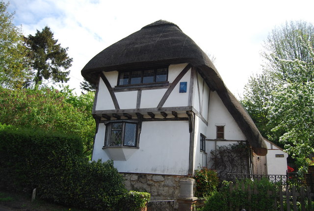
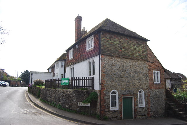
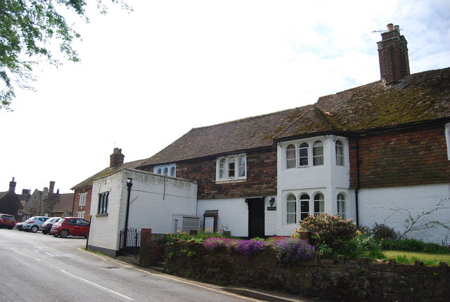
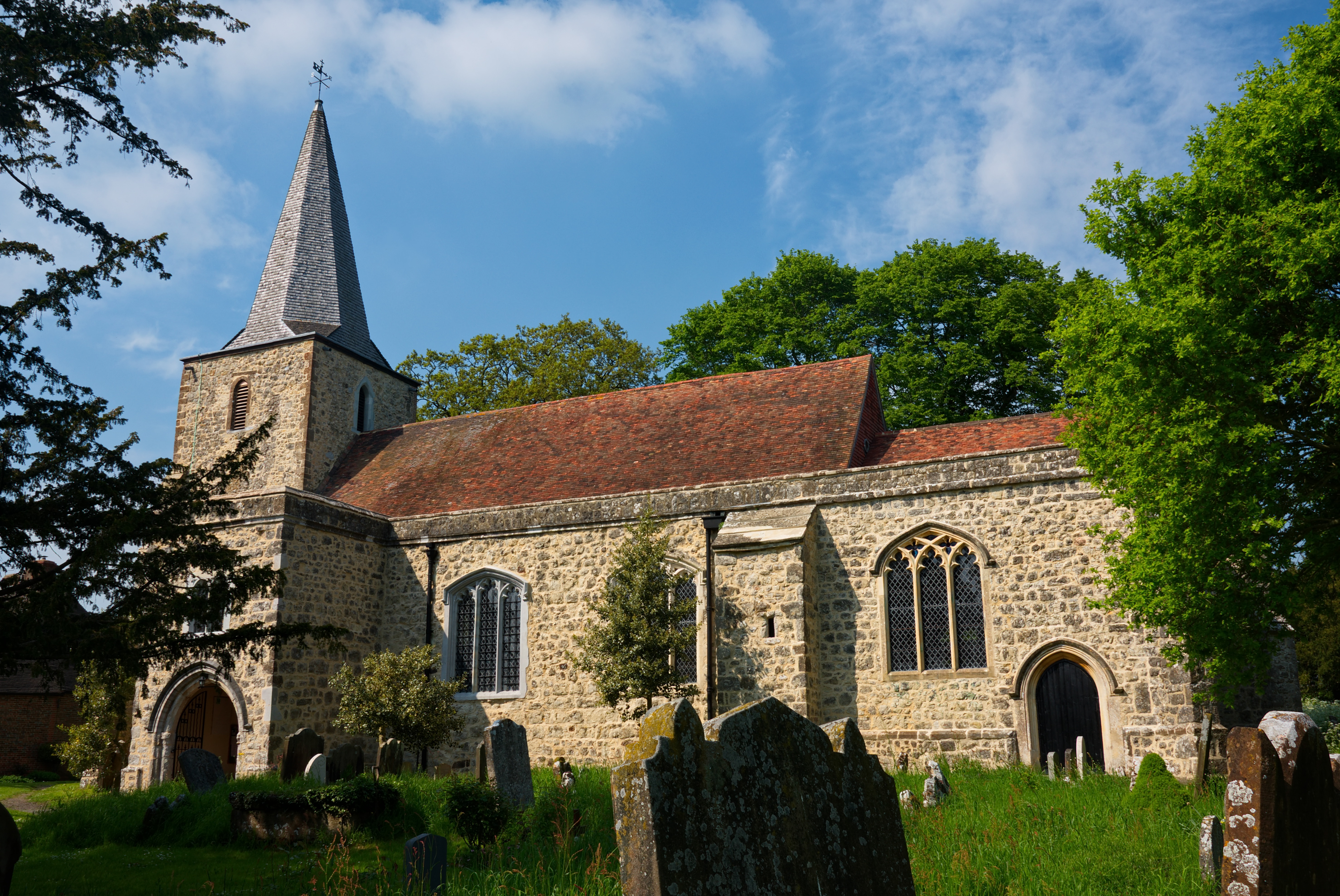
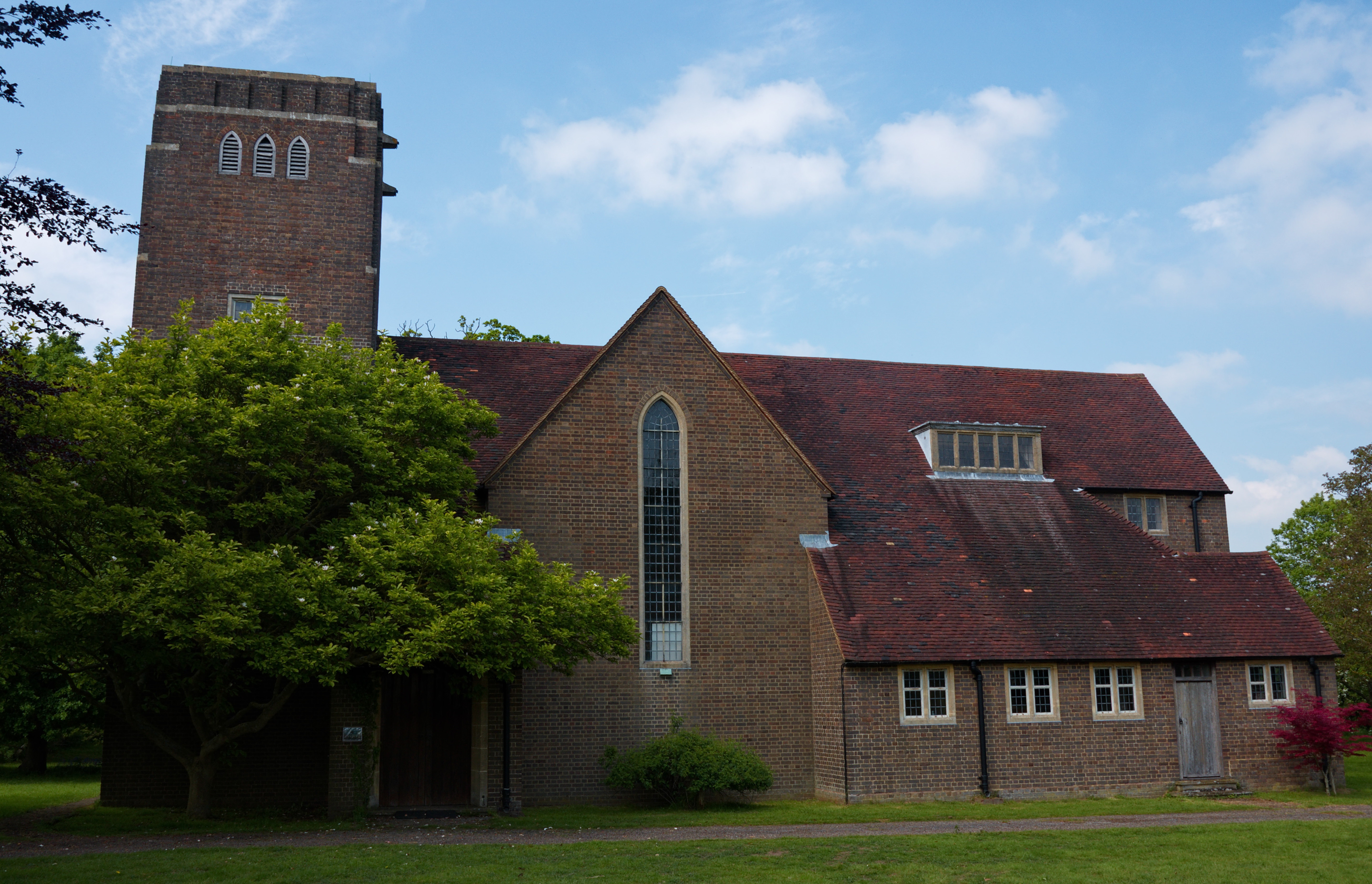
Barnfield Images

Images are sourced within 2km of 51.189966/0.7462252 or Grid Reference TQ9247. Thanks to Geograph Open Source API. All images are credited.

The font in the church of St. Nicholas, Pluckley. Looking across to the south aisle.
The font in the church of St. Nicholas, Pluckley.
Looking across to the south aisle.
The church of St. Nicholas, Pluckley
Smarden Rd
Smarden Rd
Smarden Rd to Pluckley Route of the Greensand Way link.
Smarden Rd to Pluckley
Route of the Greensand Way link.
Smarden Rd
Smarden Rd
Up the hill to Pluckley Smarden Rd rises to the village.
Up the hill to Pluckley
Smarden Rd rises to the village.
Countryside near Pluckley
Farmland near Pluckley
Forge Cottage Grade II listed thatched cottage. <span class="nowrap"><a title="http://www.britishlistedbuildings.co.uk/en-181088-forge-cottage-pluckley" rel="nofollow ugc noopener" href="http://www.britishlistedbuildings.co.uk/en-181088-forge-cottage-pluckley">Link</a><img style="margin-left:2px;" alt="External link" title="External link - shift click to open in new window" src="https://s1.geograph.org.uk/img/external.png" width="10" height="10"/></span>
Forge Cottage
Grade II listed thatched cottage. LinkExternal link
Forge Hill House Grade II listed. <span class="nowrap"><a title="http://www.britishlistedbuildings.co.uk/en-181090-forge-hill-house-pluckley" rel="nofollow ugc noopener" href="http://www.britishlistedbuildings.co.uk/en-181090-forge-hill-house-pluckley">Link</a><img style="margin-left:2px;" alt="External link" title="External link - shift click to open in new window" src="https://s1.geograph.org.uk/img/external.png" width="10" height="10"/></span>
Forge Hill House
Grade II listed. LinkExternal link
Forge Cottage 16th century Grade II listed cottage. <span class="nowrap"><a title="http://www.britishlistedbuildings.co.uk/en-181088-forge-cottage-pluckley" rel="nofollow ugc noopener" href="http://www.britishlistedbuildings.co.uk/en-181088-forge-cottage-pluckley">Link</a><img style="margin-left:2px;" alt="External link" title="External link - shift click to open in new window" src="https://s1.geograph.org.uk/img/external.png" width="10" height="10"/></span>
Forge Cottage
16th century Grade II listed cottage. LinkExternal link
Greensand Way off Smarden Rd, Pluckley The Greensand Way is a long distance walk of 108 miles (174 km) in Southeast England, from Haslemere in Surrey to Hamstreet in Kent. It follows the Greensand Ridge along the Surrey Hills and Chart Hills. The route is mostly rural, passing through woods and alongside fruit orchards and hop farms in Kent. and links with the Stour Valley Walk near Pluckley in Kent.

See <span class="nowrap"><a title="http://www.kent.gov.uk/leisure_and_culture/countryside_and_coast/walking/greensand_way.aspx" rel="nofollow ugc noopener" href="http://www.kent.gov.uk/leisure_and_culture/countryside_and_coast/walking/greensand_way.aspx">Link</a><img style="margin-left:2px;" alt="External link" title="External link - shift click to open in new window" src="https://s1.geograph.org.uk/img/external.png" width="10" height="10"/></span> for more details. See also <span class="nowrap"><a title="http://www.walkingpages.co.uk/trails_paths/LDP_greensandway.htm" rel="nofollow ugc noopener" href="http://www.walkingpages.co.uk/trails_paths/LDP_greensandway.htm">Link</a><img style="margin-left:2px;" alt="External link" title="External link - shift click to open in new window" src="https://s1.geograph.org.uk/img/external.png" width="10" height="10"/></span> for more mapping details.
Greensand Way off Smarden Rd, Pluckley
The Greensand Way is a long distance walk of 108 miles (174 km) in Southeast England, from Haslemere in Surrey to Hamstreet in Kent. It follows the Greensand Ridge along the Surrey Hills and Chart Hills. The route is mostly rural, passing through woods and alongside fruit orchards and hop farms in Kent. and links with the Stour Valley Walk near Pluckley in Kent. See LinkExternal link for more details. See also LinkExternal link for more mapping details.
Cooper's Cottage Grade II listed. <span class="nowrap"><a title="http://www.britishlistedbuildings.co.uk/en-181087-coopers-cottage-pluckley" rel="nofollow ugc noopener" href="http://www.britishlistedbuildings.co.uk/en-181087-coopers-cottage-pluckley">Link</a><img style="margin-left:2px;" alt="External link" title="External link - shift click to open in new window" src="https://s1.geograph.org.uk/img/external.png" width="10" height="10"/></span>
Cooper's Cottage
Grade II listed. LinkExternal link
Forge Hill, Pluckley Pluckley is a small village near Ashford, Kent. It dates back to the Domesday book. The village has a number of listed buildings <span class="nowrap"><a title="http://www.britishlistedbuildings.co.uk/england/kent/pluckley/map" rel="nofollow ugc noopener" href="http://www.britishlistedbuildings.co.uk/england/kent/pluckley/map">Link</a><img style="margin-left:2px;" alt="External link" title="External link - shift click to open in new window" src="https://s1.geograph.org.uk/img/external.png" width="10" height="10"/></span> . It is reputedly the most haunted village in Britain with 13/14 ghosts. The village has appeared on several TV programmes including "Darling Buds of May". There are a range of services including a church, public house, school and Post Office.
Website: <span class="nowrap"><a title="http://www.pluckley.net/" rel="nofollow ugc noopener" href="http://www.pluckley.net/">Link</a><img style="margin-left:2px;" alt="External link" title="External link - shift click to open in new window" src="https://s1.geograph.org.uk/img/external.png" width="10" height="10"/></span> 
Wikipedia: <span class="nowrap"><a title="http://en.wikipedia.org/wiki/Pluckley" rel="nofollow ugc noopener" href="http://en.wikipedia.org/wiki/Pluckley">Link</a><img style="margin-left:2px;" alt="External link" title="External link - shift click to open in new window" src="https://s1.geograph.org.uk/img/external.png" width="10" height="10"/></span>
Forge Hill, Pluckley
Pluckley is a small village near Ashford, Kent. It dates back to the Domesday book. The village has a number of listed buildings LinkExternal link . It is reputedly the most haunted village in Britain with 13/14 ghosts. The village has appeared on several TV programmes including "Darling Buds of May". There are a range of services including a church, public house, school and Post Office. Website: LinkExternal link Wikipedia: LinkExternal link
Road sign, Pluckley Pluckley is a small village near Ashford, Kent. It dates back to the Domesday book. The village has a number of listed buildings <span class="nowrap"><a title="http://www.britishlistedbuildings.co.uk/england/kent/pluckley/map" rel="nofollow ugc noopener" href="http://www.britishlistedbuildings.co.uk/england/kent/pluckley/map">Link</a><img style="margin-left:2px;" alt="External link" title="External link - shift click to open in new window" src="https://s1.geograph.org.uk/img/external.png" width="10" height="10"/></span> . It is reputedly the most haunted village in Britain with 13/14 ghosts. The village has appeared on several TV programmes including "Darling Buds of May". There are a range of services including a church, public house, school and Post Office.
Website: <span class="nowrap"><a title="http://www.pluckley.net/" rel="nofollow ugc noopener" href="http://www.pluckley.net/">Link</a><img style="margin-left:2px;" alt="External link" title="External link - shift click to open in new window" src="https://s1.geograph.org.uk/img/external.png" width="10" height="10"/></span> 
Wikipedia: <span class="nowrap"><a title="http://en.wikipedia.org/wiki/Pluckley" rel="nofollow ugc noopener" href="http://en.wikipedia.org/wiki/Pluckley">Link</a><img style="margin-left:2px;" alt="External link" title="External link - shift click to open in new window" src="https://s1.geograph.org.uk/img/external.png" width="10" height="10"/></span>
Road sign, Pluckley
Pluckley is a small village near Ashford, Kent. It dates back to the Domesday book. The village has a number of listed buildings LinkExternal link . It is reputedly the most haunted village in Britain with 13/14 ghosts. The village has appeared on several TV programmes including "Darling Buds of May". There are a range of services including a church, public house, school and Post Office. Website: LinkExternal link Wikipedia: LinkExternal link
The Old Bakery Grade II listed former hall house. <span class="nowrap"><a title="http://www.britishlistedbuildings.co.uk/en-181127-the-post-office-stores-pluckley" rel="nofollow ugc noopener" href="http://www.britishlistedbuildings.co.uk/en-181127-the-post-office-stores-pluckley">Link</a><img style="margin-left:2px;" alt="External link" title="External link - shift click to open in new window" src="https://s1.geograph.org.uk/img/external.png" width="10" height="10"/></span>
See also <a href="https://www.geograph.org.uk/photo/2450899">TQ9245 : Post Office</a>, <a href="https://www.geograph.org.uk/photo/2450892">TQ9245 : The Old Bakery</a>, <a href="https://www.geograph.org.uk/photo/2450896">TQ9245 : The Cottage</a>
The Old Bakery
Grade II listed former hall house. LinkExternal link See also TQ9245 : Post Office, TQ9245 : The Old Bakery, TQ9245 : The Cottage
The Old Bakery Grade II listed Hall House. <span class="nowrap"><a title="http://www.britishlistedbuildings.co.uk/en-181127-the-post-office-stores-pluckley" rel="nofollow ugc noopener" href="http://www.britishlistedbuildings.co.uk/en-181127-the-post-office-stores-pluckley">Link</a><img style="margin-left:2px;" alt="External link" title="External link - shift click to open in new window" src="https://s1.geograph.org.uk/img/external.png" width="10" height="10"/></span>
See also <a href="https://www.geograph.org.uk/photo/2450888">TQ9245 : The Old Bakery</a>, <a href="https://www.geograph.org.uk/photo/2450899">TQ9245 : Post Office</a>, <a href="https://www.geograph.org.uk/photo/2450896">TQ9245 : The Cottage</a>
The Old Bakery
The Cottage A grade II listed former Hall house. <span class="nowrap"><a title="http://www.britishlistedbuildings.co.uk/en-181127-the-post-office-stores-pluckley" rel="nofollow ugc noopener" href="http://www.britishlistedbuildings.co.uk/en-181127-the-post-office-stores-pluckley">Link</a><img style="margin-left:2px;" alt="External link" title="External link - shift click to open in new window" src="https://s1.geograph.org.uk/img/external.png" width="10" height="10"/></span>
See also <a href="https://www.geograph.org.uk/photo/2450888">TQ9245 : The Old Bakery</a>, <a href="https://www.geograph.org.uk/photo/2450899">TQ9245 : Post Office</a>, <a href="https://www.geograph.org.uk/photo/2450892">TQ9245 : The Old Bakery</a>
The Cottage
A grade II listed former Hall house. LinkExternal link See also TQ9245 : The Old Bakery, TQ9245 : Post Office, TQ9245 : The Old Bakery
Show me another place!

Barnfield is located at Grid Ref: TQ9247 (Lat: 51.189966, Lng: 0.7462252)

Administrative County: Kent

District: Ashford

Police Authority: Kent

What 3 Words

///dislodge.pounding.quietest. Near Charing, Kent

Nearby Locations

Barnfield Iden Plantation

Related Wikis

Stonebridge Green

Stonebridge Green is a settlement adjacent to, and within the civil parish of, Egerton in the Ashford District of Kent, England. It lies immediately north...

Volvo World Match Play Championship

The Volvo World Match Play Championship was an annual match play men's professional golf tournament which was staged from 1964 to 2014. The World Match...

2014 Volvo World Match Play Championship

The 2014 Volvo World Match Play Championship was the 49th Volvo World Match Play Championship to be played. It was held 15–19 October, with the champion...

List of local nature reserves in Kent

Kent is a county in the south-eastern corner of England. It is bounded to the north by Greater London and the Thames Estuary, to the west by Sussex and...
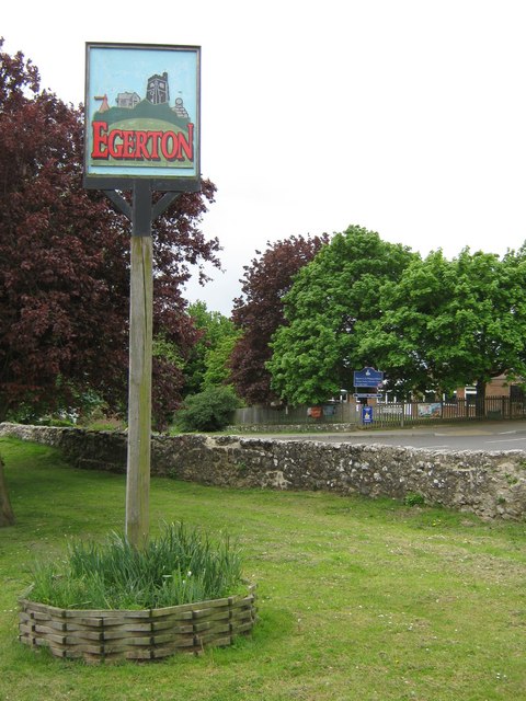
Egerton, Kent

Egerton is a village and civil parish in the Ashford District of Kent, England. The village is on the Greensand Ridge 9 miles (14.4 km) north of Ashford...

Pluckley

Pluckley is a village and civil parish in the Ashford district of Kent, England. The civil parish includes the adjacent hamlet of Pluckley Thorne. �...

Smarden

Smarden is a civil parish and village, west of Ashford in Kent, South East England. The village has the Anglican parish church of St Michael the Archangel...

Little Chart

Little Chart is a village and civil parish, situated 4 miles (6.4 km) north-west of Ashford in Kent, South East England. The parish lies south of the M20...

Nearby Amenities

Located within 500m of 51.189966,0.7462252
Barrier: stile
Lat/Long: 51.1933759/0.7504322
Barrier: stile
Lat/Long: 51.193403/0.750405
The data included in this document is from www.openstreetmap.org. The data is made available under ODbL.

Have you been to Barnfield?

Leave your review of Barnfield below (or comments, questions and feedback).