Winstead Hill

Hill, Mountain in Kent Gravesham

England

Winstead Hill

View up sloping field towards Cobham Church
View up sloping field towards Cobham Church Credit: David Martin

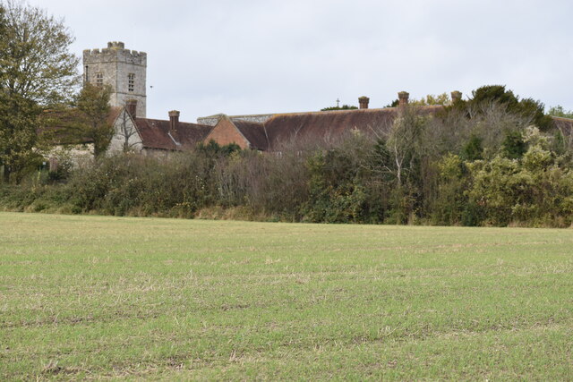
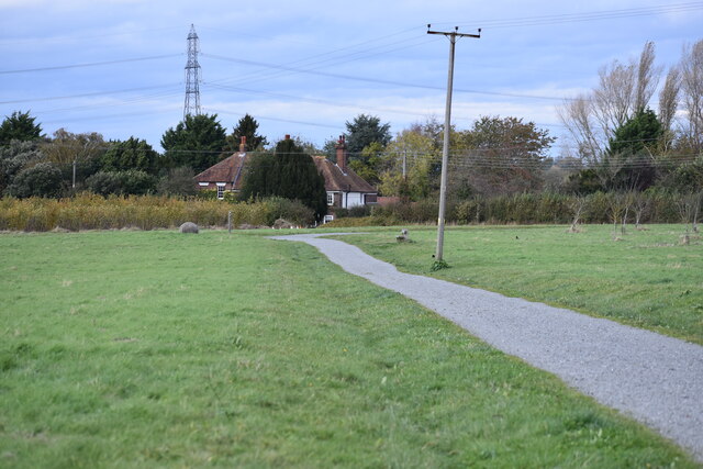
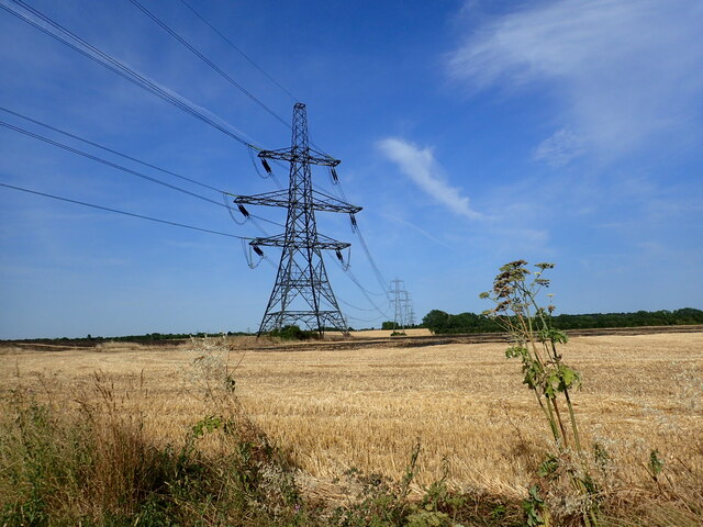
Winstead Hill, located in the county of Kent, England, is a prominent hill that offers stunning panoramic views of the surrounding landscape. With an elevation of approximately 190 meters (623 feet), it is considered one of the highest points in the region, making it a popular spot among locals and tourists alike.

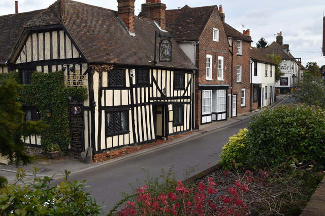
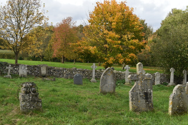
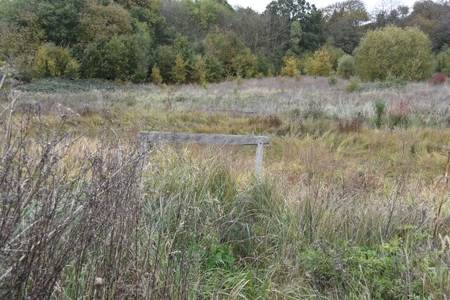
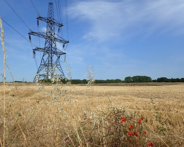
Situated in the charming town of Winstead, the hill is covered in lush greenery, including a variety of trees and vegetation. It is part of the North Downs, a range of chalk hills that stretches across southeastern England. The chalky soil found in the area contributes to the rich biodiversity and unique flora and fauna that can be observed on Winstead Hill.

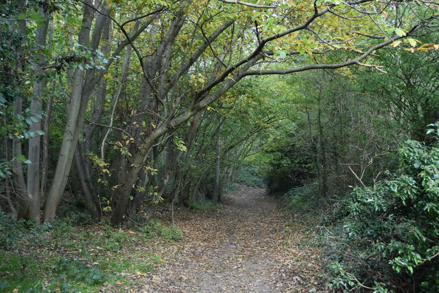
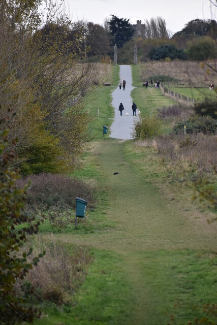
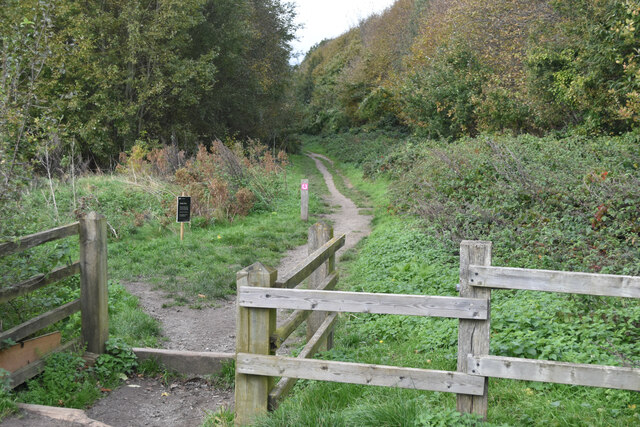
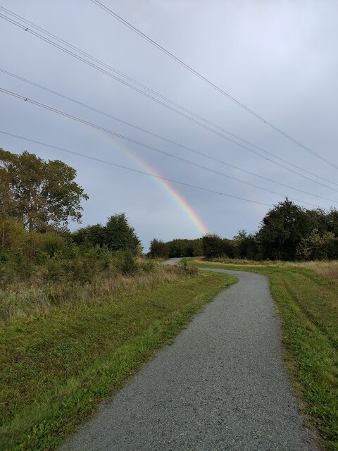
Visitors can reach the top of the hill by following well-maintained footpaths that wind their way through the countryside. Once at the summit, they are rewarded with breathtaking views of the surrounding countryside, including rolling hills, quaint villages, and even glimpses of the coastline on clear days.

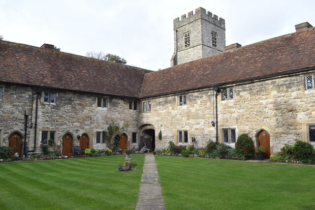
Winstead Hill also holds historical significance, as it was once used as a vantage point during World War II. It provided strategic views for military personnel to monitor and defend the area against potential threats.

Nature enthusiasts and avid hikers often explore the hill and its surrounding areas, making use of the numerous trails and pathways. On a sunny day, it is a popular spot for picnicking, photography, and simply enjoying the peaceful ambiance.

If you have any feedback on the listing, please let us know in the comments section below.

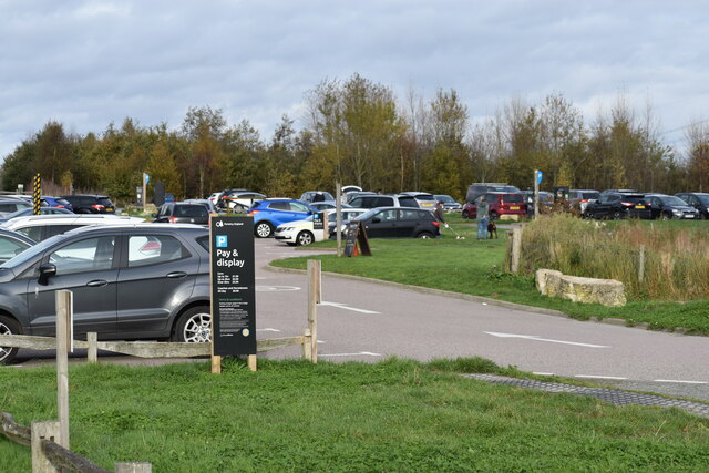
Winstead Hill Images

Images are sourced within 2km of 51.40252/0.38850548 or Grid Reference TQ6669. Thanks to Geograph Open Source API. All images are credited.

View up sloping field towards Cobham Church
Buildings opposite the church at Cobham The timber-framed building is The Leather Bottle public house.
Buildings opposite the church at Cobham
The timber-framed building is The Leather Bottle public house.
In the courtyard at Cobham College Sixteenth Century almshouses with the church tower visible beyond.
In the courtyard at Cobham College
Sixteenth Century almshouses with the church tower visible beyond.
Sloping porch at Cobham College
Autumn in the churchyard at Cobham
Owletts A National Trust property not yet reopened after pandemic restrictions, at the date of this photograph.
Owletts
A National Trust property not yet reopened after pandemic restrictions, at the date of this photograph.
Owletts, seen across The Street A National Trust property not yet reopened after pandemic restrictions, at the date of this photograph.
Owletts, seen across The Street
A National Trust property not yet reopened after pandemic restrictions, at the date of this photograph.
Byway through woods near Ashenbank Pond
Overgrown Ashenbank Pond The wooden rail marks the end of a small jetty.  No water was visible from outside the fenced enclosure.
Overgrown Ashenbank Pond
The wooden rail marks the end of a small jetty. No water was visible from outside the fenced enclosure.
Long straight path in Jeskyns Community Woodland The tower of Cobham Church can be seen on the horizon.
Long straight path in Jeskyns Community Woodland
The tower of Cobham Church can be seen on the horizon.
Horse Trail in Jeskyns Community Woodland
Car park at Jeskyns Community Woodland
Field edge on Access Lane at Henhurst
Footpath towards Jeskyns Road
Orchards at Jeskyns Community Woodland
Jeskyns Orchard Walk
Pylons seen from Church Road, Ifield This is Church Road, Ifield, just to the south of New Cottages. The fields hereabouts are completely dominated by a set of three power lines and associated pylons.
Pylons seen from Church Road, Ifield
This is Church Road, Ifield, just to the south of New Cottages. The fields hereabouts are completely dominated by a set of three power lines and associated pylons.
Show me another place!

Winstead Hill is located at Grid Ref: TQ6669 (Lat: 51.40252, Lng: 0.38850548)

Administrative County: Kent

District: Gravesham

Police Authority: Kent

What 3 Words

///couple.trial.tonic. Near Meopham, Kent

Related Wikis

Jeskyns

Jeskyns is a park near Cobham, in Kent, England. A former farm, it was reopened as a large open-space recreational area in 2007, with areas being developed...

Singlewell Infrastructure Maintenance Depot

The Singlewell Infrastructure Maintenance Depot is a railway maintenance depot located near the Gravesend ward of Singlewell, Kent, in the United Kingdom...

Gravesham

Gravesham ( GRAYV-shəm) is a local government district with borough status in north-west Kent, England. The council is based in its largest town of Gravesend...
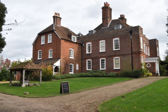
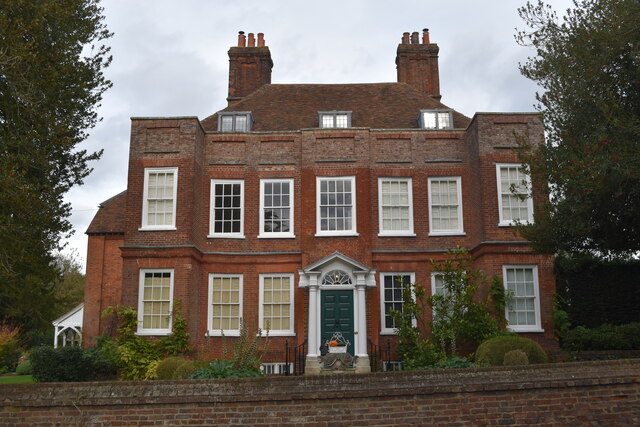
Owletts

Owletts is a country house 0.8 miles (1.3 km) to the northwest of the village of Cobham in Kent, England. It is a Grade II* listed building owned by the...

Thong, Kent

Thong is a hamlet southeast of Gravesend in Kent, England. The population of the hamlet is included in the civil parish of Shorne. It has frequently been...

Singlewell or Ifield

Singlewell or Ifield is the name given to the area south of Gravesend in Kent, England. Originally two separate settlements on either side of Watling Street...

Gravesham (UK Parliament constituency)

Gravesham () is a constituency in Kent represented in the House of Commons of the UK Parliament since 2005 by Adam Holloway, a Conservative. == Constituency... ==

Cobham, Kent

Cobham () is a village and civil parish in the borough of Gravesham in Kent, England. The village is located 6 miles (10 km) south-east of Gravesend,...

Nearby Amenities

Located within 500m of 51.40252,0.38850548
Henhurst
Place: hamlet
Source: npe
Lat/Long: 51.4016887/0.3848898
Power: tower
Lat/Long: 51.4027869/0.3849535
Power: tower
Lat/Long: 51.403547/0.3902526
Bus Stop
Henhurst Hill
Flag: no
Local Ref: opp
Naptan AtcoCode: 240097691
Naptan Bearing: S
Naptan BusStopType: CUS
Naptan CommonName: Henhurst Hill
Naptan Indicator: opp
Naptan Landmark: Henhurst Hill
Naptan NaptanCode: kntgpmpt
Naptan RevisionNumber: 3
Naptan Status: act
Naptan Street: Henhurst Road
Naptan Verified: no
Public Transport: platform
Ref: kntgpmpt
Source: naptan_import
Source Date: 2014-02-03
Lat/Long: 51.4009798/0.3855928
Bus Stop
Henhurst Hill
Flag: no
Local Ref: adj
Naptan AtcoCode: 240097693
Naptan Bearing: N
Naptan BusStopType: CUS
Naptan CommonName: Henhurst Hill
Naptan Indicator: adj
Naptan Landmark: Henhurst Hill
Naptan NaptanCode: kntgpmpm
Naptan RevisionNumber: 4
Naptan Status: act
Naptan Street: Henhurst Road
Naptan Verified: no
Public Transport: platform
Ref: kntgpmpm
Source: naptan_import
Source Date: 2018-03-27
Lat/Long: 51.4013555/0.3852262
Power: tower
Lat/Long: 51.4052548/0.3914914
Barrier: kissing_gate
Bicycle: yes
Foot: yes
Source: survey
Lat/Long: 51.4032115/0.3870745
Barrier: kissing_gate
Bicycle: no
Foot: yes
Material: wood
Source: survey
Lat/Long: 51.4004838/0.3859548
Railway: switch
Lat/Long: 51.406422/0.3858305
Barrier: kissing_gate
Bicycle: no
Foot: yes
Material: wood
Source: survey
Lat/Long: 51.400482/0.3856015
Fixme: incomplete
Lat/Long: 51.4005114/0.3855002
Bench
Backrest: yes
Colour: brown
Material: wood
Seats: 3
Lat/Long: 51.3990069/0.3898633
Barrier: kissing_gate
Bicycle: no
Foot: yes
Material: wood
Source: survey
Lat/Long: 51.4052929/0.3876933
Barrier: kissing_gate
Bicycle: no
Foot: yes
Material: wood
Source: survey
Lat/Long: 51.4026586/0.3854371
Cafe
Jeskyns Park Café
Addr City: Gravesend
Addr Postcode: DA12 3AN
Addr Street: Henhurst Road
Addr Subdistrict: Cobham
Entrance: yes
Fhrs Id: 667972
Internet Access: no
Opening Hours: Mo-Fr 09:00-15:30; Sa,Su 09:00-16:00
Smoking: no
Source: survey
Source Addr: ratings.food.gov.uk
Wheelchair: yes
Lat/Long: 51.4027088/0.3869448
Toilets
Access: customers
Drinking Water: no
Entrance: yes
Fee: no
Toilets Disposal: flush
Toilets Position: seated;urinal
Wheelchair: yes
Lat/Long: 51.4027083/0.3871436
Power: portal
Lat/Long: 51.4049556/0.3918965
Power: portal
Lat/Long: 51.4052969/0.3921688
Entrance: main
Lat/Long: 51.4038609/0.3864742
Entrance: main
Lat/Long: 51.4039492/0.3868762
Entrance: yes
Lat/Long: 51.4037208/0.3876868
Bench
Colour: brown
Material: wood
Seats: 3
Lat/Long: 51.4023557/0.3875993
Board Type: wildlife
Information: board
Tourism: information
Lat/Long: 51.4035145/0.3870689
Bench
Backrest: yes
Colour: brown
Material: wood
Seats: 3
Lat/Long: 51.403683/0.3872272
Leisure: picnic_table
Lat/Long: 51.4032707/0.3868372
Leisure: picnic_table
Lat/Long: 51.403259/0.3869026
Leisure: picnic_table
Lat/Long: 51.4032543/0.3869743
Leisure: picnic_table
Lat/Long: 51.3986294/0.3900649
Leisure: picnic_table
Lat/Long: 51.3986775/0.3901853
Leisure: picnic_table
Lat/Long: 51.3987306/0.3900301
Colour: red and white
Marker: aerial
Material: plastic
Utility: gas
Lat/Long: 51.4032463/0.3856599
Street Lamp
Lat/Long: 51.4062721/0.3918311
Colour: red and white
Marker: aerial
Material: plastic
Utility: gas
Lat/Long: 51.4062205/0.391656
Colour: red
Marker: post
Material: concrete
Utility: gas
Lat/Long: 51.4062258/0.3916599
Colour: red and white
Marker: aerial
Material: plastic
Utility: gas
Lat/Long: 51.4032145/0.3858946
Colour: red and white
Marker: aerial
Material: plastic
Utility: gas
Lat/Long: 51.4067155/0.3899745
Phases: 2
Power: transformer
Voltage Primary: 400000
Voltage Secondary: 25000
Lat/Long: 51.4050731/0.3929409
Phases: 2
Power: transformer
Voltage Primary: 400000
Voltage Secondary: 25000
Lat/Long: 51.40472/0.3926754
Barrier: kissing_gate
Lat/Long: 51.4047602/0.3874634
Barrier: kissing_gate
Lat/Long: 51.4044084/0.3871333
Traffic Sign: yes
Lat/Long: 51.4044203/0.3868124
Colour: red
Marker: post
Material: concrete
Utility: gas
Lat/Long: 51.4044779/0.3867964
Colour: red
Marker: post
Material: concrete
Utility: gas
Lat/Long: 51.4044065/0.3869886
Marker: post
Material: plastic
Utility: gas
Lat/Long: 51.4044798/0.386788
Leisure: picnic_table
Lat/Long: 51.4039697/0.3873563
Leisure: picnic_table
Lat/Long: 51.4038126/0.3873991
Leisure: picnic_table
Lat/Long: 51.4036566/0.3872299
Leisure: picnic_table
Lat/Long: 51.4035561/0.3871757
Leisure: picnic_table
Lat/Long: 51.4039563/0.387085
Marker: yes
Note: seen from car park entrance and picnic tables
Utility: gas
Lat/Long: 51.403638/0.3876224
Fixme: Tentative. Supported only by weak aerial information. Needs confirmation from other sources.
Marker: yes
Utility: gas
Lat/Long: 51.4050842/0.3889042
Fixme: Tentative. Supported only by weak aerial information. Needs confirmation from other sources.
Marker: yes
Utility: gas
Lat/Long: 51.4055779/0.3893704
Fixme: Tentative. Supported only by weak aerial information. Needs confirmation from other sources.
Marker: yes
Utility: gas
Lat/Long: 51.4048254/0.3898575
Fixme: Tentative. Supported only by weak aerial information. Needs confirmation from other sources.
Marker: yes
Utility: gas
Lat/Long: 51.4053404/0.3902505
Marker: yes
Note: seen on aerial and from car par entrance. location also supported by boulders
Utility: gas
Lat/Long: 51.4033746/0.3867032
Fixme: only seen on aerial so needs ground confirmation, however location supported by boulders
Marker: yes
Utility: gas
Lat/Long: 51.4037099/0.387877
The data included in this document is from www.openstreetmap.org. The data is made available under ODbL.

Have you been to Winstead Hill?

Leave your review of Winstead Hill below (or comments, questions and feedback).