Broom Hill

Hill, Mountain in Essex

England

Broom Hill
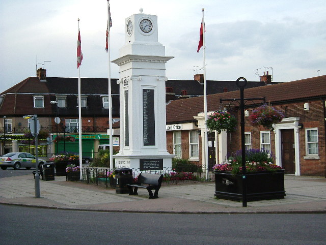
Tilbury Civic Square and War Memorial The buildings to the left are Thurrock Council offices. The square also boasts the fire station police station and a sports centre. The war memorial inscription reads "May Justice Mercy & Peace Prevail Amongst Nations". I will second that, there is nothing glorious about being dead in my opinion.
Tilbury Civic Square and War Memorial Credit: Glyn Baker

Broom Hill is a small hill located in the county of Essex, England. It is situated in the northeastern part of the county, near the town of Saffron Walden. Despite being referred to as a hill, Broom Hill is more accurately described as a gentle slope, with an elevation of approximately 100 meters.

The hill is surrounded by picturesque countryside, characterized by rolling fields and scattered woodlands. It offers panoramic views of the surrounding landscape, making it a popular spot for hikers and nature enthusiasts. The area is also home to a diverse range of flora and fauna, including wildflowers, birds, and small mammals.

Broom Hill is easily accessible, with well-maintained footpaths leading to its summit. It is a favorite destination for local residents and visitors alike, providing a peaceful retreat from the hustle and bustle of nearby towns and cities. The hill is particularly renowned for its stunning sunsets, which paint the sky with vibrant hues of red, orange, and pink.

In addition to its natural beauty, Broom Hill also holds historical significance. It is believed that the hill was once used as a lookout point during ancient times, providing a strategic vantage point for early settlers. Today, remnants of this historical past can still be seen in the form of ancient burial mounds and earthworks.

Overall, Broom Hill offers a charming combination of natural beauty, tranquility, and historical interest, making it a must-visit destination for anyone exploring the Essex countryside.

If you have any feedback on the listing, please let us know in the comments section below.

Broom Hill Images

Images are sourced within 2km of 51.474799/0.38185373 or Grid Reference TQ6577. Thanks to Geograph Open Source API. All images are credited.

Tilbury Civic Square and War Memorial The buildings to the left are Thurrock Council offices. The square also boasts the fire station police station and a sports centre. The war memorial inscription reads "May Justice Mercy & Peace Prevail Amongst Nations". I will second that, there is nothing glorious about being dead in my opinion.
Tilbury Civic Square and War Memorial
The buildings to the left are Thurrock Council offices. The square also boasts the fire station police station and a sports centre. The war memorial inscription reads "May Justice Mercy & Peace Prevail Amongst Nations". I will second that, there is nothing glorious about being dead in my opinion.
St Mary 's Chadwell St Mary St Mary's stands on a hill with commanding views across the countryside towards Tilbury.
St Mary 's Chadwell St Mary
St Mary's stands on a hill with commanding views across the countryside towards Tilbury.
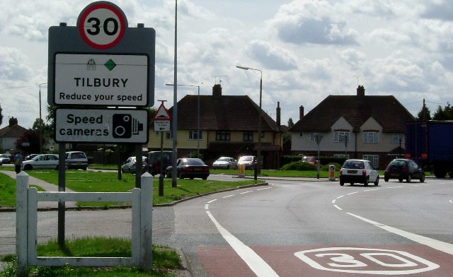
Bend on A126 Tilbury Junction of A126 from Chadwell to Tilbury and a minor road onto an estate of 1930’s council houses (many private these days). Examples of these can be seen in the background.
Bend on A126 Tilbury
Junction of A126 from Chadwell to Tilbury and a minor road onto an estate of 1930’s council houses (many private these days). Examples of these can be seen in the background.
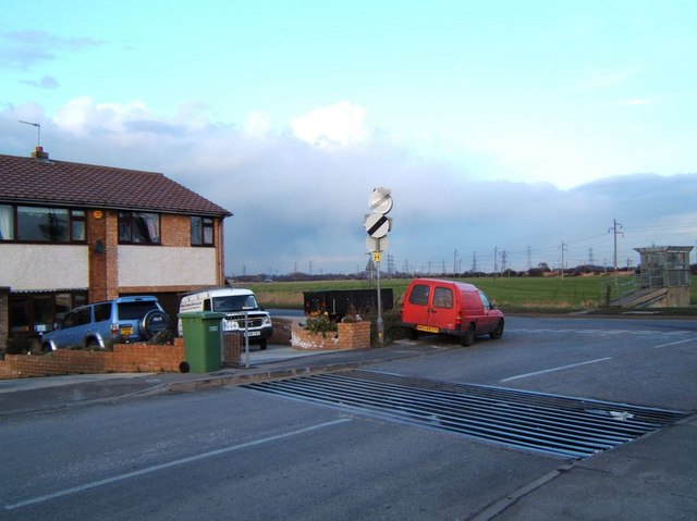
Brennan Rd Tilbury A cattle grid is not the first road feature that springs to mind when one thinks of Tilbury! However this end of Brennan Rd Tilbury is protected from bovine invasion. The junction is with Fort Rd. The concrete structure on the right is a sluice gate.
Brennan Rd Tilbury
A cattle grid is not the first road feature that springs to mind when one thinks of Tilbury! However this end of Brennan Rd Tilbury is protected from bovine invasion. The junction is with Fort Rd. The concrete structure on the right is a sluice gate.
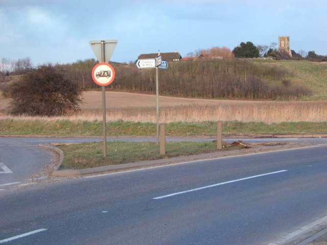
Junction in the Marshes This is the junction of Fort Rd, Gun Hill and Coopers Shaw in West Tilbury Marshes. The church on the Hill in the background is St James Low Street. It is now redundant as a church, planning permission has been sought to convert it into a dwelling.
Junction in the Marshes
This is the junction of Fort Rd, Gun Hill and Coopers Shaw in West Tilbury Marshes. The church on the Hill in the background is St James Low Street. It is now redundant as a church, planning permission has been sought to convert it into a dwelling.
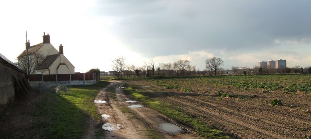
High House Farm This is High House a farm between Chadwell St Mary & Lindford. The towers <a href="https://www.geograph.org.uk/photo/42309">TQ6479 : “Three So Wild in Their Attire”</a> are in Chadwell.
High House Farm
This is High House a farm between Chadwell St Mary & Lindford. The towers TQ6479 : “Three So Wild in Their Attire” are in Chadwell.
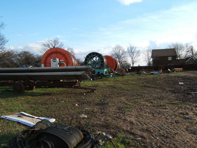
Rain Not Required! This irrigation equipment is on Mill House Farm West Tilbury
Rain Not Required!
This irrigation equipment is on Mill House Farm West Tilbury
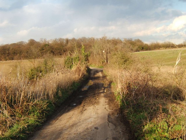
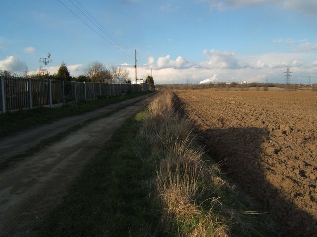
Hoford Rd This is Hoford Rd it runs between Mill House Farm and East Tilbury Rd north of Linford. It is now closed to motor vehicles (except farm traffic) and is designated as a cyclepath. The photo was taken looking northeast. See further up the road at <a href="https://www.geograph.org.uk/photo/2386341">TQ6680 : Hoford Rd (North End)</a>
Hoford Rd
This is Hoford Rd it runs between Mill House Farm and East Tilbury Rd north of Linford. It is now closed to motor vehicles (except farm traffic) and is designated as a cyclepath. The photo was taken looking northeast. See further up the road at TQ6680 : Hoford Rd (North End)
Driveway to Becksland This is the driveway to Becksland a farm near Linford
Driveway to Becksland
This is the driveway to Becksland a farm near Linford
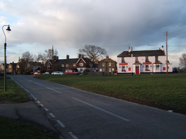
West Tilbury Village Green This is the village green at West Tilbury. The GR is for the King's Head pub sign.
West Tilbury Village Green
This is the village green at West Tilbury. The GR is for the King's Head pub sign.
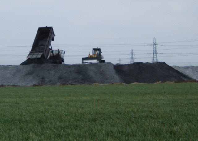
The Price of Power? At this point Tilbury Marshes appear to be vanishing under furnace ash from <a href="https://www.geograph.org.uk/photo/26771">TQ6675 : Tilbury Power Station, Tilbury, Essex</a>
The Price of Power?
At this point Tilbury Marshes appear to be vanishing under furnace ash from TQ6675 : Tilbury Power Station, Tilbury, Essex
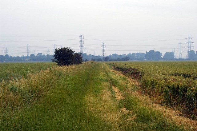
Piles of Pylons These pylons distribute the power from <a href="https://www.geograph.org.uk/photo/26771">TQ6675 : Tilbury Power Station, Tilbury, Essex</a>. The photo was taken from <a href="https://www.geograph.org.uk/photo/191226">TQ6676 : Manor Way</a>
Piles of Pylons
These pylons distribute the power from TQ6675 : Tilbury Power Station, Tilbury, Essex. The photo was taken from TQ6676 : Manor Way
Manor Way This is the Manor Way in West Tilbury Marshes, it is a farm track that runs from Walnut Tree Farm TQ667776 to the photographer position. Although used by walkers it does not appear to be a right of way.
Manor Way
This is the Manor Way in West Tilbury Marshes, it is a farm track that runs from Walnut Tree Farm TQ667776 to the photographer position. Although used by walkers it does not appear to be a right of way.
West Tilbury St James Without trespassing, this is the closest that one can get to St James' Church from this direction. It is now privately owned as a residence. The land you see in the foreground is farmland. <span class="nowrap"><a title="http://www.essexchurches.info/church.asp?p=West+Tilbury" rel="nofollow ugc noopener" href="http://www.essexchurches.info/church.asp?p=West+Tilbury">Link</a><img style="margin-left:2px;" alt="External link" title="External link - shift click to open in new window" src="https://s1.geograph.org.uk/img/external.png" width="10" height="10"/></span>
West Tilbury St James
Without trespassing, this is the closest that one can get to St James' Church from this direction. It is now privately owned as a residence. The land you see in the foreground is farmland. LinkExternal link
Tilbury Police Station When first built the new police station in Tilbury was bare concrete; I don't know when it was painted a rather sweet sky blue with dark blue detailing, but I suppose it does make it look a little bit less like a Soviet prison.
Tilbury Police Station
When first built the new police station in Tilbury was bare concrete; I don't know when it was painted a rather sweet sky blue with dark blue detailing, but I suppose it does make it look a little bit less like a Soviet prison.
Tilbury Gateway Academy (1) Formerly St Chad's school. The school now has a magnificent new site outside the town, so presumably these buildings are now surplus to (educational) requirements.
Tilbury Gateway Academy (1)
Formerly St Chad's school. The school now has a magnificent new site outside the town, so presumably these buildings are now surplus to (educational) requirements.
Tilbury Gateway Academy (2) Formerly St Chad's school. The school now has a magnificent new site outside the town, so presumably these buildings are now surplus to (educational) requirements.
Tilbury Gateway Academy (2)
Formerly St Chad's school. The school now has a magnificent new site outside the town, so presumably these buildings are now surplus to (educational) requirements.
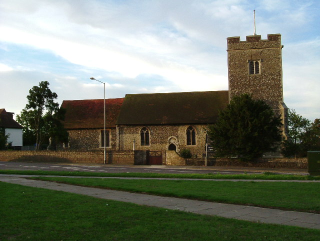
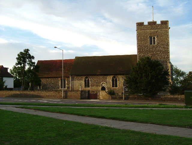
St. Mary; the parish church of Chadwell St. Mary This church stands by a very busy crossroads. Its nave is Norman and it has a 14th century chancel with a tower of c.1500
St. Mary; the parish church of Chadwell St. Mary
This church stands by a very busy crossroads. Its nave is Norman and it has a 14th century chancel with a tower of c.1500
Show me another place!

Broom Hill is located at Grid Ref: TQ6577 (Lat: 51.474799, Lng: 0.38185373)

Unitary Authority: Thurrock

Police Authority: Essex

What 3 Words

///priced.they.preoccupied. Near Chadwell St Mary, Essex

Related Wikis

Biggin, Essex

Biggin is a hamlet and manor in Chadwell St Mary, part of the borough of Thurrock, in the ceremonial county of Essex, England. It is about 2 miles (3.2...

St James' Church, West Tilbury

The church of St James is a grade II* listed former parish church in West Tilbury. It is constructed from flint and rubble and was restored by W Benton...

West Tilbury

West Tilbury is a village and former civil parish in the Thurrock district, in the ceremonial county of Essex, England. It is on the top of and on the...

Chadwell St Mary

Chadwell St Mary is an area of the unitary authority of Thurrock in Essex, England. It is one of the traditional (Church of England) parishes in Thurrock...

St Mary's Church, Chadwell St Mary

The Church of St Mary is a Church of England parish church in Chadwell St Mary, Thurrock, Essex. The church is a Grade I listed building. Together with...

The Gateway Academy

The Gateway Academy, formerly The Gateway Community College, is a coeducational academy secondary school in Grays, Essex, England. It became an academy...

Tilbury F.C.

Tilbury Football Club is a football club based in Tilbury, Thurrock, England. The club play in black and white stripes, are currently members of the Essex...

Low Street railway station

Low Street railway station was on the Tilbury loop line segment of the London, Tilbury and Southend line, at a level crossing near the villages of West...

Nearby Amenities

Located within 500m of 51.474799,0.38185373
The data included in this document is from www.openstreetmap.org. The data is made available under ODbL.

Have you been to Broom Hill?

Leave your review of Broom Hill below (or comments, questions and feedback).