Hawthorn Hill
Hill, Mountain in Kent Sevenoaks
England
Hawthorn Hill

Hawthorn Hill is a prominent hill located in the county of Kent, England. Situated near the village of Knockholt, the hill is a part of the North Downs, a ridge of chalk hills that stretches across southeast England. Standing at an elevation of approximately 245 meters (804 feet), Hawthorn Hill offers breathtaking panoramic views of the surrounding countryside.
Covered in a lush carpet of grass and dotted with hawthorn trees, the hill is a popular destination for hikers, nature enthusiasts, and photographers. Its picturesque landscape and unspoiled beauty make it an idyllic spot for a leisurely stroll or a picnic with family and friends.
Hawthorn Hill boasts a rich biodiversity, with various species of plants and wildlife inhabiting its slopes. Wildflowers such as harebells, orchids, and cowslips can be found blooming during the spring and summer months, attracting bees and butterflies. The hill is also home to a variety of bird species, including skylarks and meadow pipits, which add to its natural charm.
In addition to its natural beauty, Hawthorn Hill holds historical significance. It is believed that the hill was used as a lookout point during World War II, serving as a vantage point for spotting enemy aircraft. Remnants of old concrete structures and bunkers can still be seen, serving as a reminder of the area's wartime past.
Overall, Hawthorn Hill in Kent is a captivating destination that combines natural splendor, historical interest, and recreational opportunities. Its commanding position and stunning vistas make it a must-visit location for those seeking to immerse themselves in the beauty of the English countryside.
If you have any feedback on the listing, please let us know in the comments section below.
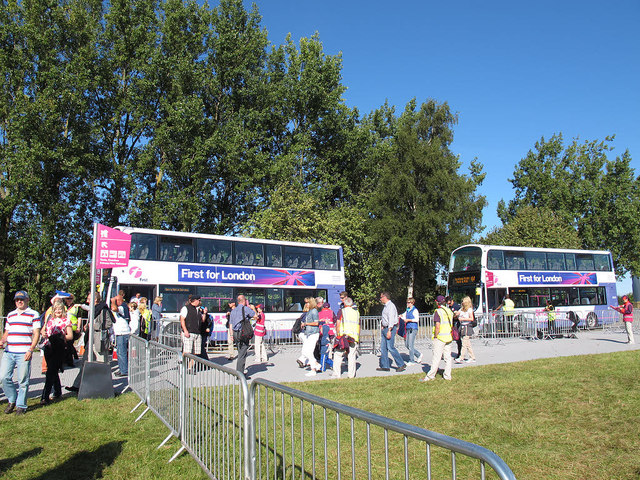
Hawthorn Hill Images
Images are sourced within 2km of 51.355653/0.26598812 or Grid Reference TQ5764. Thanks to Geograph Open Source API. All images are credited.


Hawthorn Hill is located at Grid Ref: TQ5764 (Lat: 51.355653, Lng: 0.26598812)
Administrative County: Kent
District: Sevenoaks
Police Authority: Kent
What 3 Words
///sock.pound.brains. Near West Kingsdown, Kent
Nearby Locations
Related Wikis
Brands Hatch
Brands Hatch is a motor racing circuit in West Kingsdown, Kent, England, United Kingdom. Originally used as a grasstrack motorcycle circuit on farmland...
West Kingsdown
West Kingsdown is a village and civil parish in the Sevenoaks district of Kent, England, on the A20 5 miles (8 km) southeast of Swanley, 5.5 miles (9 km...

Fawkham
Fawkham is a village and civil parish in the Sevenoaks District of Kent, England. Fawkham is defined as a hamlet by Sevenoaks District Council, with a...
Fawkham Green
Fawkham Green see Fawkham == External links == Parish church

Maplescombe
Maplescombe is a hamlet in the West Kingsdown civil parish, in the Sevenoaks District, in the county of Kent, England. == Location == It is about eight...
London Golf Club
The London Golf Club is a privately owned golf course located in the village of Ash, Kent, approximately 20 miles southeast of London. == History == The...

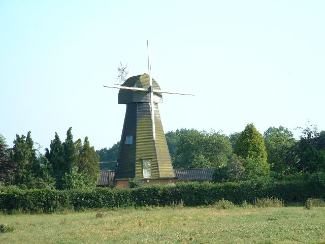
West Kingsdown Windmill
West Kingsdown Windmill is a Grade II listed smock mill in West Kingsdown, Kent, England, that was built in the early nineteenth century at Farningham...
Ash, Sevenoaks District
Ash is a small village and former civil parish located in the Sevenoaks district in Kent. It shares the parish of Ash-cum-Ridley with the nearby village...
Nearby Amenities
Located within 500m of 51.355653,0.26598812Have you been to Hawthorn Hill?
Leave your review of Hawthorn Hill below (or comments, questions and feedback).