Brasted Hill

Hill, Mountain in Kent Sevenoaks

England

Brasted Hill

Meadow near Scott's Lodge
Meadow near Scott's Lodge Credit: Pip Rolls

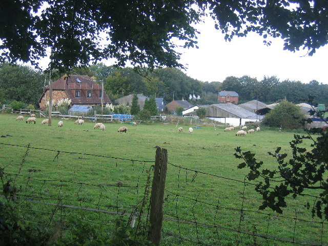
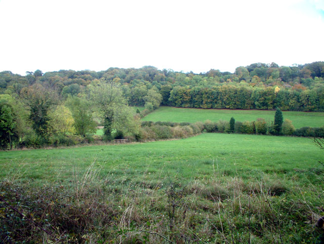
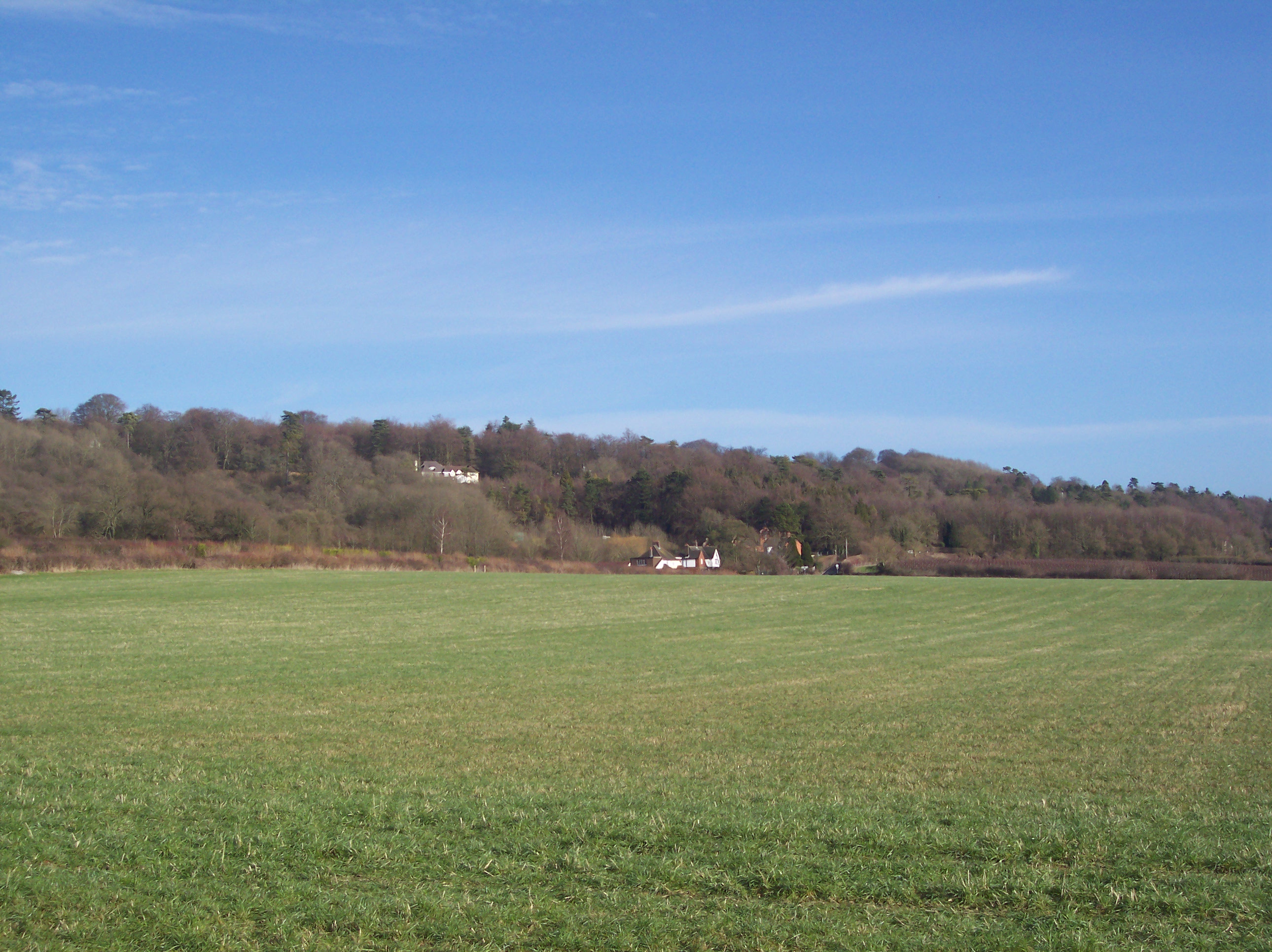
Brasted Hill, located in the county of Kent, England, is a prominent hill known for its scenic beauty and historical significance. Rising to an elevation of approximately 220 meters, it forms part of the North Downs, a range of chalk hills that stretches across southeastern England. The hill is situated near the village of Brasted, just southwest of Sevenoaks.

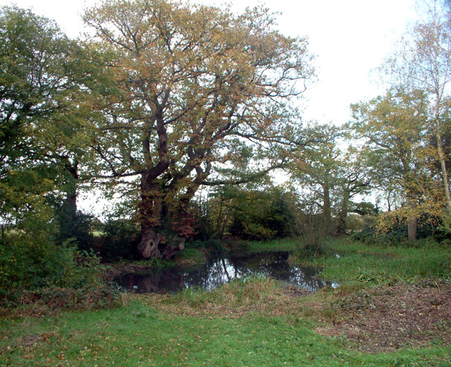
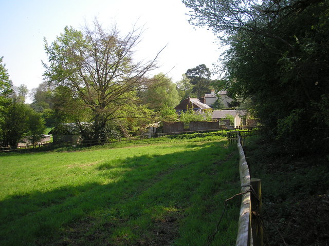
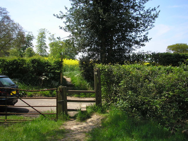
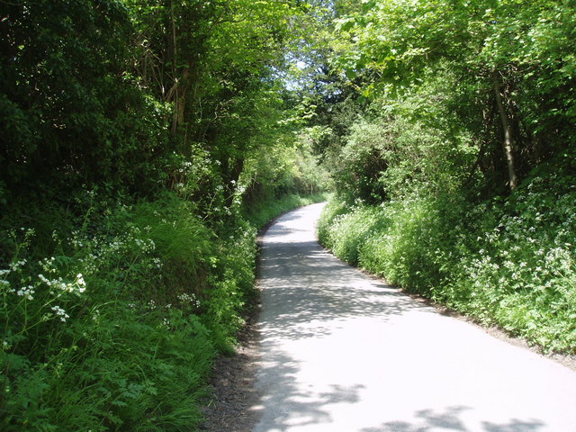
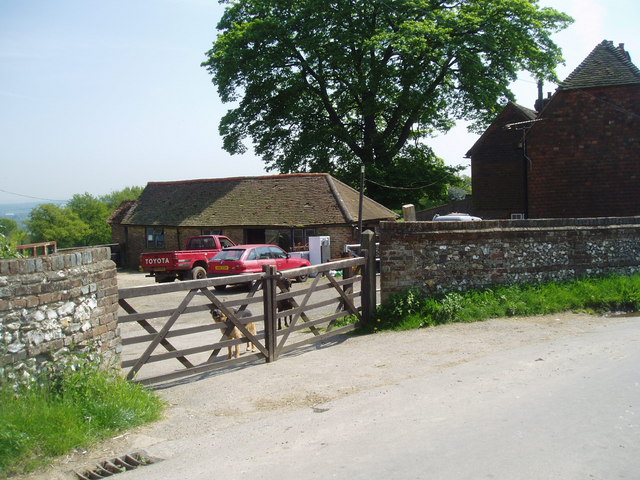
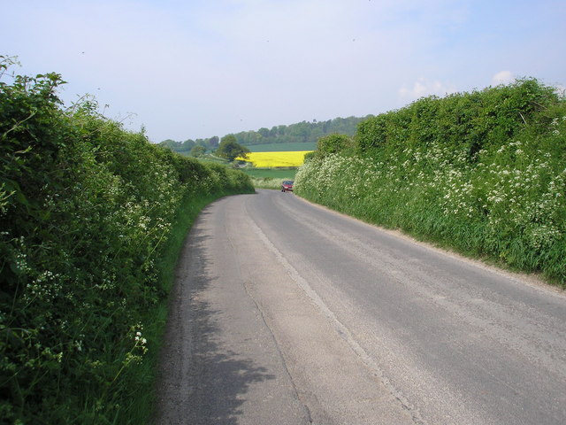
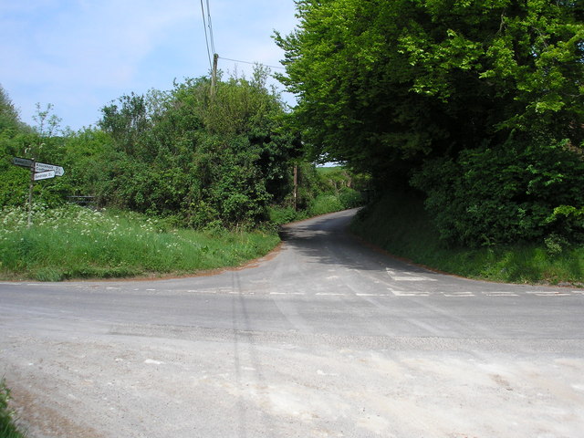
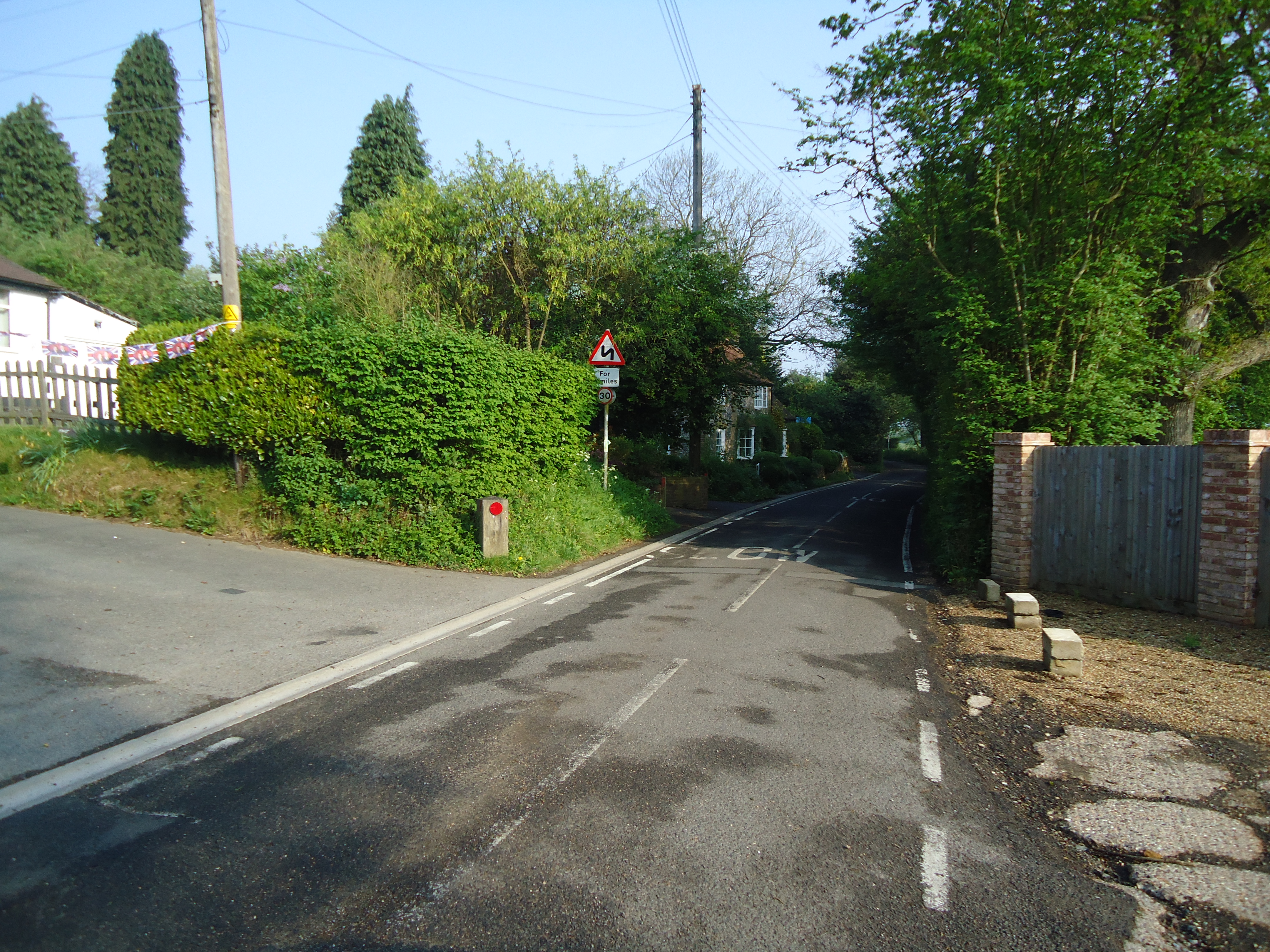
Brasted Hill offers breathtaking views of the surrounding countryside, with its sloping grassy slopes covered in a patchwork of fields, woodlands, and hedgerows. It is a popular destination for hikers, nature enthusiasts, and photographers, who are drawn to its serene and picturesque landscapes.

Besides its natural beauty, Brasted Hill also holds historical importance. The area is known to have been inhabited since prehistoric times, as evidenced by the discovery of several archaeological sites, including ancient burial mounds. Additionally, the hill was once home to a Roman villa, providing insights into the region's rich past.

Today, Brasted Hill is a protected area, designated as part of the Kent Downs Area of Outstanding Natural Beauty (AONB). This status ensures the preservation of the hill's unique flora and fauna, which includes a variety of wildflowers, birds, and insects. It also guarantees that the hill remains accessible to visitors, with designated paths and trails for walking and exploring the area.

In summary, Brasted Hill in Kent offers a blend of natural beauty and historical heritage. Its stunning landscapes and cultural significance make it a popular destination for both locals and tourists seeking to immerse themselves in the charm of the English countryside.

If you have any feedback on the listing, please let us know in the comments section below.
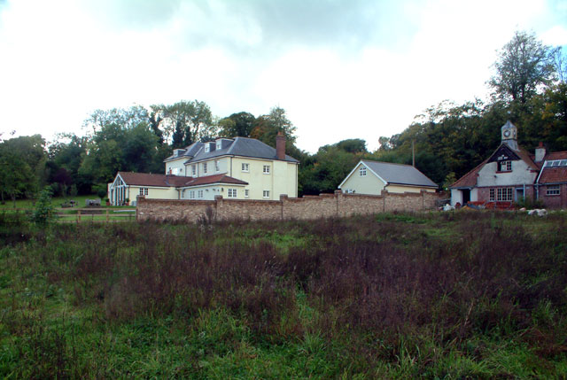
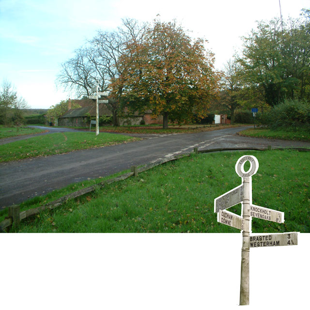
Brasted Hill Images

Images are sourced within 2km of 51.298257/0.091577532 or Grid Reference TQ4557. Thanks to Geograph Open Source API. All images are credited.

Meadow near Scott's Lodge
The Manor, New Barn Lane, TN16 Shown on the OS map as New Barn Farm - but the old farm buildings have been demolished, only the stables remaining (at the right of the photo).
The Manor, New Barn Lane, TN16
Shown on the OS map as New Barn Farm - but the old farm buildings have been demolished, only the stables remaining (at the right of the photo).
The Grove, TN14 A wooded hillside between New Barn Lane and Cudham Lane South
The Grove, TN14
A wooded hillside between New Barn Lane and Cudham Lane South
Letts Green crossroads, Knockholt TN14 Cackets Lane (behind the camera, to the left) comes from Cudham, to the west. Burlings Lane goes south towards Brasted. Away from the camera to the right, Shelleys Lane leads eastwards towards Knockholt. Northwards to the left is News Years Lane, leading northwards towards Green Street Green.
Letts Green crossroads, Knockholt TN14
Cackets Lane (behind the camera, to the left) comes from Cudham, to the west. Burlings Lane goes south towards Brasted. Away from the camera to the right, Shelleys Lane leads eastwards towards Knockholt. Northwards to the left is News Years Lane, leading northwards towards Green Street Green.
Letts Green Pond, Knockholt TN14 Just north of the crossroads.
Letts Green Pond, Knockholt TN14
Just north of the crossroads.
Farm buildings, Cudham Grange, Kent
The 'Tally Ho', Knockholt, Kent Excellent food and a choice of well-kept beers are on offer at this country 'local'.
The 'Tally Ho', Knockholt, Kent
Excellent food and a choice of well-kept beers are on offer at this country 'local'.
St Katharine's Church, Knockholt, Kent Restoration was in progress on the brick and flint tower of this old parish church.
St Katharine's Church, Knockholt, Kent
Restoration was in progress on the brick and flint tower of this old parish church.
The North Downs Way This deservedly popular long distance footpath runs close to Knockholt village. Here it is seen looking west where it crosses the minor lane from Knockholt to Sundridge.
The North Downs Way
This deservedly popular long distance footpath runs close to Knockholt village. Here it is seen looking west where it crosses the minor lane from Knockholt to Sundridge.
Sundridge Hill, Kent We are on the scarp slope of the North Downs here, and many of the lanes crossing it are both narrow and steep.  This one rates a "more than 14%" symbol on the OS map.  If you are motoring in this area, please use extra care.
Sundridge Hill, Kent
We are on the scarp slope of the North Downs here, and many of the lanes crossing it are both narrow and steep. This one rates a "more than 14%" symbol on the OS map. If you are motoring in this area, please use extra care.
Entrance to Brasted Hill Farm, Kent On approaching the farm gate, the two watchdogs - one a German Shepherd and the other a Dobermann - set up such a racket of barking that it must have been audible over half the County.  I took my photograph quickly and removed myself as rapidly as I was able.
Entrance to Brasted Hill Farm, Kent
On approaching the farm gate, the two watchdogs - one a German Shepherd and the other a Dobermann - set up such a racket of barking that it must have been audible over half the County. I took my photograph quickly and removed myself as rapidly as I was able.
The Pilgrim's Way This minor road, which here roughly parallels the M25 motorway, is on the exact alignment of the ancient Pilgrim's Way from Winchester to Canterbury.
The Pilgrim's Way
This minor road, which here roughly parallels the M25 motorway, is on the exact alignment of the ancient Pilgrim's Way from Winchester to Canterbury.
Looking up Hogtrough Hill The Pilgrim's Way runs left to right (west to east) here, while Hogtrough Hill, which rates a "more than 14%" symbol on the OS map, climbs steeply up the scarp slope of the North Downs towards Knockholt.
Looking up Hogtrough Hill
The Pilgrim's Way runs left to right (west to east) here, while Hogtrough Hill, which rates a "more than 14%" symbol on the OS map, climbs steeply up the scarp slope of the North Downs towards Knockholt.
M25 from Brasted Hill Road A motorway does not make the most beautiful of pictures, but here cars, vans, HGVs and a stretch limo. all add interest - and CO2
M25 from Brasted Hill Road
A motorway does not make the most beautiful of pictures, but here cars, vans, HGVs and a stretch limo. all add interest - and CO2
The Oast House, Combe Bank Farm, Ovenden Road, Sundridge, Kent An Oast House is a building used to dry fresh hops before they are sent to the brewers, to be used for flavouring beer. A traditional Oast House consists of the 'oast' and the 'stowage'. The oast was a kiln, with a plenum chamber fired by charcoal at ground floor and the drying floor directly above. The steep pitched roof channelled the hot air through the hops to the top. The stowage, was the barn section, it had a cooling floor and press at first floor and storage area at ground floor. Read more <a title="https://www.geograph.org.uk/article/Oast-Houses" href="https://www.geograph.org.uk/article/Oast-Houses">Link</a>
The Oast House, Combe Bank Farm, Ovenden Road, Sundridge, Kent
An Oast House is a building used to dry fresh hops before they are sent to the brewers, to be used for flavouring beer. A traditional Oast House consists of the 'oast' and the 'stowage'. The oast was a kiln, with a plenum chamber fired by charcoal at ground floor and the drying floor directly above. The steep pitched roof channelled the hot air through the hops to the top. The stowage, was the barn section, it had a cooling floor and press at first floor and storage area at ground floor. Read more Link
St Katharine's Church, Knockholt The church was consecrated here in 1281, and it is thought that much of the original building exists in the present structure, although with various additions over the years, including the tower, and in 1881 the building of the north aisle.

The lychgate dates from 1945 and is dedicated to those who died in the Second World War.
St Katharine's Church, Knockholt
The church was consecrated here in 1281, and it is thought that much of the original building exists in the present structure, although with various additions over the years, including the tower, and in 1881 the building of the north aisle. The lychgate dates from 1945 and is dedicated to those who died in the Second World War.
St Katharine's Church, Knockholt and War Memorial For description of the church, see <a href="https://www.geograph.org.uk/photo/825342">TQ4658 : St Katharine's Church, Knockholt</a>
St Katharine's Church, Knockholt and War Memorial
For description of the church, see TQ4658 : St Katharine's Church, Knockholt
Show me another place!

Brasted Hill is located at Grid Ref: TQ4557 (Lat: 51.298257, Lng: 0.091577532)

Administrative County: Kent

District: Sevenoaks

Police Authority: Kent

What 3 Words

///marble.jets.bring. Near Sundridge, Kent

Related Wikis

Horns Green

Horns Green is an area in the London Borough of Bromley located to the south of Cudham near the boundary with Kent. == References ==

Knockholt

Knockholt is a village and civil parish in the Sevenoaks District of Kent, England. It is located 5 mi (8 km) north west of Sevenoaks & 5.7 mi (9.2 km...

St Katharine's Church, Knockholt

St Katharine's Church is an Anglican parish church in the village of Knockholt and the Sevenoaks deanery. St Katharine's and St Margaret's came together...

Brasted railway station

Brasted is a disused intermediate railway station in Brasted, Kent on the closed Westerham Valley branch line. The station closed in 1961 and the site...

Pilgrims' Way

The Pilgrims' Way (also Pilgrim's Way or Pilgrims Way) is the historical route supposedly taken by pilgrims from Winchester in Hampshire, England, to the...

Betsom's Hill

Betsom's Hill is a hill on the North Downs, and the highest point in the county of Kent at 251 metres (823 ft). Situated between Westerham and Tatsfield...

R. Durtnell & Sons

R. Durtnell & Sons was an English building company established in 1591 that had been continuously in the same family in Brasted, in the English county...

Berry's Green

Berry's Green a small hamlet in the London Borough of Bromley in Greater London, UK, situated outside of London's contiguous built-up area. It is a fairly...

Nearby Amenities

Located within 500m of 51.298257,0.091577532
Barrier: kissing_gate
Foot: yes
Material: wood
Source: survey
Lat/Long: 51.3002545/0.0976404
Barrier: kissing_gate
Foot: yes
Material: wood
Source: survey
Lat/Long: 51.2992211/0.0958807
Barrier: kissing_gate
Foot: yes
Material: wood
Source: survey
Lat/Long: 51.2987909/0.0950368
Barrier: kissing_gate
Lat/Long: 51.2967566/0.0911143
Bus Stop
Hail & Ride Scotts Lodge
Naptan AtcoCode: 2400A008570A
Naptan Bearing: NE
Naptan CommonName: Main Road
Naptan Indicator: NE-bound
Naptan Landmark: Cudham Lane South
Naptan NaptanCode: kntajtpj
Naptan Street: Main Road
Naptan Verified: no
Public Transport: platform
Source: naptan_import
Lat/Long: 51.3004529/0.0863121
Brasted Hill
Natural: peak
Lat/Long: 51.2967237/0.0977173
Barrier: stile
Bicycle: no
Foot: yes
Material: wood
Source: survey
Stile: stepover
Lat/Long: 51.2995626/0.0895011
Barrier: stile
Bicycle: no
Foot: yes
Material: wood
Source: survey
Stile: stepover
Lat/Long: 51.3005512/0.0911791
Barrier: kissing_gate
Lat/Long: 51.2987044/0.0948927
Barrier: kissing_gate
Lat/Long: 51.2968183/0.0912897
Bus Stop
Hail & Ride Scotts Lodge
Naptan AtcoCode: 2400107805
Public Transport: platform
Lat/Long: 51.300607/0.0863576
Power: pole
Lat/Long: 51.2949676/0.0886903
Power: pole
Lat/Long: 51.2958616/0.0897202
Power: pole
Lat/Long: 51.2970191/0.0903856
Power: pole
Lat/Long: 51.2989265/0.0914825
Power: pole
Lat/Long: 51.2996879/0.0919224
Power: pole
Lat/Long: 51.3002849/0.0917883
Power: pole
Lat/Long: 51.2999462/0.0929899
Power: pole
Lat/Long: 51.2995638/0.0943042
Material: wood
Power: pole
Lat/Long: 51.3006069/0.0906671
Communication: pole
Lat/Long: 51.3009691/0.0893797
Communication: pole
Lat/Long: 51.3003141/0.0947683
Give Way
Lat/Long: 51.2968913/0.0964597
Give Way
Lat/Long: 51.2989393/0.0949624
Power: pole
Lat/Long: 51.3008229/0.0924983
Power: pole
Lat/Long: 51.3026181/0.0928286
Power: pole
Lat/Long: 51.3015756/0.0926515
Power: pole
Lat/Long: 51.3009619/0.08939
Power: pole
Lat/Long: 51.3012721/0.0882474
The data included in this document is from www.openstreetmap.org. The data is made available under ODbL.

Have you been to Brasted Hill?

Leave your review of Brasted Hill below (or comments, questions and feedback).