Beddingham Hill

Hill, Mountain in Sussex Lewes

England

Beddingham Hill

Door in Firle
Door in Firle Credit: Ian Cunliffe

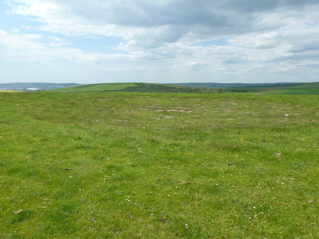
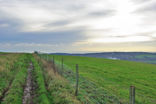
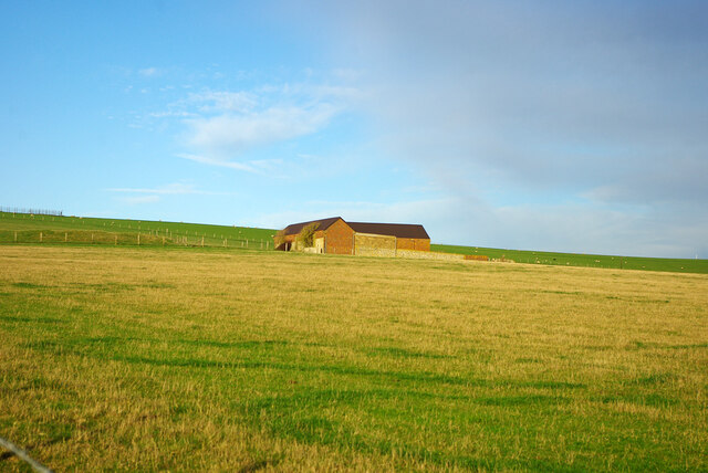
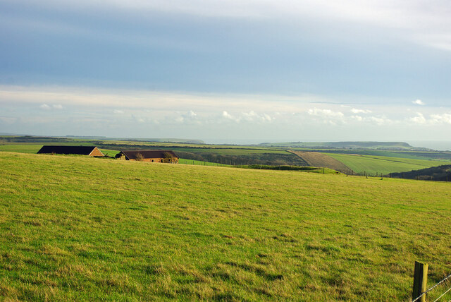
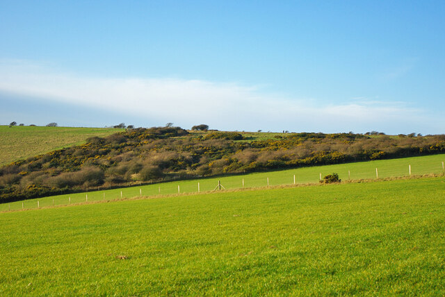
Beddingham Hill, located in the county of Sussex, England, is a prominent hill that forms part of the South Downs National Park. Rising to an elevation of 217 meters (712 feet), this natural landmark offers stunning panoramic views of the surrounding countryside and is a popular spot for outdoor enthusiasts and nature lovers.

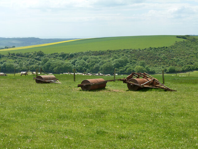
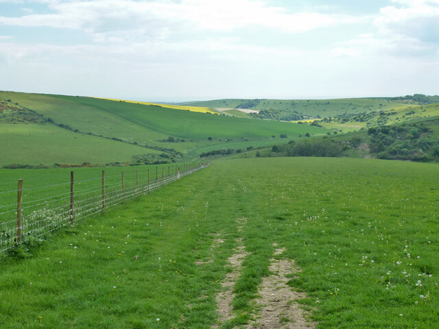
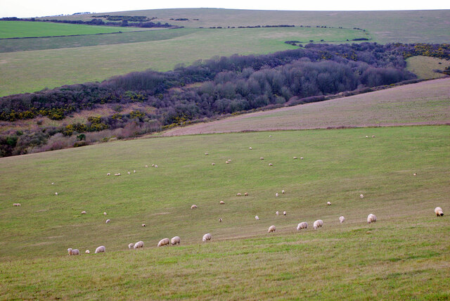
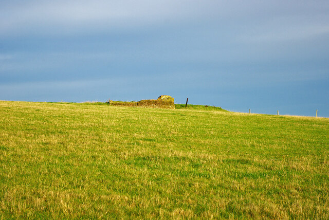
The hill is characterized by its rolling green slopes, which are covered in a patchwork of fields and scattered with picturesque woodlands. It is primarily composed of chalk, a characteristic feature of the South Downs area, which contributes to its distinctive appearance and rich biodiversity.

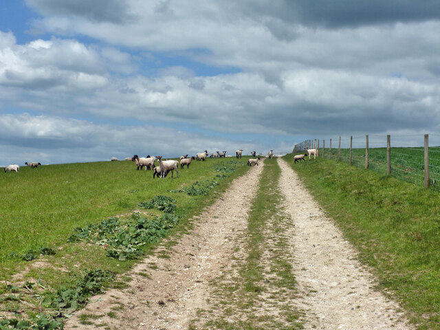
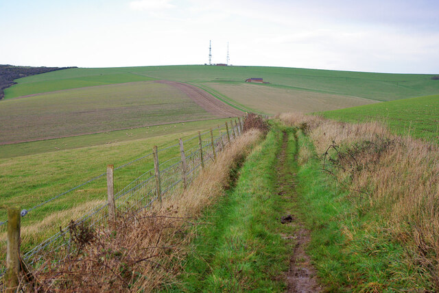
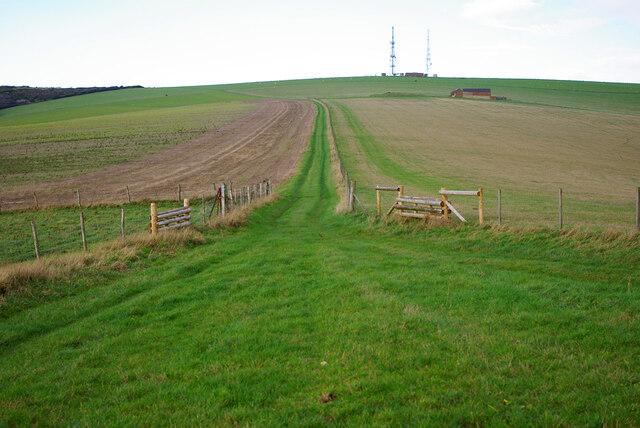
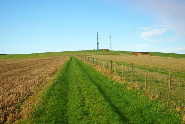
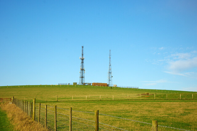
The summit of Beddingham Hill is adorned with a trig point, a concrete pillar used for surveying purposes, which acts as a navigational marker for hikers and walkers exploring the area. From this vantage point, visitors can enjoy breathtaking vistas of the nearby village of Beddingham, as well as the South Downs Way, a long-distance footpath that stretches for 160 kilometers (100 miles) through the national park.

The hill is also home to an array of wildlife, including various bird species, butterflies, and wildflowers. As such, it is a popular location for birdwatching and nature photography.

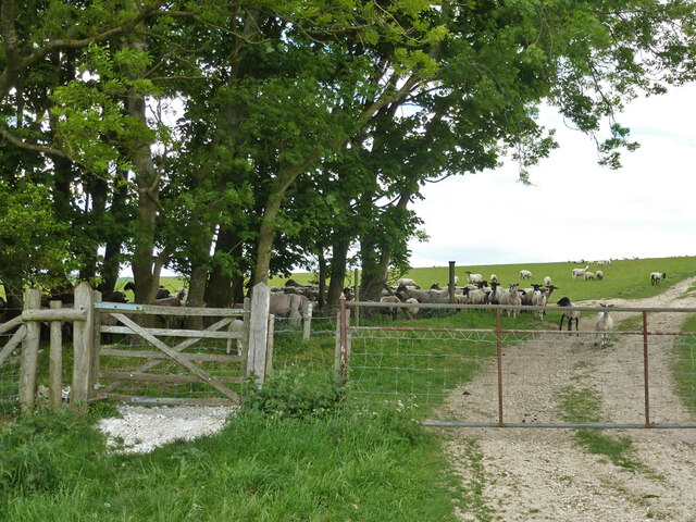
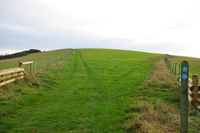
Access to Beddingham Hill is available via public footpaths and bridleways, ensuring that visitors can explore and appreciate the natural beauty of this tranquil spot. Whether it be for a leisurely stroll, a challenging hike, or simply to soak in the scenic views, Beddingham Hill offers a delightful experience for all who visit.

If you have any feedback on the listing, please let us know in the comments section below.

Beddingham Hill Images

Images are sourced within 2km of 50.835572/0.070538347 or Grid Reference TQ4506. Thanks to Geograph Open Source API. All images are credited.

Door in Firle
Door in Firle
Dew pond, Blackcap Hill Large, but not very obvious and not very wet.
Dew pond, Blackcap Hill
Large, but not very obvious and not very wet.
Rollers on Blackcap Hill
Sheep, Blackcap Hill The track is bridleway Beddingham 5.
Sheep, Blackcap Hill
The track is bridleway Beddingham 5.
Gate on bridleway at parish boundary Bridleway South Heighton 7 becomes Beddingham 5 on the other side.
Gate on bridleway at parish boundary
Bridleway South Heighton 7 becomes Beddingham 5 on the other side.
Bridleway descending into Home Bottom Bridleway South Heighton 7 from Blackcap Hill.
Bridleway descending into Home Bottom
Bridleway South Heighton 7 from Blackcap Hill.
View south from bridleway Tarring Neville 3
Bridleway towards Beddingham Hill Bridleway Tarring Neville 3.
Bridleway towards Beddingham Hill
Bridleway Tarring Neville 3.
Sheep grazing above Well Bottom
Bridleway towards Beddingham Hill Bridleway Tarring Neville 3 from the left, Beddingham 4d from the right, merge as Beddingham 4c.
Bridleway towards Beddingham Hill
Bridleway Tarring Neville 3 from the left, Beddingham 4d from the right, merge as Beddingham 4c.
Bridleway junction Looking from bridleway Beddingham 4c which splits to Tarring Neville 3 right, Beddingham 4d left.
Bridleway junction
Looking from bridleway Beddingham 4c which splits to Tarring Neville 3 right, Beddingham 4d left.
Bridleway towards Beddingham Hill Bridleway Beddingham 4c, with America Farm (just barns) off to the right.
Bridleway towards Beddingham Hill
Bridleway Beddingham 4c, with America Farm (just barns) off to the right.
America Farm Just barns, with a dew pond to the left.
America Farm
Just barns, with a dew pond to the left.
Radio station, Beddingham Hill At least partly Sussex Police.
Radio station, Beddingham Hill
At least partly Sussex Police.
Bridleway heading south from Beddingham Hill Bridleway Beddingham 4c which in the distance splits to Tarring Neville 3 right, Beddingham 4d left.
Bridleway heading south from Beddingham Hill
Bridleway Beddingham 4c which in the distance splits to Tarring Neville 3 right, Beddingham 4d left.
Ruin, America Farm At a little remove from the current barns, this site was later than the barn site, which appeared on maps in late Victorian times beside an older dew pond. This site is early 20th century, probably a house from its general appearance on maps.
Ruin, America Farm
At a little remove from the current barns, this site was later than the barn site, which appeared on maps in late Victorian times beside an older dew pond. This site is early 20th century, probably a house from its general appearance on maps.
View towards coast from near America Farm In the middle of the view the Cuckmere gap in the chalk cliffs, at the right that at Seaford extending off the view to Newhaven, the work of the Ouse.
View towards coast from near America Farm
In the middle of the view the Cuckmere gap in the chalk cliffs, at the right that at Seaford extending off the view to Newhaven, the work of the Ouse.
Top end of Well Bottom CRoW access downland, unfortunately allowed to become very scrubby.
Top end of Well Bottom
CRoW access downland, unfortunately allowed to become very scrubby.
Show me another place!

Beddingham Hill is located at Grid Ref: TQ4506 (Lat: 50.835572, Lng: 0.070538347)

Administrative County: East Sussex

District: Lewes

Police Authority: Sussex

What 3 Words

///videos.gangs.shorter. Near Newhaven, East Sussex

Related Wikis

Firle Escarpment

Firle Escarpment is a 302.1-hectare (747-acre) biological Site of Special Scientific Interest north of Seaford in East Sussex.This is a long stretch of...

Asham Quarry

Asham Quarry is a 2.6-hectare (6.4-acre) geological Site of Special Scientific Interest north of Newhaven in East Sussex. It is a Geological Conservation...

Firle Place

Firle Place is a manor house in Firle, East Sussex, United Kingdom. The Gage family have owned the land at Firle since acquiring it from the Levett family...

Firle Beacon

Firle Beacon is a hill in the South Downs of southern England. It is 217 metres high and is a Marilyn. It commands a far-reaching view. When the prevailing...

Nearby Amenities

Located within 500m of 50.835572,0.070538347
Barrier: cattle_grid
Lat/Long: 50.8349818/0.0649631
Males Burgh
Created By: Potlatch 0.10f
Historic: archaeological_site
Source: NPE
Lat/Long: 50.8336107/0.075264
Barrier: stile
Lat/Long: 50.8360168/0.0741797
Barrier: stile
Lat/Long: 50.8356296/0.0655349
Beddingham Hill
Ele: 189
Natural: peak
Lat/Long: 50.8346294/0.0691221
The data included in this document is from www.openstreetmap.org. The data is made available under ODbL.

Have you been to Beddingham Hill?

Leave your review of Beddingham Hill below (or comments, questions and feedback).