Iford Hill

Hill, Mountain in Sussex Lewes

England

Iford Hill

Swanborough Manor Farm
Swanborough Manor Farm Credit: N Chadwick

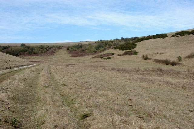
Iford Hill, located in Sussex, England, is a prominent hill that offers breathtaking views and a tranquil escape for nature enthusiasts. Standing at an elevation of approximately 200 meters, it is a popular destination for locals and tourists alike.

The hill is characterized by its lush greenery, with dense forests covering its slopes. Its diverse ecosystem supports a variety of flora and fauna, making it an ideal spot for wildlife enthusiasts and birdwatchers. Rare species such as red kites and buzzards can often be spotted soaring above the hill.

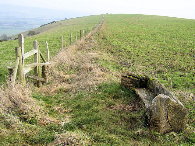
Several walking trails crisscross the hill, providing visitors with the opportunity to explore its natural beauty. These trails vary in difficulty, catering to both casual walkers and avid hikers. Along the way, visitors will come across picturesque meadows, ancient woodlands, and babbling brooks, creating a truly immersive experience in nature.

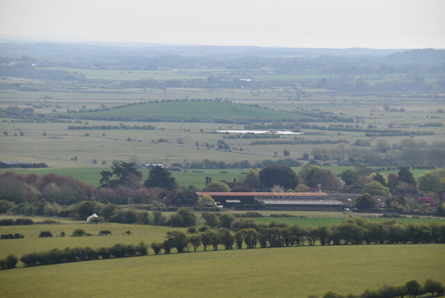
At the summit of Iford Hill, visitors are rewarded with panoramic views of the surrounding landscape. On clear days, one can see the South Downs in the distance and even catch a glimpse of the English Channel. This vantage point offers a sense of tranquility and provides ample opportunities for photography and reflection.

Iford Hill is easily accessible, with a car park located nearby and regular bus services connecting it to neighboring towns. It is a popular destination for outdoor activities such as picnicking, dog walking, and even paragliding. With its natural beauty and serene atmosphere, Iford Hill is a must-visit location for those seeking a peaceful retreat in the heart of Sussex.

If you have any feedback on the listing, please let us know in the comments section below.

Iford Hill Images

Images are sourced within 2km of 50.841496/-0.022634771 or Grid Reference TQ3906. Thanks to Geograph Open Source API. All images are credited.

Swanborough Manor Farm
Iford Iford is a parish on the western side of the lower Ouse valley that is bounded by Rottingdean to the west; Kingston near Lewes to the north; the River Ouse to the east; and Rodmell to the south. The parish boundary has remained unchanged for many centuries until 1934 when the former parish of Southover was dissolved and its rural area including both Upper and Lower Rises were added. Like many downland parishes it runs in a strip that includes the chalk downs, the greensand at the foot, and the brooklands once reclaimed from the river's former tidal estuary. 

The village itself is comprised of Norton and Sutton which straggles around a looped village lane off the eastern side of the old Lewes-Newhaven road. Norton was for centuries part of the old manor of Swanborough which was developed by the monks of Lewes Priory from 1200 until the Reformation when the land eventually fell into the hands of the Dukes of Dorset where it remained until 1879 when it came into the hands of the Robinson family who still work the farm at Iford today. The small hamlet of Swanborough, for many years just a farm, grew up from the 19th century along Swanborough Drove, a track linking the Lewes-Newhaven road with the top of the Downs. Sutton eventually came under the manor of Northease, part of neighbouring Rodmell parish, where it too fell into the hands of a local  landowner, the Abergavennys, until the beginning of the 20th century. The boundary between the two could still be made out through field boundaries until the last twenty years or so.

Communications wise, the parish is traversed by Swanborough Hollow, the main Lewes-Newhaven road formed many centuries ago to link the farms and settlements that lie on the sheltered western side of the lower Ouse valley. During the 1920s it became the A275 until it was downgraded in the 1970s to C status to encourage port traffic from Newhaven up the newly designated A26 on the eastern side and thus preventing it trying to negotiate the narrow streets of Lewes. The unnamed village street runs in a loop starting an finishing on Swanborough Hollow and was extended in the late 19th century by the owners of Iford Manor away from their front door. Swanborough Drove is now a restricted byway leading from Swanborough Hollow up onto the downs splitting into Breach Road and Dencher Road halfway up. All tracks are restricted byways.
Iford
Iford is a parish on the western side of the lower Ouse valley that is bounded by Rottingdean to the west; Kingston near Lewes to the north; the River Ouse to the east; and Rodmell to the south. The parish boundary has remained unchanged for many centuries until 1934 when the former parish of Southover was dissolved and its rural area including both Upper and Lower Rises were added. Like many downland parishes it runs in a strip that includes the chalk downs, the greensand at the foot, and the brooklands once reclaimed from the river's former tidal estuary. The village itself is comprised of Norton and Sutton which straggles around a looped village lane off the eastern side of the old Lewes-Newhaven road. Norton was for centuries part of the old manor of Swanborough which was developed by the monks of Lewes Priory from 1200 until the Reformation when the land eventually fell into the hands of the Dukes of Dorset where it remained until 1879 when it came into the hands of the Robinson family who still work the farm at Iford today. The small hamlet of Swanborough, for many years just a farm, grew up from the 19th century along Swanborough Drove, a track linking the Lewes-Newhaven road with the top of the Downs. Sutton eventually came under the manor of Northease, part of neighbouring Rodmell parish, where it too fell into the hands of a local landowner, the Abergavennys, until the beginning of the 20th century. The boundary between the two could still be made out through field boundaries until the last twenty years or so. Communications wise, the parish is traversed by Swanborough Hollow, the main Lewes-Newhaven road formed many centuries ago to link the farms and settlements that lie on the sheltered western side of the lower Ouse valley. During the 1920s it became the A275 until it was downgraded in the 1970s to C status to encourage port traffic from Newhaven up the newly designated A26 on the eastern side and thus preventing it trying to negotiate the narrow streets of Lewes. The unnamed village street runs in a loop starting an finishing on Swanborough Hollow and was extended in the late 19th century by the owners of Iford Manor away from their front door. Swanborough Drove is now a restricted byway leading from Swanborough Hollow up onto the downs splitting into Breach Road and Dencher Road halfway up. All tracks are restricted byways.
Tumulus A tumulus (plural tumuli) is a mound of earth and stones raised over a grave or graves. Tumuli are also known as barrows, burial mounds. In Britain they mainly date from Neolithic to the Bronze Age (2900 - 800BC), although some are later.
Tumulus
A tumulus (plural tumuli) is a mound of earth and stones raised over a grave or graves. Tumuli are also known as barrows, burial mounds. In Britain they mainly date from Neolithic to the Bronze Age (2900 - 800BC), although some are later.
South Downs Way The South Downs Way is a long distance footpath in Southern England and is one of Britain's National Trails. It runs for around 100 miles from Winchester in Hampshire to Eastbourne in Sussex, with a small loop around Eastbourne. The South Downs Way passes through the South Downs, a beautiful area which is now a National Park. The path mainly follows old routes and droveways along the Chalk escarpment. The majority of the path is a bridleway and so can be used by horse-riders and cyclists too. 
More information is available from <span class="nowrap"><a title="http://www.nationaltrail.co.uk/southdowns/index.asp?PageId=1" rel="nofollow ugc noopener" href="http://www.nationaltrail.co.uk/southdowns/index.asp?PageId=1">Link</a><img style="margin-left:2px;" alt="External link" title="External link - shift click to open in new window" src="https://s1.geograph.org.uk/img/external.png" width="10" height="10"/></span>
South Downs Way
The South Downs Way is a long distance footpath in Southern England and is one of Britain's National Trails. It runs for around 100 miles from Winchester in Hampshire to Eastbourne in Sussex, with a small loop around Eastbourne. The South Downs Way passes through the South Downs, a beautiful area which is now a National Park. The path mainly follows old routes and droveways along the Chalk escarpment. The majority of the path is a bridleway and so can be used by horse-riders and cyclists too. More information is available from LinkExternal link
Track on South Downs
Northease Farm
Northease Farm
South Downs Way The South Downs Way is a long distance footpath in Southern England and is one of Britain's National Trails. It runs for around 100 miles from Winchester in Hampshire to Eastbourne in Sussex, with a small loop around Eastbourne. The South Downs Way passes through the South Downs, a beautiful area which is now a National Park. The path mainly follows old routes and droveways along the Chalk escarpment. The majority of the path is a bridleway and so can be used by horse-riders and cyclists too. 
More information is available from <span class="nowrap"><a title="http://www.nationaltrail.co.uk/southdowns/index.asp?PageId=1" rel="nofollow ugc noopener" href="http://www.nationaltrail.co.uk/southdowns/index.asp?PageId=1">Link</a><img style="margin-left:2px;" alt="External link" title="External link - shift click to open in new window" src="https://s1.geograph.org.uk/img/external.png" width="10" height="10"/></span>
South Downs Way
The South Downs Way is a long distance footpath in Southern England and is one of Britain's National Trails. It runs for around 100 miles from Winchester in Hampshire to Eastbourne in Sussex, with a small loop around Eastbourne. The South Downs Way passes through the South Downs, a beautiful area which is now a National Park. The path mainly follows old routes and droveways along the Chalk escarpment. The majority of the path is a bridleway and so can be used by horse-riders and cyclists too. More information is available from LinkExternal link
Cattle on the South Downs
White Way
White Way
White Way
White Way
Breaky Bottom The South Downs is one of the four areas of chalk downland in southern England. They extend from the eastern side of Hampshire through Sussex, culminating in the cliffs at Beachy Head.
The South Downs is England's newest National Park, its designation taking effect on March 31, 2010. There are many Sites of Special Scientific Interest within the park.
The area is relatively unpopulated, although along its southern periphery there is an almost uninterrupted ribbon of seaside towns. It is extremely popular with walkers, having one principal long distance footpath, the South Downs Way, and many interconnecting ones. There are three principal gaps in the upland through which rivers flow; and there are also many dry valleys along its length.
The South Downs have a long history; there are archaeological remains from Neolithic times. Until the middle of the 20th century, sheep-rearing was the main occupation of those living on the Downs.

At 886ft, Butser Hill is the highest point of the South Downs.

Extract from Wikipedia <span class="nowrap"><a title="http://en.wikipedia.org/wiki/South_Downs" rel="nofollow ugc noopener" href="http://en.wikipedia.org/wiki/South_Downs">Link</a><img style="margin-left:2px;" alt="External link" title="External link - shift click to open in new window" src="https://s1.geograph.org.uk/img/external.png" width="10" height="10"/></span>
Breaky Bottom
The South Downs is one of the four areas of chalk downland in southern England. They extend from the eastern side of Hampshire through Sussex, culminating in the cliffs at Beachy Head. The South Downs is England's newest National Park, its designation taking effect on March 31, 2010. There are many Sites of Special Scientific Interest within the park. The area is relatively unpopulated, although along its southern periphery there is an almost uninterrupted ribbon of seaside towns. It is extremely popular with walkers, having one principal long distance footpath, the South Downs Way, and many interconnecting ones. There are three principal gaps in the upland through which rivers flow; and there are also many dry valleys along its length. The South Downs have a long history; there are archaeological remains from Neolithic times. Until the middle of the 20th century, sheep-rearing was the main occupation of those living on the Downs. At 886ft, Butser Hill is the highest point of the South Downs. Extract from Wikipedia LinkExternal link
South Downs Way crosses the Greenwich Meridian The South Downs Way is a long distance footpath in Southern England and is one of Britain's National Trails. It runs for around 100 miles from Winchester in Hampshire to Eastbourne in Sussex, with a small loop around Eastbourne. The South Downs Way passes through the South Downs, a beautiful area which is now a National Park. The path mainly follows old routes and droveways along the Chalk escarpment. The majority of the path is a bridleway and so can be used by horse-riders and cyclists too. 
More information is available from <span class="nowrap"><a title="http://www.nationaltrail.co.uk/southdowns/index.asp?PageId=1" rel="nofollow ugc noopener" href="http://www.nationaltrail.co.uk/southdowns/index.asp?PageId=1">Link</a><img style="margin-left:2px;" alt="External link" title="External link - shift click to open in new window" src="https://s1.geograph.org.uk/img/external.png" width="10" height="10"/></span>
South Downs Way crosses the Greenwich Meridian
The South Downs Way is a long distance footpath in Southern England and is one of Britain's National Trails. It runs for around 100 miles from Winchester in Hampshire to Eastbourne in Sussex, with a small loop around Eastbourne. The South Downs Way passes through the South Downs, a beautiful area which is now a National Park. The path mainly follows old routes and droveways along the Chalk escarpment. The majority of the path is a bridleway and so can be used by horse-riders and cyclists too. More information is available from LinkExternal link
View from South Downs Way
Breaky Bottom The South Downs is one of the four areas of chalk downland in southern England. They extend from the eastern side of Hampshire through Sussex, culminating in the cliffs at Beachy Head.
The South Downs is England's newest National Park, its designation taking effect on March 31, 2010. There are many Sites of Special Scientific Interest within the park.
The area is relatively unpopulated, although along its southern periphery there is an almost uninterrupted ribbon of seaside towns. It is extremely popular with walkers, having one principal long distance footpath, the South Downs Way, and many interconnecting ones. There are three principal gaps in the upland through which rivers flow; and there are also many dry valleys along its length.
The South Downs have a long history; there are archaeological remains from Neolithic times. Until the middle of the 20th century, sheep-rearing was the main occupation of those living on the Downs.

At 886ft, Butser Hill is the highest point of the South Downs.

Extract from Wikipedia <span class="nowrap"><a title="http://en.wikipedia.org/wiki/South_Downs" rel="nofollow ugc noopener" href="http://en.wikipedia.org/wiki/South_Downs">Link</a><img style="margin-left:2px;" alt="External link" title="External link - shift click to open in new window" src="https://s1.geograph.org.uk/img/external.png" width="10" height="10"/></span>
Breaky Bottom
The South Downs is one of the four areas of chalk downland in southern England. They extend from the eastern side of Hampshire through Sussex, culminating in the cliffs at Beachy Head. The South Downs is England's newest National Park, its designation taking effect on March 31, 2010. There are many Sites of Special Scientific Interest within the park. The area is relatively unpopulated, although along its southern periphery there is an almost uninterrupted ribbon of seaside towns. It is extremely popular with walkers, having one principal long distance footpath, the South Downs Way, and many interconnecting ones. There are three principal gaps in the upland through which rivers flow; and there are also many dry valleys along its length. The South Downs have a long history; there are archaeological remains from Neolithic times. Until the middle of the 20th century, sheep-rearing was the main occupation of those living on the Downs. At 886ft, Butser Hill is the highest point of the South Downs. Extract from Wikipedia LinkExternal link
Barn, Iford Farm
Barn, Iford Farm
Show me another place!

Iford Hill is located at Grid Ref: TQ3906 (Lat: 50.841496, Lng: -0.022634771)

Administrative County: East Sussex

District: Lewes

Police Authority: Sussex

What 3 Words

///deeper.fine.reap. Near Lewes, East Sussex

Related Wikis

Kingston Escarpment and Iford Hill

Kingston Escarpment and Iford Hill is a 63.4-hectare (157-acre) biological Site of Special Scientific Interest east of Brighton in East Sussex.These two...
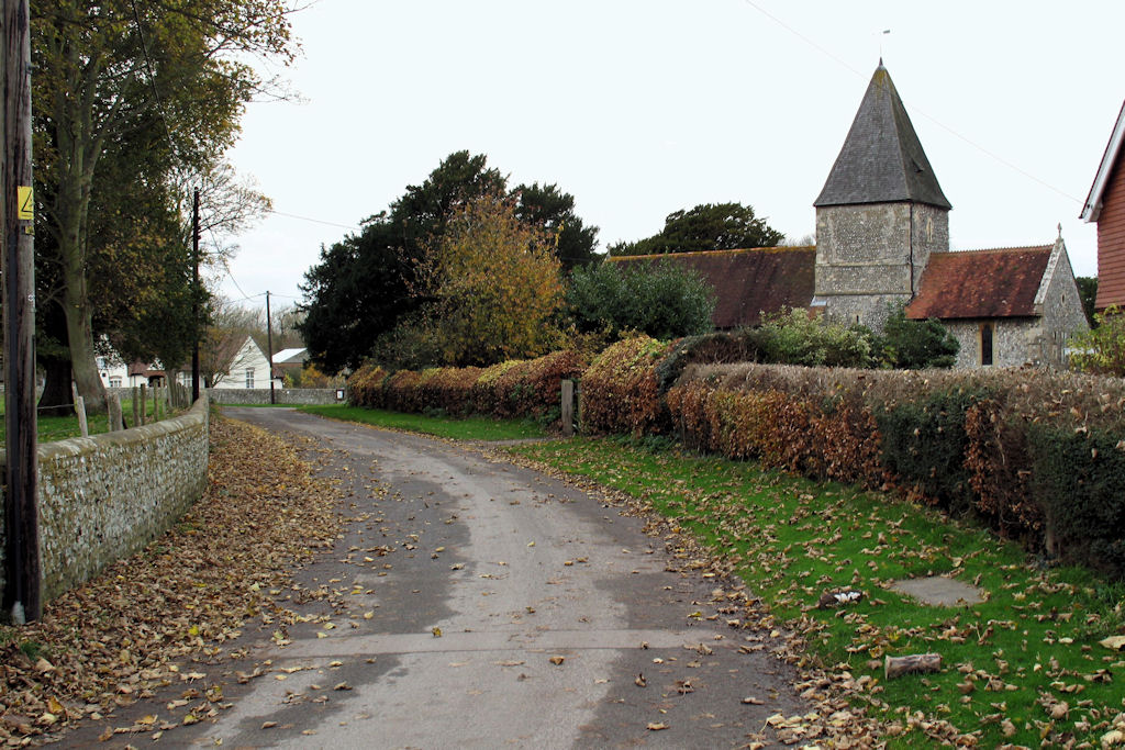
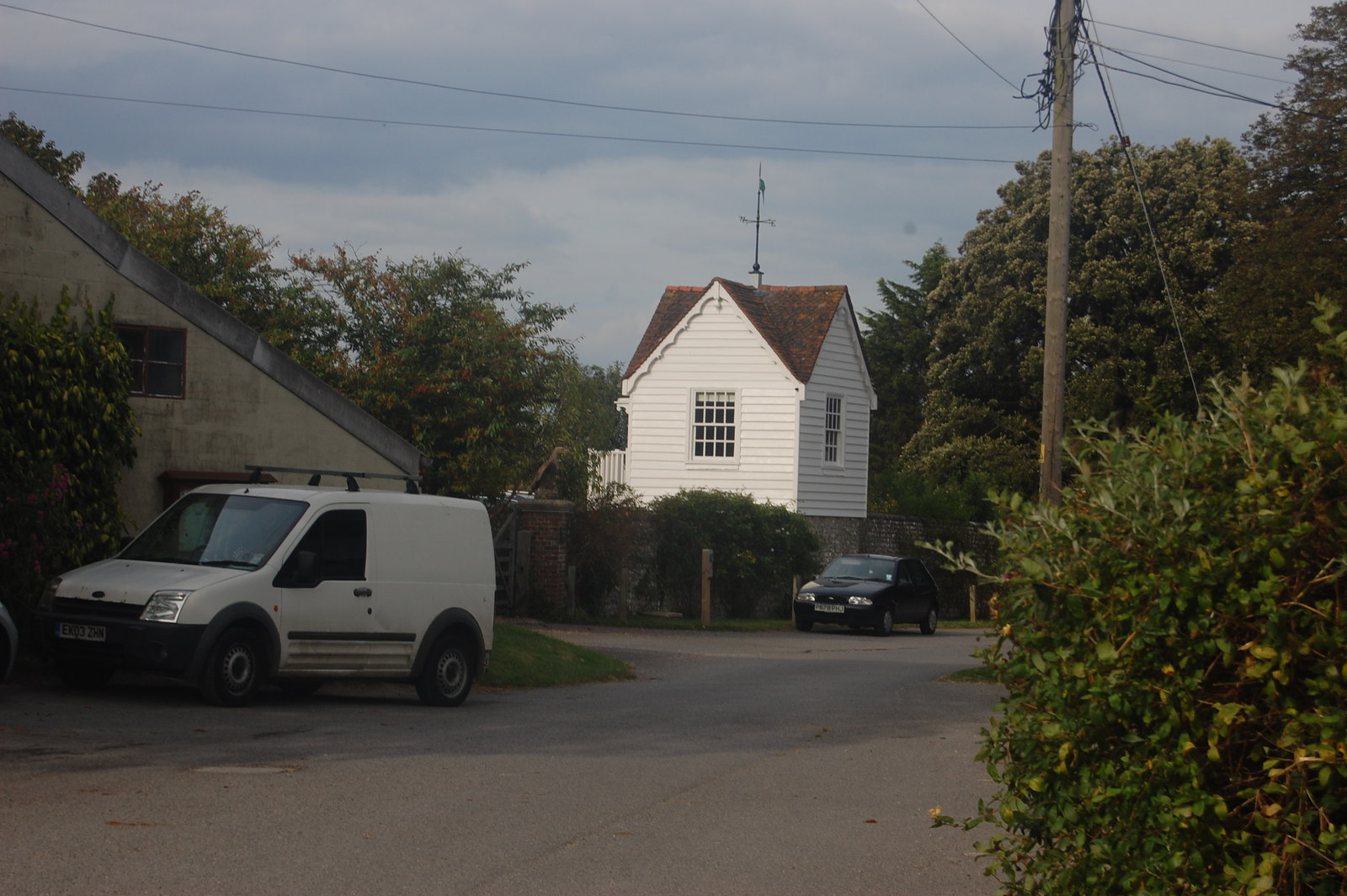
Iford, East Sussex

Iford is a village and civil parish in the Lewes District of East Sussex, England. The village is located two miles (3.2 km) south of Lewes. The parish...

Swanborough Manor

Swanborough Manor is a listed English manor dating back to the 12th century in Iford, East Sussex. == Overview == It is located on Swanborough Drove in...

St Pancras Church, Kingston near Lewes

St Pancras Church is the parish church of Kingston near Lewes in East Sussex, England. The church building was built in the 13th century and is protected...

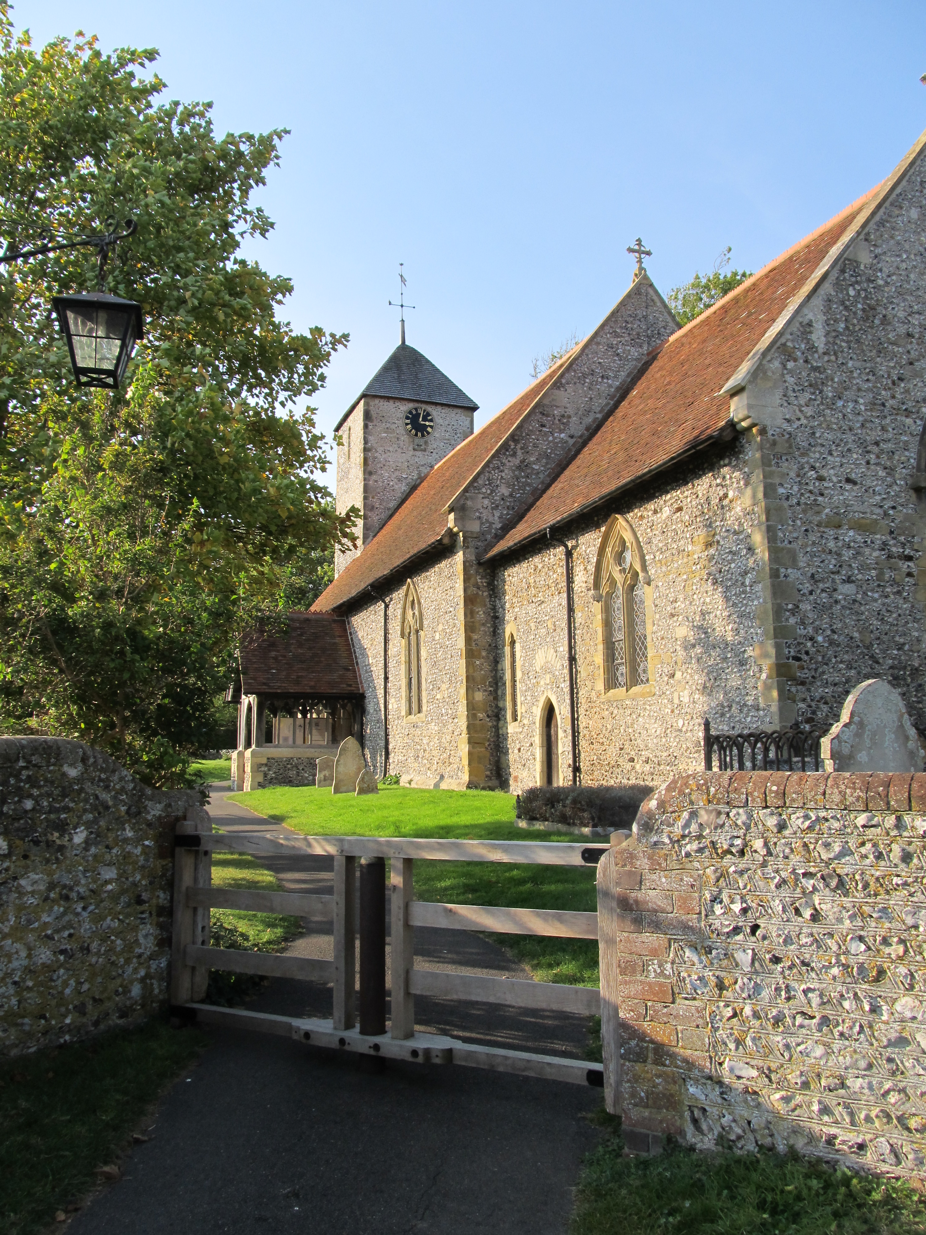
St Nicholas Church, Iford

The Church of St Nicholas is an Anglican church in the village of Iford, East Sussex, England. It is in the Diocese of Chichester, and in the United Benefice...

Kingston near Lewes

Kingston near Lewes is a village and civil parish in the Lewes District of East Sussex, England. The village is mentioned in the Domesday Book and is located...

Brighton Kemptown (UK Parliament constituency)

Brighton Kemptown, often referred to as Brighton Kemptown and Peacehaven by local political parties, is a constituency represented in the House of Commons...

Castle Hill, Brighton

Castle Hill is a 114.6-hectare (283-acre) biological Site of Special Scientific Interest on the eastern outskirts of Brighton in East Sussex. It is a Special...

Nearby Amenities

Located within 500m of 50.841496,-0.022634771
Tumulus
Archaeological Site: tumulus
Historic: archaeological_site
Source: NPE
Lat/Long: 50.843254/-0.0243663
Iford Hill
Ele: 175
Natural: peak
Lat/Long: 50.8406254/-0.0230788
FIXME: ?
Created By: Potlatch 0.10f
Ele NPE: 630ft
Source: NPE
Lat/Long: 50.8445818/-0.0246238
Created By: Potlatch 0.10f
Ele NPE: 580 ft
Source: NPE
Lat/Long: 50.8417907/-0.0220918
Barrier: stile
Fixme: How should the access land be taged?
Note: NE of here access land acouding to sign on stile.
Source: gps#
Lat/Long: 50.8433175/-0.0246634
Swanborough Hill
Ele: 191
Natural: peak
Lat/Long: 50.843488/-0.0286937
The data included in this document is from www.openstreetmap.org. The data is made available under ODbL.

Have you been to Iford Hill?

Leave your review of Iford Hill below (or comments, questions and feedback).