Barnet Gate

Settlement in Hertfordshire / Middlesex

England

Barnet Gate

On the London Loop near Brent Lodge Farm
On the London Loop near Brent Lodge Farm Credit: Mark Percy

Barnet Gate is a small village located on the borders of Hertfordshire and Middlesex in England. Situated in the London Borough of Barnet, it is nestled in the rural outskirts of the bustling city of London.

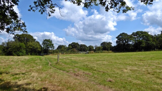
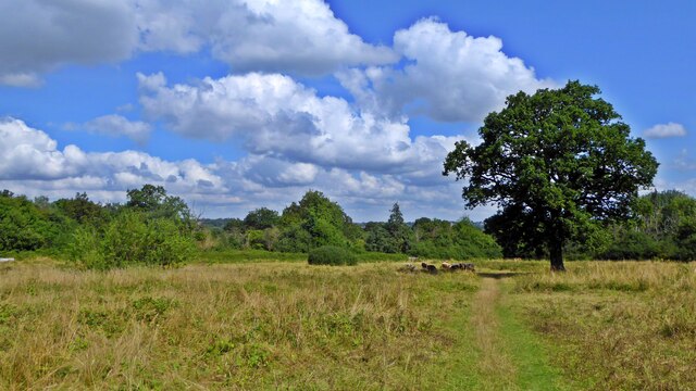
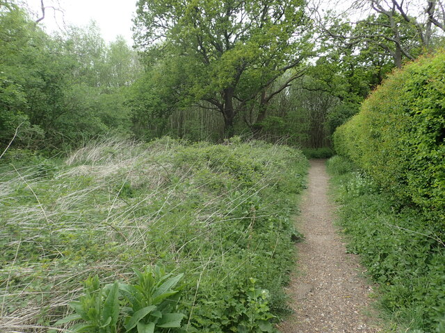
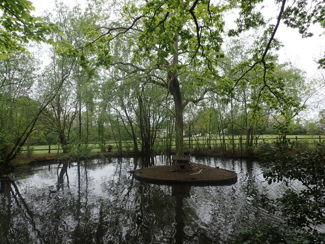
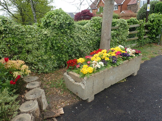
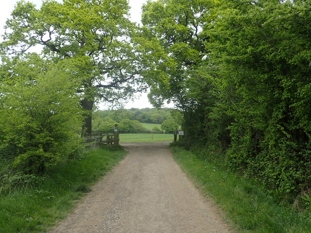
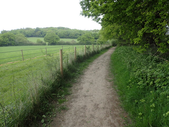
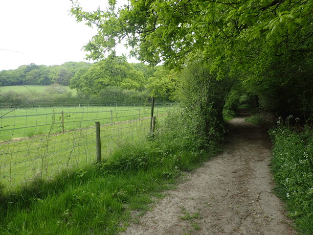
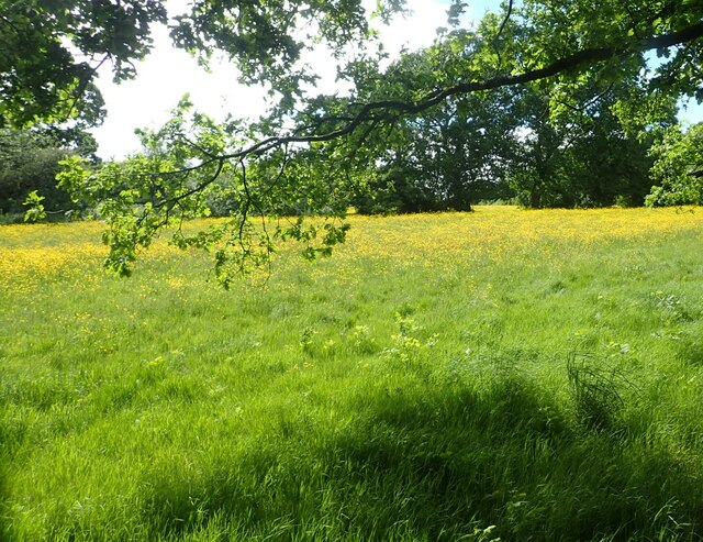
The village is known for its picturesque countryside and tranquil atmosphere, making it an ideal retreat from the city's busy lifestyle. Its location offers stunning views of the surrounding green fields and rolling hills, providing residents and visitors with a sense of serenity.

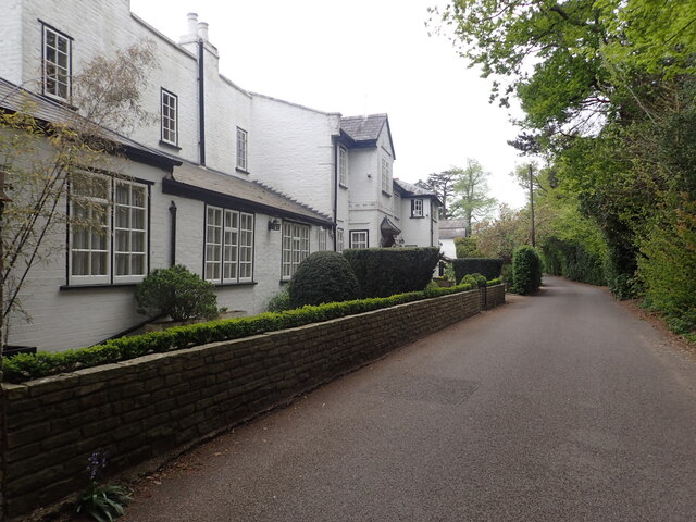
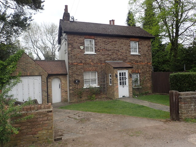
Barnet Gate is primarily residential, consisting of a small number of houses and cottages. The village maintains a close-knit community, with residents often engaging in local activities and events. The nearby countryside provides ample opportunities for outdoor activities such as walking, cycling, and horse riding.

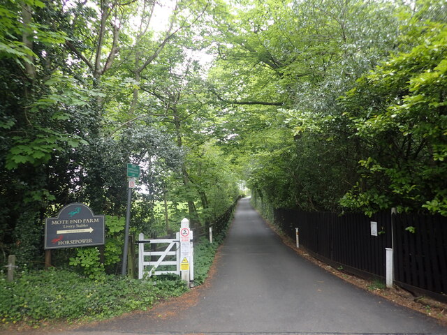
Although small in size, Barnet Gate benefits from its proximity to nearby towns and amenities. The village is within easy reach of Barnet, which offers a range of shops, supermarkets, restaurants, and other essential services. The area is also well-connected by public transportation, with bus routes and train stations nearby, providing convenient access to the city of London and other surrounding areas.

Overall, Barnet Gate offers a peaceful and idyllic setting for those seeking a rural lifestyle while still enjoying the benefits of being close to urban amenities. Its natural beauty and community spirit make it a desirable place to live or visit for those looking to escape the hustle and bustle of city life.

If you have any feedback on the listing, please let us know in the comments section below.

Barnet Gate Images

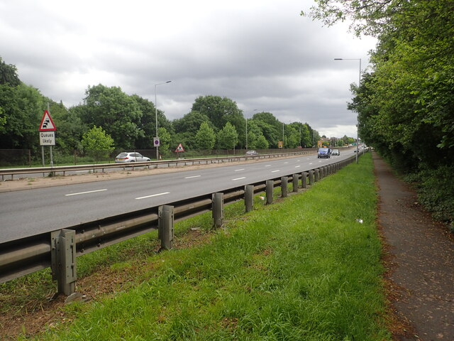
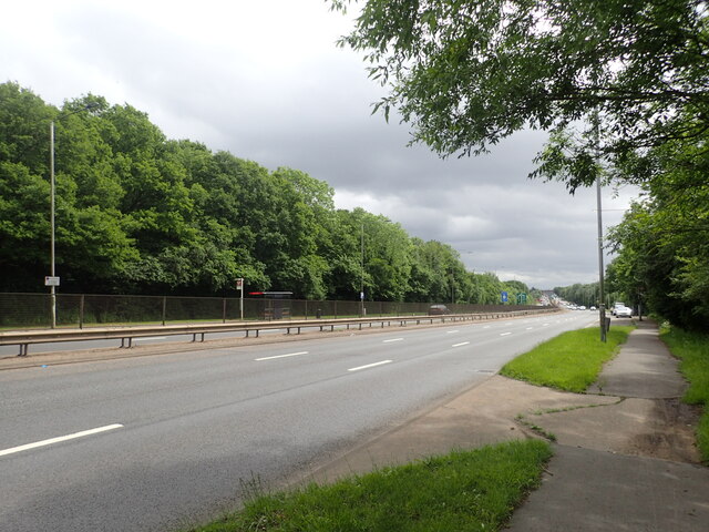
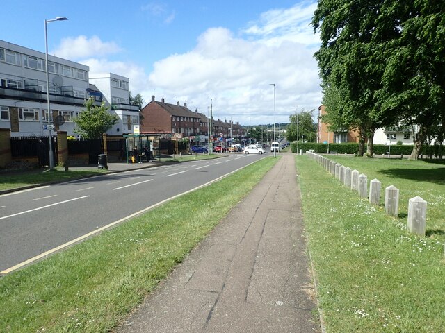
Images are sourced within 2km of 51.641963/-0.244061 or Grid Reference TQ2195. Thanks to Geograph Open Source API. All images are credited.

On the London Loop near Brent Lodge Farm
Evening Light, London N14 Liked the colour of the clouds and the vapour trails.
Evening Light, London N14
Liked the colour of the clouds and the vapour trails.
Totteridge Fields The nature reserve covers over 30 fields to the north of Totteridge Common,  stretching between Hendon Wood Lane in the west and Grange Avenue in the east.  It lies along the valley of the Dollis Brook, which flows from west to east through the site, with fields rising gently on either side.

Totteridge Fields once produced hay for London’s horse-traffic. In the early 1990s local people successfully opposed plans for a cemetery covering three fields. This led to the site coming under the management of the London Wildlife Trust from 1993. 

Traditional hay-cutting methods are still used, with volunteers mowing alternative areas each year to help conserve the richly diverse plant and invertebrate population.  This work is supplemented by conservation grazing with traditional breeds of cattle, first introduced in 2014.
Totteridge Fields
The nature reserve covers over 30 fields to the north of Totteridge Common, stretching between Hendon Wood Lane in the west and Grange Avenue in the east. It lies along the valley of the Dollis Brook, which flows from west to east through the site, with fields rising gently on either side. Totteridge Fields once produced hay for London’s horse-traffic. In the early 1990s local people successfully opposed plans for a cemetery covering three fields. This led to the site coming under the management of the London Wildlife Trust from 1993. Traditional hay-cutting methods are still used, with volunteers mowing alternative areas each year to help conserve the richly diverse plant and invertebrate population. This work is supplemented by conservation grazing with traditional breeds of cattle, first introduced in 2014.
BP petrol station on Rowley Lane, Borehamwood This is on a one way system with another BP station on the other half.
BP petrol station on Rowley Lane, Borehamwood
This is on a one way system with another BP station on the other half.
Footpath and driveway to Mote End Farm This leads off Nan Clark's Lane here and beyond Mote End Farm it reaches the London Loop.
Footpath and driveway to Mote End Farm
This leads off Nan Clark's Lane here and beyond Mote End Farm it reaches the London Loop.
The entrance to Mote End This is at Mote End Farm. The driveway through the gate leads to Pond Cottage, The Studio and the Coach House. This old horse trough with its flowers made a splash of colour on a rather dull day.
The entrance to Mote End
This is at Mote End Farm. The driveway through the gate leads to Pond Cottage, The Studio and the Coach House. This old horse trough with its flowers made a splash of colour on a rather dull day.
Footpath to Rowley Lane This leads from Barnet Road at Barnet Gate, past Windmill Cottage and through an area of woodland to reach Rowley Lane. This is just past the village hall.
Footpath to Rowley Lane
This leads from Barnet Road at Barnet Gate, past Windmill Cottage and through an area of woodland to reach Rowley Lane. This is just past the village hall.
Nan Clark's Lane Nan Clark's Lane got its name from Nan Clark who worked in the local tavern (the pub is now called The Rising Sun). She was well-liked and had many admirers, but she also had a very jealous husband. One day her husband barged into the pub drunk and started yelling and screaming at Nan as there were whispers going round that she had been having an affair. Nan Clark’s husband dragged Nan out of the tavern, down what is now called Nan Clark’s lane, pulling her hair when she tried to struggle. Nan Clark was then murdered by being drowned in a nearby lake. The lake is seen at <a title="https://www.geograph.org.uk/photo/7158900" href="https://www.geograph.org.uk/photo/7158900">Link</a>

For more about the story see <span class="nowrap"><a title="https://www.times-series.co.uk/news/18003923.mill-hill-road-one-uks-spookiest/" rel="nofollow ugc noopener" href="https://www.times-series.co.uk/news/18003923.mill-hill-road-one-uks-spookiest/">Link</a><img style="margin-left:2px;" alt="External link" title="External link - shift click to open in new window" src="https://s1.geograph.org.uk/img/external.png" width="10" height="10"/></span>  and <span class="nowrap"><a title="https://teaandtakes.com/2013/12/22/the-story-of-nan-clark/" rel="nofollow ugc noopener" href="https://teaandtakes.com/2013/12/22/the-story-of-nan-clark/">Link</a><img style="margin-left:2px;" alt="External link" title="External link - shift click to open in new window" src="https://s1.geograph.org.uk/img/external.png" width="10" height="10"/></span>
Nan Clark's Lane
Nan Clark's Lane got its name from Nan Clark who worked in the local tavern (the pub is now called The Rising Sun). She was well-liked and had many admirers, but she also had a very jealous husband. One day her husband barged into the pub drunk and started yelling and screaming at Nan as there were whispers going round that she had been having an affair. Nan Clark’s husband dragged Nan out of the tavern, down what is now called Nan Clark’s lane, pulling her hair when she tried to struggle. Nan Clark was then murdered by being drowned in a nearby lake. The lake is seen at Link For more about the story see LinkExternal link and LinkExternal link
A pond with a sinister story The nearby Nan Clark's Lane got its name from Nan Clark who worked in the local tavern (the pub is now called The Rising Sun). She was well-liked and had many admirers, but she also had a very jealous husband. One day her husband barged into the pub drunk and started yelling and screaming at Nan Clark as there were whispers going round that Nan had been having an affair. Nan Clark’s husband dragged Nan out of the tavern, down what is now called Nan Clark’s lane, pulling her hair when she tried to struggle. Nan Clark was then murdered by being drowned in this nearby lake. 

For more about the story see <span class="nowrap"><a title="https://www.times-series.co.uk/news/18003923.mill-hill-road-one-uks-spookiest/" rel="nofollow ugc noopener" href="https://www.times-series.co.uk/news/18003923.mill-hill-road-one-uks-spookiest/">Link</a><img style="margin-left:2px;" alt="External link" title="External link - shift click to open in new window" src="https://s1.geograph.org.uk/img/external.png" width="10" height="10"/></span>  and <span class="nowrap"><a title="https://teaandtakes.com/2013/12/22/the-story-of-nan-clark/" rel="nofollow ugc noopener" href="https://teaandtakes.com/2013/12/22/the-story-of-nan-clark/">Link</a><img style="margin-left:2px;" alt="External link" title="External link - shift click to open in new window" src="https://s1.geograph.org.uk/img/external.png" width="10" height="10"/></span>
A pond with a sinister story
The nearby Nan Clark's Lane got its name from Nan Clark who worked in the local tavern (the pub is now called The Rising Sun). She was well-liked and had many admirers, but she also had a very jealous husband. One day her husband barged into the pub drunk and started yelling and screaming at Nan Clark as there were whispers going round that Nan had been having an affair. Nan Clark’s husband dragged Nan out of the tavern, down what is now called Nan Clark’s lane, pulling her hair when she tried to struggle. Nan Clark was then murdered by being drowned in this nearby lake. For more about the story see LinkExternal link and LinkExternal link
At the entrance to Mote End This is at Mote End Farm, next to the driveway which leads to Pond Cottage, The Studio and the Coach House. This old horse trough with its flowers made a splash of colour on a rather dull day. See also <a title="https://www.geograph.org.uk/photo/7158223" href="https://www.geograph.org.uk/photo/7158223">Link</a>
At the entrance to Mote End
This is at Mote End Farm, next to the driveway which leads to Pond Cottage, The Studio and the Coach House. This old horse trough with its flowers made a splash of colour on a rather dull day. See also Link
London Loop ahead This is just past Mote End Farm and the London Loop is joined beyond the gate. Moat Mount and Barnet Gate Wood can be seen in the distance.
London Loop ahead
This is just past Mote End Farm and the London Loop is joined beyond the gate. Moat Mount and Barnet Gate Wood can be seen in the distance.
The London Loop at Moat Mount The London Loop is seen here at Moat Mount with Barnet Gate Wood on the horizon. The path is also followed by the Dollis Valley Greenwalk. The Dollis Brook is a tributary of the River Brent and the infant Dollis Brook is crossed ahead at the foot of the valley which is at the end of the field on the left.
The London Loop at Moat Mount
The London Loop is seen here at Moat Mount with Barnet Gate Wood on the horizon. The path is also followed by the Dollis Valley Greenwalk. The Dollis Brook is a tributary of the River Brent and the infant Dollis Brook is crossed ahead at the foot of the valley which is at the end of the field on the left.
Windmill Cottage, Arkley Arkley Windmill can just be glimpsed behind. It dates from 1826 and more about it can be seen at <span class="nowrap"><a title="https://www.hertsad.co.uk/lifestyle/property/gone-with-the-windmill-visiting-one-of-herts-most-intriguing-5054096" rel="nofollow ugc noopener" href="https://www.hertsad.co.uk/lifestyle/property/gone-with-the-windmill-visiting-one-of-herts-most-intriguing-5054096">Link</a><img style="margin-left:2px;" alt="External link" title="External link - shift click to open in new window" src="https://s1.geograph.org.uk/img/external.png" width="10" height="10"/></span>   and at <span class="nowrap"><a title="https://www.dailymail.co.uk/news/article-3231898/Four-sails-stunning-9-5million-home-windmill.html" rel="nofollow ugc noopener" href="https://www.dailymail.co.uk/news/article-3231898/Four-sails-stunning-9-5million-home-windmill.html">Link</a><img style="margin-left:2px;" alt="External link" title="External link - shift click to open in new window" src="https://s1.geograph.org.uk/img/external.png" width="10" height="10"/></span>
Windmill Cottage, Arkley
Arkley Windmill can just be glimpsed behind. It dates from 1826 and more about it can be seen at LinkExternal link and at LinkExternal link
The London Loop alongside the A1 This is bit of a low point on the London Loop as there is no way of crossing the A1 (Barnet Way) between Scratch Wood Open Space and Moat Mount without following this path alongside the busy A1. Eventually a subway is reached when you have to tramp back up the other side.
The London Loop alongside the A1
This is bit of a low point on the London Loop as there is no way of crossing the A1 (Barnet Way) between Scratch Wood Open Space and Moat Mount without following this path alongside the busy A1. Eventually a subway is reached when you have to tramp back up the other side.
Furze Hill This attractive field was surrounded by a wire fence and barbed wire so that the only way to photograph it was through the fence from Furzehill Road.
Furze Hill
This attractive field was surrounded by a wire fence and barbed wire so that the only way to photograph it was through the fence from Furzehill Road.
Manor Way, Borehamwood This is looking north from alongside Ripon Park.
Manor Way, Borehamwood
This is looking north from alongside Ripon Park.
Show me another place!

Barnet Gate is located at Grid Ref: TQ2195 (Lat: 51.641963, Lng: -0.244061)

Unitary Authority: Barnet

Police Authority: Metropolitan

What 3 Words

///bids.herds.copy. Near Borehamwood, Hertfordshire

Nearby Locations

Barnet Gate

Related Wikis

NW London F.C.

NW London Football Club is a football club based in Arkley, London, England. They are currently members of the Eastern Counties League Division One South...

Hadley F.C.

Hadley Football Club is a football club based in Arkley, Barnet, England. Affiliated to the Hertfordshire County Football Association, they are currently...

Barnet Gate Mill

Barnet Gate Mill or Arkley Windmill is a grade II* listed tower mill at Barnet Gate in the London Borough of Barnet, originally in Hertfordshire. There...

Barnet Gate

Barnet Gate is a hamlet on the northern edge of the London Borough of Barnet to the west of Arkley, in England. There was a settlement there during the...

Nearby Amenities

Located within 500m of 51.641963,-0.244061
Pub
The Gate
Alt Name: The Gate Public House
Toilets: yes
Lat/Long: 51.6419852/-0.2424157
Bus Stop
Brickfield Lane
Local Ref: C
Naptan AtcoCode: 490013368E
Naptan Bearing: E
Naptan CommonName: The Gate Brickfield Lane
Naptan Indicator: Stop C
Naptan Verified: no
Public Transport: platform
Lat/Long: 51.6425289/-0.2420118
Bus Stop
Brickfield Lane
Local Ref: F
Naptan AtcoCode: 490013368W
Naptan Bearing: W
Naptan CommonName: The Gate Brickfield Lane
Naptan Indicator: Stop F
Naptan Verified: no
Public Transport: platform
Lat/Long: 51.6422807/-0.2421721
Barnet Gate
Place: village
Wikidata: Q149502
Lat/Long: 51.6418265/-0.2429855
Traffic Signals
Traffic Signals Direction: forward
Lat/Long: 51.641859/-0.2430249
Barrier: kissing_gate
Lat/Long: 51.6409946/-0.2501727
Crossing
Crossing: traffic_signals
Crossing Island: yes
Tactile Paving: yes
Lat/Long: 51.6418735/-0.2427725
Street Lamp
Lamp Model: CU Phosco P850
Lamp Type: LED
Source: Personal memory.
Lat/Long: 51.6439716/-0.250348
Maxwidth: 2.13
Traffic Calming: choker
Lat/Long: 51.6418024/-0.2426856
Crossing
Lat/Long: 51.641202/-0.24207
Barrier: kerb
Kerb: regular
Lat/Long: 51.6398901/-0.2406912
Noexit: yes
Lat/Long: 51.6422011/-0.2421545
Traffic Signals
Traffic Signals Direction: backward
Lat/Long: 51.6419953/-0.2427494
Traffic Signals
Traffic Signals Direction: backward
Lat/Long: 51.6418608/-0.2427569
The data included in this document is from www.openstreetmap.org. The data is made available under ODbL.

Have you been to Barnet Gate?

Leave your review of Barnet Gate below (or comments, questions and feedback).