Greenbroom Hill

Hill, Mountain in Sussex Horsham

England

Greenbroom Hill

Rural Bridleway near Horsham, West Sussex This bridleway runs up a straight avenue of trees that cuts across the old St. Leonards estate from a gate lodge on the public road to the "Big House". Offered a very pleasant cycle ride on the day of the photo! Photo taken looking N along the avenue. Corn fields can be seen on the other side of the trees on the right.
Rural Bridleway near Horsham, West Sussex Credit: Pete Chapman

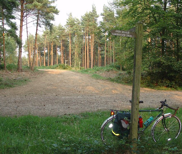
Greenbroom Hill is a prominent hill located in the county of Sussex, England. Situated in the South Downs, it is part of the larger South Downs National Park, which spans across several counties in southeastern England. The hill is known for its picturesque landscapes, vibrant flora, and historical significance.

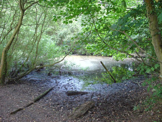
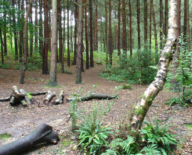
Rising to an elevation of approximately 250 meters (820 feet), Greenbroom Hill offers breathtaking panoramic views of the surrounding countryside. Its slopes are covered with lush green grass, dotted with wildflowers during the spring and summer months. The hill is also home to a variety of wildlife, including rabbits, foxes, and various species of birds.

One of the notable features of Greenbroom Hill is an ancient hill fort located on its summit. This Iron Age fort, known as Chanctonbury Ring, dates back over 2,000 years and consists of a circular earthwork enclosure. The fort offers a fascinating glimpse into the region's rich history and is a popular destination for history enthusiasts and hikers alike.

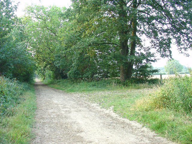
The hill is accessible via several footpaths and trails, making it a popular spot for outdoor activities such as hiking, walking, and picnicking. Its close proximity to nearby towns and villages also makes it easily accessible for visitors. Whether it's exploring the hill fort, admiring the panoramic views, or simply enjoying a peaceful stroll, Greenbroom Hill offers a tranquil and scenic escape for nature lovers and history buffs alike.

If you have any feedback on the listing, please let us know in the comments section below.

Greenbroom Hill Images

Images are sourced within 2km of 51.066453/-0.270786 or Grid Reference TQ2131. Thanks to Geograph Open Source API. All images are credited.

Rural Bridleway near Horsham, West Sussex This bridleway runs up a straight avenue of trees that cuts across the old St. Leonards estate from a gate lodge on the public road to the "Big House". Offered a very pleasant cycle ride on the day of the photo! Photo taken looking N along the avenue. Corn fields can be seen on the other side of the trees on the right.
Rural Bridleway near Horsham, West Sussex
This bridleway runs up a straight avenue of trees that cuts across the old St. Leonards estate from a gate lodge on the public road to the "Big House". Offered a very pleasant cycle ride on the day of the photo! Photo taken looking N along the avenue. Corn fields can be seen on the other side of the trees on the right.
Stew Pond, adjacent to bridleway, St Leonards Park Estate, Near Horsham, West Sussex. The original purpose of this pond (and an adjacent pond) is not obvious, but its proximity to the main estate buildings may mean that it was used as water storage or a fish pond to supply the estate. Relatively overgrown and unused these days!
Stew Pond, adjacent to bridleway, St Leonards Park Estate, Near Horsham, West Sussex.
The original purpose of this pond (and an adjacent pond) is not obvious, but its proximity to the main estate buildings may mean that it was used as water storage or a fish pond to supply the estate. Relatively overgrown and unused these days!
Forest Grange, in the heart of St Leonards Forest, Near Horsham, West Sussex Earlier maps (e.g. 1993) show this as the site of Forest Grange School. Later maps have dropped school from the name. It didn't looked like it was being used as a school at the time the picture was taken.
Forest Grange, in the heart of St Leonards Forest, Near Horsham, West Sussex
Earlier maps (e.g. 1993) show this as the site of Forest Grange School. Later maps have dropped school from the name. It didn't looked like it was being used as a school at the time the picture was taken.
Forestry Operations, St Leonards Forest, Near Horsham, West Sussex The forest is run by the Forestry Commission for commercial timber extraction. Here we see a lorry on the main access track (also a public bridleway) being loaded up with logs.
Forestry Operations, St Leonards Forest, Near Horsham, West Sussex
The forest is run by the Forestry Commission for commercial timber extraction. Here we see a lorry on the main access track (also a public bridleway) being loaded up with logs.
Track Junction in St Leonard Forest. Part of the High Weald Landscape Trail The main bridleway through the middle of the forest intersects with several public footpaths. Here we see where one of the paths (part of the route of the High Weald Landscape Trail) leads off along an intersceting track. The View also shows the characteristic trees in this forest, which are mainly pine.
Track Junction in St Leonard Forest. Part of the High Weald Landscape Trail
The main bridleway through the middle of the forest intersects with several public footpaths. Here we see where one of the paths (part of the route of the High Weald Landscape Trail) leads off along an intersceting track. The View also shows the characteristic trees in this forest, which are mainly pine.
Bridle Road To Bucks Head Through St Leonards Forest, West Sussex The start of the main route through the forest from near The Dragon pub. This is a public bridleway.
Bridle Road To Bucks Head Through St Leonards Forest, West Sussex
The start of the main route through the forest from near The Dragon pub. This is a public bridleway.
Woodsman's Hut, St Leonard's Forest. Forestry Commission Workshop.
Woodsman's Hut, St Leonard's Forest.
Forestry Commission Workshop.
Lower Grouse Farm, Grouse Road, Near Colgate, West Sussex A collection of farm buildings, including a barn and farmhouse on the south side of the road. View taken from the north, looking S.
Lower Grouse Farm, Grouse Road, Near Colgate, West Sussex
A collection of farm buildings, including a barn and farmhouse on the south side of the road. View taken from the north, looking S.
Entrance to Stone Edge Nurseries, Woodland Lane, near Colgate, West Sussex A small plant nursery in a very rural location, situated near the end of a dead end country lane.
Nursery on the N side of the Lane.
Entrance to Stone Edge Nurseries, Woodland Lane, near Colgate, West Sussex
A small plant nursery in a very rural location, situated near the end of a dead end country lane. Nursery on the N side of the Lane.
Woodland Lane, running through Barnsnap Wood A very quiet metalled lane (with grass growing up the middle!). Access to a few farms, a nursery and several private houses. View taken looking SW.
Woodland Lane, running through Barnsnap Wood
A very quiet metalled lane (with grass growing up the middle!). Access to a few farms, a nursery and several private houses. View taken looking SW.
Grouselands Farm, Near Colgate, West Sussex. Situated on an open spur at the end of Woodland Lane. This view of the farm was taken from Grouse Road (at approx TQ226302) looking NW. The farm has a flock of sheep in the adjacent field.
Grouselands Farm, Near Colgate, West Sussex.
Situated on an open spur at the end of Woodland Lane. This view of the farm was taken from Grouse Road (at approx TQ226302) looking NW. The farm has a flock of sheep in the adjacent field.
"The Meadow", Roffey Park Institute, Forest Road, Colgate, West Sussex "The Meadow" is the name of the newest part of the Institute, opened in 2003. Roffey Park Institute is a management training centre. Details at <span class="nowrap"><a title="http://www.roffeypark.com/aboutroffey.html" rel="nofollow ugc noopener" href="http://www.roffeypark.com/aboutroffey.html">Link</a><img style="margin-left:2px;" alt="External link" title="External link - shift click to open in new window" src="https://s1.geograph.org.uk/img/external.png" width="10" height="10"/></span>
"The Meadow", Roffey Park Institute, Forest Road, Colgate, West Sussex
"The Meadow" is the name of the newest part of the Institute, opened in 2003. Roffey Park Institute is a management training centre. Details at LinkExternal link
Owlbeech Woods, Horsham, West Sussex Mixed woodland. The part shown is a coniferous plantation. The woods join on to Leechpool woods <a href="https://www.geograph.org.uk/gridref/TQ1931">TQ1931</a>. Owned an run by Horsham District Council, who permit general public access.
Owlbeech Woods, Horsham, West Sussex
Mixed woodland. The part shown is a coniferous plantation. The woods join on to Leechpool woods TQ1931. Owned an run by Horsham District Council, who permit general public access.
Road Bend on Forest Road, between Horsham and Colgate, West Sussex Although classified as minor, a busy country road with local traffic. A private road to Forest Grange <a href="https://www.geograph.org.uk/gridref/TQ2131">TQ2131</a> leads off from this corner (just visible to the left). View taken looking SW.
Road Bend on Forest Road, between Horsham and Colgate, West Sussex
Although classified as minor, a busy country road with local traffic. A private road to Forest Grange TQ2131 leads off from this corner (just visible to the left). View taken looking SW.
Covered Reservoir, Forest Road, between Colgate and Horsham, West Sussex A covered water reservoir on the N side of Forest Road. At approx 120m above sea level, the reservoir is located on a ridge above Horsham.
Covered Reservoir, Forest Road, between Colgate and Horsham, West Sussex
A covered water reservoir on the N side of Forest Road. At approx 120m above sea level, the reservoir is located on a ridge above Horsham.
Motocross track near to Horsham, West Sussex A view facing roughly north of the start line, with St. Leonard's forest in the background.
Motocross track near to Horsham, West Sussex
A view facing roughly north of the start line, with St. Leonard's forest in the background.
Tattleton's ford Tattleton's ford is on the High Weald Landscape trail that goes from Horsham across the north of Sussex to Rye.
Being on a bridleway that swoops down from Carter's Lodge to the Grouse road it makes a pleasant feature (keep to the left).
Tattleton's farm once stood just over the ford, to the right.
Tattleton's ford
Tattleton's ford is on the High Weald Landscape trail that goes from Horsham across the north of Sussex to Rye. Being on a bridleway that swoops down from Carter's Lodge to the Grouse road it makes a pleasant feature (keep to the left). Tattleton's farm once stood just over the ford, to the right.
Mick Mills Race, St Leonards Forest Mick Mills (or is it Miles?) race.  Mick, a local braggart, boasted he could outrace anyone.  
The Devil took up the challenge.  
The resulting contest, which Mick won, left a course through the forest on which no tree would grow.
Being gravelled and a forestry access route probably helps.
Mick Mills Race, St Leonards Forest
Mick Mills (or is it Miles?) race. Mick, a local braggart, boasted he could outrace anyone. The Devil took up the challenge. The resulting contest, which Mick won, left a course through the forest on which no tree would grow. Being gravelled and a forestry access route probably helps.
Show me another place!

Greenbroom Hill is located at Grid Ref: TQ2131 (Lat: 51.066453, Lng: -0.270786)

Administrative County: West Sussex

District: Horsham

Police Authority: Sussex

What 3 Words

///smuggled.poetry.frog. Near Horsham, West Sussex

Related Wikis

St Leonard's Forest

St Leonard's Forest is at the western end of the Wealden Forest Ridge which runs from Horsham to Tonbridge, and is part of the High Weald Area of Outstanding...

St Leonard's Forest SSSI

St Leonard's Forest SSSI is an 85.4-hectare (211-acre) biological Site of Special Scientific Interest east of Horsham in West Sussex. The SSSI is in two...

St Leonard's Park Ponds

St Leonard's Park Ponds is a 3.9-hectare (9.6-acre) biological Site of Special Scientific Interest east of Horsham in West Sussex. These ponds and adjacent...

Mannings Heath Golf & Wine Estate

Mannings Heath Golf & Wine Estate is located in Mannings Heath, Horsham in the south of England. The 500 acre parkland site includes two golf courses and...

Nearby Amenities

Located within 500m of 51.066453,-0.270786
Barrier: stile
Lat/Long: 51.0644264/-0.2753562
Whitevane Hill
Place: locality
Lat/Long: 51.069495/-0.2682664
Greenbroom Hill
Place: locality
Lat/Long: 51.0665285/-0.2698328
Lily Beds
Place: locality
Lat/Long: 51.0637911/-0.2713992
Hiking: yes
Information: guidepost
Source: GPS
Tourism: information
Lat/Long: 51.0643899/-0.2750579
Hiking: yes
Information: guidepost
Source: GPS
Tourism: information
Lat/Long: 51.0663384/-0.2668878
Hiking: yes
Information: guidepost
Source: GPS
Tourism: information
Lat/Long: 51.0667884/-0.2647743
The data included in this document is from www.openstreetmap.org. The data is made available under ODbL.

Have you been to Greenbroom Hill?

Leave your review of Greenbroom Hill below (or comments, questions and feedback).