Highbirch Hill

Hill, Mountain in Sussex Horsham

England

Highbirch Hill

The Dragon Public House, Colgate, West Sussex At one of the main crossroads of this small village. The pub is named after the dragon which was said to live in the nearby St. Leonards Forest.
The Dragon Public House, Colgate, West Sussex Credit: Pete Chapman

Highbirch Hill, located in Sussex, is a prominent hill that offers breathtaking views of the surrounding landscape. Situated in the South East of England, Sussex is known for its picturesque countryside and Highbirch Hill is no exception. Rising to a height of approximately 300 meters, it stands as one of the highest points in the region.

The hill is covered in a dense carpet of lush green grass and is home to a variety of plant and animal species, making it a popular destination for nature lovers and hikers. The diverse flora and fauna found here create a vibrant and vibrant ecosystem.

Highbirch Hill is easily accessible, with several hiking trails leading up to its summit. These trails offer a range of difficulty levels, catering to both experienced hikers and beginners. As visitors ascend the hill, they are rewarded with stunning panoramic views of the surrounding countryside, including rolling hills, dense woodlands, and charming villages.

The hill is also steeped in history, with ancient remains of settlements and burial mounds dating back thousands of years. Archaeological excavations have uncovered artifacts and evidence of human activity, providing valuable insights into the region's past.

Overall, Highbirch Hill in Sussex is a must-visit destination for those seeking a blend of natural beauty, outdoor adventure, and historical significance. Whether it's exploring the diverse wildlife, enjoying the stunning views, or delving into its rich history, this hill offers a unique and memorable experience for visitors of all ages.

If you have any feedback on the listing, please let us know in the comments section below.

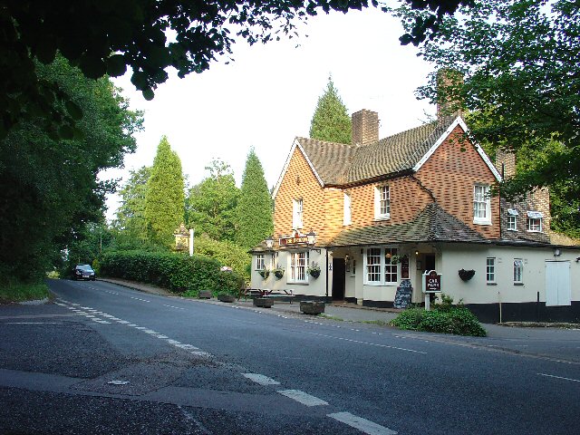
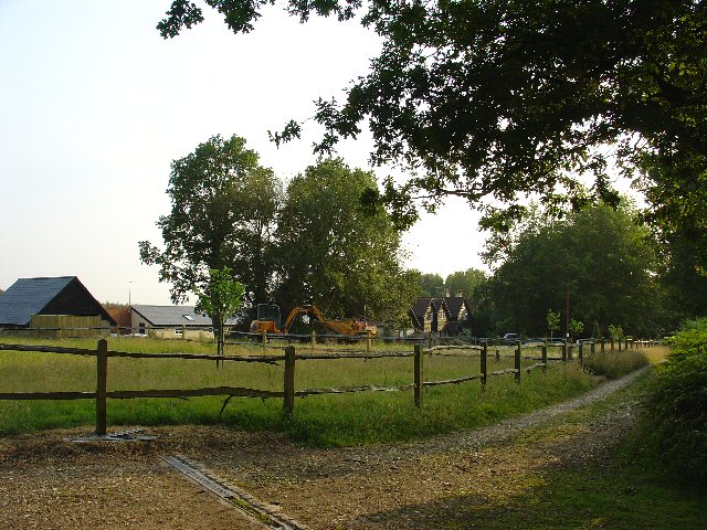
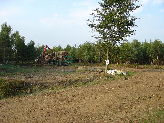
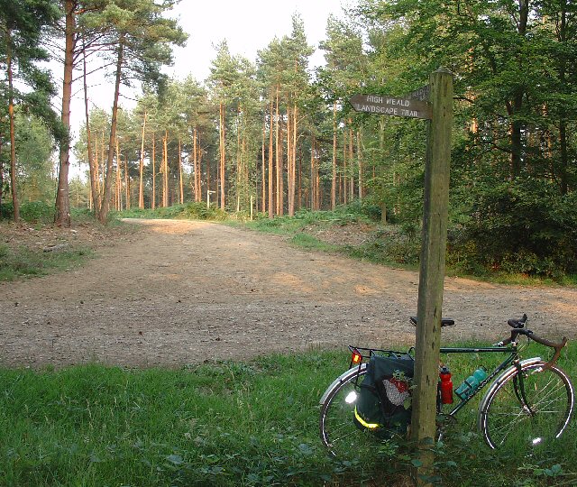
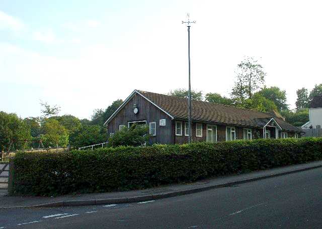
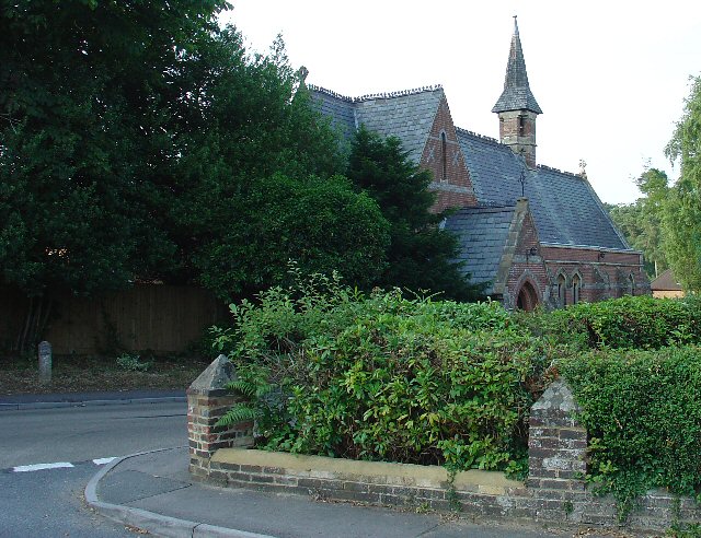
Highbirch Hill Images

Images are sourced within 2km of 51.074226/-0.26251659 or Grid Reference TQ2131. Thanks to Geograph Open Source API. All images are credited.

The Dragon Public House, Colgate, West Sussex At one of the main crossroads of this small village. The pub is named after the dragon which was said to live in the nearby St. Leonards Forest.
The Dragon Public House, Colgate, West Sussex
At one of the main crossroads of this small village. The pub is named after the dragon which was said to live in the nearby St. Leonards Forest.
The Cherry Tree Public House, Near Faygate, West Sussex. A wayside inn on the N side of the A264 dual carriageway
The Cherry Tree Public House, Near Faygate, West Sussex.
A wayside inn on the N side of the A264 dual carriageway
Water Tower, Beacon Hill, Colgate, West Sussex This concrete water tower is built near to the highest point on Beacon Hill (146m above sea level). Colgate is situated on top of a long ridge of wealdland that stretches E-W between Pease Pottage and the outskirts of Horsham. Water pressure in the area would be quite low without the use of a water tower.
Water Tower, Beacon Hill, Colgate, West Sussex
This concrete water tower is built near to the highest point on Beacon Hill (146m above sea level). Colgate is situated on top of a long ridge of wealdland that stretches E-W between Pease Pottage and the outskirts of Horsham. Water pressure in the area would be quite low without the use of a water tower.
Forest Grange, in the heart of St Leonards Forest, Near Horsham, West Sussex Earlier maps (e.g. 1993) show this as the site of Forest Grange School. Later maps have dropped school from the name. It didn't looked like it was being used as a school at the time the picture was taken.
Forest Grange, in the heart of St Leonards Forest, Near Horsham, West Sussex
Earlier maps (e.g. 1993) show this as the site of Forest Grange School. Later maps have dropped school from the name. It didn't looked like it was being used as a school at the time the picture was taken.
Forestry Operations, St Leonards Forest, Near Horsham, West Sussex The forest is run by the Forestry Commission for commercial timber extraction. Here we see a lorry on the main access track (also a public bridleway) being loaded up with logs.
Forestry Operations, St Leonards Forest, Near Horsham, West Sussex
The forest is run by the Forestry Commission for commercial timber extraction. Here we see a lorry on the main access track (also a public bridleway) being loaded up with logs.
Track Junction in St Leonard Forest. Part of the High Weald Landscape Trail The main bridleway through the middle of the forest intersects with several public footpaths. Here we see where one of the paths (part of the route of the High Weald Landscape Trail) leads off along an intersceting track. The View also shows the characteristic trees in this forest, which are mainly pine.
Track Junction in St Leonard Forest. Part of the High Weald Landscape Trail
The main bridleway through the middle of the forest intersects with several public footpaths. Here we see where one of the paths (part of the route of the High Weald Landscape Trail) leads off along an intersceting track. The View also shows the characteristic trees in this forest, which are mainly pine.
Bridle Road To Bucks Head Through St Leonards Forest, West Sussex The start of the main route through the forest from near The Dragon pub. This is a public bridleway.
Bridle Road To Bucks Head Through St Leonards Forest, West Sussex
The start of the main route through the forest from near The Dragon pub. This is a public bridleway.
Ancient Boundary? Earthwall Adjacent to Bridleway Between Beacon Hill and the St Leonards Forest Bridleway Earthwalls are often found in forested areas an can signify the presence of a very old boundary line. They often feature distinctive trees (e.g. pollards, or yews). Here we see an earthwall in a beech wood. The public right of way (bridleway) runs close to and parallel to the earthwall for some way.
Ancient Boundary? Earthwall Adjacent to Bridleway Between Beacon Hill and the St Leonards Forest Bridleway
Earthwalls are often found in forested areas an can signify the presence of a very old boundary line. They often feature distinctive trees (e.g. pollards, or yews). Here we see an earthwall in a beech wood. The public right of way (bridleway) runs close to and parallel to the earthwall for some way.
Colgate Village Hall, Colgate, West Sussex This village hall is the centre for a lot of village life and is appropriately in the centre of the village! This particular hall building replaced one that was bombed during the second world war.
Colgate Village Hall, Colgate, West Sussex
This village hall is the centre for a lot of village life and is appropriately in the centre of the village! This particular hall building replaced one that was bombed during the second world war.
St Saviours Church, Colgate, West Sussex Centrally located in the village: almost opposite one of the two main road junctions; and near to the village hall. Brick built with a slate roof.
St Saviours Church, Colgate, West Sussex
Centrally located in the village: almost opposite one of the two main road junctions; and near to the village hall. Brick built with a slate roof.
Bridleway through Holmbush Forest, near Colgate, West Sussex This bridleway runs through Holmbush forest from Colgate to the main road between Crawley and Horsham (A264).
Bridleway through Holmbush Forest, near Colgate, West Sussex
This bridleway runs through Holmbush forest from Colgate to the main road between Crawley and Horsham (A264).
Woodsman's Hut, St Leonard's Forest. Forestry Commission Workshop.
Woodsman's Hut, St Leonard's Forest.
Forestry Commission Workshop.
Bus stop and road approaching Faygate northbound The bus stop hut has now been taken down after the car above managed to "park" itself within!
Bus stop and road approaching Faygate northbound
The bus stop hut has now been taken down after the car above managed to "park" itself within!
Lower Grouse Farm, Grouse Road, Near Colgate, West Sussex A collection of farm buildings, including a barn and farmhouse on the south side of the road. View taken from the north, looking S.
Lower Grouse Farm, Grouse Road, Near Colgate, West Sussex
A collection of farm buildings, including a barn and farmhouse on the south side of the road. View taken from the north, looking S.
Entrance to Stone Edge Nurseries, Woodland Lane, near Colgate, West Sussex A small plant nursery in a very rural location, situated near the end of a dead end country lane.
Nursery on the N side of the Lane.
Entrance to Stone Edge Nurseries, Woodland Lane, near Colgate, West Sussex
A small plant nursery in a very rural location, situated near the end of a dead end country lane. Nursery on the N side of the Lane.
Woodland Lane, running through Barnsnap Wood A very quiet metalled lane (with grass growing up the middle!). Access to a few farms, a nursery and several private houses. View taken looking SW.
Woodland Lane, running through Barnsnap Wood
A very quiet metalled lane (with grass growing up the middle!). Access to a few farms, a nursery and several private houses. View taken looking SW.
Grouselands Farm, Near Colgate, West Sussex. Situated on an open spur at the end of Woodland Lane. This view of the farm was taken from Grouse Road (at approx TQ226302) looking NW. The farm has a flock of sheep in the adjacent field.
Grouselands Farm, Near Colgate, West Sussex.
Situated on an open spur at the end of Woodland Lane. This view of the farm was taken from Grouse Road (at approx TQ226302) looking NW. The farm has a flock of sheep in the adjacent field.
"The Meadow", Roffey Park Institute, Forest Road, Colgate, West Sussex "The Meadow" is the name of the newest part of the Institute, opened in 2003. Roffey Park Institute is a management training centre. Details at <span class="nowrap"><a title="http://www.roffeypark.com/aboutroffey.html" rel="nofollow ugc noopener" href="http://www.roffeypark.com/aboutroffey.html">Link</a><img style="margin-left:2px;" alt="External link" title="External link - shift click to open in new window" src="https://s1.geograph.org.uk/img/external.png" width="10" height="10"/></span>
"The Meadow", Roffey Park Institute, Forest Road, Colgate, West Sussex
"The Meadow" is the name of the newest part of the Institute, opened in 2003. Roffey Park Institute is a management training centre. Details at LinkExternal link
Show me another place!

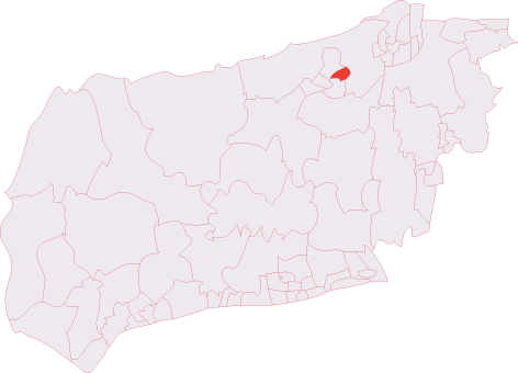
Highbirch Hill is located at Grid Ref: TQ2131 (Lat: 51.074226, Lng: -0.26251659)

Administrative County: West Sussex

District: Horsham

Police Authority: Sussex

What 3 Words

///motored.form.vitamins. Near Bewbush, West Sussex

Related Wikis

St Leonard's Forest

St Leonard's Forest is at the western end of the Wealden Forest Ridge which runs from Horsham to Tonbridge, and is part of the High Weald Area of Outstanding...

Colgate, West Sussex

Colgate is a small village and civil parish in the Horsham district of West Sussex, England, about four miles (6 km) north east of Horsham. A small village...

St Leonard's Forest SSSI

St Leonard's Forest SSSI is an 85.4-hectare (211-acre) biological Site of Special Scientific Interest east of Horsham in West Sussex. The SSSI is in two...

Roffey Road Halt railway station

Roffey Road Halt is a now disused station on the Arun Valley Line in West Sussex, England and was the second station north from Horsham on the stretch...

North Horsham railway station

North Horsham is a proposed railway station in Horsham, West Sussex which would serve the North Horsham Business Park. The proposal was backed by West...

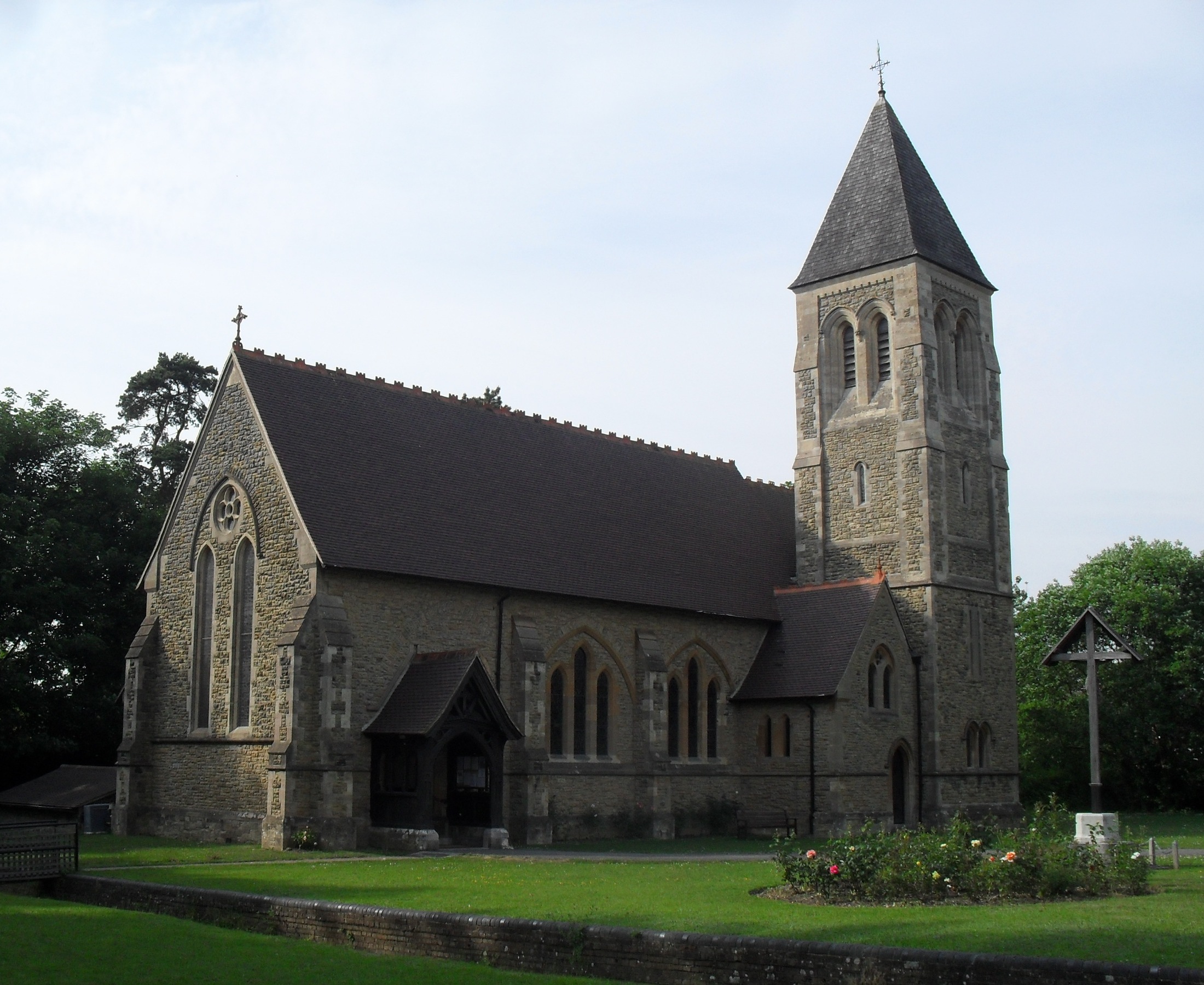
All Saints Church, Roffey

All Saints Church is the Anglican parish church of Roffey, in the Horsham district of the English county of West Sussex. The present church, built to...

Faygate

Faygate is a village in the Horsham district of West Sussex, England. It lies on the A264 road 3.4 miles (5.4 km) south west of Crawley. It has a railway...

Roffey (electoral division)

Roffey is an electoral division of West Sussex in the United Kingdom and returns one member to sit on West Sussex County Council. == Extent == The division...

Nearby Amenities

Located within 500m of 51.074226,-0.26251659
Knight's Strength
Place: locality
Lat/Long: 51.0755117/-0.2638027
The data included in this document is from www.openstreetmap.org. The data is made available under ODbL.

Have you been to Highbirch Hill?

Leave your review of Highbirch Hill below (or comments, questions and feedback).