Hampshire Hill

Hill, Mountain in Sussex Horsham

England

Hampshire Hill

Looking west on Pound Lane
Looking west on Pound Lane Credit: Shazz

Hampshire Hill, located in Sussex, is a picturesque hill/mountain that offers breathtaking views and a variety of outdoor activities. Standing at an elevation of approximately 600 meters, it is a popular destination for hikers, nature enthusiasts, and adventure seekers.

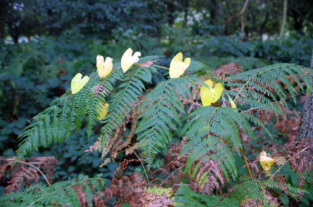
The hill is known for its diverse and vibrant flora and fauna, providing a perfect habitat for a wide range of species. Ancient woodlands cover its slopes, showcasing a rich tapestry of trees, including oak, beech, and birch. The area is also home to several rare plants and wildflowers, adding to its natural beauty.

Hampshire Hill is blessed with an extensive network of trails and paths, catering to all levels of fitness and expertise. Hikers can explore its winding paths, taking in the breathtaking views of the surrounding countryside. The hill also offers opportunities for mountain biking, horseback riding, and rock climbing, attracting thrill-seekers from far and wide.

At the summit of Hampshire Hill, visitors are rewarded with sweeping panoramic views of the rolling Sussex countryside and, on a clear day, even the distant coastline. The hill's summit is a popular spot for picnics and a great vantage point for photographers and landscape enthusiasts.

Additionally, Hampshire Hill has a rich historical and cultural significance. It is believed to have been inhabited since ancient times, with archaeological finds dating back thousands of years. The hill has also been the site of various historical events, including battles and settlements, leaving behind a fascinating legacy.

Overall, Hampshire Hill in Sussex offers a unique blend of natural beauty, recreational opportunities, and historical significance, making it a must-visit destination for anyone seeking an immersive outdoor experience.

If you have any feedback on the listing, please let us know in the comments section below.

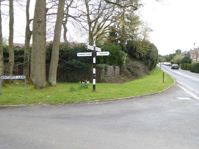
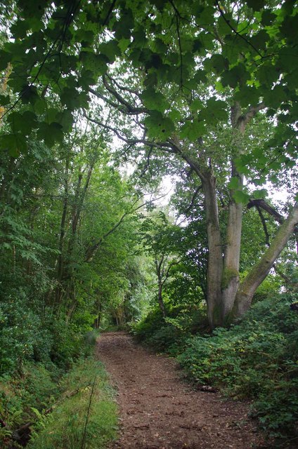
Hampshire Hill Images

Images are sourced within 2km of 51.030485/-0.29865122 or Grid Reference TQ1927. Thanks to Geograph Open Source API. All images are credited.

Looking west on Pound Lane
Looking east on Pound Lane
Signpost at western end of Winterpit Lane A different view is at <a title="https://www.geograph.org.uk/photo/1864181" href="https://www.geograph.org.uk/photo/1864181">Link</a>.
Signpost at western end of Winterpit Lane
A different view is at Link.
Seat on grassy area in Mannings Heath
Junction of Brighton and Church Roads A different view is at <a title="https://www.geograph.org.uk/photo/4232077" href="https://www.geograph.org.uk/photo/4232077">Link</a>.
Junction of Brighton and Church Roads
A different view is at Link.
Cottages on the A281 in Mannings Heath "The Dun Horse" PH beyond the dwellings is all boarded up.
See also <a title="https://www.geograph.org.uk/photo/1864075" href="https://www.geograph.org.uk/photo/1864075">Link</a>.
Cottages on the A281 in Mannings Heath
"The Dun Horse" PH beyond the dwellings is all boarded up. See also Link.
The Gallop A well used bridlepath.
The Gallop
A well used bridlepath.
Old Oaks by the Gallop These Oaks don't quite qualify as "ancient" but I am sure the last woodsman to pollard them does not get headaches anymore!
Old Oaks by the Gallop
These Oaks don't quite qualify as "ancient" but I am sure the last woodsman to pollard them does not get headaches anymore!
Fern by the Gallop I could see the bindweed leaves a hundred yards away it was not until I was within a few yards I could actually work out what I was looking at.
Fern by the Gallop
I could see the bindweed leaves a hundred yards away it was not until I was within a few yards I could actually work out what I was looking at.
Deer Fence by the Gallop A little further on I discovered why the landowner needs deer fences see <a href="https://www.geograph.org.uk/photo/5145962">TQ2027 : Venison on the Hoof</a>
Deer Fence by the Gallop
A little further on I discovered why the landowner needs deer fences see TQ2027 : Venison on the Hoof
Venison on the Hoof Farmed deer near Monk's Gate.
Venison on the Hoof
Farmed deer near Monk's Gate.
Gates by Old Camp Farm I think this bridleway is called <a href="https://www.geograph.org.uk/photo/5145940">TQ2127 : The Gallop</a> the gate to the right was impounding <a href="https://www.geograph.org.uk/photo/5145962">TQ2027 : Venison on the Hoof</a>
Gates by Old Camp Farm
I think this bridleway is called TQ2127 : The Gallop the gate to the right was impounding TQ2027 : Venison on the Hoof
Newell's Pond Technically it is a lake as it has an inlet stream and an outflow.
Newell's Pond
Technically it is a lake as it has an inlet stream and an outflow.
Newell's Pond Near Monks Gate A lake with private fishing rights.
Newell's Pond Near Monks Gate
A lake with private fishing rights.
Pond at Newell's Farm This one is a pond unlike <a href="https://www.geograph.org.uk/photo/5146206">TQ2027 : Newell's Pond</a> which is a lake.
Pond at Newell's Farm
This one is a pond unlike TQ2027 : Newell's Pond which is a lake.
Footpath to Spring Wood The green path across the stubble is an <a href="https://www.geograph.org.uk/photo/5146243">TQ2026 : Airstrip</a>
Footpath to Spring Wood
The green path across the stubble is an TQ2026 : Airstrip
Airstrip Looking across the <a href="https://www.geograph.org.uk/photo/5146245">TQ2026 : Grass Runway</a> of an airstrip near Newell's Farm. I assume it is used for microlights as it is rather short for normal light aircraft. The footpath to Newell's Lane passes to the right of the hedge.
Airstrip
Looking across the TQ2026 : Grass Runway of an airstrip near Newell's Farm. I assume it is used for microlights as it is rather short for normal light aircraft. The footpath to Newell's Lane passes to the right of the hedge.
Grass Runway Looking along the runway of the <a href="https://www.geograph.org.uk/photo/5146243">TQ2026 : Airstrip</a> near Newell's farm.
Grass Runway
Looking along the runway of the TQ2026 : Airstrip near Newell's farm.
Show me another place!

Hampshire Hill is located at Grid Ref: TQ1927 (Lat: 51.030485, Lng: -0.29865122)

Administrative County: West Sussex

District: Horsham

Police Authority: Sussex

What 3 Words

///opts.delivers.version. Near Southwater, West Sussex

Related Wikis

Southwater & Nuthurst (electoral division)

Southwater & Nuthurst is an electoral division of West Sussex in the United Kingdom and returns one member to sit on West Sussex County Council. The current...

Nuthurst

Nuthurst is a village and civil parish in the Horsham district of West Sussex, England. The north of the parish borders Horsham town, with Nuthurst village...

Monk's Gate

Monk's Gate is a hamlet in the civil parish of Nuthurst, in the Horsham District of West Sussex, England. It lies on the A281 road 3 miles (5 km) southeast...

Mannings Heath

Mannings Heath is a village in the civil parish of Nuthurst and the Horsham District of West Sussex, England. The village is on the A281 road, 2 miles...

Nearby Amenities

Located within 500m of 51.030485,-0.29865122
Nuthurst Road
Naptan AtcoCode: 4400HR0835
Naptan Bearing: NE
Naptan BusStopType: CUS
Naptan CommonName: Nuthurst Road
Naptan Indicator: HAR
Naptan Landmark: Hail & Ride
Naptan NaptanCode: wsxdwmpd
Naptan Street: Nuthurst Road
Naptan Verified: no
Source: naptan_import
Lat/Long: 51.0307668/-0.2968327
Nuthurst Road
Naptan AtcoCode: 4400HR0836
Naptan Bearing: SW
Naptan BusStopType: CUS
Naptan CommonName: Nuthurst Road
Naptan Indicator: HAR
Naptan Landmark: Hail & Ride
Naptan NaptanCode: wsxdwmpg
Naptan Street: Nuthurst Road
Naptan Verified: no
Source: naptan_import
Lat/Long: 51.0307561/-0.296719
Power: tower
Lat/Long: 51.0343349/-0.2973139
Power: tower
Lat/Long: 51.0295935/-0.2966405
Power: tower
Lat/Long: 51.0273091/-0.2952548
Power: tower
Lat/Long: 51.0316404/-0.2978975
Lot 2
Addr City: Monks Gate
Addr Housename: Lot 2, Lower Pond Farm
Addr Street: Nuthurst Road
Lat/Long: 51.0332856/-0.2958467
Lot 3
Addr City: Monks Gate
Addr Housename: Lot 3, Lower Pond Farm
Addr Street: Nuthurst Street
Lat/Long: 51.0330029/-0.2964915
Nuthurst Orchard
Addr City: Monks Gate
Addr Housename: Nuthurst Orchard
Addr Street: Nuthurst Street
Landuse: orchard
Lat/Long: 51.0335384/-0.2951447
Lower Pond Farm
Place: farm
Lat/Long: 51.0329528/-0.2952229
Ford: yes
Lat/Long: 51.0284465/-0.2982758
The data included in this document is from www.openstreetmap.org. The data is made available under ODbL.

Have you been to Hampshire Hill?

Leave your review of Hampshire Hill below (or comments, questions and feedback).