Spear Hill

Hill, Mountain in Sussex Horsham

England

Spear Hill

Modern Waymarker The Modern Waymarker is located  on the road.  Parish of Ashington (Horsham District). Carved stone plaque laid inside brick semicircle, erected in the 20th Century. 

Inscription reads:-  
ASHINGTON / LONDON / () MILES / WORTHING / 10 MILES

Milestone Society National ID: SX_XASH
Modern Waymarker Credit: Janet Dowding

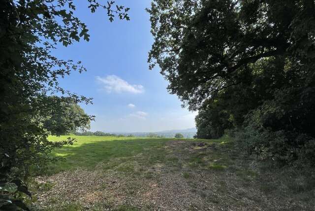
Spear Hill is a prominent geographical feature located in the county of Sussex, England. It is classified as a hill rather than a mountain, as its elevation does not meet the criteria for the latter designation. Situated in the South Downs, a range of chalk hills spanning across southern England, Spear Hill offers commanding views of the surrounding landscape and is a popular destination for hikers and nature enthusiasts.

The hill itself rises to an elevation of approximately 229 meters (751 feet) above sea level, making it a notable landmark in the region. Its location within the South Downs National Park further enhances its appeal, as visitors can enjoy the beautiful natural scenery and diverse wildlife that call this area home.

The slopes of Spear Hill are predominantly covered in lush grasslands, interspersed with patches of woodland. This combination of habitats creates an ideal environment for a variety of plant and animal species, including rare orchids and butterflies. The hill is also home to several species of birds, making it a popular spot for birdwatching.

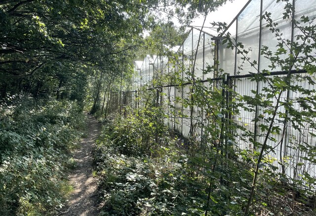
Access to Spear Hill is facilitated by a network of well-maintained footpaths and trails, allowing visitors to explore the area at their own pace. The hill is easily accessible from nearby towns and villages, making it a convenient destination for both locals and tourists alike.

Overall, Spear Hill in Sussex offers a picturesque and tranquil setting for outdoor enthusiasts, providing an opportunity to appreciate the natural beauty and biodiversity of the South Downs.

If you have any feedback on the listing, please let us know in the comments section below.
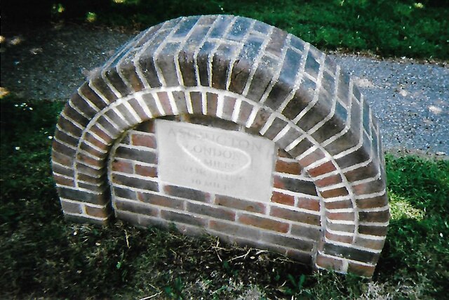
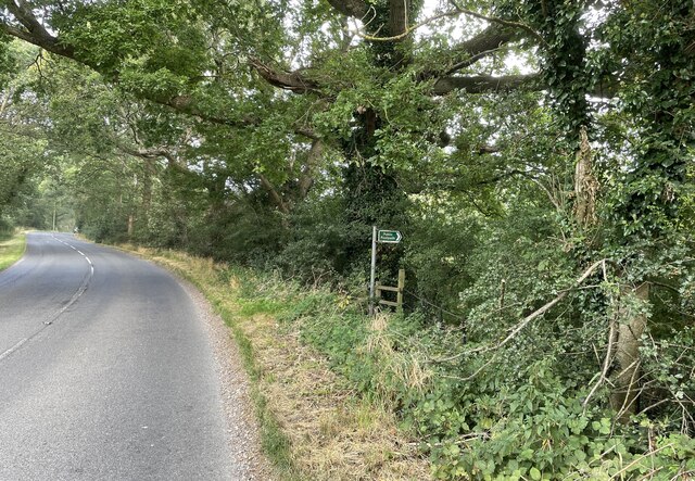
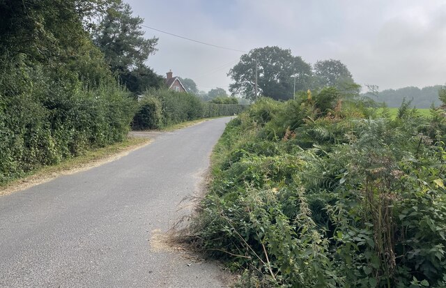
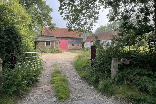
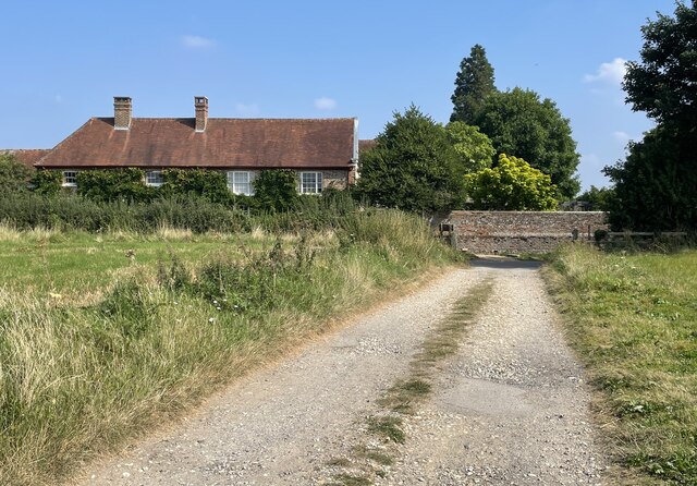
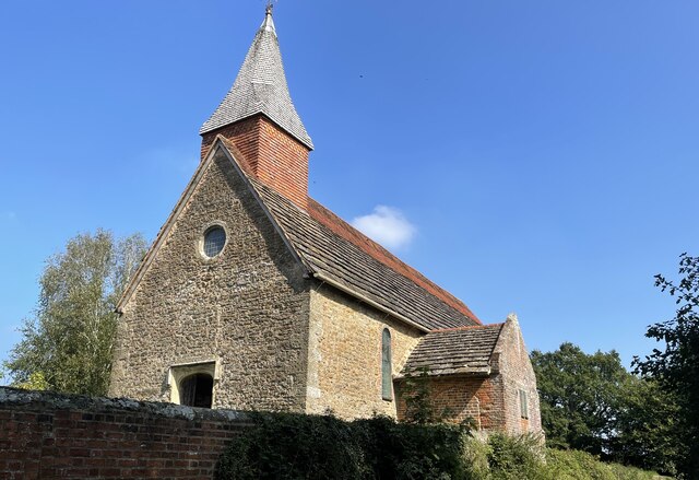
Spear Hill Images

Images are sourced within 2km of 50.945367/-0.38485168 or Grid Reference TQ1317. Thanks to Geograph Open Source API. All images are credited.

Modern Waymarker The Modern Waymarker is located  on the road.  Parish of Ashington (Horsham District). Carved stone plaque laid inside brick semicircle, erected in the 20th Century. 

Inscription reads:-  
ASHINGTON / LONDON / () MILES / WORTHING / 10 MILES

Milestone Society National ID: SX_XASH
Modern Waymarker
The Modern Waymarker is located on the road.  Parish of Ashington (Horsham District). Carved stone plaque laid inside brick semicircle, erected in the 20th Century.  Inscription reads:- ASHINGTON / LONDON / () MILES / WORTHING / 10 MILES Milestone Society National ID: SX_XASH
London Road London Road in Ashington near Church Lane looking northwards.
London Road
London Road in Ashington near Church Lane looking northwards.
London Road roundabout The roundabout at the north end of Ashington where London Road meets Billingshurst Road and Ivy Lane.
London Road roundabout
The roundabout at the north end of Ashington where London Road meets Billingshurst Road and Ivy Lane.
Oast Cottage Viewed from the Billingshurst Road the cottage is a Grade II listed building. See <span class="nowrap"><a title="https://historicengland.org.uk/listing/the-list/list-entry/1182086" rel="nofollow ugc noopener" href="https://historicengland.org.uk/listing/the-list/list-entry/1182086">Link</a><img style="margin-left:2px;" alt="External link" title="External link - shift click to open in new window" src="https://s1.geograph.org.uk/img/external.png" width="10" height="10"/></span>
Oast Cottage
Viewed from the Billingshurst Road the cottage is a Grade II listed building. See LinkExternal link
Spear Hill The junction of Spear Hill with Billingshurst Road.
Spear Hill
The junction of Spear Hill with Billingshurst Road.
Public footpath Public footpath number 2364 leaving Billingshurst Road near Bennetts Farm.
Public footpath
Public footpath number 2364 leaving Billingshurst Road near Bennetts Farm.
Bridleway at Goose Green Bridleway number 2362 leaves Billingshurst Road at the junction with Goose Green Lane and Cray’s Lane.
Bridleway at Goose Green
Bridleway number 2362 leaves Billingshurst Road at the junction with Goose Green Lane and Cray’s Lane.
Sir Robert’s Farm Viewed from Goose Green Lane.
Sir Robert’s Farm
Viewed from Goose Green Lane.
Approaching Warminghurst On public footpath number 2481 heading eastwards.
Approaching Warminghurst
On public footpath number 2481 heading eastwards.
The Church of the Holy Sepulchre Viewed from Rectory Lane the church is a Grade I listed building. See <span class="nowrap"><a title="https://historicengland.org.uk/listing/the-list/list-entry/1027448" rel="nofollow ugc noopener" href="https://historicengland.org.uk/listing/the-list/list-entry/1027448">Link</a><img style="margin-left:2px;" alt="External link" title="External link - shift click to open in new window" src="https://s1.geograph.org.uk/img/external.png" width="10" height="10"/></span>
The church is no longer used for services and is under the care of the Churches Conservation Trust.
The Church of the Holy Sepulchre
Viewed from Rectory Lane the church is a Grade I listed building. See LinkExternal link The church is no longer used for services and is under the care of the Churches Conservation Trust.
View beside Rectory Lane Looking towards the South Downs at Warminghurst.
View beside Rectory Lane
Looking towards the South Downs at Warminghurst.
Footpath beside Nursery On footpath number 2607 as it passes the greenhouses of a Nursery on the outskirts of Ashington.
Footpath beside Nursery
On footpath number 2607 as it passes the greenhouses of a Nursery on the outskirts of Ashington.
The Parish Church of St Peter and St Paul The church is a Grade II* (star) listed building. See <span class="nowrap"><a title="https://historicengland.org.uk/listing/the-list/list-entry/1027442" rel="nofollow ugc noopener" href="https://historicengland.org.uk/listing/the-list/list-entry/1027442">Link</a><img style="margin-left:2px;" alt="External link" title="External link - shift click to open in new window" src="https://s1.geograph.org.uk/img/external.png" width="10" height="10"/></span>
The Parish Church of St Peter and St Paul
The church is a Grade II* (star) listed building. See LinkExternal link
St Peter and St Paul's Church, Ashington Extended in 1871. One of the bells (the stocks for which were renewed for the millennium) dates back to 1350.
St Peter and St Paul's Church, Ashington
Extended in 1871. One of the bells (the stocks for which were renewed for the millennium) dates back to 1350.
The Old School, Ashington Looking north. Built in 1872.
The Old School, Ashington
Looking north. Built in 1872.
Holy Sepulchre Church, Warminghurst Dating from the 12th century this church held its last service in 1979. It is maintained by the Church Conservation Trust and is open to visitors during the week.
Holy Sepulchre Church, Warminghurst
Dating from the 12th century this church held its last service in 1979. It is maintained by the Church Conservation Trust and is open to visitors during the week.
London Road, Ashington Looking north from the southern end of the village. Once, as its name suggests, this was the main A24 London to Worthing road. Now the traffic has been diverted away onto a bypass and the main street has been traffic-calmed. In recent years the village has developed from being a straggle along the main road into a substantial dormitory village. Surprisingly, the church is on the outskirts of the village. This may be because a Roman building, possibly a villa, existed at Church Farm and maybe the original church was associated with it.
London Road, Ashington
Looking north from the southern end of the village. Once, as its name suggests, this was the main A24 London to Worthing road. Now the traffic has been diverted away onto a bypass and the main street has been traffic-calmed. In recent years the village has developed from being a straggle along the main road into a substantial dormitory village. Surprisingly, the church is on the outskirts of the village. This may be because a Roman building, possibly a villa, existed at Church Farm and maybe the original church was associated with it.
Ashington The A24 underpass at the south end of London Road looking south. The bypass skirts the eastern side of the village and joins up with the original main road just south of this point. The road under the underpass is the road to Hole Street and Wiston and also links up with the southbound carriageway.
Ashington
The A24 underpass at the south end of London Road looking south. The bypass skirts the eastern side of the village and joins up with the original main road just south of this point. The road under the underpass is the road to Hole Street and Wiston and also links up with the southbound carriageway.
Show me another place!

Spear Hill is located at Grid Ref: TQ1317 (Lat: 50.945367, Lng: -0.38485168)

Administrative County: West Sussex

District: Horsham

Police Authority: Sussex

What 3 Words

///whips.dunk.relief. Near Ashington, West Sussex

Nearby Locations

The Plantation Spear Hill

Related Wikis

Ashington, West Sussex

Ashington is a village and civil parish in the Horsham District of West Sussex, England. It lies on the A24 road 3 miles (4.8 km) north-east of Storrington...

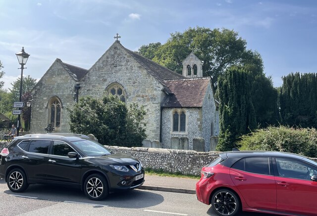
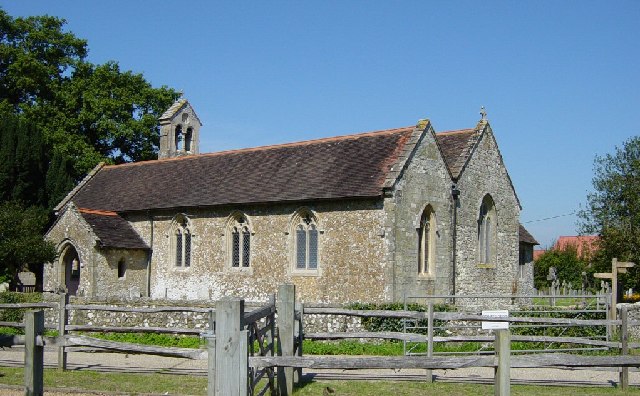
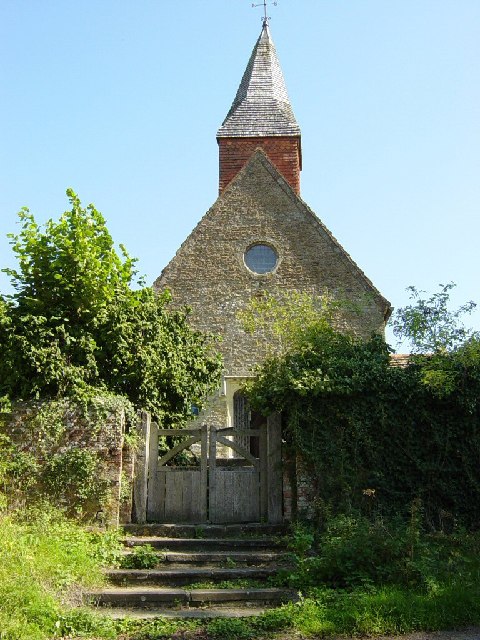
Church of the Holy Sepulchre, Warminghurst

The Church of the Holy Sepulchre is a former Anglican church in the hamlet of Warminghurst in the district of Horsham, one of seven local government districts...

Warminghurst

Warminghurst is a village and former civil parish, now in the parish of Thakeham, in the Horsham district of West Sussex, England. It lies on the Ashington...

Brightling Park

Brightling Park (previously known as Rose Hill) is a country estate which lies in the parishes of Brightling and Dallington in the Rother district of East...

Thakeham

Thakeham is a village and civil parish located north of the South Downs in the Horsham District of West Sussex, England. The village is situated approximately...

Dial Post

Dial Post is a village in the Horsham District of West Sussex, England. The civil parish, where the lowest level political meetings are held, is West Grinstead...

Little Thakeham

Little Thakeham is an Arts and Crafts style, Grade I listed private house in the parish of Thakeham, near the village of Storrington, in the Horsham district...

Wiston, West Sussex

Wiston is a scattered village and civil parish in the Horsham District of West Sussex, England. It lies on the A283 road 2.8 miles (4.5 km) northwest of...

Related Videos

Horley Walkie Talkies Go To Knepp park

Local Walking Ambling Group Called the Horley Walkie Talkies go to Knepp Park at Dial Post/Shipley for a lovley Amble.

Painting and Music with Hester Berry and David Smale (Friday 10th May, 2024)

Doors 6.30pm Event starts at 7.00pm For one evening only, the Knepp Rewilding Project will play host to an atmospheric evening ...

Laminitis - Part 2

Laminitis - Treatment Options, Management & Pain Scoring by Dr. Natasha Jocelyn MA, VetMB, MVetMed, Dip ECEIM, MRCVS, ...

Nearby Amenities

Located within 500m of 50.945367,-0.38485168
Post Box
Collection Times: Mo-Fr 16:30; Sa 10:00; Su off
Operator: Royal Mail
Operator Wikidata: Q638098
Post Box Type: lamp
Ref: RH20 379
Royal Cypher: EIIR
Royal Cypher Wikidata: Q33102113
Source: survey
Lat/Long: 50.9437451/-0.3886655
Barrier: bollard
Lat/Long: 50.9445862/-0.3907443
Spear Hill
Place: hamlet
Lat/Long: 50.9448494/-0.3871947
The data included in this document is from www.openstreetmap.org. The data is made available under ODbL.

Have you been to Spear Hill?

Leave your review of Spear Hill below (or comments, questions and feedback).