Mox Hill

Hill, Mountain in Bedfordshire

England

Mox Hill

Greensand Ridge Walk coming in to Northill
Greensand Ridge Walk coming in to Northill Credit: Philip Jeffrey

Mox Hill is a small hill located in Bedfordshire, England. It is situated near the village of Maulden, approximately 5 miles south of Bedford. Although referred to as a hill, it is more accurately described as a low-lying ridge, with an elevation of around 135 meters (443 feet) above sea level.

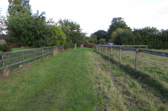
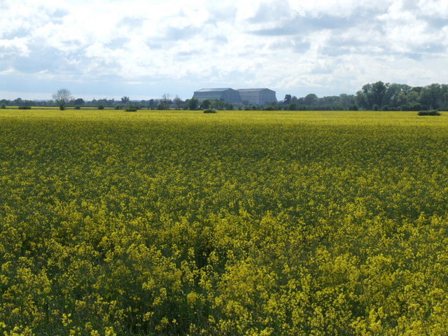
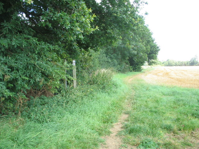
Covered in grass and scattered with a few trees, Mox Hill offers a picturesque view of the surrounding countryside. It is a popular spot for locals and visitors alike who enjoy outdoor activities such as walking, hiking, and birdwatching. The hill is easily accessible by foot, with several footpaths leading up to its summit.

Mox Hill is part of the Bedfordshire Greensand Ridge, a geological feature formed from sandstone deposits. This contributes to its unique landscape and provides a habitat for a variety of flora and fauna. The area is known for its wildflowers, including bluebells and cowslips, which bloom in the springtime.

In addition to its natural beauty, Mox Hill also holds historical significance. It is believed to have been used as a burial site during the Bronze Age, with several barrows (burial mounds) discovered nearby. These archaeological remnants offer insight into the early human activity in the region.

Overall, Mox Hill provides a tranquil escape and an opportunity to explore the natural and historical wonders of Bedfordshire.

If you have any feedback on the listing, please let us know in the comments section below.

Mox Hill Images

Images are sourced within 2km of 52.107415/-0.3555996 or Grid Reference TL1246. Thanks to Geograph Open Source API. All images are credited.

Greensand Ridge Walk coming in to Northill
Middle Farm entrance
Reservoir The reservoir is adjacent to Mox Hill
Reservoir
The reservoir is adjacent to Mox Hill
Bedford Road Looking towards Deadman's Oak
Bedford Road
Looking towards Deadman's Oak
Wood Lane. Yet another digger besides the track (wood lane). Radio mast in the distance.
Wood Lane.
Yet another digger besides the track (wood lane). Radio mast in the distance.
A field of rape near Hill Farm The airship hangars at Cardington, over 5 km away, dominate the flat Bedfordshire landscape.
A field of rape near Hill Farm
The airship hangars at Cardington, over 5 km away, dominate the flat Bedfordshire landscape.
Track to Beeston Leasoes Farm A strange name for a farm.
Track to Beeston Leasoes Farm
A strange name for a farm.
Another digger and a field
A field of rape near Beeston Leasomes Farm
Horse, farm buildings and an inquisitive horse. Budna Farm, Budna Road, Budna.  An odd name.  I don't think that this Budna is related to the one in Slovenia.
Horse, farm buildings and an inquisitive horse.
Budna Farm, Budna Road, Budna. An odd name. I don't think that this Budna is related to the one in Slovenia.
Sweetbrier Farm from Greensand Ridge Walk footpath Field has just been 'Combined'; footpath is also Old Warden circular footpath; farmhouse just visible between trees beyond the field.
Sweetbrier Farm from Greensand Ridge Walk footpath
Field has just been 'Combined'; footpath is also Old Warden circular footpath; farmhouse just visible between trees beyond the field.
Line of footpath towards Cople from Greensand Ridge Walk footpath Field part of Sweetbrier Farm, land rises slightly ahead before the dip over the Greensand Ridge, view in the distance is west of Bedford
Line of footpath towards Cople from Greensand Ridge Walk footpath
Field part of Sweetbrier Farm, land rises slightly ahead before the dip over the Greensand Ridge, view in the distance is west of Bedford
Greensand Ridge Walk footpath straight ahead is a freshly cut wheat field + Greensand Ridge Walk fp; the footpath sign indicates a footpath junction with the footpath to Cople leading off left. To the right the footpath heads off to Old Warden
Greensand Ridge Walk footpath
straight ahead is a freshly cut wheat field + Greensand Ridge Walk fp; the footpath sign indicates a footpath junction with the footpath to Cople leading off left. To the right the footpath heads off to Old Warden
Greensand Ridge Walk footpath path between freshly cut wheat field and a field awaiting the Combine.
Greensand Ridge Walk footpath
path between freshly cut wheat field and a field awaiting the Combine.
Wood Farm Home Wood beyond; wheat field just harvested leaving golden stubble
Wood Farm
Home Wood beyond; wheat field just harvested leaving golden stubble
Tobaccopipe Spinney just harvested field  on Woods Farm
Tobaccopipe Spinney
just harvested field on Woods Farm
Wood End Farm from Public Footpath
Wood End Farm
from Public Footpath
Show me another place!

Mox Hill is located at Grid Ref: TL1246 (Lat: 52.107415, Lng: -0.3555996)

Unitary Authority: Bedford

Police Authority: Bedfordshire

What 3 Words

///zoomed.minerals.undertone. Near Cople, Bedfordshire

Nearby Locations

Mox Hill

Related Wikis

Church of St Mary the Virgin, Northill

Church of St Mary the Virgin is a Grade I listed church in Northill, Bedfordshire, England. It became a listed building on 31 October 1966.The church...

Northill

Northill is a village and civil parish in the Central Bedfordshire district of the county of Bedfordshire, England about 6.5 miles (10 km) southeast of...

Ickwell Bury

Ickwell Bury, at the heart of the former manor of Ickwell, Bedfordshire, was first built by John Harvey in 1683 near the site of an older manor house....

Budna

Budna is a hamlet in the civil parish of Northill, in Bedfordshire, England. Budna is located to the north of the village of Northill, and near to Thorncote...

Nearby Amenities

Located within 500m of 52.107415,-0.3555996
The data included in this document is from www.openstreetmap.org. The data is made available under ODbL.

Have you been to Mox Hill?

Leave your review of Mox Hill below (or comments, questions and feedback).