Barnehurst

Settlement in Kent

England

Barnehurst

Path beside the railway at Braeburn Park Nature reserve south of the Dartford Loop Line.
Path beside the railway at Braeburn Park Credit: David Martin

Barnehurst is a suburban town located in the borough of Bexley, within the county of Kent, England. Situated approximately 13 miles southeast of Central London, it is a predominantly residential area with a population of around 15,000 people.

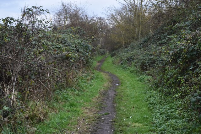
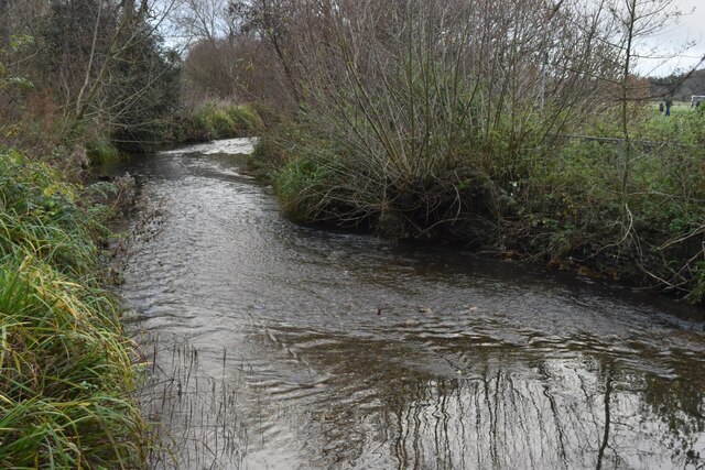
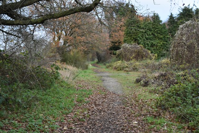
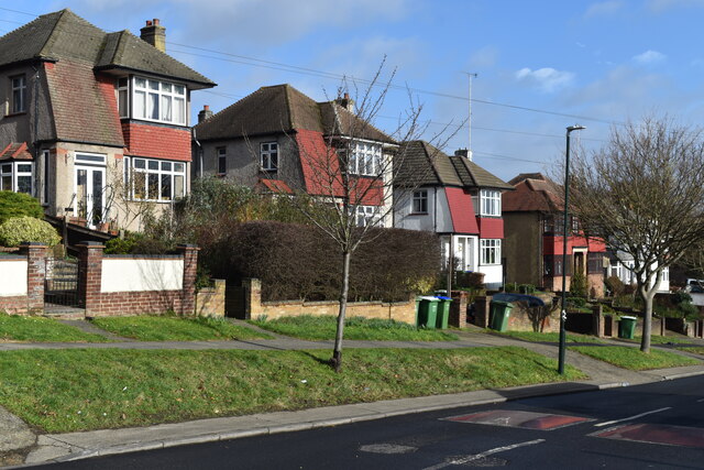
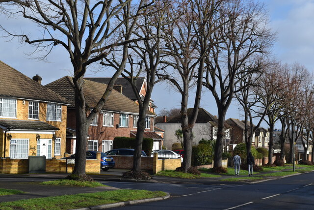
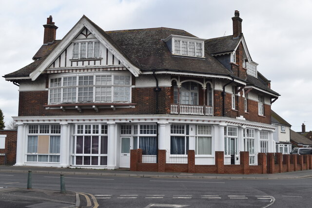
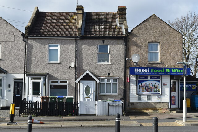
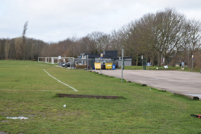
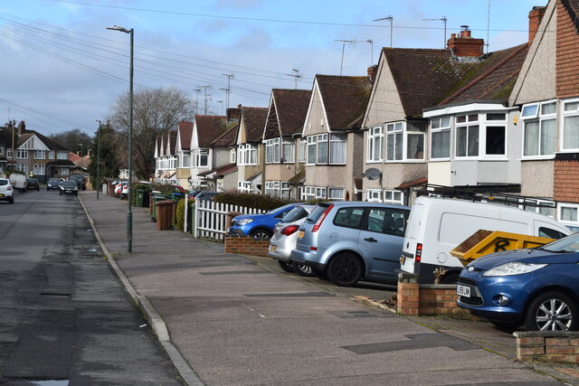
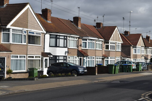
The town boasts a variety of housing options, ranging from modern apartments to Victorian terrace houses. Its quiet streets, green spaces, and attractive parks make it an ideal place for families and professionals seeking a peaceful suburban lifestyle. Barnehurst is surrounded by several large green areas, including the popular Barnehurst Golf Course and the expansive Danson Park, which offers picturesque landscapes, a boating lake, and various recreational facilities.

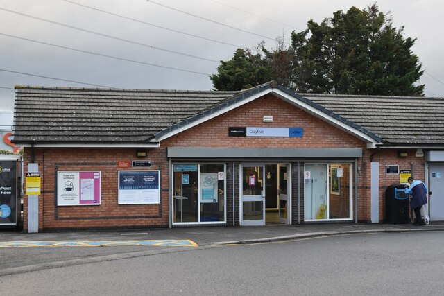
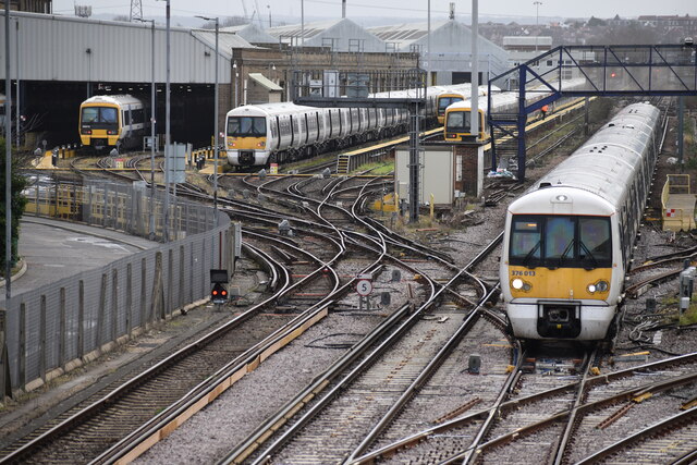
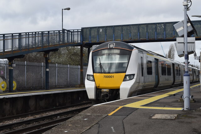
Transportation is convenient, with Barnehurst railway station providing regular services to London Victoria, Charing Cross, and Cannon Street, making it an attractive location for commuters. The A2 road also runs nearby, connecting the town to the M25 motorway and providing easy access to other parts of Kent and beyond.

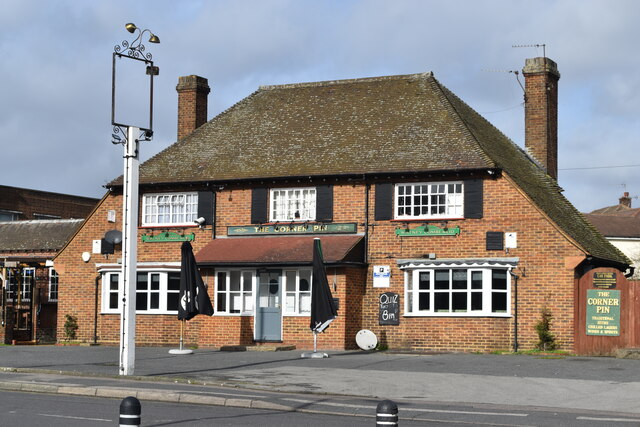
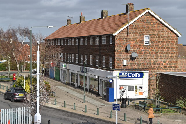
The town has a range of local amenities, including a supermarket, shops, pubs, and restaurants. It is also home to several schools, making it an appealing choice for families. For leisure activities, residents can enjoy local sports clubs, a leisure center, and nearby attractions such as the Red House, a National Trust property once home to renowned British poet and artist William Morris.

In summary, Barnehurst offers a tranquil suburban setting, excellent transportation links, and a range of amenities, making it an attractive place to live within close proximity to both London and the scenic countryside of Kent.

If you have any feedback on the listing, please let us know in the comments section below.
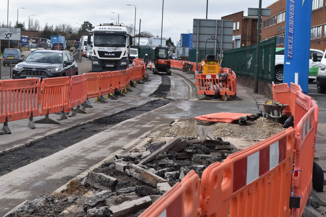
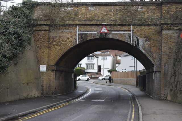
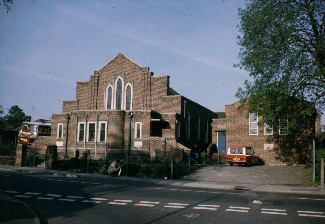
Barnehurst Images

Images are sourced within 2km of 51.462397/0.168695 or Grid Reference TQ5075. Thanks to Geograph Open Source API. All images are credited.

Path beside the railway at Braeburn Park Nature reserve south of the Dartford Loop Line.
Path beside the railway at Braeburn Park
Nature reserve south of the Dartford Loop Line.
River Cray at Hall Place
Crayford Town Hall
Crayford Town Hall
Crayford Railway Station
Footpath in Braeburn Park
Houses in Avenue Road, Erith
Houses and trees in Avenue Road
The Corner Pin public house
Slade Green Train Care Depot, seen from station footbridge The train on the right is approaching the station from the Dartford direction.
Slade Green Train Care Depot, seen from station footbridge
The train on the right is approaching the station from the Dartford direction.
Train at Slade Green Station
Parade of shops near Slade Green station
Former Railway Tavern, now apartments
Corner shop and houses, Hazel Road
Recreation ground beside Perry Street
Parked cars in Holmsdale Grove Typical of the smaller 1930s house designs in this area, built as short terraces. The lack of driveways has led to most front gardens being converted to off-street parking.
Parked cars in Holmsdale Grove
Typical of the smaller 1930s house designs in this area, built as short terraces. The lack of driveways has led to most front gardens being converted to off-street parking.
1930s houses in Parkside Avenue
Roadworks beside Thames Road
Railway arch in Old Manor Way
Show me another place!

Barnehurst is located at Grid Ref: TQ5075 (Lat: 51.462397, Lng: 0.168695)

Unitary Authority: Bexley

Police Authority: Metropolitan

What 3 Words

///beam.twins.volume. Near Bexleyheath, London

Nearby Locations

Barnehurst Martens Grove

Related Wikis

Barnehurst

Barnehurst is a town and electoral ward in South East London within the London Borough of Bexley. It lies north east of Bexleyheath, and 13.0 miles (20...

Phoenix Sports F.C.

Phoenix Sports Football Club is an English football club located in Barnehurst, Kent. The club plays in the Isthmian League South East Division. Phoenix...

Tower Hamlets F.C.

Tower Hamlets Football Club is a football club based in the London Borough of Tower Hamlets. They are currently members of the Eastern Counties League...

Greenwich Borough F.C.

Greenwich Borough Football Club was a football club based in south-east London, England. == History == The club was established in 1928 as Woolwich Borough...

Nearby Amenities

Located within 500m of 51.462397,0.168695
Ref GB Tflcid: RWG183743
Traffic Calming: table
Lat/Long: 51.4590233/0.166153
Crossing
Crossing: uncontrolled
Crossing Ref: zebra
Lat/Long: 51.4590887/0.1656007
Turning Circle
Turning Circle: circle
Lat/Long: 51.4584521/0.1668547
Ref GB Tflcid: RWG180447
Traffic Calming: cushion
Lat/Long: 51.4650087/0.167861
Bus Stop
Mayplace Road East / Manor Way
Bus: yes
Naptan AtcoCode: 490009596E
Naptan Bearing: N
Naptan CommonName: Mayplace Road East Manor Way
Naptan Street: MAYPLACE ROAD EAST
Naptan Verified: no
Network: London Buses
Operator: Transport for London
Public Transport: platform
Ref: 77038
Lat/Long: 51.459032/0.1666484
Bus Stop
Mayplace Road East / Manor Way
Bus: yes
Naptan AtcoCode: 490009596W
Naptan Bearing: N
Naptan CommonName: Mayplace Road East Manor Way
Naptan Street: MAYPLACE ROAD EAST
Naptan Verified: no
Network: London Buses
Operator: Transport for London
Public Transport: platform
Ref: 76783
Lat/Long: 51.4590368/0.1655937
Bus Stop
Parkside Avenue / Manor Way
Bus: yes
Naptan AtcoCode: 490009597E
Naptan Bearing: N
Naptan CommonName: Northall Road Parkside Avenue
Naptan Street: PARKSIDE AVENUE
Naptan Verified: no
Public Transport: platform
Ref: 77451
Source Ref: naptan
Lat/Long: 51.4637982/0.1683404
Bus Stop
Northall Road / Manor Way
Bus: yes
Naptan AtcoCode: 490009597W
Naptan Bearing: N
Naptan CommonName: Northall Road Parkside Avenue
Naptan Street: NORTHALL ROAD
Naptan Verified: no
Public Transport: platform
Ref: 77759
Source Ref: naptan
Lat/Long: 51.4641055/0.1646333
Bus Stop
Parkside Cross
Bus: yes
Naptan AtcoCode: 490010828E
Naptan Bearing: N
Naptan CommonName: Parkside Cross
Naptan Street: PARKSIDE AVENUE
Naptan Verified: no
Public Transport: platform
Ref: 59111
Source Ref: naptan
Lat/Long: 51.4637014/0.1734616
Bus Stop
Parkside Cross
Bus: yes
Naptan AtcoCode: 490010828W
Naptan Bearing: N
Naptan CommonName: Parkside Cross
Naptan Street: PARKSIDE AVENUE
Naptan Verified: no
Public Transport: platform
Ref: 55401
Source Ref: naptan
Lat/Long: 51.4636388/0.1713816
Bus Stop
Woodside Road
Bus: yes
Naptan AtcoCode: 490014899E
Naptan Bearing: E
Naptan CommonName: Woodside Road
Naptan Street: MAYPLACE ROAD EAST
Naptan Verified: no
Network: London Buses
Network Wikidata: Q1192411
Network Wikipedia: en:London Buses
Operator: Transport for London
Public Transport: platform
Ref: 48845
Lat/Long: 51.4582257/0.1708569
Post Box
Operator: Royal Mail
Operator Wikidata: Q638098
Post Box Type: pillar
Ref: DA7 189
Lat/Long: 51.4591326/0.1662613
Post Box
Brand: Royal Mail
Brand Wikidata: Q638098
Brand Wikipedia: en:Royal Mail
Operator: Royal Mail
Operator Wikidata: Q638098
Post Box Type: pillar
Ref: DA7 241
Lat/Long: 51.4655564/0.1637514
Post Box
Brand: Royal Mail
Brand Wikidata: Q638098
Brand Wikipedia: en:Royal Mail
Operator: Royal Mail
Operator Wikidata: Q638098
Post Box Type: pillar
Ref: DA7 252
Lat/Long: 51.4624999/0.1639697
Post Box
Brand: Royal Mail
Brand Wikidata: Q638098
Brand Wikipedia: en:Royal Mail
Operator: Royal Mail
Operator Wikidata: Q638098
Post Box Type: pillar
Ref: DA7 259
Lat/Long: 51.4635819/0.1755354
Post Box
Brand: Royal Mail
Brand Wikidata: Q638098
Brand Wikipedia: en:Royal Mail
Operator: Royal Mail
Operator Wikidata: Q638098
Post Box Type: pillar
Ref: DA7 260
Lat/Long: 51.4638004/0.166566
Post Box
Brand: Royal Mail
Brand Wikidata: Q638098
Brand Wikipedia: en:Royal Mail
Operator: Royal Mail
Operator Wikidata: Q638098
Post Box Type: pillar
Ref: DA7 318
Lat/Long: 51.4664932/0.1685629
Post Box
Brand: Royal Mail
Brand Wikidata: Q638098
Brand Wikipedia: en:Royal Mail
Operator: Royal Mail
Operator Wikidata: Q638098
Post Box Type: pillar
Ref: DA7 334
Lat/Long: 51.4650256/0.172939
Barrier: kissing_gate
Lat/Long: 51.4602462/0.1677868
Barrier: kissing_gate
Material: metal
Lat/Long: 51.4632281/0.1666594
Born here 1942 left here 1949 to Canada
Addr City: Barnehurst
Addr Housename: council flats
Addr Housenumber: 207
Addr Street: Parkside Avenue
Lat/Long: 51.4636743/0.1741601
Barnehurst
Place: suburb
Wikidata: Q146340
Lat/Long: 51.4626874/0.1617566
Woodside Road
Bus: yes
Network: London Buses
Operator: Transport for London
Public Transport: stop_position
Lat/Long: 51.4581902/0.1708404
Mayplace Road East / Manor Way
Bus: yes
Network: London Buses
Operator: Transport for London
Public Transport: stop_position
Lat/Long: 51.459086/0.1656159
Mayplace Road East / Manor Way
Bus: yes
Network: London Buses
Operator: Transport for London
Public Transport: stop_position
Lat/Long: 51.4590036/0.1666455
Barrier: swing_gate
Material: metal
Width: 2.8
Lat/Long: 51.4601221/0.1678432
Waste Basket
Lat/Long: 51.4603946/0.1679894
Waste Basket
Waste: dog_excrement
Lat/Long: 51.4603678/0.1679331
Barrier: kissing_gate
Material: metal
Lat/Long: 51.4604427/0.1682063
Bench
Material: metal
Lat/Long: 51.4612986/0.1676676
Waste Basket
Lat/Long: 51.4631197/0.1668435
Man Made: tower
Tower Type: lighting
Lat/Long: 51.4594754/0.1704678
Man Made: tower
Tower Type: lighting
Lat/Long: 51.4588604/0.1695545
Man Made: tower
Tower Type: lighting
Lat/Long: 51.4591604/0.1700118
Man Made: tower
Tower Type: lighting
Lat/Long: 51.4583256/0.170508
Man Made: tower
Tower Type: lighting
Lat/Long: 51.4586222/0.1711223
Man Made: tower
Tower Type: lighting
Lat/Long: 51.4590517/0.1712215
Man Made: tower
Tower Type: lighting
Lat/Long: 51.4584275/0.170331
Man Made: tower
Tower Type: lighting
Lat/Long: 51.4587426/0.170783
Entrance: yes
Lat/Long: 51.4603019/0.1699789
Bicycle Parking
Bicycle Parking: stands
Capacity: 8
Lat/Long: 51.4600816/0.1691616
Bench
Backrest: yes
Direction: W
Material: metal
Lat/Long: 51.4617448/0.1689953
Waste Basket
Waste: dog_excrement
Lat/Long: 51.4631287/0.1669259
Boot Cleaner
Lat/Long: 51.4632396/0.1666316
Waste Basket
Lat/Long: 51.4589222/0.1728375
Bench
Backrest: yes
Direction: NW
Material: metal
Surface: wood
Lat/Long: 51.4589414/0.1728657
Man Made: tower
Tower Type: lighting
Lat/Long: 51.4611482/0.175049
Man Made: tower
Tower Type: lighting
Lat/Long: 51.4617039/0.1755774
Waste Basket
Waste: dog_excrement
Lat/Long: 51.4623105/0.1756243
Barrier: kissing_gate
Material: metal
Lat/Long: 51.462931/0.1705776
Waste Basket
Waste: dog_excrement
Lat/Long: 51.4629151/0.1705322
Waste Basket
Lat/Long: 51.4629154/0.1705105
Barrier: kissing_gate
Material: metal
Lat/Long: 51.462943/0.1696441
Waste Basket
Waste: dog_excrement
Lat/Long: 51.4629294/0.1696145
Barrier: bollard
Bollard Count: 1
Lat/Long: 51.4630593/0.1752333
Maxwidth: 5
Traffic Calming: choker
Lat/Long: 51.4643316/0.1725987
Ref GB Tflcid: RWG180734
Traffic Calming: cushion
Lat/Long: 51.4636357/0.1747093
Ref GB Tflcid: RWG180735
Traffic Calming: cushion
Lat/Long: 51.4636276/0.1755929
Ref GB Tflcid: RWG180733
Traffic Calming: cushion
Lat/Long: 51.4636528/0.1731583
Ref GB Tflcid: RWG180754
Traffic Calming: cushion
Lat/Long: 51.4637245/0.1692603
Ref GB Tflcid: RWG180755
Traffic Calming: cushion
Lat/Long: 51.4636982/0.1706176
Ref GB Tflcid: RWG180449
Traffic Calming: cushion
Lat/Long: 51.4650384/0.1699809
Ref GB Tflcid: RWG180450
Traffic Calming: cushion
Lat/Long: 51.4650184/0.1709727
Ref GB Tflcid: RWG180732
Traffic Calming: cushion
Lat/Long: 51.463665/0.1723396
Ref GB Tflcid: RWG180448
Traffic Calming: cushion
Lat/Long: 51.4650677/0.1686416
Ref GB Tflcid: RWG180452
Traffic Calming: cushion
Lat/Long: 51.4649821/0.1732937
Ref GB Tflcid: RWG180451
Traffic Calming: cushion
Lat/Long: 51.4649861/0.1723679
Leisure: picnic_table
Lat/Long: 51.4640542/0.1667583
Bicycle Parking
Capacity: 2
Lat/Long: 51.4643626/0.1672628
Waste Basket
Lat/Long: 51.4642882/0.1672647
Waste Basket
Lat/Long: 51.4643/0.1667166
Waste Basket
Lat/Long: 51.4643615/0.1669831
Bench
Backrest: yes
Colour: blue
Direction: NW
Length: 1.9
Material: metal
Lat/Long: 51.4642705/0.167242
Bench
Backrest: yes
Colour: blue
Direction: E
Length: 1.9
Material: metal
Lat/Long: 51.4642817/0.1667043
Bench
Backrest: yes
Colour: blue
Direction: S
Length: 1.9
Material: metal
Lat/Long: 51.464365/0.1669423
The data included in this document is from www.openstreetmap.org. The data is made available under ODbL.

Have you been to Barnehurst?

Leave your review of Barnehurst below (or comments, questions and feedback).