Martens Grove

Wood, Forest in Kent

England

Martens Grove

London Loop footpath climbing A2 embankment The footpath uses the A2 bridge to cross the railway line.
London Loop footpath climbing A2 embankment Credit: David Martin

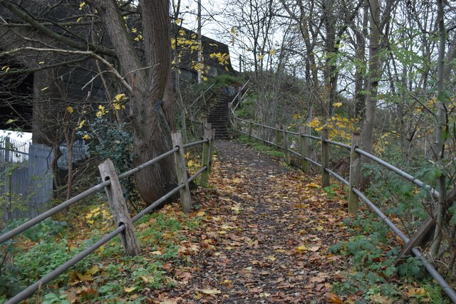
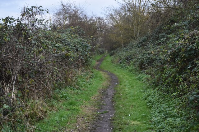
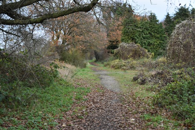
Martens Grove, located in Kent, England, is a beautiful woodland area renowned for its picturesque scenery and tranquil atmosphere. Covering an expansive area of lush greenery, the grove is primarily composed of a diverse range of trees, including oak, beech, and ash, which create a dense canopy that provides shade and adds to the natural beauty of the area.

Situated near the village of Martensbourne, Martens Grove offers visitors an opportunity to immerse themselves in nature and escape the hustle and bustle of everyday life. The woodland is crisscrossed by a network of well-maintained footpaths, allowing visitors to explore the grove and discover its hidden gems at their own pace.

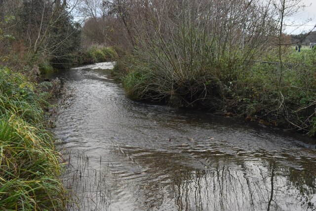
Wildlife thrives within Martens Grove, with various species of birds, such as woodpeckers and nightingales, making their homes in the trees. The grove is also home to small mammals, including squirrels and hedgehogs, which can often be spotted scampering through the undergrowth.

The grove is a popular spot for nature enthusiasts, walkers, and families, who come to enjoy the peaceful surroundings and take advantage of the numerous recreational activities on offer. Picnic areas and benches are scattered throughout the grove, providing the perfect setting for a leisurely lunch or a moment of relaxation.

Martens Grove, with its abundance of natural beauty and diverse ecosystem, offers a serene escape for visitors seeking solace in the heart of nature. Whether one is seeking a peaceful walk, a chance to spot wildlife, or simply a place to unwind, Martens Grove is a true haven for nature lovers and a must-visit destination in Kent.

If you have any feedback on the listing, please let us know in the comments section below.

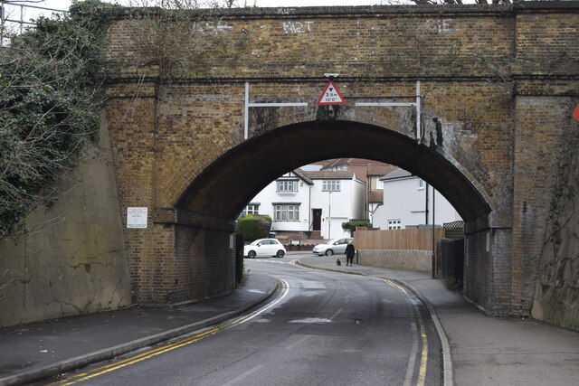
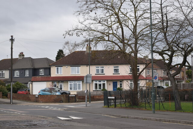
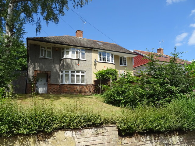
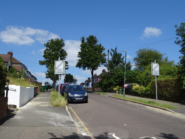
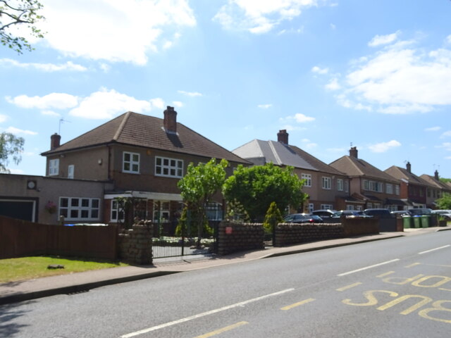
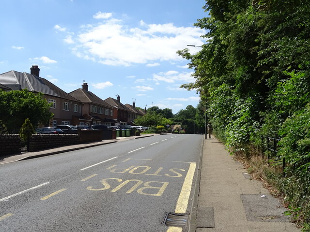
Martens Grove Images

Images are sourced within 2km of 51.456569/0.16392851 or Grid Reference TQ5075. Thanks to Geograph Open Source API. All images are credited.

London Loop footpath climbing A2 embankment The footpath uses the A2 bridge to cross the railway line.
London Loop footpath climbing A2 embankment
The footpath uses the A2 bridge to cross the railway line.
Path beside the railway at Braeburn Park Nature reserve south of the Dartford Loop Line.
Path beside the railway at Braeburn Park
Nature reserve south of the Dartford Loop Line.
River Cray at Hall Place
Crayford Town Hall
Crayford Town Hall
Crayford Railway Station
Footpath in Braeburn Park
Recreation ground beside Perry Street
Parked cars in Holmsdale Grove Typical of the smaller 1930s house designs in this area, built as short terraces. The lack of driveways has led to most front gardens being converted to off-street parking.
Parked cars in Holmsdale Grove
Typical of the smaller 1930s house designs in this area, built as short terraces. The lack of driveways has led to most front gardens being converted to off-street parking.
1930s houses in Parkside Avenue
Roadworks beside Thames Road
Railway arch in Old Manor Way
Suburban housing at Barnehurst
Pylon in a car park This is the car park of Sainsbury's in Crayford.
Pylon in a car park
This is the car park of Sainsbury's in Crayford.
Pylon in Crayford This is in the car park of Sainsbury's in Crayford. See also <a title="https://www.geograph.org.uk/photo/7145262" href="https://www.geograph.org.uk/photo/7145262">Link</a>
Pylon in Crayford
This is in the car park of Sainsbury's in Crayford. See also Link
Houses on Watling Street, Bexleyheath
Park Grove Bexleyheath Off Watling Street.
Park Grove Bexleyheath
Off Watling Street.
Houses on London Road
London Road (A207) Towards Bexleyheath.
London Road (A207)
Towards Bexleyheath.
Show me another place!

Martens Grove is located at Grid Ref: TQ5075 (Lat: 51.456569, Lng: 0.16392851)

Unitary Authority: Bexley

Police Authority: Metropolitan

What 3 Words

///values.newest.crown. Near Bexley, London

Nearby Locations

Barnehurst Martens Grove

Related Wikis

Charlton Athletic W.F.C.

Charlton Athletic Women's Football Club (CAWFC) is a team founded in 1991 as Bromley Borough which plays in the Women's Championship. Also known as Croydon...

VCD Athletic F.C.

VCD Athletic Football Club (short for Vickers, Crayford & Dartford Athletic Football Club) is a semi-professional football club based in Crayford in south...

Bexleyheath and Crayford (UK Parliament constituency)

Bexleyheath and Crayford is a constituency in Greater London represented in the House of Commons of the UK Parliament since 2005 by David Evennett, a Conservative...

Tower Hamlets F.C.

Tower Hamlets Football Club is a football club based in the London Borough of Tower Hamlets. They are currently members of the Eastern Counties League...
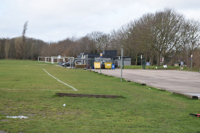
Nearby Amenities

Located within 500m of 51.456569,0.16392851
Ref GB Tflcid: RWG182674
Traffic Calming: hump
Lat/Long: 51.4539701/0.1665633
Ref GB Tflcid: RWG182646
Traffic Calming: hump
Lat/Long: 51.4524126/0.161169
Ref GB Tflcid: RWG183743
Traffic Calming: table
Lat/Long: 51.4590233/0.166153
Crossing
Crossing: uncontrolled
Crossing Ref: zebra
Lat/Long: 51.4590887/0.1656007
Crossing
Crossing: uncontrolled
Crossing Ref: zebra
Lat/Long: 51.4601252/0.1612538
Turning Circle
Lat/Long: 51.4574724/0.1706304
Noexit: yes
Lat/Long: 51.4548109/0.1689309
Noexit: yes
Lat/Long: 51.4553616/0.1692635
Noexit: yes
Lat/Long: 51.4552834/0.1700306
Turning Circle
Turning Circle: circle
Lat/Long: 51.4584521/0.1668547
Description: TA Centre
Landuse: military
Military: office
Lat/Long: 51.4548516/0.1573389
Bus Stop
Mayplace Road East / Barnehurst Road
Bus: yes
Local Ref: NJ
Naptan AtcoCode: 490003626E
Naptan Bearing: W
Naptan CommonName: Mayplace Rd EastBarnehurst Rd
Naptan Indicator: Stop NJ
Naptan Street: MAYPLACE ROAD EAST
Naptan Verified: no
Network: London Buses
Network Wikidata: Q1192411
Network Wikipedia: en:London Buses
Operator: Transport for London
Public Transport: platform
Ref: 76956
Lat/Long: 51.4598465/0.1599983
Bus Stop
Mayplace Road East / Barnehurst Road
Bus: yes
Local Ref: NM
Naptan AtcoCode: 490003626W
Naptan Bearing: W
Naptan CommonName: Mayplace Rd EastBarnehurst Rd
Naptan Indicator: Stop NM
Naptan Street: MAYPLACE ROAD EAST
Naptan Verified: no
Network: London Buses
Not Network Wikidata: Q1192411
Operator: Transport for London
Public Transport: platform
Ref: 54497
Lat/Long: 51.459721/0.1599902
Bus Stop
Mayplace Road East / Manor Way
Bus: yes
Naptan AtcoCode: 490009596E
Naptan Bearing: N
Naptan CommonName: Mayplace Road East Manor Way
Naptan Street: MAYPLACE ROAD EAST
Naptan Verified: no
Network: London Buses
Operator: Transport for London
Public Transport: platform
Ref: 77038
Lat/Long: 51.459032/0.1666484
Bus Stop
Mayplace Road East / Manor Way
Bus: yes
Naptan AtcoCode: 490009596W
Naptan Bearing: N
Naptan CommonName: Mayplace Road East Manor Way
Naptan Street: MAYPLACE ROAD EAST
Naptan Verified: no
Network: London Buses
Operator: Transport for London
Public Transport: platform
Ref: 76783
Lat/Long: 51.4590368/0.1655937
Bus Stop
Old Road
Bus: yes
Local Ref: R
Naptan AtcoCode: 490010577W
Naptan Bearing: W
Naptan CommonName: Watling Street Old Road
Naptan Indicator: Stop R
Naptan Street: WATLING STREET
Naptan Verified: no
Public Transport: platform
Ref: 53082
Lat/Long: 51.4532599/0.1632174
Bus Stop
Old Road
Bus: yes
Local Ref: S
Naptan AtcoCode: 490010587S
Naptan Bearing: E
Naptan CommonName: London Road Old Road
Naptan Indicator: Stop S
Naptan Street: LONDON ROAD
Naptan Verified: no
Public Transport: platform
Ref: 76714
Lat/Long: 51.4531607/0.1652341
Bus Stop
Park Grove
Bus: yes
Local Ref: A
Naptan AtcoCode: 490010773E1
Naptan Bearing: W
Naptan CommonName: Park Grove
Naptan Indicator: Stop A
Naptan Street: WATLING STREET
Naptan Verified: no
Network: London Buses
Network Wikidata: Q1192411
Network Wikipedia: en:London Buses
Public Transport: platform
Ref: 58877
Lat/Long: 51.4542688/0.1577885
Bus Stop
Park Grove
Bus: yes
Local Ref: K
Naptan AtcoCode: 490010773E2
Naptan Bearing: E
Naptan CommonName: Park Grove
Naptan Indicator: Stop K
Naptan Street: WATLING STREET
Naptan Verified: no
Network: London Buses
Network Wikidata: Q1192411
Network Wikipedia: en:London Buses
Public Transport: platform
Ref: 55856
Lat/Long: 51.4542712/0.1586848
Maxwidth: 7' 0"
Source Maxwidth: legal signage
Lat/Long: 51.4534396/0.164543
Barrier: cycle_barrier
Material: metal
Lat/Long: 51.4573846/0.1583539
Post Box
Operator: Royal Mail
Operator Wikidata: Q638098
Post Box Type: pillar
Ref: DA7 189
Lat/Long: 51.4591326/0.1662613
Post Box
Brand: Royal Mail
Brand Wikidata: Q638098
Brand Wikipedia: en:Royal Mail
Operator: Royal Mail
Operator Wikidata: Q638098
Post Box Type: pillar
Ref: DA7 211
Lat/Long: 51.4600997/0.1608869
Post Box
Brand: Royal Mail
Brand Wikidata: Q638098
Brand Wikipedia: en:Royal Mail
Operator: Royal Mail
Operator Wikidata: Q638098
Post Box Type: pillar
Ref: DA7 297
Lat/Long: 51.4542222/0.1643854
Crossing
Crossing: uncontrolled
Crossing Ref: zebra
Lat/Long: 51.4531549/0.164701
Barrier: chain
Lat/Long: 51.4593769/0.1613379
Entrance: yes
Width: 1.6
Lat/Long: 51.4572682/0.1573555
Barrier: bollard
Lat/Long: 51.4565988/0.1616711
Barrier: kissing_gate
Lat/Long: 51.4602462/0.1677868
Bench
Backrest: yes
Material: wood
Lat/Long: 51.4537537/0.1694419
Waste Basket
Waste: dog_excrement
Lat/Long: 51.4538736/0.1665122
Bench
Backrest: yes
Colour: black
Direction: W
Material: metal
Lat/Long: 51.4571674/0.1632446
Waste Basket
Colour: red
Waste: dog_excrement
Lat/Long: 51.4572025/0.1633143
Waste Basket
Colour: black
Lat/Long: 51.4572535/0.1625312
Bench
Lat/Long: 51.4569936/0.16211
Waste Basket
Waste: dog_excrement
Lat/Long: 51.4562248/0.1604471
Barrier: bollard
Material: metal
Lat/Long: 51.456193/0.1603854
Litter Bin
Lat/Long: 51.4579546/0.1610801
Bench
Material: metal;wood
Lat/Long: 51.458018/0.1612008
Waste Basket
Lat/Long: 51.4591211/0.1617231
Boot Cleaner
Lat/Long: 51.4587376/0.1617895
Waste Basket
Colour: red
Waste: dog_excrement
Lat/Long: 51.4587192/0.1617969
Park Grove
Bus: yes
Network: London Buses
Public Transport: stop_position
Lat/Long: 51.4542122/0.1586708
Park Grove
Bus: yes
Network: London Buses
Public Transport: stop_position
Lat/Long: 51.4543198/0.1577976
Mayplace Road East / Manor Way
Bus: yes
Network: London Buses
Operator: Transport for London
Public Transport: stop_position
Lat/Long: 51.459086/0.1656159
Mayplace Road East / Manor Way
Bus: yes
Network: London Buses
Operator: Transport for London
Public Transport: stop_position
Lat/Long: 51.4590036/0.1666455
Mayplace Road East / Barnehurst Road
Bus: yes
Network: London Buses
Operator: Transport for London
Public Transport: stop_position
Lat/Long: 51.4597821/0.159947
Mayplace Road East / Barnehurst Road
Bus: yes
Network: London Buses
Operator: Transport for London
Public Transport: stop_position
Lat/Long: 51.4598015/0.160024
Barrier: swing_gate
Material: metal
Width: 2.8
Lat/Long: 51.4601221/0.1678432
Barrier: kissing_gate
Material: metal
Lat/Long: 51.4521759/0.1642692
Waste Basket
Lit: yes
Waste: dog_excrement
Lat/Long: 51.4568616/0.1628745
Waste Basket
Lat/Long: 51.456941/0.1630716
Barrier: cycle_barrier
Material: metal
Lat/Long: 51.4531018/0.1646368
Waste Basket
Waste: dog_excrement
Lat/Long: 51.4528938/0.1647298
Waste Basket
Waste: dog_excrement
Lat/Long: 51.4568866/0.1619276
Entrance: yes
Lat/Long: 51.4572353/0.1603377
Barrier: swing_gate
Material: metal
Lat/Long: 51.4543922/0.1692313
Waste Basket
Waste: dog_excrement
Lat/Long: 51.4543663/0.1698958
Entrance: yes
Width: 1.1
Lat/Long: 51.4543125/0.1698663
Entrance: yes
Lat/Long: 51.4553365/0.1706675
Man Made: tower
Tower Type: lighting
Lat/Long: 51.455588/0.1691408
Man Made: tower
Tower Type: lighting
Lat/Long: 51.4562649/0.1692467
Man Made: tower
Tower Type: lighting
Lat/Long: 51.4562223/0.1700232
Man Made: tower
Tower Type: lighting
Lat/Long: 51.4561747/0.1708051
Man Made: tower
Tower Type: lighting
Lat/Long: 51.4555011/0.1706683
Man Made: tower
Tower Type: lighting
Lat/Long: 51.4555429/0.1699119
Man Made: tower
Tower Type: lighting
Lat/Long: 51.4588604/0.1695545
Man Made: tower
Tower Type: lighting
Lat/Long: 51.4583256/0.170508
Man Made: tower
Tower Type: lighting
Lat/Long: 51.4584275/0.170331
Maxwidth: 7' 0"
Source Maxwidth: legal signage
Lat/Long: 51.4533924/0.164548
Barrier: chain
Lat/Long: 51.4604702/0.1607508
Waste Basket
Lat/Long: 51.4572535/0.1574162
Waste Basket
Waste: dog_excrement
Lat/Long: 51.4572593/0.1574779
Entrance: yes
Lat/Long: 51.4574665/0.1599231
Entrance: yes
Lat/Long: 51.457408/0.1601752
Barrier: entrance
Lat/Long: 51.4538832/0.1665089
Entrance: yes
Lat/Long: 51.4573277/0.1599874
Entrance: yes
Lat/Long: 51.4575505/0.1601134
Disused Amenity: bench
Material: wood
Lat/Long: 51.456829/0.1636724
Bench
Backrest: yes
Colour: black
Length: 1.7
Material: metal
Lat/Long: 51.4577106/0.1619746
Waste Basket
Colour: black
Lat/Long: 51.4583406/0.1618257
Barrier: bollard
Material: metal
Lat/Long: 51.4572201/0.1646662
Ref GB Tflcid: RWG182631
Traffic Calming: hump
Lat/Long: 51.4562146/0.1683605
Ref GB Tflcid: RWG182633
Traffic Calming: hump
Lat/Long: 51.4546598/0.168095
Ref GB Tflcid: RWG182641
Traffic Calming: hump
Lat/Long: 51.4530642/0.1620396
Ref GB Tflcid: RWG182676
Traffic Calming: hump
Lat/Long: 51.4542611/0.1676444
Ref GB Tflcid: RWG182632
Traffic Calming: hump
Lat/Long: 51.4555569/0.1682418
Bicycle Parking
Bicycle Parking: stands
Capacity: 4
Ref GB Tflcid: RWG171684
Lat/Long: 51.4602086/0.1612349
Height: 0.7
Marker: post
Material: concrete
Utility: gas
Lat/Long: 51.4538134/0.1664532
Man Made: mast
Lat/Long: 51.4533434/0.1644999
Street Lamp
Lat/Long: 51.4572727/0.1620403
Street Lamp
Lat/Long: 51.4576061/0.1620215
The data included in this document is from www.openstreetmap.org. The data is made available under ODbL.

Have you been to Martens Grove?

Leave your review of Martens Grove below (or comments, questions and feedback).