Chinthurst Hill

Hill, Mountain in Surrey Waverley

England

Chinthurst Hill

The British Pullman at Shalford Bulleid Pacific No. 35028 'Clan Line' enters Shalford Station with the 'British Pullman' dining train on its circular trip through the Surrey hills.  The train is due to stop here to replenish its tender from a fire engine in the station yard.  The fire engine is operated by a company that organises water refills for steam locomotives at planned stopping places in their itinerary, now that no facilities exist at stations any more.
The British Pullman at Shalford Credit: Bob Walters

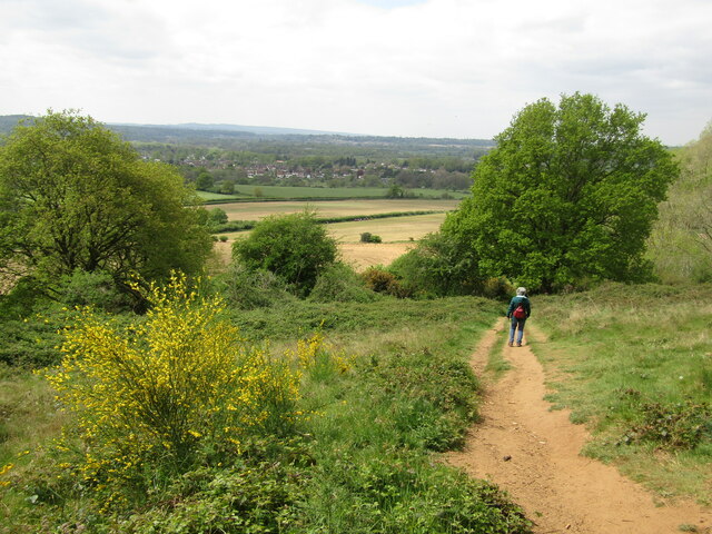
Chinthurst Hill is a prominent hill located in the county of Surrey, England. Situated near the town of Wonersh, it forms part of the picturesque Surrey Hills Area of Outstanding Natural Beauty. Standing at an elevation of around 200 meters (656 feet), the hill offers breathtaking panoramic views of the surrounding countryside.

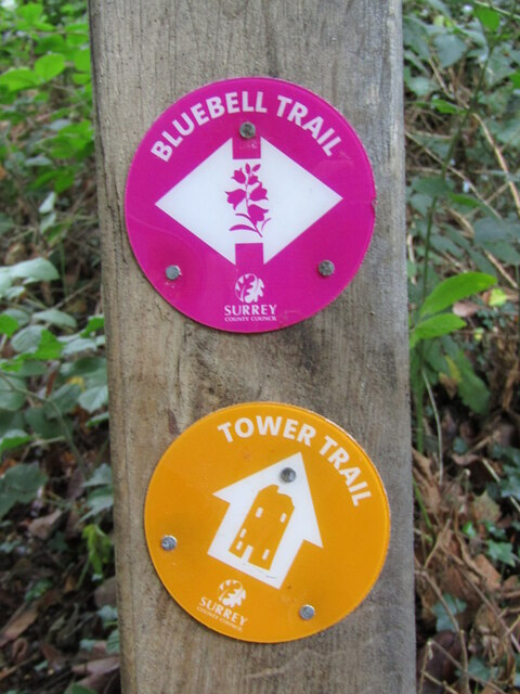
Covered in lush green vegetation, Chinthurst Hill is known for its diverse flora and fauna. The hill is home to a variety of plant species, including bluebells, primroses, and wild garlic, which create a vibrant and colorful landscape during spring and summer. The rich biodiversity of the area also attracts a range of wildlife, such as deer, badgers, and various bird species.

Chinthurst Hill is a popular destination for outdoor enthusiasts and nature lovers. It offers numerous walking and hiking trails, allowing visitors to explore its natural beauty. The hill's well-maintained footpaths provide access to different vantage points, where visitors can enjoy breathtaking views of the Surrey Hills and beyond.

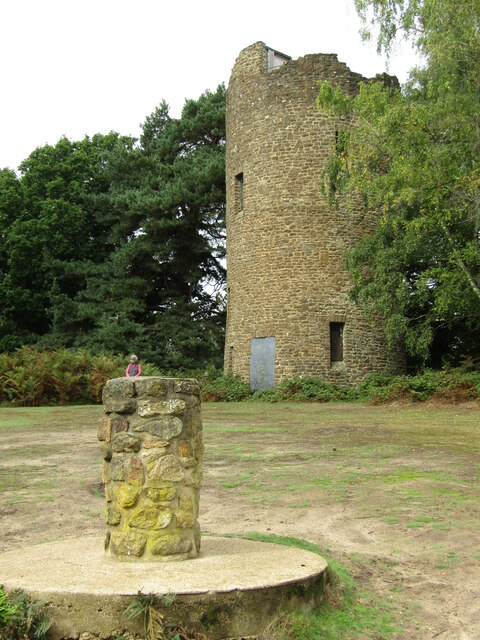
In addition to its natural attractions, Chinthurst Hill also holds historical significance. The remains of an Iron Age hillfort can be found on its summit, indicating human occupation of the area dating back thousands of years. The hillfort's earthworks and ditches are still visible today, providing an insight into the region's ancient past.

Overall, Chinthurst Hill in Surrey is a stunning natural landmark, offering a combination of scenic beauty, wildlife, and historical interest. Whether it's for a leisurely walk or a peaceful retreat, this hill provides a tranquil escape from the hustle and bustle of everyday life.

If you have any feedback on the listing, please let us know in the comments section below.

Chinthurst Hill Images

Images are sourced within 2km of 51.203016/-0.55129441 or Grid Reference TQ0145. Thanks to Geograph Open Source API. All images are credited.

The British Pullman at Shalford Bulleid Pacific No. 35028 'Clan Line' enters Shalford Station with the 'British Pullman' dining train on its circular trip through the Surrey hills.  The train is due to stop here to replenish its tender from a fire engine in the station yard.  The fire engine is operated by a company that organises water refills for steam locomotives at planned stopping places in their itinerary, now that no facilities exist at stations any more.
The British Pullman at Shalford
Bulleid Pacific No. 35028 'Clan Line' enters Shalford Station with the 'British Pullman' dining train on its circular trip through the Surrey hills. The train is due to stop here to replenish its tender from a fire engine in the station yard. The fire engine is operated by a company that organises water refills for steam locomotives at planned stopping places in their itinerary, now that no facilities exist at stations any more.
Guildford - Chantries Descending from Chantries Wood on the Greensand Ridge towards Shalford Mill in the Tillingbourne Valley below.
Guildford - Chantries
Descending from Chantries Wood on the Greensand Ridge towards Shalford Mill in the Tillingbourne Valley below.
Shalford - Old Toll House Historic building on the Guildford-Horsham road with a jettied first floor room which is above the pavement.
Shalford - Old Toll House
Historic building on the Guildford-Horsham road with a jettied first floor room which is above the pavement.
Shalford - The Queen Victoria A popular village pub beside Shalford Railway Station.
Shalford - The Queen Victoria
A popular village pub beside Shalford Railway Station.
Shalford - Railway Station On the North Downs Line, Shalford Station caters for trains to Guildford and Reading in one direction, plus to Redhill and Gatwick Airport the other way.
Shalford - Railway Station
On the North Downs Line, Shalford Station caters for trains to Guildford and Reading in one direction, plus to Redhill and Gatwick Airport the other way.
Shalford - Village Sign Pictorial sign showing St Christopher carrying the Christ Child through a shallow ford (hence Shalford).
Shalford - Village Sign
Pictorial sign showing St Christopher carrying the Christ Child through a shallow ford (hence Shalford).
Shalford - Swift Tower Swift nesting sculpture by Will Nash, on Shalford Common in the village centre.
The whole pole is ca 10 metres high.
Shalford - Swift Tower
Swift nesting sculpture by Will Nash, on Shalford Common in the village centre. The whole pole is ca 10 metres high.
Wonersh - St John the Baptist Church A church has been on this site since Saxon times.
Note the tribute to Queen Elizabeth II on the altar.
<span class="nowrap"><a title="www.wonershchurch.org.uk" rel="nofollow ugc noopener" href="http://www.wonershchurch.org.uk">Link</a><img style="margin-left:2px;" alt="External link" title="External link - shift click to open in new window" src="https://s1.geograph.org.uk/img/external.png" width="10" height="10"/></span>
Wonersh - St John the Baptist Church
A church has been on this site since Saxon times. Note the tribute to Queen Elizabeth II on the altar. LinkExternal link
Wonersh - St John the Baptist Church A church has been on this site since Saxon times.
This brass memorial is on the nave floor and celebrates Algernon Leslie Brown, vicar 1906-47.
<span class="nowrap"><a title="www.wonershchurch.org.uk" rel="nofollow ugc noopener" href="http://www.wonershchurch.org.uk">Link</a><img style="margin-left:2px;" alt="External link" title="External link - shift click to open in new window" src="https://s1.geograph.org.uk/img/external.png" width="10" height="10"/></span>
Wonersh - St John the Baptist Church
A church has been on this site since Saxon times. This brass memorial is on the nave floor and celebrates Algernon Leslie Brown, vicar 1906-47. LinkExternal link
Wonersh - St John the Baptist Church Tribute to Queen Elizabeth II (1926-2022) on the altar.
<span class="nowrap"><a title="www.wonershchurch.org.uk" rel="nofollow ugc noopener" href="http://www.wonershchurch.org.uk">Link</a><img style="margin-left:2px;" alt="External link" title="External link - shift click to open in new window" src="https://s1.geograph.org.uk/img/external.png" width="10" height="10"/></span>
Wonersh - St John the Baptist Church
Tribute to Queen Elizabeth II (1926-2022) on the altar. LinkExternal link
Wonersh - Queen Elizabeth Memorial Tribute Tribute to Queen Elizabeth II (1926-2022) on the altar in the parish church, St John the Baptist.
<span class="nowrap"><a title="www.wonershchurch.org.uk" rel="nofollow ugc noopener" href="http://www.wonershchurch.org.uk">Link</a><img style="margin-left:2px;" alt="External link" title="External link - shift click to open in new window" src="https://s1.geograph.org.uk/img/external.png" width="10" height="10"/></span>
Wonersh - Queen Elizabeth Memorial Tribute
Tribute to Queen Elizabeth II (1926-2022) on the altar in the parish church, St John the Baptist. LinkExternal link
Wonersh - Font Inside the parish church, St John the Baptist - the font bowl is restored sandstone but the gritstone base may be pre-Norman Conquest.
<span class="nowrap"><a title="www.wonershchurch.org.uk" rel="nofollow ugc noopener" href="http://www.wonershchurch.org.uk">Link</a><img style="margin-left:2px;" alt="External link" title="External link - shift click to open in new window" src="https://s1.geograph.org.uk/img/external.png" width="10" height="10"/></span>
Wonersh - Font
Inside the parish church, St John the Baptist - the font bowl is restored sandstone but the gritstone base may be pre-Norman Conquest. LinkExternal link
Wonersh - Font Cover Inside the parish church, St John the Baptist - the font cover was donated in 1915 and is a reduced copy of Michaelangelo's Madonna and Child in Bruges.
<span class="nowrap"><a title="www.wonershchurch.org.uk" rel="nofollow ugc noopener" href="http://www.wonershchurch.org.uk">Link</a><img style="margin-left:2px;" alt="External link" title="External link - shift click to open in new window" src="https://s1.geograph.org.uk/img/external.png" width="10" height="10"/></span>
Wonersh - Font Cover
Inside the parish church, St John the Baptist - the font cover was donated in 1915 and is a reduced copy of Michaelangelo's Madonna and Child in Bruges. LinkExternal link
Wonersh - Parish Church The church of St John the Baptist is on the site of a Saxon predecessor.
<span class="nowrap"><a title="www.wonershchurch.org.uk" rel="nofollow ugc noopener" href="http://www.wonershchurch.org.uk">Link</a><img style="margin-left:2px;" alt="External link" title="External link - shift click to open in new window" src="https://s1.geograph.org.uk/img/external.png" width="10" height="10"/></span>
Wonersh - Parish Church
The church of St John the Baptist is on the site of a Saxon predecessor. LinkExternal link
Chinthurst Hill - Waymarkers Two waymarkers point towards short circular walks (Bluebell Trail and Tower Trail) on Chinthurst Hill, north of Wonersh.
Chinthurst Hill - Waymarkers
Two waymarkers point towards short circular walks (Bluebell Trail and Tower Trail) on Chinthurst Hill, north of Wonersh.
Wonersh - From Chinthurst Hill Modern residential area to the north of Wonersh village centre - one of the prospects from heavily wooded Chinthurst Hill.
<span class="nowrap"><a title="www.surreywildlifetrust.org" rel="nofollow ugc noopener" href="http://www.surreywildlifetrust.org">Link</a><img style="margin-left:2px;" alt="External link" title="External link - shift click to open in new window" src="https://s1.geograph.org.uk/img/external.png" width="10" height="10"/></span>
Wonersh - From Chinthurst Hill
Modern residential area to the north of Wonersh village centre - one of the prospects from heavily wooded Chinthurst Hill. LinkExternal link
Chinthurst Hill - Tower The stone tower is a folly, built in the late 1930s for Lord Inchcape. The small column in the foreground carries a toposcope but many of its given views are obscured by trees.
<span class="nowrap"><a title="www.surreywildlifetrust.org" rel="nofollow ugc noopener" href="http://www.surreywildlifetrust.org">Link</a><img style="margin-left:2px;" alt="External link" title="External link - shift click to open in new window" src="https://s1.geograph.org.uk/img/external.png" width="10" height="10"/></span>
Chinthurst Hill - Tower
The stone tower is a folly, built in the late 1930s for Lord Inchcape. The small column in the foreground carries a toposcope but many of its given views are obscured by trees. LinkExternal link
Wonersh - Grantley Arms Historic timber-framed pub, ca 500 years old, in the centre of Wonersh village.
<span class="nowrap"><a title="www.thegrantleyarms.co.uk" rel="nofollow ugc noopener" href="http://www.thegrantleyarms.co.uk">Link</a><img style="margin-left:2px;" alt="External link" title="External link - shift click to open in new window" src="https://s1.geograph.org.uk/img/external.png" width="10" height="10"/></span>
Wonersh - Grantley Arms
Historic timber-framed pub, ca 500 years old, in the centre of Wonersh village. LinkExternal link
Show me another place!

Chinthurst Hill is located at Grid Ref: TQ0145 (Lat: 51.203016, Lng: -0.55129441)

Administrative County: Surrey

District: Waverley

Police Authority: Surrey

What 3 Words

///jazzy.stops.blast. Near Bramley, Surrey

Related Wikis

Chinthurst Hill

Chinthurst Hill is a 17.2-hectare (43-acre) Local Nature Reserve south of Guildford in Surrey. It is owned by Surrey County Council and managed by Surrey...
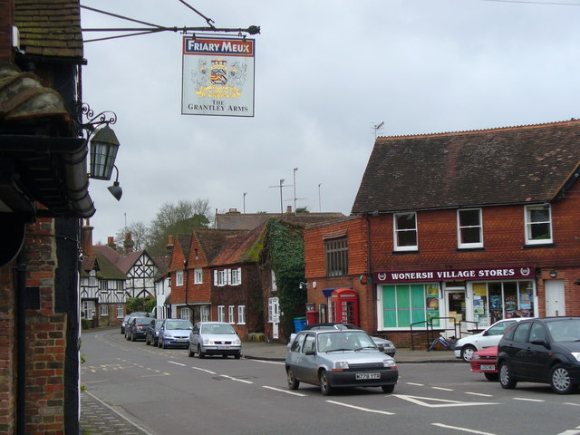
Wonersh

Wonersh is a village and civil parish in the Waverley district of Surrey, England and Surrey Hills Area of Outstanding Natural Beauty. Wonersh contains...

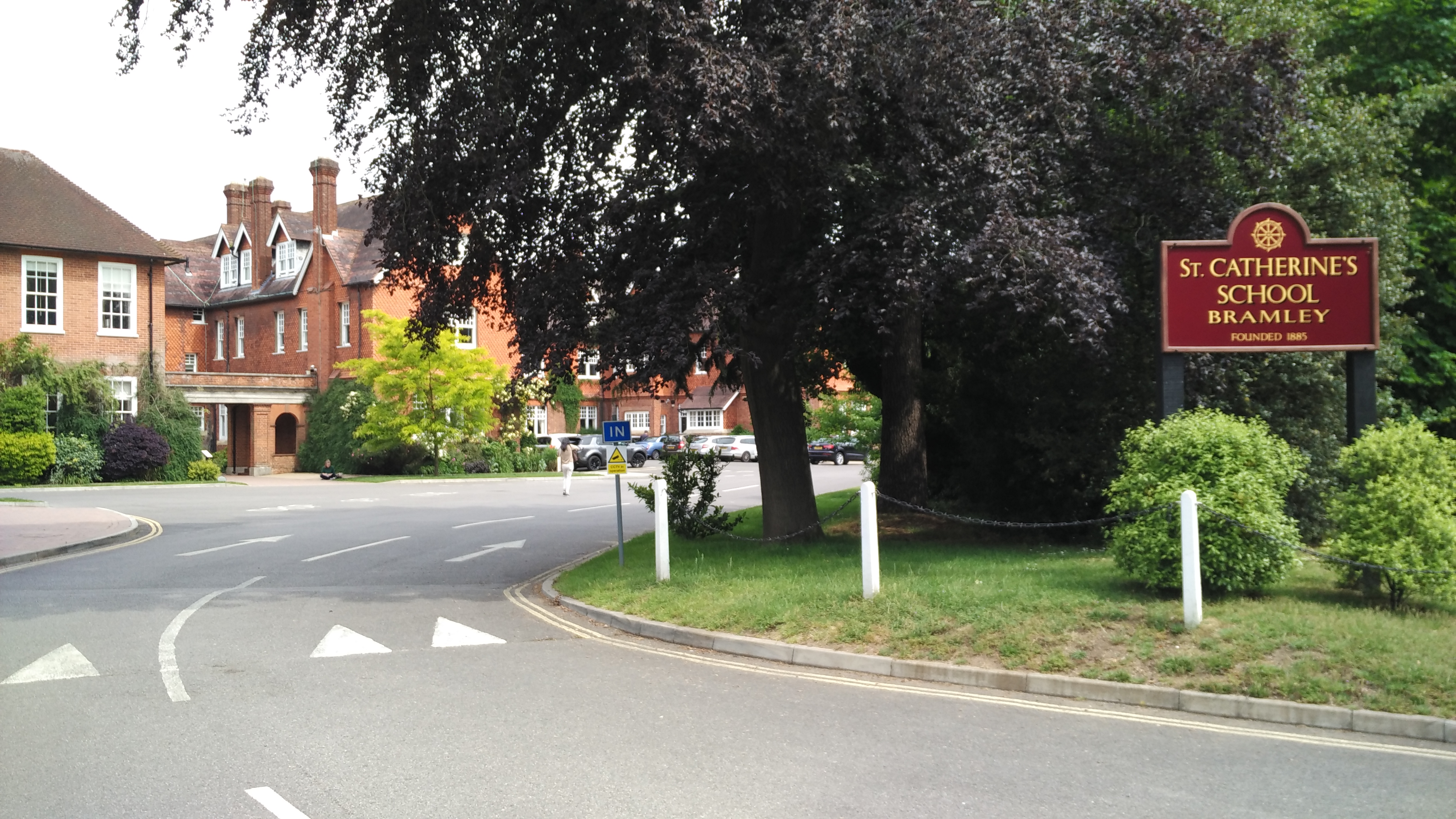
St Catherine's School, Bramley

St Catherine's School is an independent girls' boarding and day school in the village of Bramley, near Guildford, Surrey, England. The school is divided...

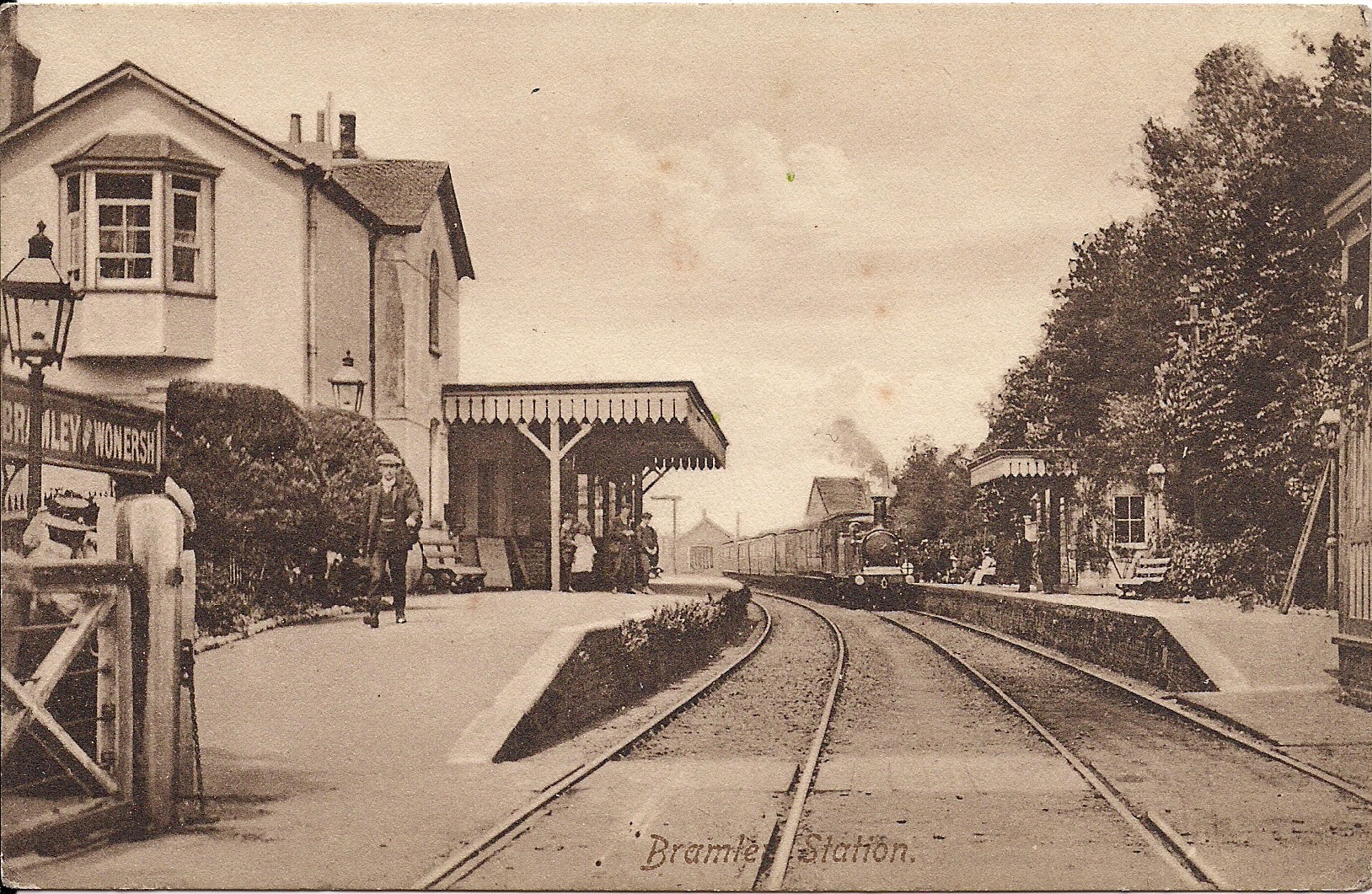
Bramley & Wonersh railway station

Bramley & Wonersh was a railway station on the Cranleigh Line. It served the villages of Bramley and Wonersh in Surrey. == History == Opened in 1865 as...
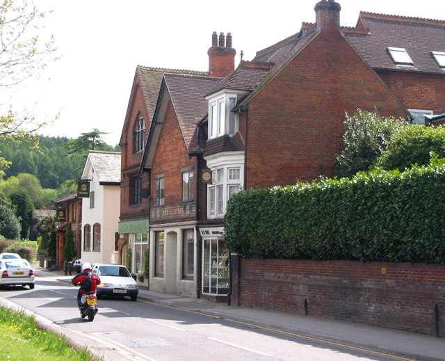
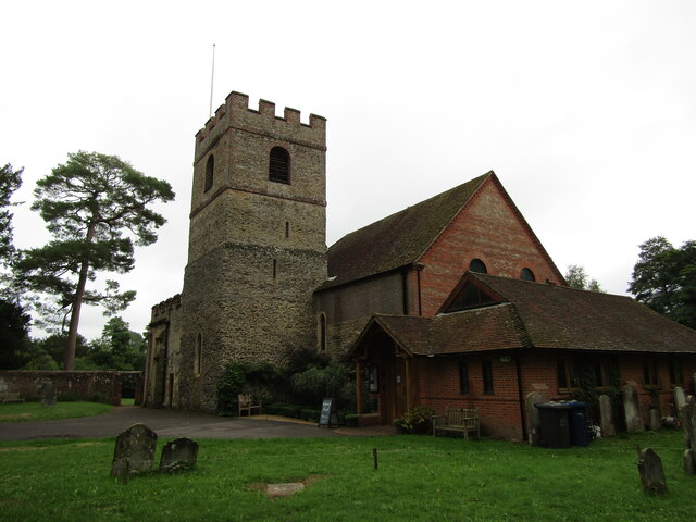
Bramley, Surrey

Bramley is a village and civil parish about three miles (5 km) south of Guildford in the Borough of Waverley in Surrey, south east England. Most of the...

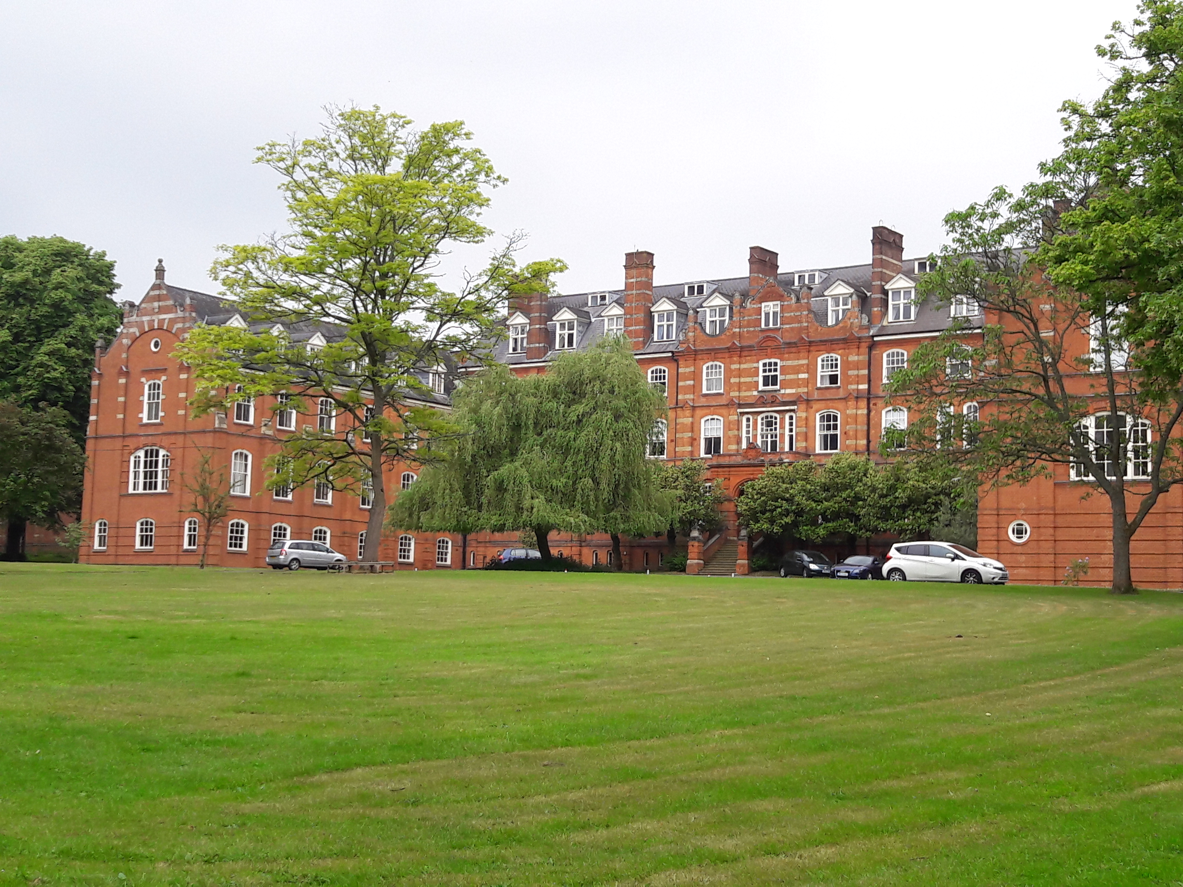
St John's Seminary, Wonersh

St John's Seminary was a Roman Catholic seminary located at Wonersh near Guildford in Surrey, in the Diocese of Arundel and Brighton, United Kingdom. St...
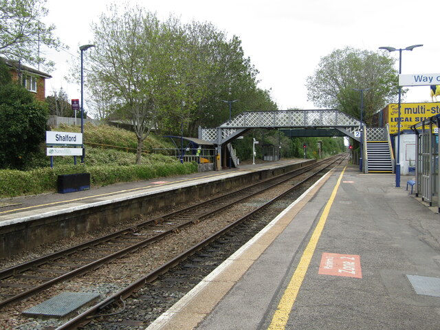
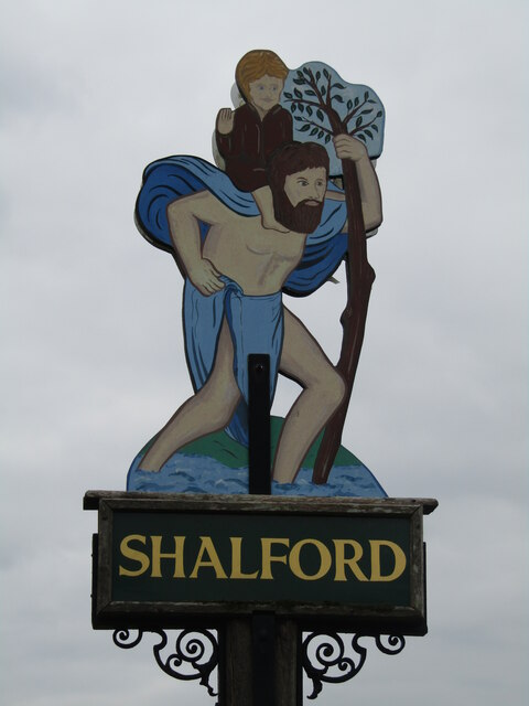
Shalford, Surrey

Shalford is a village and civil parish in Surrey, England on the A281 Horsham road immediately south of Guildford. It has a railway station which is between...

Chilworth, Surrey

Chilworth is a village in the Guildford borough of Surrey, England. It is located in the Tillingbourne valley, southeast of Guildford. == Geography... ==

Nearby Amenities

Located within 500m of 51.203016,-0.55129441
Chinthurst Hill
Ele: 121
Natural: peak
Source: npe
Lat/Long: 51.2027785/-0.5517341
Direction: NE-SE
Information: map
Map Type: toposcope
Tourism: viewpoint
Wikimedia Commons: File:The_viewpoint,_Chinthurst_Hill_-_geograph.org.uk_-_4149436.jpg
Lat/Long: 51.2027131/-0.5510311
Historic: yes
Man Made: water_well
Material: dry_stone
Wikimedia Commons: File:Well_on_Chinthurst_Hill_-_geograph.org.uk_-_1765863.jpg
Lat/Long: 51.2019824/-0.5514667
Bus Stop
Wonersh Common
Naptan AtcoCode: 40004411089A
Naptan Bearing: N
Naptan CommonName: Wonersh Common
Naptan Indicator: Just Before
Naptan Landmark: Wonersh Common
Naptan NaptanCode: surdtmdj
Naptan Street: Kings Road
Naptan Verified: no
Source: naptan_import
Lat/Long: 51.2029253/-0.5446313
Wonersh Common
Naptan AtcoCode: 40004411089B
Naptan Bearing: S
Naptan BusStopType: CUS
Naptan CommonName: Wonersh Common
Naptan Indicator: Just after
Naptan Landmark: Wonersh Common
Naptan NaptanCode: surgpwgj
Naptan Street: Kings Road
Naptan Verified: no
Source: naptan_import
Lat/Long: 51.2028664/-0.5444803
Bench
Lat/Long: 51.2025885/-0.55321
Bench
Lat/Long: 51.2037617/-0.5510443
Bench
Lat/Long: 51.2037367/-0.5504645
Crossing
Lat/Long: 51.2031043/-0.5443469
The data included in this document is from www.openstreetmap.org. The data is made available under ODbL.

Have you been to Chinthurst Hill?

Leave your review of Chinthurst Hill below (or comments, questions and feedback).