Tire Ewe Hill

Hill, Mountain in Yorkshire

England

Tire Ewe Hill

Direction Sign – Signpost on the B1249 Front Street in Langtoft Located next to the war memorial on the southwest side of the junction of the B1249 Front Street and Sledmere Road in Langtoft parish. 3 arms but no finial. See also <a title="https://www.geograph.org.uk/photo/6543487" href="https://www.geograph.org.uk/photo/6543487">Link</a>.

Milestone Society National ID: YE_TA0066
Direction Sign – Signpost on the B1249 Front Street in Langtoft Credit: D Phillips

The requested URL returned error: 429 Too Many Requests

If you have any feedback on the listing, please let us know in the comments section below.

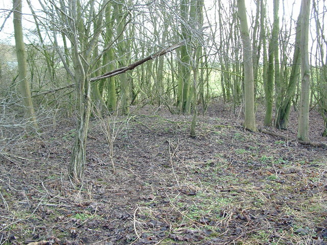
Tire Ewe Hill Images

Images are sourced within 2km of 54.078955/-0.45344363 or Grid Reference TA0165. Thanks to Geograph Open Source API. All images are credited.

Direction Sign – Signpost on the B1249 Front Street in Langtoft Located next to the war memorial on the southwest side of the junction of the B1249 Front Street and Sledmere Road in Langtoft parish. 3 arms but no finial. See also <a title="https://www.geograph.org.uk/photo/6543487" href="https://www.geograph.org.uk/photo/6543487">Link</a>.

Milestone Society National ID: YE_TA0066
Direction Sign – Signpost on the B1249 Front Street in Langtoft
Located next to the war memorial on the southwest side of the junction of the B1249 Front Street and Sledmere Road in Langtoft parish. 3 arms but no finial. See also Link. Milestone Society National ID: YE_TA0066
Entrance  to  Bridge  Gate  (track)  from  Sledmere  Road
Entrance to Bridge Gate (track) from Sledmere Road
Wolds  valley  going  down  into  Kilham  Bottoms These grass valleys are either beef cattle or sheep pasture
Wolds valley going down into Kilham Bottoms
These grass valleys are either beef cattle or sheep pasture
Track  and  bridleway  toward  Langtoft A few inches of soil on top of the chalk
Track and bridleway toward Langtoft
A few inches of soil on top of the chalk
Track  and  bridleway  down  to  Accommodation  Road The rooftops of Langtoft can be seen in the valley
Track and bridleway down to Accommodation Road
The rooftops of Langtoft can be seen in the valley
Former  Primitive  Methodist  Chapel  and  School.  Cottam  Lane The plaque above the white door reads, Primitive Methodist Chapel built 1839. At the far end of the building between the upstairs windows is a plaque reading, Primitive Methodist School with an indistinct date which could be 1848
Former Primitive Methodist Chapel and School. Cottam Lane
The plaque above the white door reads, Primitive Methodist Chapel built 1839. At the far end of the building between the upstairs windows is a plaque reading, Primitive Methodist School with an indistinct date which could be 1848
Cottam  Lane  toward  Langtoft  with  Communication  Mast
Cottam Lane toward Langtoft with Communication Mast
Cottam  Lane  with  Woodbine  Farm  on  the  left
Cottam Lane with Woodbine Farm on the left
Access  road  to  Crooked  Dale  Farm
Access road to Crooked Dale Farm
Old  WW2  buildings  reduced  to  rubble I took a Geograph on 19th Nov 2008 when derelict building was still standing. The high Wolds in this area were used for tank training before D Day
Old WW2 buildings reduced to rubble
I took a Geograph on 19th Nov 2008 when derelict building was still standing. The high Wolds in this area were used for tank training before D Day
Langtoft school The benchmark is cut into the north-east face of the village primary school. The brick wall is adjacent to the pavement.
Langtoft school
The benchmark is cut into the north-east face of the village primary school. The brick wall is adjacent to the pavement.
Langtoft school There is a benchmark cut into the north-east face of the brick-built village primary school. The brick wall is adjacent to the pavement.
Langtoft school
There is a benchmark cut into the north-east face of the brick-built village primary school. The brick wall is adjacent to the pavement.
Crooked Dale, south of Langtoft: aerial 2023
Wolds countryside A view eastwards from the junction of two minor roads at Cottam, looking towards Crooked Dale.
Wolds countryside
A view eastwards from the junction of two minor roads at Cottam, looking towards Crooked Dale.
Lane and footpath towards Cottam House The lane, now a private road, leads towards Cottam House and the deserted village site of Cottam. The roadside signpost appears to have seen better days.
Lane and footpath towards Cottam House
The lane, now a private road, leads towards Cottam House and the deserted village site of Cottam. The roadside signpost appears to have seen better days.
The way to Cottam House Farm
Concrete  roads  of  WW2  Cottam  Airfield Now back to farmland these concrete strips are not linked to any roads.
Concrete roads of WW2 Cottam Airfield
Now back to farmland these concrete strips are not linked to any roads.
Nashville
Nashville
Show me another place!

Tire Ewe Hill is located at Grid Ref: TA0165 (Lat: 54.078955, Lng: -0.45344363)

Division: East Riding

Unitary Authority: East Riding of Yorkshire

Police Authority: Humberside

What 3 Words

///empire.roadblock.tanked. Near Kilham, East Yorkshire

Related Wikis

Langtoft, East Riding of Yorkshire

Langtoft is a small village and civil parish in the East Riding of Yorkshire, England. It is situated 6 miles (10 km) north of Driffield town centre, and...

Cottam, East Riding of Yorkshire

Cottam is a hamlet and civil parish in the East Riding of Yorkshire, England. The hamlet is west of the B1249 Skipsea to Staxton road, and in the Yorkshire...

RAF Cottam

Royal Air Force Cottam or more simply RAF Cottam is a former Royal Air Force satellite airfield near Cottam in the East Riding of Yorkshire, England and...

Danes Graves

Danes Graves is an archaeological site in the East Riding of Yorkshire. It forms part of the Arras Culture of inhumation and chariot burial prevalent in...

Nearby Amenities

Located within 500m of 54.078955,-0.45344363
Line Management: termination
Material: wood
Power: pole
Transformer: distribution
Lat/Long: 54.0756012/-0.4583484
Man Made: monitoring_station
Monitoring Weather: yes
Lat/Long: 54.0756055/-0.4583933
The data included in this document is from www.openstreetmap.org. The data is made available under ODbL.

Have you been to Tire Ewe Hill?

Leave your review of Tire Ewe Hill below (or comments, questions and feedback).