Kirby-le-Soken

Settlement in Essex Tendring

England

Kirby-le-Soken

Glebe Barn Essex Wildlife Trust's <span class="nowrap"><a title="http://www.essexwt.org.uk/" rel="nofollow ugc noopener" href="http://www.essexwt.org.uk/">Link</a><img style="margin-left:2px;" alt="External link" title="External link - shift click to open in new window" src="https://s1.geograph.org.uk/img/external.png" width="10" height="10"/></span> Glebe Barn Reserve is one of its smallest closed reserves. It is not open to the public. The plot seems to be an overgrown garden in a residential street that would be a prime candidate to vanish under concrete if it were not for the Trust's Stewardship. On the northern side of the reserve there is what appears to be a wartime <a href="https://www.geograph.org.uk/photo/3053856">TM2119 : Surface Shelter</a>. You can continue on a virtual tour of Wildlife Trust Reserves in Essex by visiting <a href="https://www.geograph.org.uk/photo/4048840">TQ9383 : Gunners Park Reserve</a>
Glebe Barn Credit: Glyn Baker

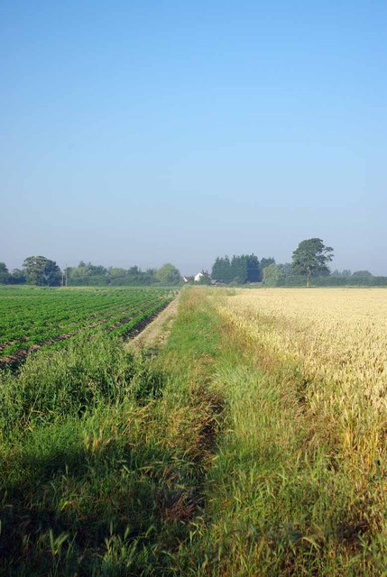
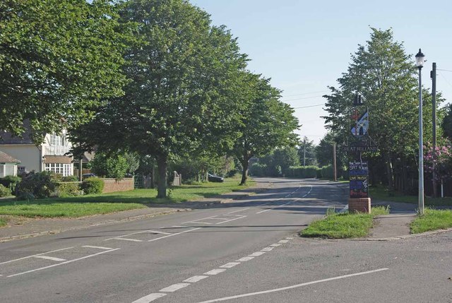
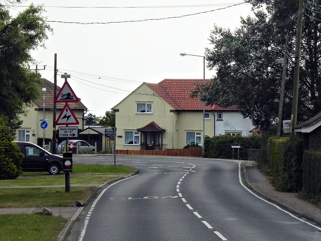
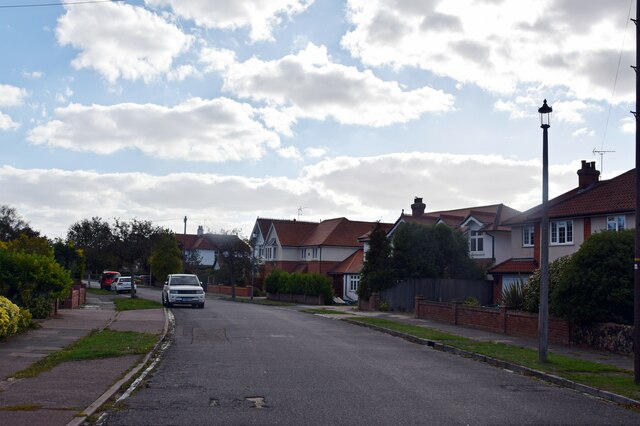
Kirby-le-Soken is a small village located in the county of Essex, England. Situated near the coast, it is part of the Tendring district. The village is nestled amidst picturesque countryside, with rolling hills and fields surrounding it, creating a serene and tranquil atmosphere.

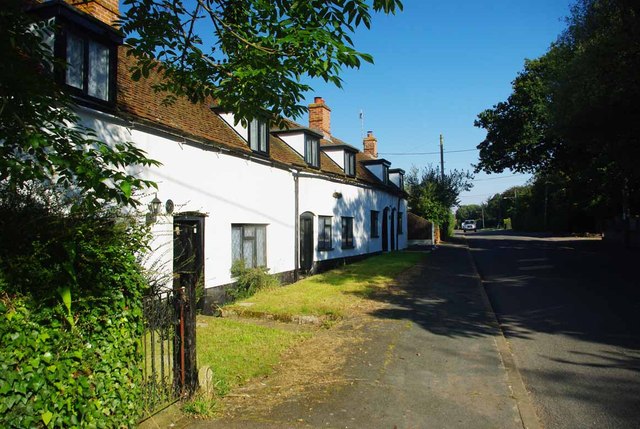
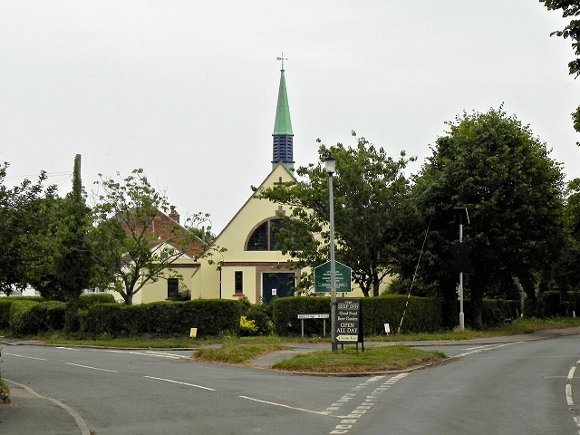
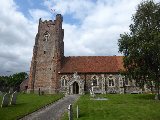
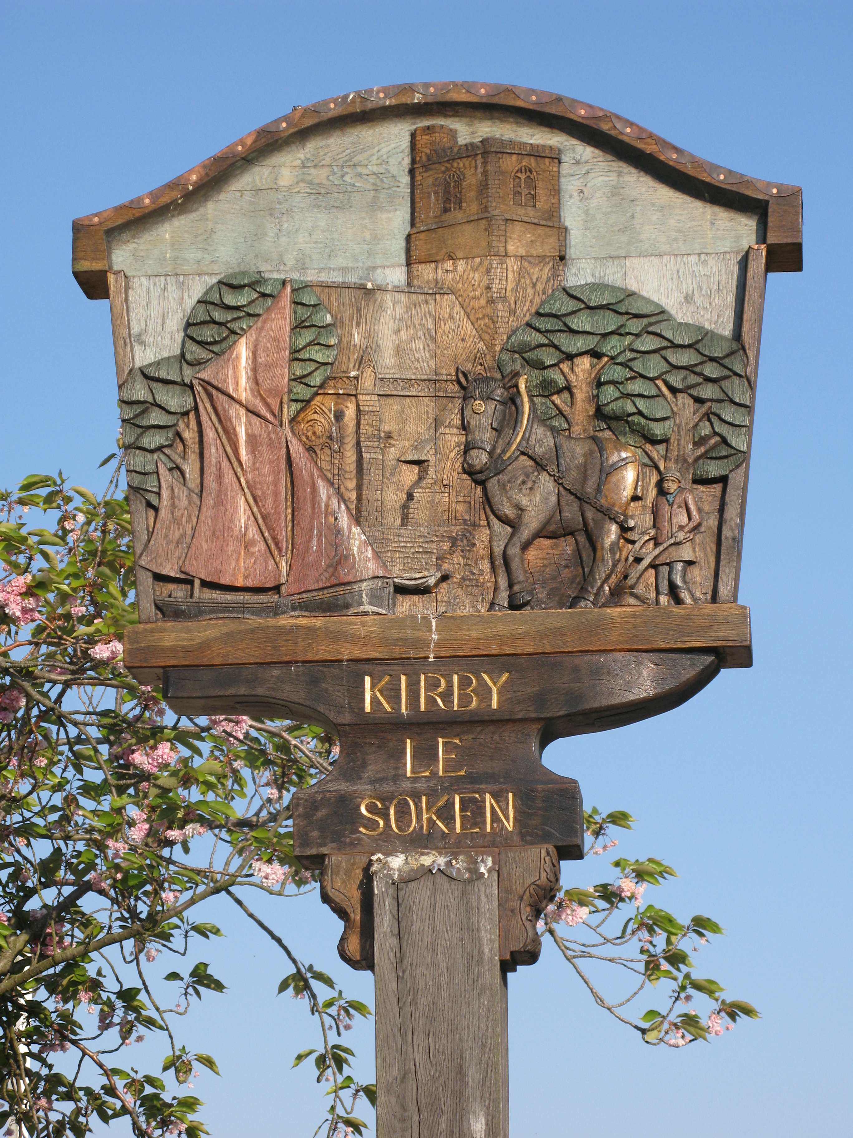
The origins of Kirby-le-Soken can be traced back to the medieval period, and it has retained much of its historical charm. The village is characterized by its traditional architecture, with a mixture of timber-framed houses and brick cottages lining the streets. The local church, St. Michael's, stands proudly at the heart of the village, showcasing beautiful Norman and Gothic architecture.

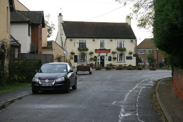
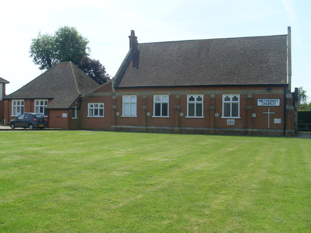
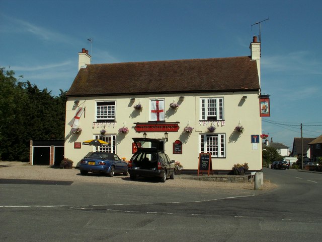
Although small in size, Kirby-le-Soken offers a range of amenities to its residents. The village has a primary school, providing education for local children, and a village hall that serves as a hub for community events and activities. There is also a local pub, where residents and visitors can enjoy a drink and sample traditional British pub food.

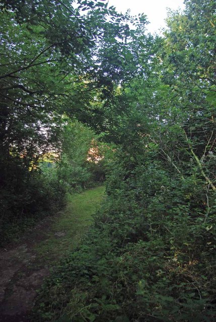
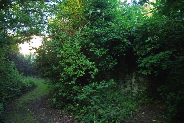
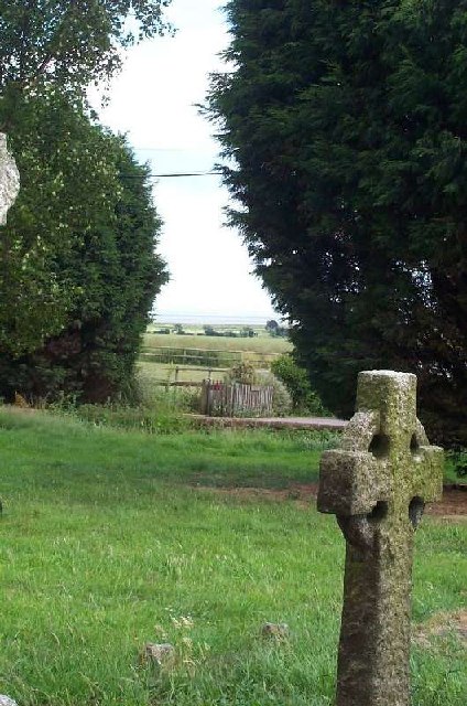
The surrounding countryside provides ample opportunities for outdoor activities and exploration. There are several scenic walking trails and nature reserves nearby, offering breathtaking views and a chance to observe local wildlife. The village is also within close proximity to the coast, allowing residents and visitors to enjoy sandy beaches and coastal walks.

Overall, Kirby-le-Soken is a charming and idyllic village, offering a peaceful retreat from the hustle and bustle of city life. Its rich history, beautiful architecture, and natural surroundings make it an attractive destination for those seeking a quintessential English countryside experience.

If you have any feedback on the listing, please let us know in the comments section below.

Kirby-le-Soken Images

Images are sourced within 2km of 51.843441/1.2214405 or Grid Reference TM2221. Thanks to Geograph Open Source API. All images are credited.

Glebe Barn Essex Wildlife Trust's <span class="nowrap"><a title="http://www.essexwt.org.uk/" rel="nofollow ugc noopener" href="http://www.essexwt.org.uk/">Link</a><img style="margin-left:2px;" alt="External link" title="External link - shift click to open in new window" src="https://s1.geograph.org.uk/img/external.png" width="10" height="10"/></span> Glebe Barn Reserve is one of its smallest closed reserves. It is not open to the public. The plot seems to be an overgrown garden in a residential street that would be a prime candidate to vanish under concrete if it were not for the Trust's Stewardship. On the northern side of the reserve there is what appears to be a wartime <a href="https://www.geograph.org.uk/photo/3053856">TM2119 : Surface Shelter</a>. You can continue on a virtual tour of Wildlife Trust Reserves in Essex by visiting <a href="https://www.geograph.org.uk/photo/4048840">TQ9383 : Gunners Park Reserve</a>
Glebe Barn
Essex Wildlife Trust's LinkExternal link Glebe Barn Reserve is one of its smallest closed reserves. It is not open to the public. The plot seems to be an overgrown garden in a residential street that would be a prime candidate to vanish under concrete if it were not for the Trust's Stewardship. On the northern side of the reserve there is what appears to be a wartime TM2119 : Surface Shelter. You can continue on a virtual tour of Wildlife Trust Reserves in Essex by visiting TQ9383 : Gunners Park Reserve
Surface Shelter Hiding below the honeysuckle in <a href="https://www.geograph.org.uk/photo/3053840">TM2119 : Glebe Barn</a> is what appears to be a WW2 air raid shelter.
Surface Shelter
Hiding below the honeysuckle in TM2119 : Glebe Barn is what appears to be a WW2 air raid shelter.
Bat Boxes in Glebe Barn The largest tree in <a href="https://www.geograph.org.uk/photo/3053840">TM2119 : Glebe Barn</a> sports a brace of bat boxes
Bat Boxes in Glebe Barn
The largest tree in TM2119 : Glebe Barn sports a brace of bat boxes
Great Holland Methodist Church See the rear elevation at <a href="https://www.geograph.org.uk/photo/2040324">TM2119 : Methodist Church, Great Holland, Essex</a>
Great Holland Methodist Church
Footpath to Seven Acres Farm You can also reach the <a href="https://www.geograph.org.uk/photo/402105">TM2019 : Footpath near Great Holland Mill</a> by a bit of a roundabout route.
Footpath to Seven Acres Farm
You can also reach the TM2019 : Footpath near Great Holland Mill by a bit of a roundabout route.
B1032 At Great Holland Village sign and Little Clacton Rd at the Junction with Manor Rd
B1032 At Great Holland
Village sign and Little Clacton Rd at the Junction with Manor Rd
Tudor Cottages Not just a description it is also the address
Tudor Cottages
Not just a description it is also the address
The Ship Inn
The Ship Inn
Great Holland The B1032 runs for 5½ miles between Clacton-on-Sea and Kirby Cross, passing through Holland-on-Sea and Great Holland.
Great Holland
The B1032 runs for 5½ miles between Clacton-on-Sea and Kirby Cross, passing through Holland-on-Sea and Great Holland.
Great Holland Methodist Church, Main Road The B1032 runs for 5½ miles between Clacton-on-Sea and Kirby Cross, passing through Holland-on-Sea and Great Holland.
Great Holland Methodist Church, Main Road
The B1032 runs for 5½ miles between Clacton-on-Sea and Kirby Cross, passing through Holland-on-Sea and Great Holland.
Great Holland, Main Road The B1032 runs for 5½ miles between Clacton-on-Sea and Kirby Cross, passing through Holland-on-Sea and Great Holland.
Great Holland, Main Road
The B1032 runs for 5½ miles between Clacton-on-Sea and Kirby Cross, passing through Holland-on-Sea and Great Holland.
Frinton Methodist Church (1) Situated in Ashlyns Road CO13 9ET, this Church is one of nineteen such churches in the Tendring Methodist Circuit which covers North East Essex. Services are held here every Sunday at 11.00am, whilst activities take place here during the week.
Frinton Methodist Church (1)
Situated in Ashlyns Road CO13 9ET, this Church is one of nineteen such churches in the Tendring Methodist Circuit which covers North East Essex. Services are held here every Sunday at 11.00am, whilst activities take place here during the week.
Frinton Methodist Church (2) This photo shows the side view of the Methodist Church in Ashlyns Road with the adjacent Church Hall to the left of the photo.
Frinton Methodist Church (2)
This photo shows the side view of the Methodist Church in Ashlyns Road with the adjacent Church Hall to the left of the photo.
Ashlyns Road, Frinton-on-Sea A residential road about a kilometre from the seafront
Ashlyns Road, Frinton-on-Sea
A residential road about a kilometre from the seafront
Great Holland, All Saints
Fourth Avenue., Frinton-on-Sea Looking south on this residential road.
Fourth Avenue., Frinton-on-Sea
Looking south on this residential road.
To the sea from churchyard of All Saints church, Great Holland
'The Ship Inn', Great Holland, Essex
Show me another place!

Kirby-le-Soken is located at Grid Ref: TM2221 (Lat: 51.843441, Lng: 1.2214405)

Administrative County: Essex

District: Tendring

Police Authority: Essex

What 3 Words

///file.sped.mocked. Near Frinton-on-Sea, Essex

Related Wikis

Kirby Cross

Kirby Cross is a village in Tendring district, Essex, England. It is situated near to Kirby-le-Soken and Frinton-on-Sea. Historically, Kirby Cross was...

Kirby Cross railway station

Kirby Cross railway station is on the Walton branch of the Sunshine Coast Line in the East of England, serving the village of Kirby Cross, Essex. It is...

Kirby-le-Soken

Kirby-le-Soken is a village and former civil parish, now in the parish of Frinton and Walton, in the Tendring district in north-east Essex, England, which...
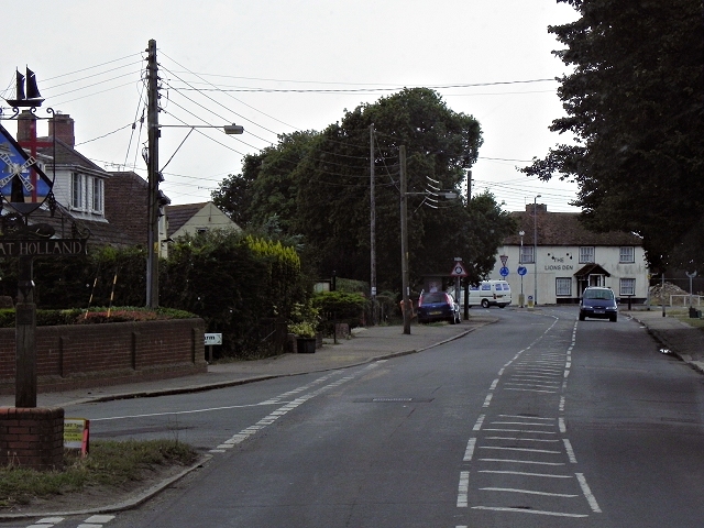
Great Holland

Great Holland is a village and former civil parish, now in the parish of Frinton and Walton, in the Tendring district, in the county of Essex, England...

Nearby Amenities

Located within 500m of 51.843441,1.2214405
Kirby Cross Station LC
Railway: crossing
Lat/Long: 51.8412635/1.2153657
Mini Roundabout
Direction: clockwise
Lat/Long: 51.8417975/1.218787
Post Box
Mapillary: 684442492674243
Post Box Mounting: telegraph_pole
Post Box Type: lamp
Postal Code: CO13 0LD
Ref: CO13 11
Survey Date: 2022-04-10
Lat/Long: 51.8418932/1.2256203
Post Box
Mapillary: 184452583798599
Post Box Mounting: pier
Post Box Type: lamp
Postal Code: CO13 0LW
Ref: CO13 94
Survey Date: 2021-09-17
Lat/Long: 51.843448/1.2205524
Post Box
Post Box Type: lamp
Ref: CO13 139
Royal Cypher: EIIR
Royal Cypher Wikidata: Q33102113
Lat/Long: 51.8400598/1.2261304
Bus Stop
Claire Road
Naptan AtcoCode: 150032009001
Naptan Bearing: W
Naptan CommonName: Claire Road
Naptan Indicator: Adj
Naptan Landmark: Claire Road
Naptan NaptanCode: esxgjwga
Naptan PlusbusZoneRef: CLACTON
Naptan Street: Thorpe Road
Public Transport: platform
Shelter: yes
Source: naptan_import; survey
Lat/Long: 51.8418373/1.2173607
Bus Stop
Kirby Cross Railway Station
Naptan AtcoCode: 150032009002
Naptan Bearing: SE
Naptan CommonName: Kirby Cross Railway Station
Naptan Indicator: Opp
Naptan Landmark: Kirby Cross Railway Station
Naptan NaptanCode: esxgjwgd
Naptan PlusbusZoneRef: CLACTON
Naptan Street: Thorpe Road
Public Transport: platform
Source: naptan_import; survey
Timetable Case: yes
Lat/Long: 51.8422948/1.2154534
Bus Stop
Parkside
Naptan AtcoCode: 150032010022
Naptan Bearing: S
Naptan CommonName: Parkside
Naptan Indicator: Opp
Naptan Landmark: Parkside
Naptan NaptanCode: esxgjtpj
Naptan PlusbusZoneRef: CLACTON
Naptan Street: Halstead Road
Public Transport: platform
Route Ref: 8;8A;107
Source: naptan_import; survey
Lat/Long: 51.8467183/1.2214863
Bus Stop
Parkside
Naptan AtcoCode: 150032010023
Naptan Bearing: N
Naptan CommonName: Parkside
Naptan Indicator: Adj
Naptan Landmark: Parkside
Naptan NaptanCode: esxgjtpm
Naptan PlusbusZoneRef: CLACTON
Naptan Street: Halstead Road
Public Transport: platform
Route Ref: 8;8A;107
Source: naptan_import; survey
Lat/Long: 51.8456879/1.22134
Bus Stop
Halstead Road School
Naptan AtcoCode: 150032010024
Naptan Bearing: N
Naptan CommonName: Halstead Road School
Naptan Indicator: Adj
Naptan Landmark: Halstead Road School
Naptan NaptanCode: esxgjtpt
Naptan PlusbusZoneRef: CLACTON
Naptan Street: Halstead Road
Public Transport: platform
Route Ref: 8;8A;107
Source: naptan_import; survey
Lat/Long: 51.8437944/1.2208005
Bus Stop
Halstead Road
Naptan AtcoCode: 150032010025
Naptan Bearing: NE
Naptan CommonName: Halstead Road
Naptan Crossing: Frinton Road
Naptan Indicator: NE-bound
Naptan Landmark: Halstead Road
Naptan NaptanCode: esxgjtpw
Naptan PlusbusZoneRef: CLACTON
Naptan Street: Halstead Road
Public Transport: platform
Route Ref: 8;8A;107
Source: naptan_import; survey
Lat/Long: 51.8427196/1.219987
Bus Stop
Kirby Cross
Naptan AtcoCode: 150032010026
Naptan Bearing: E
Naptan CommonName: Kirby Cross
Naptan Crossing: Bemerton Gardens
Naptan Indicator: E-bound
Naptan Landmark: Kirby Cross
Naptan NaptanCode: esxgjtwa
Naptan PlusbusZoneRef: CLACTON
Naptan Street: Frinton Road
Public Transport: platform
Shelter: yes
Source: naptan_import; survey
Lat/Long: 51.8421228/1.2201414
Bus Stop
Coronation Garage
Naptan AtcoCode: 150032010027
Naptan Bearing: W
Naptan CommonName: Coronation Garage
Naptan Crossing: Bemerton Gardens
Naptan Indicator: W-bound
Naptan Landmark: Coronation Garage
Naptan NaptanCode: esxgjtwd
Naptan PlusbusZoneRef: CLACTON
Naptan Street: Frinton Road
Public Transport: platform
Source: naptan_import; survey
Lat/Long: 51.8418967/1.2230274
Bus Stop
Chestnut Avenue
Naptan AtcoCode: 150032010028
Naptan Bearing: E
Naptan CommonName: Chesnut Avenue
Naptan Indicator: Adj
Naptan Landmark: Chesnut Avenue
Naptan NaptanCode: esxgjtwg
Naptan PlusbusZoneRef: CLACTON
Naptan Street: Frinton Road
Public Transport: platform
Source: naptan_import; survey
Lat/Long: 51.8418784/1.2265003
Bus Stop
Elm Grove
Naptan AtcoCode: 150032010029
Naptan Bearing: NW
Naptan CommonName: Elm Grove
Naptan Indicator: Adj
Naptan Landmark: Elm Grove
Naptan NaptanCode: esxgjtwj
Naptan PlusbusZoneRef: CLACTON
Naptan Street: Frinton Road
Public Transport: platform
Shelter: yes
Source: naptan_import; survey
Timetable Case: yes
Lat/Long: 51.8413846/1.2278873
Bus Stop
Halstead Road School
Flag: no
Naptan AtcoCode: 150032010Y24
Naptan Bearing: S
Naptan BusStopType: CUS
Naptan CommonName: Halstead Road School
Naptan Indicator: Opp
Naptan Landmark: Halstead Road School
Naptan NaptanCode: esxjdgdp
Naptan PlusbusZoneRef: CLACTON
Naptan Street: Halstead Road
Note: Stop opposite refers
Public Transport: platform
Source: naptan_import; survey
Lat/Long: 51.8437725/1.2209275
Bus Stop
Kirby Cross
Naptan AtcoCode: 1500IM41
Naptan Bearing: S
Naptan CommonName: Kirby Cross
Naptan Crossing: Thorpe Road
Naptan Indicator: S-bound
Naptan Landmark: Kirby Cross
Naptan NaptanCode: esxgjwdw
Naptan PlusbusZoneRef: CLACTON
Naptan Street: Kirby Road
Public Transport: platform
Shelter: yes
Source: naptan_import; survey
Timetable Case: yes
Lat/Long: 51.8412794/1.2188596
Crossing
Crossing: zebra
Lat/Long: 51.8416369/1.2272032
Kirby Cross
Place: village
Wikidata: Q6414911
Lat/Long: 51.8419302/1.2195049
Power: pole
Source: bing
Lat/Long: 51.8477987/1.2197478
Power: pole
Source: bing
Lat/Long: 51.8473471/1.2215288
Power: pole
Source: bing
Lat/Long: 51.8467866/1.2237384
Power: pole
Source: bing
Lat/Long: 51.8464164/1.2251947
Power: pole
Source: bing
Lat/Long: 51.8460504/1.2266209
Power: pole
Source: bing
Lat/Long: 51.8462553/1.2196105
Power: pole
Source: bing
Lat/Long: 51.8470792/1.2196769
Power: pole
Source: bing
Lat/Long: 51.8454256/1.2195689
Power: pole
Source: bing
Lat/Long: 51.8446144/1.2194355
Bench
Lat/Long: 51.8443597/1.2200613
Waste Basket
Lat/Long: 51.8443754/1.2201011
Crossing
Crossing: zebra
Lat/Long: 51.8421107/1.2219826
Barrier: bollard
Lat/Long: 51.841062/1.2229478
Peter Adams Accountants
Addr City: Kirby Cross
Addr Housename: Unit 6b
Addr Postcode: CO13 0LY
Addr Street: Claire Road
Office: accountant
Lat/Long: 51.841147/1.2178366
Railway: switch
Lat/Long: 51.8411566/1.2161065
Railway: crossing
Lat/Long: 51.8412347/1.2153498
Bus Stop
Holland Road
Naptan AtcoCode: 1500IM41A
Naptan NaptanCode: esxjpgjt
Physically Present: yes
Public Transport: platform
Lat/Long: 51.8401718/1.2184349
Bus Stop
Holland Road
Naptan AtcoCode: 1500IM41Y
Naptan NaptanCode: esxjpgda
Physically Present: yes
Public Transport: platform
Lat/Long: 51.8399746/1.2182445
Defibrillator
Defibrillator Location: On outside wall of Day Lewis Pharmacy at junction of Frinton Road and Halstead Road
Emergency: defibrillator
Mapillary: 778748990265787
Ref GB The Circuit: 6BD15A24-1455-4CD7-8B03-AD4300B56DBE
Survey Date: 2023-05-10
Lat/Long: 51.8422242/1.2198402
Bus Stop
Halstead Road
Naptan AtcoCode: 150032010Y25
Naptan NaptanCode: esxjpmpw
Naptan Verified: no
Public Transport: platform
Source: naptan
Lat/Long: 51.8426532/1.2200628
Bench
Lat/Long: 51.8420155/1.2198164
Traffic Signals
Crossing: traffic_signals
Tactile Paving: yes
Traffic Signals Direction: backward
Lat/Long: 51.842071/1.2198888
Traffic Signals
Crossing: traffic_signals
Crossing Island: yes
Tactile Paving: yes
Traffic Signals Direction: forward
Lat/Long: 51.8421423/1.2196916
Traffic Signals
Traffic Signals Direction: forward
Lat/Long: 51.8420287/1.2195334
Crossing
Crossing: unmarked
Crossing Island: yes
Tactile Paving: yes
Lat/Long: 51.8418373/1.2188642
Crossing
Crossing: unmarked
Crossing Island: yes
Tactile Paving: yes
Lat/Long: 51.8416948/1.2188199
Crossing
Crossing: unmarked
Tactile Paving: yes
Lat/Long: 51.8417934/1.218891
Man Made: village_sign
Lat/Long: 51.8417576/1.2189638
The data included in this document is from www.openstreetmap.org. The data is made available under ODbL.

Have you been to Kirby-le-Soken?

Leave your review of Kirby-le-Soken below (or comments, questions and feedback).