Castle Hill

Hill, Mountain in Lincolnshire South Kesteven

England

Castle Hill

Direction Sign – Signpost on Grantham Road, Hough on the Hill Located on the west side of the junction of Grantham Road and High Road in Hough on the Hill parish. 3 arms and pawn finial.

Milestone Society National ID: LI_SK9246
Direction Sign – Signpost on Grantham Road, Hough on the Hill Credit: D Phillips

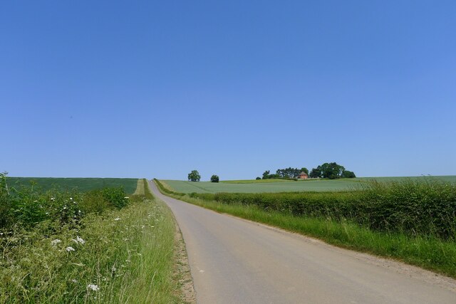
Castle Hill is a prominent and historically significant landmark located in Lincolnshire, England. It is an ancient man-made hill, often referred to as a motte, situated on the outskirts of the town of Grantham. Rising approximately 30 meters above the surrounding landscape, Castle Hill offers commanding views of the surrounding countryside.

The origins of Castle Hill date back to the Norman Conquest of England in the 11th century. It was built by William the Conqueror as part of a network of fortifications across the country. The hill was crowned by a wooden fortress, which served as a strategic military stronghold during the medieval period.

Over the centuries, Castle Hill underwent various changes and modifications. The original wooden structure was replaced by a stone castle, which was later demolished during the English Civil War in the 17th century. Today, only the earthworks and remnants of the castle's foundations can be seen.

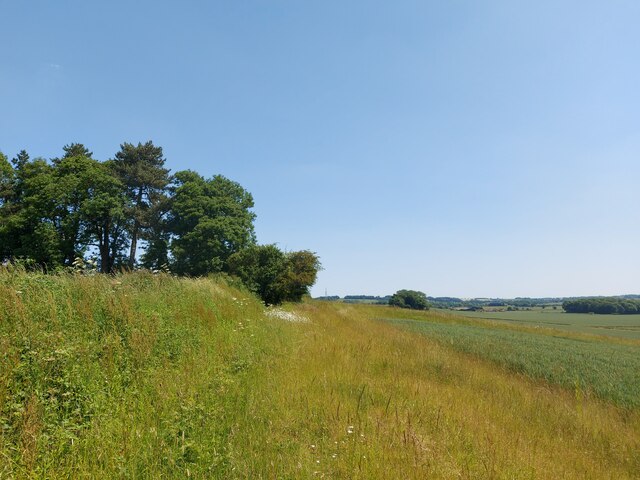
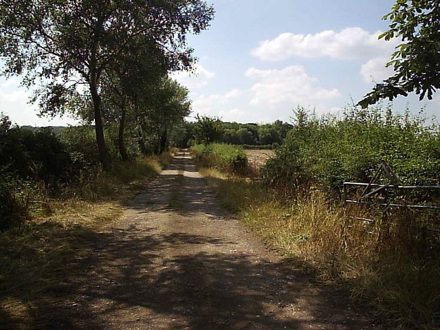
Castle Hill has become a popular destination for visitors and locals alike. Its picturesque setting, coupled with its historical significance, attracts those interested in exploring the area's rich past. The hill is surrounded by lush greenery and offers walking trails, making it a popular spot for outdoor enthusiasts.

In addition to its natural beauty and historical importance, Castle Hill also hosts various events throughout the year. These include reenactments, festivals, and guided tours, which provide visitors with an opportunity to delve into the site's fascinating history.

Overall, Castle Hill in Lincolnshire is a captivating landmark that showcases the region's rich heritage and offers a memorable experience for all who visit.

If you have any feedback on the listing, please let us know in the comments section below.

Castle Hill Images

Images are sourced within 2km of 53.006983/-0.62409692 or Grid Reference SK9246. Thanks to Geograph Open Source API. All images are credited.

Direction Sign – Signpost on Grantham Road, Hough on the Hill Located on the west side of the junction of Grantham Road and High Road in Hough on the Hill parish. 3 arms and pawn finial.

Milestone Society National ID: LI_SK9246
Direction Sign – Signpost on Grantham Road, Hough on the Hill
Located on the west side of the junction of Grantham Road and High Road in Hough on the Hill parish. 3 arms and pawn finial. Milestone Society National ID: LI_SK9246
Hough Road rising up to the Red House ridge Rising from Jurassic mudstones in the valley of Honington Beck to a ridge of harder sandstones and ironstones <span class="nowrap"><a title="https://geologyviewer.bgs.ac.uk/" rel="nofollow ugc noopener" href="https://geologyviewer.bgs.ac.uk/">Link</a><img style="margin-left:2px;" alt="External link" title="External link - shift click to open in new window" src="https://s1.geograph.org.uk/img/external.png" width="10" height="10"/></span>
Hough Road rising up to the Red House ridge
Rising from Jurassic mudstones in the valley of Honington Beck to a ridge of harder sandstones and ironstones LinkExternal link
Footpath running along the ridge below The Red House The footpath runs to Carlton Scroop. It is probably little used as Howdale Lane immediately to the north offers an easier traffic-free route
Footpath running along the ridge below The Red House
The footpath runs to Carlton Scroop. It is probably little used as Howdale Lane immediately to the north offers an easier traffic-free route
Howdale Lane east of Belle Vue Farm Taking the Viking Way east to Carlton Scroop
Howdale Lane east of Belle Vue Farm
Taking the Viking Way east to Carlton Scroop
Howdale Lane Taking the Viking Way west to Hough Road
Howdale Lane
Taking the Viking Way west to Hough Road
All Saints' church, Hough on the Hill, Lincs. Only 4 church towers in the country have a Saxon external staircase turret and All Saints' has arguably the best. A church rich in history and fine architecture, a churchyard of fine trees in a very pretty village.
All Saints' church, Hough on the Hill, Lincs.
Only 4 church towers in the country have a Saxon external staircase turret and All Saints' has arguably the best. A church rich in history and fine architecture, a churchyard of fine trees in a very pretty village.
Carlton Ashes The Red House near Carlton Scroop from the Viking Way at Carlton Ashes
Carlton Ashes
The Red House near Carlton Scroop from the Viking Way at Carlton Ashes
Viking Way Looking east along Howdale Lane towards Belle Vue Farm on the Viking Way
Viking Way
Looking east along Howdale Lane towards Belle Vue Farm on the Viking Way
Ancient Cross The base of an ancient cross in the sleepy hamlet of Gelston
Ancient Cross
The base of an ancient cross in the sleepy hamlet of Gelston
Gelston Pinfold
Gelston Pinfold
Track to Lakeside This track leads to former ironstone workings as well as to Lakeside Farm.
Track to Lakeside
This track leads to former ironstone workings as well as to Lakeside Farm.
Cracked Wheat 2 The cracks in the field of wheat are almost wide enough to swallow up your foot.
Cracked Wheat 2
The cracks in the field of wheat are almost wide enough to swallow up your foot.
Fox Covert This track leads to the small wood in the distance called Fox Covert.
Fox Covert
This track leads to the small wood in the distance called Fox Covert.
Track to Moor Barn This farm track leads to Moor Barn at the other side of this square from here.  The barn in the picture is not Moor Barn
Track to Moor Barn
This farm track leads to Moor Barn at the other side of this square from here. The barn in the picture is not Moor Barn
Teasel and Brant This ditch is part of the upper reaches of the River Brant.  The river bed was almost dry during this last week in July.
Teasel and Brant
This ditch is part of the upper reaches of the River Brant. The river bed was almost dry during this last week in July.
Footpath: Caythorpe to Hough-on-the-Hill Field full of sheep on the footpath to Hough-on-the-Hill.
Footpath: Caythorpe to Hough-on-the-Hill
Field full of sheep on the footpath to Hough-on-the-Hill.
Farmland near Gelston This farm track leads up Summerfield's Hill
Farmland near Gelston
This farm track leads up Summerfield's Hill
Country road near Gelston, Lincolnshire
Show me another place!

Castle Hill is located at Grid Ref: SK9246 (Lat: 53.006983, Lng: -0.62409692)

Administrative County: Lincolnshire

District: South Kesteven

Police Authority: Lincolnshire

What 3 Words

///folders.broached.deflect. Near Caythorpe, Lincolnshire

Related Wikis

Hough-on-the-Hill

Hough-on-the-Hill is a village and civil parish in the South Kesteven district of Lincolnshire, England. The population of the civil parish including Brandon...

Gelston, Lincolnshire

Gelston is a village in the South Kesteven district of Lincolnshire, England. It is 2 miles (3 km) west from the A607 road, 5 miles (8 km) north from Grantham...

Frieston

Frieston is a village in the South Kesteven district of Lincolnshire, England. It is situated just west of the A607 road, and 7 miles (11 km) north from...

Brandon, Lincolnshire

Brandon is a small village in South Kesteven, south Lincolnshire, England, part of the civil parish of Hough-on-the-Hill (where the population is listed...

Caythorpe, Lincolnshire

Caythorpe is a large village and civil parish in the South Kesteven district of Lincolnshire, England. The population at 2011 census was 1,374. It is situated...

St Nicholas Church, Normanton

St Nicholas Church is a redundant Anglican church in Normanton-on-Cliffe, Lincolnshire, England. It is recorded in the National Heritage List for England...

Normanton-on-Cliffe

Normanton-on-Cliffe, sometimes known as Normanton, is a village and civil parish in the South Kesteven district of Lincolnshire, England. It lies on the...

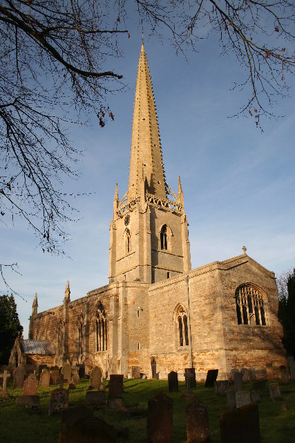
St Vincent's Church, Caythorpe

St Vincent's Church is a Grade I listed Church of England parish church in Caythorpe, Lincolnshire, England. It is at the southern edge of the Lincoln...

Nearby Amenities

Located within 500m of 53.006983,-0.62409692
Hough on the Hill
Is In: Lincolnshire, England, UK
Place: hamlet
Source: Survey
Wikidata: Q2634890
Wikipedia: en:Hough-on-the-Hill
Lat/Long: 53.0069848/-0.6243176
Bus Stop
Brownlow Arms PH
Naptan AtcoCode: 270002700761
Naptan Bearing: SE
Naptan CommonName: Brownlow Arms PH
Naptan Indicator: adj
Naptan Landmark: Brownlow Arms PH
Naptan Street: Grantham Road
Naptan Verified: no
Source: naptan_import
Lat/Long: 53.0063899/-0.6268156
Bus Stop
Brownlow Arms PH
Naptan AtcoCode: 270002700762
Naptan Bearing: NW
Naptan CommonName: Brownlow Arms PH
Naptan Indicator: opp
Naptan Landmark: Brownlow Arms PH
Naptan Street: Grantham Road
Naptan Verified: no
Source: naptan_import
Lat/Long: 53.006446/-0.6270076
Pub
Brownlow Arms
Addr City: Hough On The Hill
Addr Postcode: NG32 2AZ
Addr Street: High Road
Ele: 55.88
Fhrs Authority: South Kesteven
Fhrs Id: 238838
Fhrs Local Authority Id: 4836
Food: yes
Real Ale: Timothy Taylor Landlord, Marston's Burton Bitter, Pedigree
Wikidata: Q26315746
Lat/Long: 53.0065933/-0.6268487
Telephone
Defibrillator
Booth: K6
Covered: booth
Defibrillator Location: inside old red telephone box in Hough on the Hill
Ele: 63.8127441
Emergency: defibrillator
Man Made: telephone_box
Lat/Long: 53.0063451/-0.6260533
Post Box
Ele: 59.4868164
Post Box Type: wall
Ref: NG32 94
Royal Cypher: EIIR
Royal Cypher Wikidata: Q33102113
Source: GPS
Lat/Long: 53.0066751/-0.6266246
Ele: 46.9898682
Lat/Long: 53.0098618/-0.6235867
Barrier: stile
Steps: 2
Stile: stepover
Lat/Long: 53.0099031/-0.623546
Church Farm
Place: farm
Source: Bing
Lat/Long: 53.0076727/-0.6253383
Hall Close
Place: locality
Source: Bing
Lat/Long: 53.0059823/-0.6236306
The Limes Farm
Place: farm
Source: Bing
Lat/Long: 53.0038515/-0.6257351
Bosom Hill
Place: locality
Source: Bing
Lat/Long: 53.007259/-0.6285245
Lower Farm
Place: farm
Source: Bing
Lat/Long: 53.0087745/-0.6252418
The Wilderness
Place: locality
Source: Bing
Lat/Long: 53.0048622/-0.6279766
Wayside Farm
Place: farm
Source: Bing
Lat/Long: 53.0087384/-0.6239526
Willow Barn
Place: farm
Source: Bing
Lat/Long: 53.0098955/-0.6238907
Castle Type: defensive
Description: Medieval Motte and Baily Castle. Appears not to have its own name.
Historic: castle
Lat/Long: 53.0075191/-0.623917
Generator Method: photovoltaic
Generator Output Electricity: yes
Generator Source: solar
Generator Type: solar_photovoltaic_panel
Location: roof
Power: generator
Lat/Long: 53.0067948/-0.6227667
Generator Method: photovoltaic
Generator Output Electricity: yes
Generator Source: solar
Generator Type: solar_photovoltaic_panel
Location: roof
Power: generator
Lat/Long: 53.0071967/-0.6228526
Barrier: stile
Foot: yes
Material: wood
Stile: stepover
Lat/Long: 53.0091836/-0.6207919
Access: no
Barrier: stile
Foot: yes
Material: wood
Stile: stepover
Lat/Long: 53.0093978/-0.6191613
The data included in this document is from www.openstreetmap.org. The data is made available under ODbL.

Have you been to Castle Hill?

Leave your review of Castle Hill below (or comments, questions and feedback).