Hough-on-the-Hill

Settlement in Lincolnshire South Kesteven

England

Hough-on-the-Hill

Direction Sign – Signpost on Grantham Road, Hough on the Hill Located on the west side of the junction of Grantham Road and High Road in Hough on the Hill parish. 3 arms and pawn finial.

Milestone Society National ID: LI_SK9246
Direction Sign – Signpost on Grantham Road, Hough on the Hill Credit: D Phillips

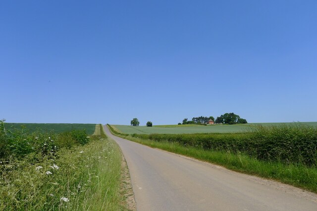
Hough-on-the-Hill is a small village located in the South Kesteven district of Lincolnshire, England. Situated on a limestone escarpment, the village offers breathtaking panoramic views of the surrounding countryside. It lies approximately 10 miles east of Grantham and 15 miles south of Lincoln, making it easily accessible by road.

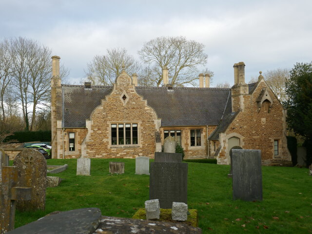
The village is known for its picturesque charm, with its traditional stone houses and well-preserved historic buildings. The centerpiece of Hough-on-the-Hill is the St. Thomas à Becket Church, a Grade I listed building dating back to the 12th century. The church features an impressive tower and beautiful stained glass windows.

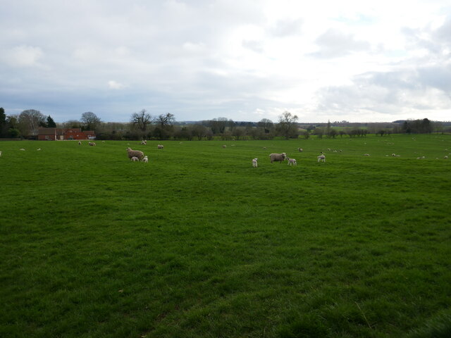
Despite its small size, Hough-on-the-Hill has a strong sense of community. The village amenities include a primary school, a village hall, and a local pub, providing residents with essential services and a place to socialize. The village also boasts a range of outdoor recreational spaces, including a children's playground and a cricket pitch, where locals can enjoy various activities.

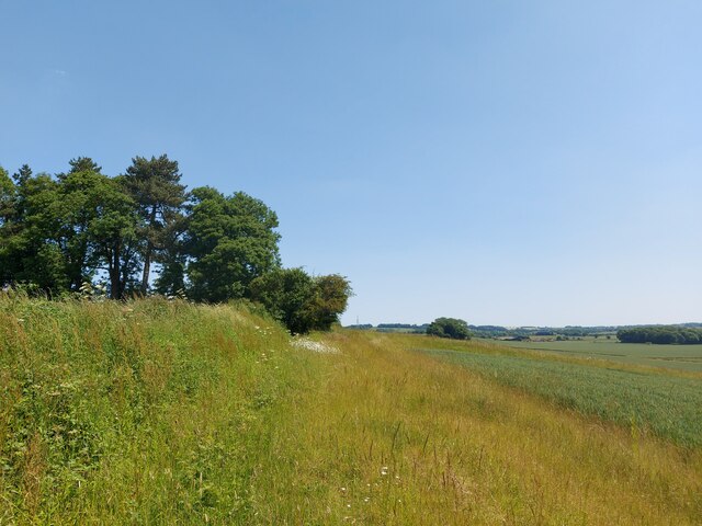
Surrounded by rolling hills and open countryside, Hough-on-the-Hill offers ample opportunities for nature lovers and outdoor enthusiasts. The area is crisscrossed by footpaths and bridleways, making it ideal for walking, hiking, and cycling. Nearby attractions include the iconic Belvoir Castle and the ancient Roman town of Ancaster.

Overall, Hough-on-the-Hill is a peaceful and idyllic village, perfect for those seeking a tranquil rural retreat while still being within easy reach of larger towns and cities.

If you have any feedback on the listing, please let us know in the comments section below.

Hough-on-the-Hill Images

Images are sourced within 2km of 53.006609/-0.62701 or Grid Reference SK9246. Thanks to Geograph Open Source API. All images are credited.

Direction Sign – Signpost on Grantham Road, Hough on the Hill Located on the west side of the junction of Grantham Road and High Road in Hough on the Hill parish. 3 arms and pawn finial.

Milestone Society National ID: LI_SK9246
Direction Sign – Signpost on Grantham Road, Hough on the Hill
Located on the west side of the junction of Grantham Road and High Road in Hough on the Hill parish. 3 arms and pawn finial. Milestone Society National ID: LI_SK9246
Hough Road rising up to the Red House ridge Rising from Jurassic mudstones in the valley of Honington Beck to a ridge of harder sandstones and ironstones <span class="nowrap"><a title="https://geologyviewer.bgs.ac.uk/" rel="nofollow ugc noopener" href="https://geologyviewer.bgs.ac.uk/">Link</a><img style="margin-left:2px;" alt="External link" title="External link - shift click to open in new window" src="https://s1.geograph.org.uk/img/external.png" width="10" height="10"/></span>
Hough Road rising up to the Red House ridge
Rising from Jurassic mudstones in the valley of Honington Beck to a ridge of harder sandstones and ironstones LinkExternal link
Footpath running along the ridge below The Red House The footpath runs to Carlton Scroop. It is probably little used as Howdale Lane immediately to the north offers an easier traffic-free route
Footpath running along the ridge below The Red House
The footpath runs to Carlton Scroop. It is probably little used as Howdale Lane immediately to the north offers an easier traffic-free route
Howdale Lane east of Belle Vue Farm Taking the Viking Way east to Carlton Scroop
Howdale Lane east of Belle Vue Farm
Taking the Viking Way east to Carlton Scroop
Sheep with lambs grazing on ridge and furrow, Frieston
Hough House The oldest part of the house dates from 1624 but most of what is visible in this picture is of the eighteenth and nineteenth centuries <span class="nowrap"><a title="https://historicengland.org.uk/listing/the-list/list-entry/1062376?section=official-list-entry" rel="nofollow ugc noopener" href="https://historicengland.org.uk/listing/the-list/list-entry/1062376?section=official-list-entry">Link</a><img style="margin-left:2px;" alt="External link" title="External link - shift click to open in new window" src="https://s1.geograph.org.uk/img/external.png" width="10" height="10"/></span>
Hough House
The oldest part of the house dates from 1624 but most of what is visible in this picture is of the eighteenth and nineteenth centuries LinkExternal link
House and former Post Office, Hough on the Hill Dates from the seventeenth century but with eighteenth century alterations <span class="nowrap"><a title="https://historicengland.org.uk/listing/the-list/list-entry/1146610?section=official-list-entry" rel="nofollow ugc noopener" href="https://historicengland.org.uk/listing/the-list/list-entry/1146610?section=official-list-entry">Link</a><img style="margin-left:2px;" alt="External link" title="External link - shift click to open in new window" src="https://s1.geograph.org.uk/img/external.png" width="10" height="10"/></span>
House and former Post Office, Hough on the Hill
Dates from the seventeenth century but with eighteenth century alterations LinkExternal link
All Saints' church Hough on the Hill, west tower The lower parts of the tower date from the eleventh century. The top stage is of the fifteenth century <span class="nowrap"><a title="https://historicengland.org.uk/listing/the-list/list-entry/1360316?section=official-list-entry" rel="nofollow ugc noopener" href="https://historicengland.org.uk/listing/the-list/list-entry/1360316?section=official-list-entry">Link</a><img style="margin-left:2px;" alt="External link" title="External link - shift click to open in new window" src="https://s1.geograph.org.uk/img/external.png" width="10" height="10"/></span>
All Saints' church Hough on the Hill, west tower
The lower parts of the tower date from the eleventh century. The top stage is of the fifteenth century LinkExternal link
Castle Hill, Hough on the Hill Seen from the churchyard. Nothing remains the castle apart from the motte.
Castle Hill, Hough on the Hill
Seen from the churchyard. Nothing remains the castle apart from the motte.
All Saints' church Hough on the Hill The oldest parts date from the eleventh century but much of what is visible in this picture is of the eighteenth century <span class="nowrap"><a title="https://historicengland.org.uk/listing/the-list/list-entry/1360316?section=official-list-entry" rel="nofollow ugc noopener" href="https://historicengland.org.uk/listing/the-list/list-entry/1360316?section=official-list-entry">Link</a><img style="margin-left:2px;" alt="External link" title="External link - shift click to open in new window" src="https://s1.geograph.org.uk/img/external.png" width="10" height="10"/></span>
All Saints' church Hough on the Hill
The oldest parts date from the eleventh century but much of what is visible in this picture is of the eighteenth century LinkExternal link
Church Farm, Hough on the Hill
Former school and schoolhouse, Hough on the Hill Date from 1867 <span class="nowrap"><a title="https://historicengland.org.uk/listing/the-list/list-entry/1308909?section=official-list-entry" rel="nofollow ugc noopener" href="https://historicengland.org.uk/listing/the-list/list-entry/1308909?section=official-list-entry">Link</a><img style="margin-left:2px;" alt="External link" title="External link - shift click to open in new window" src="https://s1.geograph.org.uk/img/external.png" width="10" height="10"/></span>
Former school and schoolhouse, Hough on the Hill
Date from 1867 LinkExternal link
Path down to the lych gate, Hough on the Hill
Table tombs, Hough on the Hill
Cottage, Hough on the Hill
Water Lane, Hough on the Hill A footpath.
Water Lane, Hough on the Hill
A footpath.
Barn at the Red House, Hough on the Hill
The Red House, Hough on the Hill Dates from the early nineteenth century <span class="nowrap"><a title="https://historicengland.org.uk/listing/the-list/list-entry/1062415?section=official-list-entry" rel="nofollow ugc noopener" href="https://historicengland.org.uk/listing/the-list/list-entry/1062415?section=official-list-entry">Link</a><img style="margin-left:2px;" alt="External link" title="External link - shift click to open in new window" src="https://s1.geograph.org.uk/img/external.png" width="10" height="10"/></span>
The Red House, Hough on the Hill
Dates from the early nineteenth century LinkExternal link
Show me another place!

Hough-on-the-Hill is located at Grid Ref: SK9246 (Lat: 53.006609, Lng: -0.62701)

Division: Parts of Kesteven

Administrative County: Lincolnshire

District: South Kesteven

Police Authority: Lincolnshire

What 3 Words

///grades.duties.elects. Near Caythorpe, Lincolnshire

Related Wikis

Hough-on-the-Hill

Hough-on-the-Hill is a village and civil parish in the South Kesteven district of Lincolnshire, England. The population of the civil parish including Brandon...

Gelston, Lincolnshire

Gelston is a village in the South Kesteven district of Lincolnshire, England. It is 2 miles (3 km) west from the A607 road, 5 miles (8 km) north from Grantham...

Frieston

Frieston is a village in the South Kesteven district of Lincolnshire, England. It is situated just west of the A607 road, and 7 miles (11 km) north from...

Brandon, Lincolnshire

Brandon is a small village in South Kesteven, south Lincolnshire, England, part of the civil parish of Hough-on-the-Hill (where the population is listed...

Nearby Amenities

Located within 500m of 53.006609,-0.62701
Hough on the Hill
Is In: Lincolnshire, England, UK
Place: hamlet
Source: Survey
Wikidata: Q2634890
Wikipedia: en:Hough-on-the-Hill
Lat/Long: 53.0069848/-0.6243176
Bus Stop
Brownlow Arms PH
Naptan AtcoCode: 270002700761
Naptan Bearing: SE
Naptan CommonName: Brownlow Arms PH
Naptan Indicator: adj
Naptan Landmark: Brownlow Arms PH
Naptan Street: Grantham Road
Naptan Verified: no
Source: naptan_import
Lat/Long: 53.0063899/-0.6268156
Bus Stop
Brownlow Arms PH
Naptan AtcoCode: 270002700762
Naptan Bearing: NW
Naptan CommonName: Brownlow Arms PH
Naptan Indicator: opp
Naptan Landmark: Brownlow Arms PH
Naptan Street: Grantham Road
Naptan Verified: no
Source: naptan_import
Lat/Long: 53.006446/-0.6270076
Pub
Brownlow Arms
Addr City: Hough On The Hill
Addr Postcode: NG32 2AZ
Addr Street: High Road
Ele: 55.88
Fhrs Authority: South Kesteven
Fhrs Id: 238838
Fhrs Local Authority Id: 4836
Food: yes
Real Ale: Timothy Taylor Landlord, Marston's Burton Bitter, Pedigree
Wikidata: Q26315746
Lat/Long: 53.0065933/-0.6268487
Telephone
Defibrillator
Booth: K6
Covered: booth
Defibrillator Location: inside old red telephone box in Hough on the Hill
Ele: 63.8127441
Emergency: defibrillator
Man Made: telephone_box
Lat/Long: 53.0063451/-0.6260533
Post Box
Ele: 59.4868164
Post Box Type: wall
Ref: NG32 94
Royal Cypher: EIIR
Royal Cypher Wikidata: Q33102113
Source: GPS
Lat/Long: 53.0066751/-0.6266246
Ele: 46.9898682
Lat/Long: 53.0098618/-0.6235867
Barrier: stile
Steps: 2
Stile: stepover
Lat/Long: 53.0099031/-0.623546
Church Farm
Place: farm
Source: Bing
Lat/Long: 53.0076727/-0.6253383
Hall Close
Place: locality
Source: Bing
Lat/Long: 53.0059823/-0.6236306
The Limes Farm
Place: farm
Source: Bing
Lat/Long: 53.0038515/-0.6257351
Bosom Hill
Place: locality
Source: Bing
Lat/Long: 53.007259/-0.6285245
Lower Farm
Place: farm
Source: Bing
Lat/Long: 53.0087745/-0.6252418
The Wilderness
Place: locality
Source: Bing
Lat/Long: 53.0048622/-0.6279766
Wayside Farm
Place: farm
Source: Bing
Lat/Long: 53.0087384/-0.6239526
Willow Barn
Place: farm
Source: Bing
Lat/Long: 53.0098955/-0.6238907
Castle Type: defensive
Description: Medieval Motte and Baily Castle. Appears not to have its own name.
Historic: castle
Lat/Long: 53.0075191/-0.623917
Generator Method: photovoltaic
Generator Output Electricity: yes
Generator Source: solar
Generator Type: solar_photovoltaic_panel
Location: roof
Power: generator
Lat/Long: 53.0067948/-0.6227667
Generator Method: photovoltaic
Generator Output Electricity: yes
Generator Source: solar
Generator Type: solar_photovoltaic_panel
Location: roof
Power: generator
Lat/Long: 53.0071967/-0.6228526
The data included in this document is from www.openstreetmap.org. The data is made available under ODbL.

Have you been to Hough-on-the-Hill?

Leave your review of Hough-on-the-Hill below (or comments, questions and feedback).