Belle Vue Hill

Hill, Mountain in Sussex Chichester

England

Belle Vue Hill

Uppark House The view of the National Trust owned Uppark House.
Uppark House Credit: Gordon Griffiths

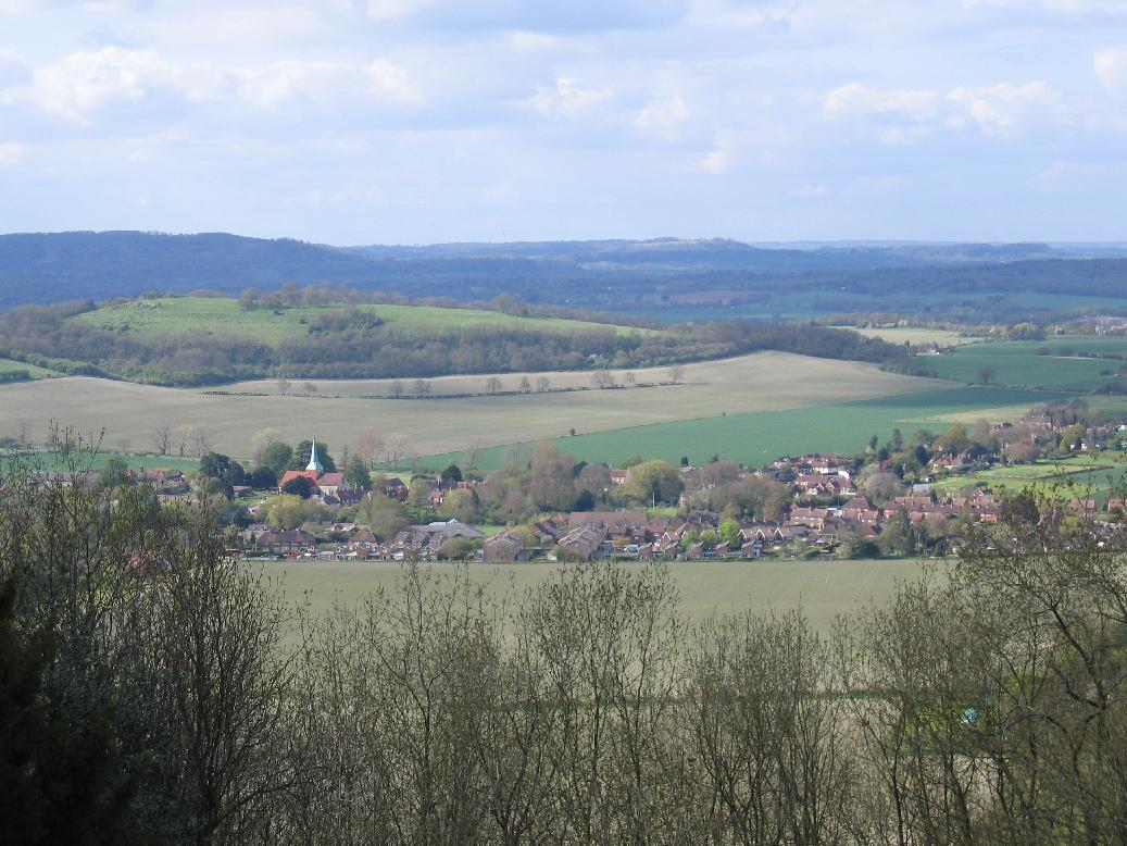
Belle Vue Hill is a prominent geological formation located in Sussex, England. It is classified as a hill rather than a mountain, as its elevation does not exceed the minimum height required for a mountain classification. However, its height and picturesque scenery make it an attractive destination for locals and tourists alike.

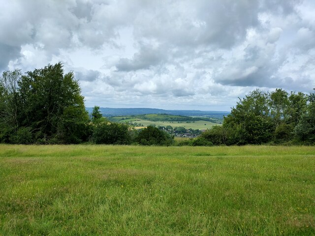
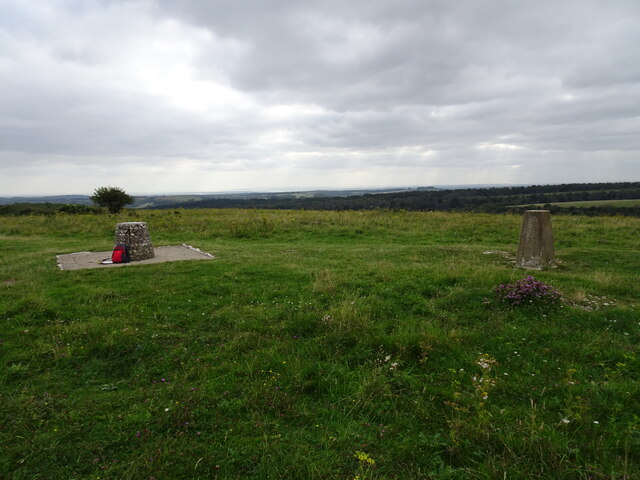
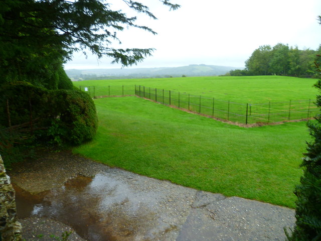
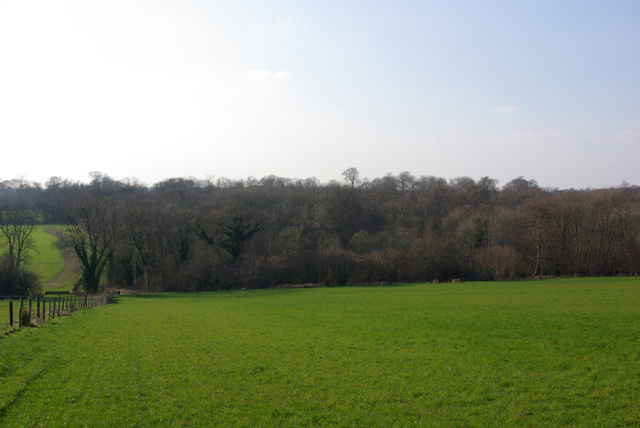
Standing at approximately 280 meters above sea level, Belle Vue Hill offers breathtaking panoramic views of the surrounding countryside. The hill is adorned with lush greenery, including a variety of trees and wildflowers, creating a captivating landscape that changes with the seasons.

The hill's name, Belle Vue, translates to "beautiful view" in French, a fitting description for the stunning vistas it offers. On a clear day, one can see for miles, with the English Channel visible in the distance.

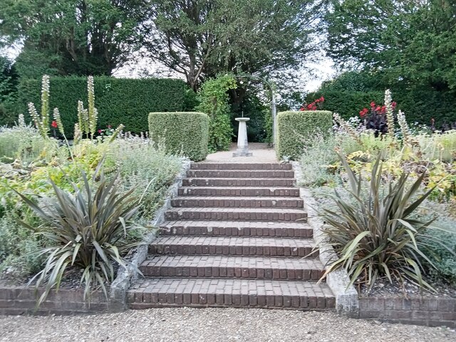
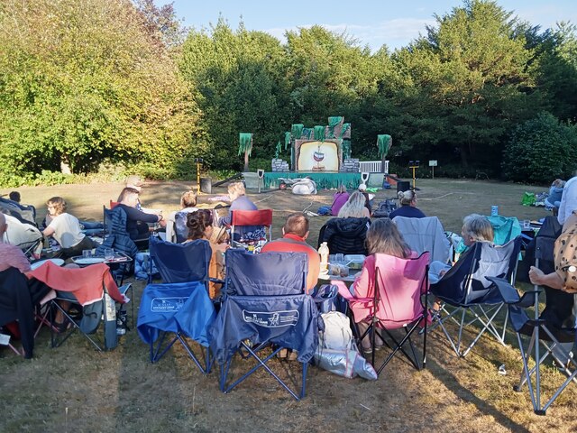
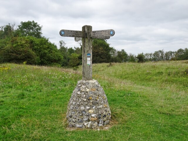
Belle Vue Hill is accessible to visitors thanks to a network of well-maintained footpaths and trails. Hikers and nature enthusiasts can explore the hill's diverse flora and fauna while enjoying the fresh air and peaceful ambiance. The area is also popular among birdwatchers, as it is home to several species of birds, including songbirds and birds of prey.

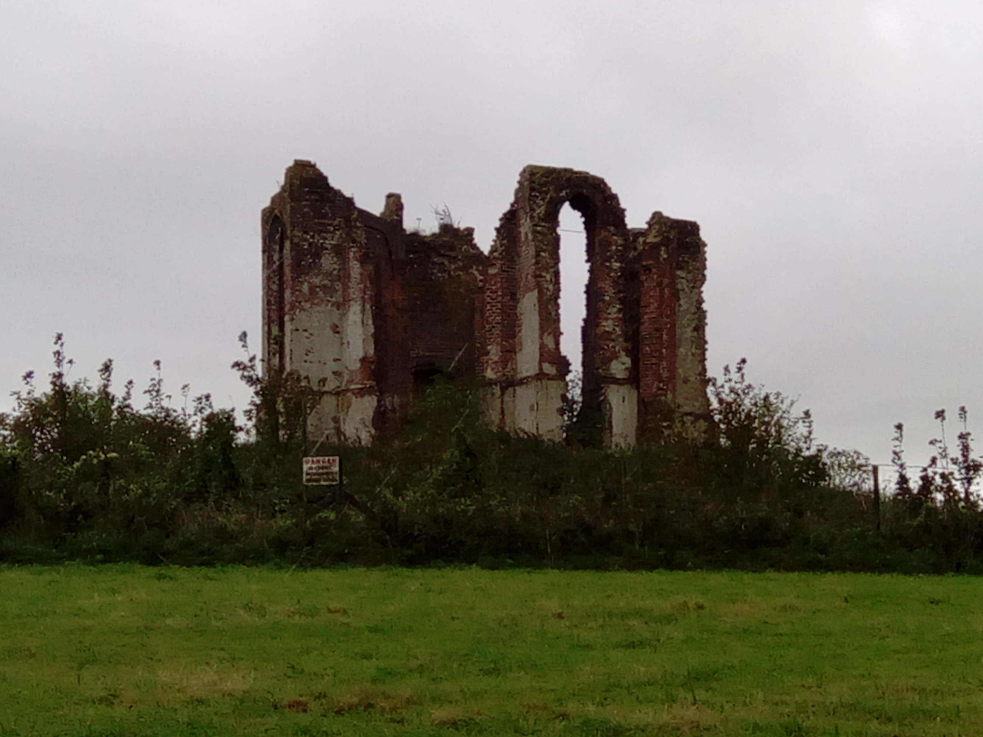
Additionally, Belle Vue Hill is steeped in history, with ancient burial mounds and remnants of Iron Age settlements scattered across its slopes. Archaeological excavations have yielded artifacts that provide insight into the lives of the early inhabitants of the area.

Overall, Belle Vue Hill is a natural gem in Sussex, offering both natural beauty and cultural significance. Whether for leisurely walks, birdwatching, or historical exploration, this picturesque hill provides a memorable experience for all who visit.

If you have any feedback on the listing, please let us know in the comments section below.

Belle Vue Hill Images

Images are sourced within 2km of 50.952252/-0.87153297 or Grid Reference SU7917. Thanks to Geograph Open Source API. All images are credited.

Uppark House The view of the National Trust owned Uppark House.
Uppark House
The view of the National Trust owned Uppark House.
Uppark Cafe The view at the National Trust owned Uppark House.
Uppark Cafe
The view at the National Trust owned Uppark House.
Looking eastwards in Pease Croft
Uppark: steps to the sundial
Uppark: waiting for a performance (which was Peter Rabbit & Benjamin Bunny)
Uppark: waiting for a performance
(which was Peter Rabbit & Benjamin Bunny)
Uppark: at twilight
Uppark: at twilight
Uppark: back after 33 years Nice to see it again after all this time!
Uppark: back after 33 years
Nice to see it again after all this time!
Uppark House Uppark is a fine country house dating from about 1689. It got its somewhat unusual name in order to distinguish it  from Down Park in the same Parish, which has long since vanished.
Built originally for Ford Lord Grey of Warke who was created Earl of Tankerville in 1701 it was sold to the  Fetherstonhaugh family in 1747 who remained its owners until it was given to the National Trust.
During restoration work on the roof in 1989 which was nearing completion, heat from an oxy-acetylene torch being used to seal the lead caused the 300 year old timbers in the roof to catch fire. The fire spread disastrously despite up to 27 fire appliances attempting to control the blaze. The damage was such that demolition was a serious option, but the outside fabric of the building was remarkably intact and most of the precious items in the lower floors had been saved by staff, volunteers and firefighters. The upper floors were completely gutted and sadly the donor family who lived in that part of the house, lost many of their possessions.
The decision was made to renovate the building completely and restore the ground floor rooms to their pre-fire status. This was all managed by 1995 when the house reopened. Today, apart from some scorched and charred wooden floor panels, you would not be able to tell there had ever been a fire as you tour the house; a great feat of restoration by the Trust and the skilled craftsmen and women they employed.  
Uppark Visitor Information (NT) <span class="nowrap"><a title="http://www.nationaltrust.org.uk/uppark" rel="nofollow ugc noopener" href="http://www.nationaltrust.org.uk/uppark">Link</a><img style="margin-left:2px;" alt="External link" title="External link - shift click to open in new window" src="https://s1.geograph.org.uk/img/external.png" width="10" height="10"/></span>
English Heritage Listings:
The House (Grade I) <span class="nowrap"><a title="http://list.english-heritage.org.uk/resultsingle.aspx?uid=1025979&searchtype=mapsearch" rel="nofollow ugc noopener" href="http://list.english-heritage.org.uk/resultsingle.aspx?uid=1025979&searchtype=mapsearch">Link</a><img style="margin-left:2px;" alt="External link" title="External link - shift click to open in new window" src="https://s1.geograph.org.uk/img/external.png" width="10" height="10"/></span>
Old Laundry and Kitchen Block (Grade I) <span class="nowrap"><a title="http://list.english-heritage.org.uk/resultsingle.aspx?uid=1232940&searchtype=mapsearch" rel="nofollow ugc noopener" href="http://list.english-heritage.org.uk/resultsingle.aspx?uid=1232940&searchtype=mapsearch">Link</a><img style="margin-left:2px;" alt="External link" title="External link - shift click to open in new window" src="https://s1.geograph.org.uk/img/external.png" width="10" height="10"/></span>
Stable Block (Grade I) <span class="nowrap"><a title="http://list.english-heritage.org.uk/resultsingle.aspx?uid=1276851&searchtype=mapsearch" rel="nofollow ugc noopener" href="http://list.english-heritage.org.uk/resultsingle.aspx?uid=1276851&searchtype=mapsearch">Link</a><img style="margin-left:2px;" alt="External link" title="External link - shift click to open in new window" src="https://s1.geograph.org.uk/img/external.png" width="10" height="10"/></span>
Dairy (Grade II) <span class="nowrap"><a title="http://list.english-heritage.org.uk/resultsingle.aspx?uid=1025980&searchtype=mapsearch" rel="nofollow ugc noopener" href="http://list.english-heritage.org.uk/resultsingle.aspx?uid=1025980&searchtype=mapsearch">Link</a><img style="margin-left:2px;" alt="External link" title="External link - shift click to open in new window" src="https://s1.geograph.org.uk/img/external.png" width="10" height="10"/></span>
Game Larder (Grade II) <span class="nowrap"><a title="http://list.english-heritage.org.uk/resultsingle.aspx?uid=1354701&searchtype=mapsearch" rel="nofollow ugc noopener" href="http://list.english-heritage.org.uk/resultsingle.aspx?uid=1354701&searchtype=mapsearch">Link</a><img style="margin-left:2px;" alt="External link" title="External link - shift click to open in new window" src="https://s1.geograph.org.uk/img/external.png" width="10" height="10"/></span>
Gothic Garden Seat (Grade II) <span class="nowrap"><a title="http://list.english-heritage.org.uk/resultsingle.aspx?uid=1233245&searchtype=mapsearch" rel="nofollow ugc noopener" href="http://list.english-heritage.org.uk/resultsingle.aspx?uid=1233245&searchtype=mapsearch">Link</a><img style="margin-left:2px;" alt="External link" title="External link - shift click to open in new window" src="https://s1.geograph.org.uk/img/external.png" width="10" height="10"/></span>
Entrance Gates (Grade II) <span class="nowrap"><a title="http://list.english-heritage.org.uk/resultsingle.aspx?uid=1354702&searchtype=mapsearch" rel="nofollow ugc noopener" href="http://list.english-heritage.org.uk/resultsingle.aspx?uid=1354702&searchtype=mapsearch">Link</a><img style="margin-left:2px;" alt="External link" title="External link - shift click to open in new window" src="https://s1.geograph.org.uk/img/external.png" width="10" height="10"/></span>
Uppark House
Uppark is a fine country house dating from about 1689. It got its somewhat unusual name in order to distinguish it from Down Park in the same Parish, which has long since vanished. Built originally for Ford Lord Grey of Warke who was created Earl of Tankerville in 1701 it was sold to the Fetherstonhaugh family in 1747 who remained its owners until it was given to the National Trust. During restoration work on the roof in 1989 which was nearing completion, heat from an oxy-acetylene torch being used to seal the lead caused the 300 year old timbers in the roof to catch fire. The fire spread disastrously despite up to 27 fire appliances attempting to control the blaze. The damage was such that demolition was a serious option, but the outside fabric of the building was remarkably intact and most of the precious items in the lower floors had been saved by staff, volunteers and firefighters. The upper floors were completely gutted and sadly the donor family who lived in that part of the house, lost many of their possessions. The decision was made to renovate the building completely and restore the ground floor rooms to their pre-fire status. This was all managed by 1995 when the house reopened. Today, apart from some scorched and charred wooden floor panels, you would not be able to tell there had ever been a fire as you tour the house; a great feat of restoration by the Trust and the skilled craftsmen and women they employed. Uppark Visitor Information (NT) LinkExternal link English Heritage Listings: The House (Grade I) LinkExternal link Old Laundry and Kitchen Block (Grade I) LinkExternal link Stable Block (Grade I) LinkExternal link Dairy (Grade II) LinkExternal link Game Larder (Grade II) LinkExternal link Gothic Garden Seat (Grade II) LinkExternal link Entrance Gates (Grade II) LinkExternal link
Harting Down
Harting Down
Uppark restored The house restored to its former glory following the devastating fire.
Uppark restored
The house restored to its former glory following the devastating fire.
Uppark House One of the National Trust's properties within the South Downs National Park. The mother of H G Wells worked here 'below stairs'.
Uppark House
One of the National Trust's properties within the South Downs National Park. The mother of H G Wells worked here 'below stairs'.
Uppark House, South Harting, Petersfield, West Sussex A fine 17th century house, Uppark House has an interesting history <span class="nowrap"><a title="https://www.nationaltrust.org.uk/visit/sussex/uppark-house-and-garden/the-history-of-uppark" rel="nofollow ugc noopener" href="https://www.nationaltrust.org.uk/visit/sussex/uppark-house-and-garden/the-history-of-uppark">Link</a><img style="margin-left:2px;" alt="External link" title="External link - shift click to open in new window" src="https://s1.geograph.org.uk/img/external.png" width="10" height="10"/></span>
Uppark House, South Harting, Petersfield, West Sussex
A fine 17th century house, Uppark House has an interesting history LinkExternal link
Direction Sign – Signpost on Elsted Road, Harting Located on the southwest side of the crossroads of Elsted Road and Hill Lane in Harting parish. 3 arms and annulus finial. See also <a title="https://www.geograph.org.uk/photo/2163747" href="https://www.geograph.org.uk/photo/2163747">Link</a>.

Milestone Society National ID: SX_SU7919C
Direction Sign – Signpost on Elsted Road, Harting
Located on the southwest side of the crossroads of Elsted Road and Hill Lane in Harting parish. 3 arms and annulus finial. See also Link. Milestone Society National ID: SX_SU7919C
Signpost on the South Downs The view of the Signpost on the South Downs Way, at the foot of Beacon Hill.
Signpost on the South Downs
The view of the Signpost on the South Downs Way, at the foot of Beacon Hill.
Beacon Hill The view of the 242m top on the South Downs.
Beacon Hill
The view of the 242m top on the South Downs.
Clock tower with weathervane at Uppark seen from the big house See also <a title="https://www.geograph.org.uk/photo/2163462" href="https://www.geograph.org.uk/photo/2163462">Link</a>.
Clock tower with weathervane at Uppark seen from the big house
See also Link.
View towards the Isle of Wight from Uppark Apparently the island is visible in good weather.
View towards the Isle of Wight from Uppark
Apparently the island is visible in good weather.
B2141, Harting Hill The B2141 runs 8 miles over the South Downs from mid Lavant to South Harting. It links Chichester with Petersfield.
<span class="nowrap"><a title="http://www.sabre-roads.org.uk/wiki/index.php?title=B2141" rel="nofollow ugc noopener" href="http://www.sabre-roads.org.uk/wiki/index.php?title=B2141">Link</a><img style="margin-left:2px;" alt="External link" title="External link - shift click to open in new window" src="https://s1.geograph.org.uk/img/external.png" width="10" height="10"/></span>
B2141, Harting Hill
The B2141 runs 8 miles over the South Downs from mid Lavant to South Harting. It links Chichester with Petersfield. LinkExternal link
Show me another place!

Belle Vue Hill is located at Grid Ref: SU7917 (Lat: 50.952252, Lng: -0.87153297)

Administrative County: West Sussex

District: Chichester

Police Authority: Sussex

What 3 Words

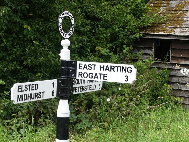
///gazette.career.extent. Near South Harting, West Sussex

Related Wikis

Harting Downs

Harting Downs is a 336.3-hectare (831-acre) biological Site of Special Scientific Interest west of Midhurst in West Sussex. It is a Nature Conservation...

Vandalian Tower

The Vandalian Tower at Harting, West Sussex, England, is an 18th-century folly, built to commemorate the British colony of Vandalia, a short-lived colony...
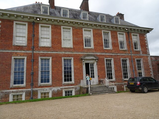
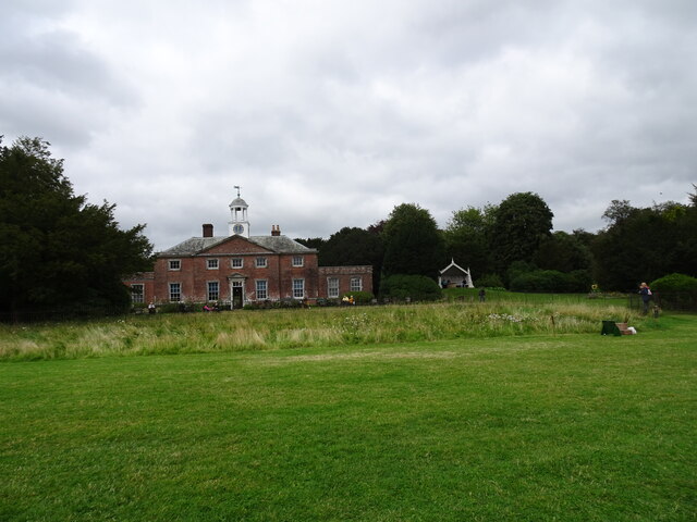
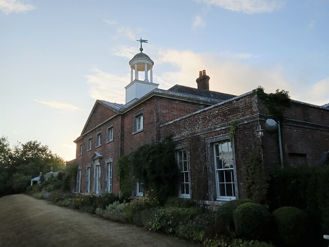
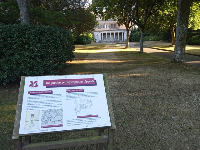
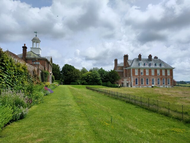
Uppark

Uppark is a 17th-century house in South Harting, West Sussex, England. It is a Grade I listed building and a National Trust property. == History == The...

Pads Wood

Pads Wood is a 22.2-hectare (55-acre) biological Site of Special Scientific Interest west of Midhurst in West Sussex.This ancient coppiced wood is mainly...

Beacon Hill, West Sussex

Beacon Hill, also known as Harting Beacon, is a hillfort on the South Downs, in the county of West Sussex in southern England. The hillfort is located...

Harting

Harting is a civil parish in the Chichester District of West Sussex, England. It is situated on the northern flank of the South Downs, around 3.5 miles...

South Harting

South Harting is a village within Harting civil parish in the Chichester district of West Sussex, England. It lies on the B2146 road, 4 miles (6.4 km)...

North Marden

North Marden is a tiny village and former civil parish, now in the parish of Marden, in the Chichester district of West Sussex, England. It is 7.5 miles...

Nearby Amenities

Located within 500m of 50.952252,-0.87153297
Barrier: kissing_gate
Lat/Long: 50.9497689/-0.8671909
Barrier: kissing_gate
Lat/Long: 50.9504746/-0.8661738
Barrier: stile
Material: wood
Stile: stepover
Lat/Long: 50.9522841/-0.8688954
Belt Plain
Place: locality
Lat/Long: 50.948113/-0.8698511
Whitcombe Bottom
Place: locality
Lat/Long: 50.9538987/-0.866375
The data included in this document is from www.openstreetmap.org. The data is made available under ODbL.

Have you been to Belle Vue Hill?

Leave your review of Belle Vue Hill below (or comments, questions and feedback).