Great Hill

Hill, Mountain in Oxfordshire South Oxfordshire

England

Great Hill

Pasture, Assendon Sheep grazing to the east of the footpath in Henley Park.
Pasture, Assendon Credit: Andrew Smith

Great Hill is a prominent hill located in Oxfordshire, England. Standing at an elevation of approximately 195 meters, it is considered one of the highest points in the county. The hill is situated near the village of Great Milton, about 10 kilometers east of the city of Oxford.

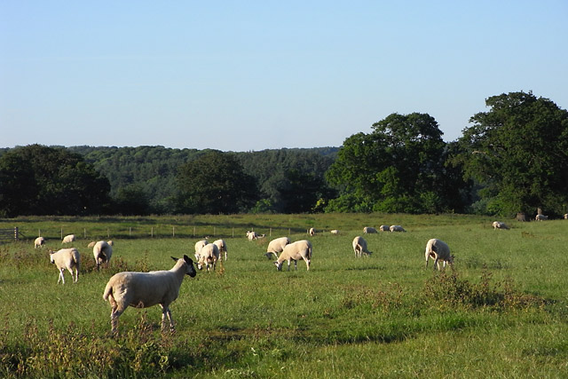
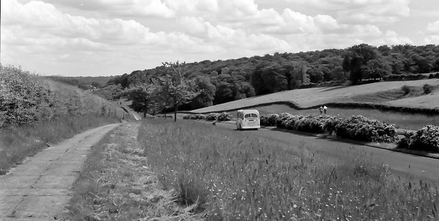
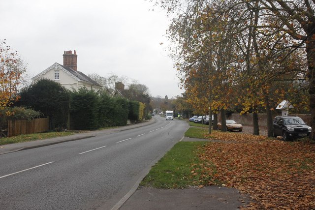
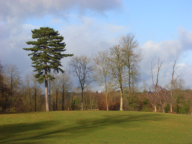
The landscape surrounding Great Hill is characterized by rolling countryside, dotted with lush green fields, ancient woodlands, and picturesque villages. The hill itself is covered in a patchwork of grassy slopes, offering panoramic views of the surrounding countryside.

Great Hill is rich in historical and cultural significance. It is believed to have been inhabited since prehistoric times, with archaeological evidence suggesting human activity dating back to the Neolithic period. The hill is also known for its association with the English Civil War, as it served as a vantage point for both Royalist and Parliamentarian forces.

Today, Great Hill attracts visitors and hikers who come to enjoy its natural beauty and explore the various walking trails that crisscross the area. The hill is part of the wider Chiltern Hills Area of Outstanding Natural Beauty, which ensures the preservation of its remarkable scenic qualities.

With its stunning views, historical significance, and tranquil surroundings, Great Hill is a popular destination for nature enthusiasts, history buffs, and those seeking a peaceful escape from the bustling city life.

If you have any feedback on the listing, please let us know in the comments section below.

Great Hill Images

Images are sourced within 2km of 51.55792/-0.92094552 or Grid Reference SU7484. Thanks to Geograph Open Source API. All images are credited.

Pasture, Assendon Sheep grazing to the east of the footpath in Henley Park.
Pasture, Assendon
Sheep grazing to the east of the footpath in Henley Park.
Fawley Court  Fawley Court viewed across the River Thames from the Thames Path.
Fawley Court
Fawley Court viewed across the River Thames from the Thames Path.
Sergeant H W Luker Of the Royal Australian Air force who died 18th June 1943 aged 24. Taken in Fairmile Cemetery Henley. <span class="nowrap"><a title="http://www.lostbombers.co.uk/bomber.php?id=1256" rel="nofollow ugc noopener" href="http://www.lostbombers.co.uk/bomber.php?id=1256">Link</a><img style="margin-left:2px;" alt="External link" title="External link - shift click to open in new window" src="https://s1.geograph.org.uk/img/external.png" width="10" height="10"/></span>
Sergeant H W Luker
Of the Royal Australian Air force who died 18th June 1943 aged 24. Taken in Fairmile Cemetery Henley. LinkExternal link
Trooper G E Mitchell The Headstone behind is inscribed Private A E Ball, the graves are in Fairmile Cemetery Henley.
Trooper G E Mitchell
The Headstone behind is inscribed Private A E Ball, the graves are in Fairmile Cemetery Henley.
The A4130 near Bix See also: <a href="https://www.geograph.org.uk/photo/2688164">SU7384 : The A4130 near Bix</a>
The A4130 near Bix
The A4130 near Bix See also: <a href="https://www.geograph.org.uk/photo/2688163">SU7384 : The A4130 near Bix</a>
The A4130 near Bix
Restricted Byway Bit of a strange thing to see alongside a main road just outside Henley
Restricted Byway
Bit of a strange thing to see alongside a main road just outside Henley
The Fair Mile View along the Fair Mile at Henley from beside the Byway.
The Fair Mile
View along the Fair Mile at Henley from beside the Byway.
Into Henley The end of the Fair Mile as you get into the Town of Henley.
Into Henley
The end of the Fair Mile as you get into the Town of Henley.
Start of the restricted byway The start of the restricted byway at the Fair Mile, Henley.  I find this rather odd and wonder if at one time this was a road.
Start of the restricted byway
The start of the restricted byway at the Fair Mile, Henley. I find this rather odd and wonder if at one time this was a road.
Pillar on the Byway A pillar stands with a commemoration plaque beside the byway at Fair Mile, Henley.
Pillar on the Byway
A pillar stands with a commemoration plaque beside the byway at Fair Mile, Henley.
Dedication on the Pillar View of the commemoration plaque on the pillar along the restricted byway at Henley.
Dedication on the Pillar
View of the commemoration plaque on the pillar along the restricted byway at Henley.
Byway through the trees View along the restricted byway through the Turkish Oak trees beside the Fair Mile Henley.
Byway through the trees
View along the restricted byway through the Turkish Oak trees beside the Fair Mile Henley.
Along the Fair Mile View along the Fair Mile from the traffic island in the road near Henley.
Along the Fair Mile
View along the Fair Mile from the traffic island in the road near Henley.
Houses beside the Fair Mile A row of houses which stand on a lane beside the Fair Mile at Henley.
Houses beside the Fair Mile
A row of houses which stand on a lane beside the Fair Mile at Henley.
Milestone by the wall I'd walked down the Fair Mile at Henley to see this milestone which stands off the road and can't help wondering if it was moved here or if the original road ran along here.
Milestone by the wall
I'd walked down the Fair Mile at Henley to see this milestone which stands off the road and can't help wondering if it was moved here or if the original road ran along here.
A footpath which runs parallel to the A4130 at Bix
Avenue of trees An Avenue of trees like those of the other side of the Fair Mile at Henley. The wall and milestone to the right does make me wonder if this could have been the old road.
Avenue of trees
An Avenue of trees like those of the other side of the Fair Mile at Henley. The wall and milestone to the right does make me wonder if this could have been the old road.
Show me another place!

Great Hill is located at Grid Ref: SU7484 (Lat: 51.55792, Lng: -0.92094552)

Administrative County: Oxfordshire

District: South Oxfordshire

Police Authority: Thames Valley

What 3 Words

///telephone.triads.releasing. Near Remenham, Berkshire

Related Wikis

Henley Park

Henley Park is a country house and landscape garden in Bix and Assendon civil parish in the Chiltern Hills of South Oxfordshire, England. The house is...

Lower Assendon

Lower Assendon is a village in the Assendon valley in the Chiltern Hills, about 1.5 miles (2.4 km) northwest of Henley-on-Thames in South Oxfordshire...

Fawley Hill Railway

Fawley Hill Railway is a privately owned heritage railway on the Fawley Hill estate of the late Sir William McAlpine at Fawley in Buckinghamshire, England...

Middle Assendon

Middle Assendon is a village in the Stonor valley in the Chiltern Hills. It is about 2 miles (3.2 km) northwest of Henley-on-Thames in South Oxfordshire...

Bix and Assendon

Bix and Assendon, formerly just Bix is a mainly rural civil parish in the high Chilterns just north of Henley-on-Thames in South Oxfordshire, in the county...

Lambridge Wood

Lambridge Wood is a 73.8-hectare (182-acre) biological Site of Special Scientific Interest north-west of Henley-on-Thames in Oxfordshire. It is in the...

Fawley Court

Fawley Court is a country house, with large mixed-use grounds standing on the west bank of the River Thames at Fawley in the English county of Buckinghamshire...

Badgemore

Badgemore is the site of an ancient manor situated West of Henley-on-Thames in Oxfordshire. == History == William the Conqueror gave Henry de Ferrers a...

Nearby Amenities

Located within 500m of 51.55792,-0.92094552
Lower Assendon
Place: hamlet
Source Name: wikipedia; OS_OpenData_StreetView
Wikidata: Q6693304
Wikipedia: en:Lower Assendon
Lat/Long: 51.5564566/-0.9272833
Barrier: kissing_gate
Foot: yes
Lat/Long: 51.5557885/-0.9165002
The data included in this document is from www.openstreetmap.org. The data is made available under ODbL.

Have you been to Great Hill?

Leave your review of Great Hill below (or comments, questions and feedback).