Lambridge Hill
Hill, Mountain in Oxfordshire South Oxfordshire
England
Lambridge Hill
Lambridge Hill is a prominent geographical feature located in the county of Oxfordshire, England. Situated near the city of Oxford, it is a notable hill that forms part of the wider Chiltern Hills range. With an elevation of approximately 190 meters (623 feet), Lambridge Hill stands as a distinctive landmark in the surrounding area.
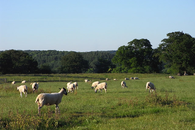
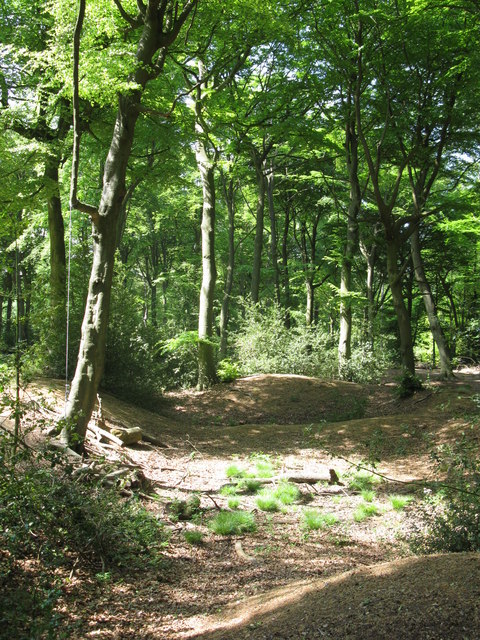
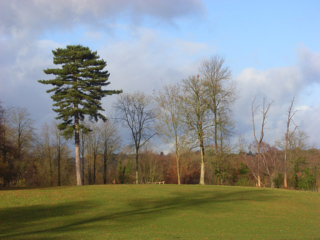
The hill is characterized by its gentle slopes and lush greenery, which are a result of the fertile soil and favorable climatic conditions. It is predominantly covered by a mix of grassland and woodlands, boasting a rich biodiversity that supports a variety of plant and animal species. This makes the area popular among nature enthusiasts and hikers alike.
Lambridge Hill offers breathtaking panoramic views of the picturesque Oxfordshire countryside. From its summit, visitors can admire the rolling hills, meandering rivers, and quaint villages that dot the landscape. On clear days, even distant landmarks such as the spires of Oxford University can be spotted.
The hill is easily accessible by foot, with several footpaths and trails crisscrossing its slopes. These paths provide opportunities for leisurely walks, challenging hikes, or simply a peaceful retreat in nature. Additionally, Lambridge Hill is well-connected to nearby towns and villages, making it a popular destination for day trips and outdoor activities.
Overall, Lambridge Hill is a cherished natural feature of Oxfordshire, offering not only stunning views but also a tranquil escape from the bustling city life. Its diverse ecosystem and accessibility make it a beloved spot for both locals and tourists seeking to immerse themselves in the beauty of the English countryside.
If you have any feedback on the listing, please let us know in the comments section below.
Lambridge Hill Images
Images are sourced within 2km of 51.552879/-0.93313718 or Grid Reference SU7484. Thanks to Geograph Open Source API. All images are credited.


Lambridge Hill is located at Grid Ref: SU7484 (Lat: 51.552879, Lng: -0.93313718)
Administrative County: Oxfordshire
District: South Oxfordshire
Police Authority: Thames Valley
What 3 Words
///bowhead.taskbar.prune. Near Remenham, Berkshire
Nearby Locations
Related Wikis

Lower Assendon
Lower Assendon is a village in the Assendon valley in the Chiltern Hills, about 1.5 miles (2.4 km) northwest of Henley-on-Thames in South Oxfordshire...

Lambridge Wood
Lambridge Wood is a 73.8-hectare (182-acre) biological Site of Special Scientific Interest north-west of Henley-on-Thames in Oxfordshire. It is in the...

Bix and Assendon
Bix and Assendon, formerly just Bix is a mainly rural civil parish in the high Chilterns just north of Henley-on-Thames in South Oxfordshire, in the county...

Henley Park
Henley Park is a country house and landscape garden in Bix and Assendon civil parish in the Chiltern Hills of South Oxfordshire, England. The house is...
Middle Assendon
Middle Assendon is a village in the Stonor valley in the Chiltern Hills. It is about 2 miles (3.2 km) northwest of Henley-on-Thames in South Oxfordshire...
Badgemore
Badgemore is the site of an ancient manor situated West of Henley-on-Thames in Oxfordshire. == History == William the Conqueror gave Henry de Ferrers a...
Bix, Oxfordshire
Bix is a village in the civil parish of Bix and Assendon in South Oxfordshire, about 2.5 miles (4 km) northwest of Henley-on-Thames. The village is about...

Rotherfield Greys Castle
Rotherfield Greys Castle, initially known as Retherfield Castle, is a 14th-century fortified manor house built in Rotherfield Greys, Oxfordshire. Only...
Nearby Amenities
Located within 500m of 51.552879,-0.93313718Have you been to Lambridge Hill?
Leave your review of Lambridge Hill below (or comments, questions and feedback).