Norwood Hill

Hill, Mountain in Nottinghamshire Newark and Sherwood

England

Norwood Hill

Footpath to Halam Part of the Robin Hood Way.
Footpath to Halam Credit: Jonathan Thacker

Norwood Hill is a small, picturesque hill located in the county of Nottinghamshire, England. Situated in the heart of the Nottinghamshire countryside, it offers breathtaking views of the surrounding area. Despite its name, Norwood Hill is not an actual mountain but rather a gently sloping hill, adding to its charm and accessibility.

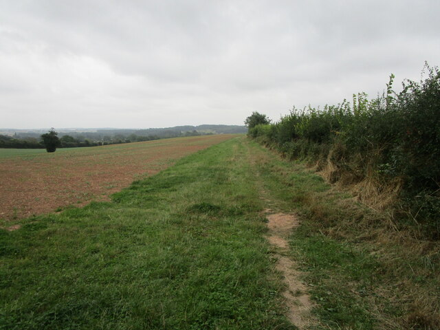
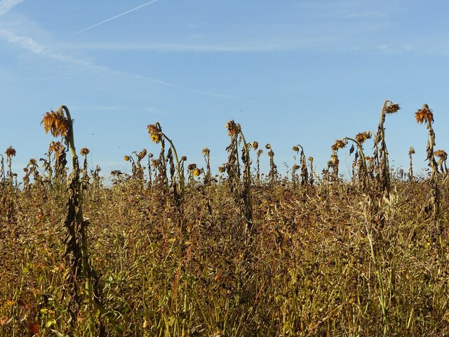
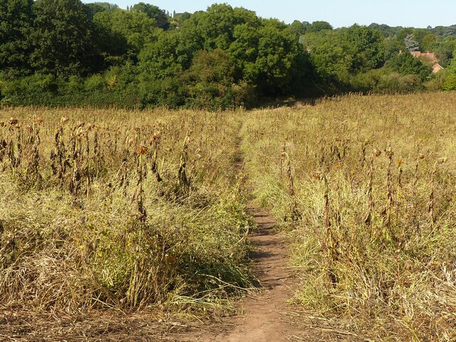
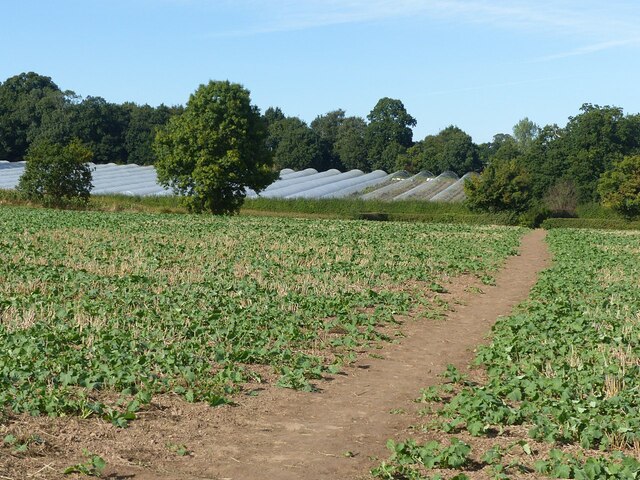
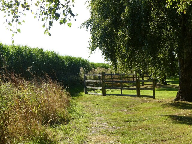
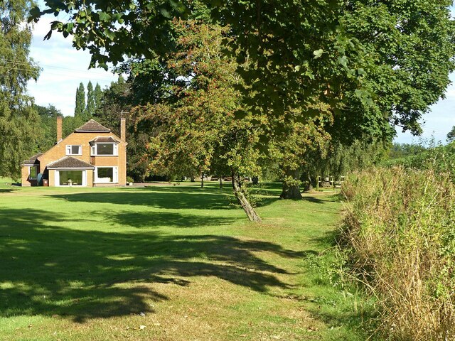
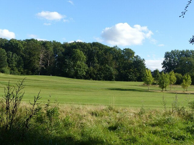
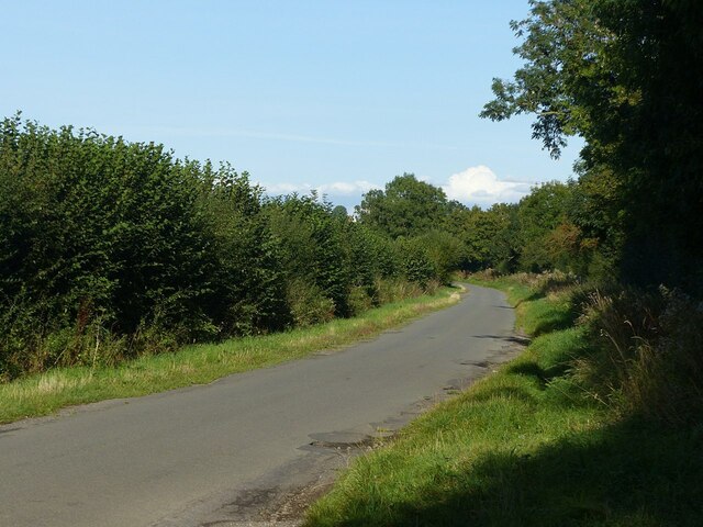
Covered in lush greenery and dotted with a variety of trees, Norwood Hill is a haven for nature enthusiasts and hikers. The hill is home to a diverse range of flora and fauna, with wildflowers and birdsong filling the air. It is not uncommon to come across grazing sheep or cattle, adding to the rural ambiance.

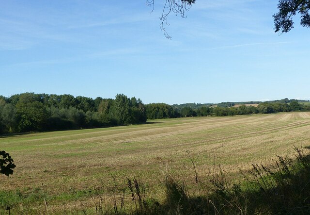
At the summit of Norwood Hill, visitors are treated to panoramic vistas of the rolling countryside, with vast fields and farmland stretching as far as the eye can see. On clear days, it is even possible to catch a glimpse of the distant city skyline.

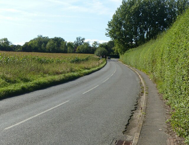
The hill is easily accessible via several footpaths and trails that wind their way up its slopes. These paths are well-maintained and suitable for various fitness levels, making Norwood Hill a popular destination for walkers, joggers, and families alike.

Norwood Hill offers a peaceful and tranquil escape from the hustle and bustle of urban life. Whether it be for a leisurely stroll, a picnic with loved ones, or simply to bask in the beauty of nature, this Nottinghamshire gem provides a serene spot to unwind and reconnect with the great outdoors.

If you have any feedback on the listing, please let us know in the comments section below.
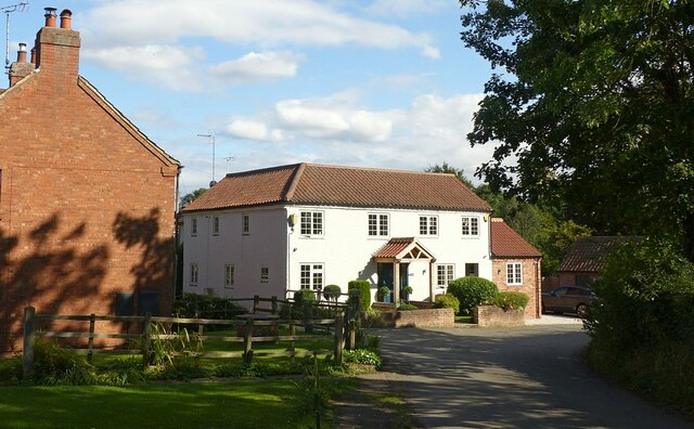
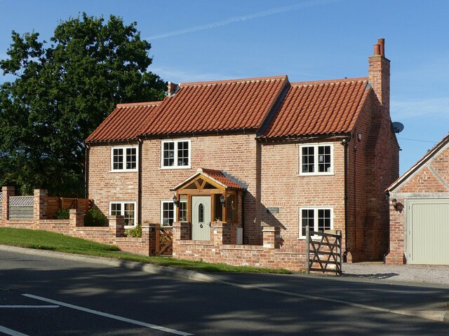
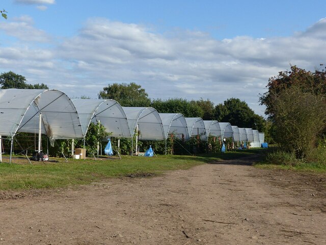
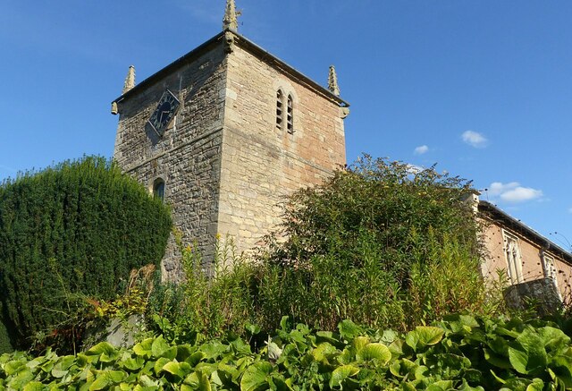
Norwood Hill Images

Images are sourced within 2km of 53.082867/-0.98169806 or Grid Reference SK6854. Thanks to Geograph Open Source API. All images are credited.

Footpath to Halam Part of the Robin Hood Way.
Footpath to Halam
Part of the Robin Hood Way.
Grounds of Southwell RFC Recreating this 'First' for the square <a title="https://www.geograph.org.uk/photo/40852" href="https://www.geograph.org.uk/photo/40852">Link</a> .

This is now the back way into the new Leisure Centre (buildings to the left) and a new long stay car park for the town.
Grounds of Southwell RFC
Recreating this 'First' for the square Link . This is now the back way into the new Leisure Centre (buildings to the left) and a new long stay car park for the town.
Droopy heads Decaying sunflower plants rising above a field of other seed plants.
Droopy heads
Decaying sunflower plants rising above a field of other seed plants.
Footpath near Westhorpe A very different crop from the barley of last year <a title="https://www.geograph.org.uk/photo/6554550" href="https://www.geograph.org.uk/photo/6554550">Link</a> , consisting of a mix of seed bearing plants, including sunflowers. The path forms part of the Robin Hood Way.
Footpath near Westhorpe
A very different crop from the barley of last year Link , consisting of a mix of seed bearing plants, including sunflowers. The path forms part of the Robin Hood Way.
The Holme, Southwell Recreating this 'First' for the square <a title="https://www.geograph.org.uk/photo/40850" href="https://www.geograph.org.uk/photo/40850">Link</a> .

The white house has undergone a major rebuild since 2005.
The Holme, Southwell
Recreating this 'First' for the square Link . The white house has undergone a major rebuild since 2005.
Sunbury Cottage, Oxton Road, Southwell 19th century farm cottage, recently refurbished from a rather dilapidated state.
Sunbury Cottage, Oxton Road, Southwell
19th century farm cottage, recently refurbished from a rather dilapidated state.
Farmland near Westhorpe An update on this 2008 view <a title="https://www.geograph.org.uk/photo/852196" href="https://www.geograph.org.uk/photo/852196">Link</a> , with a different crop and new polytunnels.
Farmland near Westhorpe
An update on this 2008 view Link , with a different crop and new polytunnels.
Junction Allenby Road and Halam Road, Southwell Recreating this 'First' for the square <a title="https://www.geograph.org.uk/photo/40856" href="https://www.geograph.org.uk/photo/40856">Link</a>
Junction Allenby Road and Halam Road, Southwell
Recreating this 'First' for the square Link
Halam Road on the edge of Southwell Recreating this 2009 submission for the square <a title="https://www.geograph.org.uk/photo/1185886" href="https://www.geograph.org.uk/photo/1185886">Link</a>
Halam Road on the edge of Southwell
Recreating this 2009 submission for the square Link
Robin Hood Way off Saversick Lane The path is not separated from the grounds of the house called Halam Gate <a title="https://www.geograph.org.uk/photo/6970083" href="https://www.geograph.org.uk/photo/6970083">Link</a> , except for this section. Until you get very close, the reason is not obvious, but is ensuring that walkers keep clear of the guy stays of an 11Kv electric transmission line pole. The path is part of the Robin Hood Way.
Robin Hood Way off Saversick Lane
The path is not separated from the grounds of the house called Halam Gate Link , except for this section. Until you get very close, the reason is not obvious, but is ensuring that walkers keep clear of the guy stays of an 11Kv electric transmission line pole. The path is part of the Robin Hood Way.
Robin Hood Way passing Halam Gate The path runs between the hedge and the line of trees but is not fenced off from the grounds of the house.
Robin Hood Way passing Halam Gate
The path runs between the hedge and the line of trees but is not fenced off from the grounds of the house.
Polytunnel at Godber's Orchard The crop in this instance is blackberries.
Polytunnel at Godber's Orchard
The crop in this instance is blackberries.
A tempting crop for passing walkers Raspberry canes with ripe fruit in a polytunnel alongside the Robin Hood Way.
A tempting crop for passing walkers
Raspberry canes with ripe fruit in a polytunnel alongside the Robin Hood Way.
Polytunnels at Godber's Orchard The track is a public footpath forming part of the Robin Hood Way.
Polytunnels at Godber's Orchard
The track is a public footpath forming part of the Robin Hood Way.
Halam Church Recreating this 'First' for the square <a title="https://www.geograph.org.uk/photo/4576" href="https://www.geograph.org.uk/photo/4576">Link</a> . The vegetation has changed significantly, to the point where I would not have chosen this viewpoint except for being in the right spot for the re-creation!
Halam Church
Recreating this 'First' for the square Link . The vegetation has changed significantly, to the point where I would not have chosen this viewpoint except for being in the right spot for the re-creation!
Norwood Park Golf Course Viewed from School Lane, Halam.
Norwood Park Golf Course
Viewed from School Lane, Halam.
Halam Mill farmland Recreating this 'First' for the square <a title="https://www.geograph.org.uk/photo/40865" href="https://www.geograph.org.uk/photo/40865">Link</a> .
Halam Mill farmland
Recreating this 'First' for the square Link .
School Lane, near Halam Approaching Lower Kirklington Road.
School Lane, near Halam
Approaching Lower Kirklington Road.
Show me another place!

Norwood Hill is located at Grid Ref: SK6854 (Lat: 53.082867, Lng: -0.98169806)

Administrative County: Nottinghamshire

District: Newark and Sherwood

Police Authority: Nottinghamshire

What 3 Words

///daily.cowering.shunts. Near Southwell, Nottinghamshire

Related Wikis

Halam, Nottinghamshire

Halam is a village and civil parish in the Newark and Sherwood district of Nottinghamshire, England, with a population of 372 in 2001, increasing to 426...

St Michael the Archangel's Church, Halam

St Michael the Archangel's Church, Halam is a Grade I listed parish church in the Church of England in Halam, Nottinghamshire. == History == St Michael...

Edingley

Edingley is a village in the Newark and Sherwood district of Nottinghamshire, England. According to the 2001 census it had a population of 390, increasing...

Holy Trinity Church, Southwell

Holy Trinity Church, Southwell is a parish church in the Church of England in Southwell, Nottinghamshire. The church is Grade II listed by the Department...

Nearby Amenities

Located within 500m of 53.082867,-0.98169806
Barrier: kissing_gate
Lat/Long: 53.0807426/-0.9881607
Bus Stop
School Lane
Bus: yes
Naptan AtcoCode: 3300NS0133
Naptan Bearing: S
Naptan CommonName: School Lane
Naptan Crossing: School Lane
Naptan Indicator: adj
Naptan NaptanCode: ntsdpdta
Naptan Notes: none
Naptan Street: The Turnpike
Naptan Verified: yes
Public Transport: platform
Source: naptan_import
Lat/Long: 53.0837692/-0.9890107
Bus Stop
Saversick Lane
Bus: yes
Naptan AtcoCode: 3300NS0221
Naptan Bearing: SE
Naptan CommonName: Saversick Lane
Naptan Crossing: Saversick Lane
Naptan Indicator: opp
Naptan NaptanCode: ntsdadjp
Naptan Notes: BW
Naptan Street: Halam Road
Naptan Verified: yes
Public Transport: platform
Source: naptan_import
Lat/Long: 53.080142/-0.9807143
Saversick Lane
Naptan AtcoCode: 3300NS0854
Naptan Bearing: W
Naptan BusStopType: CUS
Naptan CommonName: Saversick Lane
Naptan Crossing: Saversick Lane
Naptan Indicator: adj
Naptan NaptanCode: ntsgmtjg
Naptan Notes: 3300NS0221
Naptan Street: Halam Road
Naptan Verified: no
Source: naptan_import
Lat/Long: 53.0800859/-0.9808962
Bench
Lat/Long: 53.0819261/-0.9883799
Bench
Lat/Long: 53.0835245/-0.9889681
Information: route_marker
Tourism: information
Lat/Long: 53.0794595/-0.9809914
Telephone
Defibrillator
Access: yes
Booth: K6
Covered: booth
Defibrillator Location: inside red phone box, The Turnpike, Halam - opposite school
Emergency: defibrillator
Man Made: telephone_box
Old Phone: +44 1636 813140
Lat/Long: 53.0835498/-0.9890184
The data included in this document is from www.openstreetmap.org. The data is made available under ODbL.

Have you been to Norwood Hill?

Leave your review of Norwood Hill below (or comments, questions and feedback).