Kingswood

Settlement in Kent Maidstone

England

Kingswood

Lenham Road Kingswood The first year after coppicing there is usually a good display of bluebells
Lenham Road Kingswood Credit: Ron Lee

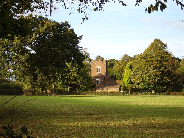
Kingswood is a small village located in the county of Kent, England. Situated approximately 20 miles southeast of London, it falls within the Sevenoaks district. The village is surrounded by picturesque countryside, providing residents with a peaceful and idyllic setting.

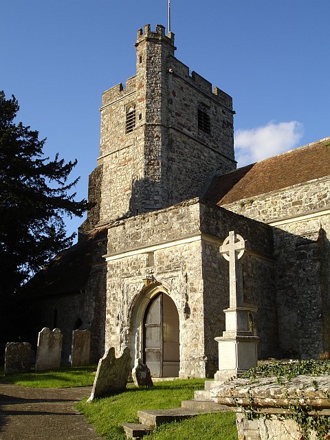
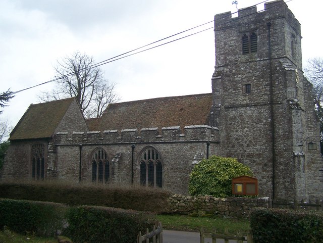
One of the notable features of Kingswood is its rich history. The village dates back to medieval times and is home to several historic buildings, including the 12th-century church of St. Simon and St. Jude. This beautiful church is a prominent landmark and serves as a reminder of the village's heritage.

Despite its small size, Kingswood offers a range of amenities for its residents. The village has a local pub, The Kingswood Arms, which is a popular gathering spot for both locals and visitors. Additionally, there is a village hall that hosts various community events and activities throughout the year.

The surrounding countryside provides ample opportunities for outdoor recreation. The village is surrounded by a network of footpaths and bridleways, making it an ideal location for hiking, cycling, and horse riding. The nearby Ashdown Forest, one of the largest free public access spaces in the South East of England, offers vast expanses of heathland and woodland for exploration.

Transport links to Kingswood are convenient, with the village being located near the M25 motorway and within easy reach of several train stations. This makes it a desirable location for commuters who work in London or other nearby towns.

Overall, Kingswood is a charming village that offers a blend of history, natural beauty, and convenient amenities, making it an attractive place to live or visit in Kent.

If you have any feedback on the listing, please let us know in the comments section below.
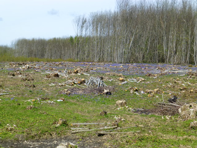
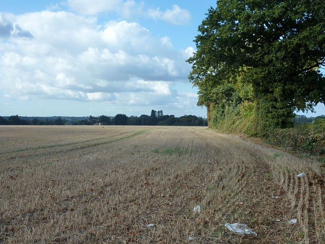
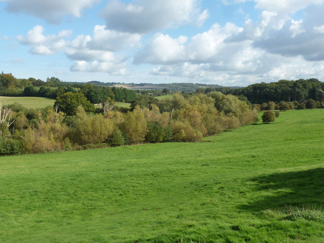
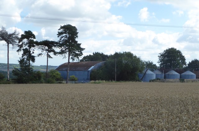
Kingswood Images

Images are sourced within 2km of 51.226569/0.629451 or Grid Reference TQ8350. Thanks to Geograph Open Source API. All images are credited.

Lenham Road Kingswood The first year after coppicing there is usually a good display of bluebells
Lenham Road Kingswood
The first year after coppicing there is usually a good display of bluebells
Field south of Burberry Lane The lane is behind the hedge on the right.
Field south of Burberry Lane
The lane is behind the hedge on the right.
Bulmershe House On Broomfield Road, opposite the end of Park Barn Road.
Bulmershe House
On Broomfield Road, opposite the end of Park Barn Road.
Broomfield church St. Margaret's.
Broomfield church
St. Margaret's.
Valley of River Len A view from the corner of Broomfield churchyard.
Valley of River Len
A view from the corner of Broomfield churchyard.
Barrack Cottages, Broomfield An early 19th century grade II listed building.
Barrack Cottages, Broomfield
An early 19th century grade II listed building.
Broomfield and Kingswood Village Sign
Morry Lane, near Kingswood
Coppiced area, Kings Wood It is chestnut coppice.
Coppiced area, Kings Wood
It is chestnut coppice.
Path junction, Kings Wood The public path is the less used one to the right, but they rejoin eventually, the left path being shorter.
Path junction, Kings Wood
The public path is the less used one to the right, but they rejoin eventually, the left path being shorter.
Pitt Road Not a very busy road - there are better alternative through routes. It seems to be mainly used by premises along it.
Pitt Road
Not a very busy road - there are better alternative through routes. It seems to be mainly used by premises along it.
Bridge over Stream on Len Valley Walk The Len Valley Walk runs between Maidstone and Lenham for 12 miles. It follows the meandering course of the River Len through the countryside of the Garden of England.
Bridge over Stream on Len Valley Walk
The Len Valley Walk runs between Maidstone and Lenham for 12 miles. It follows the meandering course of the River Len through the countryside of the Garden of England.
Park Barn Farm, near Leeds Viewed from the footpath running south from Leeds Castle and across Park Barn Road.
Park Barn Farm, near Leeds
Viewed from the footpath running south from Leeds Castle and across Park Barn Road.
Footpath on Park Barn Farm near Leeds Running south from Park Barn Road.
Footpath on Park Barn Farm near Leeds
Running south from Park Barn Road.
Footpath through Park Barn farmland, near Leeds
Footpath leading to St. Margaret's Church, Broomfield The church is Grade II* listed and dates from the 11th and 12th centuries with later alterations and restoration in 1879 by G.M.Hall.
Footpath leading to St. Margaret's Church, Broomfield
The church is Grade II* listed and dates from the 11th and 12th centuries with later alterations and restoration in 1879 by G.M.Hall.
St. Margaret's Church, Broomfield The church is Grade II* listed and dates from the 11th and 12th centuries with later alterations and restoration in 1879 by G.M.Hall.
St. Margaret's Church, Broomfield
The church is Grade II* listed and dates from the 11th and 12th centuries with later alterations and restoration in 1879 by G.M.Hall.
Show me another place!

Kingswood is located at Grid Ref: TQ8350 (Lat: 51.226569, Lng: 0.629451)

Administrative County: Kent

District: Maidstone

Police Authority: Kent

What 3 Words

///blank.decimals.seaweed. Near Harrietsham, Kent

Nearby Locations

Kingswood

Related Wikis

Kingswood, Kent

Kingswood is a village in the Maidstone District of Kent, England and forms part of the civil parish of Broomfield and Kingswood.The main village was...

Broomfield and Kingswood

Broomfield and Kingswood is a civil parish in the Maidstone district of Kent, England. The parish lies to the east of Maidstone, south of the A20 road...

All Saints Church, Ulcombe

All Saints is a parish church in Ulcombe, Kent. It was begun in the 12th century and is a Grade I listed building. == Building == The church was begun...

Ulcombe

Ulcombe is a village near the town of Maidstone in Kent, England. The name is recorded in the Domesday Book and is thought to derive from 'Owl-coomb':...

St Peter's and St Paul's Church, East Sutton

St Peter's and St Paul's Church is a parish church in Church Lane, East Sutton, Kent dedicated to saints Peter and Paul. It was begun in the mid-13th century...

East Sutton

East Sutton is a parish approximately 6 miles south-east of Maidstone in Kent, England. East Sutton is small in number of dwellings but relatively large...

HM Prison East Sutton Park

HM Prison East Sutton Park is a women's open prison and young offender's institute located in the Parish of East Sutton, near Maidstone in Kent, England...

Broomfield, Maidstone

Broomfield is a village in the Maidstone District of Kent, England, and forms part of the civil parish of Broomfield and Kingswood. It lies 6 miles (10...

Nearby Amenities

Located within 500m of 51.226569,0.629451
Bus Stop
Village Hall
Local Ref: adj
Naptan AtcoCode: 2400A022420A
Naptan Bearing: NW
Naptan BusStopType: CUS
Naptan CommonName: Village Hall
Naptan Indicator: adj
Naptan Landmark: Lenham Road
Naptan NaptanCode: kntawpaw
Naptan RevisionNumber: 4
Naptan Status: act
Naptan Street: Gravelly Bottom Road
Naptan Verified: no
Public Transport: platform
Ref: kntawpaw
Source: naptan_import
Source Date: 2018-06-04
Lat/Long: 51.2254844/0.6346326
Bus Stop
Village Hall
Local Ref: opp
Naptan AtcoCode: 2400A022430A
Naptan Bearing: SE
Naptan BusStopType: CUS
Naptan CommonName: Village Hall
Naptan Indicator: opp
Naptan Landmark: Lenham Road
Naptan NaptanCode: kntawpda
Naptan RevisionNumber: 3
Naptan Status: act
Naptan Street: Gravelly Bottom Road
Naptan Verified: no
Public Transport: platform
Ref: kntawpda
Source: naptan_import
Source Date: 2018-06-04
Lat/Long: 51.2255503/0.6347137
Bus Stop
The Waldens
Bench: yes
Bin: yes
Local Ref: adj
Naptan AtcoCode: 2400A022440A
Naptan Bearing: E
Naptan BusStopType: MKD
Naptan CommonName: The Waldens
Naptan Indicator: adj
Naptan Landmark: Holly Tree Close
Naptan NaptanCode: kntawpdg
Naptan RevisionNumber: 3
Naptan Status: act
Naptan Street: Cayser Drive
Naptan Verified: no
Public Transport: platform
Ref: kntawpdg
Shelter: yes
Source: naptan_import
Source Date: 2018-06-04
Tactile Paving: no
Lat/Long: 51.2267268/0.635509
Bus Stop
Charlesford Avenue West
Local Ref: W-bound
Naptan AtcoCode: 2400A022460A
Naptan Bearing: W
Naptan BusStopType: MKD
Naptan CommonName: Charlesford Avenue West
Naptan Indicator: W-bound
Naptan Landmark: Whitehall Road
Naptan NaptanCode: kntawpdm
Naptan RevisionNumber: 5
Naptan Status: act
Naptan Street: Charlesford Avenue
Naptan Verified: no
Public Transport: platform
Ref: kntawpdm
Source: naptan_import
Source Date: 2018-06-04
Lat/Long: 51.2291408/0.6304163
Bus Stop
Chestnut Drive
Local Ref: adj
Naptan AtcoCode: 2400A022470A
Naptan Bearing: SW
Naptan BusStopType: MKD
Naptan CommonName: Chestnut Drive
Naptan Indicator: adj
Naptan Landmark: Chestnut Drive
Naptan NaptanCode: kntawpdp
Naptan RevisionNumber: 3
Naptan Status: act
Naptan Street: Ashford Drive
Naptan Verified: no
Public Transport: platform
Ref: kntawpdp
Source: naptan_import
Source Date: 2018-06-04
Lat/Long: 51.2287579/0.6284076
Bus Stop
Chestnut Drive
Local Ref: opp
Naptan AtcoCode: 2400A022480A
Naptan Bearing: NE
Naptan BusStopType: MKD
Naptan CommonName: Chestnut Drive
Naptan Indicator: opp
Naptan Landmark: Chestnut Drive
Naptan NaptanCode: kntawpdt
Naptan RevisionNumber: 3
Naptan Status: act
Naptan Street: Ashford Drive
Naptan Verified: no
Public Transport: platform
Ref: kntawpdt
Source: naptan_import
Source Date: 2018-06-04
Lat/Long: 51.2287547/0.6282918
Bus Stop
Gravelly Bottom Road
Local Ref: before
Naptan AtcoCode: 2400A022490A
Naptan Bearing: SE
Naptan BusStopType: CUS
Naptan CommonName: Gravelly Bottom Road
Naptan Indicator: before
Naptan Landmark: Gravelly Bottom Road
Naptan NaptanCode: kntawpdw
Naptan RevisionNumber: 4
Naptan Status: act
Naptan Street: Broomfield Road
Naptan Verified: no
Public Transport: platform
Ref: kntawpdw
Source: naptan_import
Source Date: 2013-10-16
Lat/Long: 51.2269088/0.6291353
Bus Stop
Charlesford Avenue West
Local Ref: E-bound
Naptan AtcoCode: 2400A022510A
Naptan Bearing: E
Naptan BusStopType: MKD
Naptan CommonName: Charlesford Avenue West
Naptan Indicator: E-bound
Naptan Landmark: Whitehall Drive
Naptan NaptanCode: kntawpgd
Naptan RevisionNumber: 3
Naptan Status: act
Naptan Street: Charlesford Avenue
Naptan Verified: no
Public Transport: platform
Ref: kntawpgd
Source: naptan_import
Source Date: 2018-06-04
Lat/Long: 51.2291761/0.6307646
Bus Stop
Charlesford Avenue East
Bench: no
Bin: no
Lit: no
Local Ref: E-bound
Naptan AtcoCode: 2400A022520A
Naptan Bearing: E
Naptan BusStopType: MKD
Naptan CommonName: Charlesford Avenue East
Naptan Indicator: E-bound
Naptan NaptanCode: kntawpgj
Naptan RevisionNumber: 3
Naptan Status: act
Naptan Street: Charlesford Avenue
Naptan Verified: no
Public Transport: platform
Ref: kntawpgj
Shelter: no
Source: naptan_import
Source Date: 2018-06-04
Tactile Paving: no
Lat/Long: 51.2288052/0.6353504
Bus Stop
The Waldens
Bench: no
Bin: no
Local Ref: opp
Naptan AtcoCode: 2400A022530A
Naptan Bearing: W
Naptan BusStopType: MKD
Naptan CommonName: The Waldens
Naptan Indicator: opp
Naptan Landmark: The Waldens
Naptan NaptanCode: kntawpgm
Naptan RevisionNumber: 3
Naptan Status: act
Naptan Street: Cayser Drive
Naptan Verified: no
Public Transport: platform
Ref: kntawpgm
Shelter: no
Source: naptan_import
Source Date: 2018-06-04
Tactile Paving: no
Lat/Long: 51.2267865/0.6363126
Turning Circle
Lat/Long: 51.227267/0.6311732
Turning Circle
Lat/Long: 51.2281909/0.6336517
Turning Circle
Lat/Long: 51.2269714/0.6301039
Turning Circle
Lat/Long: 51.2282843/0.6301105
Turning Circle
Lat/Long: 51.2257357/0.6349996
Kingswood
Place: village
Source: OS_OpenData_StreetView
Wikidata: Q6413753
Lat/Long: 51.2274962/0.6319737
Nisa Local, Charlesford Avenue
Shop: convenience
Lat/Long: 51.2290925/0.6320907
Recycling
Lat/Long: 51.2253266/0.6349018
Turning Circle
Lat/Long: 51.2255274/0.6358018
Post Box
Operator: Royal Mail
Post Box Design: hovis
Post Box Type: lamp
Ref: ME17 100D
Royal Cypher: EVIIR
Royal Cypher Wikidata: Q33102324
Lat/Long: 51.2221455/0.628847
Post Box
Collection Times: Mo-Fr 17:00, Sa 11:30
Operator: Royal Mail
Post Box Type: pillar
Ref: ME17 317
Royal Cypher: EIIR
Royal Cypher Wikidata: Q33102113
Lat/Long: 51.2290556/0.6320546
Post Office
Kingswood Post Office
Brand: Post Office
Brand Wikidata: Q1783168
Check Date: 2023-09-27
Operator: Nisa Local
Ref Pol Id: 5112
Lat/Long: 51.2290903/0.6320583
Post Box
Operator: Royal Mail
Post Box Type: lamp
Ref: ME17 236D
Lat/Long: 51.2252708/0.6360641
Post Box
Operator: Royal Mail
Post Box Type: lamp
Ref: ME17 273D
Lat/Long: 51.2280625/0.6280974
Bus Stop
Gravelly Bottom Road
Local Ref: after
Naptan AtcoCode: 2400A022500A
Naptan Bearing: NW
Naptan BusStopType: CUS
Naptan CommonName: Gravelly Bottom Road
Naptan Indicator: after
Naptan Landmark: Gravelly Bottom Road
Naptan NaptanCode: kntawpga
Naptan RevisionNumber: 4
Naptan Status: act
Naptan Street: Broomfield Road
Naptan Verified: no
Public Transport: platform
Ref: kntawpga
Source: naptan_import
Source Date: 2013-10-16
Lat/Long: 51.2269367/0.6289519
Noexit: yes
Lat/Long: 51.2271643/0.6249507
The data included in this document is from www.openstreetmap.org. The data is made available under ODbL.

Have you been to Kingswood?

Leave your review of Kingswood below (or comments, questions and feedback).