Barnardiston

Settlement in Suffolk West Suffolk

England

Barnardiston

Demolition of food factory Part of the Vion food processing factory, near Great Wratting, is currently being demolished.
Demolition of food factory Credit: Bob Jones

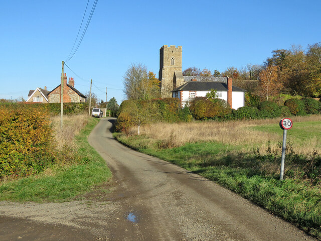
Barnardiston is a small village located in Suffolk, England. Situated in the East Anglia region, it is part of the county of Suffolk and falls within the Babergh district. The village lies approximately 15 miles south-west of the county town of Ipswich and is nestled amidst picturesque countryside.

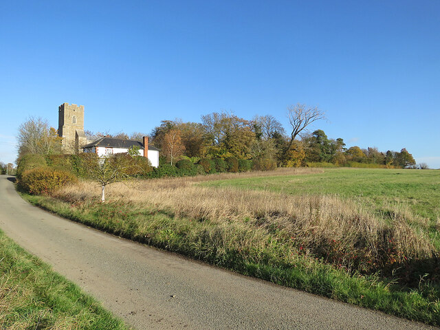
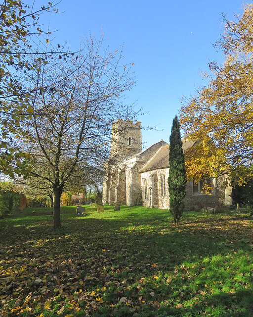
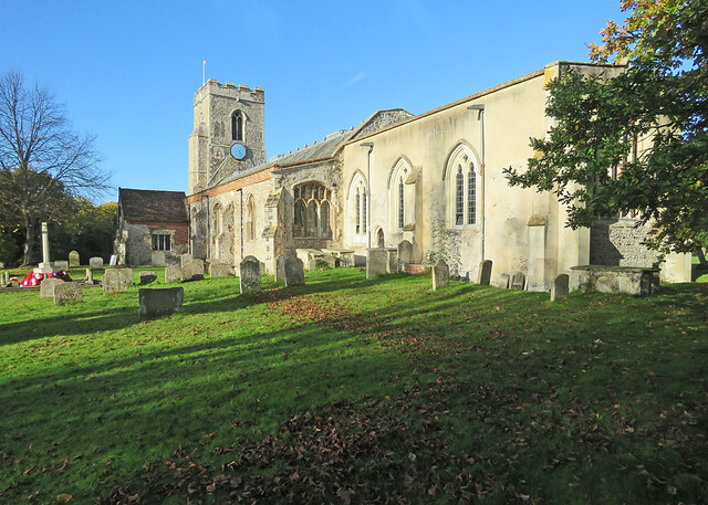
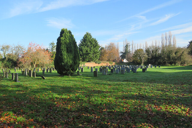
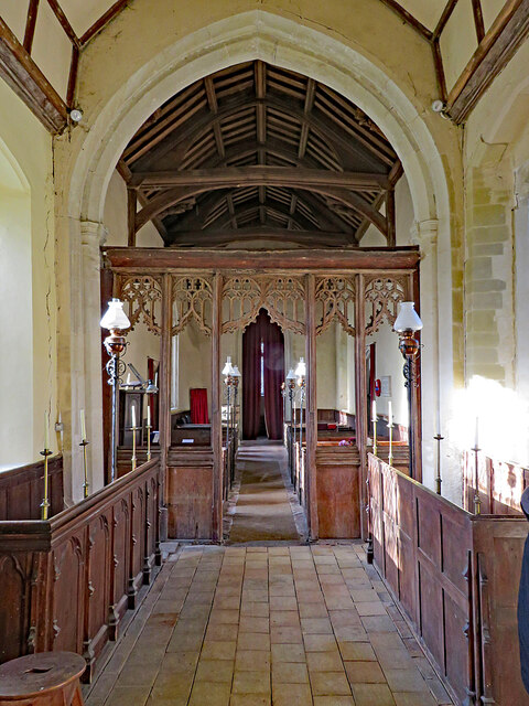
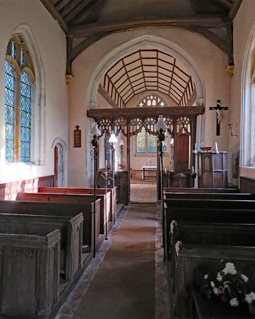
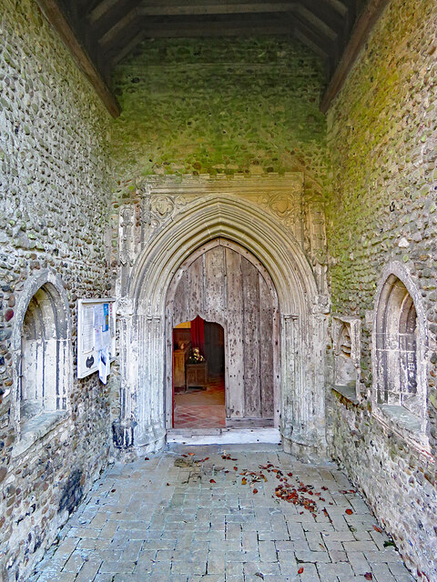
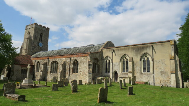
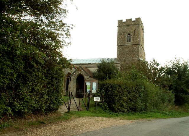
With a population of around 300 residents, Barnardiston exudes a sense of tranquility and charm. The village is renowned for its traditional thatched-roof cottages and historic buildings, reflecting its rich heritage. St. Katherine's Church, dating back to the 14th century, stands as a prominent landmark within the village.

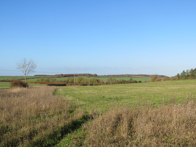
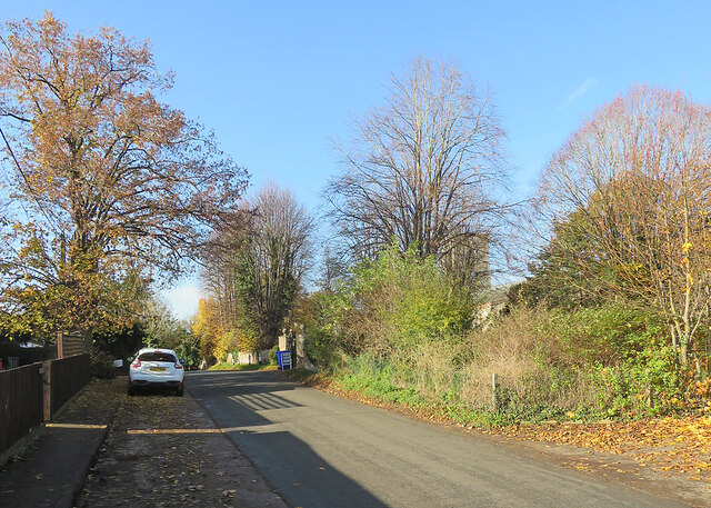
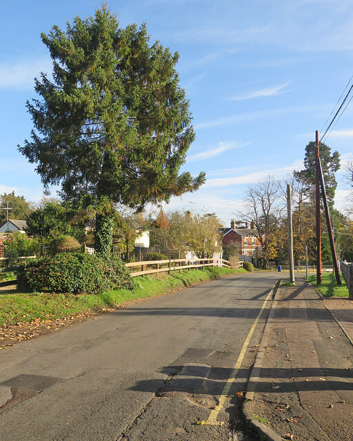
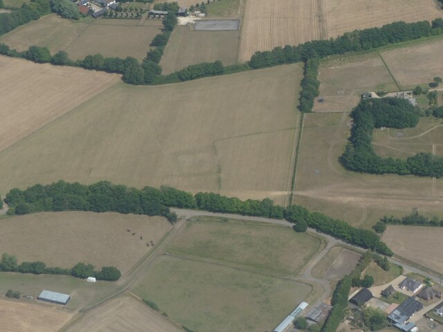
Surrounded by lush green fields and rolling hills, Barnardiston offers a peaceful retreat for nature enthusiasts and outdoor lovers. The area is known for its scenic walking trails and cycling routes, providing ample opportunities to explore the stunning countryside.

Despite its small size, Barnardiston boasts a tight-knit community and prides itself on its community spirit. The village has a local pub, The Old Plough, which serves as a social hub for residents and visitors alike. Additionally, the village hall hosts various events and activities throughout the year, fostering a sense of togetherness.

Barnardiston's rural location means that amenities and services are limited within the village itself. However, nearby towns and villages provide access to essential facilities, including schools, shops, and healthcare services.

In summary, Barnardiston offers a charming and idyllic rural setting, perfect for those seeking a peaceful retreat amidst the natural beauty of Suffolk.

If you have any feedback on the listing, please let us know in the comments section below.
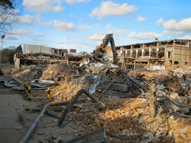
Barnardiston Images

Images are sourced within 2km of 52.111502/0.49904711 or Grid Reference TL7148. Thanks to Geograph Open Source API. All images are credited.

Demolition of food factory Part of the Vion food processing factory, near Great Wratting, is currently being demolished.
Demolition of food factory
Part of the Vion food processing factory, near Great Wratting, is currently being demolished.
Barnardiston: All Saints' Church and Church Cottage Church Lane serves Leys Farm, then becomes a track to Kedington. The church is prettily placed on a hillock on the edge of the village. The picture was taken on a mild and sunny November morning.
Barnardiston: All Saints' Church and Church Cottage
Church Lane serves Leys Farm, then becomes a track to Kedington. The church is prettily placed on a hillock on the edge of the village. The picture was taken on a mild and sunny November morning.
Barnardiston: All Saints A small and pleasing Grade II* listed mediaeval church. The south wall of the chancel shows how necessary the substantial buttresses are. Norman Scarfe (in the Shell Guide) and Nikolaus Pevsner had more to say about the interior than the external fabric.
Barnardiston: All Saints
A small and pleasing Grade II* listed mediaeval church. The south wall of the chancel shows how necessary the substantial buttresses are. Norman Scarfe (in the Shell Guide) and Nikolaus Pevsner had more to say about the interior than the external fabric.
Barnardiston: All Saints' Church and churchyard Pleasing colours on a sunny November morning. The church is Grade II* listed and has 13th-, 14th- and 15th-century elements.
Barnardiston: All Saints' Church and churchyard
Pleasing colours on a sunny November morning. The church is Grade II* listed and has 13th-, 14th- and 15th-century elements.
Barnardiston: a view from Church Lane Gently rolling country on the edge of Suffolk, dissected by streams which are tributaries of the infant River Stour, which rises just over the county border, in Cambridgeshire.
Barnardiston: a view from Church Lane
Gently rolling country on the edge of Suffolk, dissected by streams which are tributaries of the infant River Stour, which rises just over the county border, in Cambridgeshire.
Barnardiston: Church Lane and All Saints The mediaeval parish church's Grade II* listing begins "A small church with a substantial tower that stands on high ground, and so can be seen from some distance".
Barnardiston: Church Lane and All Saints
The mediaeval parish church's Grade II* listing begins "A small church with a substantial tower that stands on high ground, and so can be seen from some distance".
Kedington: Mill Road The tower of the parish church shows beyond the trees on the right in a picture taken on a fine November morning.
Kedington: Mill Road
The tower of the parish church shows beyond the trees on the right in a picture taken on a fine November morning.
Kedington: along Mill Road A sunny November morning.
Kedington: along Mill Road
A sunny November morning.
Kedington: St Peter and St Paul This delightful church, full of monuments and curiosities, is "among the first four a visitor to Suffolk should see" according to Norman Scarfe in the Shell Guide (1960). In the week after Remembrance Sunday the war memorial was surrounded by poppy wreaths.
Kedington: St Peter and St Paul
This delightful church, full of monuments and curiosities, is "among the first four a visitor to Suffolk should see" according to Norman Scarfe in the Shell Guide (1960). In the week after Remembrance Sunday the war memorial was surrounded by poppy wreaths.
In Kedington churchyard This is an eastward extension of the original churchyard. The photograph was taken on a wonderful November morning.
In Kedington churchyard
This is an eastward extension of the original churchyard. The photograph was taken on a wonderful November morning.
Kedington: over the churchyard wall in November Hall Farm is on the right.
Kedington: over the churchyard wall in November
Hall Farm is on the right.
Kedington: St Peter and St Paul from the west The imposing flint tower of this uncommonly interesting and endearing church (one of Simon Jenkins' hundred best) has chequerwork at the base and other flushwork higher up. On a fine November morning there were long shadows
Kedington: St Peter and St Paul from the west
The imposing flint tower of this uncommonly interesting and endearing church (one of Simon Jenkins' hundred best) has chequerwork at the base and other flushwork higher up. On a fine November morning there were long shadows
Barnardiston: All Saints - chancel and screen This small, simple and pleasing church has several attractive features. "Screen. One-light divisions, arches with tracery over" (Nikolaus Pevsner).
Barnardiston: All Saints - chancel and screen
This small, simple and pleasing church has several attractive features. "Screen. One-light divisions, arches with tracery over" (Nikolaus Pevsner).
Barnardiston: All Saints - nave and chancel A simple 14th-century church in a small Suffolk village.
Barnardiston: All Saints - nave and chancel
A simple 14th-century church in a small Suffolk village.
Barnardiston: All Saints - porch and north doorway "The N porch has an exceptionally tall entrance. Handsome C14 N doorway" (Nikolaus Pevsner). Though the porch is high, you have to bend down to unlock and get through the ogee-topped opening cut into the main door.
Barnardiston: All Saints - porch and north doorway
"The N porch has an exceptionally tall entrance. Handsome C14 N doorway" (Nikolaus Pevsner). Though the porch is high, you have to bend down to unlock and get through the ogee-topped opening cut into the main door.
St Peter and St Paul  Kedington The church of St Peter and St Paul Kedington is special in that it was virtually untouched by the Victorians (apart from the skylights in the nave) and stuffed full of fantastic monuments to the Barnardistons who were Lords of the Manor from 13th century until 1745 (and have caused this church to be known as the Westminster Abbey of Suffolk).
St Peter and St Paul Kedington
The church of St Peter and St Paul Kedington is special in that it was virtually untouched by the Victorians (apart from the skylights in the nave) and stuffed full of fantastic monuments to the Barnardistons who were Lords of the Manor from 13th century until 1745 (and have caused this church to be known as the Westminster Abbey of Suffolk).
Cropmark on field west of Hundon: aerial 2022
A143 towards Bury St Edmunds
Show me another place!

Barnardiston is located at Grid Ref: TL7148 (Lat: 52.111502, Lng: 0.49904711)

Administrative County: Suffolk

District: West Suffolk

Police Authority: Suffolk

What 3 Words

///dish.stiffly.deprive. Near Kedington, Suffolk

Nearby Locations

Barnardiston

Related Wikis

Barnardiston

Barnardiston ( bar-nər-DIS-tən) is a village and parish in the West Suffolk district of Suffolk, England. The village is located about four miles north...

Babel Green

Babel Green is a village in Suffolk, England. There are 3969 places (city, towns, hamlets …) within a radius of 100 kilometers / 62 miles from the center...

Kedington

Kedington is a village and civil parish in the West Suffolk district of Suffolk in eastern England, located between the towns of Clare and Haverhill in...

Great Wratting

Great Wratting is a village and civil parish in England, about four miles from Haverhill, Suffolk, in the valley of the River Stour. There is a ford across...

RAF Stradishall

Royal Air Force Stradishall or more simply RAF Stradishall is a former Royal Air Force station located 7 miles (11 km) north east of Haverhill, Suffolk...

Trundley and Wadgell's Wood, Great Thurlow

Trundley and Wadgell's Wood, Great Thurlow is a 79.4-hectare (196-acre) biological Site of Special Scientific Interest east of Great Thurlow in Suffolk...

Little Wratting

Little Wratting is a small village and civil parish in the West Suffolk district of Suffolk in eastern England. Located on the north-eastern edge of Haverhill...

HM Prison Highpoint South

HM Prison Highpoint South (formerly called Highpoint prison) is a Category C men's prison, located in the village of Stradishall (near Haverhill) in Suffolk...

Nearby Amenities

Located within 500m of 52.111502,0.49904711
Barnardiston
Place: hamlet
Source: npe
Wikidata: Q2568455
Lat/Long: 52.1110286/0.4979094
Bus Stop
Greys Lane
Naptan AtcoCode: 390050152
Naptan Bearing: SW
Naptan BusStopType: CUS
Naptan CommonName: Greys Lane
Naptan Indicator: opp
Naptan Landmark: Greys Lane
Naptan NaptanCode: sufgdmgd
Naptan Street: A143
Naptan Verified: no
Source: naptan_import
Lat/Long: 52.1117727/0.4936828
Bus Stop
Greys Lane
Naptan AtcoCode: 390050153
Naptan Bearing: NE
Naptan BusStopType: CUS
Naptan CommonName: Greys Lane
Naptan Indicator: adj
Naptan Landmark: Greys Lane
Naptan NaptanCode: sufgdmgj
Naptan Street: A143
Naptan Verified: no
Source: naptan_import
Lat/Long: 52.1116887/0.4934006
Bus Stop
Telephone Box
Naptan AtcoCode: 390050154
Naptan Bearing: E
Naptan BusStopType: CUS
Naptan CommonName: Telephone Box
Naptan Indicator: o/s
Naptan Landmark: Telephone Box
Naptan NaptanCode: sufgdmgm
Naptan Street: Hundon Road
Naptan Verified: no
Source: naptan_import
Lat/Long: 52.11315/0.501253
Bus Stop
Telephone Box
Naptan AtcoCode: 390050155
Naptan Bearing: W
Naptan BusStopType: CUS
Naptan CommonName: Telephone Box
Naptan Indicator: opp
Naptan Landmark: Telephone Box
Naptan NaptanCode: sufgdmgp
Naptan Street: Hundon Road
Naptan Verified: no
Source: naptan_import
Lat/Long: 52.1130779/0.5012636
Bus Stop
Post Office
Naptan AtcoCode: 390051003
Naptan Bearing: W
Naptan BusStopType: CUS
Naptan CommonName: Post Office
Naptan Indicator: o/s
Naptan Landmark: Post Office
Naptan NaptanCode: sufgmgmt
Naptan Street: Greys Lane
Naptan Verified: no
Source: naptan_import
Lat/Long: 52.1114684/0.4982814
Bus Stop
Post Office
Naptan AtcoCode: 390051004
Naptan Bearing: E
Naptan BusStopType: CUS
Naptan CommonName: Post Office
Naptan Indicator: opp
Naptan Landmark: Post Office
Naptan NaptanCode: sufgmgmw
Naptan Street: Greys Lane
Naptan Verified: no
Source: naptan_import
Lat/Long: 52.1115852/0.498288
Post Box
Ref: CB9 41
Lat/Long: 52.1114917/0.4974825
The data included in this document is from www.openstreetmap.org. The data is made available under ODbL.

Have you been to Barnardiston?

Leave your review of Barnardiston below (or comments, questions and feedback).