Barnard's Green

Settlement in Worcestershire Malvern Hills

England

Barnard's Green

Great Malvern Station The exterior and passenger entrance of Great Malvern Station.
Great Malvern Station Credit: Rob Newman

Barnard's Green is a small village located in the county of Worcestershire, England. Situated about two miles south of the town of Great Malvern, it is a predominantly residential area with a population of around 3,000 residents.

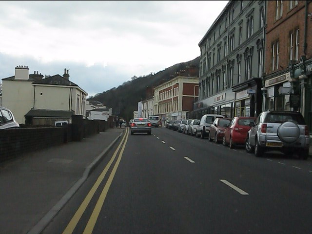
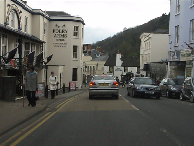
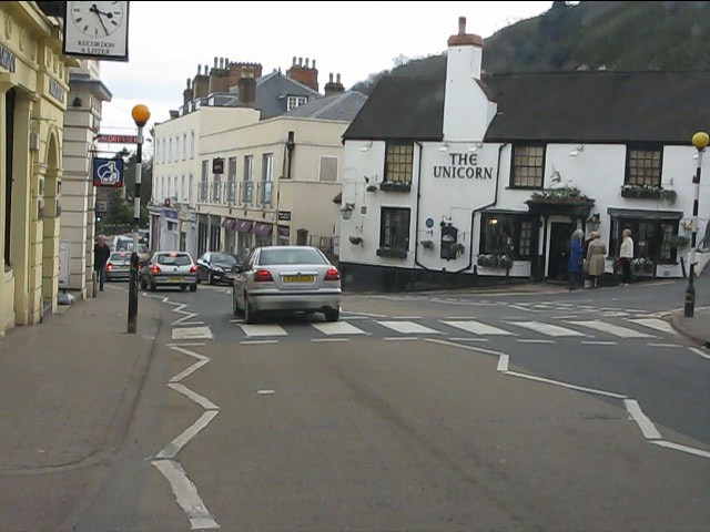
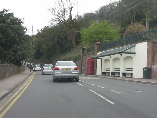
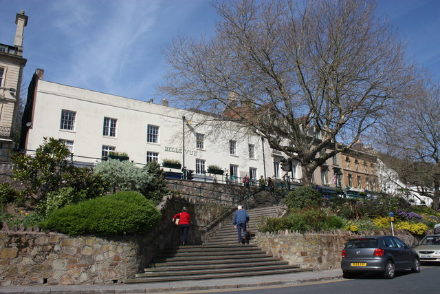
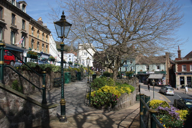
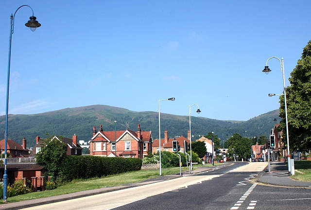
The village is known for its picturesque surroundings, nestled at the foot of the Malvern Hills, an Area of Outstanding Natural Beauty. This location provides residents and visitors with stunning views and opportunities for outdoor activities such as hiking, cycling, and horse riding.

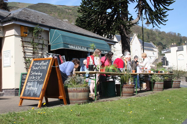
Barnard's Green is well-served by local amenities, including a range of independent shops, cafes, and restaurants. The village also boasts a primary school, making it an attractive place for families looking for a quiet and friendly community.

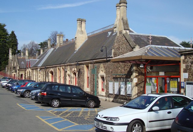
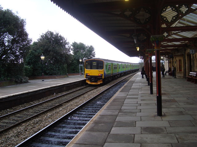
Transport connections in the area are good, with regular bus services linking Barnard's Green to nearby towns and the city of Worcester. The Great Malvern railway station, located nearby, provides easy access to larger cities such as Birmingham and London.

One of the highlights of Barnard's Green is the local cricket ground, which hosts regular matches and events throughout the summer months. Additionally, the village is home to the Barnard's Green Rugby Club, offering opportunities for sports enthusiasts to get involved in local teams and activities.

Overall, Barnard's Green offers a peaceful and idyllic setting, with a strong sense of community and access to beautiful countryside, making it a desirable place to live or visit in Worcestershire.

If you have any feedback on the listing, please let us know in the comments section below.

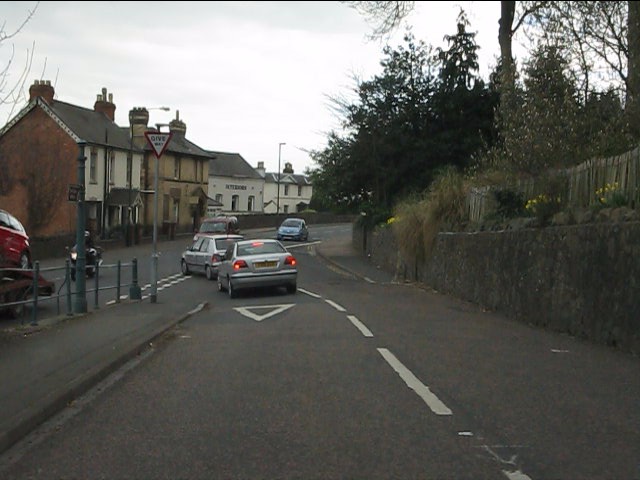
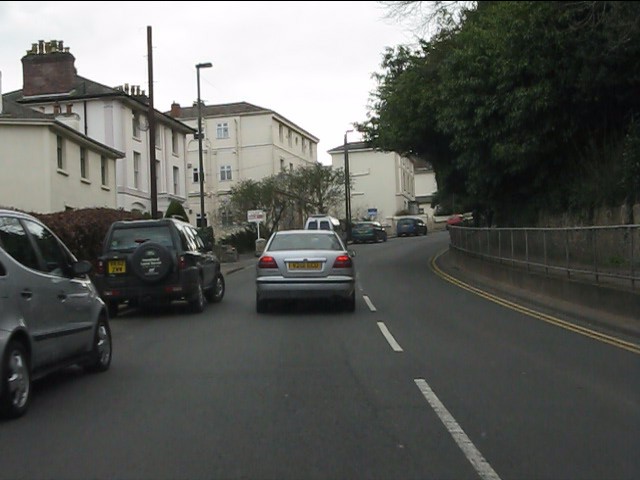
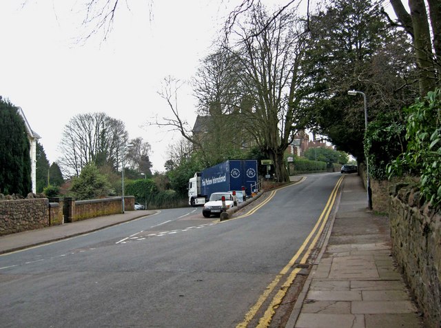
Barnard's Green Images

Images are sourced within 2km of 52.106931/-2.311704 or Grid Reference SO7845. Thanks to Geograph Open Source API. All images are credited.

Great Malvern Station The exterior and passenger entrance of Great Malvern Station.
Great Malvern Station
The exterior and passenger entrance of Great Malvern Station.
North Malvern Road meets Worcester Road A busy junction with blind sightlines both ways and heavy traffic on all routes.  Typical of local roads in the Malvern area and symptomatic of the town centre's decline in favour of more accessible retail parks.
North Malvern Road meets Worcester Road
A busy junction with blind sightlines both ways and heavy traffic on all routes. Typical of local roads in the Malvern area and symptomatic of the town centre's decline in favour of more accessible retail parks.
Great Malvern - Worcester Road near Bank Street
Great Malvern - Worcester Road at Bray's Bray's department store occupies the grey-painted building on the right.  A rare survivor of the "Are You Being Served?" variety.
Great Malvern - Worcester Road at Bray's
Bray's department store occupies the grey-painted building on the right. A rare survivor of the "Are You Being Served?" variety.
Great Malvern - Worcester Road at the Foley Arms Hotel The Foley Arms had a chequered life in the period 2008-2010. It ceased trading as a hotel, was occupied by its own staff in a "sit in" and finally acquired by the Wetherspoons chain, whose name it now sports.  The Foley Arms now (2011) provides both accommodation and the usual Wetherspoons bar experience.
Great Malvern - Worcester Road at the Foley Arms Hotel
The Foley Arms had a chequered life in the period 2008-2010. It ceased trading as a hotel, was occupied by its own staff in a "sit in" and finally acquired by the Wetherspoons chain, whose name it now sports. The Foley Arms now (2011) provides both accommodation and the usual Wetherspoons bar experience.
Great Malvern - The Unicorn pub Proof that you can see a unicorn!  There's one over the entrance.
Great Malvern - The Unicorn pub
Proof that you can see a unicorn! There's one over the entrance.
Great Malvern - sheltered seating near the Belle Vue Hotel
Great Malvern Station, South End A "Sprinter" train, No 150106, leaves Great Malvern Station for the south
Great Malvern Station, South End
A "Sprinter" train, No 150106, leaves Great Malvern Station for the south
Plant sale outside Greenlink Organic Greenlink is one of the better shops in Malvern for organic wholefood and much more.
A real alternative to Waitrose (visible beyond the monkey puzzle tree)
In addition to plants there was a sale of refurbished tools.
North Hill in the background.
Plant sale outside Greenlink Organic
Greenlink is one of the better shops in Malvern for organic wholefood and much more. A real alternative to Waitrose (visible beyond the monkey puzzle tree) In addition to plants there was a sale of refurbished tools. North Hill in the background.
Mc Cann / Hook gravestone in Malvern churchyard Just caught in the sunlight.
To the memory of Anne Elizabeth wife of John Mc Cann of this parish who died Oct 9th 1852 aged 42 years.
Also of Elizabeth Patience Hook, aged 50 years, daughter of the above, who died at sea Feb 27th 1867 (Lat 51:18s Long 132 w)
Also of Kate Elizabeth, daughter of George and Elizabeth Patience Hook who died March 8th 1867 aged 9 months
Also of William youngest son of the above
died Decr 18th 1906 aged 59 years
Mc Cann / Hook gravestone in Malvern churchyard
Just caught in the sunlight. To the memory of Anne Elizabeth wife of John Mc Cann of this parish who died Oct 9th 1852 aged 42 years. Also of Elizabeth Patience Hook, aged 50 years, daughter of the above, who died at sea Feb 27th 1867 (Lat 51:18s Long 132 w) Also of Kate Elizabeth, daughter of George and Elizabeth Patience Hook who died March 8th 1867 aged 9 months Also of William youngest son of the above died Decr 18th 1906 aged 59 years
Belle Vue Island The island stands between the A449 Ledbury to Worcester road above and Abbey Road below.
It takes its name from Belle Vue Terrace and the old Belle Vue Hotel (Belle Vue is still visible on the building).
The two London plane trees were planted in memory of the 1982 Falklands war and were saved from felling when the island was improved by a campaign: "Save the Belle Vue Two".
Belle Vue Island
The island stands between the A449 Ledbury to Worcester road above and Abbey Road below. It takes its name from Belle Vue Terrace and the old Belle Vue Hotel (Belle Vue is still visible on the building). The two London plane trees were planted in memory of the 1982 Falklands war and were saved from felling when the island was improved by a campaign: "Save the Belle Vue Two".
Belle Vue Island Looking north from the Malvhina fountain.
The gas lamps are soon to be converted to use more efficient burners making them brighter, cheaper and more reliable.
Belle Vue Island
Looking north from the Malvhina fountain. The gas lamps are soon to be converted to use more efficient burners making them brighter, cheaper and more reliable.
Gas lamp on Belle Vue Island The Victorian gas lamps are all "listed", but under threat as they are very expensive to run and maintain.
Planning permission is being sought to change the burners to make them more efficient, brighter, cheaper and more reliable.
On the right is the Post Office; on the left the Blue Bird Tea Rooms above Elts shoe shop, Time Outdoors selling hiking clothing and equipment and the Tourist Information Centre.
Gas lamp on Belle Vue Island
The Victorian gas lamps are all "listed", but under threat as they are very expensive to run and maintain. Planning permission is being sought to change the burners to make them more efficient, brighter, cheaper and more reliable. On the right is the Post Office; on the left the Blue Bird Tea Rooms above Elts shoe shop, Time Outdoors selling hiking clothing and equipment and the Tourist Information Centre.
Junction of Priory Road and Abbey Road, Great Malvern Priory Road is on the left, and Abbey Road is on the right.
Junction of Priory Road and Abbey Road, Great Malvern
Priory Road is on the left, and Abbey Road is on the right.
Grange Road, Great Malvern More or less on this corner, Abbey Road becomes Grange Road. Abbey Road also continues to the left, but not shown in this view. Beyond the car in Grange Road, in the distance, is Malvern's well known theatre complex.
Grange Road, Great Malvern
More or less on this corner, Abbey Road becomes Grange Road. Abbey Road also continues to the left, but not shown in this view. Beyond the car in Grange Road, in the distance, is Malvern's well known theatre complex.
Steps from Wells Road to Belle Vue Terrace, Great Malvern If you like hills and climbing, then Malvern is the place to be.
Steps from Wells Road to Belle Vue Terrace, Great Malvern
If you like hills and climbing, then Malvern is the place to be.
Busker outside Waitrose, Great Malvern A cellist plays under the circular glass roof at the start of the walkway by the Waitrose supermarket.
Beyond is the rival supermarket Somerfield which is becoming a Co-op, but was originally built as the International in the 1980s which then boasted a fresh fish stall, a butchery department and an in-store bakery - all soon went.
They even had a creche with a television - I remember watching the Mary Rose being raised from its watery grave from that in-store TV.
Busker outside Waitrose, Great Malvern
A cellist plays under the circular glass roof at the start of the walkway by the Waitrose supermarket. Beyond is the rival supermarket Somerfield which is becoming a Co-op, but was originally built as the International in the 1980s which then boasted a fresh fish stall, a butchery department and an in-store bakery - all soon went. They even had a creche with a television - I remember watching the Mary Rose being raised from its watery grave from that in-store TV.
Somerfield supermarket, Great Malvern Almost a Co-op supermarket now except for the external signage.
Built as the International in the 1980s promising an indoor bakery, fresh fish counter, butchery and even a creche. All soon went. 
An alley way, Church Walk, was created to connect the supermarket to the main shopping street, Church Street, by removing one shop.
This walkway continues past the supermarket to Edith Walk from where one can access the new(er) Waitrose supermarket (just visible on the left edge of the photograph).
Somerfield supermarket, Great Malvern
Almost a Co-op supermarket now except for the external signage. Built as the International in the 1980s promising an indoor bakery, fresh fish counter, butchery and even a creche. All soon went. An alley way, Church Walk, was created to connect the supermarket to the main shopping street, Church Street, by removing one shop. This walkway continues past the supermarket to Edith Walk from where one can access the new(er) Waitrose supermarket (just visible on the left edge of the photograph).
Show me another place!

Barnard's Green is located at Grid Ref: SO7845 (Lat: 52.106931, Lng: -2.311704)

Administrative County: Worcestershire

District: Malvern Hills

Police Authority: West Mercia

What 3 Words

///beside.woes.dishes. Near Great Malvern, Worcestershire

Nearby Locations

Barnard's Green

Related Wikis

Barnards Green

Barnards Green is one of the main population areas of Malvern, Worcestershire, England, situated approximately 1 mile (1.6 km) east and downhill from Great...

Malvern Hills Science Park

Malvern Hills Science Park is located on a 10 acre (4 Hectare) site in the Barnards Green suburb of Malvern, Worcestershire, England. It is a partnership...

The Chase School

The Chase School is a secondary school (ages 11–18) in Malvern, Worcestershire, England. The school opened as a Secondary Modern in 1953 under headteacher...

Great Malvern railway station

Great Malvern railway station is one of two stations serving the town of Malvern, Worcestershire, England (the other being Malvern Link station) on the...

Nearby Amenities

Located within 500m of 52.106931,-2.311704
Barnard's Green
Alt Name: Barnards Green
Place: suburb
Source: NPE
Wikidata: Q4861451
Wikipedia: en:Barnards Green
Lat/Long: 52.1084042/-2.3089257
Bicycle Parking
Bicycle Parking: stands
Capacity: 8
Covered: yes
Lat/Long: 52.1088643/-2.3183074
Traffic Signals
Crossing: traffic_signals
Crossing Ref: pelican
Lat/Long: 52.1084938/-2.3111414
Crossing
Crossing: uncontrolled
Crossing Ref: zebra
Lat/Long: 52.1088177/-2.3121273
Crossing
Crossing: uncontrolled
Crossing Ref: zebra
Lat/Long: 52.1088185/-2.3119417
Traffic Signals
Crossing: traffic_signals
Crossing Ref: pelican
Lat/Long: 52.1085309/-2.31114
Post Box
Post Box Type: lamp
Ref: WR14 18
Lat/Long: 52.1074853/-2.3173673
Barrier: cattle_grid
Lat/Long: 52.1055857/-2.30594
Crossing
Crossing: uncontrolled
Crossing Ref: zebra
Lat/Long: 52.1032749/-2.3076704
Bus Stop
Court Road Shops
Bus: yes
Naptan AtcoCode: 2000G009100
Naptan Bearing: SW
Naptan CommonName: Court Road Shops
Naptan Indicator: adj
Naptan Landmark: Shops
Naptan NaptanCode: wocdmwja
Naptan PlusbusZoneRef: GTMLVRN
Naptan Street: Court Road
Naptan Verified: no
Public Transport: platform
Source: naptan_import;survey
Lat/Long: 52.1082238/-2.3125781
Bus Stop
Clock Shelter
Bus: yes
Naptan AtcoCode: 2000G009101
Naptan Bearing: N
Naptan CommonName: Clock Shelter
Naptan Indicator: adj
Naptan Landmark: Clock Shelter
Naptan NaptanCode: wocdmwjd
Naptan PlusbusZoneRef: GTMLVRN
Naptan Street: Barnards Green
Naptan Verified: no
Public Transport: platform
Shelter: yes
Source: naptan_import
Timetable: real_time
Lat/Long: 52.1086296/-2.3122324
Bus Stop
Barnards Green Shops
Bus: yes
Naptan AtcoCode: 2000G009103
Naptan Bearing: SE
Naptan CommonName: Barnards Green Shops
Naptan Indicator: adj
Naptan Landmark: Shops
Naptan NaptanCode: wocdmwjm
Naptan PlusbusZoneRef: GTMLVRN
Naptan Street: Barnards Green Road
Naptan Verified: no
Public Transport: platform
Shelter: yes
Source: naptan_import
Timetable: real_time
Lat/Long: 52.1084775/-2.3098547
Bus Stop
Chase Technology College
Bus: yes
Naptan AtcoCode: 2000G063600
Naptan Bearing: W
Naptan CommonName: Chase Technology College
Naptan Indicator: adj
Naptan NaptanCode: wocdjpaj
Naptan PlusbusZoneRef: GTMLVRN
Naptan Street: Geraldine Road
Naptan Verified: no
Public Transport: platform
Source: naptan_import
Lat/Long: 52.1033516/-2.3090354
Bus Stop
Christ Church
Bus: yes
Naptan AtcoCode: 2000G500805
Naptan Bearing: SE
Naptan CommonName: Christ Church
Naptan Indicator: adj
Naptan Landmark: Christ Church
Naptan NaptanCode: wocdawja
Naptan PlusbusZoneRef: GTMLVRN
Naptan Street: Avenue Road
Naptan Verified: no
Public Transport: platform
Source: naptan_import
Lat/Long: 52.1096809/-2.3158465
Bus Stop
Christ Church
Bus: yes
Naptan AtcoCode: 2000G500806
Naptan Bearing: NW
Naptan CommonName: Christ Church
Naptan Indicator: opp
Naptan Landmark: Christ Church
Naptan NaptanCode: wocdawjd
Naptan PlusbusZoneRef: GTMLVRN
Naptan Street: Avenue Road
Naptan Verified: no
Public Transport: platform
Source: naptan_import
Lat/Long: 52.1096706/-2.3163429
Bus Stop
Crown Lea Avenue
Bus: yes
Naptan AtcoCode: 2000G502626
Naptan Bearing: SW
Naptan CommonName: Crown Lea Avenue
Naptan Crossing: Crown Lea Avenue
Naptan Indicator: Adj
Naptan NaptanCode: wocdmtda
Naptan PlusbusZoneRef: GTMLVRN
Naptan Street: Pound Bank Road
Naptan Verified: no
Public Transport: platform
Source: naptan_import
Lat/Long: 52.1092291/-2.3055921
Bus Stop
Malvern- Barnards Green Road
Bench: no
Bin: no
Bus: yes
Naptan AtcoCode: 2000G502631
Naptan Bearing: NW
Naptan CommonName: Malvern- Barnards Green Road
Naptan Indicator: Adj
Naptan Landmark: Playing Fields
Naptan NaptanCode: wocdmtdj
Naptan PlusbusZoneRef: GTMLVRN
Naptan Street: Barnards Green Road
Public Transport: platform
Shelter: no
Source: naptan_import;survey
Lat/Long: 52.1106622/-2.31548
Bus Stop
Borrowdale Road
Bus: yes
Naptan AtcoCode: 2000G502636
Naptan Bearing: SW
Naptan CommonName: Borrowdale Road
Naptan Crossing: Borrowdale Road
Naptan Indicator: Adj
Naptan NaptanCode: wocdmpaw
Naptan PlusbusZoneRef: GTMLVRN
Naptan Street: Pound Bank Road
Naptan Verified: no
Public Transport: platform
Shelter: yes
Source: naptan_import
Lat/Long: 52.1086697/-2.3083017
Bus Stop
Borrowdale Road
Bus: yes
Naptan AtcoCode: 2000G502637
Naptan Bearing: NE
Naptan CommonName: Borrowdale Road
Naptan Crossing: Borrowdale Road
Naptan Indicator: Opp
Naptan NaptanCode: wocdmpda
Naptan PlusbusZoneRef: GTMLVRN
Naptan Street: Pound Bank Road
Naptan Verified: no
Public Transport: platform
Source: naptan_import
Lat/Long: 52.1090009/-2.3077959
Bus Stop
Court Road
Bus: yes
Naptan AtcoCode: 2000G502659
Naptan Bearing: SW
Naptan CommonName: Court Road
Naptan Crossing: Clarence Road
Naptan Indicator: opp
Naptan NaptanCode: wocdmtjw
Naptan PlusbusZoneRef: GTMLVRN
Naptan Street: Court Road
Naptan Verified: no
Public Transport: platform
Source: naptan_import
Lat/Long: 52.1065138/-2.3171669
Bus Stop
Court Road
Bus: yes
Naptan AtcoCode: 2000G502660
Naptan Bearing: NE
Naptan CommonName: Court Road
Naptan Crossing: Clarence Road
Naptan Indicator: adj
Naptan NaptanCode: wocdmtma
Naptan PlusbusZoneRef: GTMLVRN
Naptan Street: Court Road
Naptan Verified: no
Public Transport: platform
Source: naptan_import
Lat/Long: 52.1071233/-2.3164065
Post Box
Collection Plate: CP1
Collection Times: Mo-Fr 17:30; Sa 11:30
Historic Operator: Post Office
Post Box Type: wall
Ref: WR14 34
Royal Cypher: GVIR
Royal Cypher Wikidata: Q33102169
Lat/Long: 52.1100711/-2.3139692
Co-op Food
Addr Housenumber: 86-88
Addr Postcode: WR14 3LY
Addr Street: Barnard's Green Road
Brand: Co-op Food
Brand Wikidata: Q3277439
Fhrs Id: 684877
Operator: The Co-operative Group
Operator Wikidata: Q117202
Shop: convenience
Source Addr: FHRS Open Data
Website: https://www.coop.co.uk/store-finder/WR14-3LY/86-88-barnards-green-road
Lat/Long: 52.1084084/-2.3110994
Taxi
Lat/Long: 52.1084795/-2.31129
Traffic Signals
Crossing: traffic_signals
Crossing Ref: pelican
Lat/Long: 52.1083037/-2.3091573
Fast Food
Barnards Greeen Fish Bar
Addr Housenumber: 74
Addr Postcode: WR14 3LY
Addr Street: Barnard's Green Road
Addr Unit: Unit 3
Cuisine: fish_and_chips
Delivery: no
Drive Through: no
Fhrs Id: 672743
Outdoor Seating: no
Source Addr: FHRS Open Data
Takeaway: only
Lat/Long: 52.1083799/-2.3118589
Suzannes
Shop: hairdresser
Lat/Long: 52.1084435/-2.3116612
Fast Food
Hing Tai
Addr Housenumber: 74
Addr Postcode: WR14 3LY
Addr Street: Barnard's Green Road
Cuisine: chinese
Fhrs Id: 672570
Source Addr: FHRS Open Data
Lat/Long: 52.1083953/-2.3117779
T P Travel Services
Shop: travel_agency
Source: Local_ Bing
Lat/Long: 52.1083236/-2.3102151
Dentist
Barnards Green Dental Practice
Healthcare: dentist
Source: Local_ Bing
Lat/Long: 52.108676/-2.3092025
Fast Food
Cold Chef
Addr Housenumber: 1A
Addr Postcode: WR14 3BS
Addr Street: Court Road
Cuisine: sandwich
Fhrs Id: 672730
Shop: deli
Source Addr: FHRS Open Data
Lat/Long: 52.1083036/-2.3121065
Scottwroe
Shop: hearing_aids
Lat/Long: 52.1084063/-2.3117128
Acorns
Shop: charity
Lat/Long: 52.1082692/-2.3122451
Shop: vacant
Lat/Long: 52.1083304/-2.31033
All Occassions
Shop: stationery
Lat/Long: 52.1069537/-2.3164454
Court Road Bakery
Addr City: Malvern
Addr Housenumber: 61
Addr Postcode: WR14 3ED
Addr Street: Court Road
Fhrs Id: 672863
Shop: vacant
Source Addr: FHRS Open Data
Lat/Long: 52.1068895/-2.3166365
Annette's
Shop: hairdresser
Lat/Long: 52.1071894/-2.3167756
Taxi
Lat/Long: 52.1086837/-2.312153
Historic: memorial
Memorial: war_memorial
Wikidata: Q107214872
Lat/Long: 52.1084679/-2.3123406
Atm
Lat/Long: 52.108431/-2.3102778
Post Office
Barnards Green
Addr City: Malvern
Addr Housenumber: 1
Addr Postcode: WR14 3BS
Addr Street: Court Road
Addr Village: Barnards Green
Brand: Post Office
Brand Wikidata: Q1783168
Fhrs Id: 684870
Opening Hours: Mo-Sa 09:00-17:30
Ref Pol Id: 8863
Source Addr: FHRS Open Data
Source Opening Hours: pol_branch_list_2018-01
Website: https://www.postoffice.co.uk/branch-finder/2312476/barnards-green
Lat/Long: 52.1083239/-2.312014
Post Box
Collection Plate: CP1
Collection Times: Mo-Fr 17:30; Sa 11:30
Historic Operator: Royal Mail
Post Box Apertures: 2
Post Box Manufacturer: Machan
Post Box Type: pillar
Ref: WR14 54
Royal Cypher: EIIR
Royal Cypher Wikidata: Q33102113
Lat/Long: 52.1083855/-2.3120243
Toilets
Lat/Long: 52.1084017/-2.3119799
Fast Food
Subway
Addr City: Malvern
Addr County: Worcestershire
Addr Housenumber: 85
Addr Postcode: WR14 3LT
Addr Street: Barnard's Green Road
Brand: Subway
Brand Wikidata: Q244457
Brand Wikipedia: en:Subway (restaurant)
Contact Website: https://restaurants.subway.com/united-kingdom/en/malvern/85-barnards-green-road-barnards-green
Cuisine: sandwich
Fhrs Id: 1200332
Source Addr: FHRS Open Data
Takeaway: yes
Lat/Long: 52.1087761/-2.3116762
Fast Food
Wok n' Roll
Addr Housenumber: 80
Addr Postcode: WR14 3LY
Addr Street: Barnard's Green Road
Cuisine: chinese
Fhrs Id: 672596
Source Addr: FHRS Open Data
Lat/Long: 52.1084425/-2.3114738
One Stop
Addr Housenumber: 87-91
Addr Postcode: WR14 3LT
Addr Street: Barnard's Green Road
Brand: One Stop
Brand Wikidata: Q65954217
Contact Website: https://www.onestop.co.uk/store?store=37dff838-df8d-4a33-9972-174fbe612d3e
Fhrs Id: 684990
Shop: convenience
Source Addr: FHRS Open Data
Lat/Long: 52.1087243/-2.3115275
Coral
Brand: Coral
Brand Wikidata: Q54621344
Brand Wikipedia: en:Coral (bookmaker)
Shop: bookmaker
Lat/Long: 52.1084334/-2.3113383
Barnards Green Butchers
Addr Housenumber: 78
Addr Postcode: WR14 3LY
Addr Street: Barnard's Green Road
Fhrs Id: 672855
Shop: butcher
Source Addr: FHRS Open Data
Lat/Long: 52.1084433/-2.311581
Pharmacy
Lloyds Pharmacy
Brand: Lloyds Pharmacy
Brand Wikidata: Q6662870
Brand Wikipedia: en:LloydsPharmacy
Healthcare: pharmacy
Lat/Long: 52.1086435/-2.3113571
Tokyo Nails & Spa
Shop: beauty
Lat/Long: 52.1086369/-2.3110634
Colston Bakery
Addr City: Malvern
Addr County: Worcestershire
Addr Housenumber: 106
Addr Postcode: WR14 3ND
Addr Street: Barnard's Green Road
Fhrs Id: 672861
Shop: bakery
Source Addr: FHRS Open Data
Lat/Long: 52.1083585/-2.3105149
Floral Arts Design by Carolyn
Shop: florist
Lat/Long: 52.1083535/-2.3106128
The Cheeseboard
Addr Housenumber: 100
Addr Postcode: WR14 3ND
Addr Street: Barnard's Green Road
Fhrs Id: 684939
Shop: deli
Source Addr: FHRS Open Data
Website: http://www.cheeseboardmalvern.com
Lat/Long: 52.108356/-2.3106826
Just So
Shop: gift
Lat/Long: 52.1083881/-2.3109186
Crossing
Crossing Ref: zebra
Lat/Long: 52.1031671/-2.3148604
Sir Charles Hastings
Historic: memorial
Inscription: Sir Charles Hastings M.D. 1794-1886 Founder of B.M.A. lived here
Memorial: blue_plaque
Operator: Malvern Civic Society
Lat/Long: 52.1070073/-2.3063589
A. B. Optics
Shop: optician
Lat/Long: 52.1085907/-2.3105842
Blue Cross
Brand: Blue Cross
Brand Wikidata: Q3520039
Brand Wikipedia: en:Blue Cross (animal charity)
Shop: charity
Lat/Long: 52.1088492/-2.3117745
Cafe
Cafe in the Green
Addr Housenumber: 121
Addr Postcode: WR14 3LT
Addr Street: Barnard's Green Road
Fhrs Id: 743975
Source Addr: FHRS Open Data
Lat/Long: 52.108567/-2.310411
Co-op
Shop: funeral_directors
Lat/Long: 52.108639/-2.3109585
Divine
Shop: hairdresser
Lat/Long: 52.1085744/-2.3104835
Elite Service Centre
Craft: key_cutter
Lat/Long: 52.1086285/-2.3111301
Fast Food
Food Factory
Addr Housenumber: 109
Addr Postcode: WR14 3LT
Addr Street: Barnard's Green Road
Cuisine: fish_and_chips
Fhrs Id: 672742
Source Addr: FHRS Open Data
Lat/Long: 52.1086028/-2.3107528
Gaynor-Smith, Owen & Co.
Lawyer: solicitor
Office: lawyer
Lat/Long: 52.1086236/-2.3097844
Hair Essentials
Shop: hairdresser
Lat/Long: 52.1087053/-2.310024
Fast Food
Hong Kong
Addr Housenumber: 97
Addr Postcode: WR14 3LT
Addr Street: Barnard's Green Road
Cuisine: chinese
Fhrs Id: 672744
Source Addr: FHRS Open Data
Lat/Long: 52.1086357/-2.3112432
Cats Protection
Brand: Cats Protection
Brand Wikidata: Q5053998
Brand Wikipedia: en:Cats Protection
Shop: charity
Lat/Long: 52.1085786/-2.3101545
Barnard's Green Store
Shop: convenience
Lat/Long: 52.1085637/-2.3102759
Malvern Beauty
Shop: beauty
Lat/Long: 52.1086415/-2.3107282
Marshall
Craft: pottery
Lat/Long: 52.1086031/-2.3108227
Veterinary
Masefiled Veterinary Centre
Lat/Long: 52.1083227/-2.3127706
Mobile Solutions
Shop: mobile_phone
Lat/Long: 52.1087601/-2.3100759
Natural Choice
Addr Housenumber: 111
Addr Postcode: WR14 3LT
Addr Street: Barnards Green Road
Fhrs Id: 684911
Shop: greengrocer
Source Addr: FHRS Open Data
Lat/Long: 52.1085976/-2.3106684
St Richards Hospice
Shop: charity
Lat/Long: 52.1082875/-2.3121739
Swinton
Brand: Swinton
Brand Wikidata: Q7658785
Brand Wikipedia: en:Swinton Insurance
Office: insurance
Lat/Long: 52.1086432/-2.3096153
Atm
Operator: Post Office
Lat/Long: 52.108348/-2.3120075
Bargain Booze
Brand: Bargain Booze
Brand Wikidata: Q16971315
Brand Wikipedia: en:Bargain Booze
Shop: alcohol
Lat/Long: 52.1083758/-2.3108241
Barbertown
Shop: hairdresser
Lat/Long: 52.1085876/-2.3100826
Mercian
Shop: carpet
Lat/Long: 52.1086023/-2.3099641
Beauty Salon
Addr Housenumber: 40
Addr Street: Court Road
Shop: beauty
Lat/Long: 52.1072074/-2.3162905
Dog Games LTD
Office: company
Lat/Long: 52.1080733/-2.311222
Defibrillator
Emergency: defibrillator
Lat/Long: 52.1072572/-2.3173564
Defibrillator
Emergency: defibrillator
Indoor: no
Lat/Long: 52.1096539/-2.3153662
Great Malvern
Public Transport: stop_position
Railway: stop
Train: yes
Lat/Long: 52.1089287/-2.3181828
Pharmacy
Claremont House Pharmacy
Healthcare: pharmacy
Lat/Long: 52.1084285/-2.31128
Entrance: main
Lat/Long: 52.1103909/-2.3080879
Generator Method: photovoltaic
Generator Output Electricity: yes
Generator Source: solar
Generator Type: solar_photovoltaic_panel
Location: roof
Power: generator
Lat/Long: 52.1102513/-2.3082997
Generator Method: photovoltaic
Generator Output Electricity: yes
Generator Source: solar
Generator Type: solar_photovoltaic_panel
Location: roof
Power: generator
Lat/Long: 52.1054179/-2.309221
Generator Method: photovoltaic
Generator Output Electricity: yes
Generator Source: solar
Generator Type: solar_photovoltaic_panel
Location: roof
Power: generator
Lat/Long: 52.1057391/-2.309964
Generator Method: photovoltaic
Generator Output Electricity: yes
Generator Source: solar
Generator Type: solar_photovoltaic_panel
Location: roof
Power: generator
Lat/Long: 52.1049929/-2.3092344
Bicycle Parking
Bicycle Parking: shed
Lat/Long: 52.1044552/-2.3112525
Crossing
Lat/Long: 52.1051812/-2.3053608
Bicycle Parking
Access: yes
Bicycle Parking: lockers
Capacity: 6
Covered: yes
Fee: no
Lat/Long: 52.1088288/-2.3183231
Generator Source: solar
Power: generator
Lat/Long: 52.1093699/-2.3090467
Generator Source: solar
Power: generator
Lat/Long: 52.1067115/-2.3178001
Generator Source: solar
Power: generator
Lat/Long: 52.1075323/-2.3181461
Generator Source: solar
Power: generator
Lat/Long: 52.1074714/-2.315312
Generator Source: solar
Power: generator
Lat/Long: 52.1078705/-2.3167929
Generator Source: solar
Power: generator
Lat/Long: 52.1082168/-2.317328
Generator Source: solar
Power: generator
Lat/Long: 52.1102006/-2.3069841
Barrier: yes
Lat/Long: 52.1078997/-2.3107565
Bicycle Parking
Bicycle Parking: stands
Capacity: 4
Lat/Long: 52.1086604/-2.3122157
School
MSJ Benhams
Lat/Long: 52.1104409/-2.3156372
Waste Basket
Mapillary: 928512894389682
Material: wood
Lat/Long: 52.1084415/-2.3122473
Bench
Mapillary: 928512894389682
Material: concrete
Lat/Long: 52.1084543/-2.3122633
Clock
Display: analog
Faces: 1
Support: wall
Lat/Long: 52.108568/-2.3122237
The data included in this document is from www.openstreetmap.org. The data is made available under ODbL.

Have you been to Barnard's Green?

Leave your review of Barnard's Green below (or comments, questions and feedback).