Cocks Hill

Hill, Mountain in Oxfordshire South Oxfordshire

England

Cocks Hill

Woodland, Checkendon Beeches to the west of Checkendon Court.
Woodland, Checkendon Credit: Andrew Smith

Cocks Hill is a prominent hill located in Oxfordshire, England. Situated in the southern part of the county, it lies approximately 4 miles northwest of the town of Witney and 10 miles west of the city of Oxford. The hill is part of the larger Cotswold Hills area, renowned for its natural beauty and picturesque landscapes.

Rising to an elevation of about 215 meters (705 feet), Cocks Hill stands as a notable landmark in the region. It offers stunning panoramic views of the surrounding countryside, including the rolling hills, farmland, and quaint villages that dot the area.

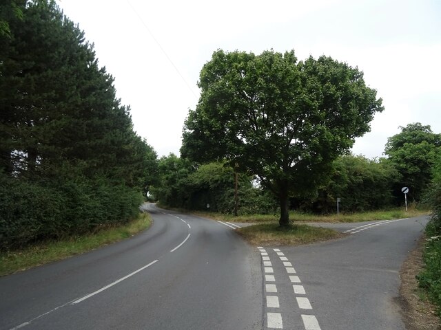
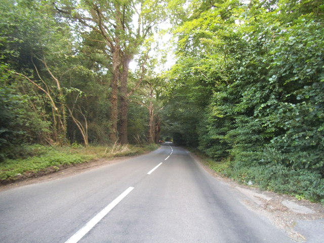
The hill itself is predominantly covered with grasslands and patches of woodland, providing habitat for a variety of plant and animal species. It is a popular spot for walkers, hikers, and nature enthusiasts who enjoy exploring the footpaths and trails that traverse the area.

Cocks Hill is also known for its historical significance. It bears remnants of ancient settlements and archaeological sites, including Iron Age hillforts and burial mounds, highlighting its importance in the region's past.

The hill is easily accessible by road, with parking available nearby. It attracts visitors throughout the year, offering a peaceful and serene environment away from the hustle and bustle of urban life. Whether it's enjoying a leisurely walk, capturing breathtaking views, or immersing oneself in the rich history of the area, Cocks Hill provides a delightful experience for all who venture to its summit.

If you have any feedback on the listing, please let us know in the comments section below.

Cocks Hill Images

Images are sourced within 2km of 51.53123/-1.0462074 or Grid Reference SU6681. Thanks to Geograph Open Source API. All images are credited.

Woodland, Checkendon Beeches to the west of Checkendon Court.
Woodland, Checkendon
Beeches to the west of Checkendon Court.
Pasture and farm buildings, Checkendon Corker's Farm viewed from the footpath passing to its west.
Pasture and farm buildings, Checkendon
Corker's Farm viewed from the footpath passing to its west.
Direction Sign – Signpost on the B471 in Woodcote parish Located on the northwest side of the junction of the B471 Goring Road and Whitehouse Road in Woodcote parish. 3 arms and pawn finial. The Goring Heath / Reading arm had been lost by 2017.

Milestone Society National ID: OX_SU6481
Direction Sign – Signpost on the B471 in Woodcote parish
Located on the northwest side of the junction of the B471 Goring Road and Whitehouse Road in Woodcote parish. 3 arms and pawn finial. The Goring Heath / Reading arm had been lost by 2017. Milestone Society National ID: OX_SU6481
Recreation ground, Woodcote
Village sign, Woodcote
The Red Lion, Woodcote On Goring Road.
See <a href="https://www.geograph.org.uk/photo/7246411">SU6482 : Sign for the Red Lion, Woodcote</a> for sign.
The Red Lion, Woodcote
On Goring Road. See SU6482 : Sign for the Red Lion, Woodcote for sign.
Sign for the Red Lion, Woodcote See <a href="https://www.geograph.org.uk/photo/7246410">SU6482 : The Red Lion, Woodcote</a> for context.
Sign for the Red Lion, Woodcote
Woodcote Village Hall
War Memorial, Woodcote
Fingerpost, Woodcote
Junction of Oxford Road / Tidmore Lane
Greenmoor hill views
The A4074 at the junction of Deadman's Lane
Woodland by the A4074, Cane End
Deadman's Lane, Cane End
1 Langtree Cottages, Checkendon, Oxfordshire 1906 by Maxwell Ayrton in Arts and Crafts style. 

(Source:Historic England)
1 Langtree Cottages, Checkendon, Oxfordshire
1906 by Maxwell Ayrton in Arts and Crafts style. (Source:Historic England)
Foundry Cottage, Checkendon, Oxfordshire C17 with C20 windows. Brick ground floor with areas of flint; timber frame to first floor, rendered panels to left, brick infill to right. Old plain tile roof; brick stacks. 2-unit plan. 2-storey, 3-window range. Central 2-panel door with C20 gabled tile porch. 2-light casement to left. 2 single-light casements to right. Three 2-light casements to first floor. Roof hipped to right. Ridge stack to right and end stack to left.

(Source:Historic England)
Foundry Cottage, Checkendon, Oxfordshire
C17 with C20 windows. Brick ground floor with areas of flint; timber frame to first floor, rendered panels to left, brick infill to right. Old plain tile roof; brick stacks. 2-unit plan. 2-storey, 3-window range. Central 2-panel door with C20 gabled tile porch. 2-light casement to left. 2 single-light casements to right. Three 2-light casements to first floor. Roof hipped to right. Ridge stack to right and end stack to left. (Source:Historic England)
Lane through the beech woods, Hook End, Oxfordshire
Show me another place!

Cocks Hill is located at Grid Ref: SU6681 (Lat: 51.53123, Lng: -1.0462074)

Administrative County: Oxfordshire

District: South Oxfordshire

Police Authority: Thames Valley

What 3 Words

///frogs.strain.laughs. Near Rotherfield Peppard, Oxfordshire

Related Wikis

Exlade Street

Exlade Street is a hamlet in Checkendon civil parish in Oxfordshire, about 6 miles (9.7 km) northwest of Reading, in the Chiltern Hills. The hamlet is...

Hook End Recording Studios

Hook End Recording Studios was a recording studio located in Hook End Manor, a 16th-century Elizabethan house near Checkendon, Oxfordshire, England. Its...

The Oratory School

The Oratory School () is an HMC co-educational private Roman Catholic boarding and day school for pupils aged 11–18 located in Woodcote, 6 miles (9.7 km...

St Peter and St Paul, Checkendon

St Peter and St Paul is the Church of England parish church of Checkendon, a village in Oxfordshire, England. Its parish is part of the Deanery of Henley...

Checkendon

Checkendon is a village and civil parish about 6 miles (10 km) west of Henley-on-Thames in South Oxfordshire and about 9 miles (14 km) north west of Reading...

Langtree School

Langtree School is a coeducational secondary school located in the village of Woodcote in South Oxfordshire, England. The school has approximately 624...

Woodcote

Woodcote is a village and civil parish in South Oxfordshire, about 5 miles (8 km) southeast of Wallingford and about 7 miles (11 km) northwest of Reading...

Wyfold Court

Wyfold Court is a country house at Rotherfield Peppard in south Oxfordshire. It is a Grade II* listed building. By the year 2000, the estate had been converted...

Nearby Amenities

Located within 500m of 51.53123,-1.0462074
Pub
The Highwayman
Addr City: Checkendon
Addr Hamlet: Exlade Street
Addr Postcode: RG8 0UA
Addr Street: Exlade Street
Email: enquiries@thehighwaymaninn-checkendon.co.uk
Opening Hours: Tu-Sa 12:00-15:00,18:00-23:00; Su 12:00-15:00; Mo closed
Phone: +44 1491 682020
Website: http://thehighwaymaninn-checkendon.co.uk/
Wikidata: Q26650360
Lat/Long: 51.5318363/-1.0507502
Exlade Street
Place: hamlet
Source Name: OS_OpenData_StreetView
Wikidata: Q5420441
Wikipedia: en:Exlade Street
Lat/Long: 51.5327262/-1.0524962
Barrier: kissing_gate
Bicycle: no
Foot: yes
Lat/Long: 51.5325391/-1.052006
Barrier: kissing_gate
Bicycle: no
Foot: yes
Lat/Long: 51.5345233/-1.0490698
Post Box
Operator: Royal Mail
Post Box Type: wall
Ref: RG8 46
Royal Cypher: VR
Lat/Long: 51.5328922/-1.0525659
The data included in this document is from www.openstreetmap.org. The data is made available under ODbL.

Have you been to Cocks Hill?

Leave your review of Cocks Hill below (or comments, questions and feedback).