Blackberry Hill

Hill, Mountain in Nottinghamshire Rushcliffe

England

Blackberry Hill

Baker's Hollow, Cotgrave Recreating this 'First' for the square <a title="https://www.geograph.org.uk/photo/51975" href="https://www.geograph.org.uk/photo/51975">Link</a> .

The name refers to the short section of Plumtree Road which at some stage has been cut deeper to ease the gradient of the road. A new housing development, Baker's Close has been added on the left of the picture.
Baker's Hollow, Cotgrave Credit: Alan Murray-Rust

Blackberry Hill, located in Nottinghamshire, is a picturesque hill that offers stunning views and outdoor recreational activities for visitors. Nestled within the Sherwood Forest, this hill is a popular destination for nature lovers and adventure seekers alike.

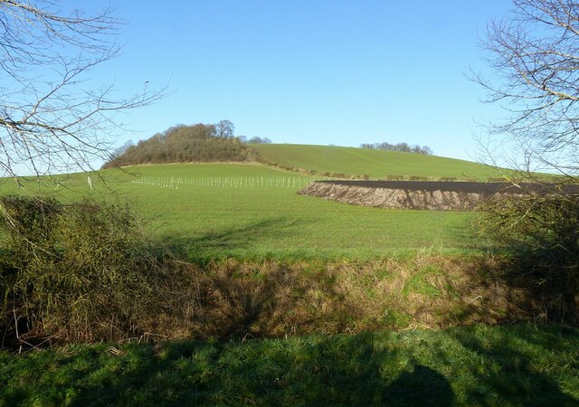
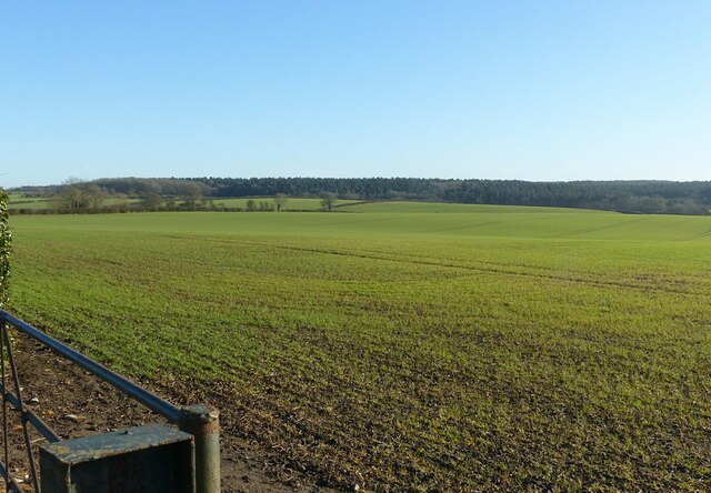
The hill, which stands at an elevation of approximately 200 meters, is covered in lush greenery, including dense forests and wildflower meadows. It is named after the abundance of blackberry bushes that grow on its slopes, adding to its natural beauty. The hill's terrain is gentle and undulating, making it accessible to hikers of all skill levels.

At the summit of Blackberry Hill, visitors are rewarded with breathtaking panoramic views of the surrounding countryside. On clear days, one can see the rolling hills, quaint villages, and even glimpses of Nottingham city in the distance. Many visitors choose to bring a picnic and spend hours enjoying the peaceful atmosphere and stunning vistas.

In addition to its natural beauty, Blackberry Hill also offers various outdoor activities. The hill is crisscrossed by numerous walking trails, which allow visitors to explore the surrounding woodland and discover hidden gems along the way. Mountain biking enthusiasts can also enjoy the hill's trails, perfect for an adrenaline-filled adventure. Birdwatchers will appreciate the diverse range of avian species that call the hill and its surrounding area home.

Overall, Blackberry Hill in Nottinghamshire is a haven for nature enthusiasts, offering stunning views, diverse wildlife, and a range of outdoor activities. Whether visitors seek a peaceful retreat or an active adventure, this hill provides a serene and captivating experience.

If you have any feedback on the listing, please let us know in the comments section below.

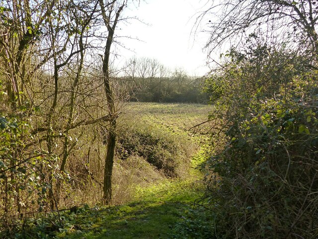
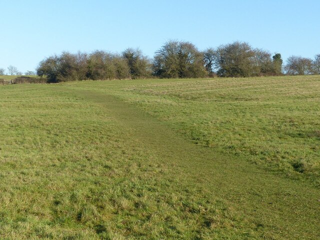
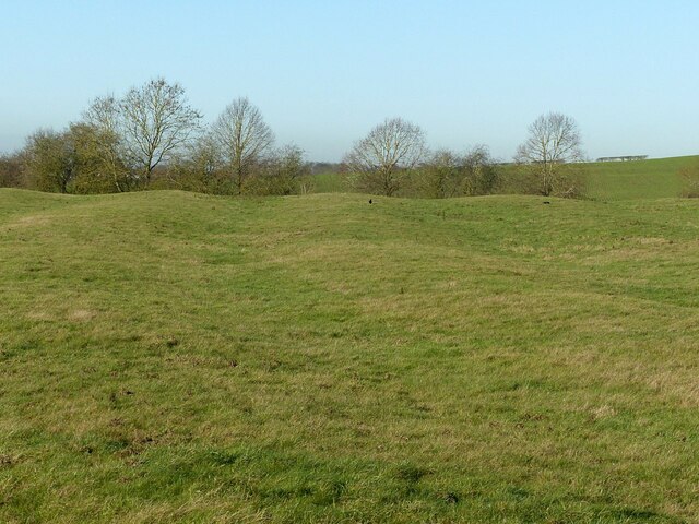
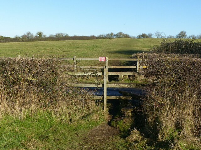
Blackberry Hill Images

Images are sourced within 2km of 52.892641/-1.0481297 or Grid Reference SK6433. Thanks to Geograph Open Source API. All images are credited.

Baker's Hollow, Cotgrave Recreating this 'First' for the square <a title="https://www.geograph.org.uk/photo/51975" href="https://www.geograph.org.uk/photo/51975">Link</a> .

The name refers to the short section of Plumtree Road which at some stage has been cut deeper to ease the gradient of the road. A new housing development, Baker's Close has been added on the left of the picture.
Baker's Hollow, Cotgrave
Recreating this 'First' for the square Link . The name refers to the short section of Plumtree Road which at some stage has been cut deeper to ease the gradient of the road. A new housing development, Baker's Close has been added on the left of the picture.
Cotgrave village entrance sign On Plumtree Road, it shows the parish Church of All Saints. The new Cotgrave signs feature a variety of local landmarks.
Cotgrave village entrance sign
On Plumtree Road, it shows the parish Church of All Saints. The new Cotgrave signs feature a variety of local landmarks.
Plumtree Road, Cotgrave Recreating this 'First' for the square <a title="https://www.geograph.org.uk/photo/51977" href="https://www.geograph.org.uk/photo/51977">Link</a>
Plumtree Road, Cotgrave
Recreating this 'First' for the square Link
Woodgate Lane, Cotgrave Unadopted road, classified as a public bridleway. The works were connected with a main gas pipe.
Woodgate Lane, Cotgrave
Unadopted road, classified as a public bridleway. The works were connected with a main gas pipe.
Woodgate Lane, Cotgrave Gas pipe installation. The trailer is a carrier foe coiled plastic piping.
Woodgate Lane, Cotgrave
Gas pipe installation. The trailer is a carrier foe coiled plastic piping.
Barn at Avenue Farm, Normanton Large late 18th century barn, converted to residential use in the early 21st century. Listed Grade II.
Barn at Avenue Farm, Normanton
Large late 18th century barn, converted to residential use in the early 21st century. Listed Grade II.
Avenue Farmhouse, Normanton Late 18th century house with late 19th century alterations, Listed Grade II. The garden wall with its attractive gateway is included in the Listing.
Avenue Farmhouse, Normanton
Late 18th century house with late 19th century alterations, Listed Grade II. The garden wall with its attractive gateway is included in the Listing.
Normanton Grange The tallest, three storey section to the right is the oldest part of the house, dating from the mid 18th century. The section to its left is early 19th century and the section to the left of the entrance dates from around 1900. Listed Grade II.
Normanton Grange
The tallest, three storey section to the right is the oldest part of the house, dating from the mid 18th century. The section to its left is early 19th century and the section to the left of the entrance dates from around 1900. Listed Grade II.
Normanton House Late 18th century Georgian 3-bay house with 19th century additions, including the octagonal bay seen here. Listed Grade II.
Normanton House
Late 18th century Georgian 3-bay house with 19th century additions, including the octagonal bay seen here. Listed Grade II.
Normanton House, main front Late 18th century Georgian 3-bay house with 19th century additions, including the octagonal bays at the sides. Listed Grade II.
Normanton House, main front
Late 18th century Georgian 3-bay house with 19th century additions, including the octagonal bays at the sides. Listed Grade II.
Earthwork mapped as 'Pond Bay' This is the dam for an extensive mill pond, and dates from the medieval period. As such it represents an unusually large such dam, rising at least 15 metres in the centre with an overall length of at least 150 metres. The pond does not appear on any OS mapping so had clearly become disused at a relatively early stage.

OS mapping uses 'Old English' type face for the name, but the earthwork has no historical designation. The local conservation area appraisal does however note its significance.
Earthwork mapped as 'Pond Bay'
This is the dam for an extensive mill pond, and dates from the medieval period. As such it represents an unusually large such dam, rising at least 15 metres in the centre with an overall length of at least 150 metres. The pond does not appear on any OS mapping so had clearly become disused at a relatively early stage. OS mapping uses 'Old English' type face for the name, but the earthwork has no historical designation. The local conservation area appraisal does however note its significance.
View from the north end of the mill dam (“Pond Bay”) Looking into the area which would have formed the mill pond.  See <a title="https://www.geograph.org.uk/photo/7074117" href="https://www.geograph.org.uk/photo/7074117">Link</a> for more information.
View from the north end of the mill dam (“Pond Bay”)
Looking into the area which would have formed the mill pond. See Link for more information.
Fields above Normanton Showing very clear evidence of medieval strip cultivation. The path is part of the Notts Wolds Way long distance path.
Fields above Normanton
Showing very clear evidence of medieval strip cultivation. The path is part of the Notts Wolds Way long distance path.
Fields above Normanton Showing very clear evidence of medieval strip cultivation.
Fields above Normanton
Showing very clear evidence of medieval strip cultivation.
Stiles at the lane to Wolds Farm, Normanton The path is part of the Notts Wolds Way long distance path.
Stiles at the lane to Wolds Farm, Normanton
The path is part of the Notts Wolds Way long distance path.
Hoe Hill near Normanton-on-the-Wolds Recreating this 'First' for the square <a title="https://www.geograph.org.uk/photo/186175" href="https://www.geograph.org.uk/photo/186175">Link</a> .

The sticks in the field probably indicate some experiment or trial in progress.
Hoe Hill near Normanton-on-the-Wolds
Recreating this 'First' for the square Link . The sticks in the field probably indicate some experiment or trial in progress.
Farmland near Normanton-on-the-Wolds Recreating this 'First' for the square <a title="https://www.geograph.org.uk/photo/186157" href="https://www.geograph.org.uk/photo/186157">Link</a>
Farmland near Normanton-on-the-Wolds
Recreating this 'First' for the square Link
Bench mark at Hall Farm, Clipston on the Wolds See <a title="https://www.geograph.org.uk/photo/7074136" href="https://www.geograph.org.uk/photo/7074136">Link</a> for location.
Bench mark at Hall Farm, Clipston on the Wolds
See Link for location.
Show me another place!

Blackberry Hill is located at Grid Ref: SK6433 (Lat: 52.892641, Lng: -1.0481297)

Administrative County: Nottinghamshire

District: Rushcliffe

Police Authority: Nottinghamshire

What 3 Words

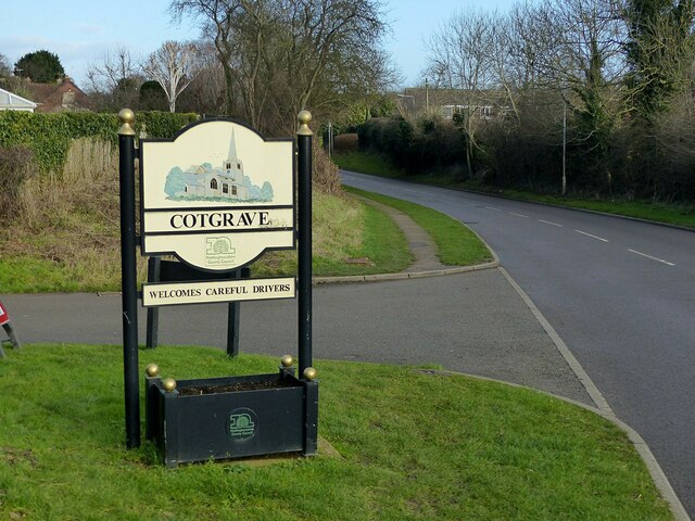
///pavement.decently.played. Near Cotgrave, Nottinghamshire

Related Wikis

Rushcliffe

Rushcliffe is a local government district with borough status in south Nottinghamshire, England. Its council is based in West Bridgford. The borough also...

Clipston, Nottinghamshire

Clipston, or Clipston on the Wolds, is a small English village and civil parish in the south Nottinghamshire district of Rushcliffe. It lies between Cotgrave...

Normanton-on-the-Wolds

Normanton-on-the-Wolds is a small village in Nottinghamshire, England. Population in 2011 was 245. Acreage 1053. == Overview == The name "Normanton" (Norwegian...

All Saints' Church, Cotgrave

All Saints’ Church is a Grade I listed Church of England parish church in the Diocese of Southwell and Nottingham in Cotgrave. == History == The church...

Related Videos

Rushcliffe Business Directory Travel Agencies

https://rushcliffebusinessdirectory.co.uk/ The business directory for key businesses in the borough of Rushcliffe In Nottinghamshire ...

Rushcliffe Business Directory East Leake Travel Agents

https://rushcliffebusinessdirectory.co.uk/ The business directory for key businesses in the borough of Rushcliffe In Nottinghamshire ...

Tips For Loose Lead Walking

Tips For Loose Lead Walking.

Nearby Amenities

Located within 500m of 52.892641,-1.0481297
Barrier: lift_gate
Source: survey
Lat/Long: 52.8935786/-1.0507669
Power: tower
Source: OS OpenData VectoMap District
Lat/Long: 52.8904696/-1.048537
Power: tower
Source: OS OpenData VectoMap District
Lat/Long: 52.8914823/-1.0446898
Power: tower
Source: OS OpenData VectoMap District
Lat/Long: 52.8897554/-1.0533108
The data included in this document is from www.openstreetmap.org. The data is made available under ODbL.

Have you been to Blackberry Hill?

Leave your review of Blackberry Hill below (or comments, questions and feedback).