Blackberry Wood

Wood, Forest in Nottinghamshire Rushcliffe

England

Blackberry Wood

Electric car charging points In the car park at Rivermead shopping centre. The fact that the view was taken on a Sunday may explain the lack of customers.
Electric car charging points Credit: Alan Murray-Rust

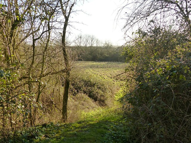
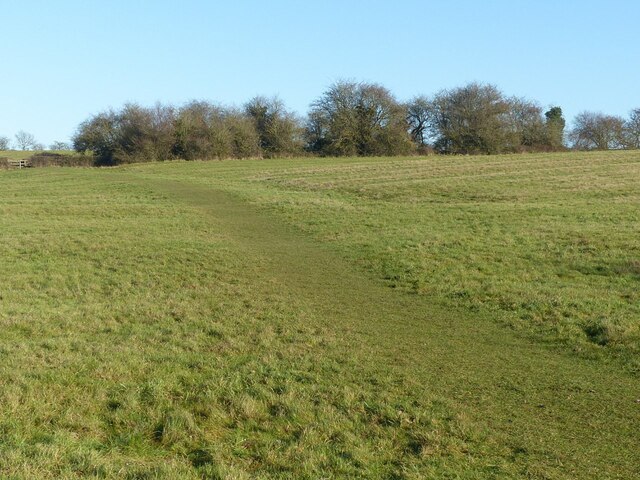
Blackberry Wood, located in Nottinghamshire, is a picturesque woodland area renowned for its natural beauty and diverse ecosystem. Spanning over several acres, this enchanting forest is a popular destination for nature enthusiasts, hikers, and families looking to reconnect with nature.

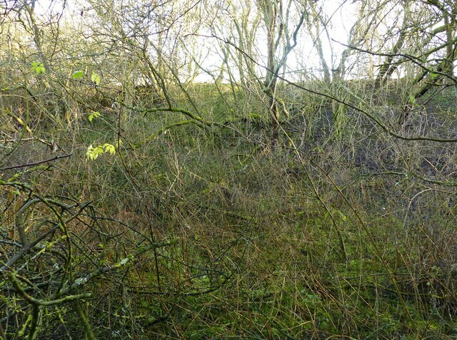
The wood is characterized by its dense canopy of trees, predominantly oak, beech, and ash, which provide a serene and tranquil atmosphere. The forest floor is adorned with a carpet of wildflowers, ferns, and moss, adding to its charm and appeal. Blackberry Wood takes its name from the abundance of blackberry bushes that can be found throughout the area, offering visitors a delightful treat during the summer months.

The woodland is home to a rich variety of wildlife, making it a haven for animal lovers and birdwatchers. Visitors may spot deer, foxes, badgers, and squirrels roaming freely, while a chorus of birdsong fills the air. The wood is particularly known for its resident tawny owls, which can often be heard hooting during the twilight hours.

Several well-maintained walking trails meander through the wood, allowing visitors to explore its hidden treasures. These paths offer breathtaking views of the surrounding countryside and lead to small clearings, perfect for picnics or simply taking in the serene surroundings. With its diverse flora and fauna, Blackberry Wood truly offers a unique and immersive natural experience for all who visit.

Overall, Blackberry Wood in Nottinghamshire is a captivating forest that showcases the beauty of nature. Its tranquil atmosphere, diverse wildlife, and picturesque trails make it an ideal destination for those seeking a peaceful retreat in the heart of the English countryside.

If you have any feedback on the listing, please let us know in the comments section below.

Blackberry Wood Images

Images are sourced within 2km of 52.893345/-1.0462414 or Grid Reference SK6433. Thanks to Geograph Open Source API. All images are credited.

Electric car charging points In the car park at Rivermead shopping centre. The fact that the view was taken on a Sunday may explain the lack of customers.
Electric car charging points
In the car park at Rivermead shopping centre. The fact that the view was taken on a Sunday may explain the lack of customers.
Butchers, Bakers and not candlestick makers See <a title="https://www.geograph.org.uk/photo/7067728" href="https://www.geograph.org.uk/photo/7067728">Link</a> for location.
Butchers, Bakers and not candlestick makers
See Link for location.
Brumpton's, Plumtree Road, Cotgrave Local family firm of butchers and bakers, occupying in part old farm buildings.
Brumpton's, Plumtree Road, Cotgrave
Local family firm of butchers and bakers, occupying in part old farm buildings.
The lych gate, Cotgrave cemetery The cemetery was inaugurated in 1899 as an extension to the churchyard, funded by the 3rd Earl Manvers. The lych gate oak timbers were sourced from Sherwood Forest. Gate and walls are Listed Grade II.
The lych gate, Cotgrave cemetery
The cemetery was inaugurated in 1899 as an extension to the churchyard, funded by the 3rd Earl Manvers. The lych gate oak timbers were sourced from Sherwood Forest. Gate and walls are Listed Grade II.
Cotgrave War Memorial – detail Bronze panels on the east face with commemorative details. See <a title="https://www.geograph.org.uk/photo/7067779" href="https://www.geograph.org.uk/photo/7067779">Link</a> for location.
Cotgrave War Memorial – detail
Bronze panels on the east face with commemorative details. See Link for location.
Cotgrave War Memorial – detail This inscription was clearly added at a late stage after the main panel had been prepared. The memorial was unveiled in June 1920. See <a title="https://www.geograph.org.uk/photo/7067779" href="https://www.geograph.org.uk/photo/7067779">Link</a> for location.
Cotgrave War Memorial – detail
This inscription was clearly added at a late stage after the main panel had been prepared. The memorial was unveiled in June 1920. See Link for location.
Cotgrave War Memorial Designed by architect Lt Col Arthur William Brewill (1861-1923) and erected in 1920. There are commemorative panels <a title="https://www.geograph.org.uk/photo/7067773" href="https://www.geograph.org.uk/photo/7067773">Link</a> on the far face of the memorial, but the sun was at an inconvenient angle to get the whole monument with the panels. Listed Grade II.
Cotgrave War Memorial
Designed by architect Lt Col Arthur William Brewill (1861-1923) and erected in 1920. There are commemorative panels Link on the far face of the memorial, but the sun was at an inconvenient angle to get the whole monument with the panels. Listed Grade II.
The Old Rectory, Cotgrave Early 19th century house with modern extension at the far end. Listed Grade II.
The Old Rectory, Cotgrave
Early 19th century house with modern extension at the far end. Listed Grade II.
Baker's Hollow, Cotgrave Recreating this 'First' for the square <a title="https://www.geograph.org.uk/photo/51975" href="https://www.geograph.org.uk/photo/51975">Link</a> .

The name refers to the short section of Plumtree Road which at some stage has been cut deeper to ease the gradient of the road. A new housing development, Baker's Close has been added on the left of the picture.
Baker's Hollow, Cotgrave
Recreating this 'First' for the square Link . The name refers to the short section of Plumtree Road which at some stage has been cut deeper to ease the gradient of the road. A new housing development, Baker's Close has been added on the left of the picture.
Cotgrave village entrance sign On Plumtree Road, it shows the parish Church of All Saints. The new Cotgrave signs feature a variety of local landmarks.
Cotgrave village entrance sign
On Plumtree Road, it shows the parish Church of All Saints. The new Cotgrave signs feature a variety of local landmarks.
Plumtree Road, Cotgrave Recreating this 'First' for the square <a title="https://www.geograph.org.uk/photo/51977" href="https://www.geograph.org.uk/photo/51977">Link</a>
Plumtree Road, Cotgrave
Recreating this 'First' for the square Link
Woodgate Lane, Cotgrave Unadopted road, classified as a public bridleway. The works were connected with a main gas pipe.
Woodgate Lane, Cotgrave
Unadopted road, classified as a public bridleway. The works were connected with a main gas pipe.
Woodgate Lane, Cotgrave Gas pipe installation. The trailer is a carrier foe coiled plastic piping.
Woodgate Lane, Cotgrave
Gas pipe installation. The trailer is a carrier foe coiled plastic piping.
Barn at Avenue Farm, Normanton Large late 18th century barn, converted to residential use in the early 21st century. Listed Grade II.
Barn at Avenue Farm, Normanton
Large late 18th century barn, converted to residential use in the early 21st century. Listed Grade II.
Avenue Farmhouse, Normanton Late 18th century house with late 19th century alterations, Listed Grade II. The garden wall with its attractive gateway is included in the Listing.
Avenue Farmhouse, Normanton
Late 18th century house with late 19th century alterations, Listed Grade II. The garden wall with its attractive gateway is included in the Listing.
Earthwork mapped as 'Pond Bay' This is the dam for an extensive mill pond, and dates from the medieval period. As such it represents an unusually large such dam, rising at least 15 metres in the centre with an overall length of at least 150 metres. The pond does not appear on any OS mapping so had clearly become disused at a relatively early stage.

OS mapping uses 'Old English' type face for the name, but the earthwork has no historical designation. The local conservation area appraisal does however note its significance.
Earthwork mapped as 'Pond Bay'
This is the dam for an extensive mill pond, and dates from the medieval period. As such it represents an unusually large such dam, rising at least 15 metres in the centre with an overall length of at least 150 metres. The pond does not appear on any OS mapping so had clearly become disused at a relatively early stage. OS mapping uses 'Old English' type face for the name, but the earthwork has no historical designation. The local conservation area appraisal does however note its significance.
View from the north end of the mill dam (“Pond Bay”) Looking into the area which would have formed the mill pond.  See <a title="https://www.geograph.org.uk/photo/7074117" href="https://www.geograph.org.uk/photo/7074117">Link</a> for more information.
View from the north end of the mill dam (“Pond Bay”)
Looking into the area which would have formed the mill pond. See Link for more information.
Fields above Normanton Showing very clear evidence of medieval strip cultivation. The path is part of the Notts Wolds Way long distance path.
Fields above Normanton
Showing very clear evidence of medieval strip cultivation. The path is part of the Notts Wolds Way long distance path.
Show me another place!

Blackberry Wood is located at Grid Ref: SK6433 (Lat: 52.893345, Lng: -1.0462414)

Administrative County: Nottinghamshire

District: Rushcliffe

Police Authority: Nottinghamshire

What 3 Words

///hood.torch.compiler. Near Cotgrave, Nottinghamshire

Related Wikis

Rushcliffe

Rushcliffe is a local government district with borough status in south Nottinghamshire, England. Its council is based in West Bridgford. The borough also...

Clipston, Nottinghamshire

Clipston, or Clipston on the Wolds, is a small English village and civil parish in the south Nottinghamshire district of Rushcliffe. It lies between Cotgrave...

Normanton-on-the-Wolds

Normanton-on-the-Wolds is a small village in Nottinghamshire, England. Population in 2011 was 245. Acreage 1053. == Overview == The name "Normanton" (Norwegian...

All Saints' Church, Cotgrave

All Saints’ Church is a Grade I listed Church of England parish church in the Diocese of Southwell and Nottingham in Cotgrave. == History == The church...
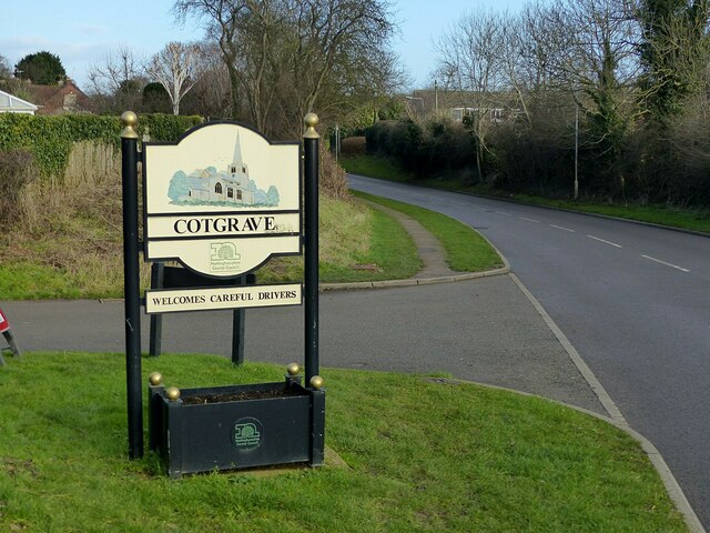
Cotgrave

Cotgrave () is a town and civil parish in the borough of Rushcliffe in Nottinghamshire, England, some 5 miles (8 km) south-east of central Nottingham....

Plumtree railway station

Plumtree railway station served Plumtree in the English county of Nottinghamshire, on the Nottingham direct line of the Midland Railway between London...

Owthorpe

Owthorpe is a small English village and civil parish in the Wolds of the East Midland county of Nottinghamshire. The population of about 90 was included...

Church of St Mary the Virgin, Plumtree

The Church of St Mary the Virgin, Plumtree is a parish church in the Church of England in Plumtree, Nottinghamshire. The church is Grade II listed by the...

Nearby Amenities

Located within 500m of 52.893345,-1.0462414
Barrier: lift_gate
Source: survey
Lat/Long: 52.8935786/-1.0507669
Power: tower
Source: OS OpenData VectoMap District
Lat/Long: 52.8904696/-1.048537
Power: tower
Source: OS OpenData VectoMap District
Lat/Long: 52.8914823/-1.0446898
Power: tower
Source: OS OpenData VectoMap District
Lat/Long: 52.8925575/-1.0406297
The data included in this document is from www.openstreetmap.org. The data is made available under ODbL.

Have you been to Blackberry Wood?

Leave your review of Blackberry Wood below (or comments, questions and feedback).