Bembridge Down
Hill, Mountain in Hampshire
England
Bembridge Down

Bembridge Down is a prominent feature located in the eastern part of the Isle of Wight, Hampshire, England. It is an elevated area that offers panoramic views of the surrounding landscape and the English Channel. Although commonly referred to as a down, it is not a true downland but rather a hill or mountain due to its height and steepness.
Standing at an impressive 107 meters (351 feet) above sea level, Bembridge Down is a cherished natural landmark and a popular destination for locals and tourists alike. It is part of the wider Bembridge and Culver Downs Site of Special Scientific Interest (SSSI), recognized for its unique biodiversity and geological significance. The area is home to a variety of plant species, including rare orchids, and provides a habitat for a diverse range of wildlife.
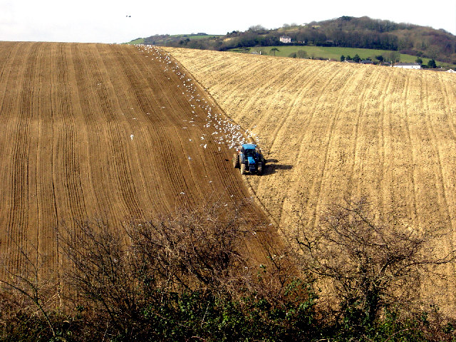
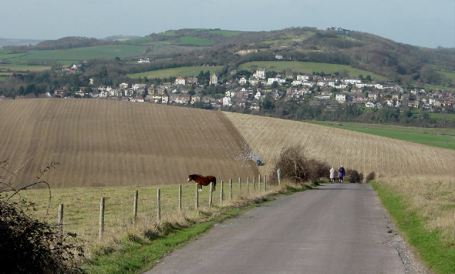
The down is easily accessible, with several footpaths and trails leading to its summit, making it a favorite spot for outdoor enthusiasts, hikers, and walkers. As visitors ascend the hill, they are treated to breathtaking views of the surrounding countryside, the Solent, and the distant coastline of the mainland. On a clear day, it is even possible to see the famous Spinnaker Tower in Portsmouth.
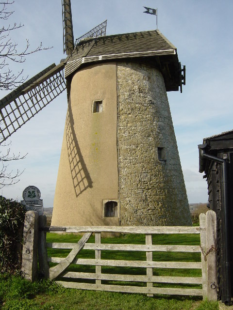
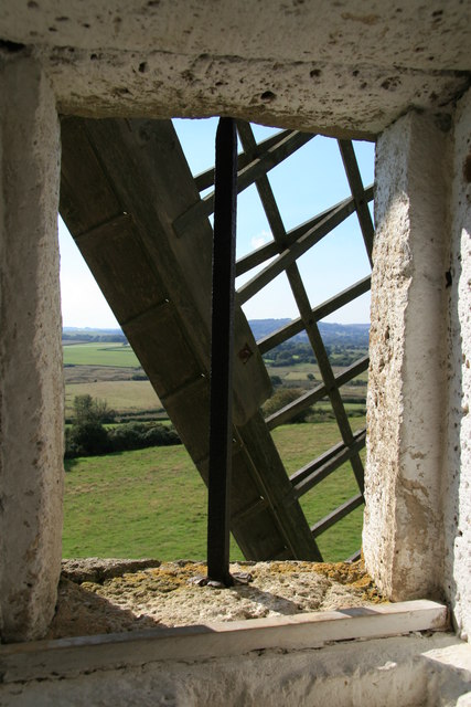
Bembridge Down also holds historical significance, with evidence of prehistoric activity and Bronze Age burials found in the area. Additionally, a prominent feature on the hill is the Bembridge Windmill, a restored 18th-century windmill that stands as a reminder of the island's agricultural past.
Overall, Bembridge Down is a remarkable natural and cultural treasure, offering visitors a chance to appreciate the beauty of the Isle of Wight's landscape while immersing themselves in its rich history and diverse ecology.
If you have any feedback on the listing, please let us know in the comments section below.
Bembridge Down Images
Images are sourced within 2km of 50.670411/-1.1158442 or Grid Reference SZ6286. Thanks to Geograph Open Source API. All images are credited.


Bembridge Down is located at Grid Ref: SZ6286 (Lat: 50.670411, Lng: -1.1158442)
Unitary Authority: Isle of Wight
Police Authority: Hampshire
What 3 Words
///tripling.conclude.tenses. Near Brading, Isle of Wight
Nearby Locations
Related Wikis
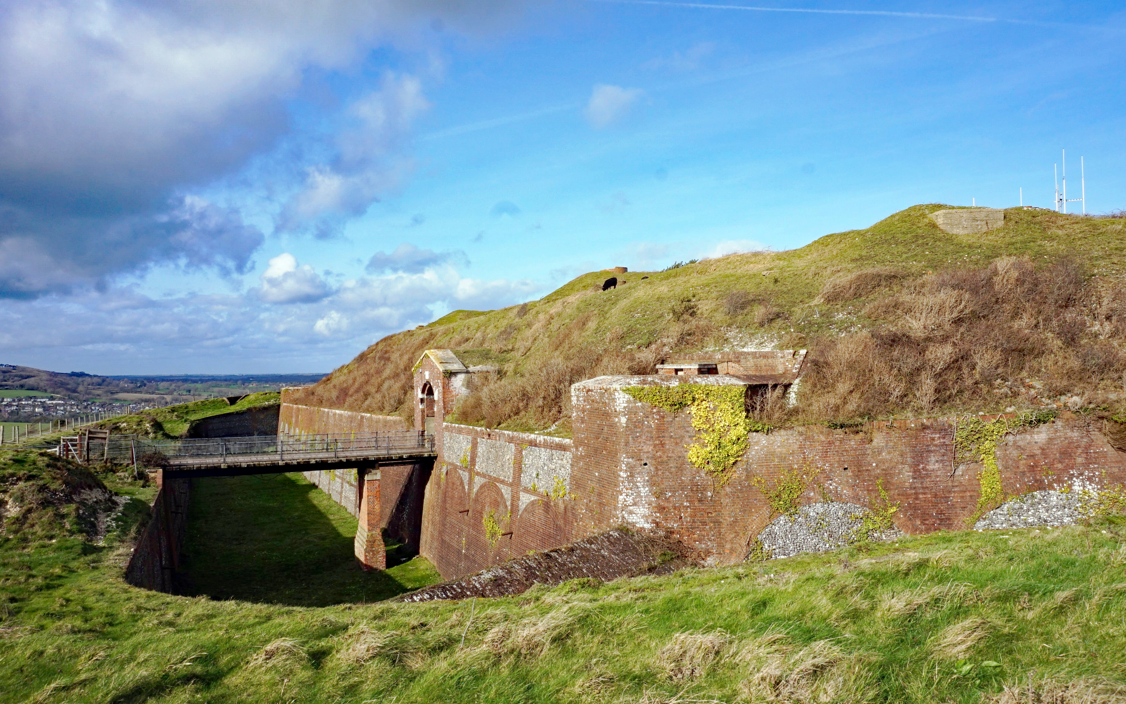
Bembridge Fort
Bembridge Fort (map reference SZ624861) is a fort built on the highest point of Bembridge Down close to the village of Bembridge on the Isle of Wight,...

Bembridge Down
Bembridge Down is a 56.3-hectare (139-acre) Site of special scientific interest which is north-east of Sandown, Isle of Wight, England. The site was notified...

Culver Down
Culver Down is a chalk down to the north of Sandown, Isle of Wight. It is believed that its name derives from "Culfre", which is Old English for dove....

Whitecliff Bay and Bembridge Ledges
Whitecliff Bay and Bembridge Ledges is a 131.6-hectare (325-acre) Site of Special Scientific Interest that lies around the coastline of the easternmost...
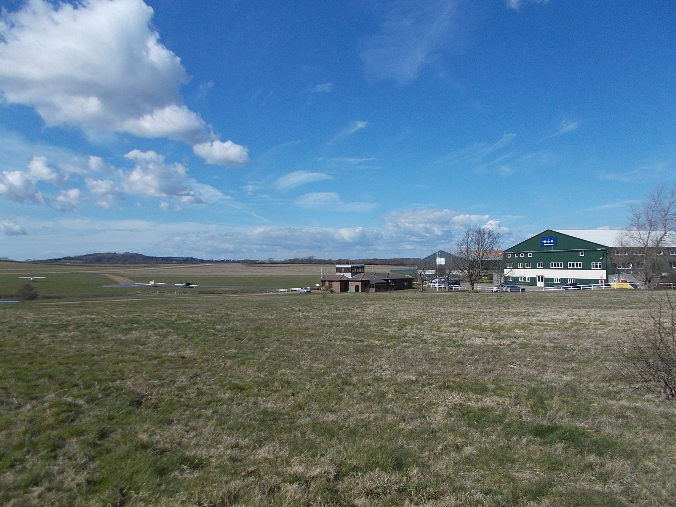
Bembridge Airport
Bembridge Airport (IATA: BBP, ICAO: EGHJ) is an unlicensed aerodrome located about a mile south-west of the village of Bembridge, Isle of Wight, England...
Hillway
Hillway is a settlement on the Isle of Wight, off the south coast of England. The hamlet lies near to the south-east coast of the island, and is located...
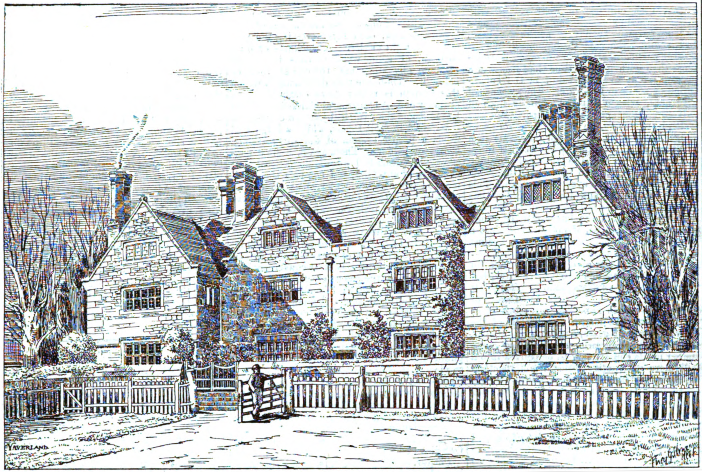
Yaverland Manor
Yaverland Manor is a medieval manor house in Yaverland, near Sandown, on the Isle of Wight. It was reconstructed in c. 1620 with alterations c. 1709. It...
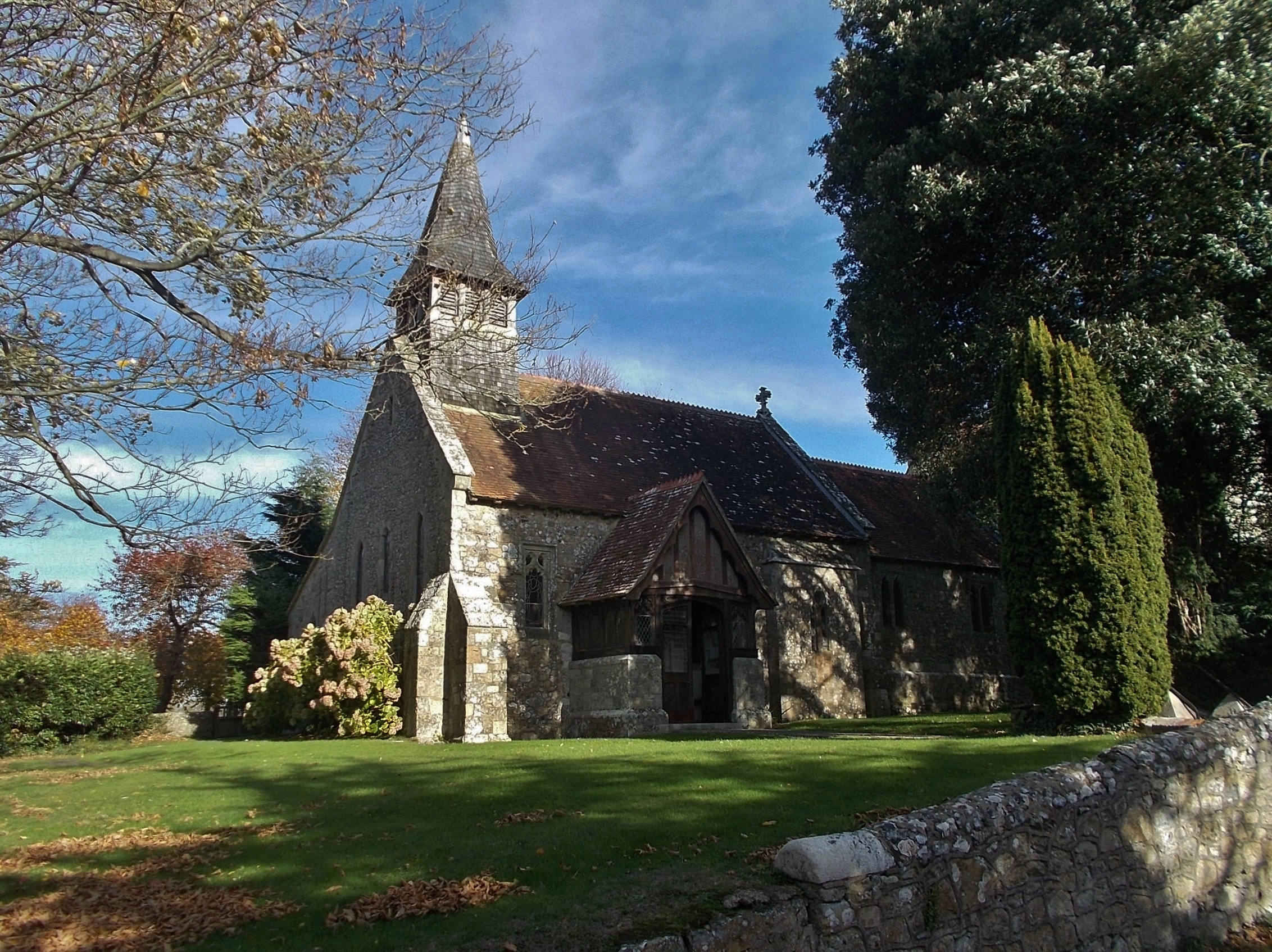
St John the Baptist Church, Yaverland
St John the Baptist Church, Yaverland is a parish church in the Church of England located in Yaverland, Isle of Wight. == History == The church is medieval...
Nearby Amenities
Located within 500m of 50.670411,-1.1158442Have you been to Bembridge Down?
Leave your review of Bembridge Down below (or comments, questions and feedback).