Misk Hill

Hill, Mountain in Nottinghamshire Ashfield

England

Misk Hill

Crop Field and Woodland near Felley Mill The wooded area beyond the field is evocatively named 'Pamela's Larches'.
Crop Field and Woodland near Felley Mill Credit: Jonathan Clitheroe

Misk Hill is a small hill located in the county of Nottinghamshire, England. Situated in the northern part of the county, it is a prominent natural feature in the landscape. Despite being referred to as a hill, it should be noted that Misk Hill does not meet the technical definition of a mountain, as it does not reach the required height of 2,000 feet.

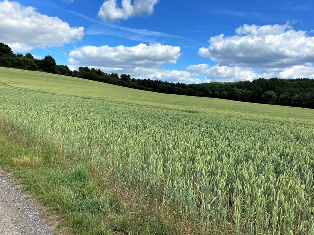
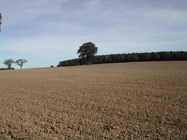
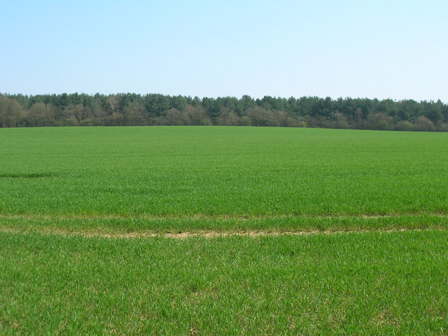
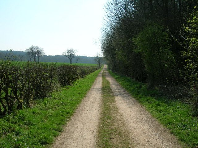
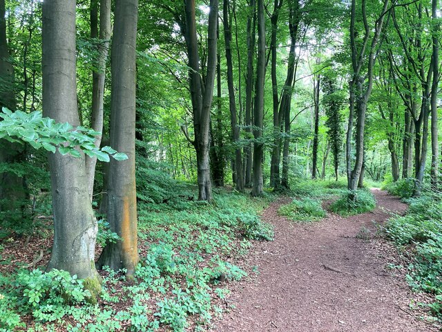
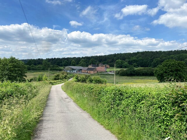
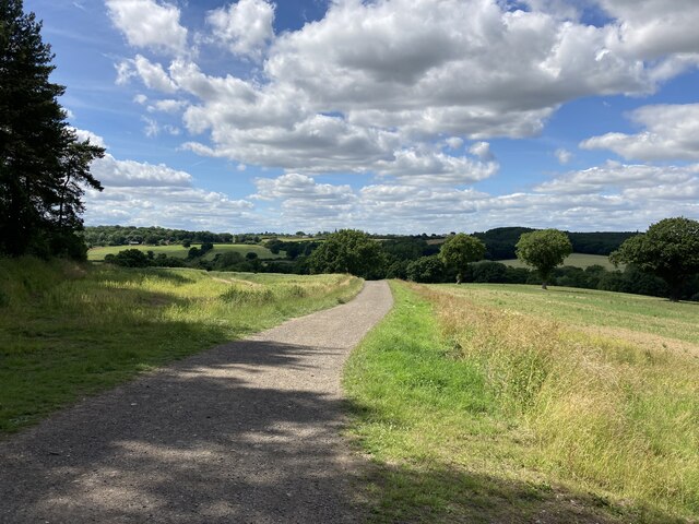
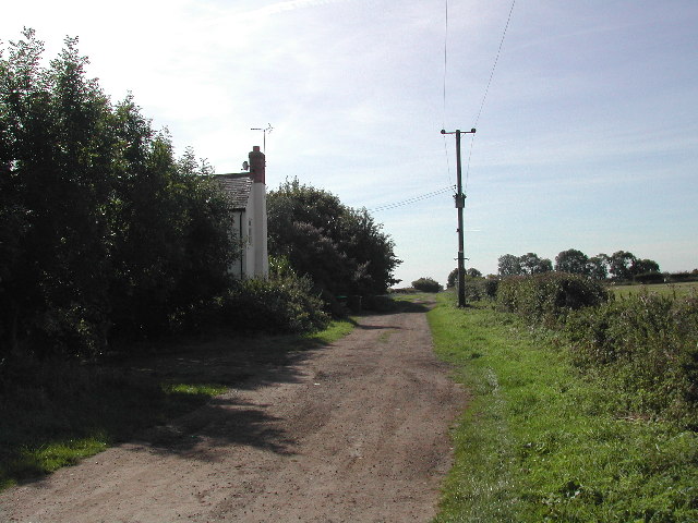
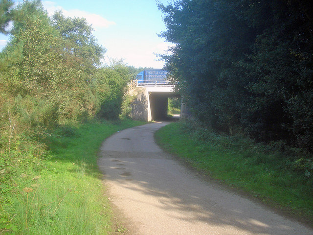
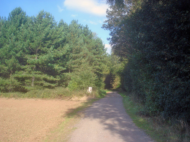
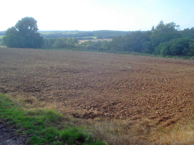
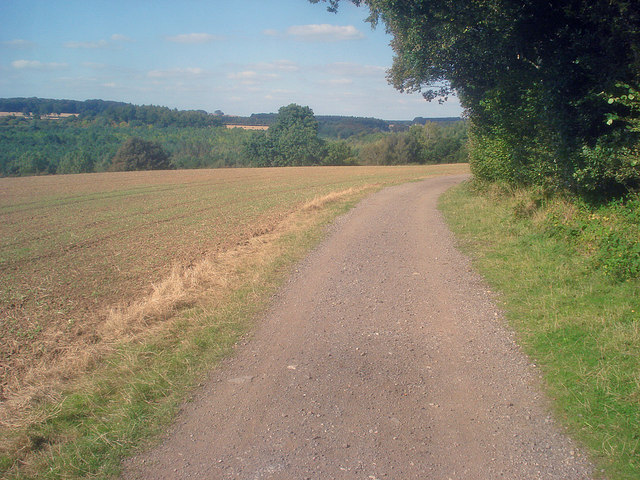
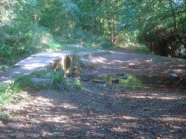
The hill is characterized by its gentle slopes and is covered in lush greenery, primarily consisting of grass and scattered trees. It offers panoramic views of the surrounding countryside, providing visitors with a picturesque scene. Misk Hill is a popular destination for hikers and nature enthusiasts, who can enjoy walking trails that meander through the area.

At the summit of Misk Hill, there is a stone marker that indicates the highest point of the hill. This marker serves as a point of interest for those who reach the top, offering a sense of accomplishment and a spot for photo opportunities.

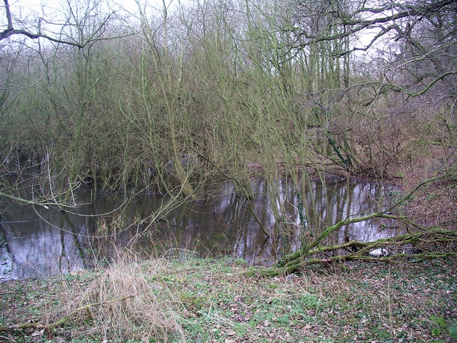
The hill is also known for its rich biodiversity, with various species of flora and fauna inhabiting the area. It is home to a range of wildlife, including birds, small mammals, and insects. The diverse ecosystem of Misk Hill adds to its natural beauty and attracts nature lovers from far and wide.

Overall, Misk Hill is a charming natural landmark in Nottinghamshire, offering a peaceful escape from the hustle and bustle of city life. Its scenic beauty, recreational opportunities, and ecological significance make it a cherished destination for locals and visitors alike.

If you have any feedback on the listing, please let us know in the comments section below.

Misk Hill Images

Images are sourced within 2km of 53.039094/-1.2484138 or Grid Reference SK5049. Thanks to Geograph Open Source API. All images are credited.

Crop Field and Woodland near Felley Mill The wooded area beyond the field is evocatively named 'Pamela's Larches'.
Crop Field and Woodland near Felley Mill
The wooded area beyond the field is evocatively named 'Pamela's Larches'.
Ready for the winter crop Viewed NE from Kennel Lane towards Park Forest these are the fields of Home Farm
Ready for the winter crop
Viewed NE from Kennel Lane towards Park Forest these are the fields of Home Farm
Kennel Lane Most of the farm buildings around here have been converted to private dwellings
Kennel Lane
Most of the farm buildings around here have been converted to private dwellings
Kennel Lane heading south (footpath)
Farmland looking towards Balaklava Wood
Track through the Dumbles (footpath)
Woodland near Beauvale Priory Unofficial path is situated in an area of the wood marked as Callis Hagg. We are also close to Robin Hood's Well here although I didn't find any evidence on the ground today.
Woodland near Beauvale Priory
Unofficial path is situated in an area of the wood marked as Callis Hagg. We are also close to Robin Hood's Well here although I didn't find any evidence on the ground today.
Beauvale Priory and Abbey Farm Pictured from the access road to the south of the location. The priory can be seen by visitors when the tea room nearby is open. It wasn't on this day and I was shunted off.
Beauvale Priory and Abbey Farm
Pictured from the access road to the south of the location. The priory can be seen by visitors when the tea room nearby is open. It wasn't on this day and I was shunted off.
Remains of Beauvale Priory This priory was built for Carthusian monks in 1343 - one of only a handful to be built in England for this order. They resisted Henry VIII's Oath of Supremacy and two members of the charterhouse later achieved martyrdom. A small portion of the remains are located outside this grid square in SK4950.
Remains of Beauvale Priory
This priory was built for Carthusian monks in 1343 - one of only a handful to be built in England for this order. They resisted Henry VIII's Oath of Supremacy and two members of the charterhouse later achieved martyrdom. A small portion of the remains are located outside this grid square in SK4950.
View Towards Felley Mill and Priory One of Nottinghamshire's fabled 'hidden valleys'. The spire of Underwood church can just be deciphered on the mid-horizon.
View Towards Felley Mill and Priory
One of Nottinghamshire's fabled 'hidden valleys'. The spire of Underwood church can just be deciphered on the mid-horizon.
America Farm on Weavers Lane A bridleway between the A608 at Home Farm and Felley Lane at Underwood. There is a locked barrier at the pole to stop cars and motorcycles
America Farm on Weavers Lane
A bridleway between the A608 at Home Farm and Felley Lane at Underwood. There is a locked barrier at the pole to stop cars and motorcycles
Felley Mill pond Felley Mill was the setting for 'Strelley Mill' in DH Lawrence's novel 'The White Peacock'. At one time a watermill on this site was used by the monks of Felley Priory. The mill no longer exists but the pond and evidence of the mill race still remain. The area is still known as Felley Mill.
Felley Mill pond
Felley Mill was the setting for 'Strelley Mill' in DH Lawrence's novel 'The White Peacock'. At one time a watermill on this site was used by the monks of Felley Priory. The mill no longer exists but the pond and evidence of the mill race still remain. The area is still known as Felley Mill.
If only! 50 mile per hour signs in the M1 roadworks as the traffic continues to be gridlocked going North.
If only!
50 mile per hour signs in the M1 roadworks as the traffic continues to be gridlocked going North.
Motorway bridge at Park Springs Wood Looking east along Kennel Lane to the M1.
Motorway bridge at Park Springs Wood
Looking east along Kennel Lane to the M1.
Farm track enters Park Springs Wood Heading north-east as the track reaches the conifer forest.
Farm track enters Park Springs Wood
Heading north-east as the track reaches the conifer forest.
Arable land near Park Springs Wood View north-west from the edge of the wood. An autumn-sown crop is just breaking through the ground.
Arable land near Park Springs Wood
View north-west from the edge of the wood. An autumn-sown crop is just breaking through the ground.
Farm track near Park Springs Wood Leading northwards along the edge of the wood. More woodland at The Dumbles on the other side of the field.
Farm track near Park Springs Wood
Leading northwards along the edge of the wood. More woodland at The Dumbles on the other side of the field.
Small bridge near Felley Mill The bridge is no more than two large pipes packed around with cement, but quite adequate for walkers and better than those stepping stones. Farm traffic has a ford on the right.
Small bridge near Felley Mill
The bridge is no more than two large pipes packed around with cement, but quite adequate for walkers and better than those stepping stones. Farm traffic has a ford on the right.
Show me another place!

Misk Hill is located at Grid Ref: SK5049 (Lat: 53.039094, Lng: -1.2484138)

Administrative County: Nottinghamshire

District: Ashfield

Police Authority: Nottinghamshire

What 3 Words

///coach.random.logic. Near Hucknall, Nottinghamshire

Nearby Locations

Misk Hill

Related Wikis

Beauvale

Beauvale, or Beauvale Newthorpe, is a village in Nottinghamshire, England. It is located 1 mile to the east of Eastwood. It is in Greasley parish. Beauvale...
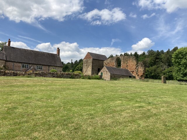
Beauvale Priory

Beauvale Priory (also known as Beauvale Charterhouse) was a Carthusian monastery in Beauvale, Nottinghamshire. It is a scheduled ancient monument. ��2...

The Holgate Academy

The Holgate Academy (formerly Holgate School) is a coeducational secondary school and sixth form with academy status, located in Hucknall, Nottinghamshire...

Church of St Peter and St Paul, Hucknall

The Church of St Peter and St Paul, Hucknall is a parish church in the Church of England in the Westville suburb of Hucknall, Nottinghamshire. == History... ==

Westville, Nottinghamshire

Westville is a residential area to the west of Hucknall. It is approximately eight miles north-west of Nottingham, England. It has many new build houses...

The National Academy

The National Church of England Academy, formerly known as The National School, is a Church of England secondary school in the Ashfield district of Nottinghamshire...

Greasley

Greasley is a civil parish north west of Nottingham in Nottinghamshire, England. Although it is thought there was once a village called Greasley, there...

Hucknall Town F.C.

Hucknall Town Football Club is a football club based in the town of Hucknall, Nottinghamshire, England. The club is a member of the United Counties League...

Nearby Amenities

Located within 500m of 53.039094,-1.2484138
Barrier: stile
Stile: stepover
Lat/Long: 53.0380088/-1.2512949
Barrier: stile
Material: wood
Steps: 1
Stile: stepover
Lat/Long: 53.0410776/-1.2458783
Barrier: stile
Material: wood
Steps: 3
Stile: stepover
Lat/Long: 53.0385278/-1.2506667
Barrier: stile
Material: wood
Steps: 1
Stile: stepover
Lat/Long: 53.0393666/-1.2490416
Barrier: stile
Material: wood
Steps: 3
Stile: stepover
Lat/Long: 53.0382804/-1.2509492
Barrier: stile
Steps: 2
Stile: stepover
Lat/Long: 53.0379216/-1.2524733
Note: grounds to cross M1
Power: pole
Source: Bing
Lat/Long: 53.0379055/-1.2527553
Power: pole
Source: Bing
Lat/Long: 53.0373669/-1.2534607
Power: pole
Source: Bing
Lat/Long: 53.036704/-1.2544853
Barrier: entrance
Lat/Long: 53.035922/-1.2436763
Barrier: entrance
Lat/Long: 53.0369837/-1.2464802
Barrier: entrance
Lat/Long: 53.038225/-1.2494832
Misk Hill
Natural: peak
Lat/Long: 53.0405603/-1.2462478
The data included in this document is from www.openstreetmap.org. The data is made available under ODbL.

Have you been to Misk Hill?

Leave your review of Misk Hill below (or comments, questions and feedback).