Hill of Susetter

Hill, Mountain in Shetland

Scotland

Hill of Susetter

Bus at a junction at Voe The Viking Energy windfarm in the background.
Bus at a junction at Voe Credit: Mike Pennington

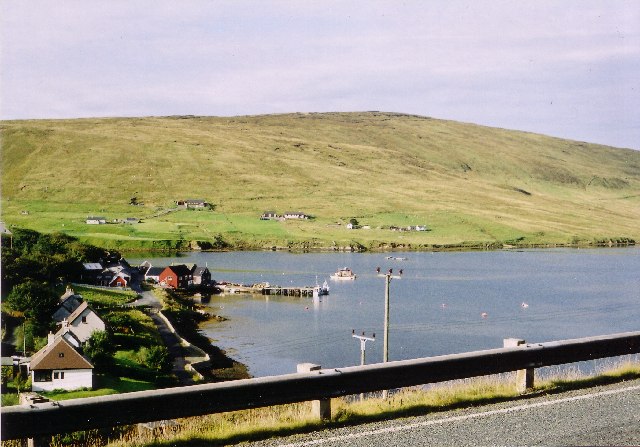
The Hill of Susetter is a prominent geographic feature located in the Shetland Islands, an archipelago in Scotland. Rising to a height of approximately 286 meters (938 feet), it is considered one of the larger hills in the region. The hill is situated in the central part of the Shetland Mainland, near the village of Sound, which lies to the east.

Hill of Susetter is characterized by its distinctive cone-shaped summit, which provides panoramic views of the surrounding landscape. The hill is primarily composed of basalt, a volcanic rock formed from cooled lava flows. This geological composition is typical of the Shetland Islands, which were shaped by volcanic activity millions of years ago.

The hill is a popular destination for outdoor enthusiasts, offering opportunities for hillwalking and hiking. It is accessible via several footpaths that wind their way up the slopes. Along the way, visitors can enjoy the diverse flora and fauna that thrive in the area, including heather, mosses, and various species of birds.

Moreover, the Hill of Susetter holds historical significance as it is home to several archaeological sites. These include the remains of Iron Age settlements, indicating human habitation in the area for thousands of years.

Overall, the Hill of Susetter is a prominent and captivating natural landmark in the Shetland Islands, offering both recreational and historical value to visitors. Its stunning vistas and rich archaeological heritage make it a must-visit destination for nature lovers and history enthusiasts alike.

If you have any feedback on the listing, please let us know in the comments section below.

Hill of Susetter Images

Images are sourced within 2km of 60.365572/-1.2474044 or Grid Reference HU4164. Thanks to Geograph Open Source API. All images are credited.

Bus at a junction at Voe The Viking Energy windfarm in the background.
Bus at a junction at Voe
The Viking Energy windfarm in the background.
"Honestas" in Voe Harbour For some reason I assumed this fine boat was permanently moored here, it looks so much part of the scenery.
But it doesn't feature in any other pictures of the harbour so I guess it's a visitor and I was lucky to get this shot.
"Honestas" in Voe Harbour
For some reason I assumed this fine boat was permanently moored here, it looks so much part of the scenery. But it doesn't feature in any other pictures of the harbour so I guess it's a visitor and I was lucky to get this shot.
Lower Voe The head of Olna Firth, which is frozen.
Lower Voe
The head of Olna Firth, which is frozen.
Frozen marina at Voe Olna Firth is salt water, but is enclosed and has frozen after several days of very hard frosts.
Frozen marina at Voe
Olna Firth is salt water, but is enclosed and has frozen after several days of very hard frosts.
Olna Firth at Voe This sheltered arm of the sea has frozen in the hard frosts of recent nights.
Olna Firth at Voe
This sheltered arm of the sea has frozen in the hard frosts of recent nights.
Roadside pund west of Sussetter Hill, Voe A pund is a gathering place for sheep.
Roadside pund west of Sussetter Hill, Voe
A pund is a gathering place for sheep.
The lane from Collafirth The lane joins the A970 just out of shot to the right.
The lane from Collafirth
The lane joins the A970 just out of shot to the right.
Country near Sursetter
The Hill of Susetter
The Manse Rocky stream at Voe
The Manse
Rocky stream at Voe
Houses at Voe A view of houses at Voe
Houses at Voe
A view of houses at Voe
Road at Hamars The A968 Road at Hamars
Road at Hamars
The A968 Road at Hamars
A968 road View to Olna Firth
A968 road
View to Olna Firth
Colourful Housing This is Mulla, nice bright colours against the green hillside.
Colourful Housing
This is Mulla, nice bright colours against the green hillside.
Valley of the Burn of Sursetter The Burn of Sursetter is around 3 kms long and flows into Olna Firth. The conical thing in the foreground is a stack of rusty metal fence posts.
Valley of the Burn of Sursetter
The Burn of Sursetter is around 3 kms long and flows into Olna Firth. The conical thing in the foreground is a stack of rusty metal fence posts.
Overlooking Voe Harbour
Information Board at Voe There is a lay by and overlook beside the road with a view over the harbour and a visitor board with history and old pictures of the development of Voe.
Information Board at Voe
There is a lay by and overlook beside the road with a view over the harbour and a visitor board with history and old pictures of the development of Voe.
Hamars, near Voe One of several farms along the valley
Hamars, near Voe
One of several farms along the valley
Show me another place!

Hill of Susetter is located at Grid Ref: HU4164 (Lat: 60.365572, Lng: -1.2474044)

Unitary Authority: Shetland Islands

Police Authority: Highlands and Islands

What 3 Words

///reports.ballparks.plodding. Near Vidlin, Shetland Islands

Related Wikis

Voe, Delting

Voe is a village in Delting parish on Mainland, Shetland, Scotland. It is one of the three main settlements in Delting. It is at the junction of the A968...

Laxo

Laxo is a small settlement at the end of Laxo Voe in Vidlin, Shetland, Scotland. A ferry from the Mainland to Symbister in Whalsay operates from the nearby...

Delting

Delting is a civil parish and community council area on Mainland, Shetland, Scotland. It includes the Sullom Voe oil terminal and its main settlements...

North Mainland

The North Mainland of the Shetland Islands, Scotland is the part of the Mainland lying north of Voe (60° 21′N). == Geography == Notable places in North...

Nearby Amenities

Located within 500m of 60.365572,-1.2474044
Hill of Susetter
Corbett: no
Ele: 171
Graham: no
Marilyn: no
Munro: no
Natural: peak
Lat/Long: 60.3669452/-1.2469457
Man Made: antenna
Lat/Long: 60.3657382/-1.2480317
Power: pole
Lat/Long: 60.3676228/-1.25484
Power: pole
Lat/Long: 60.3676277/-1.2537139
Power: pole
Lat/Long: 60.3676107/-1.2524359
Power: pole
Lat/Long: 60.3675998/-1.251153
Power: pole
Lat/Long: 60.3675938/-1.2498065
Power: pole
Lat/Long: 60.3675841/-1.2485604
The data included in this document is from www.openstreetmap.org. The data is made available under ODbL.

Have you been to Hill of Susetter?

Leave your review of Hill of Susetter below (or comments, questions and feedback).