Tagon Hill

Hill, Mountain in Shetland

Scotland

Tagon Hill

Bus at a junction at Voe The Viking Energy windfarm in the background.
Bus at a junction at Voe Credit: Mike Pennington

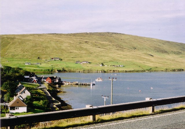
Tagon Hill is a prominent hill located in the Shetland Islands, Scotland. It is situated in the central part of the Mainland, the largest island in the archipelago. With an elevation of approximately 122 meters (400 feet), Tagon Hill offers stunning panoramic views of the surrounding landscapes.

The hill is characterized by its gently sloping sides, covered in heather and grasses, creating a picturesque scenery. It is easily accessible, with well-defined paths leading to its summit, making it a popular destination for hikers and nature enthusiasts.

From the top of Tagon Hill, visitors can admire the breathtaking vistas of the surrounding countryside, including rolling hills, rugged coastlines, and the vast expanse of the North Sea. On clear days, it is even possible to see neighboring islands such as Foula and Fair Isle in the distance.

Aside from its natural beauty, Tagon Hill also holds historical significance. The area is known to have been inhabited since prehistoric times, with archaeological remains found nearby, including Iron Age structures and burial sites. This adds an extra layer of fascination for those interested in the island's rich history.

Whether it is for the stunning views, the opportunity to explore the local flora and fauna, or the chance to delve into Shetland's ancient past, Tagon Hill offers an unforgettable experience for visitors of all ages and interests.

If you have any feedback on the listing, please let us know in the comments section below.

Tagon Hill Images

Images are sourced within 2km of 60.358732/-1.2541233 or Grid Reference HU4164. Thanks to Geograph Open Source API. All images are credited.

Bus at a junction at Voe The Viking Energy windfarm in the background.
Bus at a junction at Voe
The Viking Energy windfarm in the background.
Constructing aerogenerators near Voe
"Honestas" in Voe Harbour For some reason I assumed this fine boat was permanently moored here, it looks so much part of the scenery.
But it doesn't feature in any other pictures of the harbour so I guess it's a visitor and I was lucky to get this shot.
"Honestas" in Voe Harbour
For some reason I assumed this fine boat was permanently moored here, it looks so much part of the scenery. But it doesn't feature in any other pictures of the harbour so I guess it's a visitor and I was lucky to get this shot.
Lower Voe The head of Olna Firth, which is frozen.
Lower Voe
The head of Olna Firth, which is frozen.
Frozen marina at Voe Olna Firth is salt water, but is enclosed and has frozen after several days of very hard frosts.
Frozen marina at Voe
Olna Firth is salt water, but is enclosed and has frozen after several days of very hard frosts.
Olna Firth at Voe This sheltered arm of the sea has frozen in the hard frosts of recent nights.
Olna Firth at Voe
This sheltered arm of the sea has frozen in the hard frosts of recent nights.
Roadside pund west of Sussetter Hill, Voe A pund is a gathering place for sheep.
Roadside pund west of Sussetter Hill, Voe
A pund is a gathering place for sheep.
Country near Sursetter
The Hill of Susetter
The Manse Rocky stream at Voe
The Manse
Rocky stream at Voe
Houses at Voe A view of houses at Voe
Houses at Voe
A view of houses at Voe
Road at Hamars The A968 Road at Hamars
Road at Hamars
The A968 Road at Hamars
A968 road View to Olna Firth
A968 road
View to Olna Firth
Colourful Housing This is Mulla, nice bright colours against the green hillside.
Colourful Housing
This is Mulla, nice bright colours against the green hillside.
Valley of the Burn of Sursetter The Burn of Sursetter is around 3 kms long and flows into Olna Firth. The conical thing in the foreground is a stack of rusty metal fence posts.
Valley of the Burn of Sursetter
The Burn of Sursetter is around 3 kms long and flows into Olna Firth. The conical thing in the foreground is a stack of rusty metal fence posts.
Overlooking Voe Harbour
Information Board at Voe There is a lay by and overlook beside the road with a view over the harbour and a visitor board with history and old pictures of the development of Voe.
Information Board at Voe
There is a lay by and overlook beside the road with a view over the harbour and a visitor board with history and old pictures of the development of Voe.
The daggerfly Empis tessellata, Loch of Voe A common predacious fly.
The daggerfly Empis tessellata, Loch of Voe
A common predacious fly.
Show me another place!

Tagon Hill is located at Grid Ref: HU4164 (Lat: 60.358732, Lng: -1.2541233)

Unitary Authority: Shetland Islands

Police Authority: Highlands and Islands

What 3 Words

///caring.most.diplomats. Near Vidlin, Shetland Islands

Related Wikis

Voe, Delting

Voe is a village in Delting parish on Mainland, Shetland, Scotland. It is one of the three main settlements in Delting. It is at the junction of the A968...

Laxo

Laxo is a small settlement at the end of Laxo Voe in Vidlin, Shetland, Scotland. A ferry from the Mainland to Symbister in Whalsay operates from the nearby...

Delting

Delting is a civil parish and community council area on Mainland, Shetland, Scotland. It includes the Sullom Voe oil terminal and its main settlements...

Shetland

Shetland, also called the Shetland Islands, is an archipelago in Scotland lying between Orkney, the Faroe Islands, and Norway. It is the northernmost region...

Nearby Amenities

Located within 500m of 60.358732,-1.2541233
Playground: swing
Lat/Long: 60.356938/-1.2623592
Playground: swing
Lat/Long: 60.3569271/-1.2622669
Playground: structure
Lat/Long: 60.3569658/-1.2624695
Playground: balancebeam
Lat/Long: 60.3568666/-1.2622799
Playground: balancebeam
Lat/Long: 60.3568849/-1.2623712
Playground: balancebeam
Lat/Long: 60.3568621/-1.2623872
Power: pole
Lat/Long: 60.3592352/-1.2629342
Power: pole
Lat/Long: 60.3550605/-1.2584585
Power: pole
Lat/Long: 60.3556067/-1.2583263
Power: pole
Lat/Long: 60.3561746/-1.2581721
Power: pole
Lat/Long: 60.3564761/-1.2583973
Power: pole
Lat/Long: 60.3570379/-1.2588429
Power: pole
Lat/Long: 60.3576482/-1.2588159
Power: pole
Lat/Long: 60.3583008/-1.2588037
Power: pole
Lat/Long: 60.3590394/-1.258789
Power: pole
Lat/Long: 60.3596703/-1.2587523
Power: pole
Lat/Long: 60.3603483/-1.2587449
Power: pole
Lat/Long: 60.3610263/-1.25874
Power: pole
Lat/Long: 60.3617685/-1.2585687
Power: pole
Lat/Long: 60.3625481/-1.2583899
The data included in this document is from www.openstreetmap.org. The data is made available under ODbL.

Have you been to Tagon Hill?

Leave your review of Tagon Hill below (or comments, questions and feedback).