Leawood Knoll

Hill, Mountain in Derbyshire Amber Valley

England

Leawood Knoll

Mill House, Lea Mill With the old mill pond in the foreground now an attractive garden feature.
Mill House, Lea Mill Credit: Neil Theasby

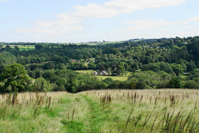
Leawood Knoll is a prominent hill located in Derbyshire, England. Situated within the Peak District National Park, it forms part of the picturesque landscape of the region. This hill is approximately 400 meters high and offers breathtaking views of the surrounding countryside.

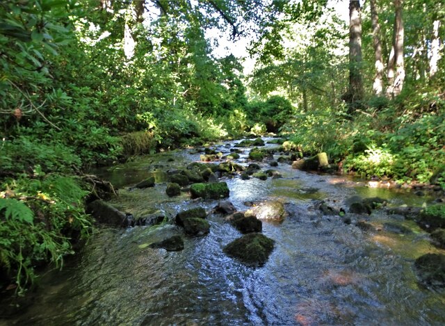
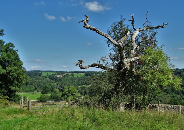
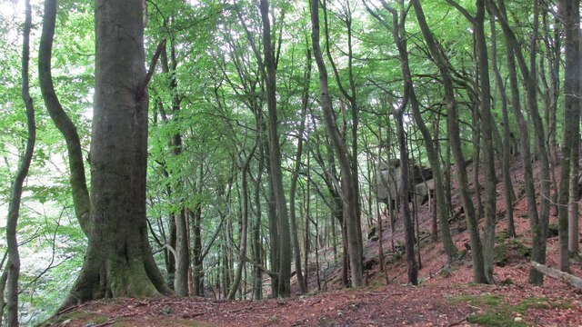
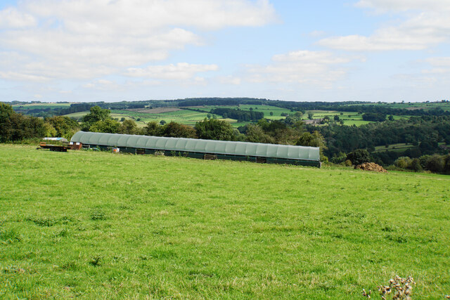
Leawood Knoll is known for its distinctive shape, characterized by its gentle slopes and rounded summit. The hill is covered in lush greenery, with a mix of grasses, heather, and scattered trees. It provides a habitat for various flora and fauna, including rare wildflowers and bird species.

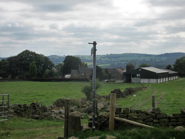
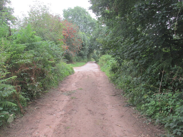
The hill is a popular destination for outdoor enthusiasts, offering a range of activities such as hiking, walking, and nature photography. There are well-marked trails that lead to the summit, providing visitors with an opportunity to explore the diverse terrain and enjoy the panoramic vistas.

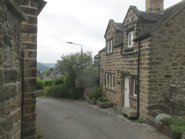
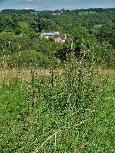
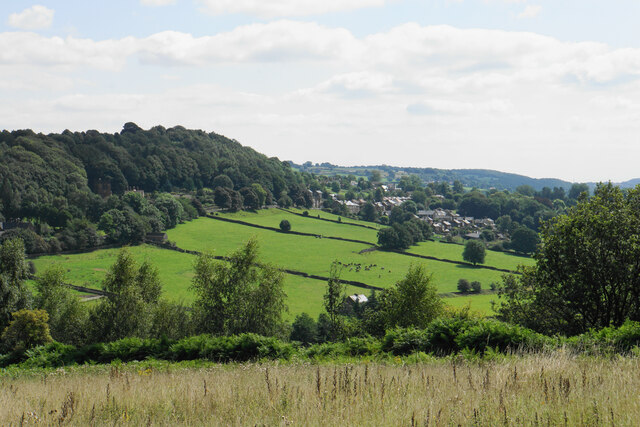
Leawood Knoll is also home to several historical and cultural sites. At the base of the hill, there is a charming village that reflects the traditional architecture and lifestyle of the region. The hill itself has witnessed centuries of human activity, with evidence of ancient settlements and farming practices.

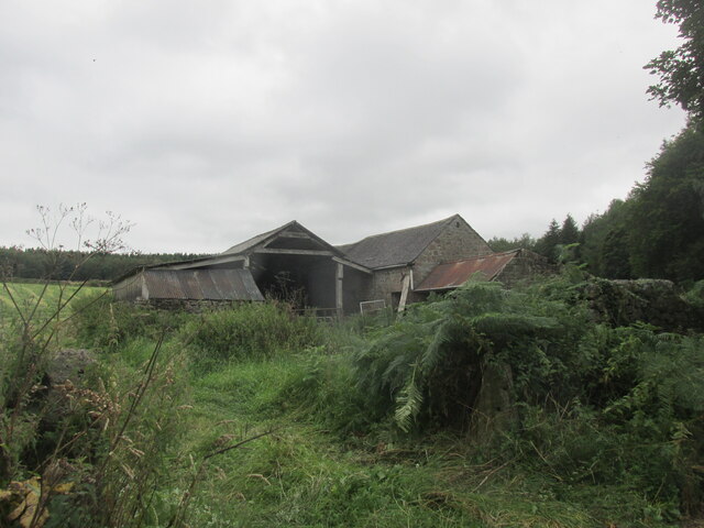
Visitors to Leawood Knoll can also explore the nearby Leawood Pumphouse, a historic water pumping station that dates back to the 19th century. The pumphouse, now a museum, offers insight into the industrial heritage of the area and showcases the technology used in water management during that era.

Overall, Leawood Knoll is a captivating natural landmark in Derbyshire, providing both recreational opportunities and a glimpse into the region's rich history and natural beauty.

If you have any feedback on the listing, please let us know in the comments section below.

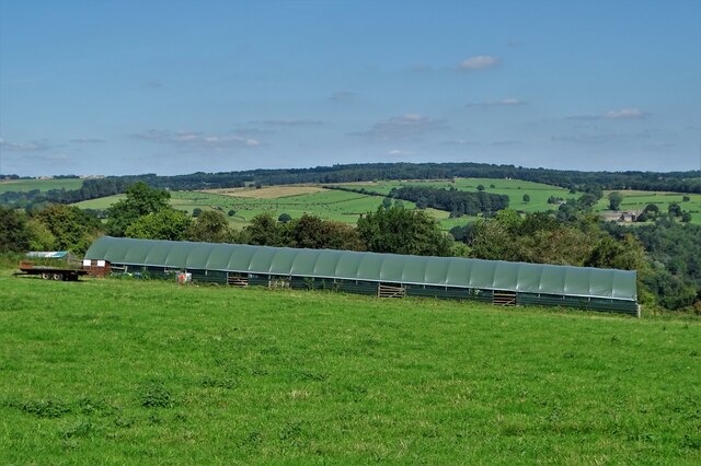
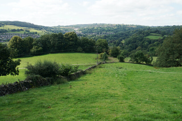
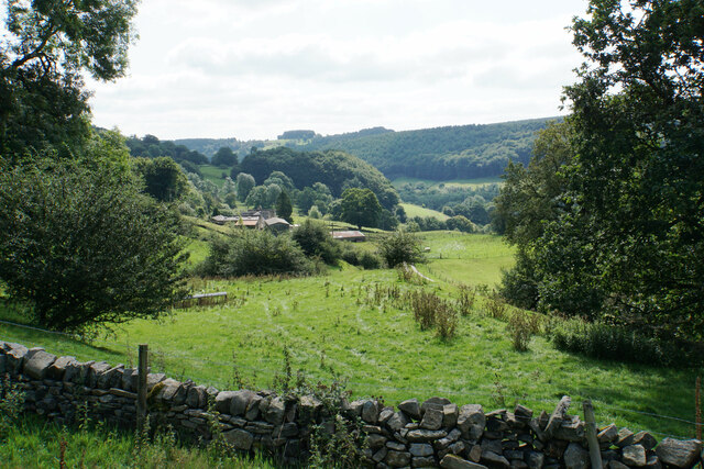
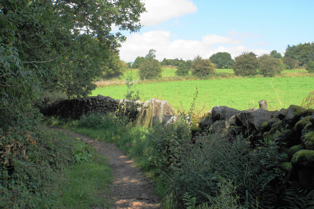
Leawood Knoll Images

Images are sourced within 2km of 53.100601/-1.5224819 or Grid Reference SK3256. Thanks to Geograph Open Source API. All images are credited.

Mill House, Lea Mill With the old mill pond in the foreground now an attractive garden feature.
Mill House, Lea Mill
With the old mill pond in the foreground now an attractive garden feature.
Lea Brook Flowing through Upper Doe Carr Wood
Lea Brook
Flowing through Upper Doe Carr Wood
North of Coumbs Wood looking towards Dethick
Upper Holloway Farm Walking along the footpath that runs down towards the farm.
Upper Holloway Farm
Walking along the footpath that runs down towards the farm.
Cottages in Holloway Narrow street in the village.
Cottages in Holloway
Narrow street in the village.
Intake Lane Close to Birchwood Farm campsite.
Intake Lane
Close to Birchwood Farm campsite.
Old barn alongside the Midshires Way Intake Lane.
Old barn alongside the Midshires Way
Intake Lane.
Bauston Tor In the trees above the Incline.
Bauston Tor
In the trees above the Incline.
View to Low Leas House ...and beyond that to Dethick with its church tower peeping above the trees. Dethick was the home of Anthony Babington after whom The Babington Plot of 1586 was named. It was a plan born out of bitter religious competition that would have involved the assassination of Queen Elizabeth I.
View to Low Leas House
...and beyond that to Dethick with its church tower peeping above the trees. Dethick was the home of Anthony Babington after whom The Babington Plot of 1586 was named. It was a plan born out of bitter religious competition that would have involved the assassination of Queen Elizabeth I.
Matlock town sign on Littlemoor Lane
Modern barn on a hillside by High Leas Farm
Raised path along the street at Lea. A quiet little village.
Raised path along the street at Lea.
A quiet little village.
Hillside above Cromford A footpath from Lea descends into the Derwent valley here. Middleton Top is on the opposite hill.
Hillside above Cromford
A footpath from Lea descends into the Derwent valley here. Middleton Top is on the opposite hill.
Meadow Wood Farm The eastern side of the Derwent valley.
Meadow Wood Farm
The eastern side of the Derwent valley.
Hearthstone Lane An ancient route which climbs the ridge between Lea Brook and the River Derwent.
Hearthstone Lane
An ancient route which climbs the ridge between Lea Brook and the River Derwent.
Cloche by High Leas Farm The cloche is for the benefit of livestock and not for plants. The valley of Lea Brook is behind.
Cloche by High Leas Farm
The cloche is for the benefit of livestock and not for plants. The valley of Lea Brook is behind.
Footpath to Lea The village of Lea is in the trees on the other side of the valley. The valley of Lea Brook runs between.
Footpath to Lea
The village of Lea is in the trees on the other side of the valley. The valley of Lea Brook runs between.
Hillside above Lea Brook Looking down the valley towards Holloway which is on the other side.
Hillside above Lea Brook
Looking down the valley towards Holloway which is on the other side.
Show me another place!

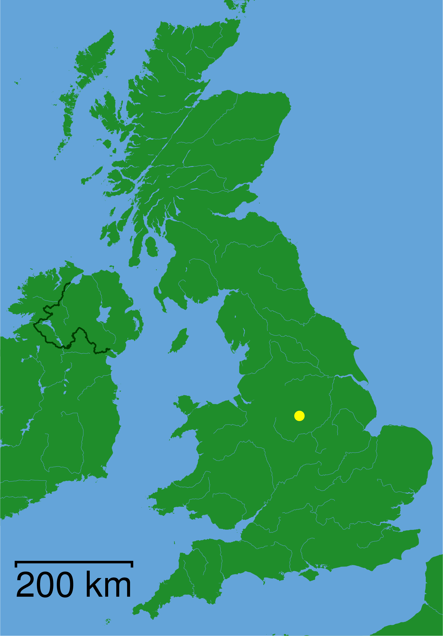
Leawood Knoll is located at Grid Ref: SK3256 (Lat: 53.100601, Lng: -1.5224819)

Administrative County: Derbyshire

District: Amber Valley

Police Authority: Derbyshire

What 3 Words

///beaks.applause.waltzed. Near Cromford, Derbyshire

Related Wikis

Leawood Pump House

The Leawood Pump House (also known as High Peak Pump House) was built near Cromford, Derbyshire, England in 1849 to supply water to the Cromford Canal...

High Peak Junction

High Peak Junction, near Cromford, Derbyshire, England, is the name now used to describe the site where the former Cromford and High Peak Railway (C&HPR...

Christ Church, Holloway

Christ Church, Holloway is a Grade II* listed parish church in the Church of England in Holloway, Derbyshire. == History == The foundation stone was laid...

Wakebridge

Wakebridge is a hamlet in Derbyshire, England. It is located 1 mile north-west of Crich and lies close to Crich quarry.

St John the Baptist's Church, Dethick

St John the Baptist's Church, Dethick is a Grade II* listed parish church in the Church of England in Dethick, Derbyshire. == History == The church was...
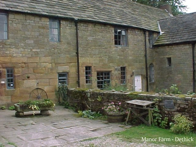
Dethick Manor

Dethick Manor is a 16th-century manor house, situated at Dethick, Amber Valley, Derbyshire, much altered in the 18th century and converted to use as a...

Coddington, Derbyshire

Coddington is a place in Derbyshire, England. It is part of the civil parish of Crich, and is ½ mile west of that village. According to Kelly's Directory...

Cromford railway station

Cromford railway station is a Grade II listed railway station owned by Network Rail and managed by East Midlands Railway. It is located in the village...

Nearby Amenities

Located within 500m of 53.100601,-1.5224819
Lea Bridge
Is In: Derbyshire, England, UK
Place: village
Lat/Long: 53.103145/-1.5264897
Bench
Lat/Long: 53.0969945/-1.5198787
Post Box
Brand: Royal Mail
Brand Wikidata: Q638098
Brand Wikipedia: en:Royal Mail
Operator: Royal Mail
Operator Wikidata: Q638098
Ref: DE4 977
Lat/Long: 53.1033132/-1.51678
Bus Stop
Bus: yes
Ele: 74.0000000
Naptan AtcoCode: 1000DLBL2701
Naptan NaptanCode: dbsdtpad
Public Transport: platform
Lat/Long: 53.1015574/-1.5290455
Bus Stop
Bus: yes
Ele: 73.0000000
Public Transport: platform
Lat/Long: 53.1014124/-1.5291475
Ele: 75.0000000
Lat/Long: 53.1016596/-1.5288537
Ele: 98.0000000
Lat/Long: 53.0968001/-1.525297
Ele: 106.0000000
Lat/Long: 53.0972718/-1.5260629
Ele: 100.0000000
Lat/Long: 53.0978468/-1.5268944
Ele: 99.0000000
Lat/Long: 53.0977029/-1.5273253
Ele: 85
Lat/Long: 53.0974337/-1.5188786
Ele: 96
Lat/Long: 53.097622/-1.5199888
Ele: 93
Lat/Long: 53.0975474/-1.5207956
Ele: 87
Lat/Long: 53.0969087/-1.5226718
Ele: 91
Lat/Long: 53.0968345/-1.5237051
Barrier: stile
Stile: squeezer
Lat/Long: 53.1026276/-1.5271529
Ele: 70.0000000
Lat/Long: 53.1012117/-1.5292579
Ele: 70.0000000
Lat/Long: 53.1011715/-1.5291956
Ele: 75.0000000
Lat/Long: 53.0983787/-1.5280558
Ele: 75.0000000
Lat/Long: 53.0989808/-1.5278612
Ele: 76.0000000
Lat/Long: 53.1008804/-1.5278745
Ele: 122
Lat/Long: 53.1028469/-1.5289537
Ele: 123
Lat/Long: 53.1028974/-1.52889
Ele: 124
Lat/Long: 53.103013/-1.5287688
Post Box
Brand: Royal Mail
Brand Wikidata: Q638098
Brand Wikipedia: en:Royal Mail
Operator: Royal Mail
Operator Wikidata: Q638098
Ref: DE4 972
Lat/Long: 53.1032092/-1.5259545
Ele: 119.0000000
Lat/Long: 53.1027603/-1.5219993
Barrier: kissing_gate
Ele: 118
Lat/Long: 53.1026726/-1.5224958
Barrier: kissing_gate
Lat/Long: 53.1018152/-1.5208322
Barrier: stile
Material: stone
Source: survey
Steps: 2
Stile: stepover
Lat/Long: 53.1013408/-1.5175177
Ele: 147.0000000
Lat/Long: 53.10343/-1.5172716
Ele: 148.0000000
Lat/Long: 53.103704/-1.5173157
Bus Stop
Bus: yes
Public Transport: platform
Lat/Long: 53.1025463/-1.5272599
Historic Operator: Derwent Valley Water Board
Note: Probably part of Derwent Aquedect (gate to east is a Derwent Aqueduct-style gate)
Operator: Severn Trent Water
Pipeline: valve
Lat/Long: 53.1013932/-1.5155207
Barrier: kissing_gate
Source: survey;gps
Lat/Long: 53.1012921/-1.5181987
Ele: 108.0000000
Lat/Long: 53.0979306/-1.5258752
Barrier: kissing_gate
Lat/Long: 53.1009405/-1.521244
Generator Method: photovoltaic
Generator Output Electricity: yes
Generator Source: solar
Generator Type: solar_photovoltaic_panel
Location: roof
Power: generator
Lat/Long: 53.1025738/-1.5181755
Information: guidepost
Tourism: information
Lat/Long: 53.0981134/-1.5257156
The data included in this document is from www.openstreetmap.org. The data is made available under ODbL.

Have you been to Leawood Knoll?

Leave your review of Leawood Knoll below (or comments, questions and feedback).