Pewet Hill
Hill, Mountain in Yorkshire Hambleton
England
Pewet Hill

Pewet Hill is a prominent hill located in Yorkshire, England. Sitting at an elevation of approximately 300 meters (984 feet), it is considered one of the highest points in the region. Situated within the picturesque countryside, Pewet Hill offers breathtaking views of the surrounding landscape, making it a popular destination for nature enthusiasts and hikers.
The hill is characterized by its gentle slopes and rolling terrain, covered with lush green vegetation, including grasses, heather, and scattered patches of woodland. Its diverse flora and fauna make it an ideal habitat for various species of birds, mammals, and insects.
At the summit of Pewet Hill, visitors can enjoy panoramic vistas of the Yorkshire Dales, the North York Moors, and the nearby valleys. On clear days, it is even possible to catch a glimpse of the distant coastline.
Pewet Hill is accessible via a network of well-maintained footpaths and trails, making it a popular destination for walkers and outdoor enthusiasts. The hill's location within the Yorkshire countryside also offers opportunities for other outdoor activities such as picnicking, photography, and wildlife spotting.
With its natural beauty and tranquil atmosphere, Pewet Hill provides visitors with an escape from the hustle and bustle of everyday life, allowing them to immerse themselves in the serene surroundings of the Yorkshire countryside.
If you have any feedback on the listing, please let us know in the comments section below.
Pewet Hill Images
Images are sourced within 2km of 54.25445/-1.5323738 or Grid Reference SE3084. Thanks to Geograph Open Source API. All images are credited.


Pewet Hill is located at Grid Ref: SE3084 (Lat: 54.25445, Lng: -1.5323738)
Division: North Riding
Administrative County: North Yorkshire
District: Hambleton
Police Authority: North Yorkshire
What 3 Words
///sloping.shook.eventful. Near Bedale, North Yorkshire
Nearby Locations
Related Wikis
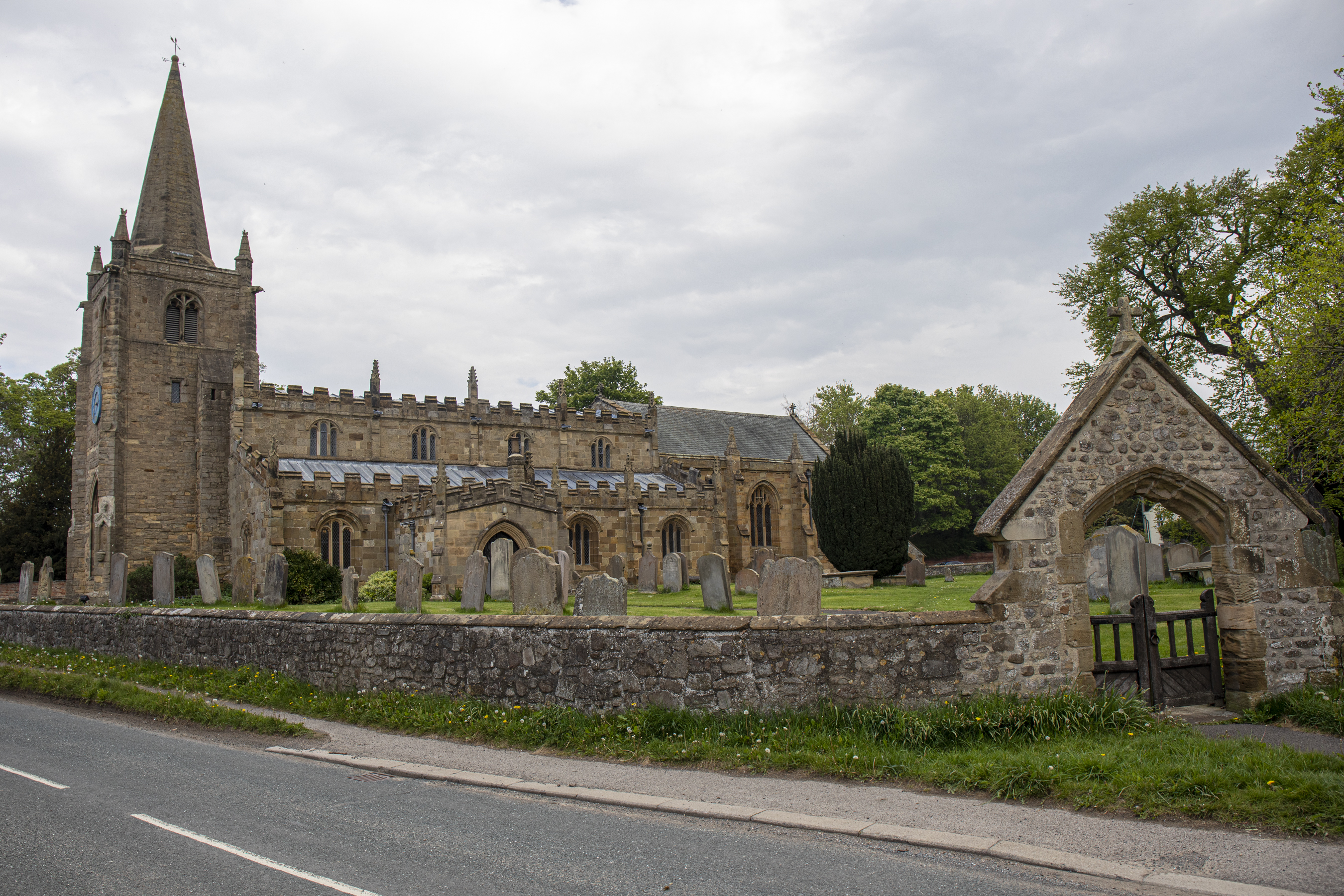
Church of St Lambert, Burneston
The Church of St Lambert, Burneston, is the Anglican parish church for the village of Burneston in North Yorkshire, England. The church was built progressively...

Carthorpe
Carthorpe is a small village and civil parish in North Yorkshire, England. It is located about 4 miles (6.4 km) south of Bedale. Village services include...

Burneston
Burneston is a village and civil parish in North Yorkshire, England. According to the 2001 Census it had a population of 244, increasing to 311 at the...

Hallikeld
Hallikeld was a Wapentake (Hundred), which is an administrative division (or ancient district), in the historic county of the North Riding of Yorkshire...

Theakston, North Yorkshire
Theakston is a village and civil parish in North Yorkshire, England. The population of the civil parish at the 2011 census was 143. == Geography == The...
Exelby, Leeming and Londonderry
Exelby, Leeming and Londonderry (formerly Exelby, Leeming and Newton) is a civil parish in the Hambleton District of North Yorkshire, England. It contains...
Exelby
Exelby is a village in the Hambleton district of North Yorkshire, England. It is 2 miles (3.2 km) south-east of Bedale and 0.5 miles (0.8 km) west of the...

Londonderry, North Yorkshire
Londonderry is a village near the Yorkshire Dales, England situated 4 miles (6 kilometres) south-east of Bedale, almost on the A1 road. It was part of...
Nearby Amenities
Located within 500m of 54.25445,-1.5323738Have you been to Pewet Hill?
Leave your review of Pewet Hill below (or comments, questions and feedback).