Brecon Hill

Hill, Mountain in Durham

England

Brecon Hill

Morton House 14th Durham VA Hospital in First World War.
Morton House Credit: Patrick Brennan - donmouth.co.uk

Brecon Hill, located in Durham, England, is a prominent hill that offers breathtaking panoramic views of the surrounding countryside. Standing at an elevation of approximately 400 feet, it is a popular destination for nature enthusiasts and hikers alike.

Situated in the northeast of Durham, Brecon Hill is part of the larger Durham Dales area, known for its rolling hills, picturesque landscapes, and rich history. The hill is known for its distinctive shape, resembling a gently sloping dome, covered in lush greenery and dotted with shrubs and trees.

Brecon Hill provides visitors with a variety of walking trails, ranging from easy strolls to more challenging hikes, catering to all fitness levels. The paths wind their way through the hill's countryside, offering stunning views of the surrounding valleys, meadows, and rivers. On a clear day, the hilltop provides an uninterrupted vista, allowing visitors to see as far as the Durham Cathedral and beyond.

The hill is home to a diverse range of flora and fauna, including wildflowers, butterflies, and various bird species, making it a haven for nature lovers and birdwatchers. It is also an ideal spot for picnics, offering serene and peaceful surroundings.

Brecon Hill's proximity to Durham city center, approximately 5 miles away, makes it easily accessible for both locals and tourists. The area surrounding the hill is dotted with charming villages, offering quaint pubs, cafes, and accommodation for those seeking a longer stay.

Overall, Brecon Hill in Durham is a natural gem that provides visitors with an opportunity to immerse themselves in the beauty of the English countryside while enjoying leisurely walks, stunning views, and a sense of tranquility.

If you have any feedback on the listing, please let us know in the comments section below.
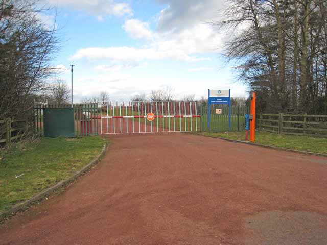
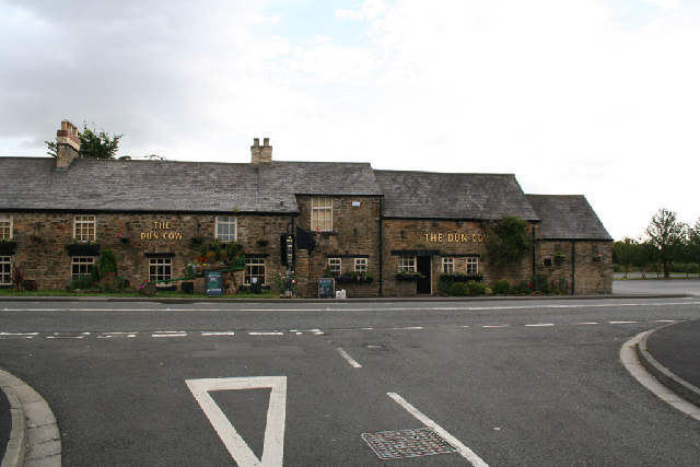
Brecon Hill Images

Images are sourced within 2km of 54.849048/-1.5337029 or Grid Reference NZ3050. Thanks to Geograph Open Source API. All images are credited.

Morton House 14th Durham VA Hospital in First World War.
Morton House
14th Durham VA Hospital in First World War.
Weardale Way
Weardale Way
Public Bridleway A section of the Weardale Way
Public Bridleway
A section of the Weardale Way
A1(M) near Pea Flatts Farm
Repairs to the Grass Verge, Northbound A1(M) near to Great Lumley The A1 is the longest numbered road in the UK at 410 miles long. It connects London with Edinburgh, via the east of England. 
For much of its path it follows the Great North Road the old coaching route between London and Edinburgh. Several sections of the route are classified as motorway A1(M). The modern A1 bypasses the towns the Great North Road passed through and is dual carriageway for most of its route through England.
Repairs to the Grass Verge, Northbound A1(M) near to Great Lumley
The A1 is the longest numbered road in the UK at 410 miles long. It connects London with Edinburgh, via the east of England. For much of its path it follows the Great North Road the old coaching route between London and Edinburgh. Several sections of the route are classified as motorway A1(M). The modern A1 bypasses the towns the Great North Road passed through and is dual carriageway for most of its route through England.
Little Lumley : A1(M) Looking north on the A1(M).
Little Lumley : A1(M)
Looking north on the A1(M).
Little Lumley : Grassy Field Looking along a grassy field with a fence through it.
Little Lumley : Grassy Field
Looking along a grassy field with a fence through it.
A1(M) northbound
A1(M) northbound
A1(M) northbound
A1(M) northbound
Gateway to Lumley Water Treatment Works
A1(M) near Great Lumley
The Dun Cow The Dun Cow Public house near Houghton Gate
The Dun Cow
The Dun Cow Public house near Houghton Gate
The Floaters Mill The Floaters Mill Public house in New Lambton
The Floaters Mill
The Floaters Mill Public house in New Lambton
The Church of St. Barnabas Built in 1867-1868, the church is in the village of Bournmoor in County Durham.
Photographed on a cold and frosty morning in late January 2006
The Church of St. Barnabas
Built in 1867-1868, the church is in the village of Bournmoor in County Durham. Photographed on a cold and frosty morning in late January 2006
Shops and Post Office on Marigold Crescent, Bournmoor, County Durham
Shops and Post Office
on Marigold Crescent, Bournmoor, County Durham
Breckon Hill Photo taken while walking along the rivers foot path
Breckon Hill
Photo taken while walking along the rivers foot path
Fencehouses County Durham
Fence Houses old fire station Fence Houses old fire station, on the A1052, at Fence Houses, Tyne & Wear now houses a Home Improvements Company
Fence Houses old fire station
Fence Houses old fire station, on the A1052, at Fence Houses, Tyne & Wear now houses a Home Improvements Company
Show me another place!

Brecon Hill is located at Grid Ref: NZ3050 (Lat: 54.849048, Lng: -1.5337029)

Unitary Authority: County Durham

Police Authority: Durham

What 3 Words

///papers.error.obey. Near Chester-le-Street, Co. Durham

Nearby Locations

Brecon Hill Lumley Thicks

Related Wikis

Lumley Thicks

Lumley Thicks is a small village in County Durham, in England. It is situated between Chester-le-Street and Houghton-le-Spring, north of Great Lumley.

Woodstone Village

Woodstone Village is a hamlet in the civil parish of Little Lumley, in the County Durham district, in the ceremonial county of Durham, England. It neighbours...
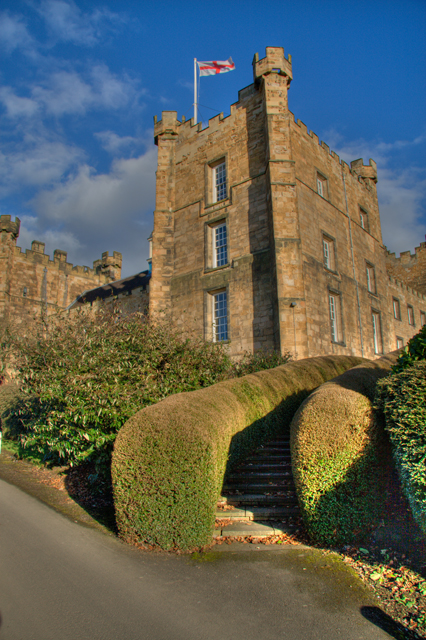
Lumley Castle

Lumley Castle is a 14th-century quadrangular castle at Chester-le-Street in the North of England, near the city of Durham and a property of the Earl of...

Great Lumley

Great Lumley is a village in County Durham, England. It is situated south east of Chester-le-Street, near Lumley Castle. It has a population of 3,843,...

Related Videos

D&D in a Castle - Your Vacation Beyond Imagination. Eat. Sleep. Roll Dice. In a Castle.

Play the adventure of a life time in a castle at D&D in a Castle Website: https://dndinacastle.com The premier D&D vacation awaits ...

Bhaves County Durham 2020

Walkingup to Penshaw Monument.

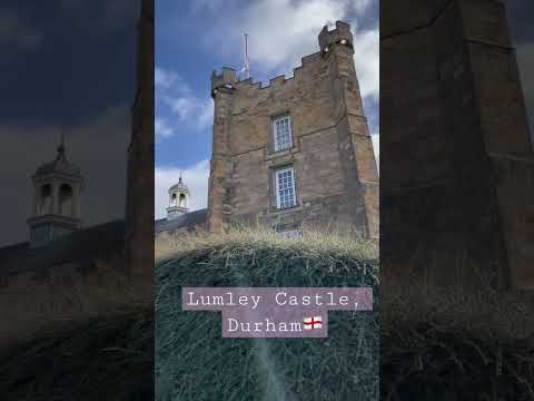
Lumley Castle Haunted and Spooky - Cubs Visit

Lumley Castle is a gorgeous English castle, steeped in history, elegant decor and beautiful natural surroundings The perfect ...

Nearby Amenities

Located within 500m of 54.849048,-1.5337029
Bus Stop
Scorers Lane End
Naptan AtcoCode: 13002317A
Naptan Bearing: N
Naptan CommonName: Scorers Lane End
Naptan Indicator: north bound
Naptan Landmark: Landmark not known
Naptan NaptanCode: duramtdw
Naptan Notes: Scorers Lane just south of where it joins Lumley New Rd- Castle Dene- Great Lumley
Naptan Street: Scorers Lane
Shelter: yes
Source: naptan_import
Lat/Long: 54.8468195/-1.5394265
Bus Stop
Scorers Lane End
Naptan AtcoCode: 13002317E
Naptan Bearing: S
Naptan CommonName: Scorers Lane End
Naptan Indicator: south bound
Naptan Landmark: Landmark not known
Naptan NaptanCode: duramtga
Naptan Notes: Scorers Lane just south of where it joins Lumley New Rd- Castle Dene- Great Lumley
Naptan Street: Scorers Lane
Naptan Verified: no
Source: naptan_import
Lat/Long: 54.8467561/-1.5392758
Bus Stop
Castle Dene
Naptan AtcoCode: 13002318C
Naptan Bearing: E
Naptan CommonName: Castle Dene
Naptan Indicator: east bound
Naptan Landmark: Landmark not known
Naptan NaptanCode: duramtgd
Naptan Notes: W end of Tinkler Terrace- Lumley New Rd- Castle Dene- Great Lumley
Naptan Street: B1284 Lumley New Road
Naptan Verified: yes
Source: naptan_import; GPS survey
Lat/Long: 54.8474295/-1.5402843
Bus Stop
Castle Dene
Bench: no
Bin: no
Bus: yes
Naptan AtcoCode: 13002318G
Naptan Bearing: W
Naptan CommonName: Castle Dene
Naptan Indicator: west bound
Naptan Landmark: Landmark not known
Naptan NaptanCode: duramtgj
Naptan Notes: 60m e of Scorers Lane junction- Lumley New Rd- Castle Dene- Great Lumley
Naptan Street: B1284 Lumley New Road
Naptan Verified: no
Public Transport: platform
Shelter: yes
Source: naptan_import
Tactile Paving: no
Lat/Long: 54.8473809/-1.5381474
Bus Stop
Lumley Thicks
Bench: no
Bin: no
Bus: yes
Naptan AtcoCode: 13002319C
Naptan Bearing: E
Naptan CommonName: Lumley Thicks
Naptan Indicator: east bound
Naptan Landmark: Landmark not known
Naptan NaptanCode: duramtgm
Naptan Notes: Lumley New Rd opp and just w of lane to Lumley Thicks- Great Lumley
Naptan Street: B1284 Lumley New Road
Naptan Verified: no
Public Transport: platform
Shelter: no
Source: naptan_import
Tactile Paving: no
Lat/Long: 54.8480195/-1.5312564
Bus Stop
Lumley Thicks
Bench: yes
Bin: yes
Bus: yes
Naptan AtcoCode: 13002319G
Naptan Bearing: W
Naptan CommonName: Lumley Thicks
Naptan Indicator: west bound
Naptan Landmark: Landmark not known
Naptan NaptanCode: duramtgp
Naptan Notes: Lumley New Rd just w of lane to Lumley Thicks- Great Lumley
Naptan Street: B1284 Lumley New Road
Naptan Verified: no
Public Transport: platform
Shelter: yes
Source: naptan_import
Tactile Paving: no
Lat/Long: 54.8479155/-1.5316791
Crossing
Crossing: unmarked
Lat/Long: 54.8473872/-1.5393576
Post Box
Ref: DH3 147
Lat/Long: 54.8475524/-1.5391962
Castle Dene
Place: hamlet
Lat/Long: 54.8473844/-1.5394982
Barrier: stile
Foot: yes
Lat/Long: 54.8493987/-1.5367785
Barrier: block
Foot: yes
Lat/Long: 54.8513643/-1.535472
Phone
Check Date: 2021-11-07
Emergency: phone
Ref: 9472A
Lat/Long: 54.8520924/-1.5365182
Phone
Check Date: 2021-12-11
Emergency: phone
Lat/Long: 54.8523327/-1.5362566
Grit Bin
Operator: Durham County Council
Operator Type: government
Operator Wikidata: Q5316492
Ref: CH148
Lat/Long: 54.8524556/-1.5346675
Grit Bin
Operator: Durham County Council
Operator Type: government
Operator Wikidata: Q5316492
Ref: CH147
Lat/Long: 54.8522803/-1.5335034
Addr City: Chester-le-Street
Addr Housenumber: 9
Addr Postcode: DH3 4HA
Lat/Long: 54.8477844/-1.5407829
Addr City: Chester-le-Street
Addr Housenumber: 8
Addr Postcode: DH3 4HA
Lat/Long: 54.8477975/-1.5409234
Addr City: Chester-le-Street
Addr Housenumber: 7
Addr Postcode: DH3 4HA
Lat/Long: 54.8478107/-1.541064
Addr City: Chester-le-Street
Addr Housenumber: 6
Addr Postcode: DH3 4HA
Lat/Long: 54.8478238/-1.5412045
Crossing
Crossing: unmarked
Lat/Long: 54.8472256/-1.5396401
Crossing
Crossing: unmarked
Lat/Long: 54.8472749/-1.5396285
Crossing
Crossing: unmarked
Lat/Long: 54.8473314/-1.53905
Crossing
Crossing: unmarked
Lat/Long: 54.8472568/-1.5390298
Barrier: kissing_gate
Lat/Long: 54.8466282/-1.5322608
Barrier: kissing_gate
Lat/Long: 54.8467228/-1.533664
Addr Housenumber: 9
Lat/Long: 54.8465926/-1.5316225
Addr Housename: Castleview
Note: Location approximate, sign by footpath had multiple names.
Lat/Long: 54.8462447/-1.5310472
Addr Housename: The Lawns
Note: Location approximate, sign by footpath had multiple names.
Lat/Long: 54.8463069/-1.5314622
Addr Housename: Fairview
Note: Location approximate, sign by footpath had multiple names.
Lat/Long: 54.8463208/-1.5316547
Addr Housename: Meads
Addr Housenumber: 4
Lat/Long: 54.8466845/-1.5315836
Addr Housename: The Rockery
Addr Housenumber: 8
Lat/Long: 54.8465494/-1.5316379
Power: pole
Transformer: distribution
Lat/Long: 54.8495325/-1.5353622
Power: pole
Lat/Long: 54.8478871/-1.5352616
Power: pole
Lat/Long: 54.8484407/-1.5356518
Power: pole
Lat/Long: 54.8489882/-1.5360434
Power: pole
Transformer: distribution
Lat/Long: 54.8495437/-1.5365054
Grit Bin
Ref: CH 146
Lat/Long: 54.849795/-1.5363251
Lumley Thicks
Place: hamlet
Wikidata: Q11764244
Wikipedia: en:Lumley Thicks
Lat/Long: 54.8467073/-1.5310049
Crossing
Crossing: unmarked
Lat/Long: 54.8478999/-1.5309013
Shelter
Shelter Type: public_transport
Lat/Long: 54.8478958/-1.5317187
Bench
Lat/Long: 54.8479052/-1.5316098
Waste Basket
Lat/Long: 54.847906/-1.5316339
Power: pole
Lat/Long: 54.8472347/-1.5376833
Power: pole
Lat/Long: 54.8470237/-1.535661
Power: pole
Lat/Long: 54.8469591/-1.5349927
Power: pole
Lat/Long: 54.8468896/-1.5343157
Power: pole
Lat/Long: 54.8470654/-1.539564
Hiking: yes
Information: guidepost
Tourism: information
Lat/Long: 54.8477385/-1.535848
The data included in this document is from www.openstreetmap.org. The data is made available under ODbL.

Have you been to Brecon Hill?

Leave your review of Brecon Hill below (or comments, questions and feedback).