Windy Hill

Hill, Mountain in Durham

England

Windy Hill

Durham Castle Durham Castle viewed from the central tower of Durham Cathedral; the spire of St Nicholas Church is in the background, Palace Green in the foreground and the River Wear to the left.
Durham Castle Credit: Adrian Taylor

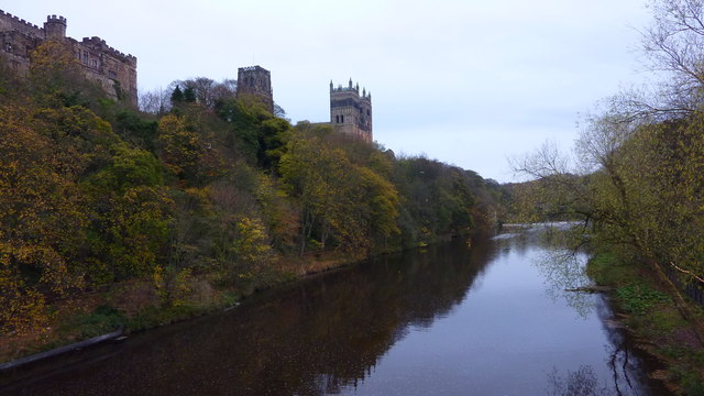
Windy Hill, located in Durham, is a prominent hill that stands as a testament to the region's natural beauty and geological history. Situated in the northeast of England, this hill is part of the larger North Pennines Area of Outstanding Natural Beauty.

With an elevation of approximately 380 meters (1,250 feet), Windy Hill is one of the highest peaks in the Durham region. The hill is characterized by its rolling slopes and rugged terrain, covered in a mixture of grasses, heather, and scattered trees. The name "Windy Hill" accurately reflects the gusty winds that often sweep across its summit, creating a unique and dynamic environment.

Windy Hill offers breathtaking panoramic views of the surrounding countryside, including the nearby villages, farmland, and even glimpses of the distant North Sea on clear days. These vistas attract both locals and tourists alike, who come to appreciate the dramatic landscapes and the tranquil atmosphere the hill provides.

The hill is also known for its rich history. In the past, it served as a strategic lookout point during various conflicts, and remnants of ancient settlements and burial sites have been discovered in the area. Today, Windy Hill remains a popular destination for outdoor enthusiasts, offering opportunities for hiking, hillwalking, and birdwatching.

In conclusion, Windy Hill in Durham is a picturesque and historically significant hill in the North Pennines Area of Outstanding Natural Beauty. With its commanding views and rugged charm, it continues to captivate visitors, providing an escape into the beauty of nature and a glimpse into the region's past.

If you have any feedback on the listing, please let us know in the comments section below.
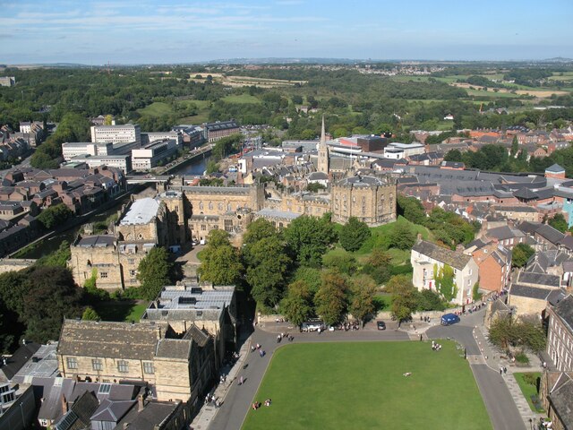
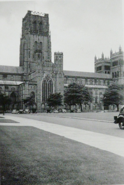
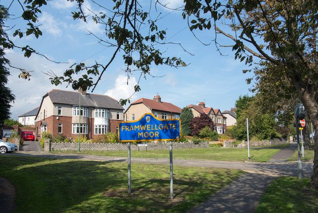
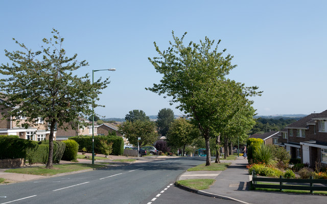
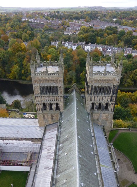
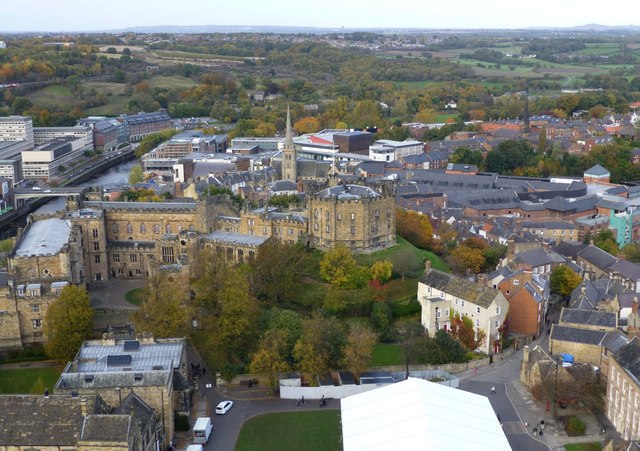
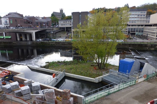
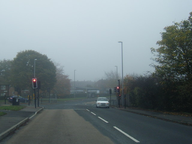
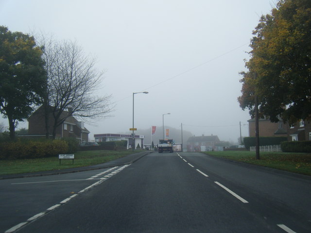
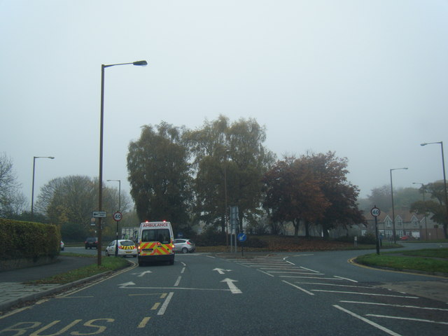
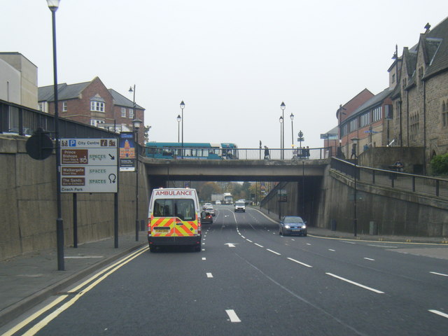
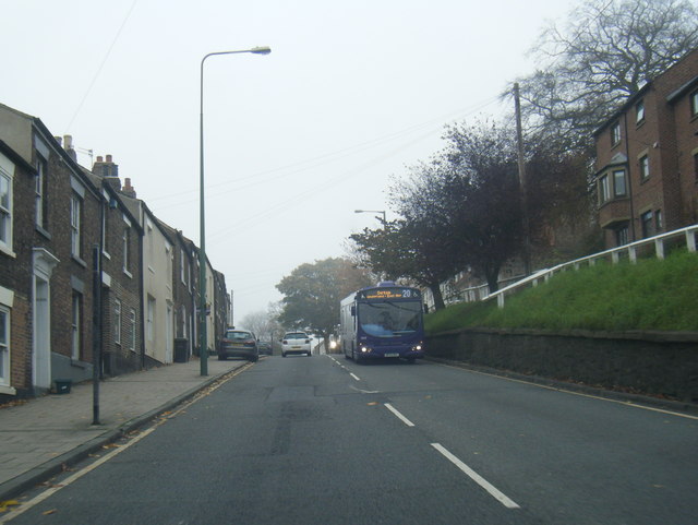
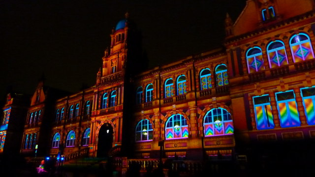
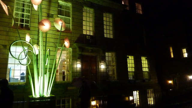
Windy Hill Images

Images are sourced within 2km of 54.780923/-1.5837573 or Grid Reference NZ2642. Thanks to Geograph Open Source API. All images are credited.

Durham Castle Durham Castle viewed from the central tower of Durham Cathedral; the spire of St Nicholas Church is in the background, Palace Green in the foreground and the River Wear to the left.
Durham Castle
Durham Castle viewed from the central tower of Durham Cathedral; the spire of St Nicholas Church is in the background, Palace Green in the foreground and the River Wear to the left.
Durham Cathedral, 1936 Taken by my grandfather, George W Baker. His son/my father took a similar photo two years later of <a href="https://www.geograph.org.uk/photo/2161815">NZ2742 : Durham Cathedral in 1938</a>.
Durham Cathedral, 1936
Taken by my grandfather, George W Baker. His son/my father took a similar photo two years later of NZ2742 : Durham Cathedral in 1938.
Semi-detached houses in Framwellgate Moor Framwellgate Moor is an area of Durham city, north of the centre. The houses are on Durham Moor Crescent. The blue and yellow sign is in a style in use in County Durham for some time.
Semi-detached houses in Framwellgate Moor
Framwellgate Moor is an area of Durham city, north of the centre. The houses are on Durham Moor Crescent. The blue and yellow sign is in a style in use in County Durham for some time.
Canterbury Road heading east Canterbury Road is one of the main roads to pass through the large residential area of Newton Hall which is on the north side of Durham City.
Canterbury Road heading east
Canterbury Road is one of the main roads to pass through the large residential area of Newton Hall which is on the north side of Durham City.
The Western Towers of Durham Cathedral Viewed from the top of the Central Tower.
The Cathedral’s original western towers were small, and were later incorporated into the larger, current structures when these were built around 1200.
The Cathedral’s towers were especially important in Durham, where the building stands surrounded by rising land, and would otherwise be hidden from view.
The Western Towers of Durham Cathedral
Viewed from the top of the Central Tower. The Cathedral’s original western towers were small, and were later incorporated into the larger, current structures when these were built around 1200. The Cathedral’s towers were especially important in Durham, where the building stands surrounded by rising land, and would otherwise be hidden from view.
Durham Castle Viewed from the top of the Central Tower of Durham Cathedral.
Durham Castle
Viewed from the top of the Central Tower of Durham Cathedral.
Archimedean screw  An Archimedean screw harvesting energy from the River Wear to drive a 100kw generator capable of supplying 75% of the total energy requirement of the new Freeman’s Reach development in Durham City.
Energy had previously been extracted for more than 800 years to drive the medieval Bishop’s Mill near the site.
<span class="nowrap"><a title="http://www.thejournal.co.uk/news/20-tonne-water-power-installation-7199432" rel="nofollow ugc noopener" href="http://www.thejournal.co.uk/news/20-tonne-water-power-installation-7199432">Link</a><img style="margin-left:2px;" alt="External link" title="External link - shift click to open in new window" src="https://s1.geograph.org.uk/img/external.png" width="10" height="10"/></span>
Archimedean screw
An Archimedean screw harvesting energy from the River Wear to drive a 100kw generator capable of supplying 75% of the total energy requirement of the new Freeman’s Reach development in Durham City. Energy had previously been extracted for more than 800 years to drive the medieval Bishop’s Mill near the site. LinkExternal link
Durham Cathedral door knocker (1965)
Pit Lane/Bek Road junction
Finchale Road at Lilac Avenue
B6532 near County Hall
A690 Leazes Road, Durham
A181 Gilesgate heading east
Durham Cathedral-Lumiere 2015 Amazing view of the Cathedral during Lumiere 2015
Durham Cathedral-Lumiere 2015
Amazing view of the Cathedral during Lumiere 2015
Durham Cathedral during Lumiere 2015 Wonderful illuminations on the Cathedral
Durham Cathedral during Lumiere 2015
Wonderful illuminations on the Cathedral
Old Shire Hall, Durham The building is being lit as part of the Durham Lumiere Light Festival 2015
Old Shire Hall, Durham
The building is being lit as part of the Durham Lumiere Light Festival 2015
St. John's College, Durham Lumiere 2015
River Wear & Durham Cathedral From Framwellgate Bridge
River Wear & Durham Cathedral
From Framwellgate Bridge
Show me another place!

Windy Hill is located at Grid Ref: NZ2642 (Lat: 54.780923, Lng: -1.5837573)

Unitary Authority: County Durham

Police Authority: Durham

What 3 Words

///early.renew.scam. Near Durham, Co. Durham

Related Wikis

Durham railway station

Durham is a railway station on the East Coast Main Line, which runs between London King's Cross and Edinburgh Waverley. The station, situated 14 miles...
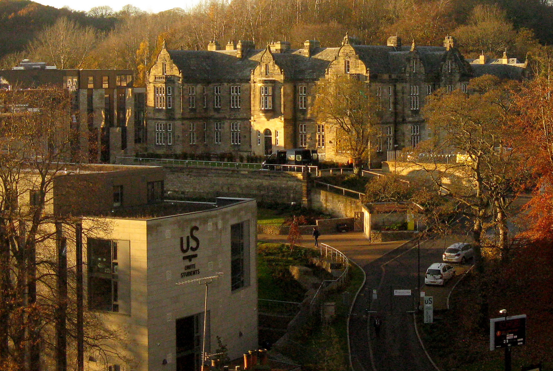
Rushford Court

Rushford Court is a student hall and former hospital in Durham, England. It opened in 1853 as County Hospital, and closed as a hospital in 2010 after services...

Durham Viaduct

Durham Viaduct is a grade II* listed railway viaduct in the City of Durham in County Durham, in North East England. The viaduct is an important local landmark...

Durham bus station

Durham bus station served the city of Durham, in County Durham, England. The bus station is managed by Durham County Council. This bus station is situated...

Holiday Park (Durham)

Holiday Park was a football ground and greyhound racing stadium in Durham in England. It was the home ground of Durham City between 1923 and 1939. ��2...

St Leonard's Catholic School, Durham

St Leonard's Catholic School is a coeducational Roman Catholic secondary school and sixth form. It is located in Durham, County Durham, England. ��2�...

Durham Rural District

Durham was a rural district in County Durham, England from 1894 to 1974. It was created under the Local Government Act 1894 based on the Durham rural...

Durham Miners' Hall

Redhills is the headquarters building of the Durham Miners' Association (DMA) in Durham, England. Officially called Miners' New Hall, it is known as Redhills...

Nearby Amenities

Located within 500m of 54.780923,-1.5837573
Crossing
Crossing: unmarked
Tactile Paving: yes
Lat/Long: 54.777844/-1.5825082
Barrier: bollard
Lat/Long: 54.7775209/-1.5816708
Barrier: entrance
Foot: yes
Lat/Long: 54.7783581/-1.5822685
Crossing
Crossing: unmarked
Kerb: lowered
Tactile Paving: yes
Lat/Long: 54.7781672/-1.5824678
Barrier: entrance
Foot: yes
Lat/Long: 54.778354/-1.5824808
Traffic Calming: bump
Lat/Long: 54.7788037/-1.581198
Crossing
Crossing: unmarked
Crossing Island: yes
Tactile Paving: yes
Lat/Long: 54.7775299/-1.5841463
Durham
Local Ref: 2
Name Lt: Daramas
Naptan AtcoCode: 9100DRHM
Public Transport: stop_position
Railway: stop
Train: yes
Lat/Long: 54.7796799/-1.5816987
Crossing
Crossing: unmarked
Kerb: lowered
Tactile Paving: yes
Lat/Long: 54.777673/-1.5829671
Railway: switch
Lat/Long: 54.7786341/-1.5827398
Turning Circle
Lat/Long: 54.7779139/-1.5799247
Traffic Signals
Traffic Signals: signal
Lat/Long: 54.7779988/-1.5794912
Traffic Signals
Crossing: traffic_signals
Tactile Paving: yes
Lat/Long: 54.7781991/-1.5797944
Traffic Signals
Traffic Signals: signal
Lat/Long: 54.7780755/-1.579292
Traffic Signals
Crossing: traffic_signals
Tactile Paving: yes
Lat/Long: 54.7780922/-1.5798254
Traffic Signals
Button Operated: yes
Crossing: traffic_signals
Traffic Signals Sound: no
Traffic Signals Vibration: yes
Lat/Long: 54.778377/-1.5794926
Traffic Signals
Button Operated: yes
Crossing: traffic_signals
Traffic Signals Sound: no
Lat/Long: 54.7783738/-1.5793021
Crossing
Crossing: unmarked
Crossing Island: yes
Lat/Long: 54.7780026/-1.5848406
Crossing
Crossing: unmarked
Crossing Island: yes
Kerb: lowered
Tactile Paving: yes
Lat/Long: 54.7784228/-1.5841596
Post Box
Collection Times: Mo-Fr 16:45, Sa 11:30
Ref: DH1 168
Lat/Long: 54.7778455/-1.5852245
Disused Office: association
Old Name: Durham Miners' Association
Lat/Long: 54.7771875/-1.5876455
Barrier: bollard
Motor Vehicle: no
Lat/Long: 54.7804708/-1.5795857
Barrier: lift_gate
Lat/Long: 54.78185/-1.5813291
Crossing
Crossing: uncontrolled
Crossing Ref: zebra
Lat/Long: 54.7836108/-1.5808174
Traffic Signals
Button Operated: yes
Crossing: traffic_signals
Tactile Paving: yes
Traffic Signals Sound: no
Traffic Signals Vibration: yes
Lat/Long: 54.777879/-1.5794466
Traffic Signals
Button Operated: yes
Crossing: traffic_signals
Tactile Paving: yes
Traffic Signals Sound: no
Traffic Signals Vibration: yes
Lat/Long: 54.7779135/-1.5792814
Crossing
Crossing: uncontrolled
Crossing Ref: zebra
Lat/Long: 54.7800505/-1.582013
Crossing
Crossing: uncontrolled
Crossing Ref: zebra
Lat/Long: 54.7802525/-1.5815685
Mini Roundabout
Lat/Long: 54.7802989/-1.5814237
Barrier: lift_gate
Lat/Long: 54.7804591/-1.5811497
Traffic Calming: bump
Lat/Long: 54.7818785/-1.5809595
Crossing
Bicycle: yes
Crossing: unmarked
Crossing Island: no
Crossing Markings: no
Lat/Long: 54.7822954/-1.5834794
Barrier: swing_gate
Foot: yes
Vehicle: private
Lat/Long: 54.7835708/-1.5803246
Parking
Access: destination
Operator: Durham Dental Clinic
Lat/Long: 54.7780799/-1.5834913
Post Box
Collection Times: Mo-Fr 09:00; Sa 07:00
Ref: DH1 39D
Royal Cypher: EIIR
Royal Cypher Wikidata: Q33102113
Lat/Long: 54.7825278/-1.5900586
Crossing
Crossing: uncontrolled
Crossing Ref: zebra
Lat/Long: 54.7797998/-1.5822222
Barrier: entrance
Foot: yes
Lat/Long: 54.7802936/-1.5833054
Barrier: entrance
Motorcar: yes
Lat/Long: 54.7825664/-1.5845446
Crossing
Crossing: uncontrolled
Lat/Long: 54.7815642/-1.5834221
Obelisk
Historic: monument
Wikidata: Q26414573
Lat/Long: 54.7813831/-1.5860375
Post Box
Collection Times: Mo-Fr 09:00; Sa 07:00
Ref: DH1 1D
Royal Cypher: EIIR
Royal Cypher Wikidata: Q33102113
Lat/Long: 54.7807024/-1.5867674
Barrier: bollard
Foot: yes
Lat/Long: 54.7784566/-1.5868272
Traffic Signals
Bicycle: yes
Button Operated: yes
Crossing: traffic_signals
Crossing Island: yes
Kerb: lowered
Tactile Paving: yes
Lat/Long: 54.7835758/-1.585481
Traffic Signals
Bicycle: yes
Button Operated: yes
Crossing: traffic_signals
Crossing Island: yes
Kerb: lowered
Tactile Paving: yes
Traffic Signals Sound: no
Traffic Signals Vibration: yes
Lat/Long: 54.783693/-1.5853624
Crossing
Crossing: unmarked
Crossing Island: yes
Note: Re-opened (Mar 2022)
Tactile Paving: no
Lat/Long: 54.7796618/-1.5795595
Waste Basket
Ele: 78.23
Lat/Long: 54.7824254/-1.5828017
Waste Basket
Ele: 68.14
Lat/Long: 54.7835192/-1.5788793
Waste Basket
Ele: 66.22
Lat/Long: 54.7836925/-1.5792741
Waste Basket
Ele: 66.46
Lat/Long: 54.7839053/-1.5789136
Waste Basket
Ele: 70.06
Lat/Long: 54.7836578/-1.5799093
Grit Bin
Lat/Long: 54.7838311/-1.5798749
The Jubilee Walk
Ele: 93.13
Information: map
Razed Tourism: information
Lat/Long: 54.7828412/-1.5815915
Grit Bin
Lat/Long: 54.7835836/-1.5808448
Grit Bin
Ele: 71.26
Lat/Long: 54.7835341/-1.5828618
Bench
Ele: 71.5
Lat/Long: 54.7838756/-1.581849
Ele: 78.23
Tourism: picnic_site
Lat/Long: 54.7842369/-1.5812911
Bench
Ele: 77.03
Lat/Long: 54.7842859/-1.5815432
Bench
Ele: 75.35
Lat/Long: 54.784235/-1.5819544
Bench
Ele: 71.26
Lat/Long: 54.7840389/-1.5808191
Bench
Ele: 71.26
Lat/Long: 54.7840686/-1.5808276
Bench
Ele: 71.26
Lat/Long: 54.784133/-1.5809736
Waste Basket
Ele: 75.59
Waste: dog_excrement
Lat/Long: 54.7839997/-1.5804567
Bench
Ele: 76.79
Lat/Long: 54.7841924/-1.5805101
Bench
Ele: 76.79
Lat/Long: 54.7842369/-1.5807161
Ele: 74.87
Historic: memorial
Lat/Long: 54.784226/-1.5809628
Ele: 77.03
Man Made: flagpole
Lat/Long: 54.7842998/-1.5808697
Disused Amenity: toilets
Lat/Long: 54.7843706/-1.5807075
Bench
Ele: 78.47
Lat/Long: 54.7842122/-1.5810937
Waste Basket
Ele: 78.71
Lat/Long: 54.7842914/-1.5811967
Bench
Ele: 77.51
Lat/Long: 54.7842765/-1.5810937
Bench
Ele: 66.94
Lat/Long: 54.7840538/-1.5824413
Bench
Ele: 65.25
Lat/Long: 54.7837172/-1.581128
Bench
Ele: 68.38
Lat/Long: 54.7837568/-1.5813598
Bench
Ele: 64.77
Lat/Long: 54.7837321/-1.5812482
Traffic Calming: choker
Lat/Long: 54.7812348/-1.5768712
Restaurant
Collage bar and restaurant
Old Name: Filini
Lat/Long: 54.7806277/-1.57676
Access: yes
Entrance: main
Wheelchair: yes
Lat/Long: 54.7803416/-1.5771188
Barrier: lift_gate
Lat/Long: 54.7799002/-1.5775752
Bench
Backrest: yes
Colour: black
Material: wood
Seats: 4
Lat/Long: 54.7795131/-1.5772154
Waste Basket
Colour: black
Lat/Long: 54.7795426/-1.5772047
Waste Basket
Colour: black
Lat/Long: 54.7789509/-1.5774332
Bench
Backrest: yes
Colour: black
Material: wood
Seats: 4
Lat/Long: 54.7789214/-1.577444
Bicycle Parking
Capacity: 10
Lat/Long: 54.7787749/-1.5774897
Post Box
Collection Times: Mo-Fr 09:00; Sa 07:00
Drive Through: no
Operator: Royal Mail
Operator Wikidata: Q638098
Post Box Type: wall
Ref: DH1 190D
Royal Cypher: GR
Royal Cypher Wikidata: Q33102273
Lat/Long: 54.7839717/-1.5862515
Crossing
Crossing: unmarked
Crossing Island: no
Kerb: lowered
Tactile Paving: yes
Lat/Long: 54.7844246/-1.586759
Turning Circle
Lat/Long: 54.7843328/-1.5865143
Ele: 84.48
Note: Hatch in ground
Lat/Long: 54.7851142/-1.5829157
Bus Stop
Wharton Park
Bench: no
Bin: no
Bus: yes
Lit: yes
Naptan AtcoCode: 13005001E
Naptan Bearing: S
Naptan CommonName: Wharton Park
Naptan Indicator: south bound
Naptan Landmark: Bus Stop
Naptan NaptanCode: durdgjdj
Naptan PlusbusZoneRef: DRHM
Naptan Street: North Road
Public Transport: platform
Seats: no
Shelter: no
Source: naptan_import
Tactile Paving: no
Lat/Long: 54.7795896/-1.5847227
Bus Stop
Wharton Park
Bench: no
Bin: yes
Bus: yes
Lit: yes
Naptan AtcoCode: 13005001H
Naptan Bearing: NW
Naptan CommonName: Wharton Park
Naptan Indicator: north west bound
Naptan Landmark: Outside entrance to hospital
Naptan NaptanCode: durdgjdm
Naptan Notes: hospital- north rd- Durham
Naptan PlusbusZoneRef: DRHM
Naptan Street: North Road
Public Transport: platform
Seats: no
Shelter: no
Source: naptan_import
Tactile Paving: no
Lat/Long: 54.7788316/-1.5845846
Bus Stop
St Leonards School
Bench: yes
Lit: yes
Naptan AtcoCode: 13005003A
Naptan Bearing: N
Naptan CommonName: St Leonards School
Naptan Indicator: north bound
Naptan Landmark: Bus shelter outside school entrance
Naptan NaptanCode: durdgjdp
Naptan PlusbusZoneRef: DRHM
Naptan Street: North Road
Naptan Verified: no
Shelter: yes
Source: naptan_import
Lat/Long: 54.7836843/-1.5860154
Bus Stop
St Leonards School
Bench: no
Bin: no
Check Date Shelter: 2023-01-07
Lit: yes
Naptan AtcoCode: 13005003E
Naptan Bearing: S
Naptan CommonName: St Leonards School
Naptan Indicator: south bound
Naptan Landmark: Bus stop at rear of Garden House pub
Naptan NaptanCode: durdgjdt
Naptan Notes: Between 1 North Road and Garden House pub- North End- Durham
Naptan PlusbusZoneRef: DRHM
Naptan Street: North Road
Seats: no
Shelter: no
Source: naptan_import
Tactile Paving: no
Lat/Long: 54.7828182/-1.5858546
Bus Stop
North Road Stand A
Bench: no
Naptan AtcoCode: 13005015A
Naptan Bearing: SE
Naptan CommonName: North Road Stand A
Naptan Indicator: south east bound
Naptan Landmark: Outside British Heart Foundation
Naptan NaptanCode: durdgjpa
Naptan PlusbusZoneRef: DRHM
Naptan Street: North Road
Naptan Verified: yes
Shelter: no
Source: naptan_import
Lat/Long: 54.7777125/-1.5821667
Bus Stop
North Road Stand B
Bench: no
Naptan AtcoCode: 13005015B
Naptan Bearing: SE
Naptan CommonName: North Road Stand B
Naptan Indicator: south east bound
Naptan Landmark: Outside Johnson's
Naptan NaptanCode: durdgjpd
Naptan PlusbusZoneRef: DRHM
Naptan Street: North Road
Naptan Verified: yes
Shelter: no
Source: naptan_import
Lat/Long: 54.7775797/-1.5818919
Millburngate Stand B
Disused Highway: bus_stop
Naptan AtcoCode: 13005016B
Naptan Bearing: N
Naptan CommonName: Millburngate Stand B
Naptan Indicator: north bound
Naptan Landmark: Landmark not known
Naptan NaptanCode: durdgjpm
Naptan Notes: Opposite Millburngate car park- Milburngate- Durham City
Naptan PlusbusZoneRef: DRHM
Naptan Street: Milburngate
Naptan Verified: yes
Note: Suspended for duration of bus station rebuilding
Shelter: yes
Source: naptan_import
Tactile Paving: no
Lat/Long: 54.7769155/-1.5805391
Bus Stop
Millburngate Stand D
Fixme: Check NAPTAN codes - these have probably got muddled
Naptan AtcoCode: 13005016C
Naptan Bearing: N
Naptan CommonName: Millburngate Stand C
Naptan Indicator: north bound
Naptan Landmark: Landmark not known
Naptan NaptanCode: durdgjpt
Naptan Notes: Opposite Millburngate car park- Milburngate- Durham City
Naptan PlusbusZoneRef: DRHM
Naptan Street: Milburngate
Naptan Verified: yes
Note: Temporarily replaced by new stands
Shelter: yes
Source: naptan_import
Lat/Long: 54.7776878/-1.5794626
Bus Stop
North End-The Crescent
Bench: no
Bin: no
Check Date Shelter: 2023-01-07
Lit: yes
Naptan AtcoCode: 13005018F
Naptan Bearing: SW
Naptan CommonName: North End-The Crescent
Naptan Indicator: south west bound
Naptan Landmark: Landmark not known
Naptan NaptanCode: durdgjta
Naptan Notes: 10m North of number 1 South Crescent- North End- Durham
Naptan PlusbusZoneRef: DRHM
Naptan Street: Street not known
Naptan Verified: no
Shelter: no
Source: naptan_import
Tactile Paving: no
Lat/Long: 54.7842093/-1.5870242
Bus Stop
Durham Bus Station 'Stand A'
Bus: yes
Covered: yes
Departures Board: timetable
Disused Highway: bus_stop
Local Ref: A
Naptan AtcoCode: 13005528A
Naptan CommonName: Bus Station Stand A
Naptan Indicator: north east bound
Naptan NaptanCode: durdmdap
Naptan Notes: Durham city bus station off north road- Durham (buses enter from roundabout at north rd end)
Naptan PlusbusZoneRef: DRHM
Naptan Street: North Road
Naptan Verified: no
Public Transport: platform
Ref: A
Source: naptan_import
Tactile Paving: no
Lat/Long: 54.7774158/-1.5822131
Bus Stop
Durham Bus Station 'Stand B'
Bench: yes
Bus: yes
Covered: yes
Disused Highway: bus_stop
Local Ref: B
Naptan AtcoCode: 13005528B
Naptan CommonName: Bus Station Stand B
Naptan Indicator: north east bound
Naptan NaptanCode: durdmdat
Naptan PlusbusZoneRef: DRHM
Naptan Street: North Road
Naptan Verified: no
Public Transport: platform
Ref: B
Source: naptan_import
Tactile Paving: no
Lat/Long: 54.7773917/-1.5821605
Bus Stop
Durham Bus Station 'Stand C'
Bench: yes
Bus: yes
Disused Highway: bus_stop
Local Ref: C
Naptan AtcoCode: 13005528C
Naptan CommonName: Bus Station Stand C
Naptan Indicator: north east bound
Naptan NaptanCode: durdmdaw
Naptan PlusbusZoneRef: DRHM
Naptan Street: North Road
Naptan Verified: no
Public Transport: platform
Ref: C
Shelter: yes
Source: naptan_import
Tactile Paving: no
Lat/Long: 54.777368/-1.5821091
Bus Stop
Durham Bus Station 'Stand D'
Bench: yes
Bus: yes
Disused Highway: bus_stop
Local Ref: D
Naptan AtcoCode: 13005528D
Naptan CommonName: Bus Station Stand D
Naptan Indicator: north east bound
Naptan NaptanCode: durdmdga
Naptan PlusbusZoneRef: DRHM
Naptan Street: North Road
Naptan Verified: no
Public Transport: platform
Ref: D
Shelter: yes
Source: naptan_import
Tactile Paving: no
Lat/Long: 54.7773477/-1.5820651
Bus Stop
Durham Bus Station 'Stand E'
Bus: yes
Disused Highway: bus_stop
Local Ref: E
Naptan AtcoCode: 13005528E
Naptan CommonName: Bus Station Stand E
Naptan Indicator: north east bound
Naptan NaptanCode: durdmdgd
Naptan PlusbusZoneRef: DRHM
Naptan Street: North Road
Naptan Verified: no
Public Transport: platform
Ref: E
Shelter: yes
Source: naptan_import
Tactile Paving: no
Lat/Long: 54.7773263/-1.5820185
Bus Stop
Durham Bus Station 'Stand F'
Bus: yes
Disused Highway: bus_stop
Local Ref: F
Naptan AtcoCode: 13005528F
Naptan CommonName: Bus Station Stand F
Naptan Indicator: north east bound
Naptan NaptanCode: durdmdgj
Naptan PlusbusZoneRef: DRHM
Naptan Street: North Road
Naptan Verified: no
Public Transport: platform
Ref: F
Shelter: yes
Source: naptan_import
Tactile Paving: no
Lat/Long: 54.7773013/-1.5819642
Bus Stop
Durham Bus Station 'Stand G'
Bus: yes
Disused Highway: bus_stop
Local Ref: G
Naptan AtcoCode: 13005528G
Naptan CommonName: Bus Station Stand G
Naptan Indicator: north east bound
Naptan NaptanCode: durdmdgm
Naptan PlusbusZoneRef: DRHM
Naptan Street: North Road
Naptan Verified: no
Public Transport: platform
Ref: G
Shelter: yes
Source: naptan_import
Tactile Paving: no
Lat/Long: 54.7772808/-1.5819197
Bus Stop
Durham Bus Station 'Stand H'
Bus: yes
Disused Highway: bus_stop
Local Ref: H
Naptan AtcoCode: 13005528H
Naptan CommonName: Bus Station Stand H
Naptan Indicator: north east bound
Naptan NaptanCode: durdmdgp
Naptan PlusbusZoneRef: DRHM
Naptan Street: North Road
Naptan Verified: no
Public Transport: platform
Ref: H
Shelter: yes
Source: naptan_import
Tactile Paving: no
Lat/Long: 54.7772588/-1.5818721
Bus Stop
Durham Bus Station 'Stand J'
Bus: yes
Disused Highway: bus_stop
Local Ref: J
Naptan AtcoCode: 13005528J
Naptan CommonName: Bus Station Stand J
Naptan Indicator: north east bound
Naptan NaptanCode: durdmdgw
Naptan PlusbusZoneRef: DRHM
Naptan Street: North Road
Naptan Verified: no
Public Transport: platform
Ref: J
Shelter: yes
Source: naptan_import
Tactile Paving: no
Lat/Long: 54.7772359/-1.5818223
Bus Stop
Durham Bus Station 'Stand K'
Bench: yes
Bus: yes
Disused Highway: bus_stop
Disused Public Transport: platform
Local Ref: K
Naptan AtcoCode: 13005528K
Naptan CommonName: Bus Station Stand K
Naptan Indicator: north east bound
Naptan NaptanCode: durdmdja
Naptan PlusbusZoneRef: DRHM
Naptan Street: North Road
Naptan Verified: no
Public Transport: platform
Ref: K
Shelter: yes
Source: naptan_import
Tactile Paving: no
Lat/Long: 54.7772066/-1.5817585
Bus Stop
Durham Bus Station 'Stand L'
Bus: yes
Disused Highway: bus_stop
Local Ref: L
Naptan AtcoCode: 13005528L
Naptan CommonName: Bus Station Stand L
Naptan Indicator: north east bound
Naptan NaptanCode: durgatda
Naptan PlusbusZoneRef: DRHM
Naptan Street: North Road
Naptan Verified: no
Public Transport: platform
Ref: L
Source: naptan_import
Lat/Long: 54.7771793/-1.5816993
Bus Stop
Railway Station
Bench: yes
Bin: no
Naptan AtcoCode: 13005555D
Naptan Bearing: SE
Naptan BusStopType: MKD
Naptan CommonName: Railway Station
Naptan Indicator: SE-bound
Naptan Landmark: Landmark not known
Naptan NaptanCode: durdmdjd
Naptan PlusbusZoneRef: DRHM
Naptan RevisionNumber: 5
Naptan Street: Station Approach
Naptan Verified: no
Shelter: yes
Source: naptan_import
Lat/Long: 54.779441/-1.580907
Bus Stop
Sutton Street
Bench: no
Naptan AtcoCode: 13005645B
Naptan Bearing: NE
Naptan BusStopType: MKD
Naptan CommonName: Sutton Street
Naptan Indicator: NE-bound
Naptan Landmark: Landmark not known
Naptan NaptanCode: durdmgjd
Naptan PlusbusZoneRef: DRHM
Naptan RevisionNumber: 3
Naptan Street: Sutton Street
Naptan Verified: yes
Shelter: yes
Source: naptan_import
Lat/Long: 54.7782449/-1.5845575
Barrier: lift_gate
Lat/Long: 54.7850875/-1.5850823
Bicycle Parking
Visitor cycle parking
Bicycle Parking: stands
Capacity: 6
Covered: yes
Description: rusty
Lat/Long: 54.7853647/-1.584833
Parking
Disabled parking
Capacity Disabled: yes
Lat/Long: 54.7853042/-1.5850178
Post Box
Check Date: 2022-05-27
Collection Times: Mo-Fr 09:00; Sa 07:00
Ref: DH1 356
Royal Cypher: EIIR
Lat/Long: 54.7793256/-1.5816938
Description: Good view of the Cathedral
Tourism: viewpoint
Lat/Long: 54.7792025/-1.5829174
Bicycle Parking
Bicycle Parking: stands
Capacity: 20
Lat/Long: 54.7773996/-1.5829696
Access: private
Addr Housenumber: 2
Addr Street: St Godric's Court
Entrance: yes
Lat/Long: 54.7778792/-1.5800125
Grit Bin
Operator: Durham County Council
Operator Type: government
Operator Wikidata: Q5316492
Ref: DU 268
Lat/Long: 54.7773732/-1.5829088
Access: private
Addr Housenumber: 1
Addr Street: St Godric's Court
Entrance: yes
Lat/Long: 54.7779334/-1.5801471
Access: private
Addr Housenumber: 4
Addr Street: St Godric's Court
Entrance: yes
Lat/Long: 54.7777502/-1.5799436
Access: private
Addr Housenumber: 3
Addr Street: St Godric's Court
Entrance: yes
Lat/Long: 54.7778099/-1.5799755
Railway: switch
Lat/Long: 54.783141/-1.5782703
Barrier: bollard
Lat/Long: 54.7802263/-1.5831003
Barrier: bollard
Lat/Long: 54.7802263/-1.5830775
Crossing
Button Operated: yes
Crossing: traffic_signals
Crossing Island: no
Crossing Ref: puffin
Tactile Paving: yes
Traffic Signals Sound: yes
Lat/Long: 54.7767494/-1.5848483
Bicycle Parking
Bicycle Parking: stands
Capacity: 14
Covered: yes
Lat/Long: 54.7796953/-1.5813183
Barrier: bollard
Lat/Long: 54.7796612/-1.5813005
Hangman's Hill
Natural: peak
Lat/Long: 54.7809418/-1.5890265
Welcome to Flass Vale Local Nature Reserve
Information: map
Tourism: information
Lat/Long: 54.7796134/-1.589296
Bench
Lat/Long: 54.7796943/-1.5893439
Tourism: viewpoint
Lat/Long: 54.7807614/-1.5889707
Traffic Signals
Traffic Signals: signal
Lat/Long: 54.7782767/-1.5793487
Crossing
Crossing: unmarked
Crossing Island: no
Crossing Markings: no
Tactile Paving: yes
Lat/Long: 54.7782061/-1.5831594
Crossing
Crossing: unmarked
Tactile Paving: yes
Lat/Long: 54.777803/-1.5825613
Crossing
Crossing: unmarked
Kerb: lowered
Tactile Paving: yes
Lat/Long: 54.7848824/-1.5872924
Crossing
Crossing: unmarked
Kerb: lowered
Tactile Paving: yes
Lat/Long: 54.7845856/-1.5867766
Crossing
Crossing: unmarked
Kerb: lowered
Tactile Paving: yes
Lat/Long: 54.784602/-1.5868505
Traffic Signals
Lat/Long: 54.7838998/-1.5856753
Crossing
Crossing: unmarked
Crossing Island: no
Kerb: lowered
Tactile Paving: yes
Lat/Long: 54.7845132/-1.5870766
Barrier: entrance
Lat/Long: 54.7835675/-1.5851058
Crossing
Crossing: zebra
Lat/Long: 54.7852286/-1.585518
Waste Basket
Lat/Long: 54.7770549/-1.5809777
Dcc Strategic 2011: yes
Dcc Strategic Ref: 10
Description: Argos, North Road
Man Made: surveillance
Operator: Durham County Council
Source: http://democracy.durham.gov.uk/mgAi.aspx?ID=7115
Surveillance: public
Surveillance Direction Changes: yes
Lat/Long: 54.7777413/-1.5821751
Description: China Town
Man Made: surveillance
Surveillance: public
Lat/Long: 54.7768675/-1.5806498
Man Made: surveillance
Surveillance: public
Lat/Long: 54.7770314/-1.5810228
Man Made: surveillance
Surveillance: public
Lat/Long: 54.7771441/-1.5812042
Man Made: surveillance
Surveillance: public
Lat/Long: 54.7772403/-1.5814075
Count: 3
Description: For the construction site
Man Made: surveillance
Surveillance: outdoor
Lat/Long: 54.7799245/-1.5763807
Man Made: surveillance
Surveillance: outdoor
Lat/Long: 54.7799244/-1.5773529
Man Made: surveillance
Surveillance: outdoor
Lat/Long: 54.779998/-1.5779633
Noexit: yes
Lat/Long: 54.7811706/-1.5789258
Atm
Fee: no
Operator: Link
Lat/Long: 54.779252/-1.5816041
Entrance: main
Lat/Long: 54.7784153/-1.5839955
Grit Bin
Operator: Durham County Council
Operator Type: government
Operator Wikidata: Q5316492
Ref: DU223
Lat/Long: 54.7790118/-1.5847285
John Forman
Artwork Subject: John Forman
Artwork Type: statue
Subject Wikipedia: en:John Forman (trade unionist)
Tourism: artwork
Lat/Long: 54.7772772/-1.587075
Mine Cart
Artwork Type: sculpture
Tourism: artwork
Lat/Long: 54.7770702/-1.5871501
Mine Cart
Artwork Type: sculpture
Tourism: artwork
Lat/Long: 54.7771473/-1.5872522
W. H. Patterson
Artwork Type: statue
Subject: William Hammond Patterson
Subject Wikipedia: en:W. H. Patterson
Tourism: artwork
Lat/Long: 54.7772624/-1.5870105
Bench
Lat/Long: 54.777127/-1.587163
Bench
Lat/Long: 54.7771439/-1.5871888
William Crawford
Artwork Type: statue
Subject: William Crawford
Subject Wikipedia: en:William Crawford (trade unionist)
Tourism: artwork
Lat/Long: 54.7771938/-1.5869138
Alexander Macdonald
Artwork Type: statue
Subject: Alexander Macdonald
Subject Wikipedia: en:Alexander Macdonald (Lib–Lab politician)
Tourism: artwork
Lat/Long: 54.7772299/-1.5869647
Grit Bin
Operator: Durham County Council
Operator Type: government
Operator Wikidata: Q5316492
Ref: DU423
Lat/Long: 54.7808538/-1.5858215
Disused Barrier: gate
Note: inaccessible, and presumably private anyway - hence disused tag
Lat/Long: 54.7813043/-1.5887172
Barrier: bollard
Lat/Long: 54.7769004/-1.5828494
Barrier: bollard
Lat/Long: 54.7771517/-1.582514
Railway: switch
Lat/Long: 54.7827806/-1.5786613
Railway: buffer_stop
Lat/Long: 54.7822479/-1.5792619
Railway: switch
Lat/Long: 54.7827503/-1.5785498
Dentist
Castle View Dental Surgery
Addr City: Durham
Addr Housenumber: 70
Addr Postcode: DH1 4SQ
Addr Street: North Road
Lat/Long: 54.7770835/-1.5807389
Community Centre
Durham Community Association
Addr City: Durham
Addr Housenumber: Shakespeare Hall, 71
Addr Postcode: DH1 4SQ
Addr Street: North Road
Start Date: 1948
Lat/Long: 54.777112/-1.5805458
Nightclub
Loft
Addr City: Durham
Addr Housenumber: 17
Addr Postcode: DH1 4SH
Addr Street: North Road
Alt Name: The Loft / Studio
Lat/Long: 54.7768868/-1.5807255
Addr City: Durham
Addr Postcode: DH1 4SH
Contact Facebook: JMFoleys
Disused Amenity: bar
Old Name: J M Foley's Irish Bar & Kitchen
Lat/Long: 54.7769591/-1.5809416
Post Box
Collection Times: Mo-Fr 09:00; Sa 07:00
Operator: Royal Mail
Post Box Type: wall
Ref: DH1 286D
Royal Cypher: EIIR
Royal Cypher Wikidata: Q33102113
Lat/Long: 54.7769223/-1.5804307
Addr City: Durham
Addr Housename: Shakespeare Hall
Addr Postcode: DH1 4SQ
Addr Street: North Road
Entrance: main
Lat/Long: 54.7769872/-1.5805703
Atm
Brand: Tesco Bank
Lat/Long: 54.777045/-1.5810498
Addr Housename: Tenter Chambers
Entrance: main
Lat/Long: 54.7774051/-1.5814465
Bicycle Parking
Bicycle Parking: stands
Capacity: 10
Lat/Long: 54.7785718/-1.5880031
Bench
Backrest: yes
Check Date: 2022-11-25
Colour: black
Material: wood
Seats: 4
Lat/Long: 54.7799245/-1.5770258
Street Lamp
Lat/Long: 54.7799391/-1.5770429
Bench
Backrest: yes
Colour: black
Material: wood
Seats: 4
Lat/Long: 54.7785128/-1.5775892
Waste Basket
Colour: black
Lat/Long: 54.7797721/-1.5771075
Bench
Backrest: yes
Colour: black
Material: wood
Seats: 4
Lat/Long: 54.7790499/-1.5774161
Bench
Backrest: yes
Colour: black
Material: wood
Seats: 4
Lat/Long: 54.7797509/-1.5771209
Bench
Backrest: no
Colour: brown
Material: wood
Seats: 4
Lat/Long: 54.779625/-1.5764711
Bench
Backrest: yes
Colour: black
Material: wood
Seats: 4
Lat/Long: 54.7796015/-1.5771876
Bench
Backrest: yes
Colour: black
Material: wood
Seats: 4
Lat/Long: 54.7782525/-1.5776816
Bench
Backrest: yes
Colour: black
Material: wood
Seats: 4
Lat/Long: 54.7787539/-1.5775143
Bench
Backrest: yes
Colour: black
Material: wood
Seats: 4
Lat/Long: 54.7791826/-1.5773595
Grit Bin
Colour: grey
Operator: Durham County Council
Operator Type: government
Operator Wikidata: Q5316492
Ref: DU377
Lat/Long: 54.7780628/-1.5778551
Bench
Backrest: yes
Colour: black
Material: wood
Seats: 4
Lat/Long: 54.7783826/-1.5776378
Waste Basket
Colour: black
Lat/Long: 54.7784049/-1.5776232
Street Lamp
Lat/Long: 54.7804478/-1.5766924
Bench
Backrest: no
Colour: brown
Material: wood
Seats: 4
Lat/Long: 54.779714/-1.5764231
Waste Basket
Colour: black
Lat/Long: 54.7780541/-1.5778582
Bench
Backrest: yes
Colour: black
Material: wood
Seats: 4
Lat/Long: 54.7793582/-1.5772837
Grit Bin
Colour: yellow
Lat/Long: 54.7794013/-1.5764747
Grit Bin
Colour: yellow
Lat/Long: 54.7793819/-1.5764822
Waste Basket
Lat/Long: 54.779557/-1.5830383
The Way
Artist Name: Hamish Horsley
Artwork Type: sculpture
Flickr: https://www.flickr.com/photos/66857806@N02/8037120180
Tourism: artwork
Lat/Long: 54.7803814/-1.5825676
Waddington Street
Operator: Northern Powergrid (Northeast) Limited
Power: substation
Lat/Long: 54.7782209/-1.5861627
Durham Picture Frame
Artwork Type: sculpture
Tourism: artwork
Lat/Long: 54.7798354/-1.5832065
Bench
Lat/Long: 54.7795107/-1.5836121
Information: map
Map Size: site
Tourism: information
Lat/Long: 54.7795378/-1.5830287
Waste Basket
Waste: dog_excrement
Lat/Long: 54.7795749/-1.583018
Waste Basket
Waste: dog_excrement
Lat/Long: 54.7797234/-1.5845281
Information: map
Map Size: site
Tourism: information
Lat/Long: 54.779728/-1.5844127
Information: guidepost
Tourism: information
Lat/Long: 54.7797899/-1.584457
Bicycle Parking
Bicycle Parking: stands
Capacity: 10
Lat/Long: 54.7806478/-1.5834985
Durham
Local Ref: 1
Public Transport: stop_position
Railway: stop
Train: yes
Lat/Long: 54.7795058/-1.5817092
Crossing
Crossing: uncontrolled
Crossing Ref: zebra
Lat/Long: 54.7822859/-1.5881976
Waste Basket
Check Date: 2023-01-07
Lat/Long: 54.7824514/-1.5898626
Crossing
Crossing: unmarked
Kerb: lowered
Tactile Paving: yes
Lat/Long: 54.7837843/-1.5860894
Leisure: picnic_table
Lat/Long: 54.7804842/-1.5829038
Addr City: Durham
Addr Flats: Flat C
Addr Postcode: DH1 4RJ
Entrance: yes
Lat/Long: 54.7794602/-1.5856609
Bicycle Parking
Bicycle Parking: double_deck_stands
Capacity: 24
Check Date: 2023-08-31
Covered: yes
Lat/Long: 54.7797305/-1.5812928
Traffic Signals
Traffic Signals: signal
Lat/Long: 54.7780422/-1.579064
Grit Bin
Operator: Durham County Council
Operator Type: government
Operator Wikidata: Q5316492
Ref: DU001
Lat/Long: 54.7826672/-1.5900459
3
Entrance: yes
Lat/Long: 54.7807466/-1.5855821
Grey House
Entrance: main
Lat/Long: 54.7807448/-1.5856365
Bench
Backrest: yes
Material: wood
Lat/Long: 54.7811639/-1.5835145
Sidegate
Board Type: notice
Information: board
Tourism: information
Lat/Long: 54.7802053/-1.5796424
Bench
Lat/Long: 54.7834183/-1.5857161
Waste Basket
Lat/Long: 54.7834114/-1.585751
Crossing
Crossing: traffic_signals
Crossing Island: no
Crossing Ref: puffin
Tactile Paving: yes
Lat/Long: 54.7834221/-1.5858907
Addr City: Durham
Addr Housenumber: 1
Addr Postcode: DH1 4NF
Addr Street: South Crescent
Source Postcode: Land Registry Price Paid Data
Survey Date: 2017-03-11
Lat/Long: 54.784076/-1.5870163
Addr City: Durham
Addr Housenumber: 1
Addr Postcode: DH1 4NE
Addr Street: North Crescent
Source Postcode: Land Registry Price Paid Data
Survey Date: 2017-03-11
Lat/Long: 54.7841988/-1.5873591
Addr City: Durham
Addr Housenumber: 2
Addr Postcode: DH1 4NE
Addr Street: North Crescent
Source Postcode: Land Registry Price Paid Data
Survey Date: 2017-03-11
Lat/Long: 54.7841425/-1.5874568
Addr City: Durham
Addr Housenumber: 12
Addr Postcode: DH1 4NF
Addr Street: South Crescent
Note: House number assumed, none displayed
Source Postcode: Land Registry Price Paid Data
Survey Date: 2017-03-11
Lat/Long: 54.7836044/-1.5883422
Addr City: Durham
Addr Housenumber: 3
Addr Postcode: DH1 4NF
Addr Street: South Crescent
Source Postcode: Land Registry Price Paid Data
Survey Date: 2017-03-11
Lat/Long: 54.7839459/-1.5872416
Addr City: Durham
Addr Housenumber: 4
Addr Postcode: DH1 4NF
Addr Street: South Crescent
Source Postcode: Land Registry Price Paid Data
Survey Date: 2017-03-11
Lat/Long: 54.7839184/-1.5873246
Addr City: Durham
Addr Housenumber: 4
Addr Postcode: DH1 4NE
Addr Street: North Crescent
Source Postcode: Land Registry Price Paid Data
Survey Date: 2017-03-11
Lat/Long: 54.7840223/-1.5876642
Addr City: Durham
Addr Housenumber: 3
Addr Postcode: DH1 4NE
Addr Street: North Crescent
Note: House number assumed, none displayed
Source Postcode: Land Registry Price Paid Data
Survey Date: 2017-03-11
Lat/Long: 54.7840668/-1.5875869
Addr City: Durham
Addr Housenumber: 7
Addr Postcode: DH1 4NF
Addr Street: South Crescent
Source Postcode: Land Registry Price Paid Data
Survey Date: 2017-03-11
Lat/Long: 54.7837458/-1.5877047
Addr City: Durham
Addr Housenumber: 8
Addr Postcode: DH1 4NF
Addr Street: South Crescent
Source Postcode: Land Registry Price Paid Data
Survey Date: 2017-03-11
Lat/Long: 54.7837201/-1.5877886
Addr City: Durham
Addr Housenumber: 2
Addr Postcode: DH1 4NF
Addr Street: South Crescent
Source Postcode: Land Registry Price Paid Data
Survey Date: 2017-03-11
Lat/Long: 54.7840247/-1.5870932
Addr City: Durham
Addr Housenumber: 11
Addr Postcode: DH1 4NF
Addr Street: South Crescent
Note: House number assumed, none displayed
Source Postcode: Land Registry Price Paid Data
Survey Date: 2017-03-11
Lat/Long: 54.7836201/-1.5882429
Addr City: Durham
Addr Housenumber: 22
Addr Postcode: DH1 4NE
Addr Street: North Crescent
Source Postcode: Land Registry Price Paid Data
Survey Date: 2017-03-11
Lat/Long: 54.7833891/-1.5896308
Addr City: Durham
Addr Housenumber: 13
Addr Postcode: DH1 4NF
Addr Street: South Crescent
Source Postcode: Land Registry Price Paid Data
Survey Date: 2017-03-11
Lat/Long: 54.7835695/-1.5885648
Addr City: Durham
Addr Housenumber: 21
Addr Postcode: DH1 4NF
Addr Street: South Crescent
Note: House number assumed, none displayed
Source Postcode: Land Registry Price Paid Data
Survey Date: 2017-03-11
Lat/Long: 54.7831739/-1.5893905
Addr City: Durham
Addr Housenumber: 23
Addr Postcode: DH1 4NE
Addr Street: North Crescent
Source Postcode: Land Registry Price Paid Data
Survey Date: 2017-03-11
Lat/Long: 54.7833097/-1.5897375
Addr City: Durham
Addr Housenumber: 24
Addr Postcode: DH1 4NE
Addr Street: North Crescent
Source Postcode: Land Registry Price Paid Data
Survey Date: 2017-03-11
Lat/Long: 54.7832603/-1.5898066
Addr City: Durham
Addr Housenumber: 14
Addr Postcode: DH1 4NF
Addr Street: South Crescent
Source Postcode: Land Registry Price Paid Data
Survey Date: 2017-03-11
Lat/Long: 54.783554/-1.5886704
Addr City: Durham
Addr Housenumber: 22
Addr Postcode: DH1 4NF
Addr Street: South Crescent
Note: House number assumed, none displayed
Source Postcode: Land Registry Price Paid Data
Survey Date: 2017-03-11
Lat/Long: 54.7831204/-1.5894602
Addr City: Durham
Addr Housenumber: 16
Addr Postcode: DH1 4NF
Addr Street: South Crescent
Note: House number assumed, none displayed
Source Postcode: Land Registry Price Paid Data
Survey Date: 2017-03-11
Lat/Long: 54.7834312/-1.5889155
Addr City: Durham
Addr Housenumber: 15
Addr Postcode: DH1 4NF
Addr Street: South Crescent
Note: House number assumed, none displayed
Source Postcode: Land Registry Price Paid Data
Survey Date: 2017-03-11
Lat/Long: 54.7834819/-1.5888422
Addr City: Durham
Addr Housenumber: 17
Addr Postcode: DH1 4NF
Addr Street: South Crescent
Source Postcode: Land Registry Price Paid Data
Survey Date: 2017-03-11
Lat/Long: 54.7833817/-1.589001
Addr City: Durham
Addr Housenumber: 18
Addr Postcode: DH1 4NF
Addr Street: South Crescent
Source Postcode: Land Registry Price Paid Data
Survey Date: 2017-03-11
Lat/Long: 54.7833291/-1.5891173
Addr City: Durham
Addr Housenumber: 19
Addr Postcode: DH1 4NF
Addr Street: South Crescent
Source Postcode: Land Registry Price Paid Data
Survey Date: 2017-03-11
Lat/Long: 54.7832799/-1.5892025
Addr City: Durham
Addr Housenumber: 21
Addr Postcode: DH1 4NE
Addr Street: North Crescent
Source Postcode: Land Registry Price Paid Data
Survey Date: 2017-03-11
Lat/Long: 54.7834423/-1.5895328
Addr City: Durham
Addr Housenumber: 20
Addr Postcode: DH1 4NF
Addr Street: South Crescent
Source Postcode: Land Registry Price Paid Data
Survey Date: 2017-03-11
Lat/Long: 54.783243/-1.589289
Addr City: Durham
Addr Housenumber: 24
Addr Postcode: DH1 4NF
Addr Street: South Crescent
Source Postcode: Land Registry Price Paid Data
Survey Date: 2017-03-11
Lat/Long: 54.7829317/-1.5895636
Addr City: Durham
Addr Housenumber: 25
Addr Postcode: DH1 4NF
Addr Street: South Crescent
Note: House number assumed, none displayed
Source Postcode: Land Registry Price Paid Data
Survey Date: 2017-03-11
Lat/Long: 54.7828438/-1.5896041
Addr City: Durham
Addr Housenumber: 26
Addr Postcode: DH1 4NF
Addr Street: South Crescent
Source Postcode: Land Registry Price Paid Data
Survey Date: 2017-03-11
Lat/Long: 54.7827553/-1.5896397
Addr City: Durham
Addr Housenumber: 23
Addr Postcode: DH1 4NF
Addr Street: South Crescent
Source Postcode: Land Registry Price Paid Data
Survey Date: 2017-03-11
Lat/Long: 54.7829951/-1.5895341
Grit Bin
Operator: Durham County Council
Operator Type: government
Operator Wikidata: Q5316492
Ref: DU219
Lat/Long: 54.7801703/-1.5881975
Waste Basket
Lat/Long: 54.7784528/-1.5805691
Waste Basket
Lat/Long: 54.7787645/-1.5795028
Addr Flats: 11;12;14-17
Entrance: yes
Lat/Long: 54.780016/-1.5801094
Addr Flats: 21;22;24;25
Entrance: yes
Lat/Long: 54.7794222/-1.5804227
Addr Flats: 43;44;46;47
Entrance: yes
Lat/Long: 54.7785004/-1.5797787
Addr City: Durham
Addr Housenumber: 36
Addr Postcode: DH1 4GA
Addr Street: Highgate
Lat/Long: 54.778559/-1.5806171
Addr City: Durham
Addr Housenumber: 57
Addr Postcode: DH1 4GA
Addr Street: Highgate
Lat/Long: 54.7790743/-1.5798275
Addr City: Durham
Addr Housenumber: 37
Addr Postcode: DH1 4GA
Addr Street: Highgate
Lat/Long: 54.7785455/-1.5805427
Addr City: Durham
Addr Housenumber: 58
Addr Postcode: DH1 4GA
Addr Street: Highgate
Lat/Long: 54.7790713/-1.5799469
Addr City: Durham
Addr Housenumber: 59
Addr Postcode: DH1 4GA
Addr Street: Highgate
Lat/Long: 54.7790669/-1.5800507
Addr City: Durham
Addr Housenumber: 55
Addr Postcode: DH1 4GA
Addr Street: Highgate
Lat/Long: 54.7790793/-1.5796819
Addr City: Durham
Addr Housenumber: 61
Addr Postcode: DH1 4GA
Addr Street: Highgate
Lat/Long: 54.7786838/-1.580075
Tiger Creative
Addr City: Durham
Addr Housename: Ainsley House
Addr Housenumber: 12
Addr Postcode: DH1 4BG
Addr Street: Waddington Street
Office: it
Phone: +44 191 340 2690
Website: https://www.tiger-creative.com/
Lat/Long: 54.778192/-1.5869276
Crossing
Crossing: uncontrolled
Crossing Ref: zebra
Kerb: flush
Tactile Paving: no
Lat/Long: 54.7790444/-1.5815222
Entrance: main
Railway: train_station_entrance
Wheelchair: no
Lat/Long: 54.7790853/-1.5816139
Bench
Backrest: yes
Lat/Long: 54.7821136/-1.582823
Bench
Backrest: no
Material: concrete
Lat/Long: 54.7845439/-1.5836818
Bug Hotel
Man Made: insect_hotel
Lat/Long: 54.7787732/-1.5892954
Vending Machine
Check Date: 2022-11-11
Vending: parking_tickets
Lat/Long: 54.7781302/-1.5809969
Grit Bin
Operator: Durham County Council
Operator Type: government
Operator Wikidata: Q5316492
Ref: DU333
Lat/Long: 54.7779718/-1.5815067
Crossing
Bicycle: yes
Crossing: uncontrolled
Crossing Island: yes
Kerb: flush
Tactile Paving: yes
Lat/Long: 54.7770999/-1.5846407
Crossing
Crossing: uncontrolled
Kerb: flush
Tactile Paving: no
Lat/Long: 54.7796051/-1.5810051
Grit Bin
Operator: Durham County Council
Operator Type: government
Operator Wikidata: Q5316492
Ref: DU 270
Lat/Long: 54.7779016/-1.5798682
Access: private
Addr City: Durham
Addr Housenumber: 64B
Addr Postcode: DH1 4SQ
Addr Street: North Road
Entrance: yes
Lat/Long: 54.7773029/-1.5812383
Access: private
Addr City: Durham
Addr Housenumber: 66
Addr Postcode: DH1 4SQ
Addr Street: North Road
Entrance: yes
Lat/Long: 54.7771904/-1.5809954
Addr City: Durham
Addr Housename: Castle View Dental Surgery
Addr Housenumber: 70
Addr Postcode: DH1 4SQ
Addr Street: North Road
Entrance: staircase
Lat/Long: 54.7770747/-1.5807503
Access: private
Addr City: Durham
Addr Housenumber: 69A
Addr Postcode: DH1 4SQ
Addr Street: North Road
Entrance: yes
Lat/Long: 54.7771415/-1.5808918
Waste Basket
Lat/Long: 54.7774013/-1.5814769
Waste Basket
Lat/Long: 54.7789786/-1.5809431
Waste Basket
Lat/Long: 54.7769306/-1.5803718
Access: private
Addr City: Durham
Addr Housenumber: 1
Addr Postcode: DH1 4RZ
Addr Street: Reform Place
Entrance: yes
Lat/Long: 54.7769505/-1.5802166
Barrier: bollard
Foot: yes
Lat/Long: 54.7777464/-1.5835154
Removed Leisure: picnic_table
Lat/Long: 54.7776236/-1.5828077
Bench
Backrest: yes
Lat/Long: 54.7773885/-1.5844733
Addr City: Durham
Addr Housenumber: 16-17
Addr Postcode: DH1 4RT
Addr Street: Bridge Street
Entrance: home
Lat/Long: 54.7776146/-1.5846048
Addr City: Durham
Addr Housenumber: 9-12;14-15
Addr Postcode: DH1 4RT
Addr Street: Bridge Street
Entrance: home
Lat/Long: 54.7777553/-1.5844828
Addr City: Durham
Addr Housenumber: 4
Addr Postcode: DH1 4RT
Addr Street: Bridge Street
Entrance: home
Lat/Long: 54.7777484/-1.5844063
Addr City: Durham
Addr Housenumber: 16
Addr Postcode: DH1 4RU
Addr Street: Lambton Street
Entrance: home
Lat/Long: 54.7780346/-1.5836889
Addr City: Durham
Addr Housenumber: 15
Addr Postcode: DH1 4RU
Addr Street: Lambton Street
Entrance: home
Lat/Long: 54.7780152/-1.5837197
Addr City: Durham
Addr Housenumber: 14
Addr Postcode: DH1 4RU
Addr Street: Lambton Street
Entrance: home
Lat/Long: 54.7779997/-1.5838216
Access: private
Addr Housenumber: 41-43
Addr Street: North Road
Entrance: yes
Lat/Long: 54.7783354/-1.5840644
Vending Machine
Vending: parking_tickets
Lat/Long: 54.7777275/-1.5849052
Boujee Beauty
Disused Office: it
Note: Moved to Crook, https://www.mneumonix.co.uk/
Old Name: Mneumonix
Shop: beauty
Lat/Long: 54.7776882/-1.5851199
Entrance: yes
Lat/Long: 54.7776835/-1.5850657
Full Steam Ahead
Laundry Service: yes
Self Service: no
Shop: laundry
Lat/Long: 54.7776556/-1.5850836
Full Steam Ahead
Addr Housenumber: 28B
Addr Street: Sutton Street
Entrance: yes
Lat/Long: 54.7776727/-1.5850627
Entrance: main
Lat/Long: 54.7777584/-1.5851158
Access: private
Entrance: yes
Lat/Long: 54.7775244/-1.5801872
Entrance: main
Lat/Long: 54.7773422/-1.5802953
Removed Amenity: waste_basket
Lat/Long: 54.7776546/-1.5827772
Telephone
Booth: KX100
Covered: booth
Operator: BT
Lat/Long: 54.7776965/-1.5827365
Durham Community Support Centre
Addr City: Durham
Addr Postcode: DH1 4BE
Addr Street: Ainsley Street
Email: durhamcsc@gmail.com
Office: association
Phone: +44 191 372 7137
Website: https://durhamcsc.wordpress.com/
Lat/Long: 54.7773649/-1.5873012
Access: private
Addr City: Durham
Addr Housenumber: 53A
Addr Postcode: DH1 4SF
Addr Street: North Road
Entrance: home
Lat/Long: 54.7777754/-1.5822383
Addr City: Durham
Addr Housenumber: 47
Addr Postcode: DH1 4LT
Addr Street: Fieldhouse Lane
Source Postcode: Land Registry Price Paid Data
Lat/Long: 54.7825159/-1.5901785
Addr City: Durham
Addr Housenumber: 46
Addr Postcode: DH1 4LT
Addr Street: Fieldhouse Lane
Source Postcode: Land Registry Price Paid Data
Lat/Long: 54.7825685/-1.5902831
Vending Machine
Lat/Long: 54.7773437/-1.586296
Vending Machine
Vending: parking_tickets
Lat/Long: 54.7776319/-1.5855395
Addr Flats: 16A
Entrance: yes
Lat/Long: 54.7776286/-1.5855005
Access: private
Entrance: home
Lat/Long: 54.7776403/-1.5854749
Crossing
Crossing: unmarked
Crossing Island: yes
Note: Re-opened (Mar 2022)
Tactile Paving: no
Lat/Long: 54.7796526/-1.5796682
Crossing
Crossing: uncontrolled
Tactile Paving: yes
Lat/Long: 54.7771378/-1.5848347
Crossing
Bicycle: yes
Crossing Island: yes
Foot: yes
Lat/Long: 54.7772023/-1.5847202
Barrier: bollard
Foot: yes
Lat/Long: 54.7774127/-1.5836982
Fram Well Head
HE Ref: 1120637
Historic: monument
Inscription: This superstructure stood on the original site of the ancient Fram Well Head at a spot approximately 165 yards to the north north-east now marked by a cairn. [...]
Listed Status: Grade II
Note: Combines structure itself with attached plaque. See OpenPlaques.org for full inscription
Openplaques Id: 31081
Wikidata: Q26413864
Wikimedia Commons: File:Marker stone about Framwellgate well in Durham City - geograph.org.uk - 669983.jpg
Lat/Long: 54.7807122/-1.5801913
HE Ref: 1322851
Description: Drinking fountain
Disused Amenity: drinking_water
Historic: yes
Listed Status: Grade II*
Wikidata: Q17536853
Wikimedia Commons: File:Durham Railway Viaduct - geograph.org.uk - 309686.jpg
Lat/Long: 54.7778905/-1.5837126
HE Ref: 1433777
Historic: memorial
Listed Status: Grade II
Memorial: war_memorial
Wikidata: Q26677970
Lat/Long: 54.7780268/-1.580831
Entrance: main
Lat/Long: 54.7779812/-1.5809114
Cafe
Costa
Addr City: Durham
Addr Housename: South Platform, Railway Station
Addr Postcode: DH1 4RB
Addr Street: Station Approach
Brand Wikidata: Q608845
Cuisine: coffee_shop
Diet Vegan: yes
Diet Vegetarian: yes
Fhrs Id: 303374
Indoor Seating: yes
Outdoor Seating: no
Payment Credit Cards: yes
Payment Debit Cards: yes
Lat/Long: 54.7792268/-1.5817812
WHSmith
Addr City: Durham
Addr Housename: South Platform, Railway Station
Addr Postcode: DH1 4RB
Addr Street: Station Approach
Fhrs Id: 303290
Payment Credit Cards: yes
Payment Debit Cards: yes
Shop: newsagent
Lat/Long: 54.7791117/-1.5819146
Vending Machine
Note: 4 machines
Vending: public_transport_tickets
Lat/Long: 54.7790578/-1.5817322
Vending Machine
Vending: parking_tickets
Lat/Long: 54.779851/-1.582044
Pub
The Waiting Room
Addr City: Durham
Addr Housename: North Platform, Railway Station
Addr Postcode: DH1 4RB
Addr Street: Station Approach
Contact Facebook: thewaitingroomdurham
Dog: yes
Fhrs Id: 866145
Indoor Seating: yes
Outdoor Seating: yes
Payment American Express: yes
Payment Visa: yes
Smoking: no
Lat/Long: 54.7800448/-1.5817644
Cafe
Costa
Addr City: Durham
Addr Housename: North Platform, Railway Station
Addr Postcode: DH1 4RB
Addr Street: Station Approach
Brand: Costa
Brand Wikidata: Q608845
Brand Wikipedia: en:Costa Coffee
Cuisine: coffee_shop
Fhrs Id: 1090245
Indoor Seating: yes
Outdoor Seating: yes
Takeaway: yes
Lat/Long: 54.7798746/-1.5819628
The Jubilee Walk
Ele: 76.79
Information: map
Tourism: information
Lat/Long: 54.7841967/-1.5810581
Waste Basket
Waste: dog_excrement
Lat/Long: 54.7840897/-1.5794811
Tourism: viewpoint
Lat/Long: 54.782751/-1.5816115
Barrier: lift_gate
Lat/Long: 54.7824176/-1.582974
Addr City: Durham
Addr Housenumber: 2
Addr Postcode: DH1 4LT
Addr Street: Fieldhouse Lane
Survey Date: 2019-07-04
Lat/Long: 54.7828162/-1.5901476
Addr City: Durham
Addr Housenumber: 2a
Addr Postcode: DH1 4LT
Addr Street: Fieldhouse Lane
Survey Date: 2019-07-04
Lat/Long: 54.7827843/-1.5900865
Generator Method: photovoltaic
Generator Orientation: 227
Generator Solar Modules: 2
Generator Source: solar
Generator Type: solar_photovoltaic_panel
Location: roof
Power: generator
Lat/Long: 54.7833747/-1.589638
Generator Method: photovoltaic
Generator Orientation: 140
Generator Solar Modules: 6
Generator Source: solar
Generator Type: solar_photovoltaic_panel
Location: roof
Power: generator
Lat/Long: 54.7833785/-1.5896058
Generator Method: photovoltaic
Generator Orientation: 225
Generator Solar Modules: 14
Generator Source: solar
Generator Type: solar_photovoltaic_panel
Location: roof
Power: generator
Lat/Long: 54.7841426/-1.586597
Generator Method: photovoltaic
Generator Orientation: 190
Generator Output Electricity: yes
Generator Solar Modules: 16
Generator Source: solar
Generator Type: solar_photovoltaic_panel
Location: roof
Power: generator
Lat/Long: 54.7778613/-1.5855233
Crossing
Crossing: unmarked
Crossing Island: no
Tactile Paving: no
Lat/Long: 54.7781598/-1.5818756
William Wharton
Artist Name: Tommy Craggs
Artwork Subject: William Wharton
Artwork Type: sculpture
Material: wood
Start Date: 2016
Tourism: artwork
Lat/Long: 54.7794133/-1.5832886
Waste Basket
Lat/Long: 54.7795344/-1.583064
Entrance: main
Lat/Long: 54.7779127/-1.5852935
Defibrillator
Access: customers
Defibrillator Location: On Platform 2 at Durham Railway Station, north of the station buildings. Attached to platform side of fence.
Emergency: defibrillator
Indoor: no
Lat/Long: 54.7802578/-1.5812737
Durham
Naptan AtcoCode: 9100DRHM
Network: National Rail
Network Website: https://www.nationalrail.co.uk/stations/dhm/
Network Wikidata: Q26334
Platforms: 2
Public Transport: station
Railway: station
Ref Crs: DHM
Train: yes
Wheelchair: yes
Wikidata: Q2407800
Wikimedia Commons: File:Durham.jpg
Wikipedia: en:Durham railway station
Lat/Long: 54.7797488/-1.5815122
Historic: boundary_stone
Image: https://www.geograph.org.uk/photo/6051295
Wikidata: Q26454069
Lat/Long: 54.7812312/-1.5853102
Traffic Calming: cushion
Lat/Long: 54.7822261/-1.5891951
Traffic Calming: cushion
Lat/Long: 54.7829103/-1.5906385
Barrier: entrance
Foot: yes
Lat/Long: 54.7777452/-1.5816351
Waste Basket
Waste: dog_excrement
Lat/Long: 54.7793823/-1.5841629
Bird feeding station
Leisure: bird_hide
Lat/Long: 54.7800177/-1.5826951
Ps in a Pod
Information: board
Tourism: information
Lat/Long: 54.7801964/-1.5826012
Ps in a Pod
Artist Name: Louise Plant
Artwork Type: sculpture
Tourism: artwork
Lat/Long: 54.7801283/-1.5826428
Bench
Backrest: yes
Material: wood
Seats: 1
Lat/Long: 54.7802327/-1.5826358
Community Orchard
Board Type: notice
Information: board
Tourism: information
Lat/Long: 54.78037/-1.5823913
Entrance: main
Lat/Long: 54.7823419/-1.5852303
Barrie of Durham
Office: insurance
Website: https://www.barries-of-durham.co.uk/
Lat/Long: 54.7777476/-1.5851332
Entrance: yes
Lat/Long: 54.7780166/-1.5858868
Entrance: yes
Lat/Long: 54.7779232/-1.5859817
Abandoned Landuse: quarry
Resource: sand
Lat/Long: 54.7792365/-1.5876076
Defibrillator
Access: yes
Emergency: defibrillator
Opening Hours: 24/7
Ref GB The Circuit: D4AD86AE-1F87-4380-8405-ADFA00E90305
Lat/Long: 54.7779941/-1.5857677
Parking
Odeon Luxe Parking (Riverwalk car park 2)
Access: yes
Addr City: Durham
Addr Postcode: DH1 4SL
Fee: yes
Level: -1
Parking: underground
Lat/Long: 54.7778118/-1.5782788
Parking
Access: customers
Parking: surface
Surface: asphalt
Lat/Long: 54.7830951/-1.585384
Traffic Calming: bump
Lat/Long: 54.7830903/-1.5857829
Addr City: Durham
Addr Flats: 62B
Addr Postcode: DH1 4RJ
Entrance: yes
Level: -1
Lat/Long: 54.779547/-1.5857489
Addr City: Durham
Addr Flats: 62A
Addr Postcode: DH1 4RJ
Entrance: yes
Lat/Long: 54.7795728/-1.5857709
Addr City: Durham
Addr Flats: Flat B
Addr Postcode: DH1 4RJ
Entrance: yes
Lat/Long: 54.7795556/-1.5855913
Addr City: Durham
Addr Flats: Flat A
Addr Postcode: DH1 4RJ
Entrance: yes
Lat/Long: 54.7795209/-1.5857243
Camera Mount: pole
Camera Type: panning
Dcc Strategic 2011: yes
Dcc Strategic Ref: 30
Description: Train Station
Man Made: surveillance
Operator: Durham County Council
Source: http://democracy.durham.gov.uk/mgAi.aspx?ID=7115
Surveillance: public
Surveillance Direction Changes: yes
Surveillance Type: camera
Lat/Long: 54.7783619/-1.5821182
Crossing
Crossing: unmarked
Kerb: lowered
Tactile Paving: yes
Lat/Long: 54.7847941/-1.5872739
Vending Machine
Vending: parking_tickets
Lat/Long: 54.7825367/-1.5844452
Bench
Backrest: no
Material: concrete
Lat/Long: 54.7844856/-1.5836956
Bench
Backrest: no
Material: concrete
Lat/Long: 54.7844972/-1.5836044
Bug Hotel
Man Made: insect_hotel
Lat/Long: 54.778965/-1.5898217
Vending Machine
Vending: parking_tickets
Lat/Long: 54.7781753/-1.5860881
Vending Machine
Check Date: 2023-01-07
Vending: parking_tickets
Lat/Long: 54.7817935/-1.5857327
Vending Machine
Check Date: 2023-01-07
Vending: parking_tickets
Lat/Long: 54.7807699/-1.5849421
Vending Machine
Check Date: 2023-01-07
Vending: parking_tickets
Lat/Long: 54.7803321/-1.5847919
Vending Machine
Check Date: 2023-01-07
Vending: parking_tickets
Lat/Long: 54.7795691/-1.5848181
Grit Bin
Operator: Durham County Council
Operator Type: government
Operator Wikidata: Q5316492
Ref: DU 410
Lat/Long: 54.777123/-1.5864958
Vending Machine
Vending: parking_tickets
Lat/Long: 54.7814168/-1.5761438
Vending Machine
Vending: parking_tickets
Lat/Long: 54.7815109/-1.576543
Vending Machine
Vending: parking_tickets
Lat/Long: 54.7815933/-1.5765962
Albert the Good
Artwork Type: statue
Tourism: artwork
Lat/Long: 54.7798154/-1.5843755
Waste Basket
Waste: dog_excrement
Lat/Long: 54.7839249/-1.5798003
Vending Machine
Vending: parking_tickets
Lat/Long: 54.778209/-1.5843768
Addr Flats: 3A
Entrance: yes
Level: -1
Lat/Long: 54.7797377/-1.5861492
Entrance: main
Lat/Long: 54.7797453/-1.5861557
Railway: signal
Railway Signal Direction: forward
Railway Signal Main: GB-NR:main
Railway Signal Main Design: individual
Railway Signal Main Form: light
Railway Signal Main Height: normal
Railway Signal Main States: red;green;yellow;flashing_yellow;double_yellow;flashing_double_yellow
Railway Signal Operator: Network Rail
Railway Signal Position: left
Railway Signal Route: GB-NR:junction
Railway Signal Route Design: feather
Railway Signal Route Form: light
Railway Signal Route States: position_4;position_5;off
Ref: T 369
Lat/Long: 54.7815056/-1.5798684
Railway: signal
Railway Signal Direction: backward
Railway Signal Main: GB-NR:main
Railway Signal Main Design: individual
Railway Signal Main Form: light
Railway Signal Main Height: normal
Railway Signal Main States: red;green;yellow;flashing_yellow
Railway Signal Operator: Network Rail
Railway Signal Position: left
Railway Signal Route: GB-NR:junction
Railway Signal Route Design: feather
Railway Signal Route Form: light
Railway Signal Route States: position_1;off
Ref: T 367
Lat/Long: 54.7770389/-1.5855286
Railway: signal
Railway Signal Direction: forward
Railway Signal Main: GB-NR:main
Railway Signal Main Design: individual
Railway Signal Main Form: light
Railway Signal Main Height: normal
Railway Signal Main States: red;green;yellow;flashing_yellow;double_yellow;flashing_double_yellow
Railway Signal Operator: Network Rail
Railway Signal Position: left
Railway Signal Route: GB-NR:junction
Railway Signal Route Design: feather
Railway Signal Route Form: light
Railway Signal Route States: position_1;position_4;off
Ref: T 371
Lat/Long: 54.7770764/-1.5855702
Crossing
Crossing: uncontrolled
Crossing Ref: zebra
Lat/Long: 54.7823921/-1.5884342
North End Allotments
Board Type: notice
Information: board
Tourism: information
Lat/Long: 54.7817989/-1.5909181
Grit Bin
Operator: Durham County Council
Operator Type: government
Operator Wikidata: Q5316492
Ref: DU 222
Lat/Long: 54.7794191/-1.5855664
Grit Bin
Operator: Durham County Council
Operator Type: government
Operator Wikidata: Q5316492
Ref: DU218
Lat/Long: 54.781911/-1.590794
Vending Machine
Vending: parking_tickets
Lat/Long: 54.7776726/-1.5866058
Addr Housenumber: 24
Entrance: yes
Lat/Long: 54.7806908/-1.5877812
Addr Housenumber: 9
Entrance: yes
Lat/Long: 54.7799481/-1.5868586
Entrance: yes
Lat/Long: 54.7798973/-1.5868167
Addr Housenumber: 7
Entrance: yes
Lat/Long: 54.7797971/-1.5867338
Addr City: Durham
Addr Housenumber: 1
Addr Postcode: DH1 4RG
Entrance: yes
Lat/Long: 54.779524/-1.5864716
Grit Bin
Operator: Durham County Council
Operator Type: government
Operator Wikidata: Q5316492
Ref: DU 233
Lat/Long: 54.7846078/-1.5877122
Lightbenches
Artist Name: Bernd Spiecker
Artwork Type: installation
Start Date: 2015
Tourism: artwork
Website: https://www.lumiere-festival.com/programme-item/lightbenches/
Lat/Long: 54.7789689/-1.5768211
Rushford Court Public Notice Board
Board Type: notice
Information: board
Tourism: information
Lat/Long: 54.7786158/-1.5843426
The Wharton Family
Board Type: history
Information: board
Tourism: information
Lat/Long: 54.7809381/-1.5834857
Tourism: picnic_site
Lat/Long: 54.7806264/-1.5835534
Access: yes
Entrance: main
Wheelchair: yes
Lat/Long: 54.7807392/-1.5836915
Man Made: monitoring_station
Monitoring Air Quality: yes
Lat/Long: 54.7783107/-1.5797561
Bench
Backrest: yes
Lat/Long: 54.78072/-1.5801309
Durham Framwell
Power: substation
Lat/Long: 54.7813398/-1.5791566
Man Made: mast
Tower Type: communication
Lat/Long: 54.7817683/-1.5813935
Vending Machine
Check Date: 2023-01-07
Vending: parking_tickets
Lat/Long: 54.7825089/-1.5859929
Vending Machine
Check Date: 2023-01-07
Vending: parking_tickets
Lat/Long: 54.7798777/-1.5847322
Bench
Backrest: yes
Lat/Long: 54.7814111/-1.5835485
Vending Machine
Vending: parking_tickets
Lat/Long: 54.7767185/-1.584228
Barrier: bollard
Foot: yes
Lat/Long: 54.7764469/-1.5840657
nuspa
Shop: massage
Website: https://www.nuspadurham.co.uk/
Lat/Long: 54.7800904/-1.5777076
Pace Health Club
Leisure: fitness_centre
Website: https://www.pacehealthclubdurham.co.uk/
Lat/Long: 54.7804415/-1.5774876
The Mystery of Wharton Park
Board Type: history
Information: board
Tourism: information
Lat/Long: 54.7796905/-1.5844131
The Amphitheatre
Information: board
Tourism: information
Lat/Long: 54.7802845/-1.5832449
Timeline
Board Type: history
Information: board
Tourism: information
Lat/Long: 54.7791592/-1.5835145
Bench
Backrest: yes
Lat/Long: 54.7791197/-1.5835199
Barrier: entrance
Lat/Long: 54.7802192/-1.5843284
Leisure: picnic_table
Lat/Long: 54.7801159/-1.5840704
Bench
Backrest: yes
Lat/Long: 54.7802114/-1.5840389
Bench
Backrest: yes
Lat/Long: 54.7802381/-1.5840409
The Battery
Board Type: history
Information: board
Tourism: information
Lat/Long: 54.779327/-1.5831229
Friends of Wharton Park
Board Type: notice
Information: board
Tourism: information
Lat/Long: 54.7793928/-1.5841281
Entrance: yes
Lat/Long: 54.7770232/-1.5803519
Addr City: Durham
Addr Housenumber: 72A
Addr Postcode: DH1 4SQ
Addr Street: North Road
Entrance: yes
Lat/Long: 54.7770397/-1.5803618
Traffic Calming: bump
Lat/Long: 54.7819357/-1.5804988
Power: pole
Lat/Long: 54.7817919/-1.5815713
Jubilee Walk
Information: route_marker
Tourism: information
Lat/Long: 54.7830371/-1.5818234
Jubilee Walk
Information: route_marker
Tourism: information
Lat/Long: 54.7836264/-1.5804528
Jubilee Walk
Information: route_marker
Tourism: information
Lat/Long: 54.7840985/-1.579453
Wharton Park
Information: map
Tourism: information
Lat/Long: 54.7797814/-1.5822653
Barrier: lift_gate
Lat/Long: 54.7851217/-1.5852385
Charging Station
Durham County Hall
Amperage: 32
Capacity: 1
Fee: yes
Operator: Charge Your Car
Ref: 80618
Lat/Long: 54.7849063/-1.5853465
Bus Stop
North End
Bench: no
Bin: no
Lit: yes
Naptan AtcoCode: 13005019F
Naptan Bearing: SW
Naptan CommonName: North End
Naptan Indicator: SW-bound
Naptan Landmark: Landmark not known
Naptan NaptanCode: durdgjtd
Naptan Street: The Crescent
Naptan Verified: yes
Shelter: no
Source: naptan_import
Tactile Paving: no
Lat/Long: 54.7827158/-1.5898028
Crossing
Crossing: unmarked
Kerb: lowered
Tactile Paving: yes
Lat/Long: 54.777679/-1.5830832
Crossing
Crossing: unmarked
Crossing Island: no
Kerb: lowered
Tactile Paving: yes
Lat/Long: 54.7780721/-1.5824274
Crossing
Crossing: unmarked
Kerb: lowered
Tactile Paving: yes
Lat/Long: 54.777842/-1.5833952
Crossing
Crossing: unmarked
Kerb: lowered
Tactile Paving: yes
Lat/Long: 54.7779211/-1.5834078
North Rd Temporary Stop F
Bench: no
Bin: yes
Disused Highway: bus_stop
Naptan AtcoCode: 13005998D
Naptan Bearing: SE
Naptan CommonName: North Rd Temporary Stop F
Naptan Indicator: Stand F
Naptan Landmark: Landmark not known
Naptan NaptanCode: durgdjma
Naptan Street: North Road
Naptan Verified: yes
Shelter: no
Source: naptan_import
Tactile Paving: no
Lat/Long: 54.7771236/-1.5809487
Denomination: evangelical
Disused Amenity: place_of_worship
Old Name: Durham Vineyard
Religion: christian
Lat/Long: 54.777082/-1.5804769
North Rd Temporary Stop E
Bench: no
Bin: yes
Disused Highway: bus_stop
Naptan AtcoCode: 13005998C
Naptan Bearing: SE
Naptan CommonName: North Rd Temporary Stop E
Naptan Indicator: Stand E
Naptan Landmark: Landmark not known
Naptan NaptanCode: durgdjgw
Naptan Street: North Road
Naptan Verified: yes
Shelter: yes
Source: naptan_import
Tactile Paving: no
Lat/Long: 54.7772043/-1.5810926
North Rd Temporary Stop D
Bench: no
Disused Highway: bus_stop
Naptan AtcoCode: 13005998B
Naptan Bearing: SE
Naptan CommonName: North Rd Temporary Stop D
Naptan Indicator: Stand D
Naptan Landmark: Landmark not known
Naptan NaptanCode: durgdjgt
Naptan Street: North Road
Naptan Verified: yes
Shelter: no
Source: naptan_import
Lat/Long: 54.7773365/-1.5813792
Passing Place
Lat/Long: 54.7814064/-1.5834334
Passing Place
Lat/Long: 54.7816632/-1.583318
Barrier: entrance
Lat/Long: 54.7806466/-1.5777453
Bus Stop
Millburngate Stand B
Bench: yes
Bus: yes
Departures Board: timetable
Fixme: Check NAPTAN codes - these have probably got muddled
Lit: yes
Naptan AtcoCode: 13005999H
Naptan Bearing: N
Naptan BusStopType: MKD
Naptan CommonName: Millburngate Stand L
Naptan Indicator: Stand L
Naptan Landmark: Landmark not known
Naptan NaptanCode: durgdjmt
Naptan Street: Millburngate
Naptan Verified: yes
Public Transport: platform
Shelter: yes
Source: naptan_import
Lat/Long: 54.7773832/-1.5793803
Bus Stop
Millburngate Stand C
Bench: yes
Fixme: Check NAPTAN codes - these have probably got muddled
Lit: yes
Naptan AtcoCode: 13005999J
Naptan Bearing: N
Naptan BusStopType: MKD
Naptan CommonName: Millburngate Stand C
Naptan Indicator: Stand M
Naptan Landmark: Landmark not known
Naptan NaptanCode: durgdjmw
Naptan Street: Millburngate
Naptan Verified: yes
Passenger Information Display: yes
Shelter: yes
Source: naptan_import
Lat/Long: 54.7775686/-1.5794162
Waterside Hotel
Power: substation
Lat/Long: 54.7809443/-1.5774702
Barrier: lift_gate
Lat/Long: 54.7810626/-1.5769458
Vending Machine
Vending: parking_tickets
Lat/Long: 54.7804435/-1.5778946
Entrance: yes
Lat/Long: 54.7805111/-1.5776349
Entrance: yes
Lat/Long: 54.7799691/-1.5776914
Millburngate Stand K
Lit: yes
Naptan AtcoCode: 13005999G
Naptan Bearing: N
Naptan BusStopType: MKD
Naptan CommonName: Millburngate Stand K
Naptan Indicator: Stand K
Naptan Landmark: Landmark not known
Naptan NaptanCode: durgdjmp
Naptan Street: Millburngate
Naptan Verified: no
Passenger Information Display: yes
Shelter: yes
Source: naptan_import
Tactile Paving: no
Was Highway: bus_stop
Lat/Long: 54.777344/-1.5793744
Vending Machine
Vending: parking_tickets
Lat/Long: 54.7771853/-1.5840295
Vending Machine
Vending: parking_tickets
Lat/Long: 54.7766964/-1.5836942
Sutton Street
Camera Mount: pole
Camera Type: fixed
Contact Webcam: https://dcc.ussgroup.co.uk/i_dutmc_39.html
Man Made: surveillance
Operator: Durham County Council
Surveillance: public
Surveillance Type: camera
Surveillance Zone: traffic
Website: http://www.durham.gov.uk/article/6139
Lat/Long: 54.7771133/-1.5847698
Camera Mount: pole
Camera Type: dome
Man Made: surveillance
Surveillance: public
Surveillance Type: camera
Lat/Long: 54.7776818/-1.5823799
Milburngate roundabout
Camera Mount: pole
Camera Type: fixed
Contact Webcam: https://dcc.ussgroup.co.uk/i_dutmc_37.html
Man Made: surveillance
Operator: Durham County Council
Surveillance: public
Surveillance Type: camera
Surveillance Zone: traffic
Website: http://www.durham.gov.uk/article/6135
Lat/Long: 54.7781684/-1.5793397
Framwellgate Peth
Camera Mount: pole
Camera Type: fixed
Contact Webcam: https://dcc.ussgroup.co.uk/i_dutmc_24.html
Man Made: surveillance
Operator: Durham County Council
Surveillance: public
Surveillance Type: camera
Surveillance Zone: traffic
Website: http://www.durham.gov.uk/article/6134
Lat/Long: 54.7844307/-1.5864059
A691 Framwellgate Peth
Camera Mount: pole
Camera Type: fixed
Contact Webcam: https://dcc.ussgroup.co.uk/i_dutmc_06.html
Man Made: surveillance
Operator: Durham County Council
Surveillance: public
Surveillance Type: camera
Surveillance Zone: traffic
Website: http://www.durham.gov.uk/article/23824
Lat/Long: 54.7803665/-1.5798157
Telephone
Booth: KX100
Covered: booth
Operator: BT
Lat/Long: 54.7787763/-1.5842266
Leisure: fitness_station
Operator: Durham County Council
Lat/Long: 54.7806125/-1.5829298
Leisure: picnic_table
Lat/Long: 54.7803951/-1.582907
Tourism: picnic_site
Lat/Long: 54.7806349/-1.5837935
Leisure: picnic_table
Lat/Long: 54.7803066/-1.5828795
Addr City: Durham
Addr Housenumber: 40A
Addr Postcode: DH1 4RJ
Addr Street: Albert Street
Entrance: yes
Lat/Long: 54.7807719/-1.5867068
Colour: yellow
Location: overground
Marker: post
Material: plastic
Utility: gas
Lat/Long: 54.7846039/-1.5870658
Crossing
Crossing: unmarked
Crossing Island: no
Kerb: lowered
Tactile Paving: yes
Lat/Long: 54.7844115/-1.5869154
Crossing
Crossing: unmarked
Kerb: flush
Tactile Paving: no
Lat/Long: 54.7846483/-1.5862384
Vending Machine
Vending: parking_tickets
Lat/Long: 54.7807066/-1.5833073
Waste Basket
Waste: dog_excrement
Lat/Long: 54.7809296/-1.5831631
Bench
Backrest: yes
Lat/Long: 54.7800069/-1.5831363
Bench
Backrest: yes
Lat/Long: 54.7800297/-1.5831001
Bench
Backrest: yes
Lat/Long: 54.7800459/-1.5830465
Bench
Backrest: yes
Lat/Long: 54.780445/-1.5832912
Bench
Backrest: yes
Lat/Long: 54.7803568/-1.5832584
Bench
Backrest: yes
Lat/Long: 54.7802563/-1.5832503
Colour: yellow
Location: overground
Marker: plate
Material: plastic
Utility: gas
Lat/Long: 54.7822414/-1.584036
Kevin Reese Physiotherapy
Healthcare: physiotherapist
Website: https://www.physioindurham.co.uk/kevin-reece
Lat/Long: 54.7776273/-1.585093
Bicycle Parking
Bicycle Parking: stands
Capacity: 6
Covered: no
Lat/Long: 54.7769292/-1.5807981
Crossing
Crossing: zebra
Lat/Long: 54.7852207/-1.5852886
Bench
Lat/Long: 54.784573/-1.5840456
50 years of landscape architecture
Historic: memorial
Material: metal
Memorial: plaque
Start Date: 1999
Lat/Long: 54.7845424/-1.5836547
Windy Hill
Board Type: history
Information: board
Tourism: information
Lat/Long: 54.7800165/-1.5831095
Artwork Type: mosaic
Start Date: 2016
Tourism: artwork
Lat/Long: 54.7793958/-1.5839028
Bench
Backrest: yes
Lat/Long: 54.7792649/-1.5838679
Creepy Crawly Town
Man Made: insect_hotel
Lat/Long: 54.7792284/-1.5838069
Bench
Lat/Long: 54.7792136/-1.5840345
Addr Housenumber: 5-12
Addr Street: St Godric's Court
Entrance: staircase
Lat/Long: 54.7777768/-1.5799578
Access: private
Addr Housenumber: 6
Addr Street: St Godric's Court
Entrance: yes
Level: 1
Lat/Long: 54.7778511/-1.5801786
Entrance: yes
Lat/Long: 54.7777643/-1.5801444
ST News
Addr City: Durham
Addr Housenumber: 71C
Addr Postcode: DH1 4SQ
Addr Street: North Road
Fhrs Id: 1601489
Old Name: Ramsden's
Shop: convenience
Lat/Long: 54.777034/-1.5805574
Parkin's
Addr City: Durham
Addr Postcode: DH1 4SQ
Addr Street: North Road
Clothes: men
Shop: clothes
Website: https://www.parkinsschoolandmenswear.co.uk/
Lat/Long: 54.777053/-1.580605
Legendz
Male: yes
Old Name: Sharp Traditional Barbers
Shop: hairdresser
Lat/Long: 54.7770789/-1.5806546
Restaurant
Turtle Bay
Addr City: Durham
Addr Postcode: DH1 4SL
Addr Street: The Riverwalk
Addr Unit: 7
Cuisine: caribbean
Fhrs Id: 1396808
Outdoor Seating: no
Source Addr: FHRS data
Website: https://www.turtlebay.co.uk/restaurants/durham
Lat/Long: 54.7778597/-1.5780723
Charging Station
Capacity: 4
Operator: Mer
Ref: Mer-UK-00221
Socket Type2: 2
Lat/Long: 54.7814942/-1.5761036
Charging Station
Capacity: 2
Opening Hours: 24/7
Operator: Mer
Ref: Mer-UK-00220
Socket Type2: 2
Lat/Long: 54.7814822/-1.5761746
Defibrillator
Access: customers
Emergency: defibrillator
Fixme: Find precise location on platform
Indoor: yes
Lat/Long: 54.7795119/-1.5815887
Charging Station
Capacity: 1
Fee: yes
Fixme: Just installed (Apr 2022) - missing details
Operator: mer
Ref: MER-UK-AC00074
Lat/Long: 54.780916/-1.5832074
Information: map
Tourism: information
Lat/Long: 54.7804918/-1.5832664
Grit Bin
Lat/Long: 54.7802555/-1.5829499
Parking Entrance
Access: customers
Fee: yes
Lit: yes
Parking: multi-storey
Lat/Long: 54.7819106/-1.5801791
Parking Entrance
Access: customers
Fee: yes
Lit: yes
Maxheight: 3.4
Parking: multi-storey
Lat/Long: 54.7811567/-1.5804557
Jubilee Walk
Information: route_marker
Tourism: information
Lat/Long: 54.7841643/-1.5810053
Traffic Signals
Crossing: no
Traffic Signals Direction: forward
Lat/Long: 54.7768049/-1.5848381
Traffic Signals
Crossing: no
Traffic Signals Direction: backward
Lat/Long: 54.7767219/-1.5848492
Durham City Probation Office
Office: government
Website: https://www.gov.uk/guidance/county-durham-framwell-house
Lat/Long: 54.7812273/-1.5792713
Camera Mount: pole
Camera Type: fixed
Man Made: surveillance
Surveillance: public
Surveillance Type: camera
Lat/Long: 54.777229/-1.5811273
Elevator
Lat/Long: 54.7795825/-1.5813129
Motorcycle Parking
Covered: no
Lat/Long: 54.7793208/-1.5815156
Grit Bin
Lat/Long: 54.7792296/-1.5815719
Durham Station
Power: substation
Lat/Long: 54.7792752/-1.5816048
Telephone
Covered: yes
Indoor: yes
Note: 2 phones
Operator: BT
Lat/Long: 54.7791754/-1.5818368
Shop: ticket
Lat/Long: 54.779141/-1.5817027
Durham railway station
Information: tactile_map
Map Type: scheme
Tourism: information
Lat/Long: 54.7791139/-1.5816189
Entrance: yes
Railway: train_station_entrance
Wheelchair: yes
Lat/Long: 54.7790596/-1.581662
Crossing
Crossing: unmarked
Crossing Island: no
Crossing Markings: no
Tactile Paving: yes
Lat/Long: 54.7784391/-1.5836057
Vending Machine
Note: At least two machines. One inside waiting room, one outside
Vending: public_transport_tickets
Lat/Long: 54.7799025/-1.5818797
Elevator
Lat/Long: 54.7797494/-1.5819552
Telephone
Booth: K6
Colour: red
Covered: booth
Lat/Long: 54.779793/-1.5819663
Information: board
Tourism: information
Lat/Long: 54.7797543/-1.5820167
Atm
Brand: NatWest
Cash In: no
Lat/Long: 54.779742/-1.581934
Covered: yes
Leisure: outdoor_seating
Lat/Long: 54.7799775/-1.5817201
Durham railway station
Information: tactile_map
Map Type: scheme
Tourism: information
Lat/Long: 54.7799643/-1.5819682
Entrance: yes
Lat/Long: 54.7798842/-1.5818846
Entrance: yes
Lat/Long: 54.7799214/-1.5819925
Covered: yes
Leisure: outdoor_seating
Lat/Long: 54.7792752/-1.5817557
Entrance: yes
Wheelchair: yes
Lat/Long: 54.778945/-1.5820476
Vending Machine
Payment Cash: no
Vending: parking_tickets
Lat/Long: 54.778931/-1.5816725
Information: map
Map Size: city
Map Type: street
Tourism: information
Lat/Long: 54.7787005/-1.5811468
Photo Booth
Operator: Photo Me
Lat/Long: 54.7790756/-1.5819783
Toilets
Changing Table: yes
Fee: no
Female: yes
Male: yes
Wheelchair: yes
Lat/Long: 54.7790122/-1.5818596
20,000th Mast on East Coast Main Line
Flickr: https://www.flickr.com/photos/111842568@N03/49669222538
Historic: memorial
Memorial: plaque
Openplaques Id: 53321
Lat/Long: 54.7789496/-1.5821496
North Rd Temporary Stop C
Disused Highway: bus_stop
Naptan AtcoCode: 13005998A
Naptan Bearing: SE
Naptan BusStopType: MKD
Naptan CommonName: North Rd Temporary Stop C
Naptan Indicator: Stand C
Naptan NaptanCode: durgdjgp
Naptan RevisionNumber: 2
Naptan Street: North Road
Naptan Verified: no
Shelter: no
Source: naptan_import
Lat/Long: 54.777449/-1.581632
Jindamai
Shop: massage
Website: https://www.jindamaithaimassageandspa.co.uk/
Lat/Long: 54.7778503/-1.5822945
Crossing
Crossing: unmarked
Crossing Island: yes
Crossing Markings: no
Tactile Paving: yes
Lat/Long: 54.7786573/-1.5842252
Crossing
Crossing: unmarked
Crossing Island: no
Crossing Markings: no
Tactile Paving: yes
Lat/Long: 54.7781517/-1.5832367
Crossing
Bicycle: yes
Crossing: unmarked
Crossing Island: no
Crossing Markings: no
Lat/Long: 54.782214/-1.5836374
Bicycle: yes
Hiking: yes
Information: guidepost
Tourism: information
Lat/Long: 54.7810034/-1.5818006
Bus Stop
Radisson Hotel Waterside
Naptan AtcoCode: 13005295F
Shelter: no
Lat/Long: 54.7798727/-1.5770672
Life Ring
Emergency: life_ring
Lat/Long: 54.7791298/-1.5773776
Life Ring
Emergency: life_ring
Lat/Long: 54.7782213/-1.5776928
Beacon Hill
Information: board
Tourism: information
Lat/Long: 54.7836314/-1.5803173
Beacon Hill
Information: board
Tourism: information
Lat/Long: 54.7823836/-1.5827742
Sweets and Spices Durham
Addr City: Durham
Addr Housenumber: 69
Addr Postcode: DH1 4SQ
Addr Street: North Road
Fhrs Id: 1628434
Shop: confectionery
Lat/Long: 54.7771636/-1.5808377
Durham Tech
Fixme: Check whether better tag as mobile phone shop
Old Name: Dickson's
Shop: computer
Lat/Long: 54.7771474/-1.5808041
Aykley Heads Pit
Historic: mine
Operator: Aykley Heads Colliery
Resource: coal
Website: http://www.dmm.org.uk/colliery/a012.htm
Lat/Long: 54.7835506/-1.579966
Defibrillator
Defibrillator Location: Behind tills
Emergency: defibrillator
Indoor: yes
Ref GB The Circuit: CB9772E0-A184-46DD-A617-AE1D00ECAA83
Lat/Long: 54.7770166/-1.5810549
Crossing
Crossing: uncontrolled
Kerb: lowered
Tactile Paving: yes
Lat/Long: 54.77749/-1.582968
Entrance: main
Wheelchair: yes
Lat/Long: 54.7773597/-1.5816464
Entrance: yes
Wheelchair: no
Lat/Long: 54.7775391/-1.5820349
Entrance: yes
Lat/Long: 54.7774593/-1.5822193
Bicycle Parking
Covered: no
Lat/Long: 54.7774483/-1.582282
Durham Bus Station
Information: tactile_map
Tourism: information
Lat/Long: 54.7775271/-1.582101
Toilets
Access: yes
Fee: yes
Female: yes
Male: yes
Lat/Long: 54.7774351/-1.5818797
Defibrillator
Access: yes
Emergency: defibrillator
Indoor: no
Opening Hours: 24/7
Postal Code: DH1 4SG
Ref GB The Circuit: CB45100E-76C8-4F14-9D4D-B0FA00E2227E
Lat/Long: 54.7775237/-1.5820015
Leisure: outdoor_seating
Lat/Long: 54.7830402/-1.5853129
Shuck Salons
Addr City: Durham
Addr Housenumber: 51
Addr Postcode: DH1 4SF
Addr Street: North Road
Old Name: Sherlocks
Shop: hairdresser
Lat/Long: 54.7778184/-1.5823042
Shelter
Bench: yes
Bin: no
Lit: yes
Lockable: yes
Shelter Type: public_transport
Lat/Long: 54.7802681/-1.580858
Camera Mount: pole
Camera Type: fixed
Man Made: surveillance
Surveillance Type: camera
Lat/Long: 54.7808111/-1.5803458
The data included in this document is from www.openstreetmap.org. The data is made available under ODbL.

Have you been to Windy Hill?

Leave your review of Windy Hill below (or comments, questions and feedback).