Tuft Hill

Hill, Mountain in Durham

England

Tuft Hill

Crossing over Red House Beck A stepping stone crossing over Red House Beck near Middridge Grange
Crossing over Red House Beck Credit: Dylan Chester

Tuft Hill is a prominent geological feature located near the city of Durham, in the northeastern region of England. Classified as a hill or a mountain depending on different sources, it stands at an elevation of approximately 260 meters (850 feet). Tuft Hill is a part of the larger North Pennines Area of Outstanding Natural Beauty, renowned for its stunning landscapes and diverse wildlife.

The hill is primarily composed of sandstone, with layers of limestone and shale visible in some areas. Its distinct shape and prominent position make it a notable landmark, providing breathtaking views of the surrounding countryside. Tuft Hill is covered in a mix of heather moorland, grassy slopes, and scattered trees, contributing to its picturesque appearance.

The hill is a popular destination for outdoor enthusiasts and nature lovers, offering various walking trails and paths that cater to different levels of difficulty. Visitors can explore the hill's extensive network of footpaths, which provide access to its summit and offer panoramic vistas of the Durham countryside.

Aside from its natural beauty, Tuft Hill is also significant from a historical perspective. It is believed to have been inhabited since prehistoric times, with archaeological evidence suggesting human presence in the area dating back thousands of years. The hill is also home to several ancient burial mounds, further emphasizing its historical importance.

In conclusion, Tuft Hill is a captivating natural feature in Durham, England, known for its striking landscapes, diverse flora and fauna, and historical significance. With its accessibility and range of outdoor activities, it continues to be a popular destination for locals and tourists alike.

If you have any feedback on the listing, please let us know in the comments section below.
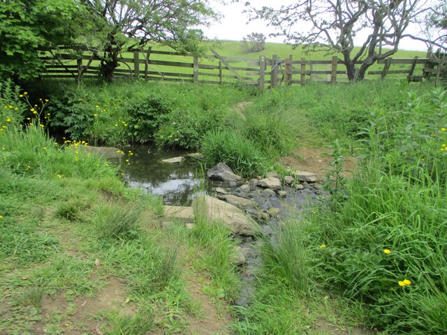
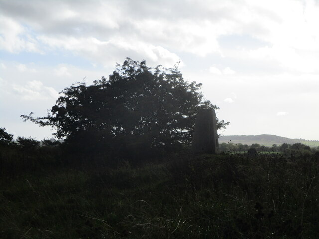
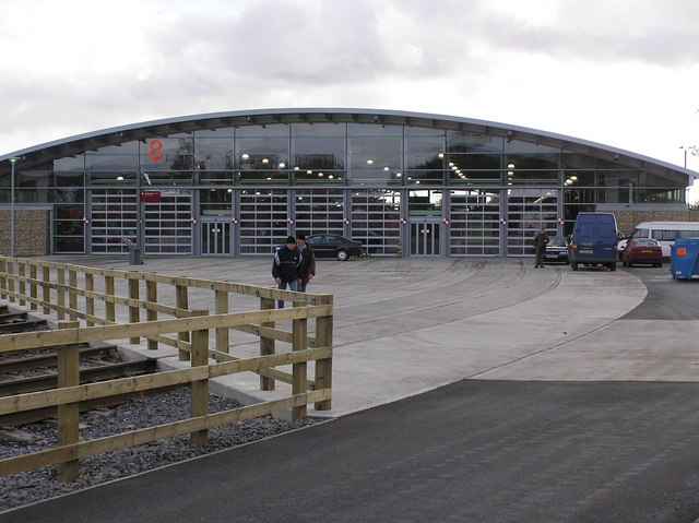
Tuft Hill Images

Images are sourced within 2km of 54.628422/-1.6088435 or Grid Reference NZ2525. Thanks to Geograph Open Source API. All images are credited.

Crossing over Red House Beck A stepping stone crossing over Red House Beck near Middridge Grange
Crossing over Red House Beck
A stepping stone crossing over Red House Beck near Middridge Grange
Field on Walkers Lane A field on Walkers Lane near the Bishop Line railway.
Field on Walkers Lane
A field on Walkers Lane near the Bishop Line railway.
Bridge over the Bishop Line railway A bridge carrying a public footpath over the Bishop Line railway, footpath leads towards School Aycliffe and Redworth.
Bridge over the Bishop Line railway
A bridge carrying a public footpath over the Bishop Line railway, footpath leads towards School Aycliffe and Redworth.
Parking area near Shildon railway station A small area for parking and works access to the railway
Parking area near Shildon railway station
A small area for parking and works access to the railway
Footpath across the Bishop line railway A footpath heading towards Middridge Grange going over the Bishop line railway
Footpath across the Bishop line railway
A footpath heading towards Middridge Grange going over the Bishop line railway
Class 71 Locomotive The class 71 was an electric locomotive built for use on British Rail's 3rd rail electrified Southern Region. Though main current pickup was from 750V DC third rail via a pickup shoe, the locomotives also had a pantograph to take current from overhead wires where an electrified ground system was deemed too dangerous, such as areas of marshaling yards with heavy footfall. Built 1958 - 60, the final class member was withdrawn in 1977, with E5001 (71001) the only class member preserved.

Info from Wiki: <span class="nowrap"><a title="https://en.wikipedia.org/wiki/British_Rail_Class_71" rel="nofollow ugc noopener" href="https://en.wikipedia.org/wiki/British_Rail_Class_71">Link</a><img style="margin-left:2px;" alt="External link" title="External link - shift click to open in new window" src="https://s1.geograph.org.uk/img/external.png" width="10" height="10"/></span>
Class 71 Locomotive
The class 71 was an electric locomotive built for use on British Rail's 3rd rail electrified Southern Region. Though main current pickup was from 750V DC third rail via a pickup shoe, the locomotives also had a pantograph to take current from overhead wires where an electrified ground system was deemed too dangerous, such as areas of marshaling yards with heavy footfall. Built 1958 - 60, the final class member was withdrawn in 1977, with E5001 (71001) the only class member preserved. Info from Wiki: LinkExternal link
Eldon Hall Farm trigpoint Trigpoint at Eldon Hall Farm near old eldon
Eldon Hall Farm trigpoint
Trigpoint at Eldon Hall Farm near old eldon
Road signs near Shildon
Historic coal drops Alongside the Shildon Locomotion Museum link walk
Historic coal drops
Alongside the Shildon Locomotion Museum link walk
Thickley Wood Railway Footbridge An historic footbridge at the former Shildon Wagon Works. Beyond the bridge is the National Railway Museum, Locomotion.
Thickley Wood Railway Footbridge
An historic footbridge at the former Shildon Wagon Works. Beyond the bridge is the National Railway Museum, Locomotion.
Further Display Hall at Locomotion The steel work for the expansion of display space at the National Railway Museum at Shildon.
The project is for the 200th anniversary of the opening of the Stockton & Darlington Railway in 1825.
Further Display Hall at Locomotion
The steel work for the expansion of display space at the National Railway Museum at Shildon. The project is for the 200th anniversary of the opening of the Stockton & Darlington Railway in 1825.
Dog rose Dog rose, (Rosa canina agg.), at National Railway Museum, Shildon.
Dog rose
Dog rose, (Rosa canina agg.), at National Railway Museum, Shildon.
Yard at Locomotion Looking across the tracks leading to the main building at the National Railway Museum in Shildon.
Yard at Locomotion
Looking across the tracks leading to the main building at the National Railway Museum in Shildon.
Construction of the new building Looking towards the construction site for a new building at Locomotion in Shildon.
Construction of the new building
Looking towards the construction site for a new building at Locomotion in Shildon.
Locomotion building The main exhibition building for the National Railway Museum in Shildon.
Locomotion building
The main exhibition building for the National Railway Museum in Shildon.
Rail for the new building A compound in part of the car park at Locomotion storing railway lines for the new building.
Rail for the new building
A compound in part of the car park at Locomotion storing railway lines for the new building.
Car park used as a construction compound Railway lines and sleepers are being stored for the construction of the new exhibition building.
Car park used as a construction compound
Railway lines and sleepers are being stored for the construction of the new exhibition building.
LNER Q7 and pacer Parked up alongside the main collections building at Locomotion in Shildon, part of the National Railway Museum. Both objects are part of the National Collection of the Science Museum. The pacer is 142001.
LNER Q7 and pacer
Parked up alongside the main collections building at Locomotion in Shildon, part of the National Railway Museum. Both objects are part of the National Collection of the Science Museum. The pacer is 142001.
Show me another place!

Tuft Hill is located at Grid Ref: NZ2525 (Lat: 54.628422, Lng: -1.6088435)

Unitary Authority: County Durham

Police Authority: Durham

What 3 Words

///aviators.fulfilled.reset. Near Shildon, Co. Durham

Nearby Locations

Tuft Hill

Related Wikis

Middridge

Middridge is a village in County Durham, North East England. It is situated east of Shildon and north-west of Newton Aycliffe. The village is situated...

Middridge Quarry

Middridge Quarry is a Site of Special Scientific Interest in the Sedgefield district of County Durham, England. It is a disused quarry, situated alongside...

Greenfield Academy

Greenfield Academy (formerly Greenfield Secondary School and then Greenfield Community College) is a coeducational secondary school with academy status...

Riseburn

Riseburn was a short-lived village in County Durham, situated south of Middridge and close to Eden Pit. It consisted of three terraces and a Primitive...

Locomotion Museum

Locomotion, previously known as Locomotion the National Railway Museum at Shildon, is a railway museum in Shildon, County Durham, England. The museum was...

Shildon railway station

Shildon is a railway station serving the town of Shildon in County Durham, England on the Tees Valley Line, between Bishop Auckland and Saltburn via Darlington...

Old Eldon

Old Eldon is a village in County Durham, in England. It is situated a short distance to the east of Bishop Auckland. == External links == Media related...

Newton Aycliffe railway station

Newton Aycliffe is a railway station on the Tees Valley Line, which runs between Bishop Auckland and Saltburn via Darlington. The station, situated 7 miles...

Nearby Amenities

Located within 500m of 54.628422,-1.6088435
Middridge
Place: village
Source: NPE
Wikidata: Q2080438
Wikipedia: en:Middridge
Lat/Long: 54.6299977/-1.6110421
Bus Stop
Lane Cottages
Naptan AtcoCode: 13006875C
Naptan Bearing: E
Naptan CommonName: Lane Cottages
Naptan Indicator: east bound
Naptan Landmark: Landmark not known
Naptan NaptanCode: durdtmtp
Naptan Notes: Middridge in front of Middridge lane cottages (number 11)
Naptan Street: Middridge Road
Naptan Verified: no
Source: naptan_import
Lat/Long: 54.6296813/-1.6038184
Bus Stop
Lane Cottages
Naptan AtcoCode: 13006875G
Naptan Bearing: W
Naptan CommonName: Lane Cottages
Naptan Indicator: west bound
Naptan Landmark: Landmark not known
Naptan NaptanCode: durdtmtw
Naptan Notes: Middridge cottages- west of number 11. Middridge
Naptan Street: Middridge Road
Naptan Verified: no
Source: naptan_import
Lat/Long: 54.629619/-1.6040048
Bus Stop
Village
Naptan AtcoCode: 13006876D
Naptan Bearing: SE
Naptan CommonName: Village
Naptan Indicator: south east bound
Naptan Landmark: Landmark not known
Naptan NaptanCode: durdtmwa
Naptan Notes: Middridge. Middridge Village Bus Stop.
Naptan Street: Middridge Lane
Naptan Verified: no
Source: naptan_import
Lat/Long: 54.6296008/-1.6109815
Bus Stop
Village
Naptan AtcoCode: 13006876H
Naptan Bearing: NW
Naptan CommonName: Village
Naptan Indicator: north west bound
Naptan Landmark: Landmark not known
Naptan NaptanCode: durdtmwd
Naptan Notes: Middridge. Next to the Poachers Pocket.
Naptan Street: Middridge Lane
Naptan Verified: no
Source: naptan_import
Lat/Long: 54.6297978/-1.6120036
Post Box
Ref: DL5 162
Source: local_knowledge
Lat/Long: 54.6302417/-1.6131755
Pub
The Bay Horse
Addr City: Newton Aycliffe
Addr Housenumber: 42
Addr Postcode: DL5 7JD
Addr Street: Southside
Addr Village: Middridge
Brand: Marston's
Brand Wikidata: Q6773982
Fhrs Id: 304645
Source Addr: FHRS Open Data
Lat/Long: 54.6297636/-1.6126484
Barrier: stile
Foot: yes
Lat/Long: 54.6309871/-1.6143504
Generator Method: photovoltaic
Generator Orientation: 210
Generator Output Electricity: yes
Generator Solar Modules: 10
Generator Source: solar
Generator Type: solar_photovoltaic_panel
Location: roof
Power: generator
Lat/Long: 54.6304946/-1.6124659
Generator Method: photovoltaic
Generator Orientation: 200
Generator Output Electricity: yes
Generator Solar Modules: 8
Generator Source: solar
Generator Type: solar_photovoltaic_panel
Location: roof
Power: generator
Lat/Long: 54.6302151/-1.6117471
Generator Method: photovoltaic
Generator Orientation: 200
Generator Output Electricity: yes
Generator Solar Modules: 16
Generator Source: solar
Generator Type: solar_photovoltaic_panel
Location: roof
Power: generator
Lat/Long: 54.630684/-1.6113555
Generator Method: photovoltaic
Generator Orientation: 200
Generator Output Electricity: yes
Generator Solar Modules: 10
Generator Source: solar
Generator Type: solar_photovoltaic_panel
Location: roof
Power: generator
Lat/Long: 54.6303425/-1.6109746
Generator Method: photovoltaic
Generator Orientation: 150
Generator Output Electricity: yes
Generator Solar Modules: 16
Generator Source: solar
Generator Type: solar_photovoltaic_panel
Location: roof
Power: generator
Lat/Long: 54.6293022/-1.6089951
Power: pole
Transformer: distribution
Lat/Long: 54.625274/-1.6075511
Power: pole
Transformer: distribution
Lat/Long: 54.6242142/-1.6103299
Power: pole
Lat/Long: 54.6250729/-1.6092181
Power: pole
Lat/Long: 54.625642/-1.6084698
Power: pole
Lat/Long: 54.6275511/-1.6134185
Power: pole
Lat/Long: 54.6271365/-1.6123295
Power: pole
Lat/Long: 54.6263772/-1.6103044
Power: pole
Lat/Long: 54.6260154/-1.6093576
Power: pole
Lat/Long: 54.6256707/-1.6084537
Power: pole
Lat/Long: 54.6253151/-1.6075096
Power: pole
Lat/Long: 54.624958/-1.6065466
Power: pole
Lat/Long: 54.6246086/-1.6055945
Power: pole
Lat/Long: 54.6279874/-1.6145785
Power: pole
Lat/Long: 54.6280441/-1.6145557
Power: pole
Lat/Long: 54.6295393/-1.6142432
Power: pole
Lat/Long: 54.6283732/-1.6155602
Power: pole
Lat/Long: 54.6276303/-1.6021357
Power: pole
Lat/Long: 54.6266917/-1.6030705
Power: pole
Lat/Long: 54.6258198/-1.6036056
Power: pole
Lat/Long: 54.6251637/-1.6040026
Crossing
Lat/Long: 54.6296589/-1.6031426
The data included in this document is from www.openstreetmap.org. The data is made available under ODbL.

Have you been to Tuft Hill?

Leave your review of Tuft Hill below (or comments, questions and feedback).