Maugersbury Hill
Hill, Mountain in Gloucestershire Cotswold
England
Maugersbury Hill
Maugersbury Hill is a prominent natural landmark located in Gloucestershire, England. Situated near the village of Maugersbury, the hill is part of the beautiful Cotswolds region, renowned for its undulating hills and picturesque landscapes.
Rising to an elevation of approximately 240 meters (790 feet), Maugersbury Hill is considered a prominent feature in the local topography. It is classified as a hill rather than a mountain due to its relatively modest height. Nevertheless, its position and distinct shape make it easily recognizable within the surrounding countryside.
The hill is characterized by its gently sloping sides, which are covered with a mix of grasses, shrubs, and occasional patches of woodland. During the spring and summer months, the hillside is embellished with vibrant wildflowers, adding to its natural beauty.
Maugersbury Hill offers stunning panoramic views of the surrounding area, including the nearby towns of Stow-on-the-Wold and Bourton-on-the-Water. On clear days, visitors can also catch a glimpse of the distant Malvern Hills to the west. The hill's elevated position makes it a popular spot for outdoor enthusiasts, such as hikers, nature lovers, and photographers, who are drawn to its peaceful ambiance and breathtaking vistas.
Historically, Maugersbury Hill has played a role in the local area, with evidence of Iron Age occupation and a possible hill fort. Archaeological finds, including pottery and tools, have been discovered in the vicinity, attesting to its ancient past. Today, the hill stands as a testament to the natural and cultural heritage of Gloucestershire, captivating all who venture to its summit.
If you have any feedback on the listing, please let us know in the comments section below.
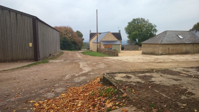
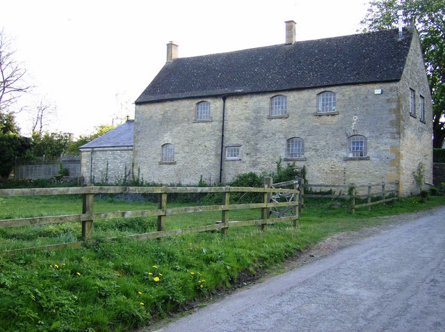
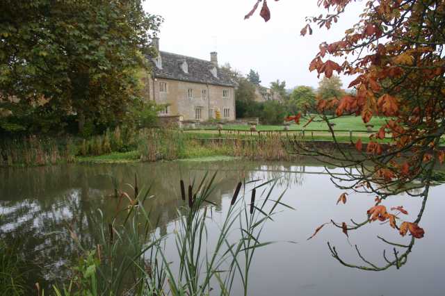
Maugersbury Hill Images
Images are sourced within 2km of 51.909649/-1.7055673 or Grid Reference SP2023. Thanks to Geograph Open Source API. All images are credited.


Maugersbury Hill is located at Grid Ref: SP2023 (Lat: 51.909649, Lng: -1.7055673)
Administrative County: Gloucestershire
District: Cotswold
Police Authority: Gloucestershire
What 3 Words
///feasting.vowing.ideals. Near Stow on the Wold, Gloucestershire
Nearby Locations
Related Wikis

Icomb
Icomb is a village in the Gloucestershire Cotswolds, near to Stow on the Wold. The population taken at the 2011 census was 202.The village appears as Iacumbe...

Icomb Place
Icomb Place (pronounced "Ickum") is a medieval manor house on the edge of the village of Icomb, near Stow on the Wold in Gloucestershire. The word "place...

Church of St Mary, Icomb
The Anglican Church of St Mary at Icomb in the Cotswold District of Gloucestershire, England was built in the 15th century. It is a grade I listed building...

Stow-on-the-Wold railway station
Stow-on-the-Wold railway station was a station on the Great Western Railway's Banbury and Cheltenham Direct Railway that opened in 1881. Situated about...
Maugersbury
Maugersbury is a village and civil parish in Gloucestershire, England. Situated less than a mile south-east of the market town of Stow-on-the-Wold and...
Maugersbury Manor
Maugersbury Manor is a manor house in the village of Maugersbury in Gloucestershire. It has been listed Grade II on the National Heritage List for England...
Quarwood
Quarwood or Quar Wood is a Victorian manor near Stow-on-the-Wold, Gloucestershire, England. It was formerly owned by The Who's bassist John Entwistle....
Wyck Rissington
Wyck Rissington is a village and civil parish in the picturesque Cotswold hills of Gloucestershire, England. The village is located 1.5 miles (2.4 km)...
Have you been to Maugersbury Hill?
Leave your review of Maugersbury Hill below (or comments, questions and feedback).