Humbleton Hill

Hill, Mountain in Northumberland

England

Humbleton Hill

Field beside Ingram Lane Looking across an arable field with the Farne Islands in the distance.
Field beside Ingram Lane Credit: DS Pugh

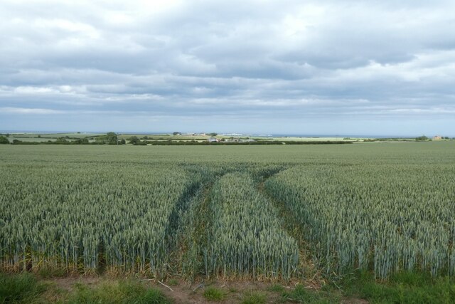
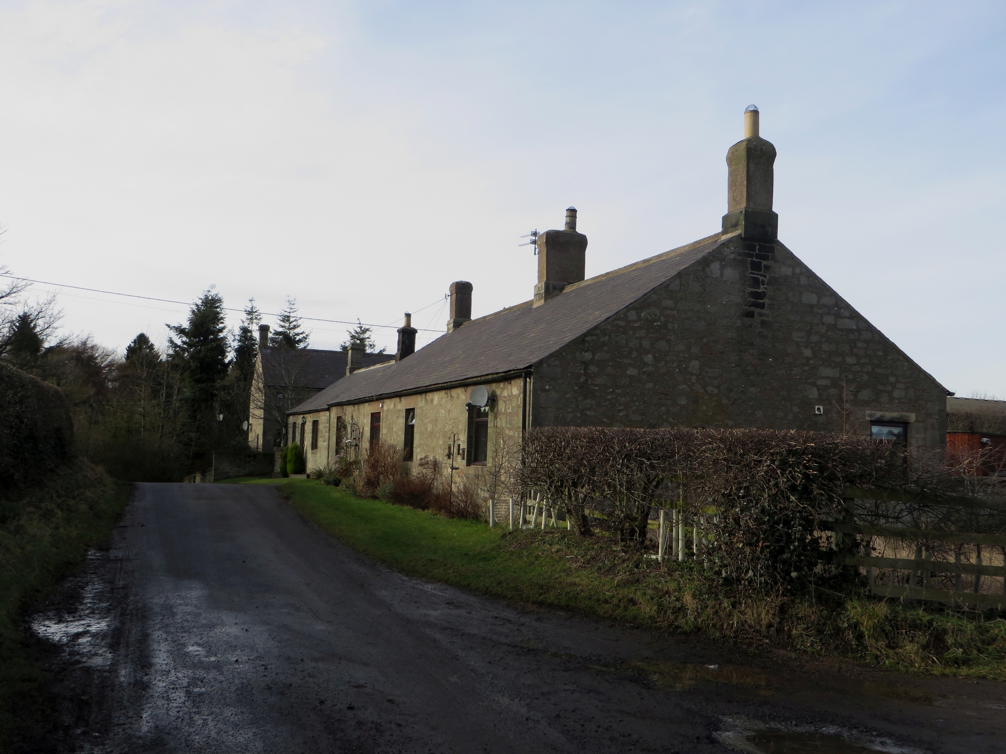
Humbleton Hill is a prominent hill located in Northumberland, England. Rising to an elevation of 189 meters (621 feet), it is a notable landmark in the region. Situated near the village of Wooler, Humbleton Hill forms part of the Cheviot Hills range in Northumberland National Park.

The hill is characterized by its distinctive conical shape, making it easily recognizable from a distance. It is composed mainly of sandstone, which gives it a reddish hue. The summit of Humbleton Hill offers breathtaking panoramic views of the surrounding countryside, including the Cheviot Hills, the Northumberland coast, and the Scottish Borders.

The hill is a popular destination for hikers and nature enthusiasts, attracting visitors throughout the year. Numerous footpaths and trails crisscross the area, allowing visitors to explore the diverse flora and fauna that inhabit the hill and its surroundings. During spring and summer, the hill is adorned with vibrant wildflowers, creating a picturesque landscape.

Humbleton Hill also holds historical significance. On its southern slopes, there are the remains of an Iron Age hillfort, dating back to approximately 500 BC. The fort is believed to have been a defensive structure, providing protection to its inhabitants.

Overall, Humbleton Hill is a captivating natural landmark in Northumberland, offering both recreational opportunities and a glimpse into the region's ancient past. Its scenic beauty, coupled with its historical significance, make it a must-visit destination for anyone exploring the Northumberland countryside.

If you have any feedback on the listing, please let us know in the comments section below.

Humbleton Hill Images

Images are sourced within 2km of 55.586064/-1.7311206 or Grid Reference NU1732. Thanks to Geograph Open Source API. All images are credited.

Field beside Ingram Lane Looking across an arable field with the Farne Islands in the distance.
Field beside Ingram Lane
Looking across an arable field with the Farne Islands in the distance.
Converted vernacular farm buildings
Direction Sign – Signpost at Glororum, near Bamburgh Located on the east side of the crossroads on the B1341 at Glororum in Bamburgh parish. 4 arms and annulus finial. See also <a title="https://www.geograph.org.uk/photo/6068876" href="https://www.geograph.org.uk/photo/6068876">Link</a> and <a title="https://www.geograph.org.uk/photo/4340627" href="https://www.geograph.org.uk/photo/4340627">Link</a>.

Milestone Society National ID: NB_NU1633
Direction Sign – Signpost at Glororum, near Bamburgh
Located on the east side of the crossroads on the B1341 at Glororum in Bamburgh parish. 4 arms and annulus finial. See also Link and Link. Milestone Society National ID: NB_NU1633
Glororum Farm Steam enginehouse at Glororum Farm.
Glororum Farm
Steam enginehouse at Glororum Farm.
cottages at Spindlestone
Farm buildings at Bradford
Looking across to Bamburgh Wheatfield looking NE to Bamburgh and the sea. Taken whilst completing Sustrans Coast and Castles Route
Looking across to Bamburgh
Wheatfield looking NE to Bamburgh and the sea. Taken whilst completing Sustrans Coast and Castles Route
Old kiln near Burton Quarry In a pasture field between East Burton and Burton Goldenhill. More modern looking tanks sit on top of the old building.
Old kiln near Burton Quarry
In a pasture field between East Burton and Burton Goldenhill. More modern looking tanks sit on top of the old building.
Looking down the road to Ingram Lane Near East Burton, this is a typical example of the narrow roads in this rural area.
Looking down the road to Ingram Lane
Near East Burton, this is a typical example of the narrow roads in this rural area.
Farm tracks Farmland at Reapers Hill.
Farm tracks
Farmland at Reapers Hill.
Track near Newhouses Farm Newhouses Wood is on the left.
Track near Newhouses Farm
Newhouses Wood is on the left.
Bradford Kaims Caravan Park Viewed from Bradford Goldenhill.
Bradford Kaims Caravan Park
Viewed from Bradford Goldenhill.
Bradford Kaims Caravan Park Rows of static caravans, some with pitched roofs.
Bradford Kaims Caravan Park
Rows of static caravans, some with pitched roofs.
Pond at Well Hill
Pond at Well Hill
Horses on Lidderton Hill
Arable field near Hoppen
Hoppen Hall Farm Sign
Pasture by Ingram Lane Bamburgh Castle is in the background.
Pasture by Ingram Lane
Bamburgh Castle is in the background.
Show me another place!

Humbleton Hill is located at Grid Ref: NU1732 (Lat: 55.586064, Lng: -1.7311206)

Unitary Authority: Northumberland

Police Authority: Northumbria

What 3 Words

///picture.timeless.comforted. Near Bamburgh, Northumberland

Nearby Locations

Burton Humbleton Hill

Related Wikis

Bradford Kames

Bradford Kames is the name given to a Site of Special Scientific Interest (SSSI) in north Northumberland, England. The site is an esker, a ridge of glacial...

Burton, Northumberland

Burton is a hamlet and former civil parish, now in the parish of Bamburgh, in the county of Northumberland, England. It is situated to the south of the...

Glororum

Glororum is a hamlet and former civil parish, now in the parish of Bamburgh in the county of Northumberland, England, about 1.25 miles (2.01 km) south...

Bradford, Adderstone with Lucker

Bradford is a village and former civil parish, now in the parish of Adderstone with Lucker, in the county of Northumberland, England. It is situated to...

Nearby Amenities

Located within 500m of 55.586064,-1.7311206
Humbleton Hill
Created By: Potlatch 0.10f
Place: locality
Lat/Long: 55.5844945/-1.7271754
The data included in this document is from www.openstreetmap.org. The data is made available under ODbL.

Have you been to Humbleton Hill?

Leave your review of Humbleton Hill below (or comments, questions and feedback).