Old Hill

Hill, Mountain in Yorkshire

England

Old Hill

Lower Playground, Peel Park, Bradford
Lower Playground, Peel Park, Bradford Credit: Stephen Armstrong

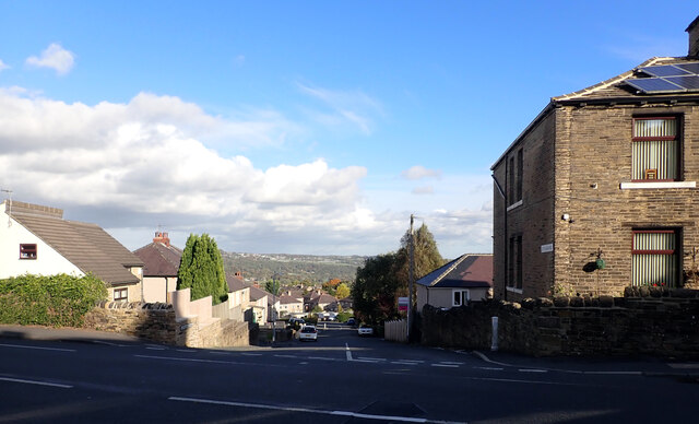
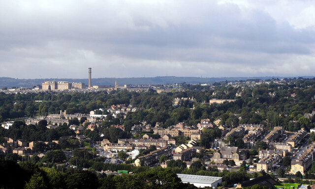
Old Hill is a prominent landmark located in the picturesque region of Yorkshire, England. Situated in the northern part of the county, Old Hill stands proudly as one of the highest points in the area, offering breathtaking panoramic views of the surrounding countryside. Rising to an impressive height of approximately 500 meters, it is often referred to as a hill or a mountain due to its considerable elevation.

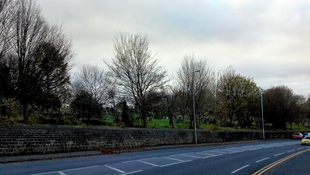
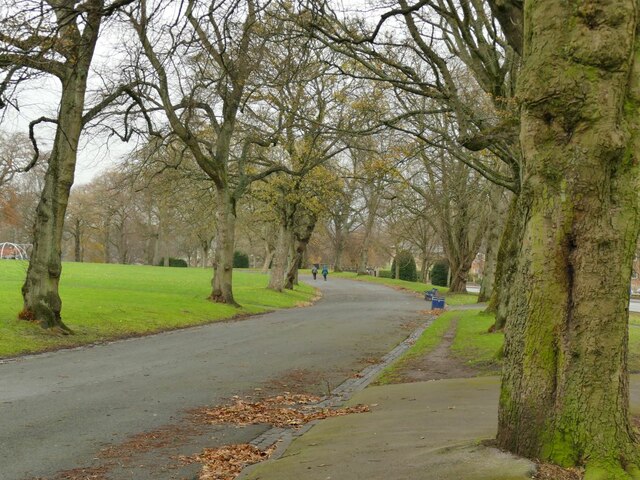
The terrain of Old Hill is primarily composed of rugged and undulating slopes, covered in lush green vegetation and dotted with a variety of trees, including oak and beech. This creates a scenic and idyllic setting for hikers, nature enthusiasts, and photographers alike.

The summit of Old Hill provides an exceptional vantage point, affording visitors with sweeping vistas that extend for miles. On a clear day, one can see the rolling hills, charming villages, and meandering rivers that make up the Yorkshire landscape. The breathtaking views and peaceful atmosphere make Old Hill a popular destination for outdoor activities such as hiking, picnicking, and bird watching.

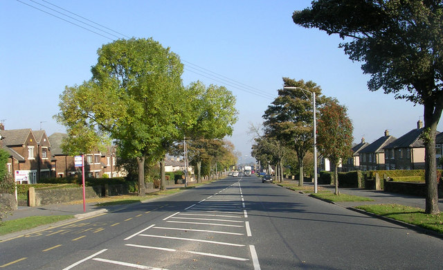
To reach Old Hill, visitors can follow designated footpaths that wind their way through the surrounding countryside. The area is well-maintained, ensuring safe and enjoyable exploration of the hill. Additionally, there are plenty of parking spaces available nearby for those arriving by car.

Old Hill, Yorkshire, is a cherished natural landmark that showcases the beauty and tranquility of the region. Its towering presence, coupled with the stunning vistas it offers, makes it a must-visit destination for anyone seeking a memorable experience in the heart of Yorkshire.

If you have any feedback on the listing, please let us know in the comments section below.
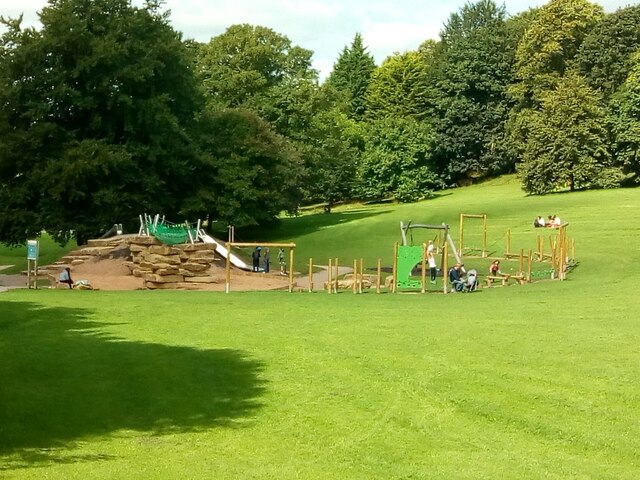
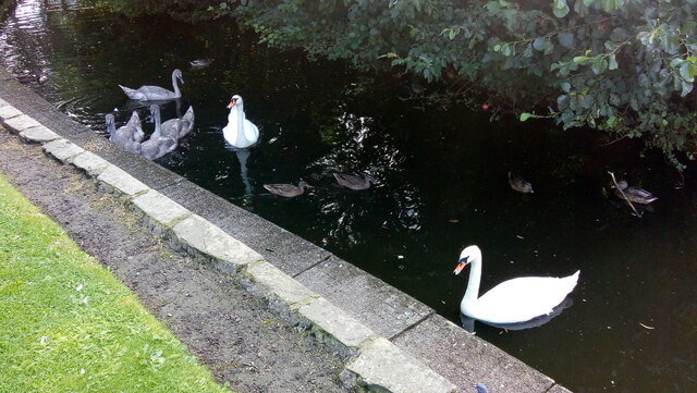
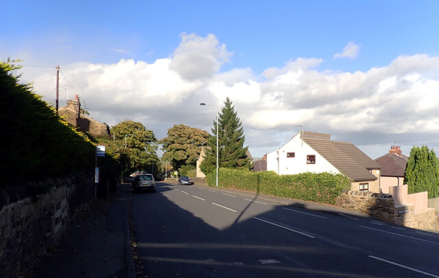
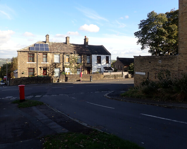
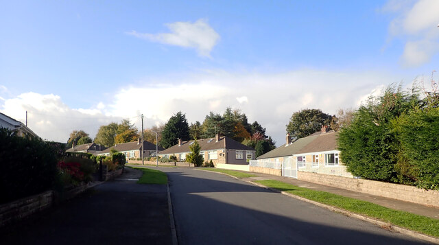
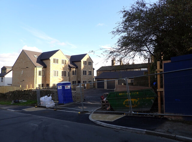
Old Hill Images

Images are sourced within 2km of 53.818071/-1.7441947 or Grid Reference SE1635. Thanks to Geograph Open Source API. All images are credited.

Lower Playground, Peel Park, Bradford
A Family of Swans on Peel Park Lake, Bradford Mum, dad and four cygnets, plus a few ducks.
A Family of Swans on Peel Park Lake, Bradford
Mum, dad and four cygnets, plus a few ducks.
Post box, Santa Monica Road, Idle, Bradford This post box can be seen in context in <a href="https://www.geograph.org.uk/photo/7002152">SE1737 : The junction of Santa Monica Road and Highfield Road, Idle, Bradford</a>.
Post box, Santa Monica Road, Idle, Bradford
Ley Fleaks Road seen from Highfield Road, Idle, Bradford
Highfield Road, Idle, Bradford
The junction of Santa Monica Road and Highfield Road, Idle, Bradford A close-up of the post box can be seen in <a href="https://www.geograph.org.uk/photo/7002148">SE1737 : Post box, Santa Monica Road, Idle, Bradford</a>.
The junction of Santa Monica Road and Highfield Road, Idle, Bradford
A close-up of the post box can be seen in SE1737 : Post box, Santa Monica Road, Idle, Bradford.
Santa Monica Road, Idle, Bradford
New housing development, Santa Monica Road, Idle, Bradford
Frizinghall seen from the top of Carr Lane
Undercliffe Cemetery, Bradford Taken from Otley Road.
Undercliffe Cemetery, Bradford
Taken from Otley Road.
Bricked-up Arch, Otley Road, Bradford This is in the boundary wall of Undercliffe Cemetery, at the north-west corner. Was it a water trough?
Bricked-up Arch, Otley Road, Bradford
This is in the boundary wall of Undercliffe Cemetery, at the north-west corner. Was it a water trough?
South lodge, Lister Park The lodge in 'Italianate' style dates from 1904 and is grade II listed (list entry 1133049) along with the adjacent gates.
South lodge, Lister Park
The lodge in 'Italianate' style dates from 1904 and is grade II listed (list entry 1133049) along with the adjacent gates.
South gates, Lister Park The gates were designed by J W Simpson and M Allen, and erected to commemorate the opening of the Bradford Exhibition of 1904 by the Prince and Princess of Wales. Grade II listed (list entry 1133049) along with the adjacent lodge <a href="https://www.geograph.org.uk/photo/7044450">SE1534 : South lodge, Lister Park</a>.
South gates, Lister Park
The gates were designed by J W Simpson and M Allen, and erected to commemorate the opening of the Bradford Exhibition of 1904 by the Prince and Princess of Wales. Grade II listed (list entry 1133049) along with the adjacent lodge SE1534 : South lodge, Lister Park.
Closed toilets, Lister Park Even a substantial park nowadays rarely has open toilets. These were clearly locked permanently shut.
Closed toilets, Lister Park
Even a substantial park nowadays rarely has open toilets. These were clearly locked permanently shut.
Eastern carriage drive, Lister Park The road within the park runs roughly parallel to the main road to Shipley.
Eastern carriage drive, Lister Park
The road within the park runs roughly parallel to the main road to Shipley.
Playground in Lister Park I didn't want to get too close since there were several children using the facility. <a href="https://www.geograph.org.uk/photo/6304542">SE1535 : Playground, Lister Park, Bradford</a> shows a closer view.
Playground in Lister Park
I didn't want to get too close since there were several children using the facility. SE1535 : Playground, Lister Park, Bradford shows a closer view.
Rainbow rings in Lister Park The rings form a sort of entrance tunnel to the playground. To the right a pair of stone lions forms an older and more elegant entrance.
Rainbow rings in Lister Park
The rings form a sort of entrance tunnel to the playground. To the right a pair of stone lions forms an older and more elegant entrance.
South end of the lake in Lister Park See also <a href="https://www.geograph.org.uk/photo/387972">SE1535 : Boating Pavilion & Cafe - Lister Park</a>.
South end of the lake in Lister Park
Show me another place!

Old Hill is located at Grid Ref: SE1635 (Lat: 53.818071, Lng: -1.7441947)

Division: West Riding

Unitary Authority: Bradford

Police Authority: West Yorkshire

What 3 Words

///maybe.panic.drove. Near Shipley, West Yorkshire

Related Wikis

Hanson Academy

Hanson Academy (formerly Hanson Grammar School and then Hanson School) is a co-educational secondary school and sixth-form located in Bradford, West Yorkshire...

Bradford North (UK Parliament constituency)

Bradford North was a borough constituency represented in the House of Commons of the Parliament of the United Kingdom. Until it was abolished for the 2010...

Eccleshill, Bradford

Eccleshill is an area, former village, and ward within the City of Bradford Metropolitan District Council in the county of West Yorkshire, England. The...

Peel Park, Bradford

Peel Park is a 22.6-hectare (56-acre) urban public park in the Bolton and Undercliffe area of Bradford, England, located about 0.75 miles (1.2 km) north...

Nearby Amenities

Located within 500m of 53.818071,-1.7441947
Mini Roundabout
Direction: clockwise
Lat/Long: 53.8168089/-1.7401948
Traffic Signals
Lat/Long: 53.821808/-1.741646
Post Box
Operator: Royal Mail
Operator Wikidata: Q638098
Post Box Type: pillar
Ref: BD2 126
Royal Cypher: GR
Royal Cypher Wikidata: Q33102273
Lat/Long: 53.8212091/-1.7437812
Turning Circle
Lat/Long: 53.8183734/-1.7502437
Turning Circle
Lat/Long: 53.8184195/-1.75177
Power: tower
Source: survey
Lat/Long: 53.8198676/-1.7502367
Power: tower
Lat/Long: 53.8176622/-1.7502287
Turning Circle
Lat/Long: 53.8181333/-1.7488334
Turning Circle
Lat/Long: 53.8178073/-1.7506258
Turning Circle
Lat/Long: 53.8167451/-1.7511695
Barrier: stile
Foot: yes
Lat/Long: 53.8202392/-1.7492219
Bus Stop
450 16628
Bus: yes
Public Transport: platform
Lat/Long: 53.8217091/-1.7442946
Public Building
Greenwood Centre
Lat/Long: 53.8209311/-1.7479449
Bus Stop
450 16622
Bus: yes
Public Transport: platform
Shelter: yes
Lat/Long: 53.8163198/-1.7507989
Bus Stop
450 16623
Bench: yes
Bus: yes
Public Transport: platform
Shelter: yes
Tactile Paving: no
Lat/Long: 53.8160494/-1.7508024
Bus Stop
450 16625
Bus: yes
Public Transport: platform
Lat/Long: 53.818855/-1.7473854
Post Box
Operator: Royal Mail
Operator Wikidata: Q638098
Ref: BD2 581
Lat/Long: 53.8174249/-1.7501597
Turning Circle
Lat/Long: 53.8188741/-1.7465949
Pub
Horse and Farrier
Lat/Long: 53.8175982/-1.7480846
Turning Circle
Lat/Long: 53.8162901/-1.7461031
Turning Circle
Lat/Long: 53.8169672/-1.745948
Turning Circle
Lat/Long: 53.8175333/-1.7458988
Turning Circle
Lat/Long: 53.8182542/-1.7462896
Turning Circle
Lat/Long: 53.8178505/-1.7470711
Turning Circle
Lat/Long: 53.8172002/-1.7475571
Man Made: tower
Lat/Long: 53.8169128/-1.7497009
Turning Circle
Lat/Long: 53.8204226/-1.7381448
Turning Circle
Lat/Long: 53.8182189/-1.7388586
Bus Stop
Bus: yes
Naptan AtcoCode: 450050447
Naptan NaptanCode: 45050447
Public Transport: platform
Lat/Long: 53.8188238/-1.7395657
Turning Circle
Lat/Long: 53.8159265/-1.7384068
Post Box
Operator: Royal Mail
Post Box Type: wall
Ref: BD2 23
Royal Cypher: GR
Royal Cypher Wikidata: Q33102273
Lat/Long: 53.8168025/-1.7400222
Turning Circle
Lat/Long: 53.8142178/-1.7419979
Turning Circle
Lat/Long: 53.8137752/-1.7421838
Turning Circle
Lat/Long: 53.8157801/-1.7456301
Turning Circle
Lat/Long: 53.8147104/-1.7427296
Turning Circle
Lat/Long: 53.8142709/-1.7468189
Turning Circle
Lat/Long: 53.814773/-1.7466926
Turning Circle
Lat/Long: 53.8153422/-1.7501296
Barrier: stile
Foot: yes
Lat/Long: 53.8158749/-1.7460315
Crossing
Crossing: uncontrolled
Crossing Ref: zebra
Lat/Long: 53.8193942/-1.7449959
Crossing
Crossing: uncontrolled
Crossing Ref: zebra
Lat/Long: 53.8194435/-1.7443092
Bus Stop
450 16624
Bus: yes
Public Transport: platform
Shelter: yes
Lat/Long: 53.8182139/-1.7479582
Bus Stop
450 16626
Lat/Long: 53.8193374/-1.746478
Bus Stop
Ashbourne Road Ashbourne Haven
Bus: yes
Local Ref: 45016646
Naptan AtcoCode: 450016646
Naptan Bearing: S
Naptan CommonName: Ashbourne Road Ashbourne Haven
Naptan Crossing: Ashbourne Haven
Naptan Indicator: Stop 45016646
Naptan PlusbusZoneRef: LEEDS
Naptan ShortCommonName: Ashbourne Haven
Naptan Street: Ashbourne Road
Naptan Verified: no
Public Transport: platform
Ref: 450 16646
Source: naptan_import
Lat/Long: 53.8145783/-1.7443064
Bus Stop
Ashbourne Way Ashbourne Road
Bus: yes
Local Ref: 45016652
Naptan AtcoCode: 450016652
Naptan Bearing: W
Naptan CommonName: Ashbourne Way Ashbourne Road
Naptan Crossing: Ashbourne Road
Naptan Indicator: Stop 45016652
Naptan PlusbusZoneRef: LEEDS
Naptan ShortCommonName: Ashbourne Road
Naptan Street: Ashbourne Way
Naptan Verified: no
Public Transport: platform
Ref: 450 16652
Source: naptan_import
Lat/Long: 53.8151612/-1.7436953
Bus Stop
Ashbourne Way Ashbourne Garth
Bus: yes
Local Ref: 45016653
Naptan AtcoCode: 450016653
Naptan Bearing: W
Naptan CommonName: Ashbourne Way Ashbourne Garth
Naptan Crossing: Ashbourne Garth
Naptan Indicator: Stop 45016653
Naptan PlusbusZoneRef: LEEDS
Naptan ShortCommonName: Ashbourne Garth
Naptan Street: Ashbourne Way
Naptan Verified: no
Public Transport: platform
Ref: 450 16653
Source: naptan_import
Lat/Long: 53.8150227/-1.7419798
Bus Stop
Grove House Road Ashbourne Way
Bus: yes
Local Ref: 45016654
Naptan AtcoCode: 450016654
Naptan Bearing: N
Naptan CommonName: Grove House Road Ashbourne Way
Naptan Crossing: Ashbourne Way
Naptan Indicator: Stop 45016654
Naptan PlusbusZoneRef: LEEDS
Naptan ShortCommonName: Grove House Cres
Naptan Street: Grove House Road
Naptan Verified: no
Public Transport: platform
Ref: 450 16554
Source: naptan_import
Lat/Long: 53.8153152/-1.7400795
Bus Stop
Grove House Road Myers Lane
Bus: yes
Local Ref: 45016655
Naptan AtcoCode: 450016655
Naptan Bearing: S
Naptan CommonName: Grove House Road Myers Lane
Naptan Crossing: Myers Lane
Naptan Indicator: Stop 45016655
Naptan PlusbusZoneRef: LEEDS
Naptan ShortCommonName: Myers Lane
Naptan Street: Grove House Road
Naptan Verified: no
Public Transport: platform
Ref: 450 16655
Source: naptan_import
Lat/Long: 53.8164209/-1.7401486
Bus Stop
High House Road Kestral Mount
Bus: yes
Local Ref: 45016656
Naptan AtcoCode: 450016656
Naptan Bearing: N
Naptan CommonName: High House Road Kestral Mount
Naptan Crossing: Kestral Mount
Naptan Indicator: Stop 45016656
Naptan Landmark: Hanson School Sports Centre
Naptan PlusbusZoneRef: LEEDS
Naptan ShortCommonName: Kestrel Drive
Naptan Street: High House Road
Naptan Verified: no
Public Transport: platform
Source: naptan_import
Lat/Long: 53.8176518/-1.7398979
Bus Stop
High House Road Myers Avenue
Bus: yes
Local Ref: 45016657
Naptan AtcoCode: 450016657
Naptan Bearing: W
Naptan CommonName: High House Road Myers Avenue
Naptan Crossing: Adj Myers Avenue
Naptan Indicator: Stop 45016657
Naptan Landmark: Adj Hanson School Sports Centre
Naptan PlusbusZoneRef: LEEDS
Naptan ShortCommonName: Kestrel Mount
Naptan Street: High House Road
Naptan Verified: no
Public Transport: platform
Source: naptan_import
Lat/Long: 53.8187206/-1.7395268
Bus Stop
High House Road Greenwood Drive
Bus: yes
Local Ref: 45016658
Naptan AtcoCode: 450016658
Naptan Bearing: E
Naptan CommonName: High House Road Greenwood Drive
Naptan Crossing: Greenwood Drive
Naptan Indicator: Stop 45016658
Naptan PlusbusZoneRef: LEEDS
Naptan ShortCommonName: Myers Avenue
Naptan Street: High House Road
Naptan Verified: no
Public Transport: platform
Source: naptan_import
Lat/Long: 53.8190582/-1.7377323
Bus Stop
Kings Road Poplars Park Road
Bus: yes
Local Ref: 45016622
Naptan AtcoCode: 450016622
Naptan Bearing: NE
Naptan CommonName: Kings Road Poplars Park Road
Naptan Crossing: Poplars Park Road
Naptan Indicator: Stop 45016622
Naptan PlusbusZoneRef: LEEDS
Naptan ShortCommonName: Poplars Park Road
Naptan Street: King-s Road
Naptan Verified: no
Public Transport: platform
Source: naptan_import
Lat/Long: 53.8163088/-1.750827
Bus Stop
Kings Road Bolton
Bus: yes
Local Ref: 45016623
Naptan AtcoCode: 450016623
Naptan Bearing: SW
Naptan CommonName: Kings Road Bolton
Naptan Crossing: Adj Ashbourne Way
Naptan Indicator: Stop 45016623
Naptan PlusbusZoneRef: LEEDS
Naptan ShortCommonName: Poplars Park Road
Naptan Street: King-s Road
Naptan Verified: no
Public Transport: platform
Shelter: yes
Source: naptan_import
Tactile Paving: no
Lat/Long: 53.8161198/-1.7507522
Bus Stop
Kings Road Thorndale Rise
Bus: yes
Local Ref: 45016624
Naptan AtcoCode: 450016624
Naptan Bearing: SW
Naptan CommonName: Kings Road Thorndale Rise
Naptan Crossing: Thorndale Rise
Naptan Indicator: Stop 45016624
Naptan PlusbusZoneRef: LEEDS
Naptan ShortCommonName: Thorndale Rise
Naptan Street: King-s Road
Naptan Verified: no
Public Transport: platform
Source: naptan_import
Lat/Long: 53.8183249/-1.7478379
Bus Stop
Kings Road Bolton
Bus: yes
Local Ref: 45016625
Naptan AtcoCode: 450016625
Naptan Bearing: NE
Naptan CommonName: Kings Road Bolton
Naptan Crossing: Nr-At Thorndale Rise
Naptan Indicator: Stop 45016625
Naptan PlusbusZoneRef: LEEDS
Naptan ShortCommonName: Thorndale Rise
Naptan Street: King-s Road
Naptan Verified: no
Public Transport: platform
Source: naptan_import
Lat/Long: 53.8188721/-1.7473334
Bus Stop
Kings Road Flower Bank
Local Ref: 45016626
Naptan AtcoCode: 450016626
Naptan Bearing: SW
Naptan CommonName: Kings Road Flower Bank
Naptan Crossing: Flower Bank
Naptan Indicator: Stop 45016626
Naptan PlusbusZoneRef: LEEDS
Naptan ShortCommonName: Flower Bank
Naptan Street: King-s Road
Naptan Verified: no
Source: naptan_import
Lat/Long: 53.8193108/-1.7465105
Bus Stop
Kings Road Flower Bank
Local Ref: 45016627
Naptan AtcoCode: 450016627
Naptan Bearing: NE
Naptan CommonName: Kings Road Flower Bank
Naptan Crossing: Flower Bank
Naptan Indicator: Stop 45016627
Naptan PlusbusZoneRef: LEEDS
Naptan ShortCommonName: Flower Bank
Naptan Street: King-s Road
Naptan Verified: no
Source: naptan_import
Lat/Long: 53.8195084/-1.7464637
Bus Stop
Kings Road Swain House
Bus: yes
Local Ref: 45016628
Naptan AtcoCode: 450016628
Naptan Bearing: N
Naptan CommonName: Kings Road Swain House
Naptan Crossing: Wood Lane
Naptan Indicator: Stop 45016628
Naptan PlusbusZoneRef: LEEDS
Naptan ShortCommonName: Wood Lane
Naptan Street: King-s Road
Naptan Verified: no
Public Transport: platform
Source: naptan_import
Lat/Long: 53.8216791/-1.7443847
Bus Stop
Swain House Road Kings Road
Bus: yes
Local Ref: 45016634
Naptan AtcoCode: 450016634
Naptan Bearing: NE
Naptan CommonName: Swain House Road Kings Road
Naptan Crossing: Kings Road
Naptan Indicator: Stop 45016634
Naptan PlusbusZoneRef: LEEDS
Naptan ShortCommonName: Kings Road
Naptan Street: Swain House Road
Naptan Verified: no
Public Transport: platform
Ref: 450 16634
Source: naptan_import
Lat/Long: 53.8208436/-1.7445568
Bus Stop
Kings Road Swain House Road
Bus: yes
Local Ref: 45016635
Naptan AtcoCode: 450016635
Naptan Bearing: SW
Naptan CommonName: Kings Road Swain House Road
Naptan Crossing: Swain House Road
Naptan Indicator: Stop 45016635
Naptan PlusbusZoneRef: LEEDS
Naptan ShortCommonName: Swain House Road
Naptan Street: King-s Road
Naptan Verified: no
Public Transport: platform
Ref: 450 16635
Source: naptan_import
Lat/Long: 53.8205386/-1.7448321
Bus Stop
Ashbourne Road Bolton
Bus: yes
Local Ref: 45050441
Naptan AtcoCode: 450050441
Naptan Bearing: N
Naptan BusStopType: CUS
Naptan CommonName: Ashbourne Road Bolton
Naptan Indicator: Stop 45050441
Naptan PlusbusZoneRef: LEEDS
Naptan ShortCommonName: Ashbourne Way
Naptan Street: Ashbourne Road
Naptan Verified: no
Public Transport: platform
Source: naptan_import
Lat/Long: 53.8145606/-1.7444432
Bus Stop
Ashbourne Way Bolton
Bus: yes
Local Ref: 45050443
Naptan AtcoCode: 450050443
Naptan Bearing: E
Naptan BusStopType: CUS
Naptan CommonName: Ashbourne Way Bolton
Naptan Indicator: Stop 45050443
Naptan PlusbusZoneRef: LEEDS
Naptan ShortCommonName: Ashbourne Garth
Naptan Street: Ashbourne Way
Naptan Verified: no
Public Transport: platform
Source: naptan_import
Lat/Long: 53.8150668/-1.7415847
Bus Stop
Grove House Road Bolton
Bus: yes
Local Ref: 45050444
Naptan AtcoCode: 450050444
Naptan Bearing: S
Naptan BusStopType: CUS
Naptan CommonName: Grove House Road Bolton
Naptan Indicator: Stop 45050444
Naptan PlusbusZoneRef: LEEDS
Naptan ShortCommonName: Grovelands
Naptan Street: Grove House Road
Naptan Verified: no
Public Transport: platform
Ref: 450050444
Source: naptan_import
Lat/Long: 53.815342/-1.739973
Bus Stop
Grove House Road Bolton
Bus: yes
Local Ref: 45050445
Naptan AtcoCode: 450050445
Naptan Bearing: N
Naptan BusStopType: CUS
Naptan CommonName: Grove House Road Bolton
Naptan Indicator: Stop 45050445
Naptan PlusbusZoneRef: LEEDS
Naptan ShortCommonName: Grove House Cres
Naptan Street: Grove House Road
Naptan Verified: no
Public Transport: platform
Ref: 450050445
Source: naptan_import
Lat/Long: 53.8164301/-1.7402548
Bus Stop
High House Road Bolton
Bus: yes
Local Ref: 45050448
Naptan AtcoCode: 450050448
Naptan Bearing: W
Naptan BusStopType: CUS
Naptan CommonName: High House Road Bolton
Naptan Indicator: Stop 45050448
Naptan PlusbusZoneRef: LEEDS
Naptan ShortCommonName: Myers Avenue
Naptan Street: High House Road
Naptan Verified: no
Public Transport: platform
Source: naptan_import
Lat/Long: 53.8189772/-1.7377024
Gate
Lat/Long: 53.8184904/-1.7487681
Crossing
Lat/Long: 53.8220502/-1.7411838
Crossing
Lat/Long: 53.8221963/-1.7440449
Crossing
Lat/Long: 53.8217995/-1.7419278
Crossing
Lat/Long: 53.8219434/-1.7415007
Crossing
Lat/Long: 53.8219129/-1.7410486
Crossing
Lat/Long: 53.8218071/-1.7413657
Crossing
Lat/Long: 53.8216649/-1.7417918
Traffic Calming: bump
Lat/Long: 53.8148213/-1.7444349
Traffic Calming: bump
Lat/Long: 53.8151858/-1.7423935
Parking
Parking: surface
Lat/Long: 53.8171504/-1.7404555
Parking
Capacity Disabled: 2
Parking: surface
Lat/Long: 53.8169877/-1.7377254
Turning Circle
Lat/Long: 53.8164011/-1.7461753
Turning Circle
Lat/Long: 53.816898/-1.7459039
The data included in this document is from www.openstreetmap.org. The data is made available under ODbL.

Have you been to Old Hill?

Leave your review of Old Hill below (or comments, questions and feedback).